YASHWANTGAD
TYPE : COASTAL FORT
DISTRICT : RATNAGIRI
HEIGHT : 0
GRADE : EASY
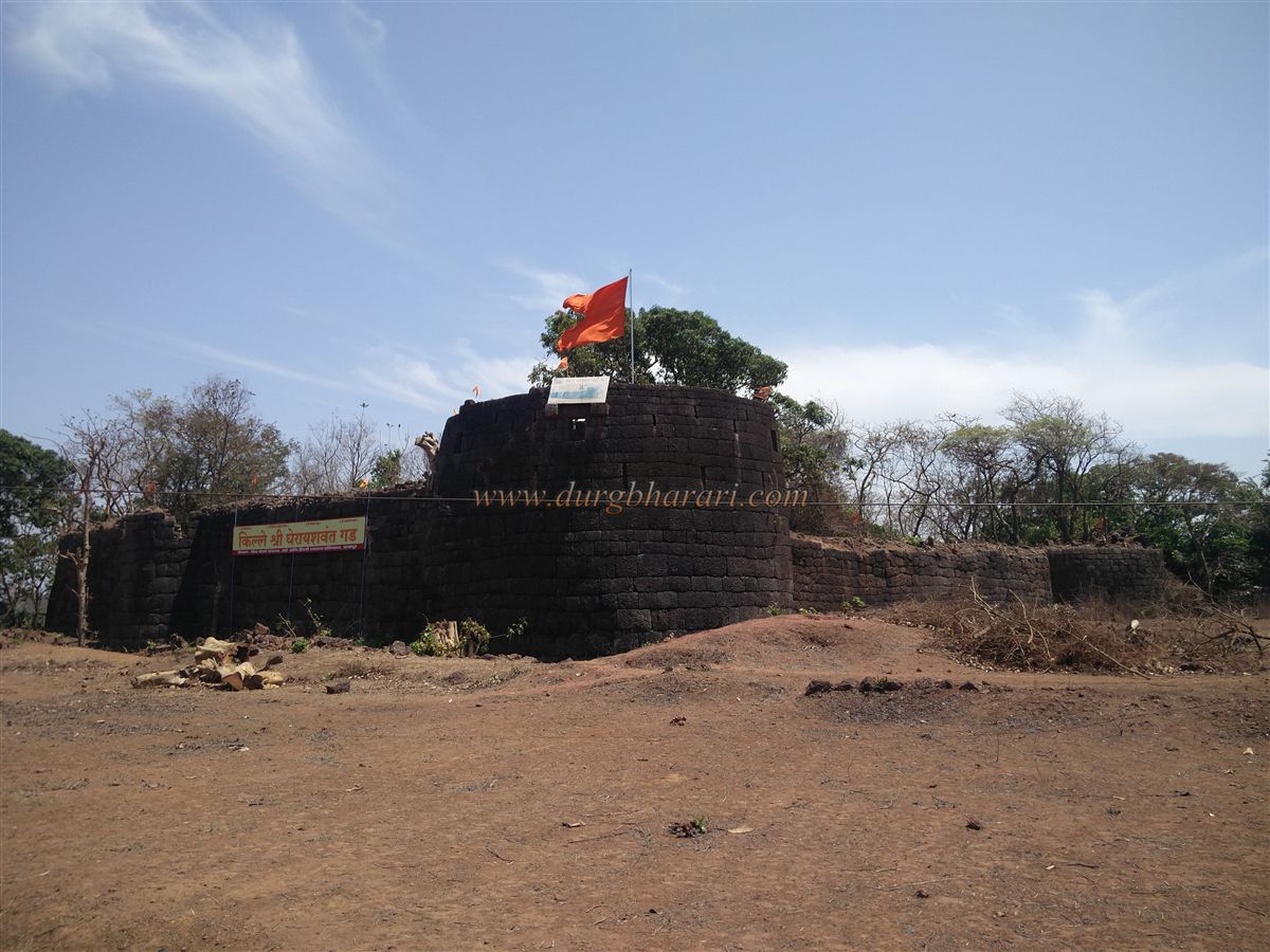
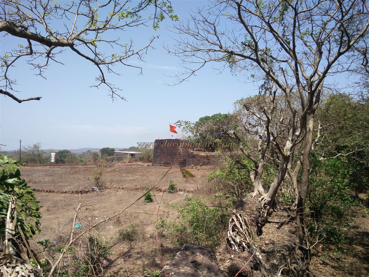
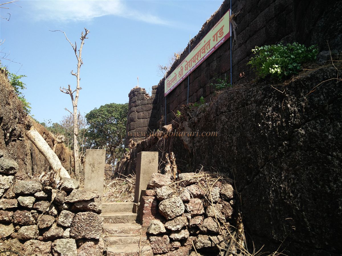
There are two sea forts named Yashwantgad on the Konkan coast of Maharashtra. One of them is located at Redi in Sindhudurg district, near the seashore, while the other is situated in Ratnagiri district’s Rajapur taluka, on a hillside north of the Jaitapur creek. The distance from Rajapur to this Yashwantgad is about 30 km. The fort lies to the west of Nate village and is surrounded by water on its western and southern sides. About 3 km from the fort is the port of Musakaji. While heading toward Ambolgad from Nate village, one can spot a bastion with a saffron flag and a sign reading "Shri Ghera Yashwantgad Fort."
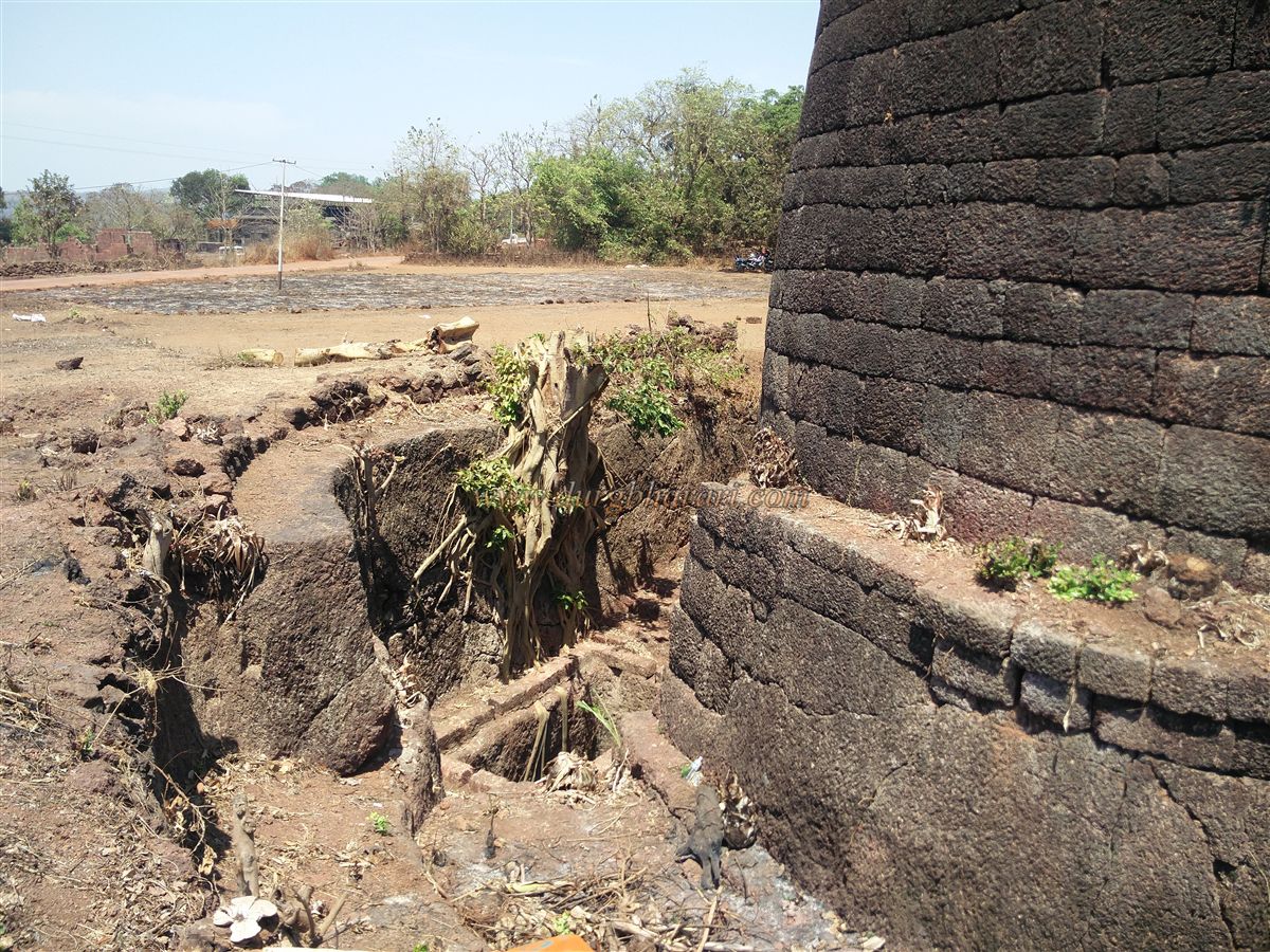
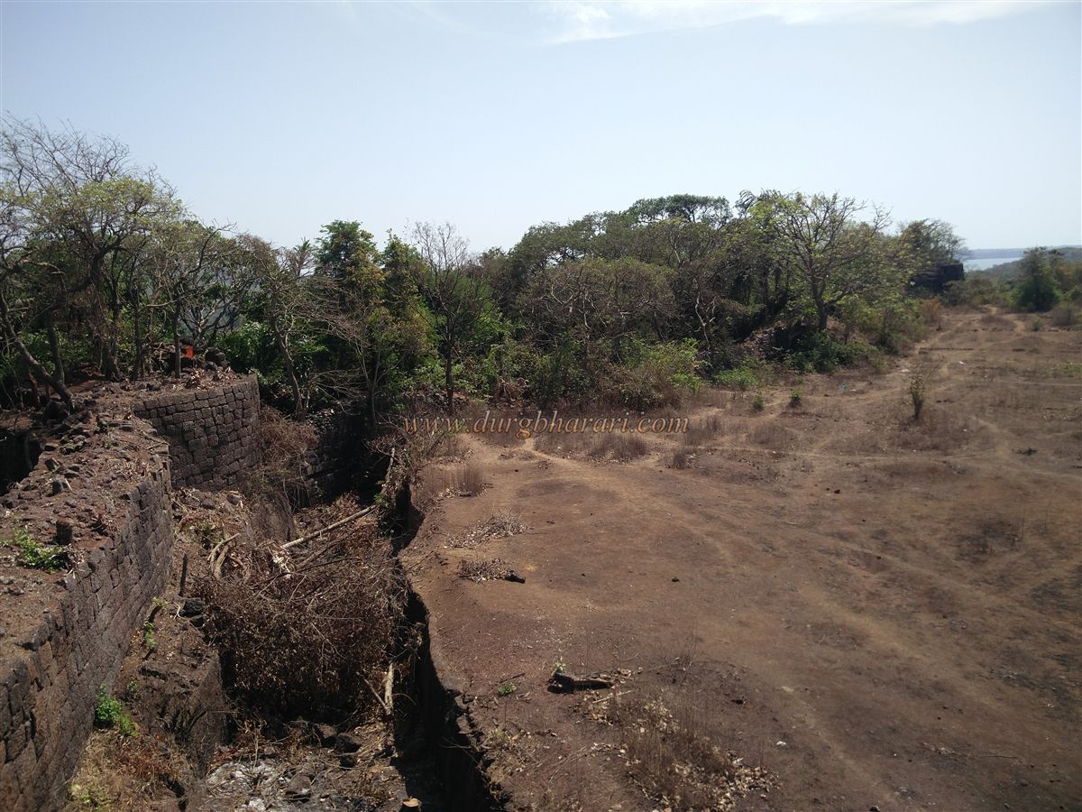
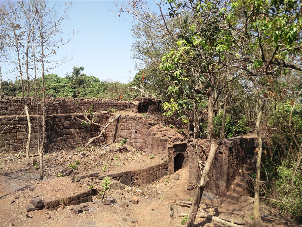
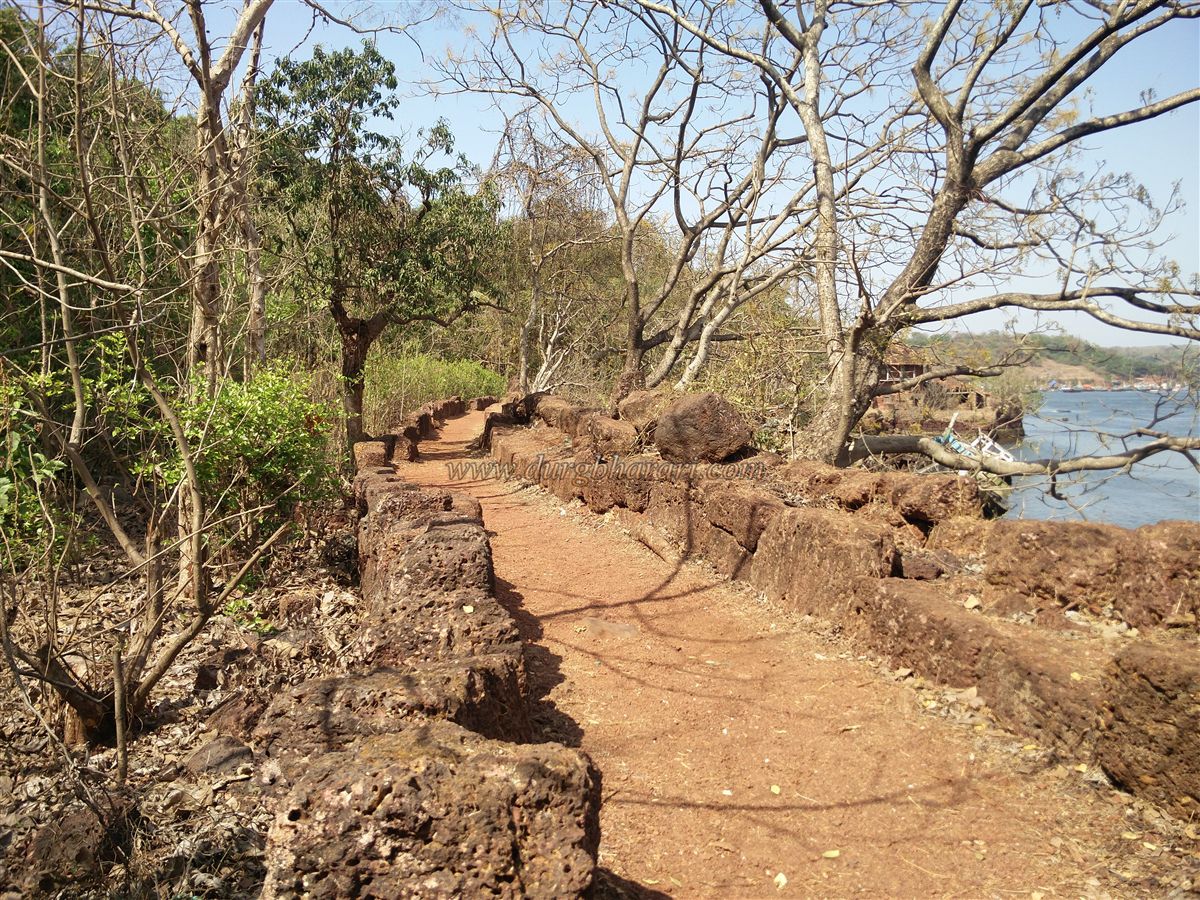
To prevent direct attacks on the fort walls, a 15-foot-wide and 15-foot-deep trench was dug in the flat area near the plateau side of the fort. Like hill forts that are divided into two parts — the main fort and the citadel — Yashwantgad also has two sections: the outer fort and the citadel.
...
As one enters from the plateau, access is directly into the citadel. Entry from this side requires descending into the trench from the left. In the trench, to the left, lies the ruined entrance of the citadel between two strong bastions, and to the right is a small shrine or memorial.
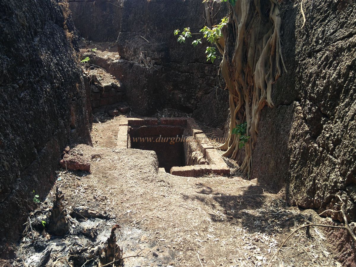
Further along the trench is a red-powder-smeared statue of Hanuman, and under the bastion with the flag, there’s a deep, rectangular well about 50-60 feet deep. Grooves carved into the rock provide access into the well, and two stone pillars protrude from the bastion above — a mechanism likely designed to draw water without exiting the fort.
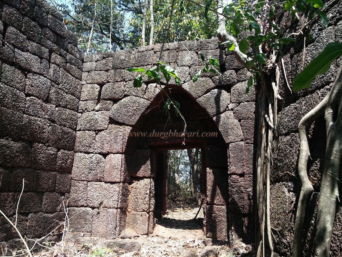
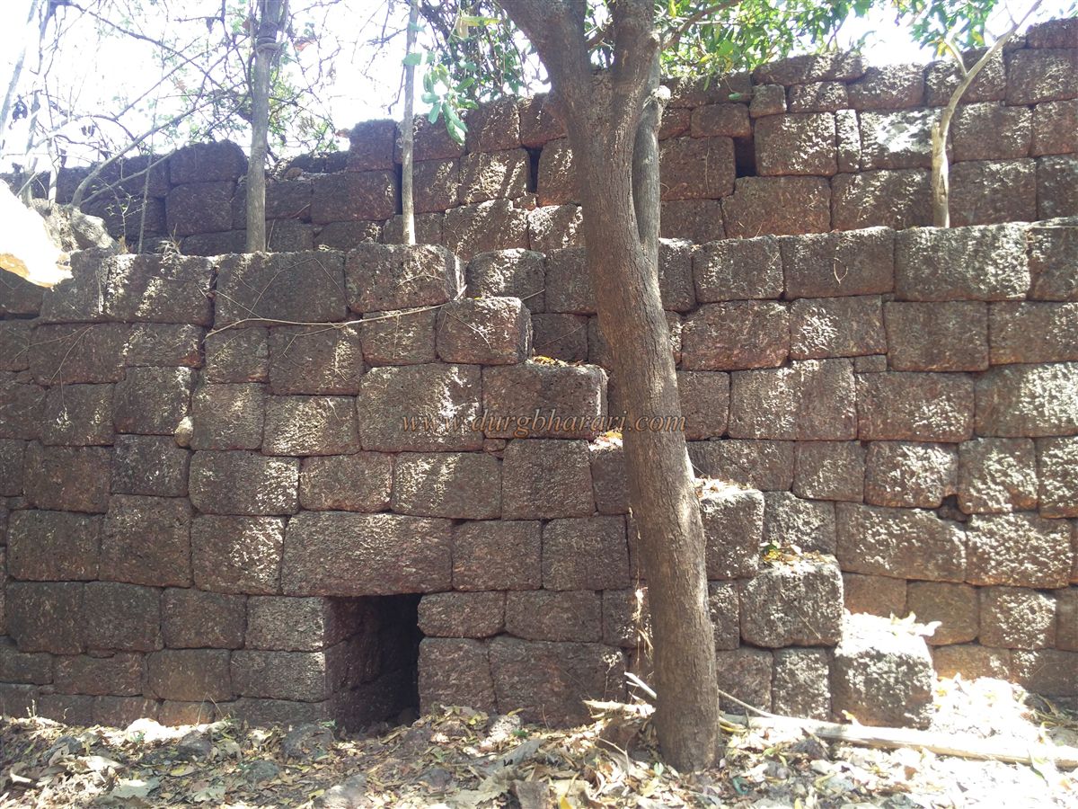
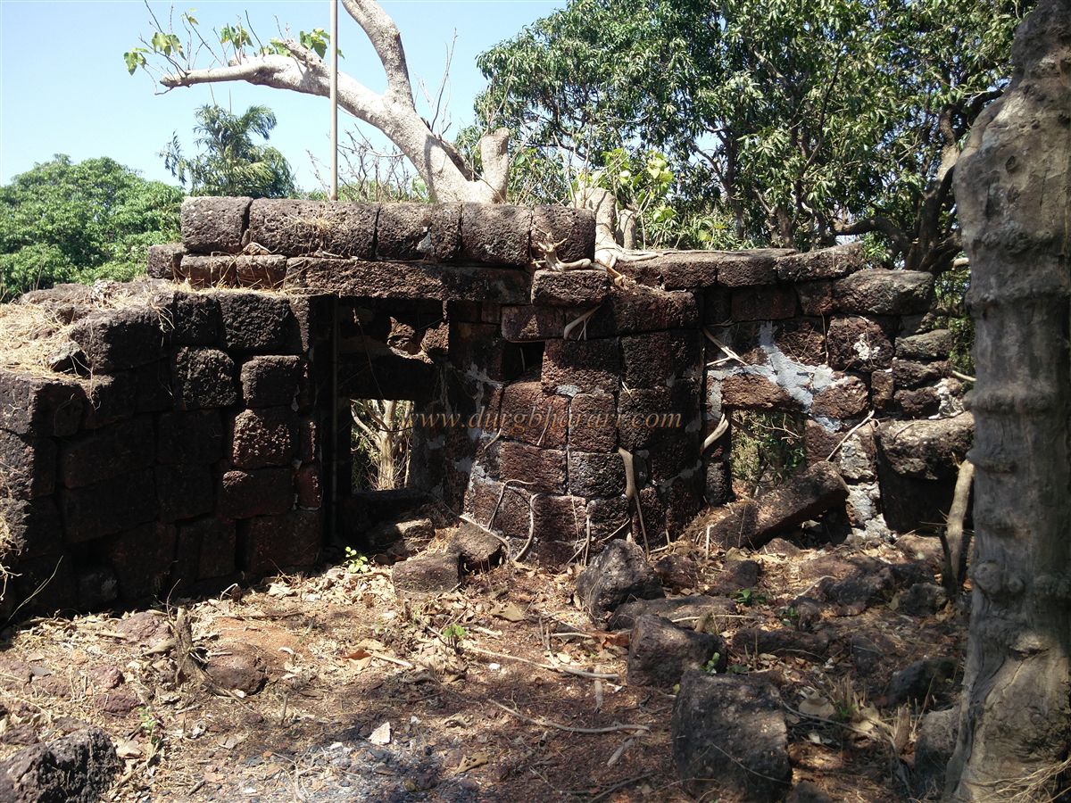
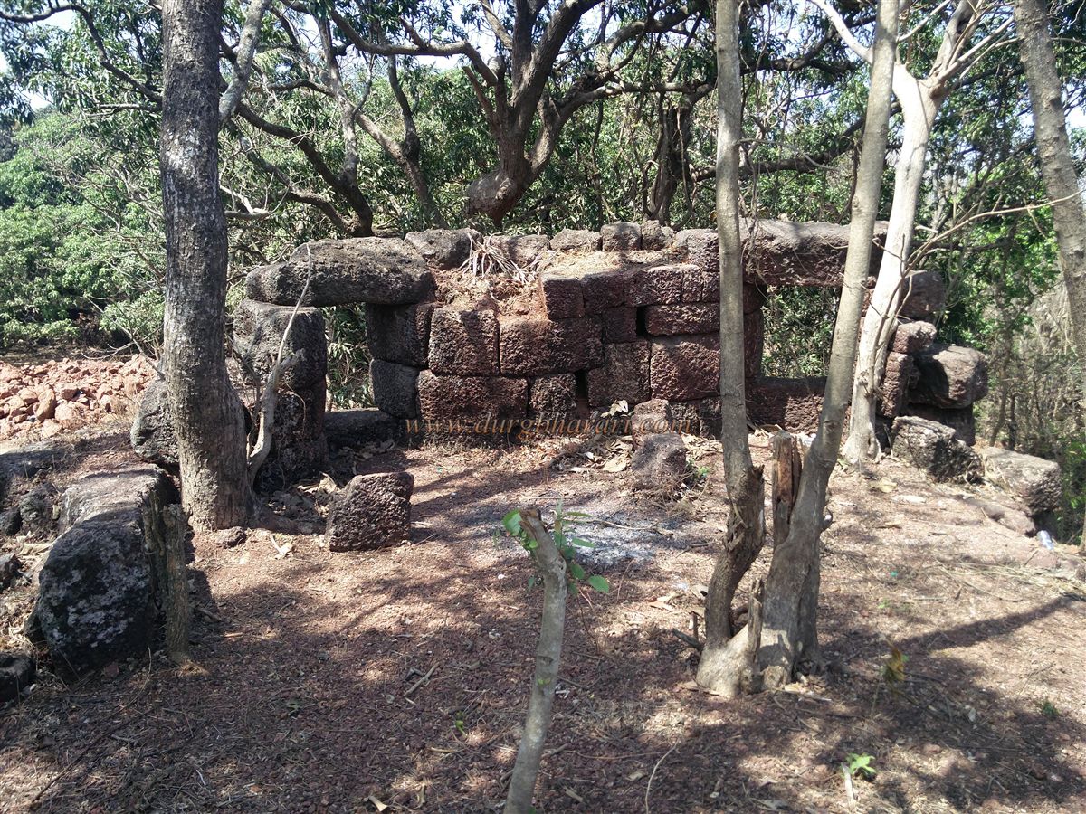
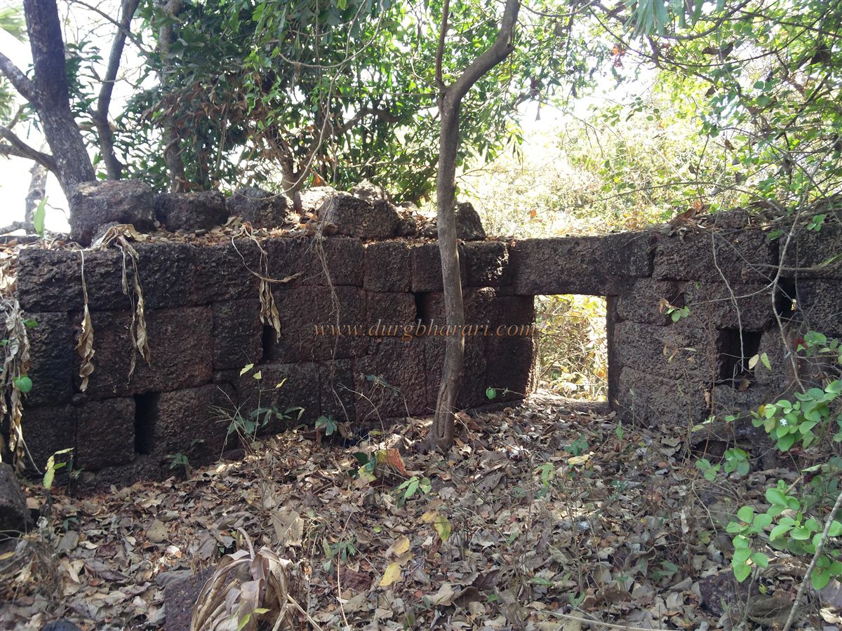
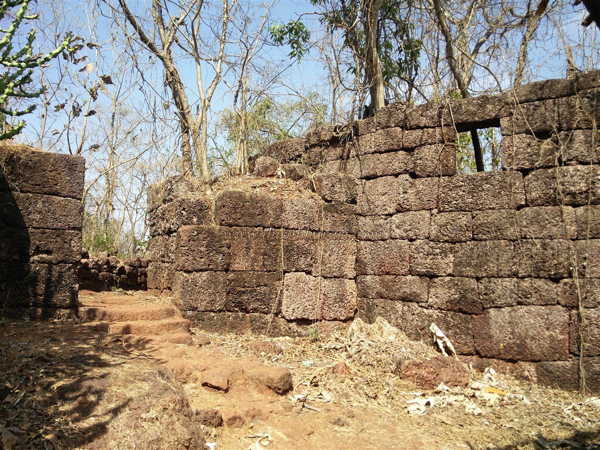
After seeing the well, one enters the fort through the ruined gate. The fort walls and bastions, built with neatly stacked laterite stones, remain largely intact, though overgrown with large trees and thorny bushes. The archway of the main gate has collapsed, but the guards' chambers on either side are still standing. The fort has two main gates: one facing east near the sea and another facing north on the plateau side. In total, five gates are visible: the two main ones, one connecting the outer fort to the citadel, another (now closed) leading from the outer fort to the trench, and a small gate on the sea-facing side.
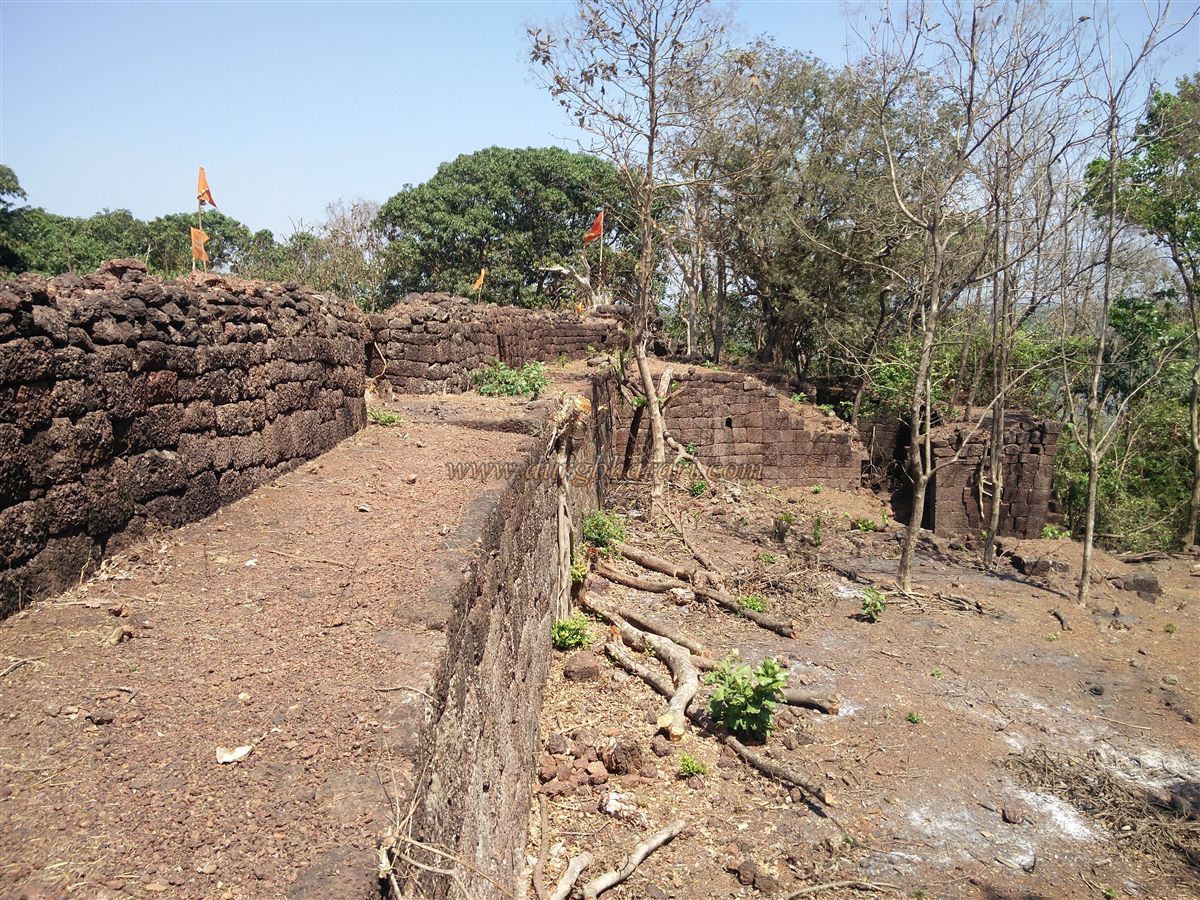
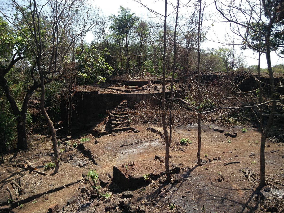
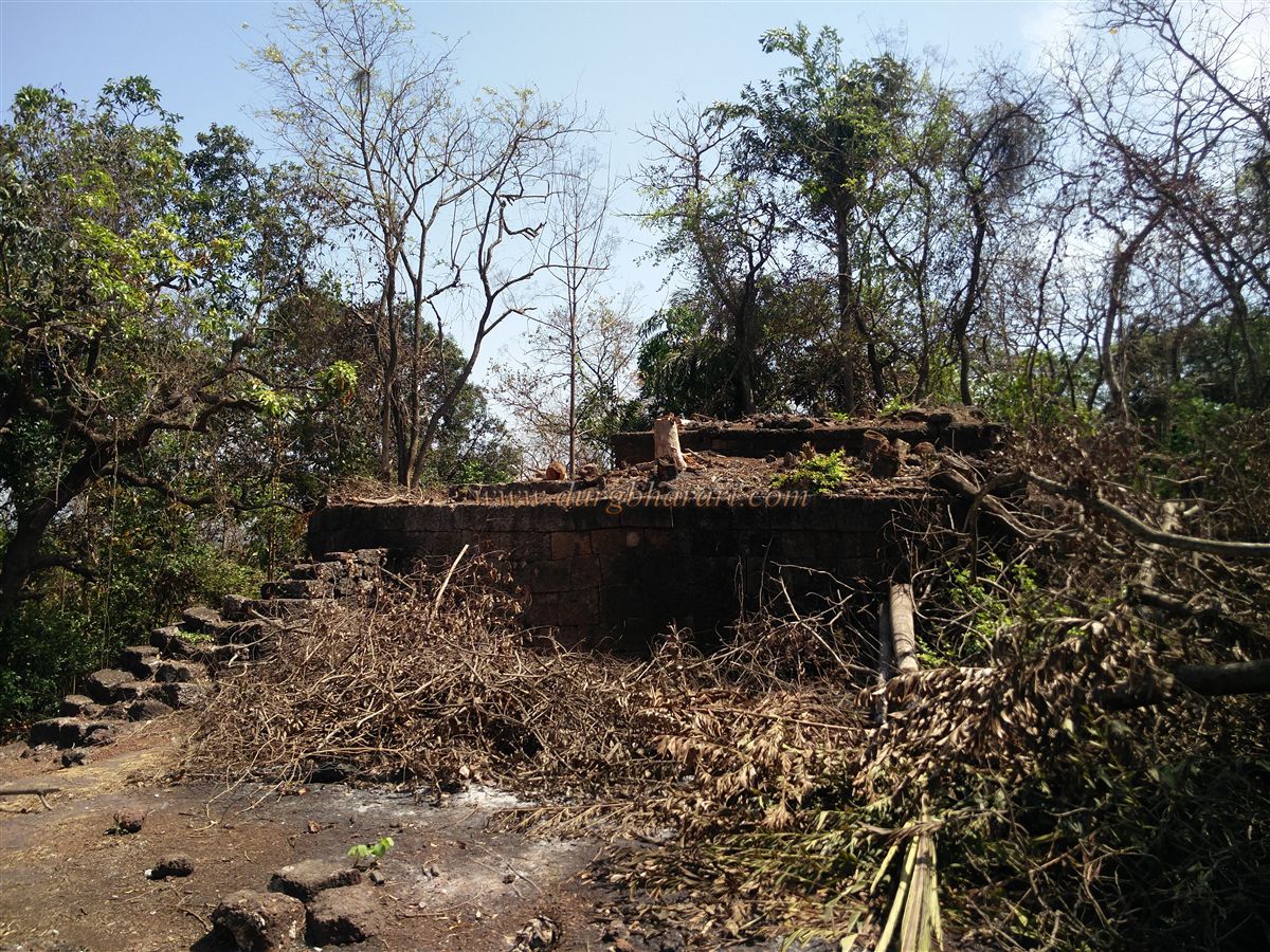
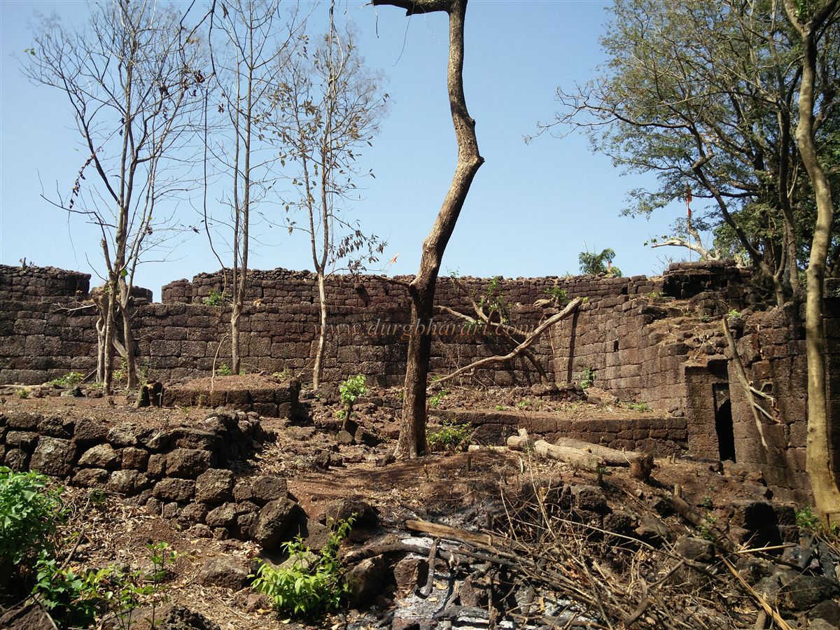
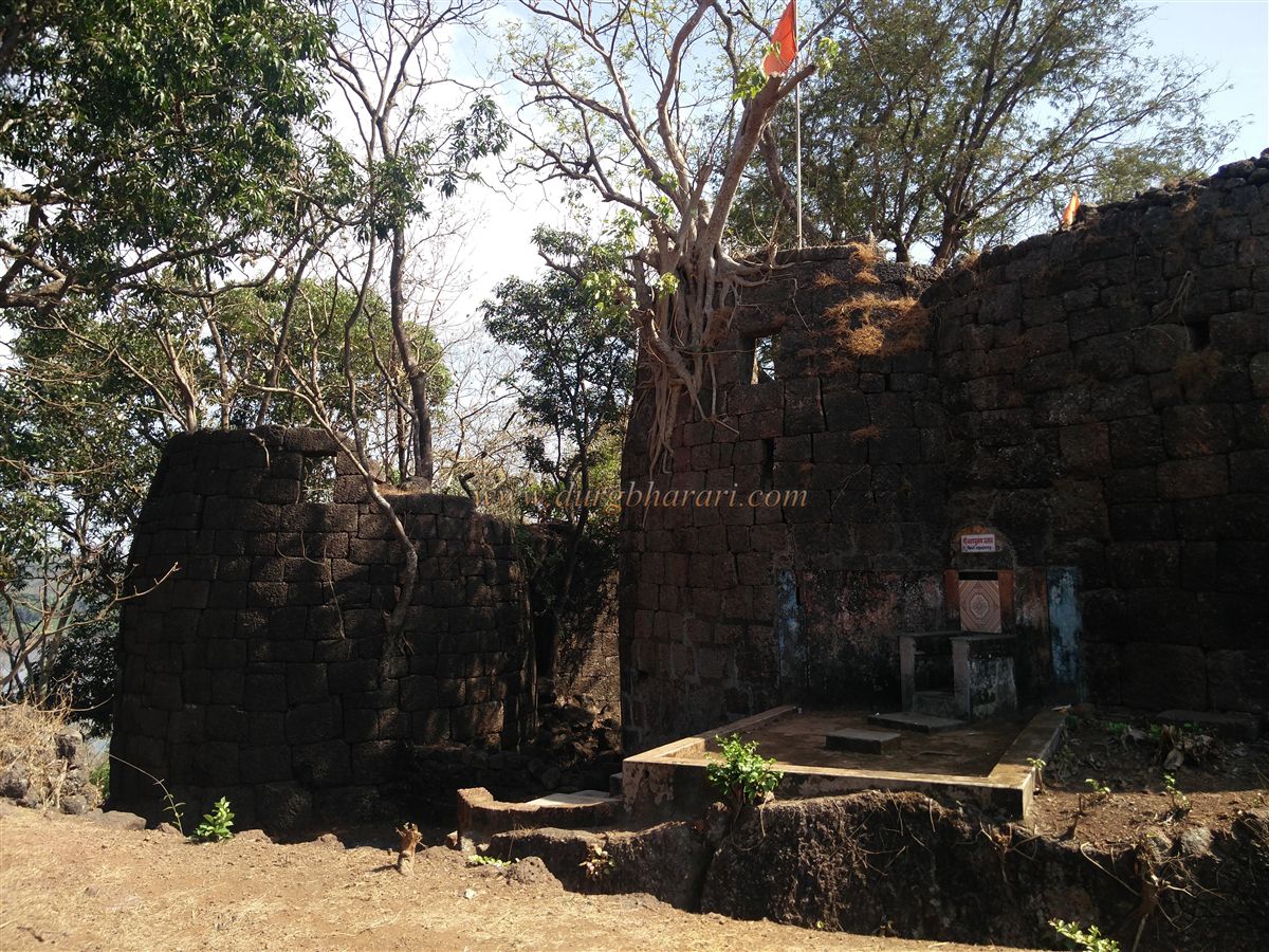
There might be another small gate in the wall descending toward the sea, but due to thick thorny vegetation, it’s currently inaccessible. The fort spans about 7 acres — 1 acre for the citadel and 6 acres for the outer fort. On the left side of the citadel, a large platform of a former structure can be seen. At the center of the citadel is a tall standalone bastion with steps leading up. In front of this bastion is a Tulsi Vrindavan, suggesting the structure here was likely a residential building. This is the highest point of the fort, offering a panoramic view of the entire fort and surrounding areas, though thick vegetation obscures the sea view.
Descending from the bastion, one can circle the entire citadel via the ramparts. There are five stairways to access the citadel’s walls. Behind the main gate, there’s a stairway that leads down to a half-filled well and two storerooms in the wall. The outer fort gate remains intact and features a defensive structure in front. Near this gate, on the inside corner of the rampart, a Ganesh idol and two lotus carvings can be seen.
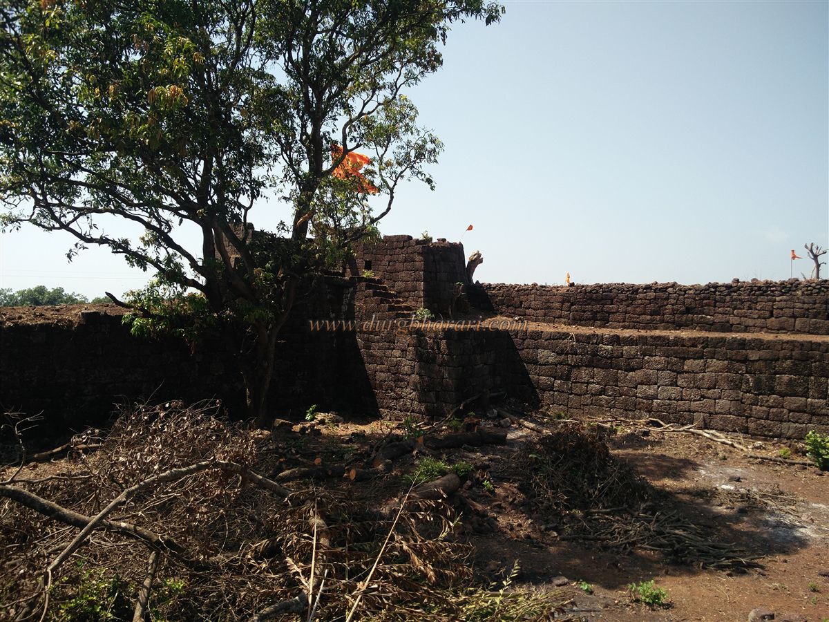
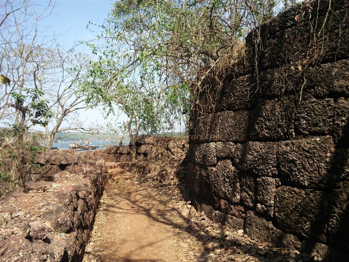
Altogether, the fort has 21 bastions — 9 in the citadel and 12 in the outer fort. The bastion arrangement in the citadel includes two near the main gate, two near the outer gate, two at corners, two in the wall, and one central bastion. Exiting from the citadel’s outer gate, the rampart of the outer fort stretches to the right, with a bastion at the tip and another midway. One stairway provides access to this rampart.
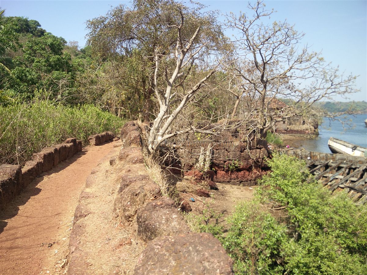
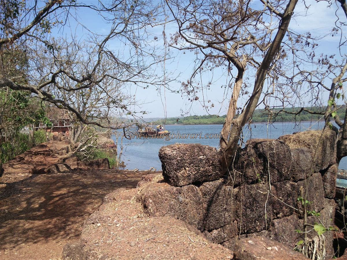
On the outer side of the rampart is a trench, and the corner bastion has openings for cannons, though the path to it is no longer visible — either the stairs have vanished or ladders were once used. From here and from the outer gate, one can see the wall descending toward the creek, but dense vegetation prevents access to its end.
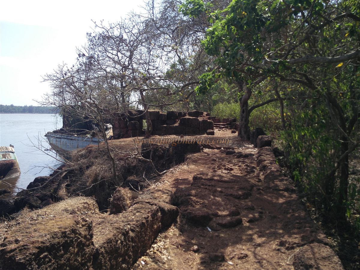
After this, exit through the citadel’s main gate and take the steps near the mango orchard down toward the creek. Near a well on this path, one can access the sea-facing fortifications. This area includes a small hamlet named Ghera Yashwantgad with 10-12 houses. From the seaside, the fort appears even more fortified with strong walls and bastions. There are seven bastions along this wall, one of which has the ruined home of Vishwanath Raghunath Patki. The fort once belonged to the Patki family but was acquired by the government in 1914 through a purchase agreement.
Near this bastion, the main sea-facing gate is completely collapsed, with only remnants visible. There are remains of a former dock here, once used to anchor ships. Today, local fishing boats use it for repairs. At the end of this wall is a small gate where the descending wall from the citadel ends. Outside this wall is a cemetery. This marks the end of the fort tour.
To fully explore Yashwantgad, first visit the citadel and its adjacent outer fort, then explore the sea-facing walls along the hillside. The complete tour — from the citadel to the outer fort — takes about three hours.
Not much is known about who built Yashwantgad or when, but it is believed that the Bijapur rulers constructed it in the 16th century to guard ports like Jaitapur, Rajapur, and Musakaji, and to monitor maritime trade. After capturing Rajapur port and nearby areas, Shivaji Maharaj fortified the fort by constructing walls from the main gate down to the creek to safeguard the region and monitor boats entering via the creek.
In November 1659, after killing Afzal Khan, Shivaji sent his commander Doroji to seize three ships full of Afzal Khan’s goods docked at Dabhol. The ships, under the control of Khan’s officer Mahmud Sharif, were handed over to Rajapur governor Abdul Karim. When the defeat of Bijapur Konkan Subhedar Rustamej Khan became known, Mahmud Sharif and Abdul Karim fled to Jaitapur. Doroji, with 700–800 soldiers, reached Rajapur, left 500–600 troops there, and sent 200 to Jaitapur.
There, Mahmud Sharif and Abdul Karim collaborated with the English, who falsely claimed the ships were theirs. Henry Revington of the English created fake documents for one ship and advised that the remaining two be sent to Surat. While returning, frightened sailors declared allegiance to Shivaji and mutinied. Sharif and Karim were denied boarding and fled to Vengurla under Dutch protection.
When Doroji realized Revington’s deception, he captured English agents Gifford and Velji and imprisoned them at Kharepatan Fort. After Shivaji’s coronation in 1674, a naval dockyard was started at the Jaitapur port below the fort. By 1690, the fort was under Kanhoji Angre's control. It remained with the Marathas until 1818, when British Colonel Imlak captured it. An 1862 survey found 28 cannons on the fort.
On 18 January 1871, General Outram’s boat crashed on a rock 6 km north of the Jaitapur islet near the fort during a storm. In the 19th century, the British rewarded Raghunath Patki with the fort for his services.
© Suresh Nimbalkar
GALLERY