VISHALGAD
TYPE : HILL FORT
DISTRICT : KOLHAPUR
HEIGHT : 2540 FEET
GRADE : EASY
Vishalgad, located on the main range of the Sahyadri, is separated from the Sahyadri only by a valley. To protect the Anuskura Ghat and Amba Ghat, which connected the ports in Konkan with the markets on the plateau, the fort of Khelna, also known as Vishalgad, was built during the Shilahara period. From Malkapur in Shahuwadi Taluka, one can reach the base of Vishalgad directly via Gajapur either by private vehicle or by bus. The distance from Kolhapur via Shahuwadi–Pavan Khind–Gajapur is 80 km, while via Ratnagiri–Sakharpa it is 85 km. There are two routes to reach the fort: one from Machal village in Konkan, which climbs to the fort through the Konkan Darwaja. This route is longer and steeper, taking about two and a half hours. The other route is from the parking area in front of the fort, from where one can reach the fort in 15 minutes.
...
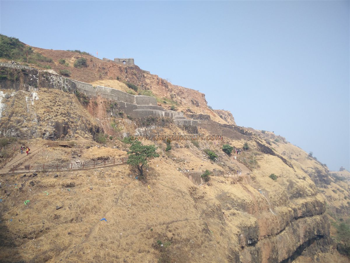
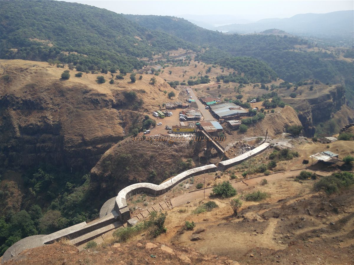
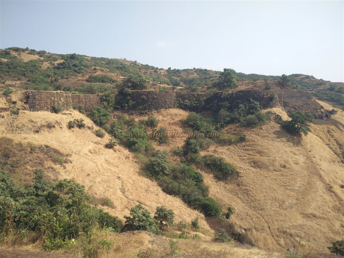
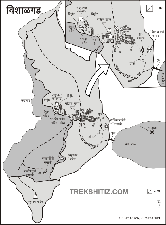
If traveling by private vehicle or bus, one reaches the parking area in front of the fort. From here, one gets a beautiful view of the fort’s fortifications, bastions, and the Mundha Darwaja located between two bastions at the upper level. The government has spent a considerable amount of money repairing the fort with cement plaster. A bridge has been built across the valley that separates the parking area from the fort, mainly for the convenience of devotees visiting the dargah on the fort. For fort enthusiasts like us, however, the original stepped path descending into the valley and climbing up to the fort is still preferable.
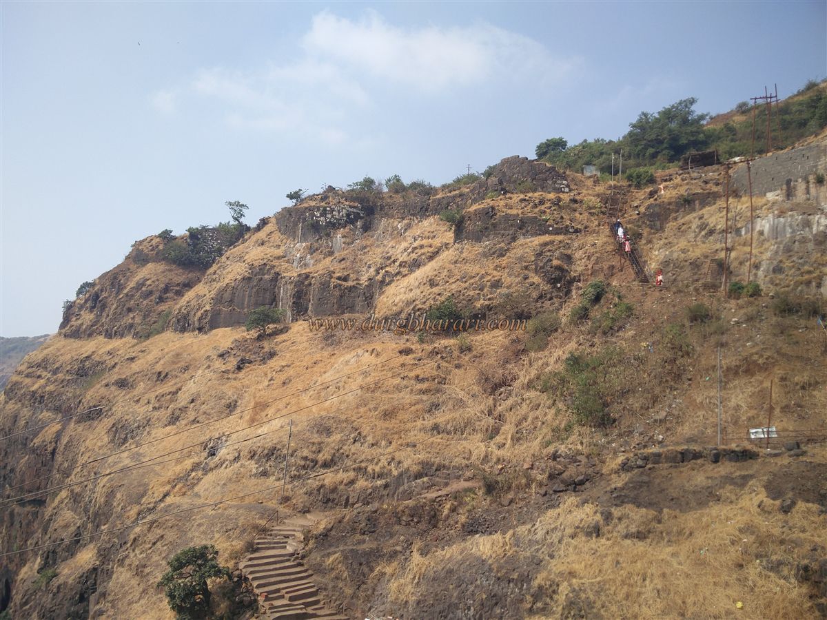
Behind a shop located before the bridge, there is a path descending into the valley. Upon descending, one encounters a small domed structure housing a deity. From here, steps lead up to the fort. On this route, to the right, in a small rock-cut niche, a deity has been enshrined. Looking at the fortifications here, one can deduce that there must have been a gate or a guard post at this point. Climbing the steps brings one to the edge of the cliff on the fort side of the bridge. From here, two routes go up: the straight route climbs with the help of newly installed ladders, while the right-hand path winds around to the main entrance of the fort.
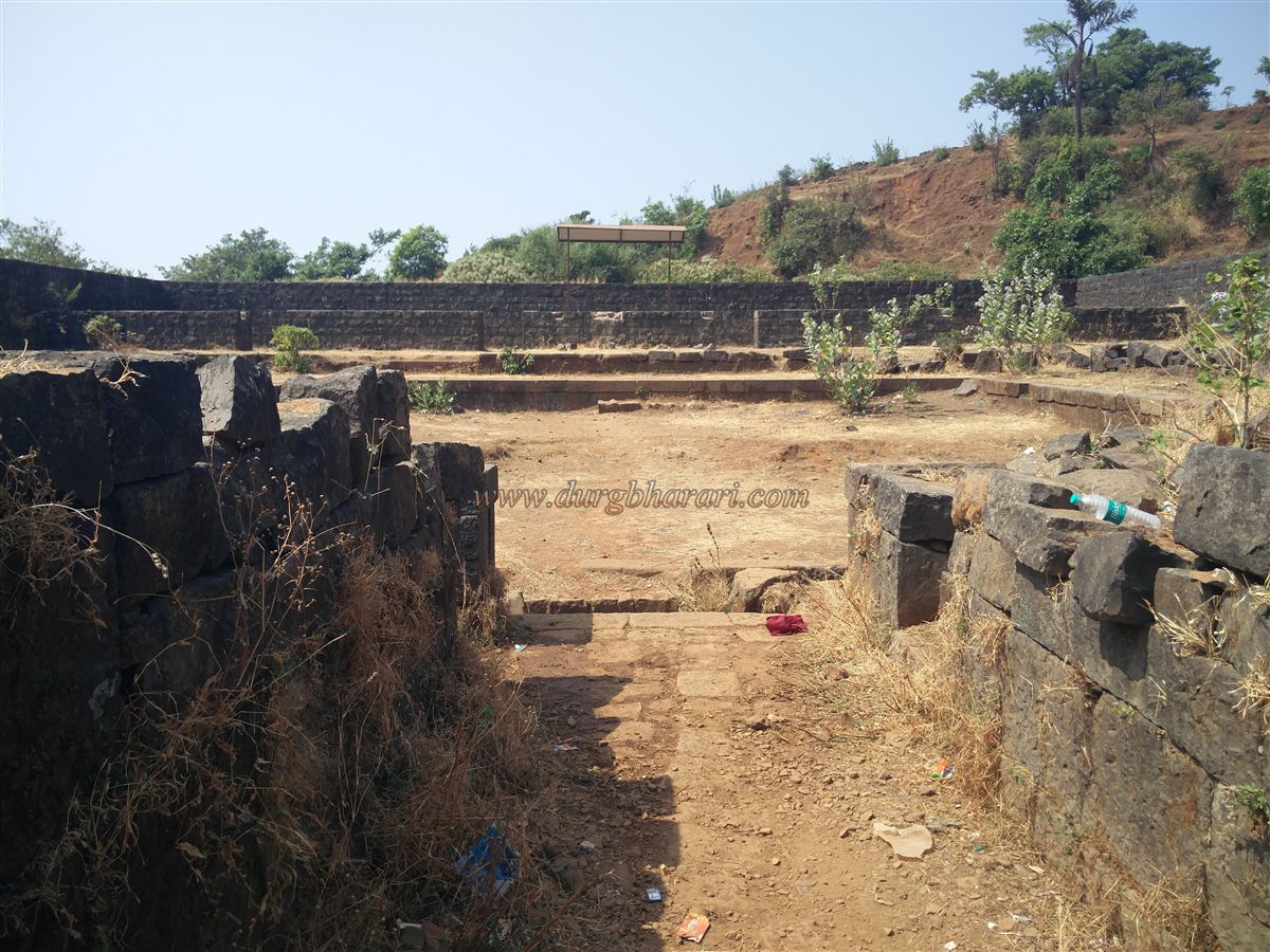
We begin our exploration along the stepped route. On this path, to the left, one can see a worn-out virgal (hero stone). The fort wall descends all the way down the hillside to the valley, and soon one reaches the ruined north-facing gate of the fort. This gate is now completely destroyed, with only traces of its existence and that of the adjacent bastion remaining. Inside the gate, long platforms are built on both sides, suggesting that another gate once stood ahead. Passing through these, one comes to the junction where the ladder route joins. In this area, one can see large stretches of fort walls and bastions, some of which have been repaired recently.
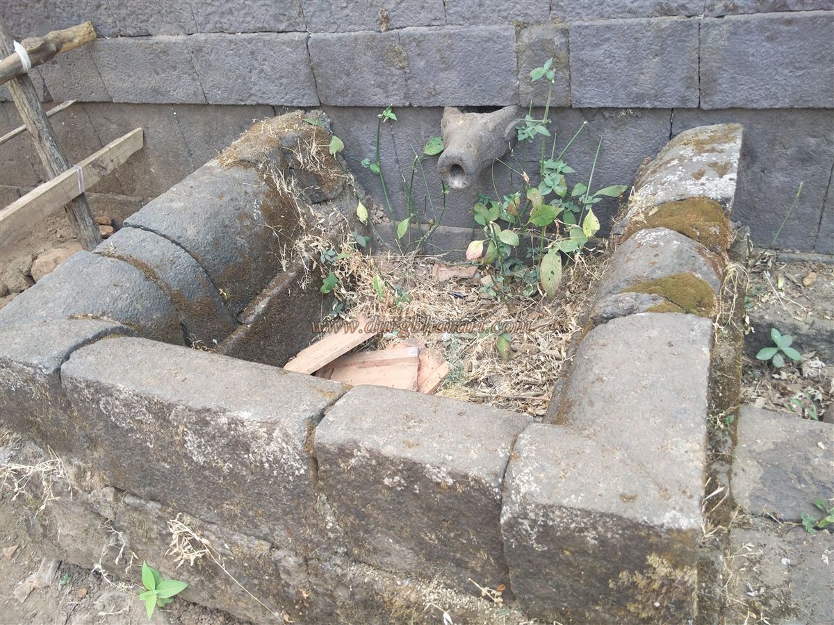
Instead of proceeding straight on this path, one should first walk along the edge of the fortifications to observe the walls and bastions in this section. There are a total of eight bastions here, three of which have double fortifications. Remnants of a guard post and a small masonry tank can also be seen in this area. After exploring this section, one should return to the main stepped path and continue forward.
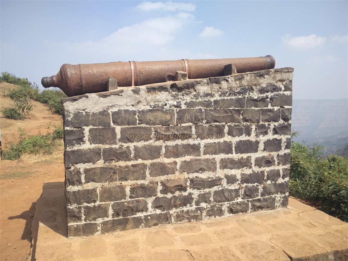
About five minutes ahead, the path splits into two: the straight route leads to the dargah, while the left path leads to the Amruteshwar Temple. We first explore the left section of the fort. The route to Amruteshwar Temple is paved with well-cut stones and is quite spacious. After walking for about 10 minutes, descending a few steps at the end, one reaches the premises of the Amruteshwar Temple. This Shiva temple is built in a depression between two small hills. A surrounding wall encloses the temple, near which a large cannon is partially buried. Inside the temple are a Shivlinga, a Ganapati idol, and two more carved statues, while outside stands a Nandi idol.
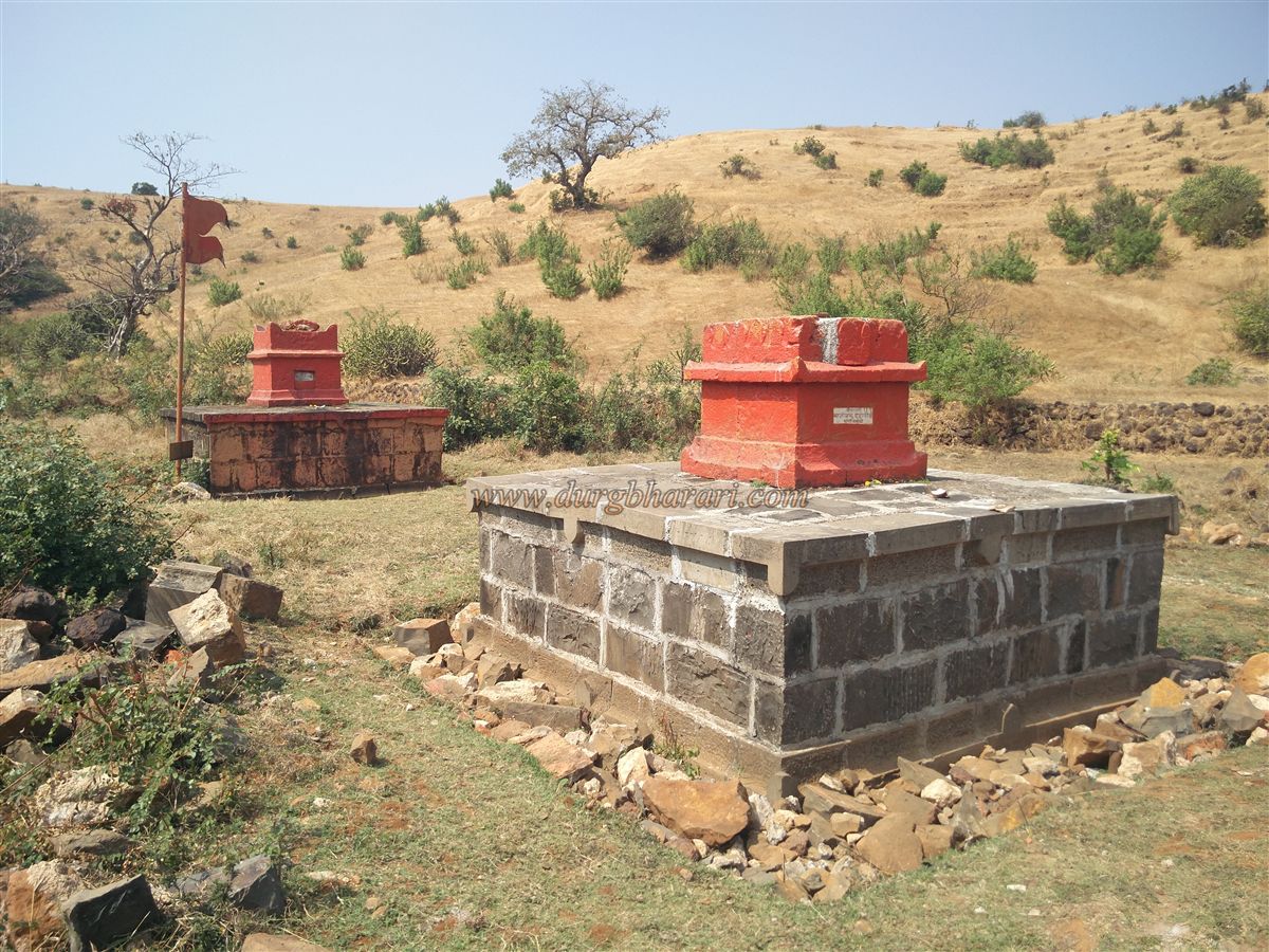
In front of the temple, a rock-cut water tank has been constructed to collect rainwater flowing from above. The water in this tank is drinkable. The temple was constructed between 1751 and 1762 by Amritrao Pratinidhi. Instead of returning the same way, one can descend directly into the adjoining valley. This valley, known as Pataldari, has two arched outlets built into the retaining wall to let water flow out. In this valley, to the right, are two platforms with Tulsi Vrindavan (holy basil shrines) built on them. These are the memorials of Baji Prabhu Deshpande and his brother Phulaji Prabhu. After their heroic martyrdom at Ghodkhind, Shivaji Maharaj brought their mortal remains here and performed their final rites at this spot. Next to these memorials is a small dried-up circular well.
Climbing the hill opposite Pataldari brings one to the Hanuman Temple at the hilltop. Only the sanctum and outer walls of this temple survive, the roof having completely collapsed. In the temple premises is a cellar and, at a short distance, a large carved stone slab. After visiting the temple, one should descend the hill, but instead of climbing back to the Amruteshwar Temple hill, turn left to reach the top of another hill. From here, the path leads straight to the Bhagwanteshwar Temple. On the way, to the left, are two more memorials, which locals call the Mama-Bhache memorials, though they cannot identify who these individuals were.
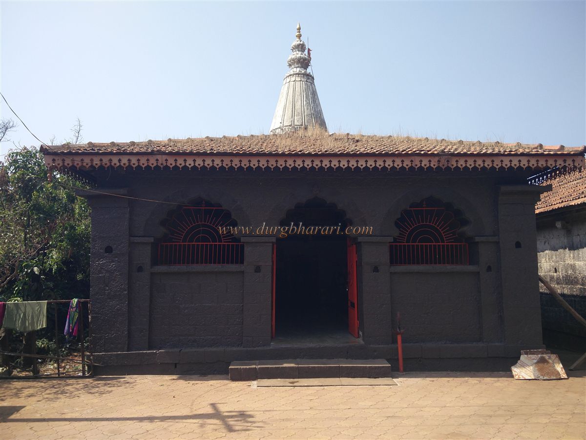
Proceeding further, one reaches the premises of the Bhagwanteshwar Temple. This Shiva temple houses a Shivlinga, two idols of Shiva, an idol of Brahma, and a tortoise sculpture. Two inscriptions can be seen here: one on the back of the tortoise and another near the sanctum door. The latter inscription clearly reads “Abaji Jadhav Shaka 1701 Vishalgad.” Near the temple are two more temples — one dedicated to Vitthal and another to Ganesh (the latter newly constructed). In the Ganesh temple premises lies a broken cannon. The wooden structure of the Vitthal temple features intricate carvings.
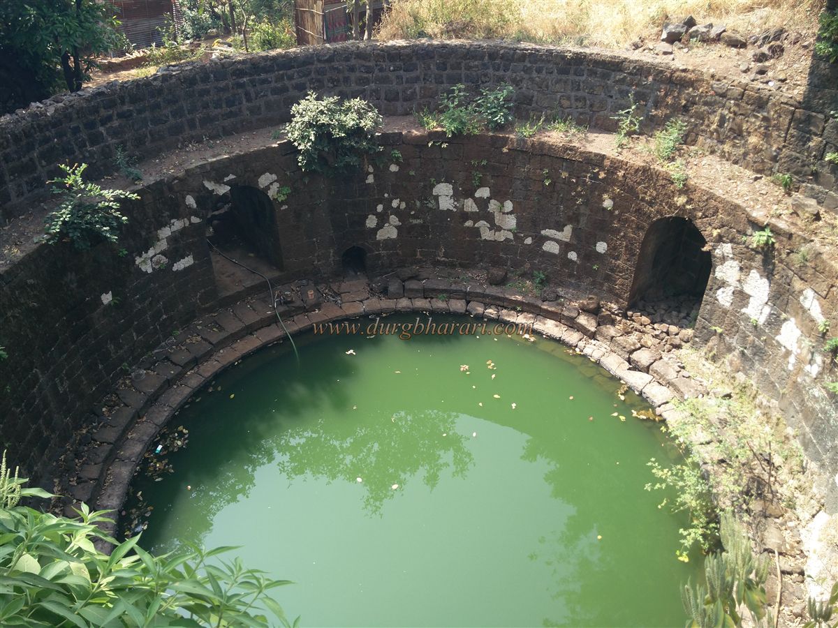
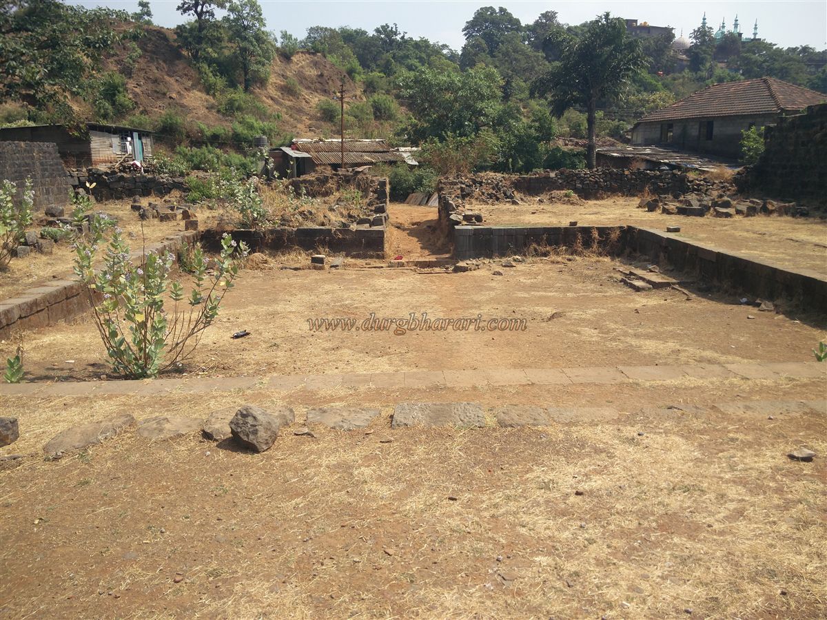
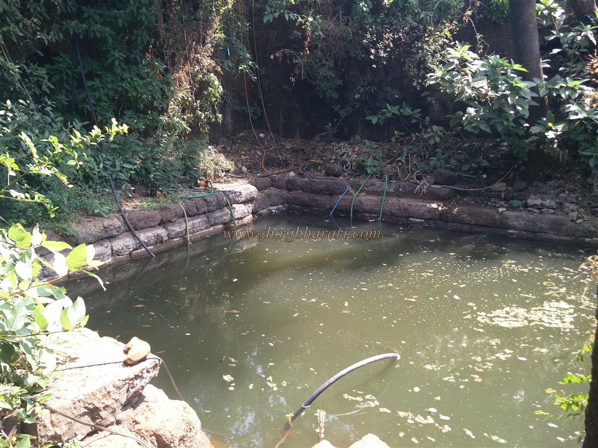
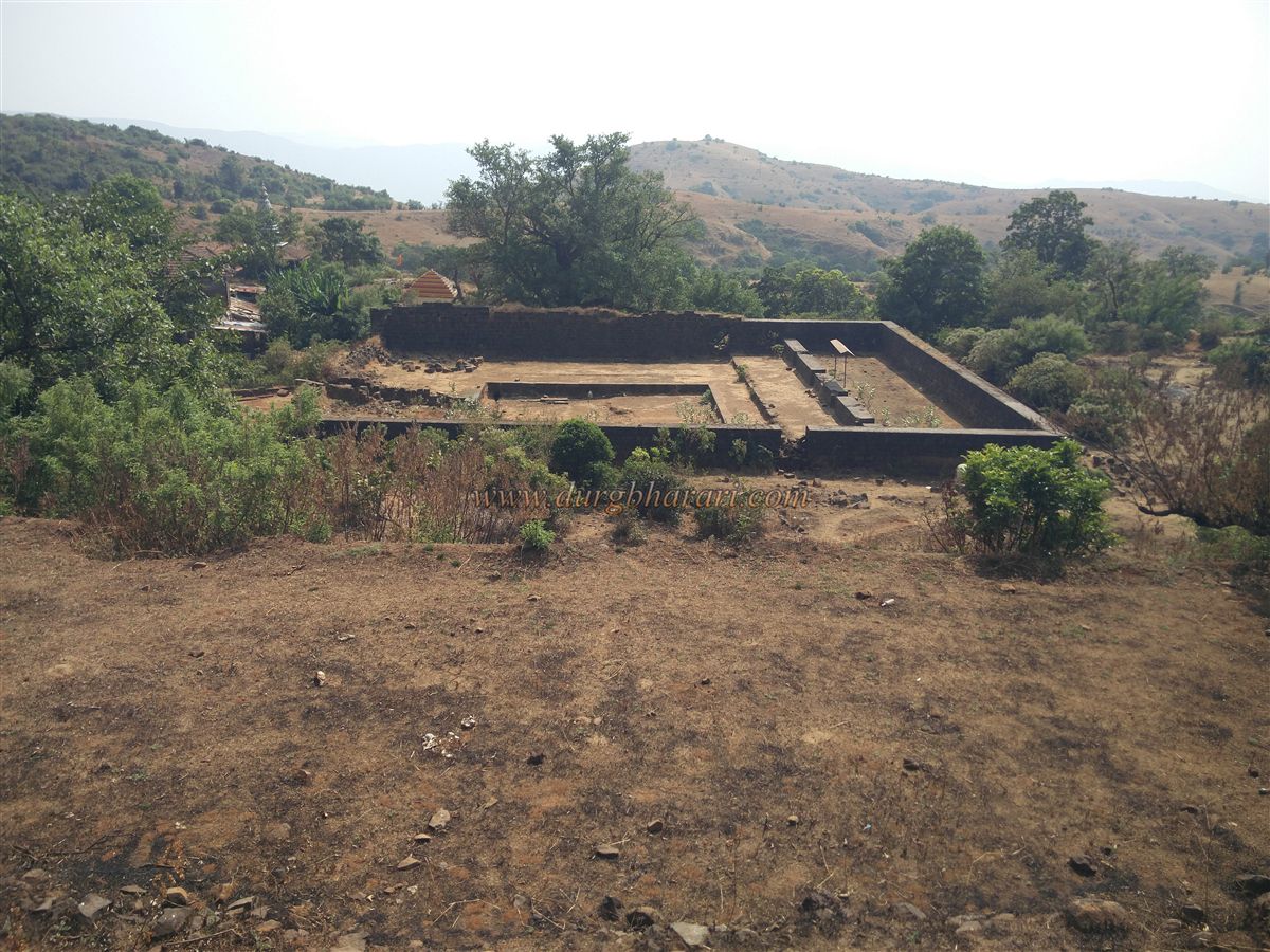
To the right of the Ganesh temple, at a short distance, is a large circular well known as the Ardhachandra Tank. It has steps and a small entrance door for descending. The interior of the well features decorative arches, and in one of them a Shivlinga is enshrined. In front of this well is the Pratinidhi Wada (mansion). A small doorway in the wall leads into the 100 x 80 ft quadrangular mansion. Today only the central courtyard, plinths, and walls survive. The main entrance of the wada faces east, and to the left of this entrance is a subterranean passage leading to a square well on the eastern side of the mansion. This underground passage is still usable. The walls of the well also feature arches, and there are steps on the outside for descending.
Climbing the hill above the wada reveals numerous ruins of houses. This was likely the main settlement of the fort during the Maratha period. After exploring this section, one should return to the Bhagwanteshwar Temple and proceed towards the dargah. On the way, to the left, are the ruins of another wada, with a small dried-up well in its premises. A little ahead, to the left, is an old stone-paved path leading to the dargah, but due to illegal constructions, the upper section of this path is now closed. Hence, one must proceed via the newly constructed cement path.
On this route, to the left in an open field, is a well whose water is currently supplied to visiting devotees. Passing through the shops and eateries, one reaches the Malik Rehan Dargah. From the square here, the straight path leads to the Ram Temple, the left path to the dargah, and the right path to the Mundha Darwaja on the eastern side of the fort. We first visit the Ram Temple. This temple has been recently restored. On the stone platform in front of the temple is a Hanuman idol, and nearby are remnants of some old temple structures.
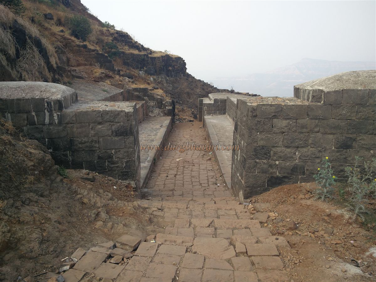
After visiting the temple, one returns to the dargah. The original dargah structure is old. Some sources mention that in 1639, Gordusheth Ballar, a trader from Rajapur, undertook its restoration, though references are unclear. However, records state that in 1941, Sheikh Ahmed Mohammad Bakk of Rajapur renovated the dargah. From the square, taking the right path towards the Mundha Darwaja, one sees some worn-out virgal on a platform. Proceeding through the narrow lane leads to the Mundha Darwaja. Unfortunately, devotees visiting this area have turned it into a dumping ground. Most visitors drink alcohol, sacrifice cocks, consume the offerings, and finally litter the fort with filth.
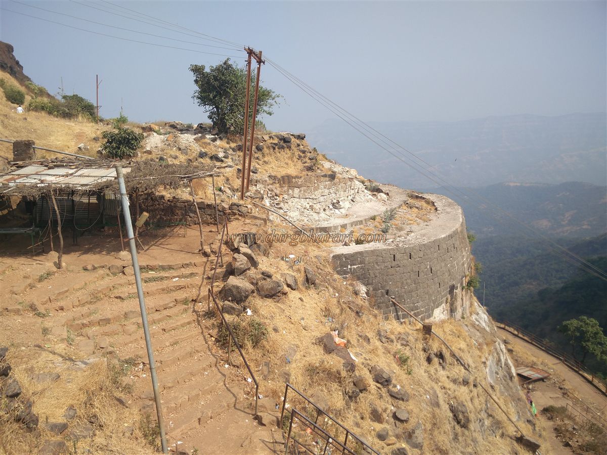
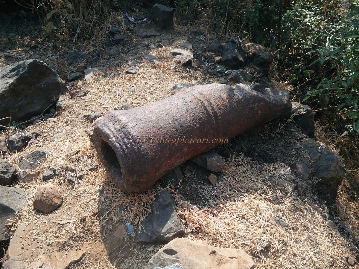
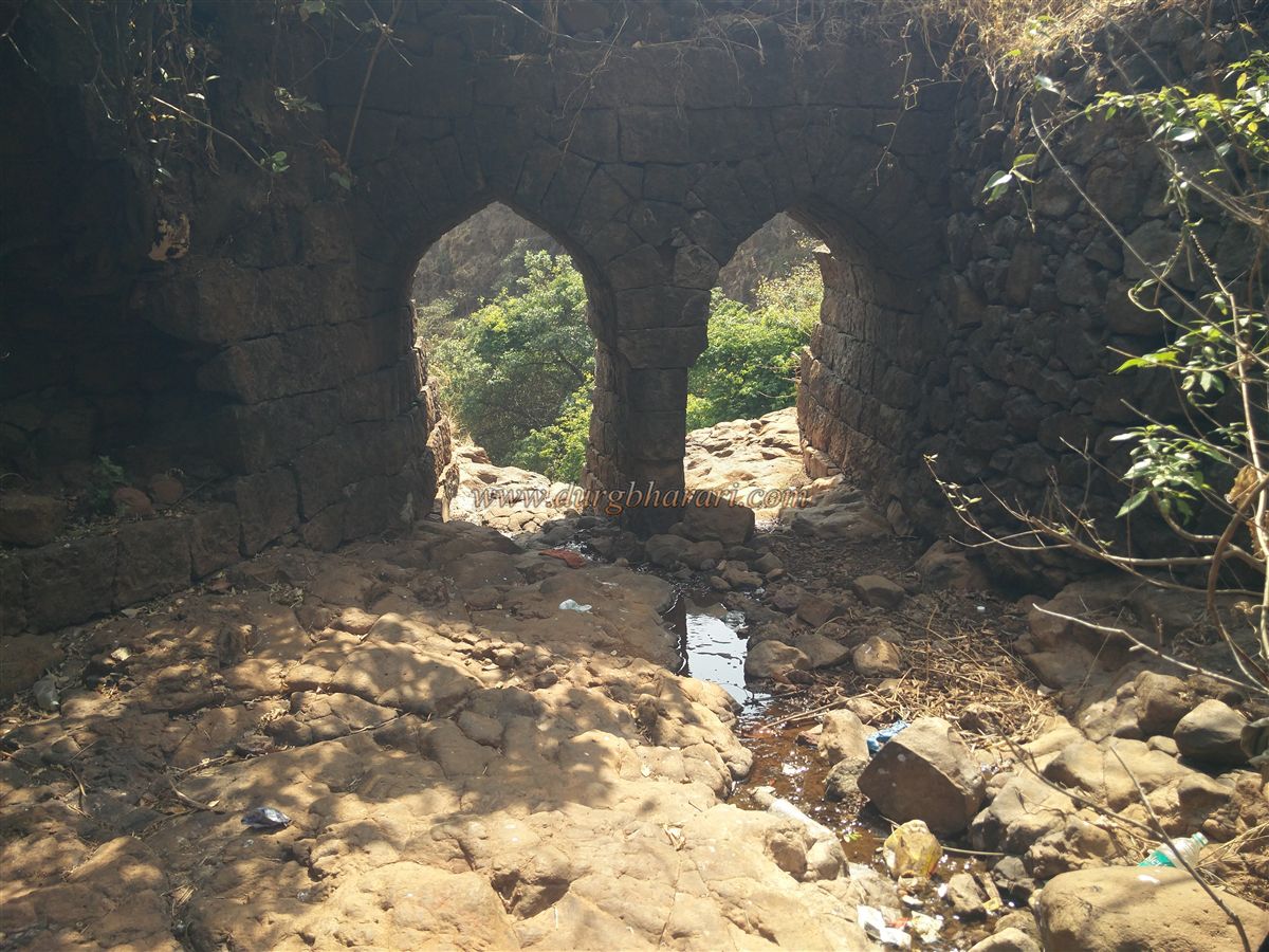
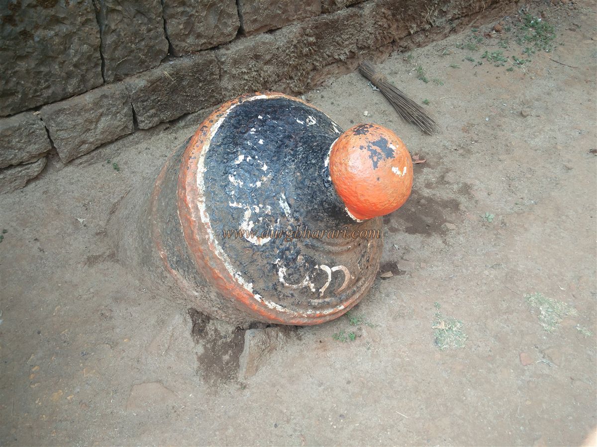
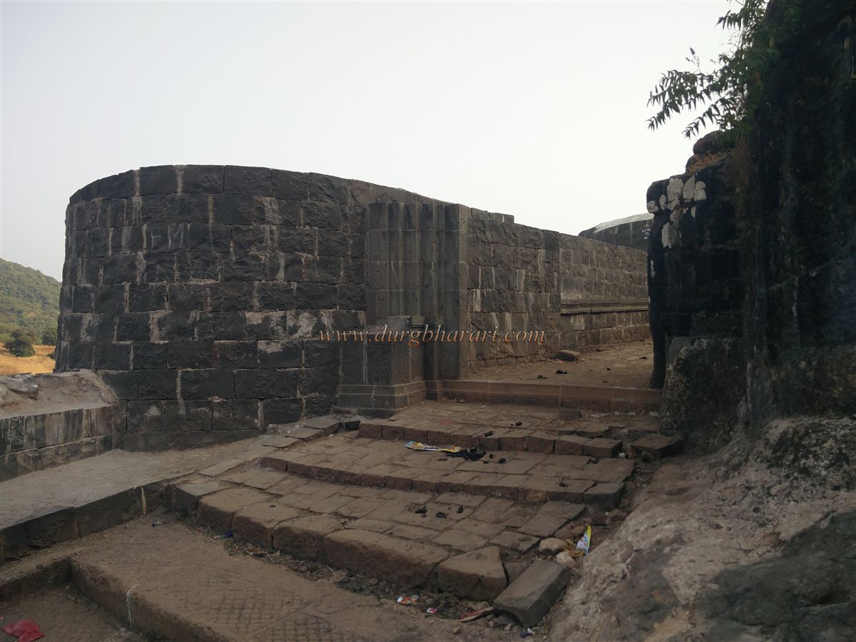
Passing through this filth, one reaches a stagnant water tank on the way to the Mundha Darwaja. The gate, situated between two bastions, has been preserved by the government, though the adjoining structures are completely destroyed. From the base of the fort, this gate is always visible, appearing to keep watch over visitors. The adjacent fort wall descends all the way down to the valley. In front of the gate, on a newly constructed platform, lies an eight-foot-long cannon. From here, one can see the entire fort wall below and the parking area opposite.
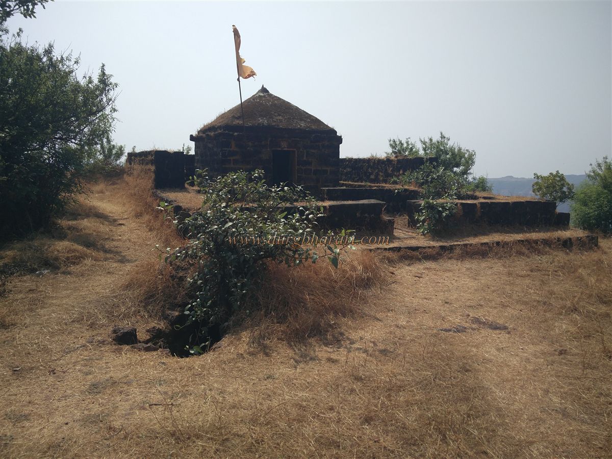
Although the exit route is nearby, half the fort remains unexplored. Looking from the cannon, to the right of the gate is the valley, and to the left, a hilltop with a fluttering saffron flag. This hill, known as Ranmandal, is the highest point on the fort, offering a panoramic view of the entire area. Here the fort rises to an altitude of 2,490 ft above sea level and spreads across approximately 250 acres. In the open flat areas of the fort, farming is done during the monsoon.
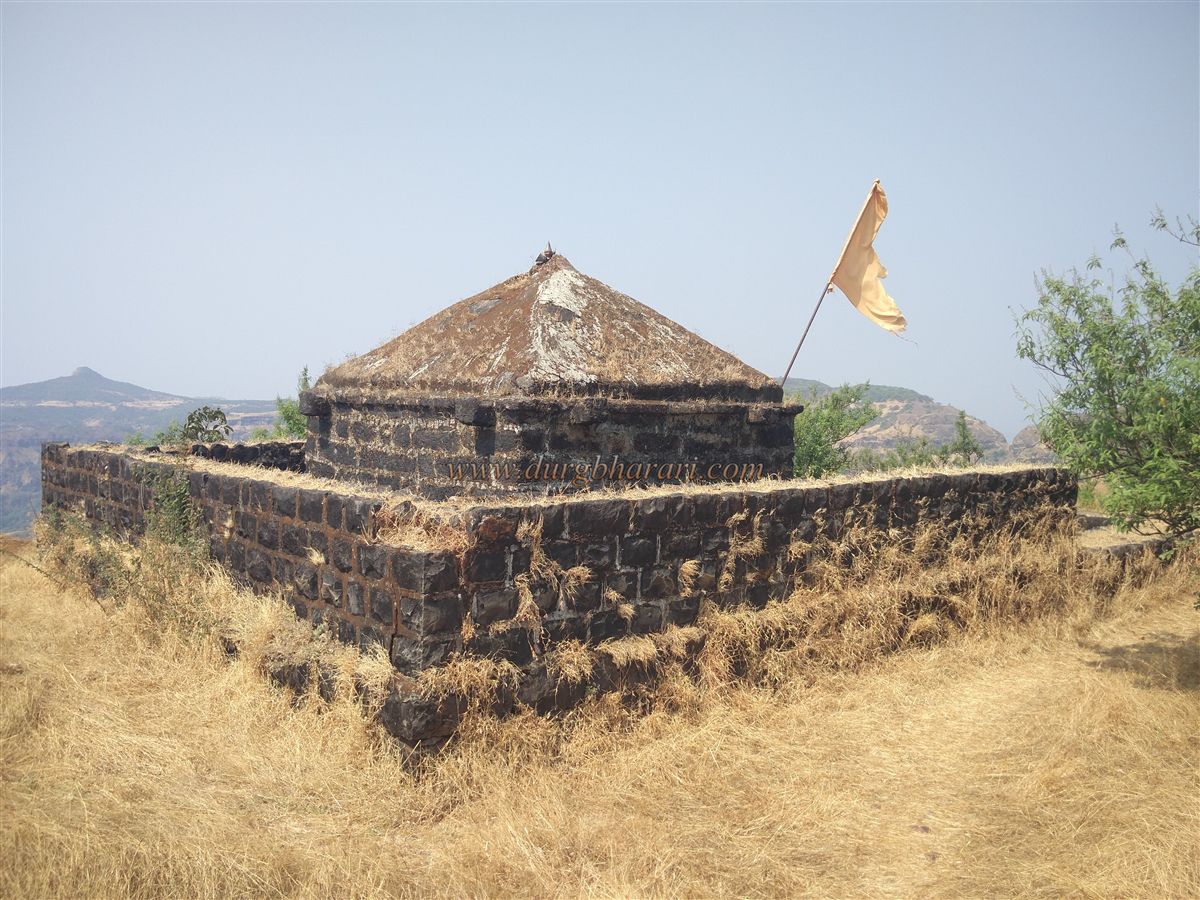
Descending from this hill and walking along the inner side of the fort wall near the valley begins the next phase of exploration. After enduring the stench and passing through the inhabited section, one comes to a spacious path. At its beginning, to the left, stands the ruins of the Narasimha Temple. Only the plinth and sanctum of this stone-built temple remain; the idol is missing. Continuing further, on the right, one finds an enclosed courtyard surrounded by house ruins and another dargah. From this dargah, a right-hand path leads to the memorial of Ambikabai, wife of Chhatrapati Rajaram Maharaj. This stone-built memorial houses a platform with two carved footprints. After Chhatrapati Rajaram Maharaj died at Sinhagad, his third wife Ambikabai (also known as Ahilyabai) committed sati here along with his turban. This memorial was restored in 1940.
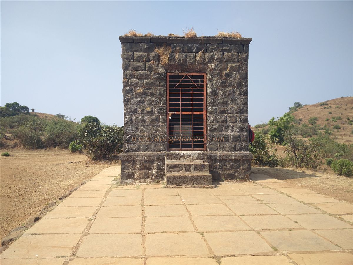
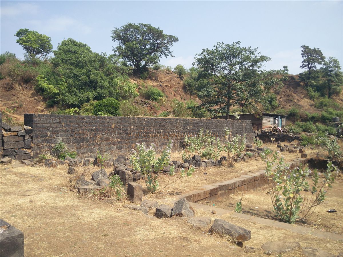
From here, a straight path along the edge of the valley leads to a small rock-cut water tank. Returning to the memorial and proceeding straight ahead takes one to the western section of the fort. On this path, to the right, are some graves on a hillock. A little further ahead, to the right, one sees a retaining wall built between two mounds to store water. Continuing along, one finds that this entire section of the fort is enclosed by bastions and fort walls, which remain in good condition.
In this area are the ruins of the Waghjai Devi Temple. Looking at the carved pillars and worn-out idols here, it is evident that a very old temple once stood at this spot. Along the edge of the fortifications, another retaining wall can be seen. At the western end of the fort is a large bastion with remnants of a guard post. Just before this bastion lies the Konkan Darwaja, flanked by two bastions. Opposite this gate stands Machaldurg. Those coming from Konkan would enter Vishalgad through this gate. The proximity of the Machal hill provided significant protection to this area. The constant movement of villagers from Machal has kept this route well-trodden.
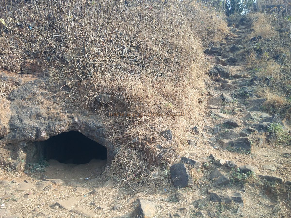
Descending from this gate, one finds a 30-ft-long deep rock-cut cave. Its inner opening has been blocked by debris. Steps have been carved here to descend into the valley or proceed towards Machal. Fort enthusiasts visiting Vishalgad must explore this section. Historical references mention four reservoirs on the fort: Bhupaltale, Ardhachandratale, Gauritale, and Pasaltale, though even locals today cannot identify their exact locations. From the fort, vast stretches of the Konkan are visible.
It takes about six hours to explore the entire Vishalgad. Food and lodging arrangements are available on the fort, though not ideal for fort enthusiasts. Some houses near the Bhagwanteshwar Temple premises can provide these facilities if notified in advance.
The construction of Vishalgad is attributed to Shilahara King Marsinha in 1058 CE, though some historians believe that Shilahara King Bhoj II (1175–1212 CE) built this fort. Around 1190 CE, King Bhoj II shifted his capital from Kolhapur to Panhala and constructed fifteen new forts in southern Maharashtra, including Khelna (Vishalgad), to protect the mountain passes. In the 13th century, the Yadavas of Devgiri defeated the Shilahara and took control of the fort.
After the Yadavas, while the Konkan region was under the Shirke and More families, Vishalgad came under the Mores. During the Bahmani period in 1453, Bahmani commander Malik Uttujar invaded Konkan for expansion. He defeated the Shirkes, took their fort, and demanded their conversion to Islam. However, the Shirkes countered with a condition: first, convert their enemy Shankar Rao More of Khelna Fort, and then they would convert and serve the Sultan. They even guided Utujar’s army through the dense forests at the base of Vishalgad. But the Bahmani soldiers, unaccustomed to the rugged Sahyadri terrain, were exhausted. Malik Uttujar fell ill with dysentery. Seizing the moment, the Shirkes allied with the Mores and ambushed the Bahmani army from both sides, killing Malik Uttujar and 7,000 of his men. This was the first known battle fought with the Sahyadri as an ally, vividly described in Ferishta’s Burhan-i-Masir.
In 1469, the Bahmani Sultan sent Commander Babkire Malik Rehan to capture Khelna. After nine months of fierce effort, he succeeded in 1470. The dargah of this Malik Rehan still stands on the fort, with a Persian inscription confirming this. After the Bahmani, Vishalgad came under Adilshahi control and remained under Muslim rule for nearly 190 years.
On 28 November 1659, when Shivaji Maharaj captured Panhala, he also took Khelna and renamed it Vishalgad. On 3 March 1660, Siddi Jauhar laid siege to Panhala, while Jaswantrao Dalvi and Suryarao Surve of Shringarpur besieged Vishalgad. On 13 July 1660, in heavy rains, Shivaji Maharaj broke out of the Panhala siege and, after the heroic stand of Baji Prabhu Deshpande at Pavan Khind, reached Vishalgad by breaking the siege. At this time, Rango Narayan Sarpotdar was the fort commander. Historical records mention that Shivaji Maharaj spent 5,000 hon (gold coins) to strengthen Vishalgad.
After Shivaji Maharaj, Chhatrapati Sambhaji Maharaj also repaired the fort. In 1686, to quell the Shirke rebellion, Sambhaji sent Kavi kalash, who, after being defeated, took refuge at Vishalgad. In 1689, while traveling from Vishalgad to Raigad, Sambhaji Maharaj was captured at Sangameshwar and brutally executed at Tulapur.
After the fall of Raigad to the Mughals in 1689, the Marathas took refuge at Vishalgad. When Chhatrapati Rajaram Maharaj went to Jinji, his three queens — Ambikabai, Rajasabai, and Tarabai — stayed at Vishalgad for some time before Ramchandrapant Amatya safely escorted them to Jinji.
After spending seven years in Jinji, Rajaram Maharaj returned to Maharashtra on 22 February 1698 and came to Vishalgad. During his time, Ramchandrapant Amatya made Vishalgad his main base, making it the nerve center of Maratha operations. After Rajaram Maharaj’s death in 1701, his third wife, Ambikabai, committed sati at Vishalgad.
In December 1701, Aurangzeb himself came with a large army to capture Vishalgad. The fort commander, Parashuram Pant Pratinidhi, valiantly defended the fort for six months before surrendering it on 6 June 1702 in exchange for safe passage and two lakh rupees. Aurangzeb renamed the fort “Sakkarlana.” On his way from Vishalgad to Panhala, Aurangzeb’s forces suffered immense hardships, taking 37 days to cover the distance, as recorded in Mughal documents.
In 1707, Tararani recaptured Vishalgad. During the peak of Maratha resistance, Tarabai and Ramchandrapant Amatya governed the Swarajya from Vishalgad. The Pratinidhi family of Vishalgad traces its lineage to Parashuram Trimbak. In 1844, Chhatrapati Sambhaji of Kolhapur issued a sanad (grant) in the name of Janardanpant Pratinidhi to continue the fort’s inam (jagir). Being Jagirdar of Vishalgad, the Pratinidhi resided on the fort.
In the same year, a rebellion broke out against the British in Kolhapur. The British captured Vishalgad but later returned it to the Pratinidhi. Due to the damages sustained, the Pratinidhi shifted their residence to Malkapur. Until the princely states were merged, Vishalgad remained under the control of the Pratinidhi family of Kolhapur.
In history, Vishalgad has been referred to by various names — Kishagila, Khelna, Khilgila, Khilkila, and Sakkarlana.
© Suresh Nimbalkar
GALLERY