VILASGAD
TYPE : HILL FORT
DISTRICT : SANGALI
HEIGHT : 2680 FEET
GRADE : EASY
On the Mumbai–Bengaluru highway, between Karad and Kolhapur, lies an overlooked fort named Vilasgad, located east of Karad. Though historical records refer to this fort as Vilasgad, it is more popularly known in the region as Mallikarjun Fort because of the Mallikarjun cave-temple on the hill. It is not known exactly who built this fort, but the presence of the ancient caves atop the hill suggests that the site had been in use since very early times. However, when exactly it began to be used as a fort remains uncertain. Some documents from around 1717 CE mention this hill as a fort.
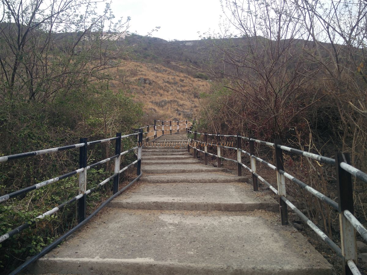
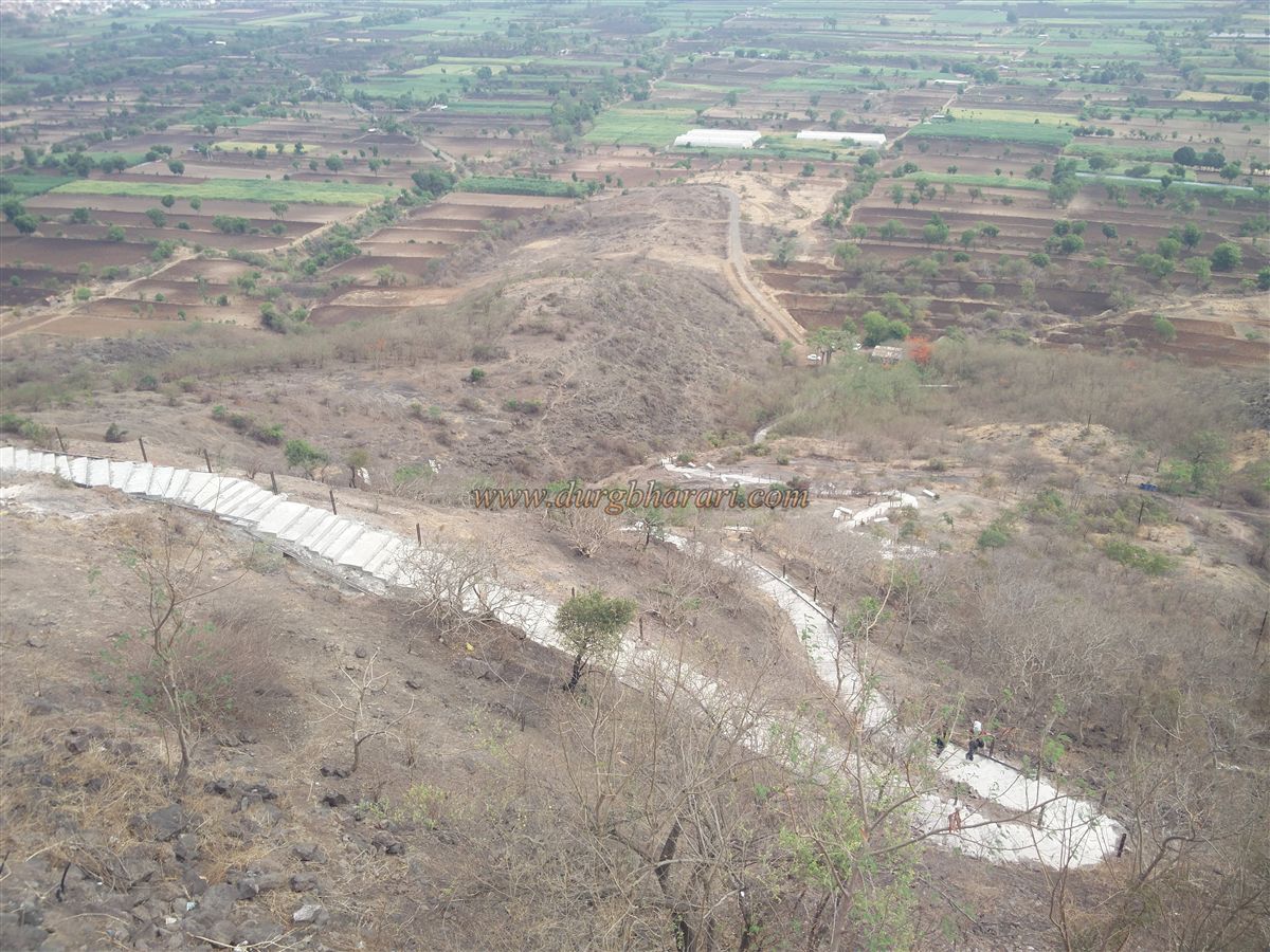
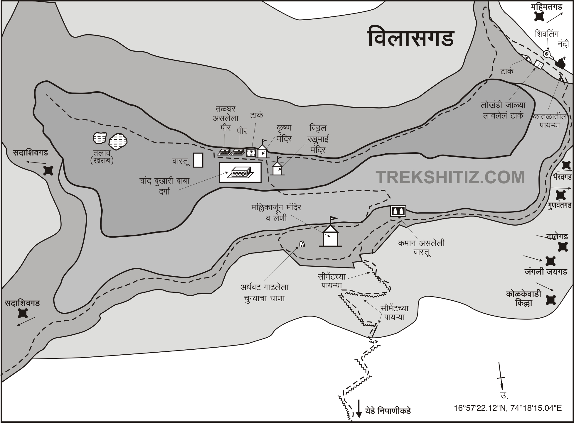
To reach Mallikarjun Fort, one must travel to Yedenipani, the base village, which is located about 40 km from both Karad and Kolhapur. From the village, a rough road leads to the foot of the hill, where newly constructed cement steps begin.
...
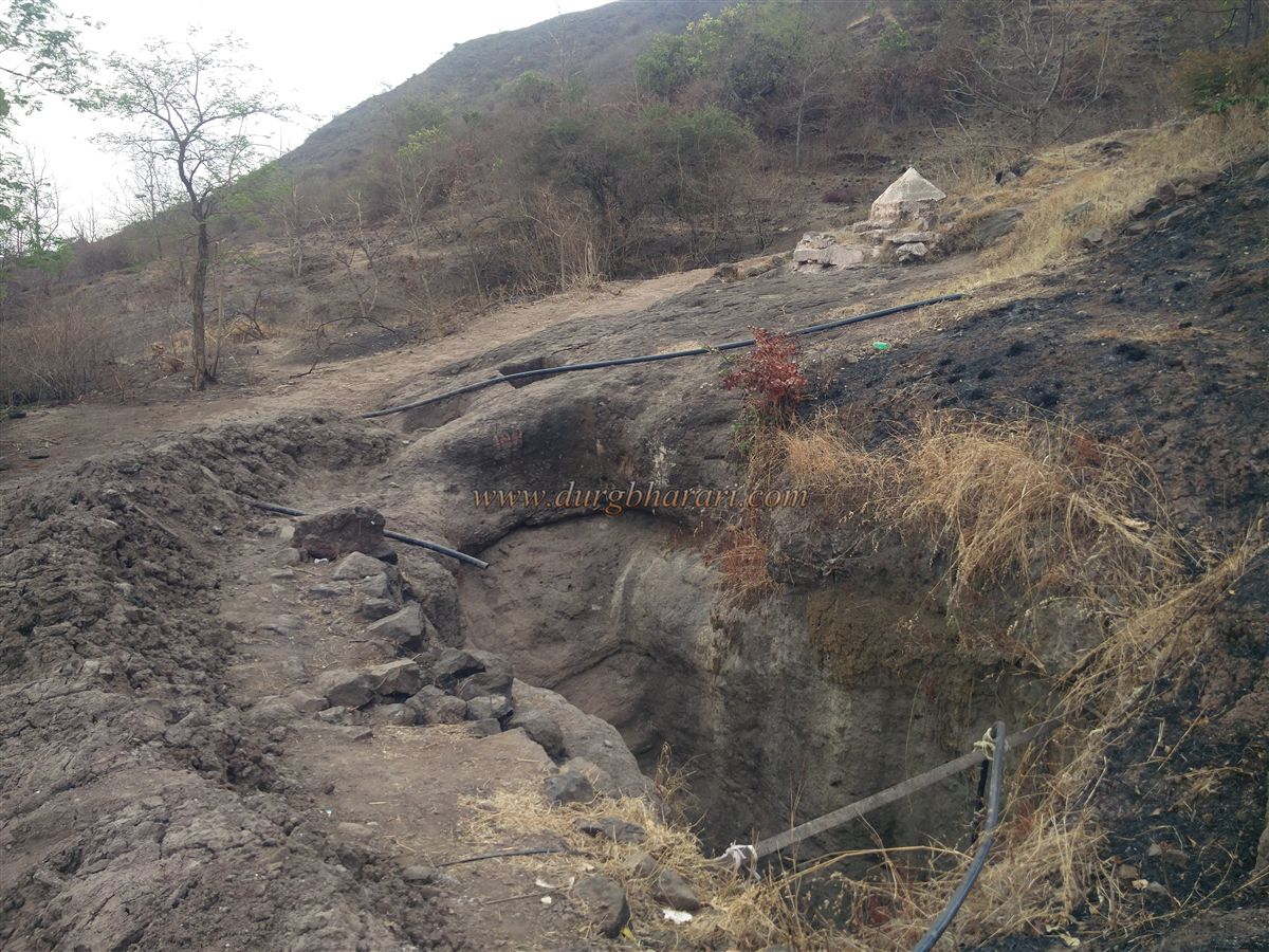
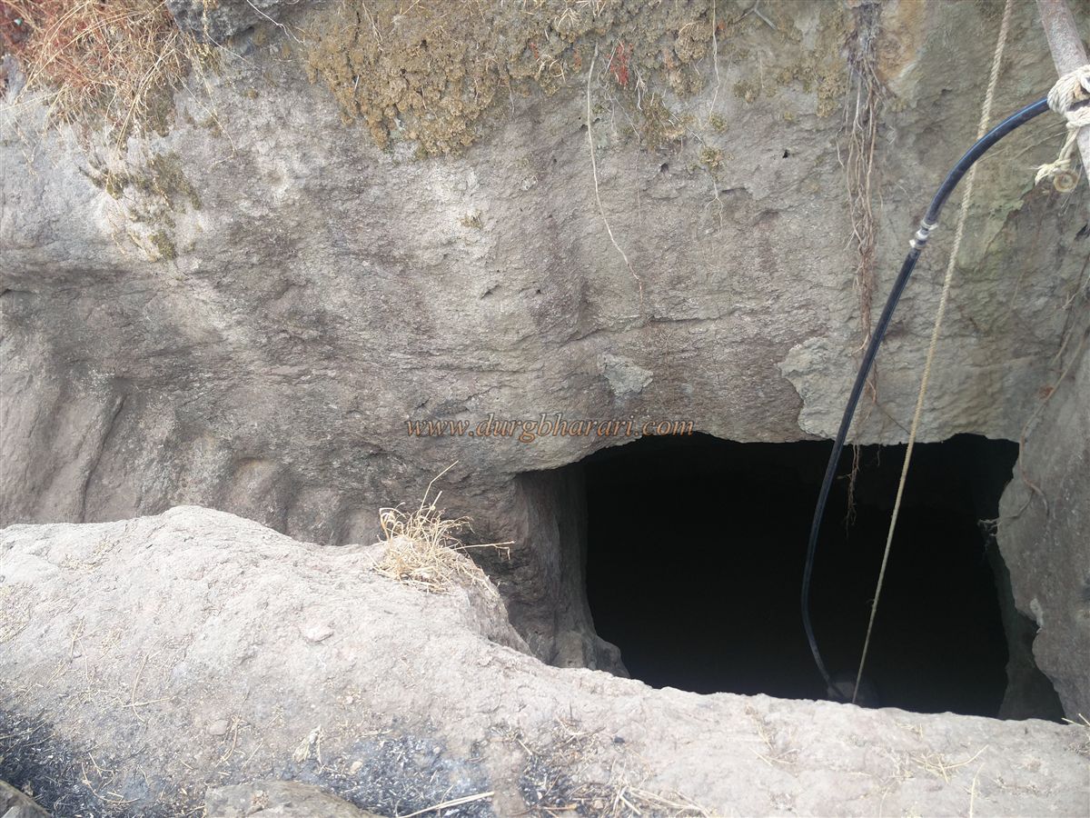
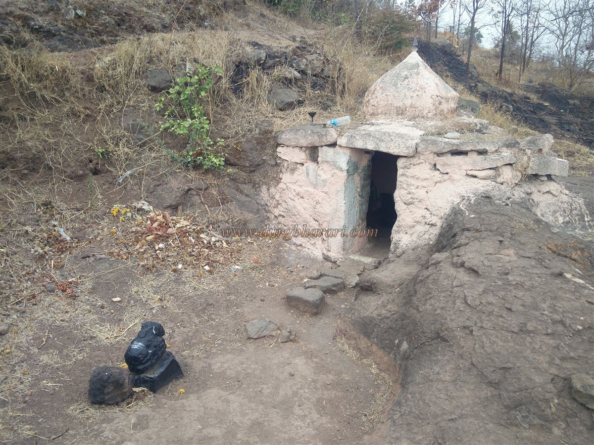
On the way up these steps, one can also see remnants of the original rock-cut steps of the fort. After about ten minutes of climbing halfway up the hill, to the left of the steps, stands a domed structure. On the way to this dome lies a large, deep rock-cut cistern with steps carved into the rock for descending. The water from this cistern is pumped to the temple and used for drinking and worship purposes. The dome contains a naga (serpent) sculpture and a Shiva Linga.
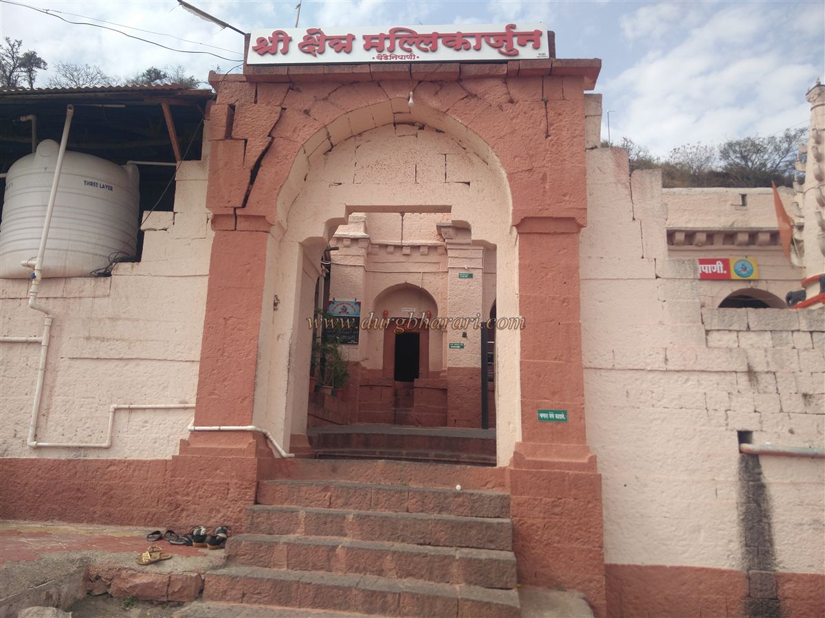
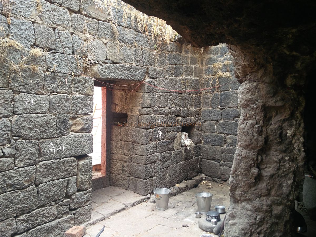
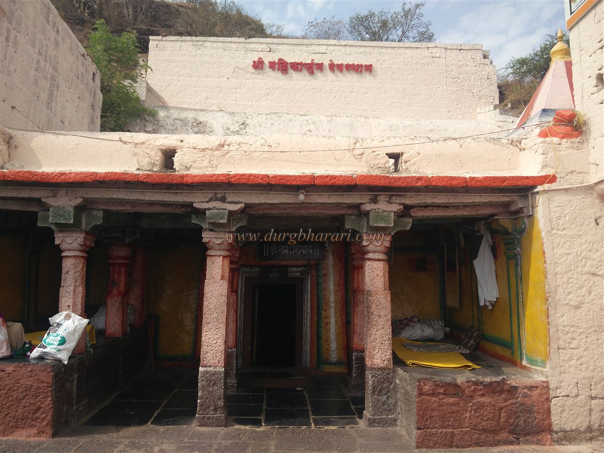
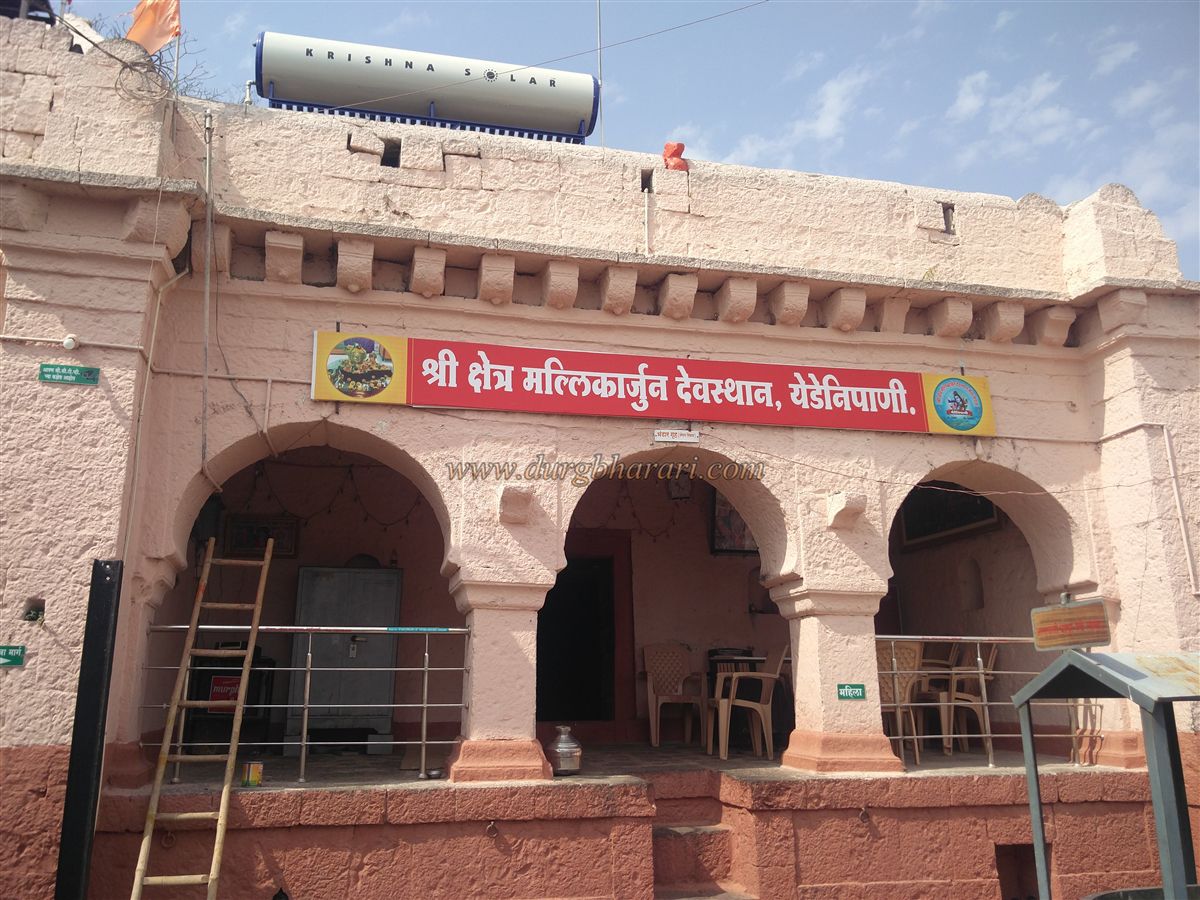
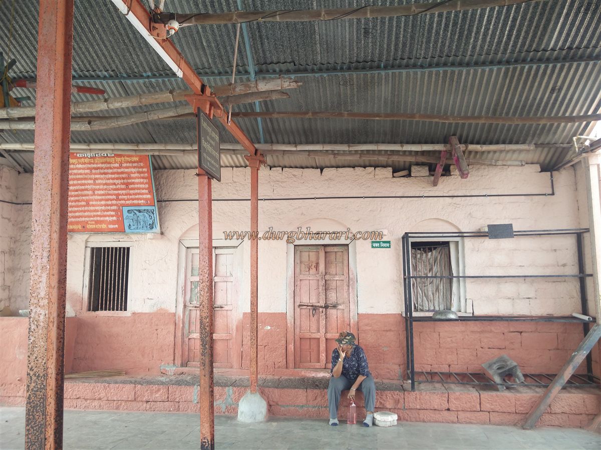
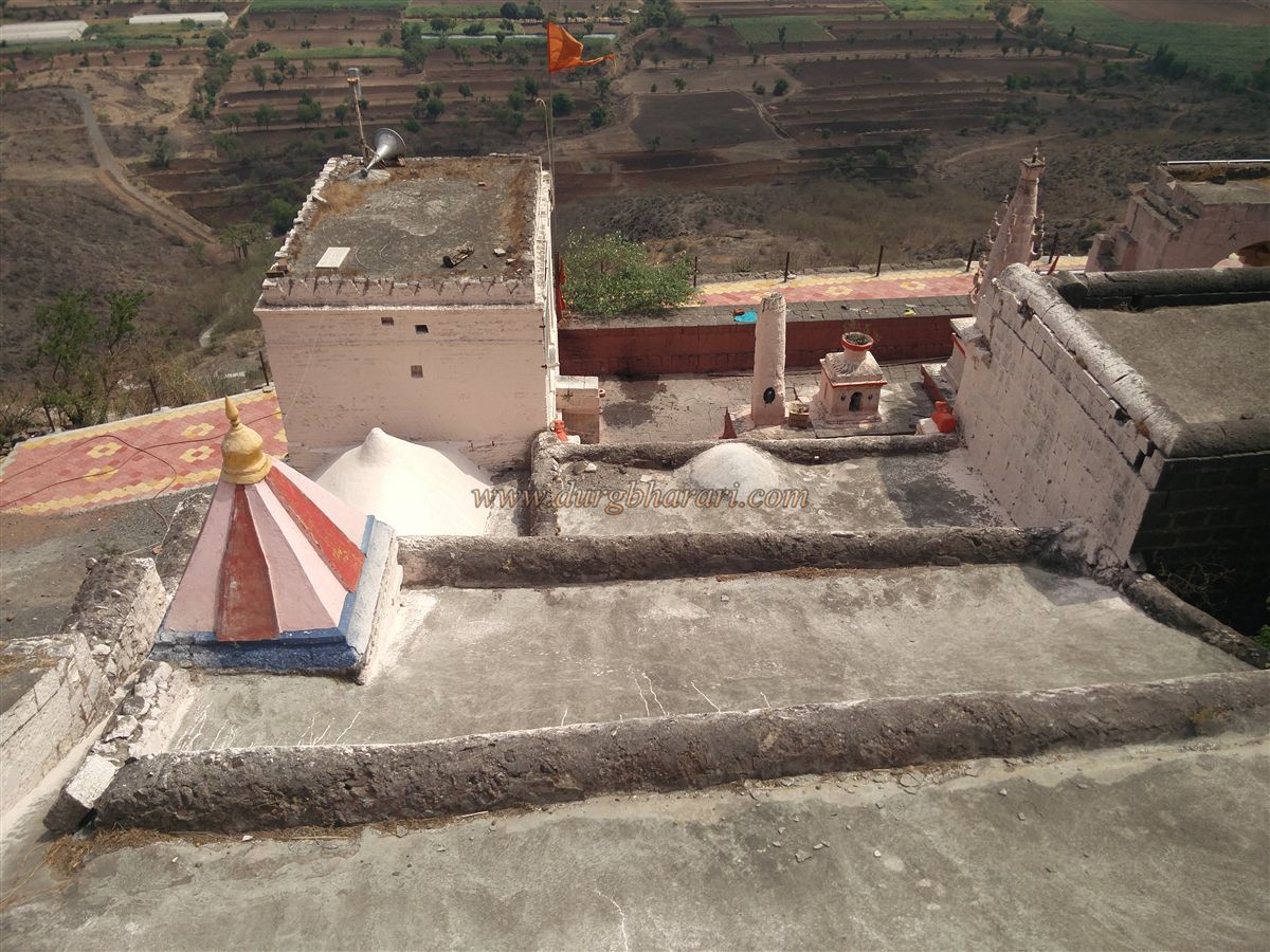
Returning to the main path and climbing for another 15 minutes brings you to the premises of the Mallikarjun Temple. The temple complex is enclosed by a stone wall, with a gateway crowned by a stone arch. On this wall, there is a cow-shaped spout (Gomukh) and a weathered Devanagari inscription. To the right of the temple wall, two arched structures can be seen.
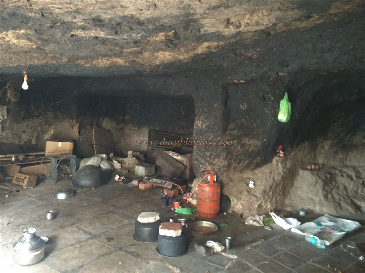
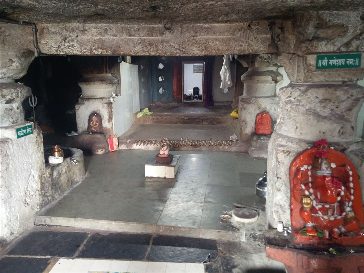
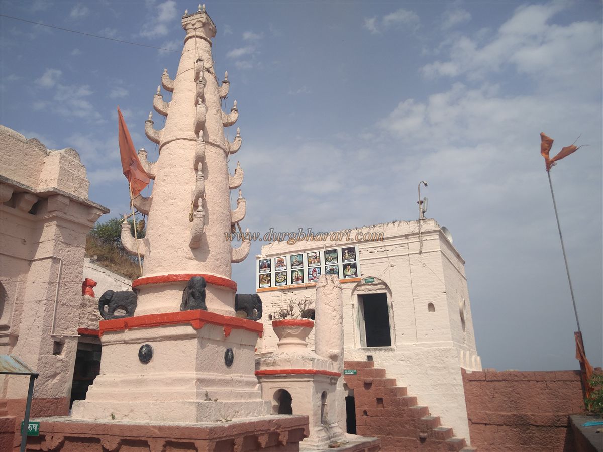
Inside the temple enclosure, to the left, is a tin-roofed shelter adjoining the hillside, which serves as a Dharamshala for devotees. To the right are two stone deepmalas (lamp towers) with a stone tulsi-Vrindavan (holy basil pedestal) between them. In front of these stands the Nagarkhana (drum house), built into the fort wall, with steps leading up to it. Below the Nagarkhana is a room housing a stone Nandi with its head turned sideways. A path from here leads to the main cave temple, but it is currently closed.
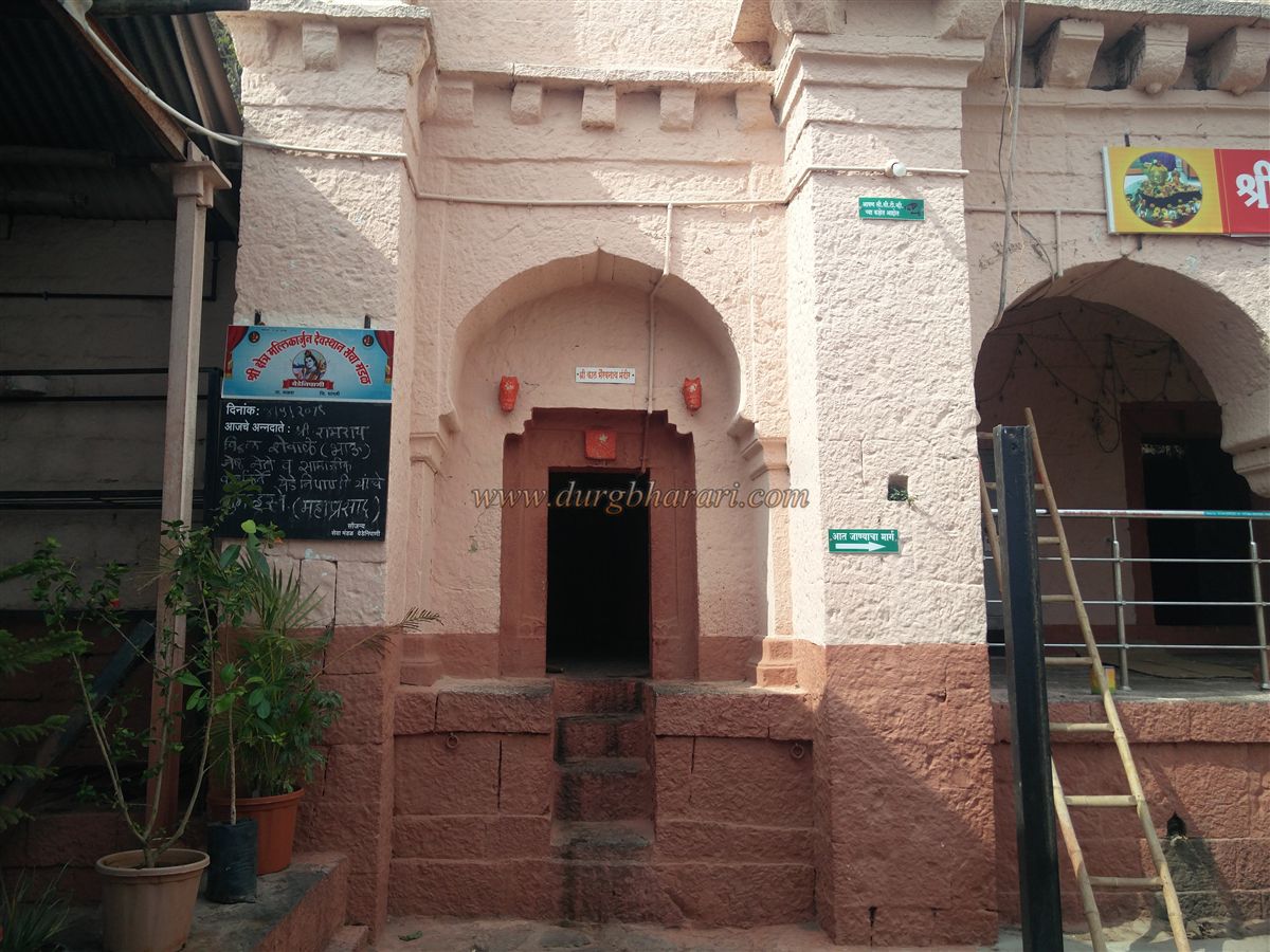
Directly opposite the main gate of the enclosure is a small stone temple housing a Kalbhairav idol. Adjacent to this temple is a stone platform with a pillared Sabhamandap (assembly hall). Its square stone arch doorway leads to a partially rock-cut cave. The facade of this cave has been fully enclosed with stone masonry, and three stone arches have been built in front to enhance its appearance. From the outside, this structure resembles a stone warehouse rather than a cave. This cave is currently used by the temple priest.
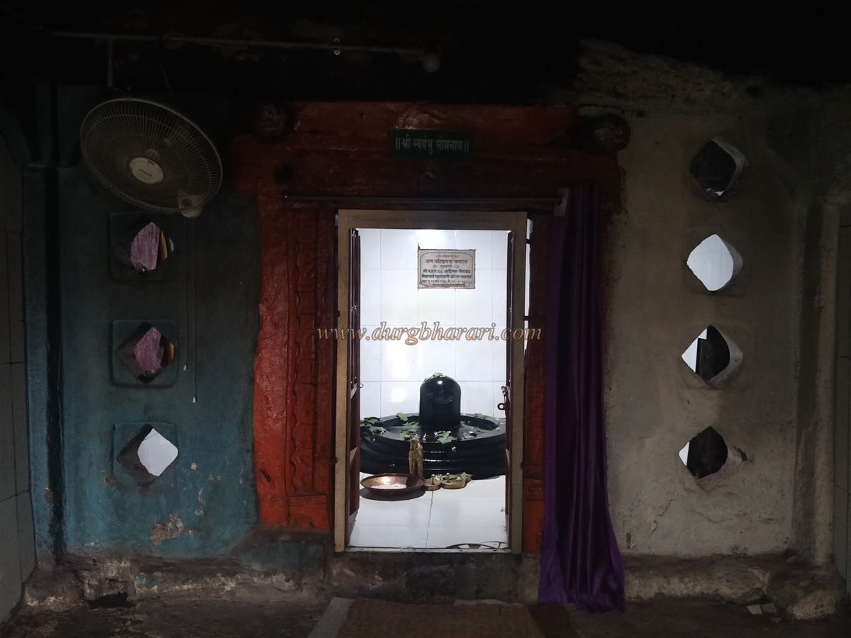
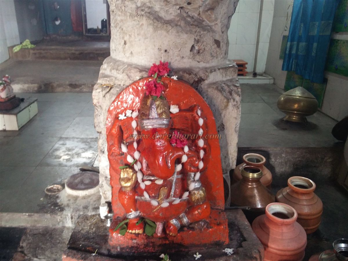
Next to this cave is the main Mallikarjun cave-temple. Its front Sabhamandap is supported by six intricately carved stone pillars, while the inner sanctum is a large rock-cut chamber resting on four elaborately carved pillars. The temple has three separate chambers (vihar): to the right is the Mallikarjun shrine with a Shiva Linga, the central shrine is dedicated to Sorathi Somnath (another form of Shiva), and the third chamber houses an idol of Kartik Swami. The Nandi facing the Mallikarjun shrine is now placed in the room beneath the Nagarkhana.
The pillars and walls of the main cave also display sati stones, idols of Ganesha, naga carvings, Shivalings, and Jain ascetic figures. Although the entire temple complex is exquisitely crafted, its beauty has been diminished by layers of oil paint applied over time.
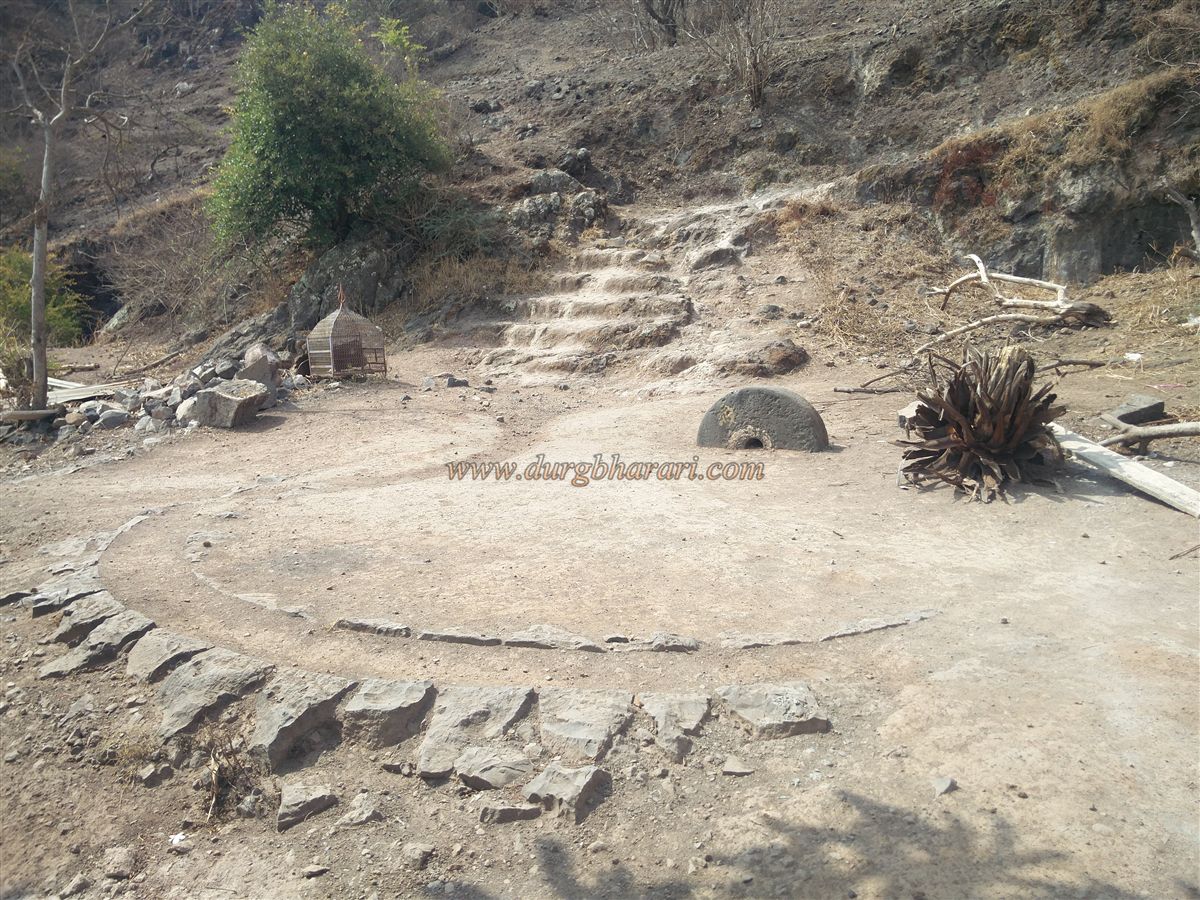
After exploring the temple complex, one can proceed toward the fort summit. The path to the top begins to the left of the temple complex, where one first encounters a traditional lime-grinding stone wheel, half-buried in the ground. Beyond this are unfinished rock-cut water tanks and steps leading higher. In about 10 minutes, this path brings you to the remains of the ruined fort gateway. Only the stone platform of the gateway survives today.
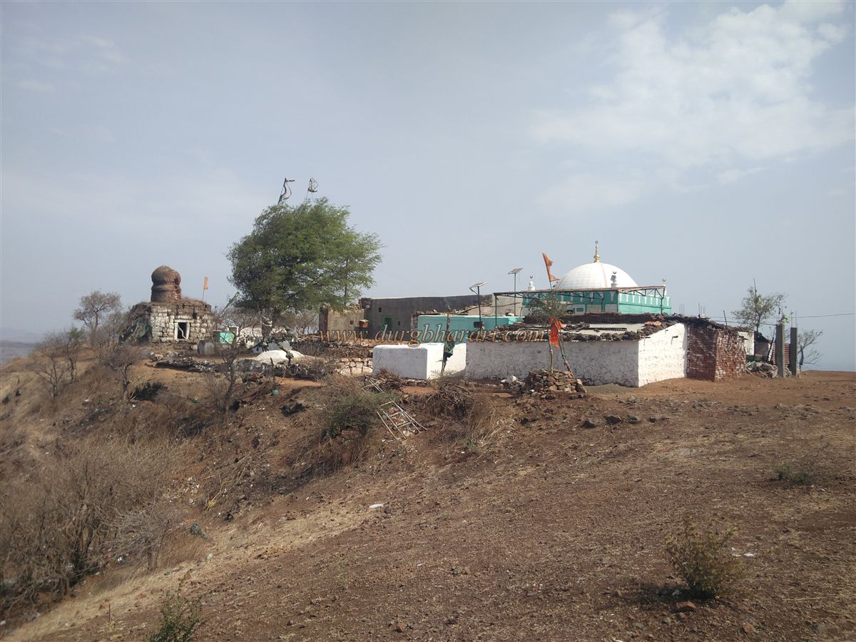
At the top of the fort is a small, dilapidated stone temple with a brick dome, dedicated to Vitthal-Rukmini and Shri Krishna. Their idols are now kept in a nearby tin shelter. The temple stands on a stone platform, beneath which lies a basement with niches and steps, though its poor condition makes entry dangerous.
In front of the temple are two tombs and a dargah. Beneath one of the tombs lies another underground chamber housing an additional tomb. The dargah, dedicated to Hazrat Chand Bukhari Baba, has been maintained by the Jadhav family for seven generations. Notably, the renowned Shivshahir (folk poet) Babasaheb Deshmukh belonged to this family. His fourth brother, Nawanath Jadhav (Deshmukh), now 80 years old, still resides here. We were fortunate to meet him, listen to his powerful renditions of powada (Marathi ballads), and explore the fort in his company.
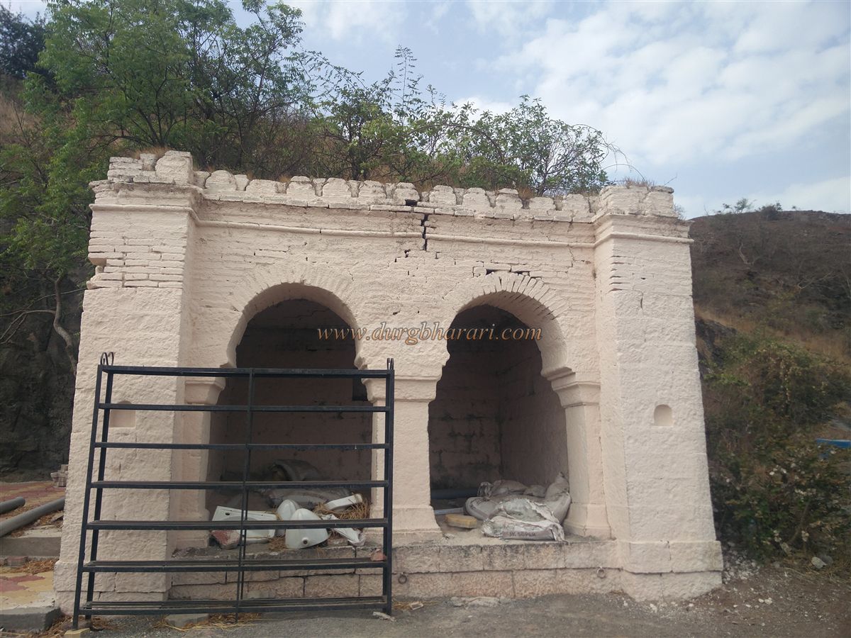
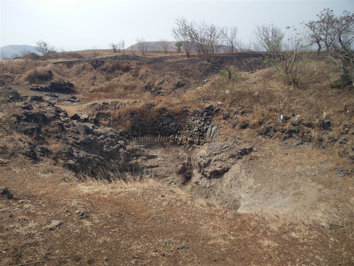
Further ahead stands a well-preserved but roofless stone structure measuring approximately 15 x 12 feet, with arched entrances on two sides. Judging by its design, this was likely the fort’s administrative building (sadar). This is the only surviving fort-related structure still standing on the summit.
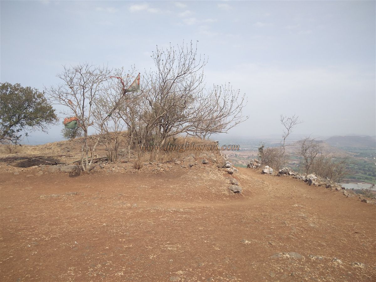
A little farther from this building is a small, deep rock-cut pond. Walking past this leads to the opposite end of the fort, where one can see a flat plateau known as Ghodatalao. On the summit, there are two small houses where members of the Jadhav family occasionally reside.
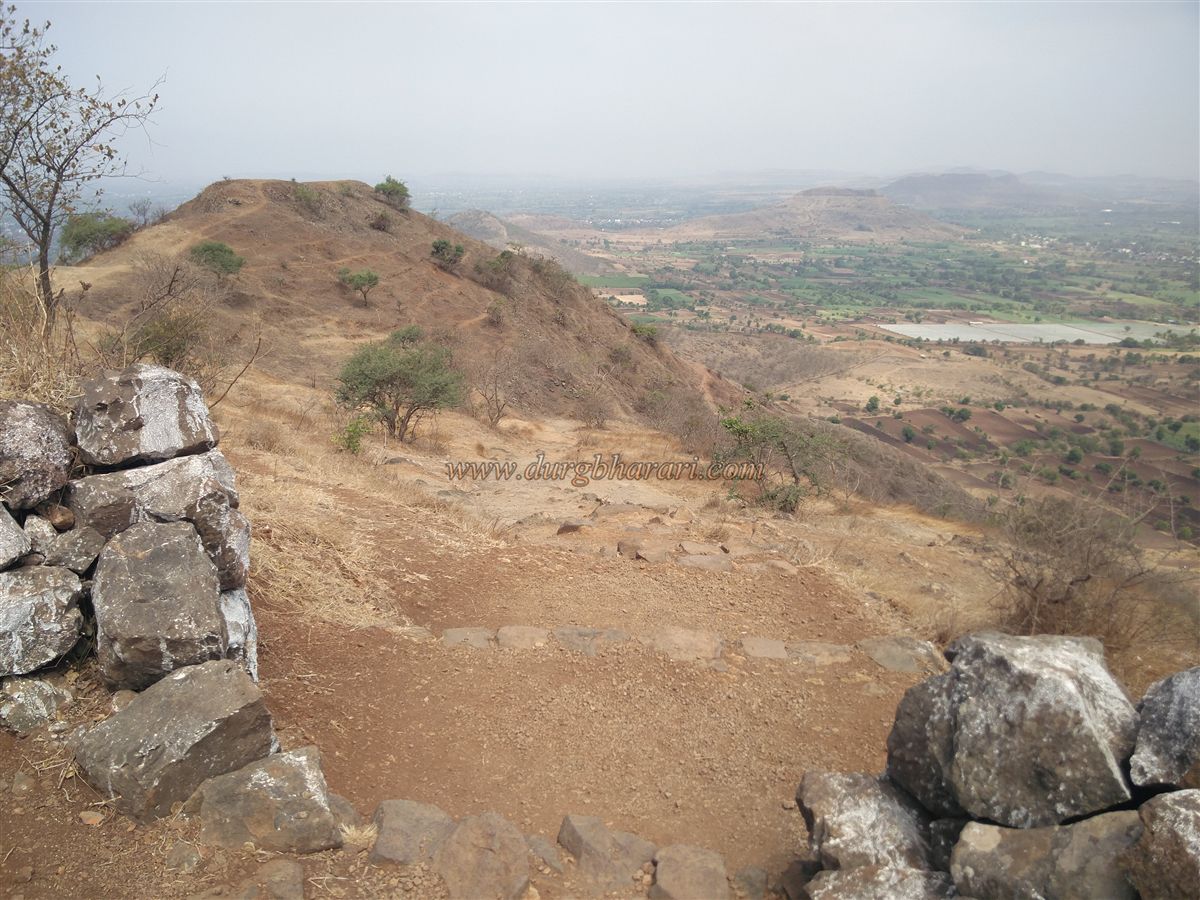
While exploring the fort, one can also spot the ruins of a mansion and portions of fort walls behind the temple. From any point on the summit, panoramic views of the surrounding region unfold. The fort was likely used primarily for surveillance. From the top, the Warna River can be seen to the south, Jotiba and Panhala to the southwest, and Machhindragad and Agashiv Hill to the north.
After fully exploring the summit, returning to the Mallikarjun Temple completes the tour. It takes about three hours to explore the entire fort from base to summit and back.
Though no records indicate exactly when this fort came under Maratha control, it is likely that it was captured during the Maratha expeditions into Adilshahi territory after Afzal Khan’s defeat, which extended their dominion up to Miraj. Documents from 1717–18 mention Vilasgad in the list of forts and provinces granted by the Mughals to Chhatrapati Shahu. According to a letter from the Karvir records dated August 18, 1798, while the Karvirkar Maharaj was at Bhatashirale, an auspicious date was chosen for the reconstruction of a fort on Mallikarjun Hill. This suggests that plans were made to rebuild the long-abandoned fort, though no actual construction appears to have taken place.
© Suresh Nimbalkar
GALLERY