VARUGAD
TYPE : HILL FORT
DISTRICT : SATARA
HEIGHT : 3160 FEET
GRADE : EASY
The Manganga River, which originates in the Sitabai hills of Satara district, joins the Bhima river at Sarkoli near Pandharpur, fertilizing a region of 150 km on its banks. This region along the river Manganga is known as Mandesh. The tributary of Sahyadri, which runs east-west from the border of Phaltan and Maan tehsil, is known as the Mahadev mountain range.Varugad was created to keep an eye on the region near the origin of the Manganga in this Mahadev mountain range in Maan tehsil. Although the fort is in Maan tehsil, you have to reach Phaltan to visit Varugad. The distance from Pune to Varugad is 140 km via Saswad-Lonand-Phaltan. The distance from Phaltan to Varugad via Dahivadi road is 35 km.
...
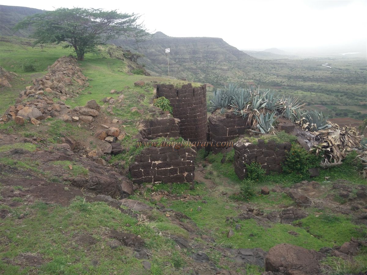
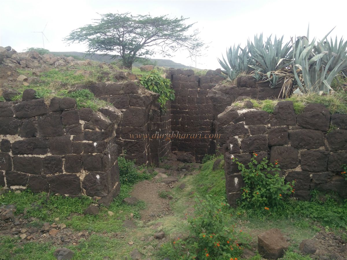
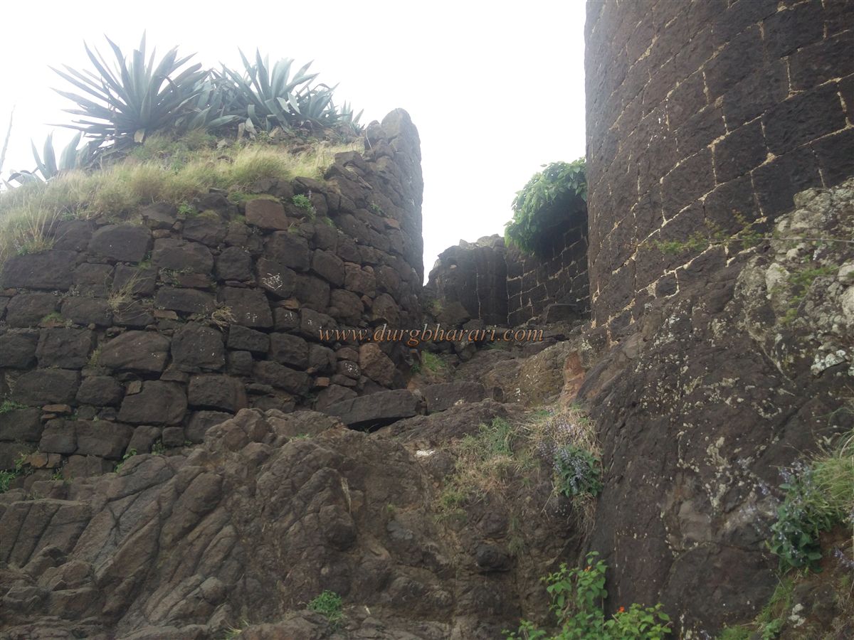
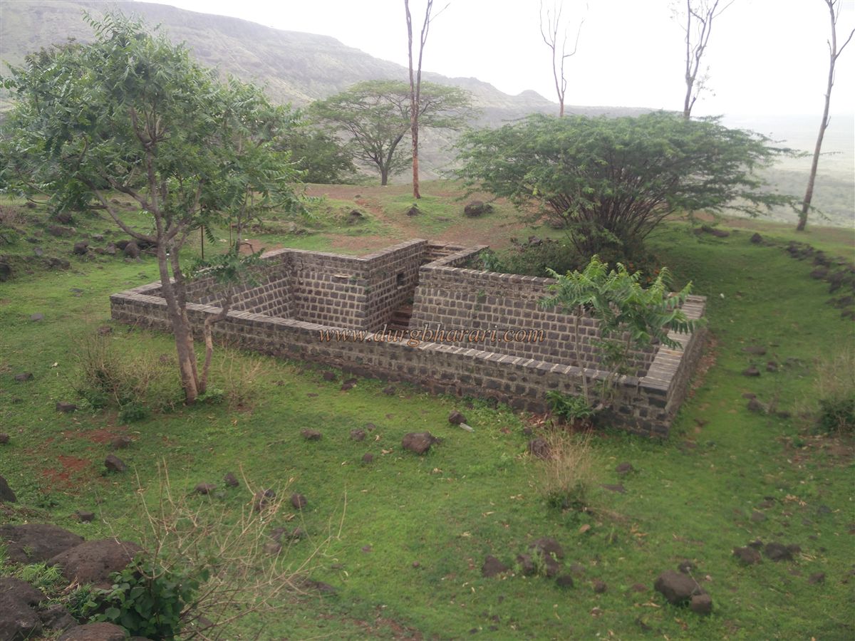
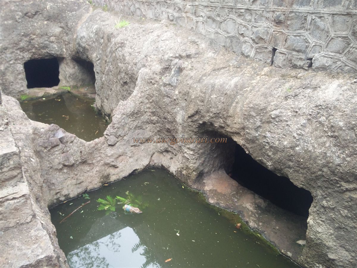
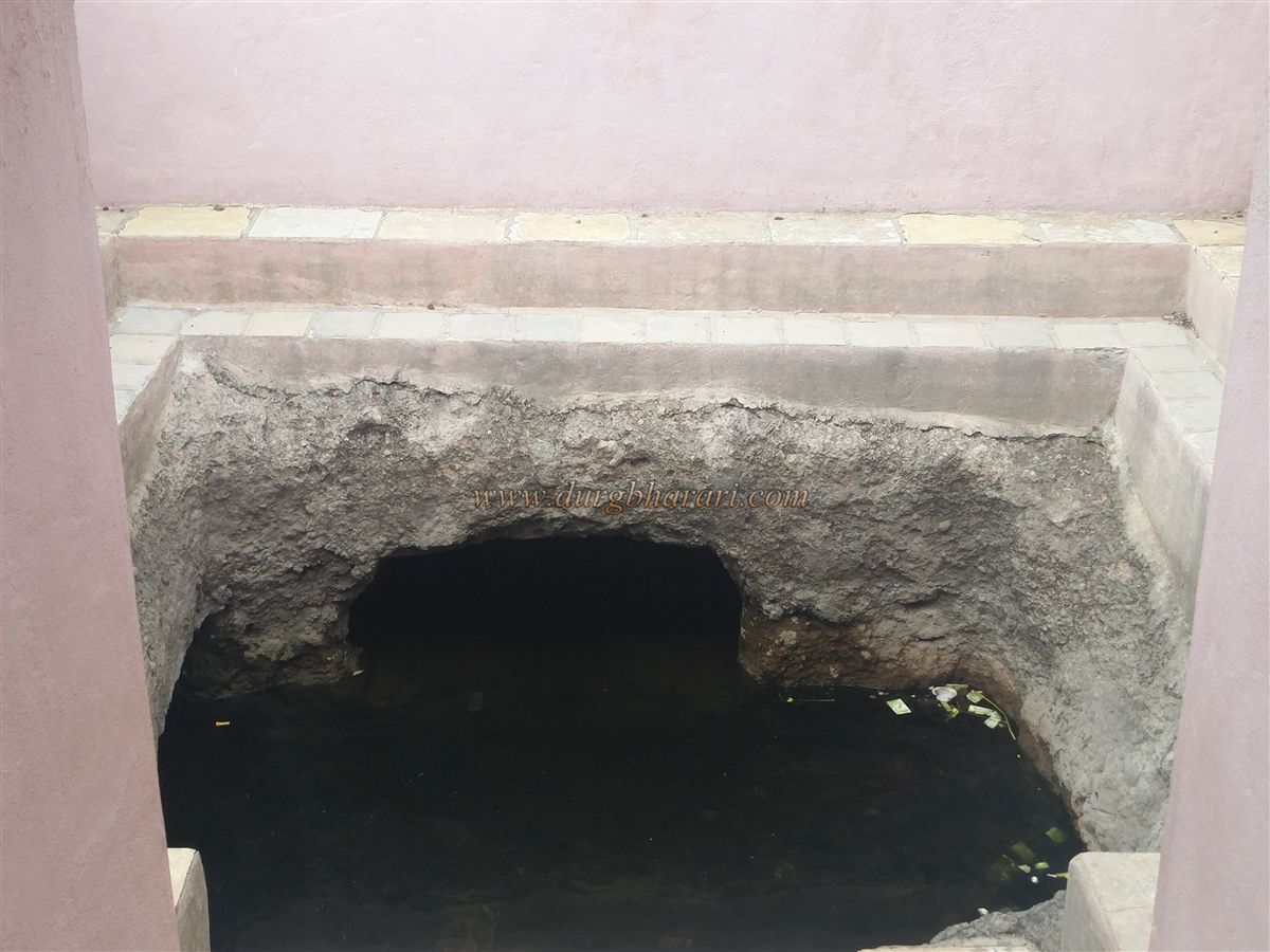
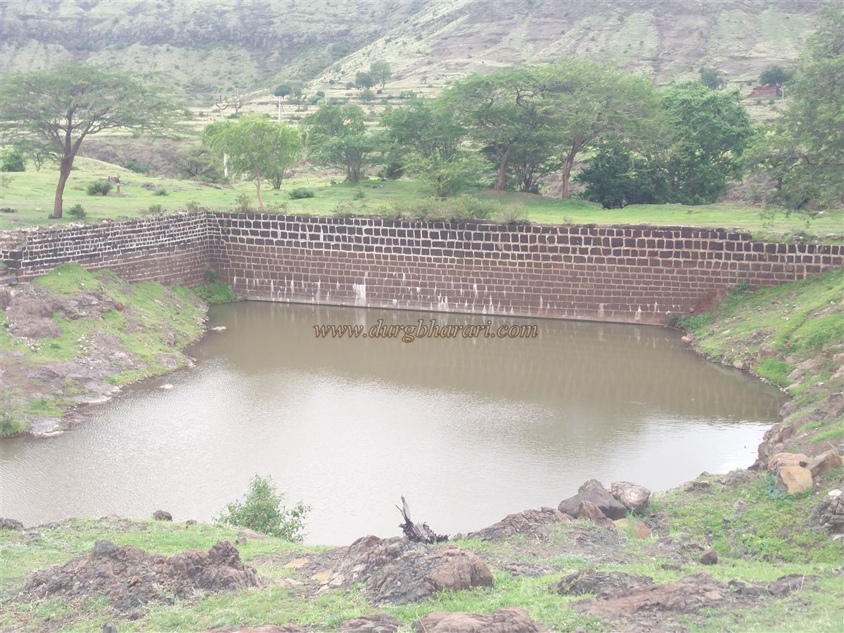
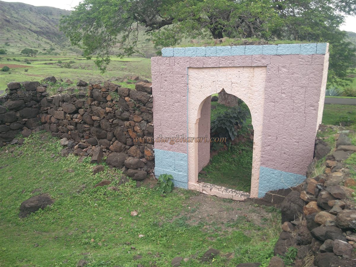
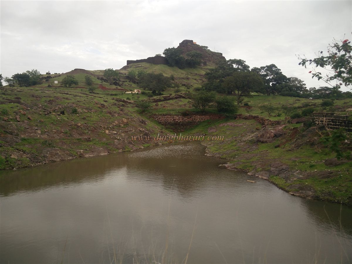
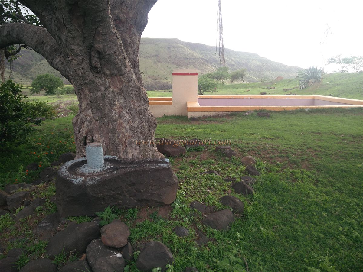
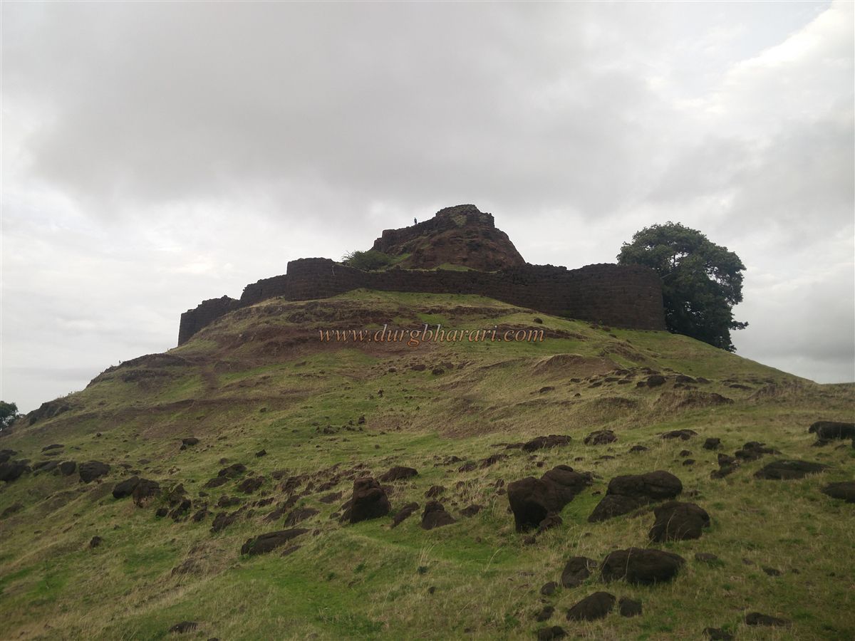
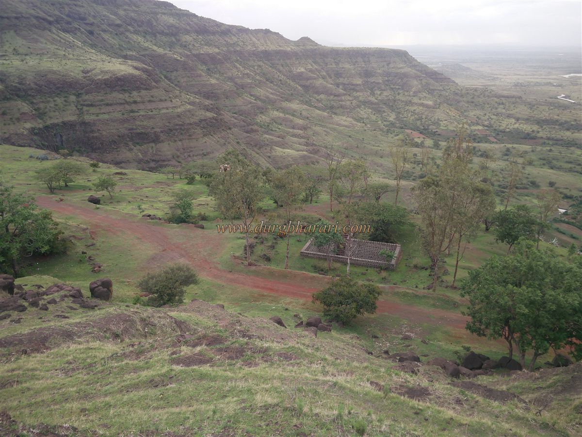
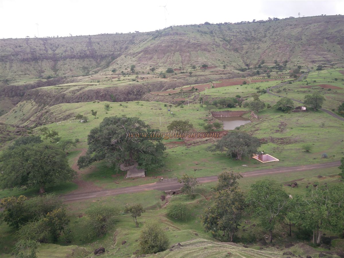
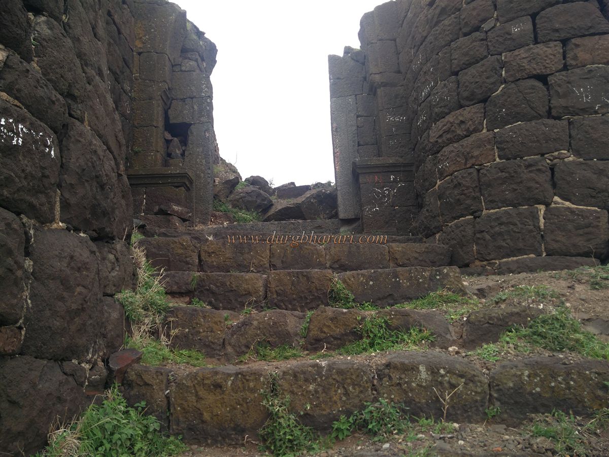
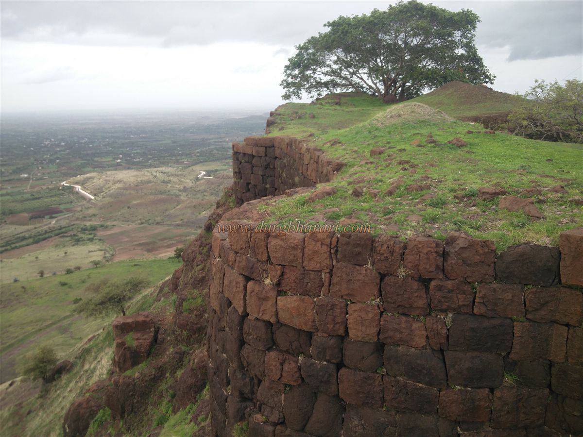
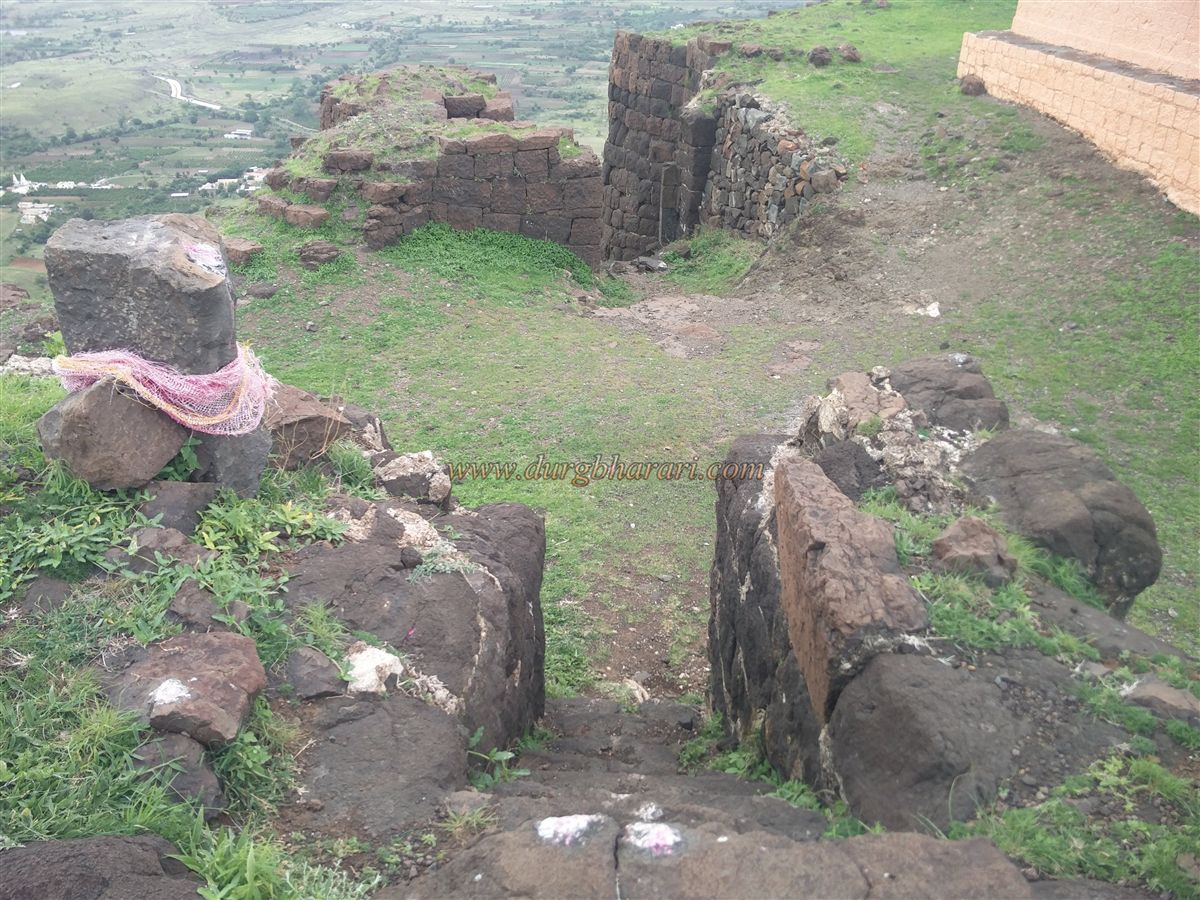
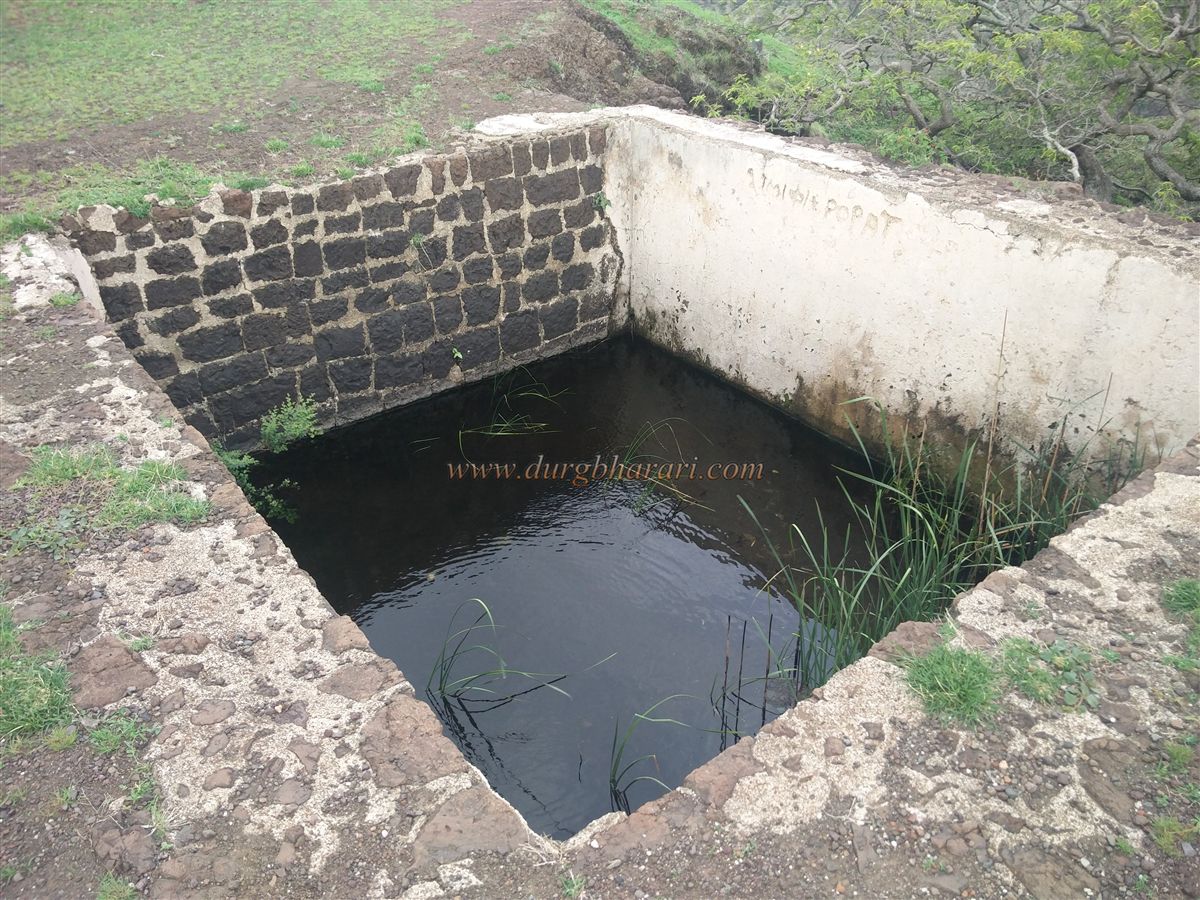
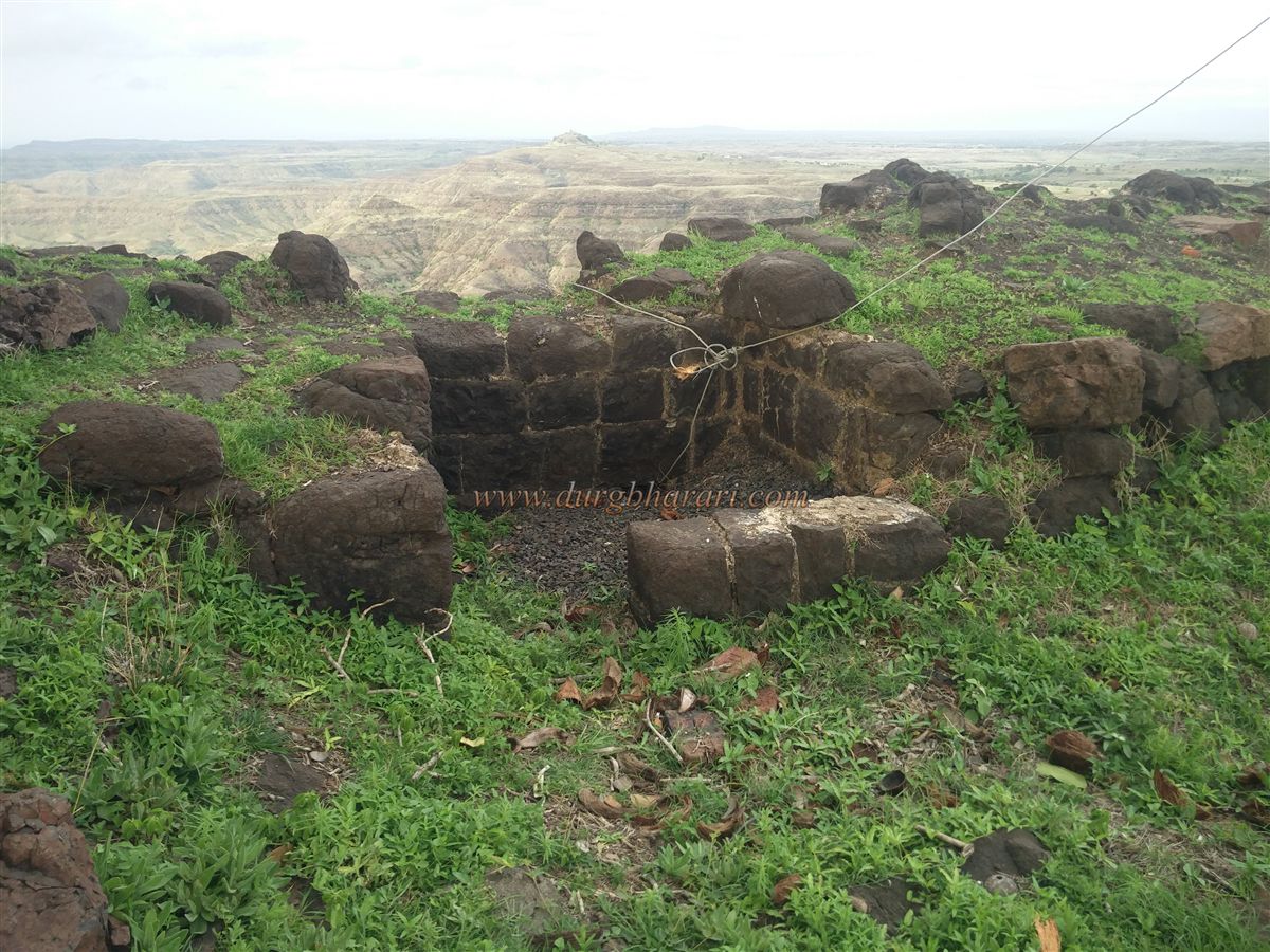
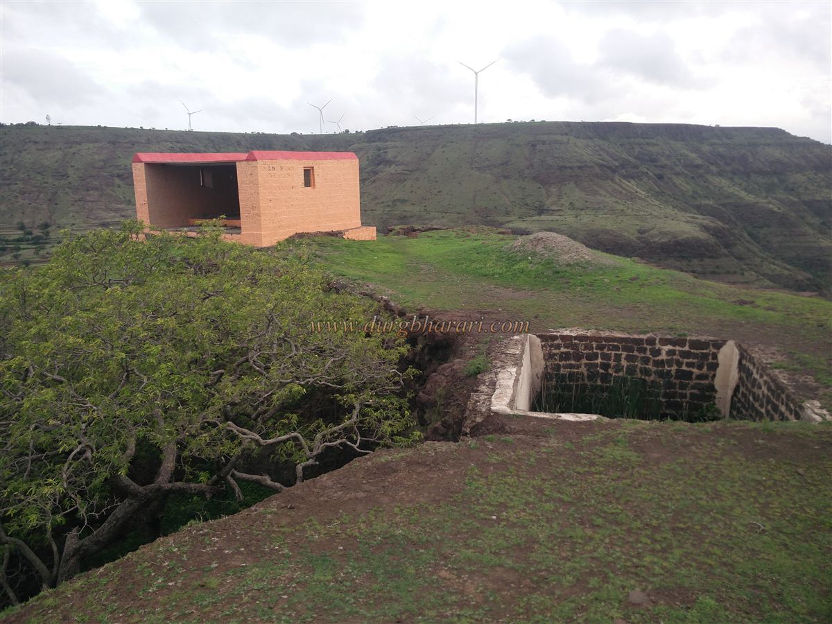
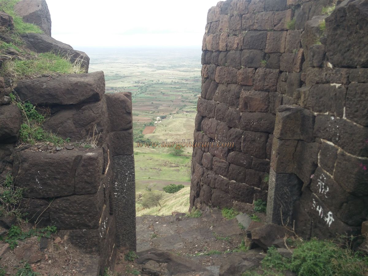
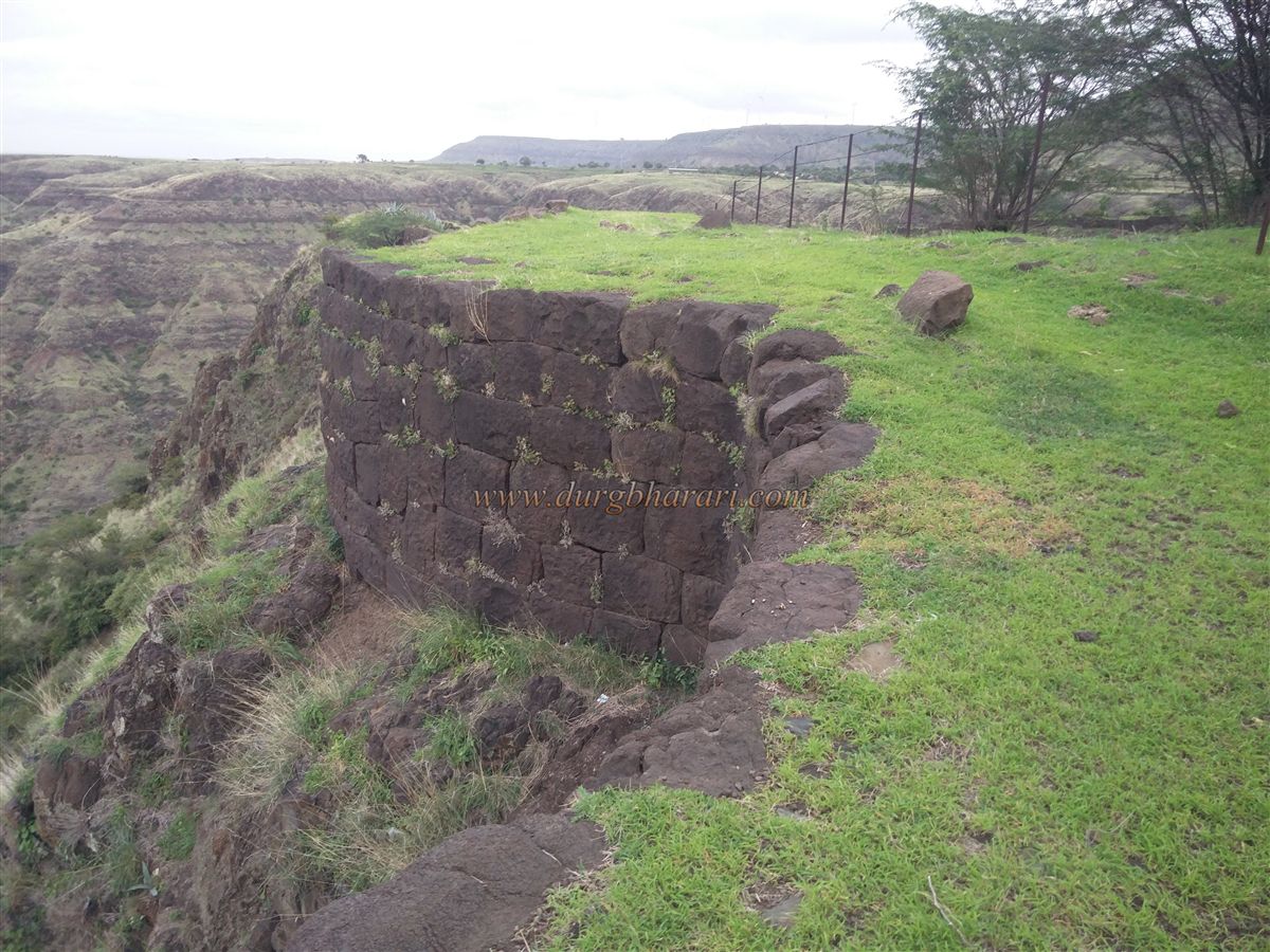
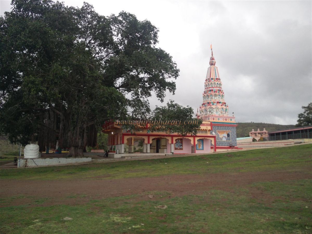
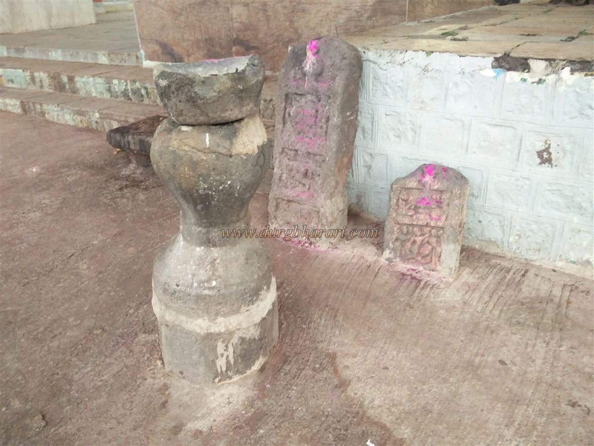
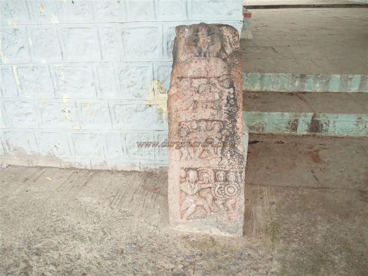
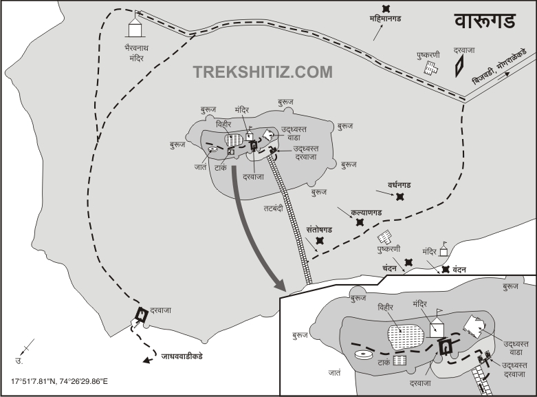
Machi and the citadel of Varugad are two parts and since Ghodewadi is on the Machi of the fort, you can reach the Machi of the fort directly by private vehicle or ST. Varugad is 3080 feet above sea level and 860 feet from the base. Looking at the 55-acre area of Machi, it seems that the fort should have more than one gate, but at present, there is only one gate to the north of the fort, and this gate is known as Phaltan gate. Upon entering Machi by the paved road, one can see the fort of Varugad and the area of Machi in front. The Machi part of the fort is surrounded by ramparts and these ramparts are remaining on a large scale. The citadel of the fort is divided into two stages and the top part of it is very narrow. On the right side of the road is a ruined Shiv temple and the stone door of this temple is still standing. In front of the temple is a large pond with a stone embankment. The footpath on the left side of the road leads directly to the citadel but without going there you should first visit the Machi. A little further along the paved road is a pillared water cistern on the right. The cistern has steps to descend and a tunnel can be seen on the inside. This tunnel is said to be connected to the tunnel in another cistern on the other side of the fort. A large Shivling carved on the rock can be seen under the Banyan tree on the front side of the cistern. On the right side of the cistern, on the Machi side of the lake, there are some memorial quadrangle structures and a dome temple built out of stone. This entire part of Machi is surrounded by ramparts and there are double ramparts at the two ends. Remains of old houses can be seen on the Machi. After seeing all this, come to the restored Bhairavnath temple. In front of this beautifully painted temple, there are 3 Deepmal’s. Accommodation can be arranged in this temple and the Dharamshala behind the temple as well as meals can be arranged if informed in advance. There is a water tank for drinking water outside the temple. After seeing the temple and taking a detour around the fort, one can see the memorial quadrangle structure of the fort keeper. At a short distance from this memorial, on the hillside, there is a north-facing main gate of the fort. Built between two bastions, the arch of the gate has collapsed and there are guard porches on both sides in the interior of the gate. This door is known as Phaltan Gate as it is in the direction of Phaltan. If you through Jadhavwadi, you can enter Machi through this door. The ramparts and bastions of the area are still standing. When you see the door and go straight ahead on the main road, you can see a huge pillared water cistern. There are steps to descend into this cistern and the upper part of this cistern has been newly constructed. There are another two cisterns at the bottom of this cistern and also the tunnel is visible on the inside. The tunnel of the cistern you saw on the other side joins this cistern. In front of the cistern is a small temple with a small idol. Looking from the temple to the citadel, one can see the ruined ramparts built on the hill slopes starting from the citadel down to the Machi. The hill slope is divided into two parts due to the ramparts. From these ramparts, a winding footpath leads to the citadel. The lower part of the citadel had a plain area but it is now enclosed by building ramparts. Although the ramparts remain, the gate to enter through has been destroyed. Six bastions of the fort can be seen in this area. From here, take a straight uphill path and in five minutes you reach the north-facing gate of the citadel. The fortified bastion and gate of the citadel are still standing but the arch above the gate has collapsed. In front of the door is a high bastion of the citadel and there are steps to go up to it. This should be the place where the flag is hoisted. There is a structure built of stone in the citadel and in front of it, there is a lime plated water cistern and a well. The interior of the well is not visible due to overgrown trees inside it. There are five bastions in the ramparts of the citadel and one toilet can be seen in the ramparts. Apart from this, you can see huge stones in one place. From the top of the fort, the whole of Machi as well as Phaltan, Sitabai's hill and Shikhar Shinganapur temple in Mahadev mountain range can be seen. This is where your fort round ends. It takes two hours to walk around the entire fort and Machi. Although it is said that Varugad was built by Shivaji Maharaj, the two water cisterns on the top of the fort make it clear that the fort existed before Shivaji Maharaj’s era. It is also said that after the Purandar’s treaty Varugad in Adilshahi’s area was conquered by Shivaji Maharaj on behalf of the Mughals. On his return from Agra, this fort may have probably been rebuilt by Shivaji Maharaj to curb the invasions from Bijapur. During this period, the fort keeper was of Prabhu caste. There were 200 guards and many soldiers on the fort. During the reign of Sambhaji Maharaj, the fort was under the control of the Marathas. While capturing Varugad fort, Nagoji Mane joined the Mughals and was appointed in the army of Sheikh Nizam. On September 29, 1688, Aurangzeb's forces captured the fort. Multafatkhan informs Aurangzeb that, ‘We left Khatav and reached Sambhaji's province after crossing approximately 13 km. Sambhaji's territory at the foot of Narogad (Varugad) was destroyed and the fort was then attacked. In 1818, Vitthalpant Fadnis sent 200 soldiers and captured the fort from the second Bajirao.
© Suresh Nimbalkar
GALLERY