VAIRATGAD
TYPE : HILL FORT
DISTRICT : SATARA
HEIGHT : 3870 FEET
GRADE : MEDIUM
The city of Wai, situated on the banks of the river Krishna, has an ancient history. Today's Wai city, known as Viratnagari in ancient times, is referred to as Viratnagari in Kavindra Parmanand's book of Sanskrit poetry, Shivbharat. There are forts like Pandavgad, Vairatgad, Kamalgad, Kenjalgad, and Chandan-Vandan on the mountain range in the Wai area. If you take a two-day break and have a private vehicle with you, you can easily see four or five of these forts. Of these, Vairatgad is the stronghold of Vairatnagar. To visit this fort located in Wai province of Satara district, first, you have to travel 86 km from Pune on the Mumbai-Bangalore highway. The Mahadev Temple at Vairatgad is frequented visited by devotees from the area, so there are many villages like Vyahali, Mhasve, Sartale, Vyajwadi at the foot of the fort. The nearest and easiest way to reach the fort is through Malusare Wadi in Vyajwadi.
...
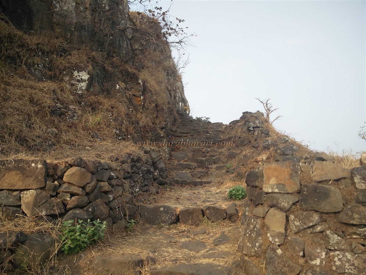
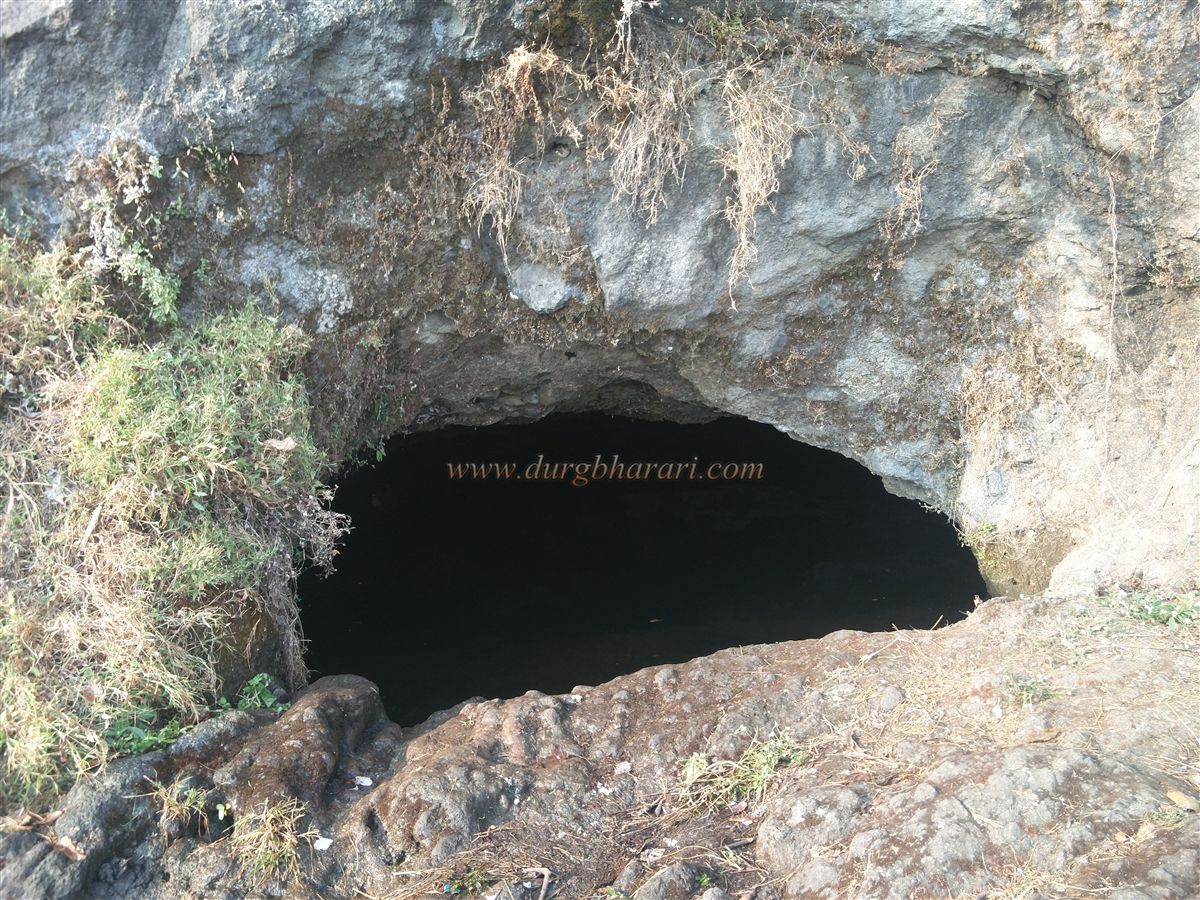
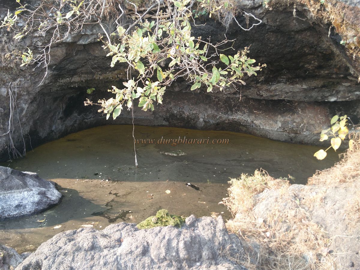
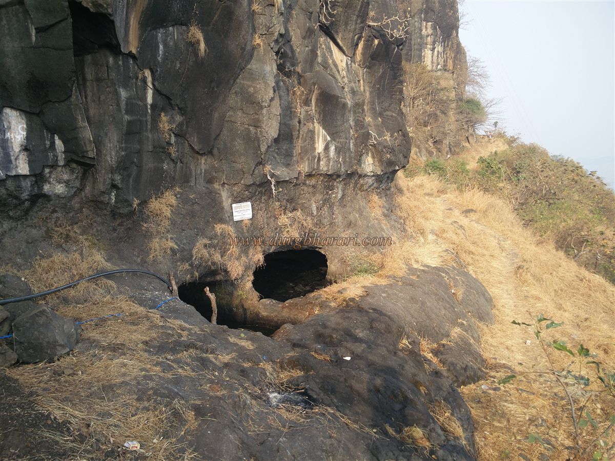
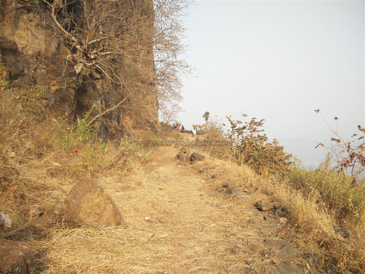
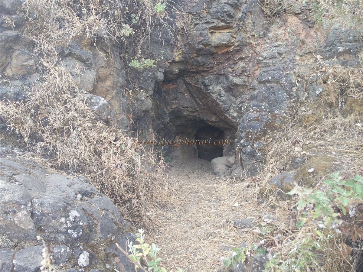
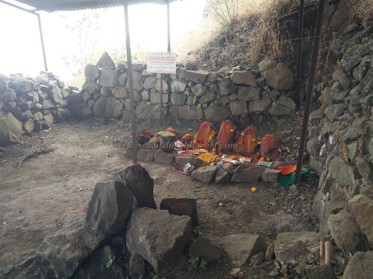
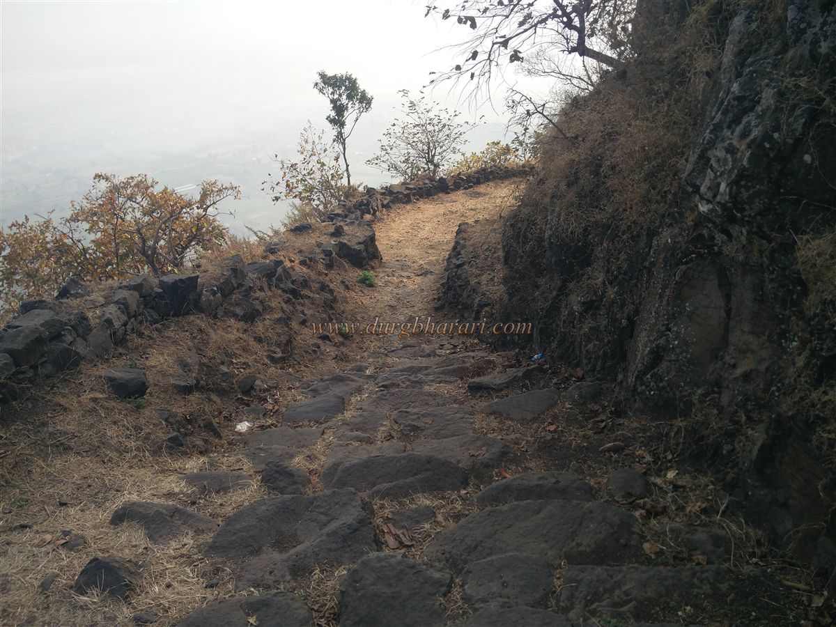
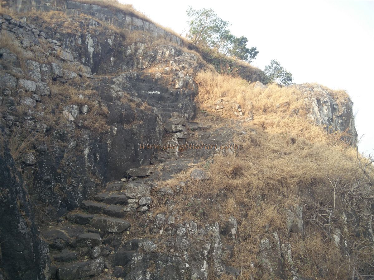
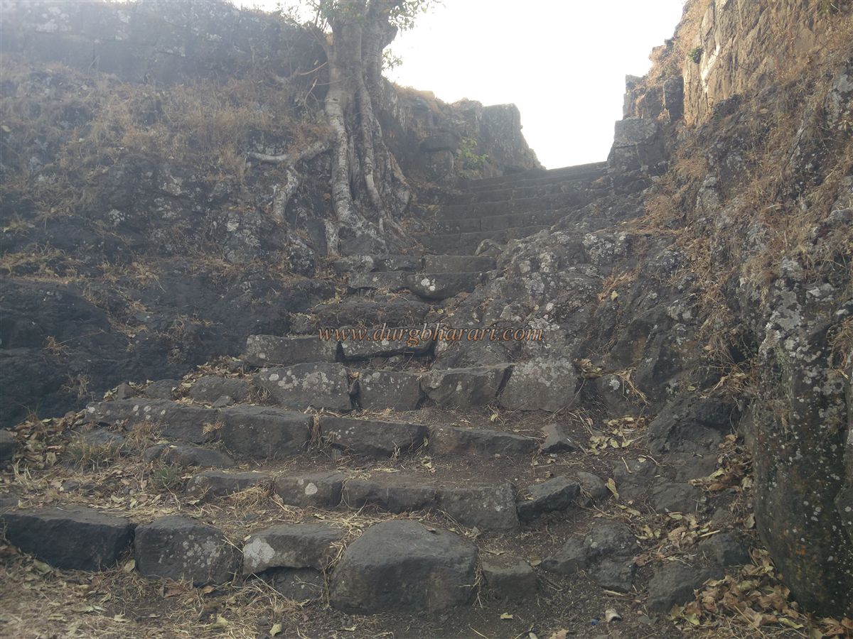
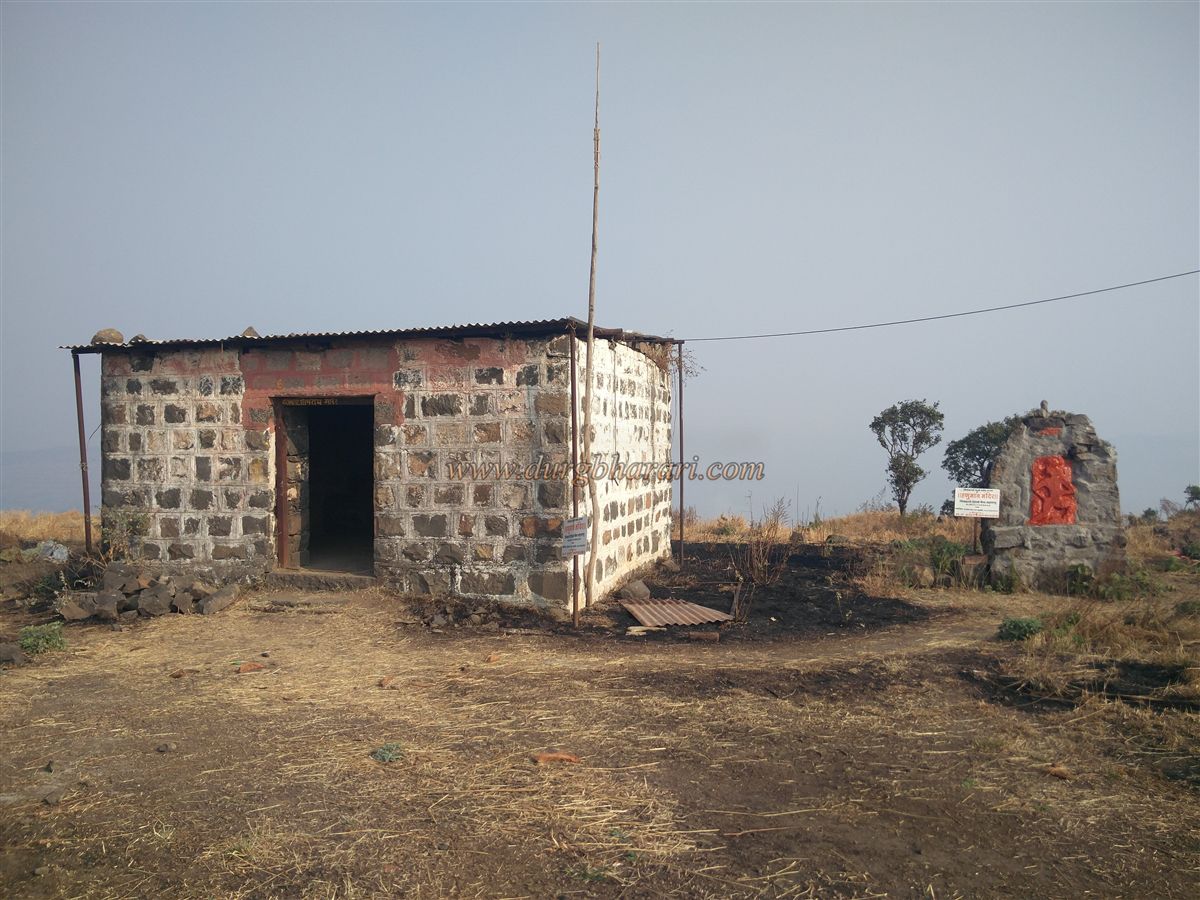
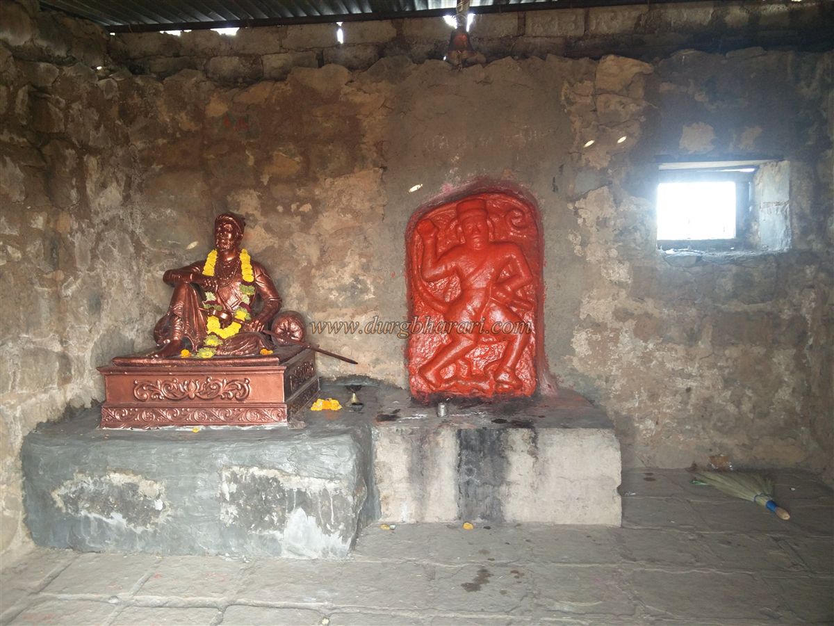
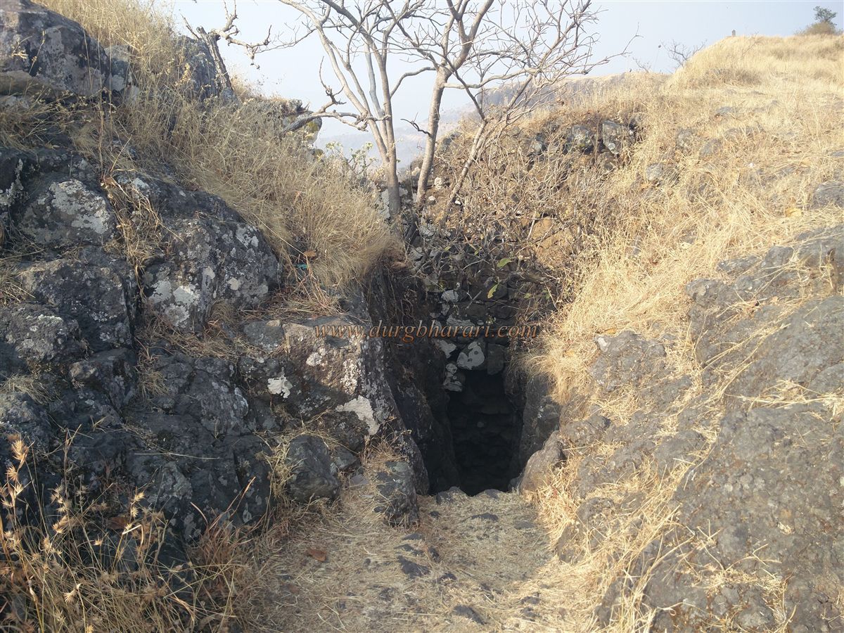
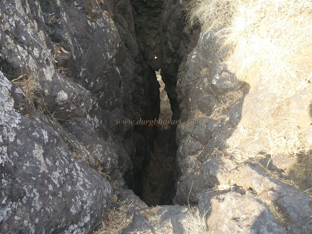
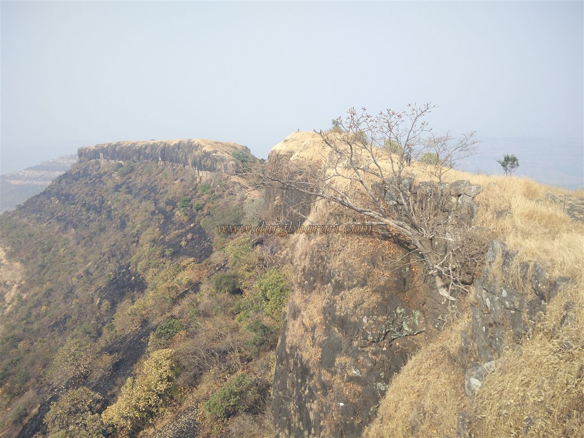
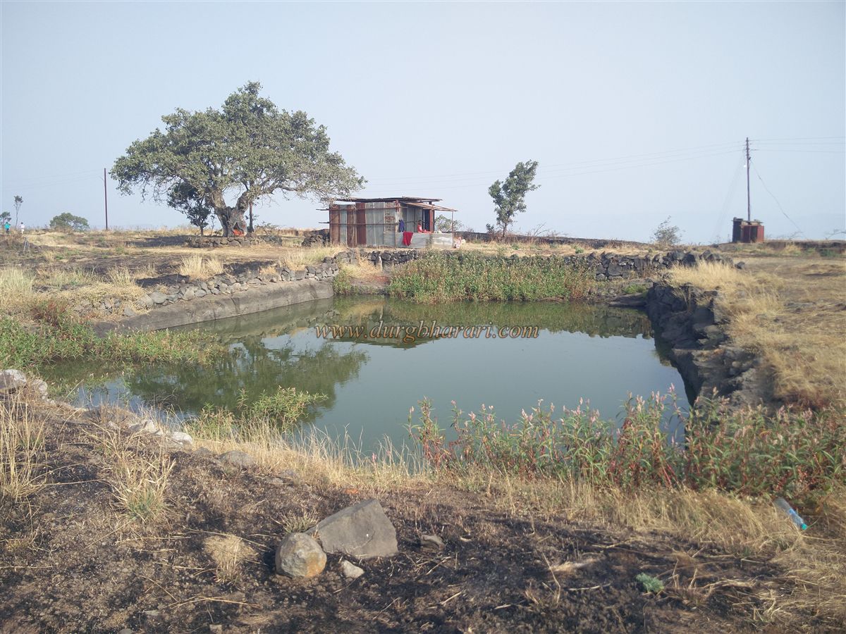
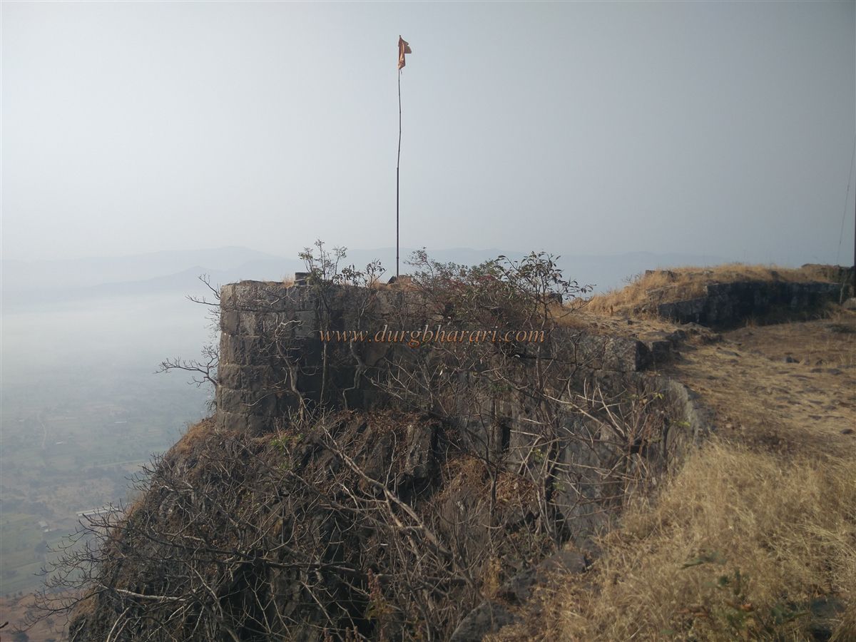
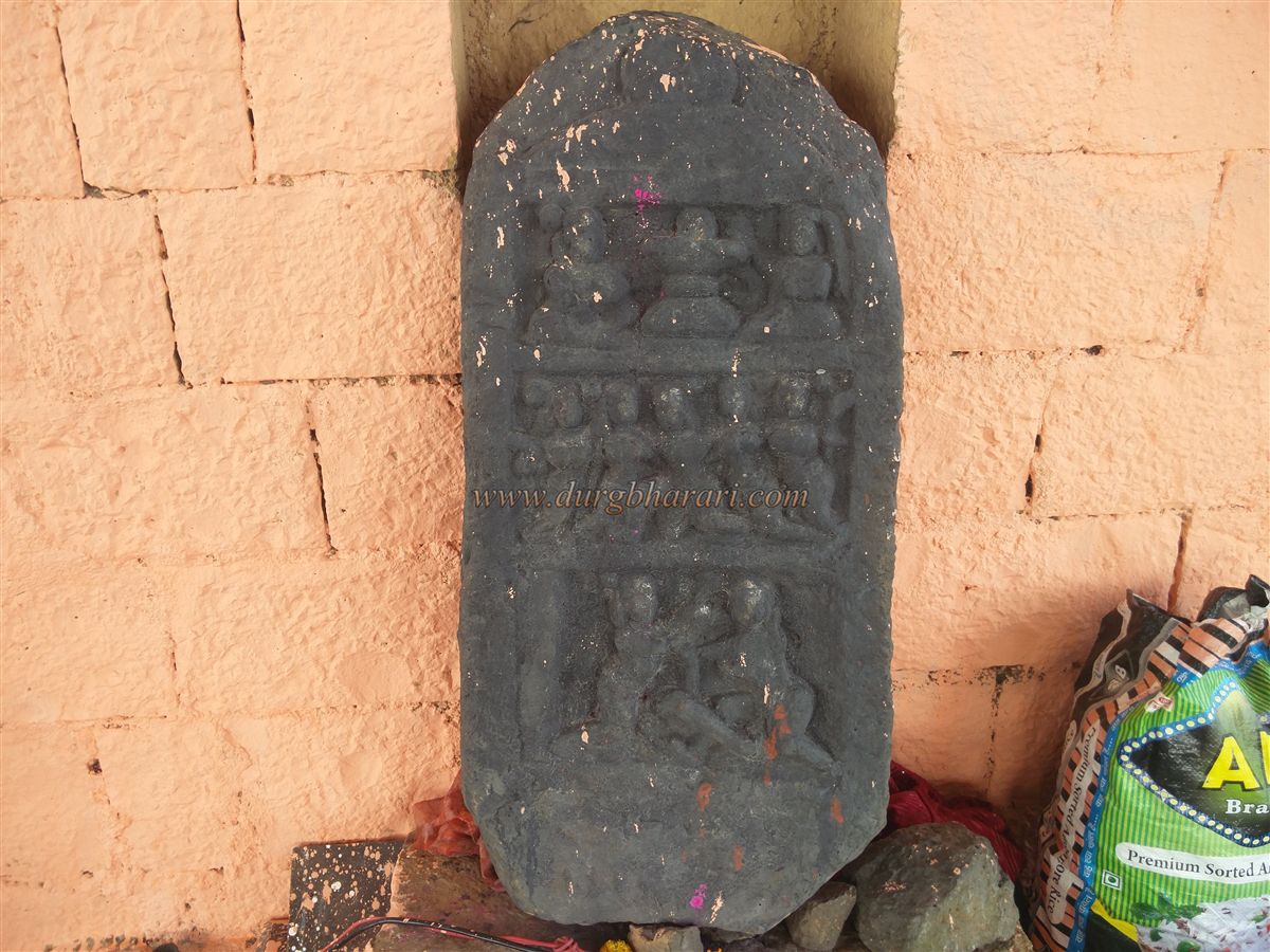
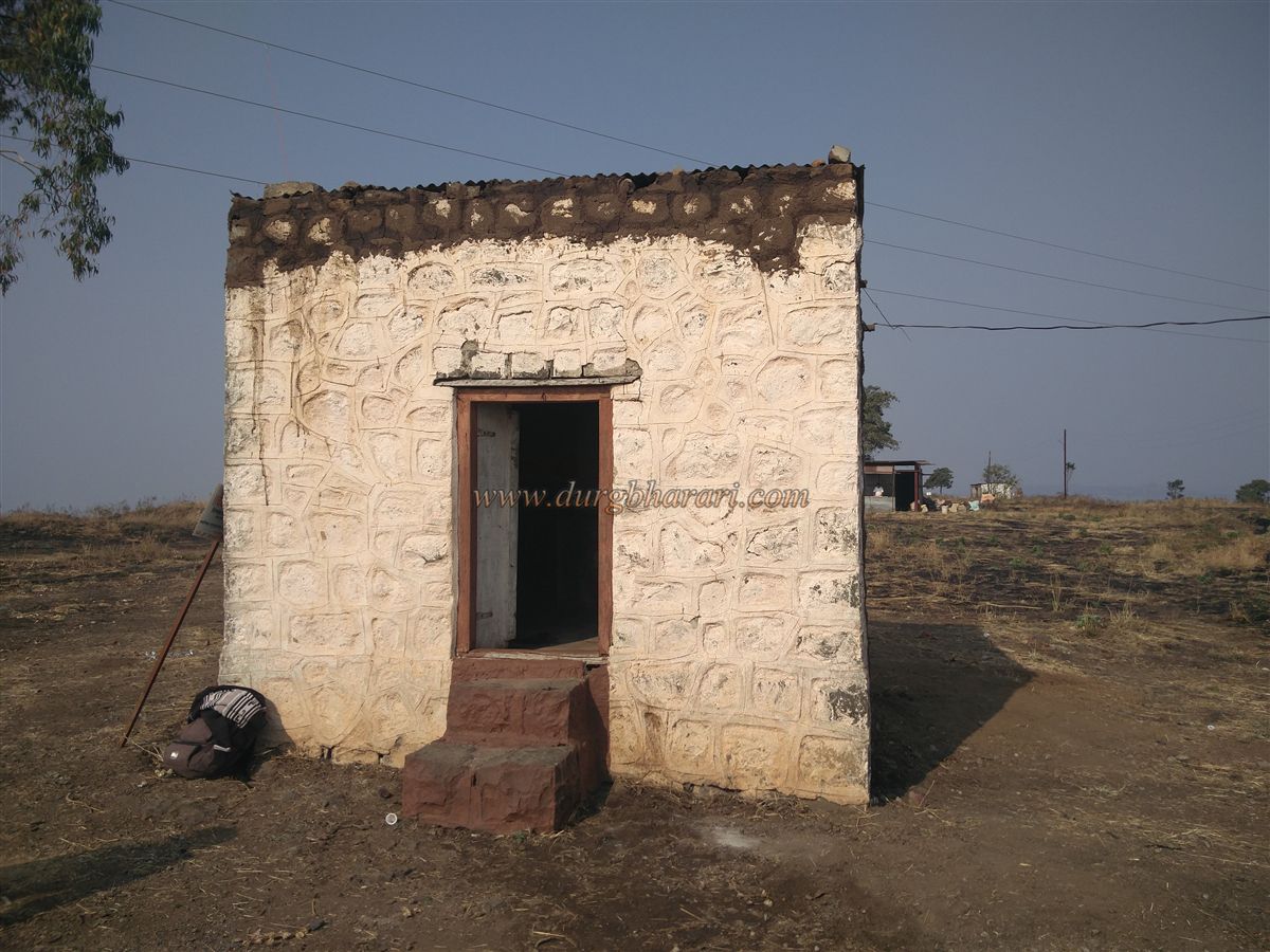
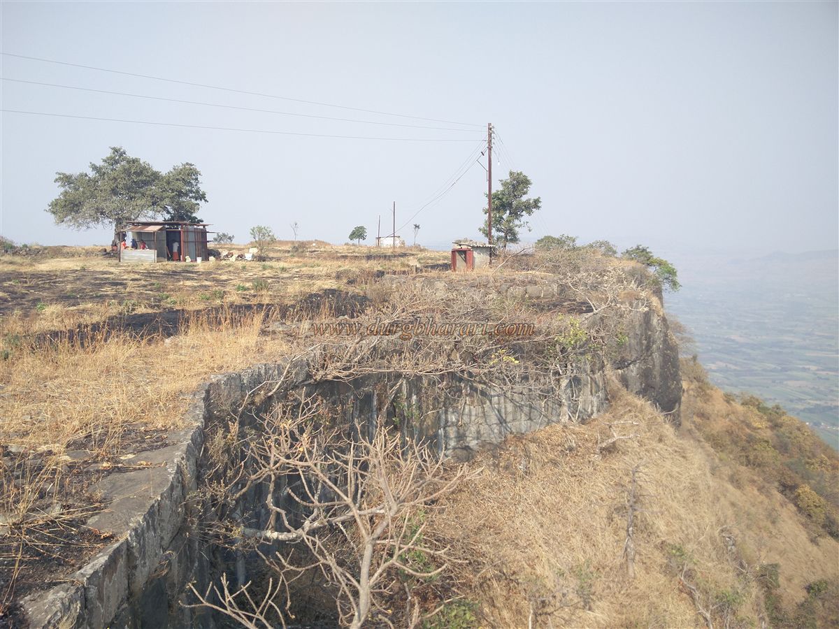
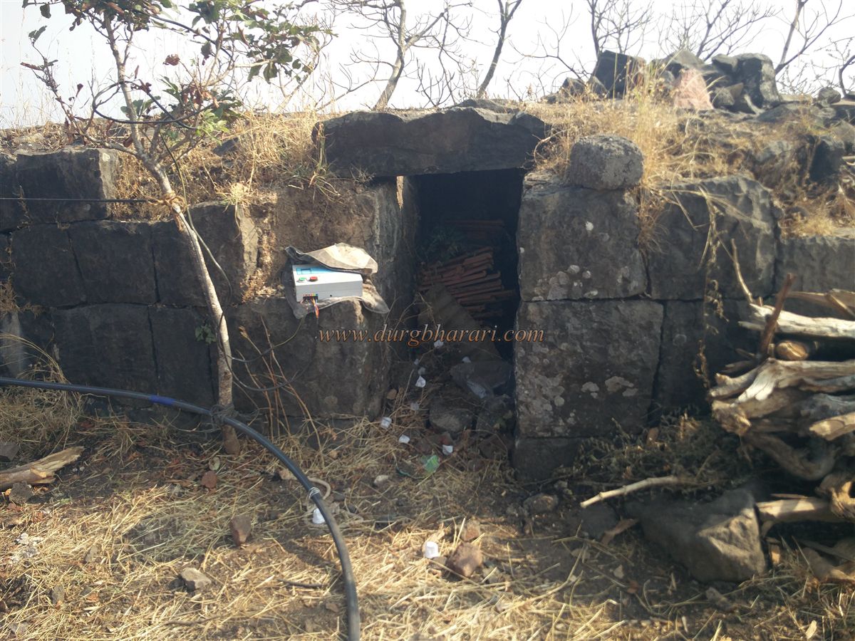
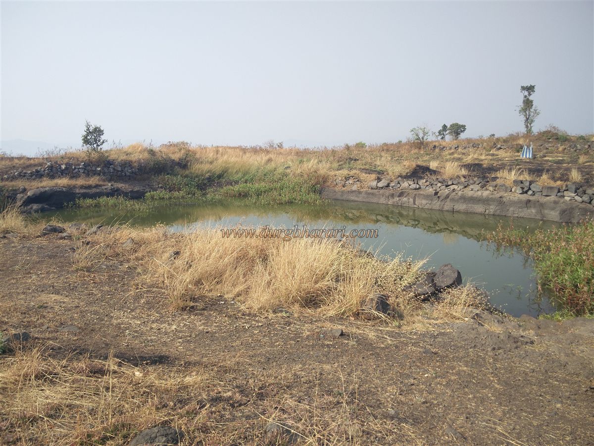
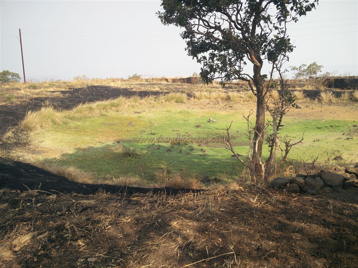
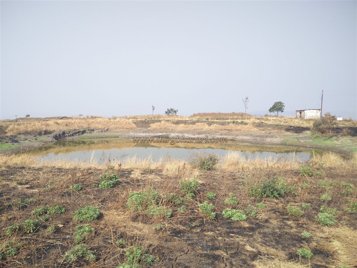
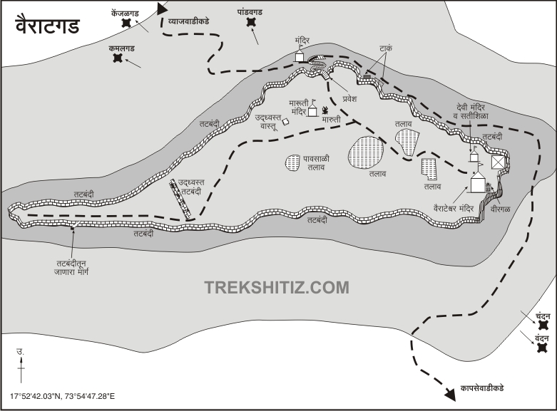
Vyajwadi is 8 km from Pachwad via Kadegaon and there are two ways to reach the fort from here. The road which goes to the fort from the hill trunk is slippery and the road from Maruti Mandir in Malusare Wadi is convenient. The road is well paved and 1 hour is enough to reach the fort by this path. After climbing the hill behind the village for about half an hour, you take a few steps carved in the rock. The straight path leads to Mhasav village and the left path leads to the fort. This is where the directional arrow is painted showing the directions to the fort. In half an hour, you come to the road near the fort and you can see the fort's bastions and ramparts. Before leaving this road, you can see a ruined quadrangle structure on the left. The entrance to the fort has steps leading to the fort gate on the right and the main paved road leading to the fort on the left. Most of the paths that reach the fort, all meet here. You should first go to the left and see the remains on this path. The road leading to the fort is very wide and there are five small cisterns carved in the rock of the fort. Three of these cisterns are cave cisterns and the water from one of them is used for drinking on the fort. Four of these cisterns contain perennial water. After seeing the cisterns, turn around and start climbing the fort. After climbing about 15-20 steps on the edge of the fort, you can see the path coming up on the other side of the fort. After descending 5-6 steps along this path, you can see a small cave carved in the rock. In the next part of this cave, there is a Lakshmi Mata temple with an idol in a tin shelter. The winding steps leading to the fort from here are in the line of fire from the ramparts. After climbing 25-30 steps in this way, we enter the fort through the north-facing gate of the fort which has two bastions. The arch of the door has been destroyed and only the stone frame and the porches on both sides in the interior remain. Vairatgad is 3850 feet above sea level and the triangular-shaped fort is spread over 9 acres from east to west. The western end of the fort is a long trunk and the tip of this trunk is closed by a bastion. Upon entering the fort, we would start our fort round in the direction of this trunk which is visible on the right. There is a Maruti temple at the beginning of this road and there is a newly installed idol in this temple and the original worn out idol is placed on a quadrangle structure outside the temple. Next to the temple are the remains of some structures and a dried-up pond. After walking straight from here, we cross the main part of the fort and reach the area above the trunk. This part of the trunk has been fortified and somewhat separated from the fort. Some rare relics can be seen in this area. The ramparts at the trunk are still intact with barrages. There is a secret door to get out of the fort in the ramparts. This is the secret gate of the fort. A path coming from Mhasav village comes up through this secret door. There is a carved stone on the bastion at the end of the trunk and some letters are carved on it. This part of the trunk is separated from the hill in front by a mine. After turning back from here, you should come to the main part of the fort from the other side of the ramparts. As you walk along this path, you can see holes in the ramparts to prevent waterlogging, as well as a stone painted in white on a quadrangle structure. The ramparts of the main part of the fort are very wide and have been buried to some extent. The ramparts have a toilet and a dry lake adjacent to the ramparts. Looking at the quadrangle structures of many buildings in this area, we come to a square-shaped pond carved in the rock filled with water. The saffron flag is seen fluttering on the ramparts on the right side of the lake. The ramparts in this area still exist up to a great extent. There is a small temple of Vairateshwar in front of the bastion and a quadrangle structure with a tin roof has been erected in front of it. There is a hero stone placed against the wall of this temple and there are Nandi and Tulsi Vrindavan on the premises. In the small temple next to the Vairateshwar temple, there is another hero stone and an idol built of wrought stone. There is a monastery built beside the ramparts and the disciples of Gagangiri Maharaj live in this monastery. They can arrange meals for 4-5 people if required. The Maruti temple and Dharamshala on the fort can accommodate 10-12 people. Coming ahead from the ramparts, you can see another toilet in ramparts. Going down from the ramparts towards the door, you will see a dry pond on the right side of the road and a circular pond filled with water on the left side. Coming to the door from here, your fort round is complete. The forts of Pandavgad, Kenjalgad, Chandan-Vandan, Nandgiri and Jarandeshwar Mandhardev, and Khambatki are visible while walking along the ramparts. One hour is enough for the entire fort round. After the fall of the Chalukyas, the Panhala-Kolhapur region was ruled by the Shilahars. Historians believe that the fort was built by Shilahar king Bhoj II between 1178 and 1193 in the late 12th century. Although there is not much mention of this fort during Shivaji Maharaj’s period, he conquered Wai province from Adilshahi in the year 1673, in which Vairatgad along with Pandavgad must have also joined the Swarajya. This is not mentioned, but the fort must have been used as a military base for the defense of Wai. After the death of Shivaji Maharaj, the fort came under the control of the Mughals in the year 1699. The naming of the fort during this period was Sarjagad although this name was not very popular. Later in 1818, the fort was captured by the British.
© Suresh Nimbalkar
GALLERY