UDGIR
TYPE : GROUND FORT
DISTRICT : LATUR
HEIGHT : 0
GRADE : EASY
While exploring the forts of Marathwada, one encounters impressive and sturdy land forts like those at Solapur, Ausa, Paranda, Udgir, and Kandhar. These forts are still well-preserved, and their design is quite distinct from other land forts found elsewhere in Maharashtra. This region of Marathwada lies far from the main Sahyadri mountain range, consisting mostly of flat plains and small hills. Unlike the Sahyadri region, natural mountainous defences were absent here, so forts were designed with thick double or triple walls and moats dug all around for protection. Additionally, a series of successive gates were built to make the internal approach difficult.
To experience this, one should visit Udgir Fort in Latur district. Udgir is 68 km from Latur city, and as it has a railway station, it is accessible by train. From Udgir station, the fort is only 1.5 km away, with rickshaw facilities available.
...
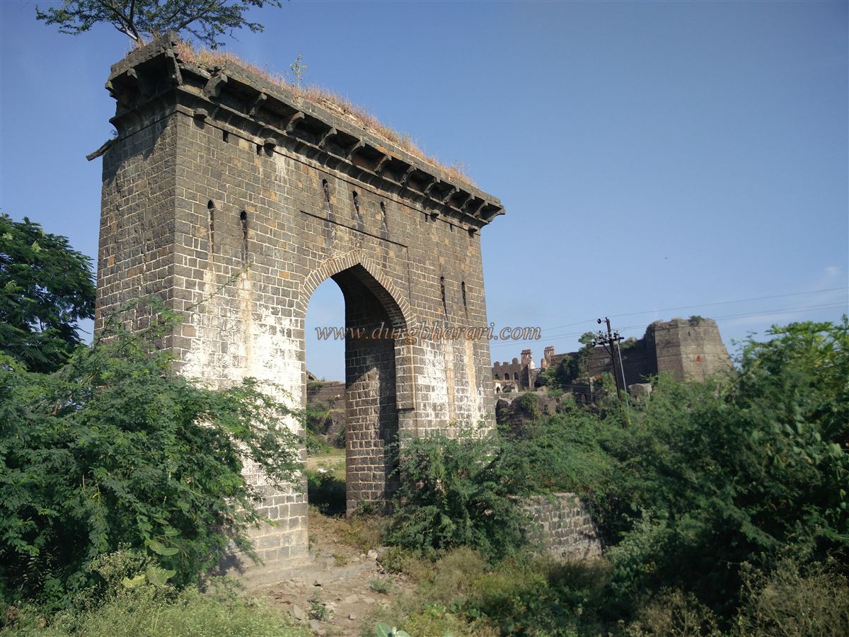
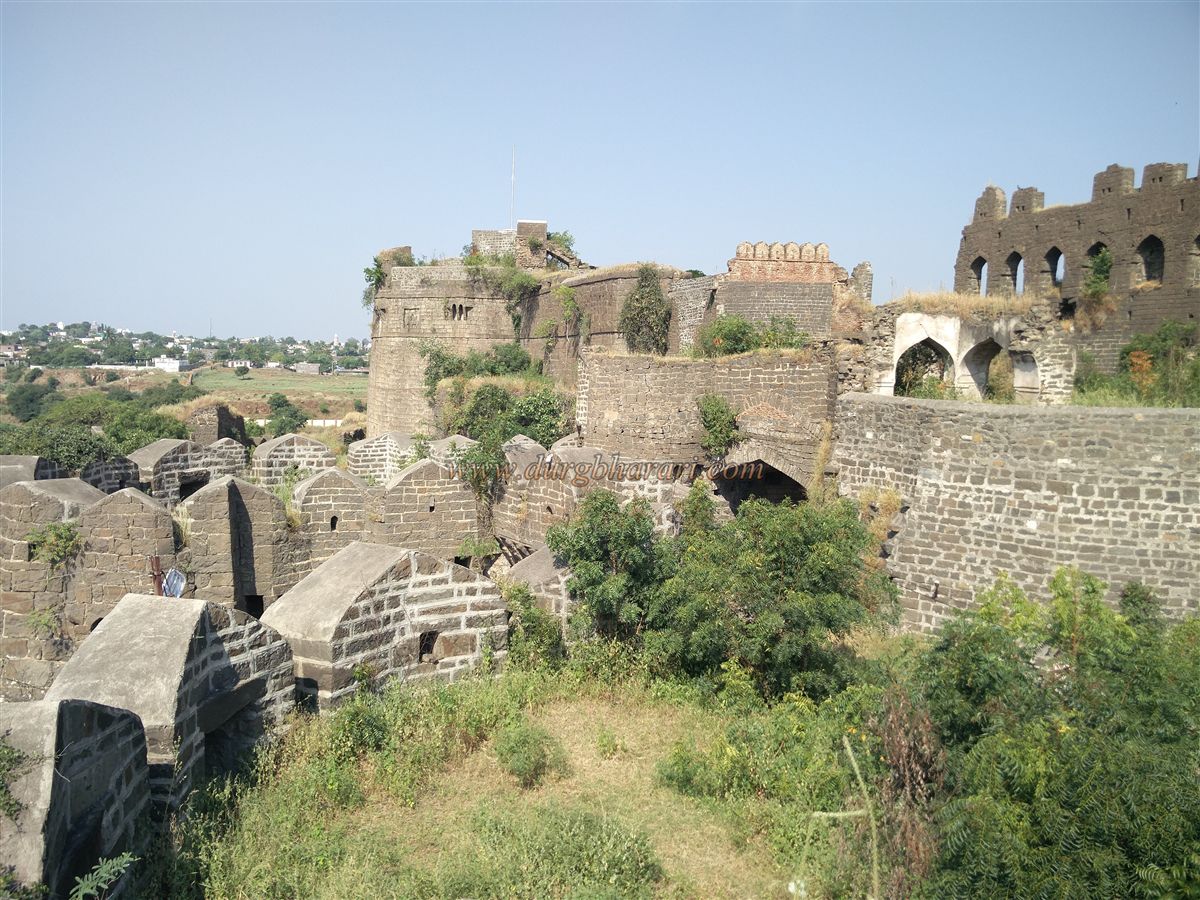
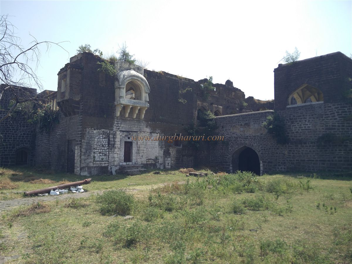
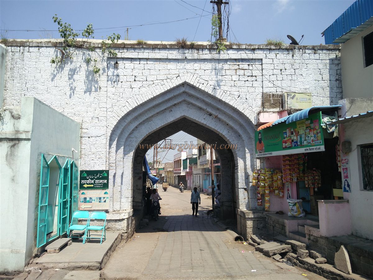
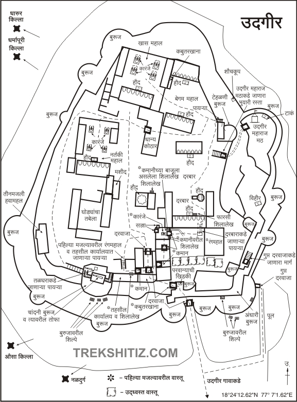
The town itself shows traces of former fortifications along its old settlement. Approaching the fort, one passes two main gates of the town and the old water tanks in the central square, reaching the outer fort area. The fort is divided into three parts: the outer fort (Parkot), the moat, and the main fort with double walls. The Parkot, facing the entrance, has largely collapsed except for four internal structures and a small pond. Its gateway retains an arch, but most ornamental work is gone. Inside one structure, small water tanks with clay pipes are visible, likely used as a bathhouse or for water supply. Another structure along the moat contains a subterranean passage into the moat.
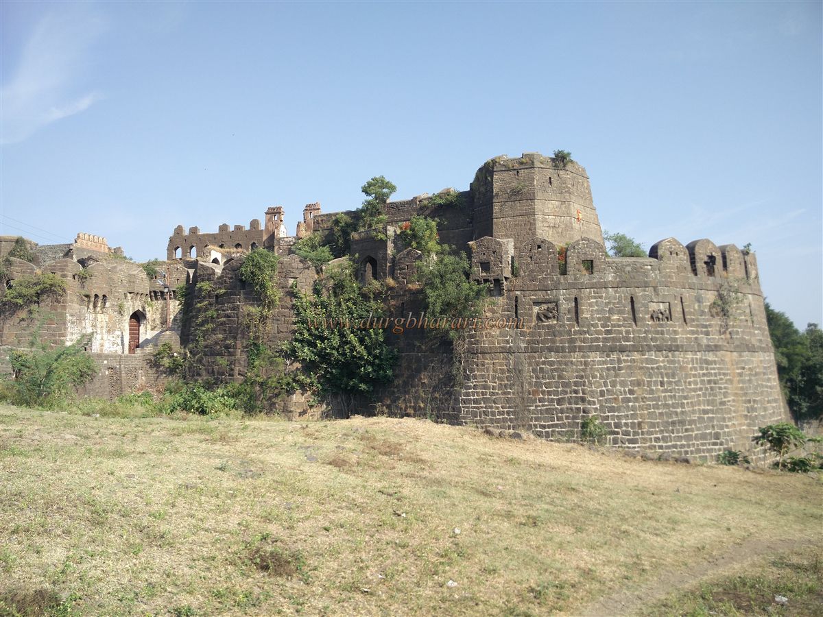
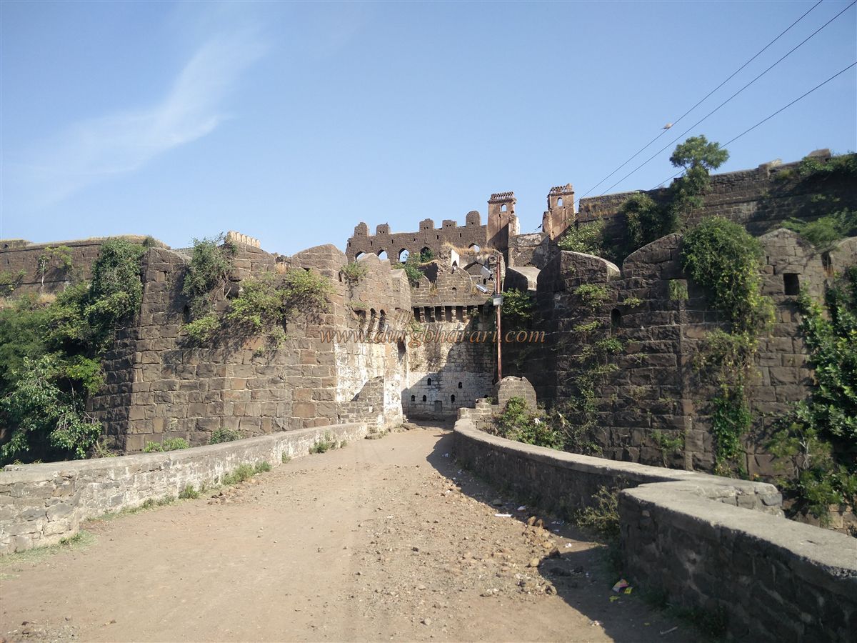
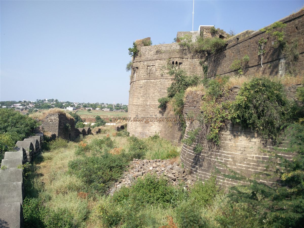
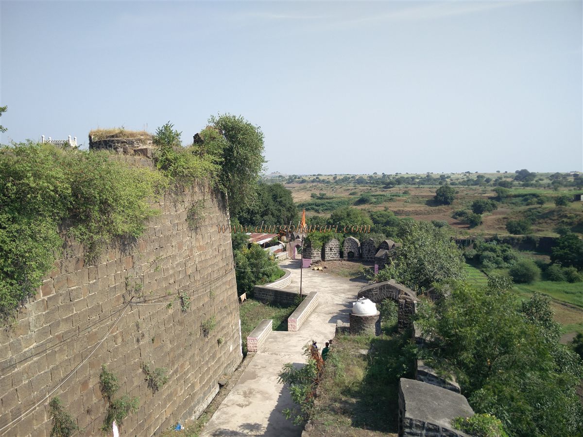
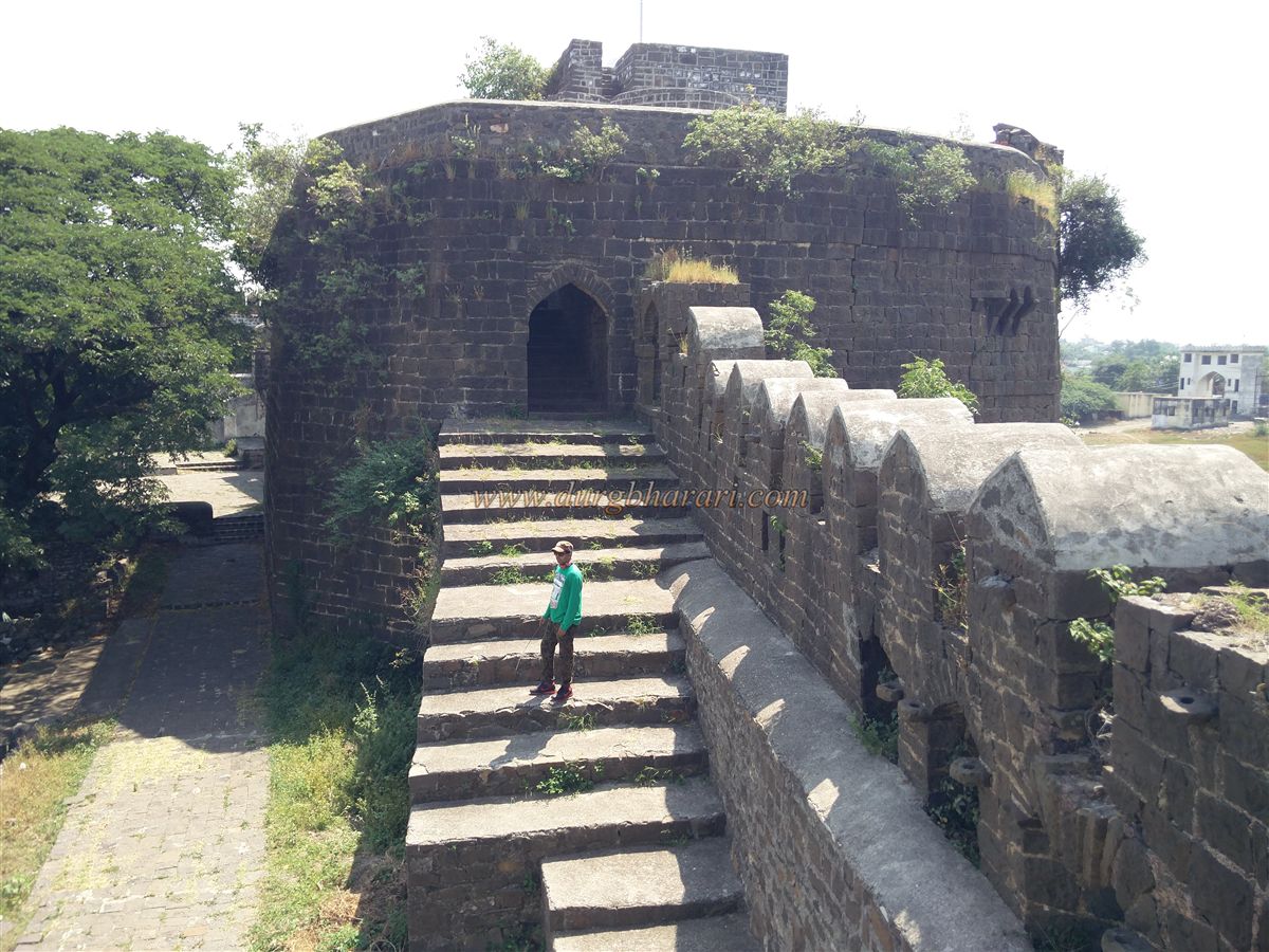
In front of the main gate, a 20-foot-wide and 25-foot-deep moat separates the fort from the surrounding land, built with stone walls on both sides. Originally it had a removable wooden bridge, now replaced with a permanent stone bridge. On the right edge, an iron bridge was once used to access the Udgir Baba monastery outside the fort during closures. Though a land fort, Udgir is on a small elevation, so other sides benefit from minor natural cliffs. The roughly circular fort spans eight acres, with the Parkot covering four acres. Approaching the main gate from the moat, two elephant sculptures and one Sharabh sculpture are visible on the right wall of the bastion, one partially hidden by foliage. On the left side, the inner wall has an octagonal bastion with another Sharabh sculpture and two elephants in combat, making three sculptures in total. The outer wall is approximately 40 feet high, and the inner wall 60 feet, both fitted with parapets for cannons and firearms, with embrasures and battlements.
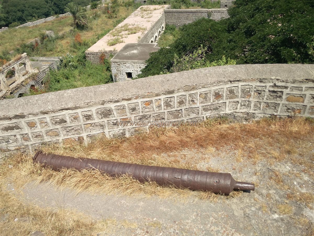
Crossing the moat leads to the first expansive gate of the fort, where the Archaeological Survey has installed a new iron gate, known as the Lohbandi Gate. Its construction is offset to prevent direct assault. Minimal space in front of this east-facing gate allows defenders to fire upon attackers, with battlements and loopholes along the sides. Inside the gate are guard chambers, one of which contains a broken cannon. A small passage leads from this point into the double-walled section. Crossing the Iron Gate, one reaches a bastion in the outer fort, with a weathered Persian inscription barely visible. From here, the inner wall’s left side has five elephant-holding Sharabh sculptures, partially hidden by vegetation. The path continues to the Udgir Maharaj monastery, initially secured by an iron grille gate to prevent unauthorized entry when the main gate was closed. Along the way, a deep well filled with vegetation is seen on the left, and a bas-relief of elephants on the right battlement. The outer moat area is farmed, with a dam to regulate water. A newly built arch leads to a 40-foot-deep trench below, where the Udgir Maharaj monastery is situated, connected by new steps, almost level with the outer ground.
The original approach to the monastery is from the well. At the monastery base, a carved tank leads to a cave housing Udgir Maharaj’s samadhi. The cave contains a Shivling, paduka, and some ancient idols. After visiting, one returns via the fort walls to the well. Descending from the walls, the stone-arched main gate leading to the monastery is visible, now temporarily closed with stones. This gate originally formed the main access from the inner fort to the monastery.
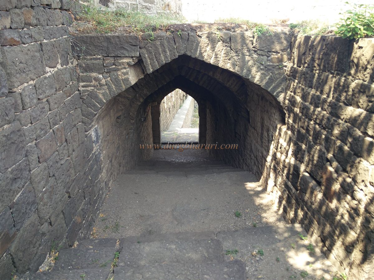
While exploring the fully enclosed pathways of Udgir Fort, visitors encounter three small gates along the route, with steps leading down to the monastery. After visiting the monastery, one returns to the main gate from where the fort was first entered.
The second gate, like the first, faces east and is built between two bastions. It is entirely fortified, with loopholes on the roof for firing upon attackers, and is known as the Parwana Gate. To its right is a latticed window with a small loophole beside it, likely used for questioning visitors or examining documents—a unique feature not seen in other forts. Inside this gate are guard chambers on both sides and a small drinking water tank.
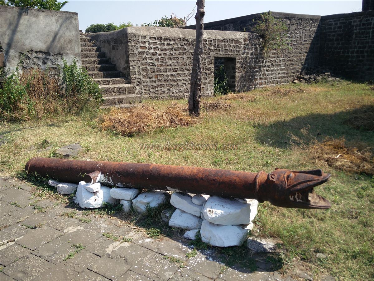
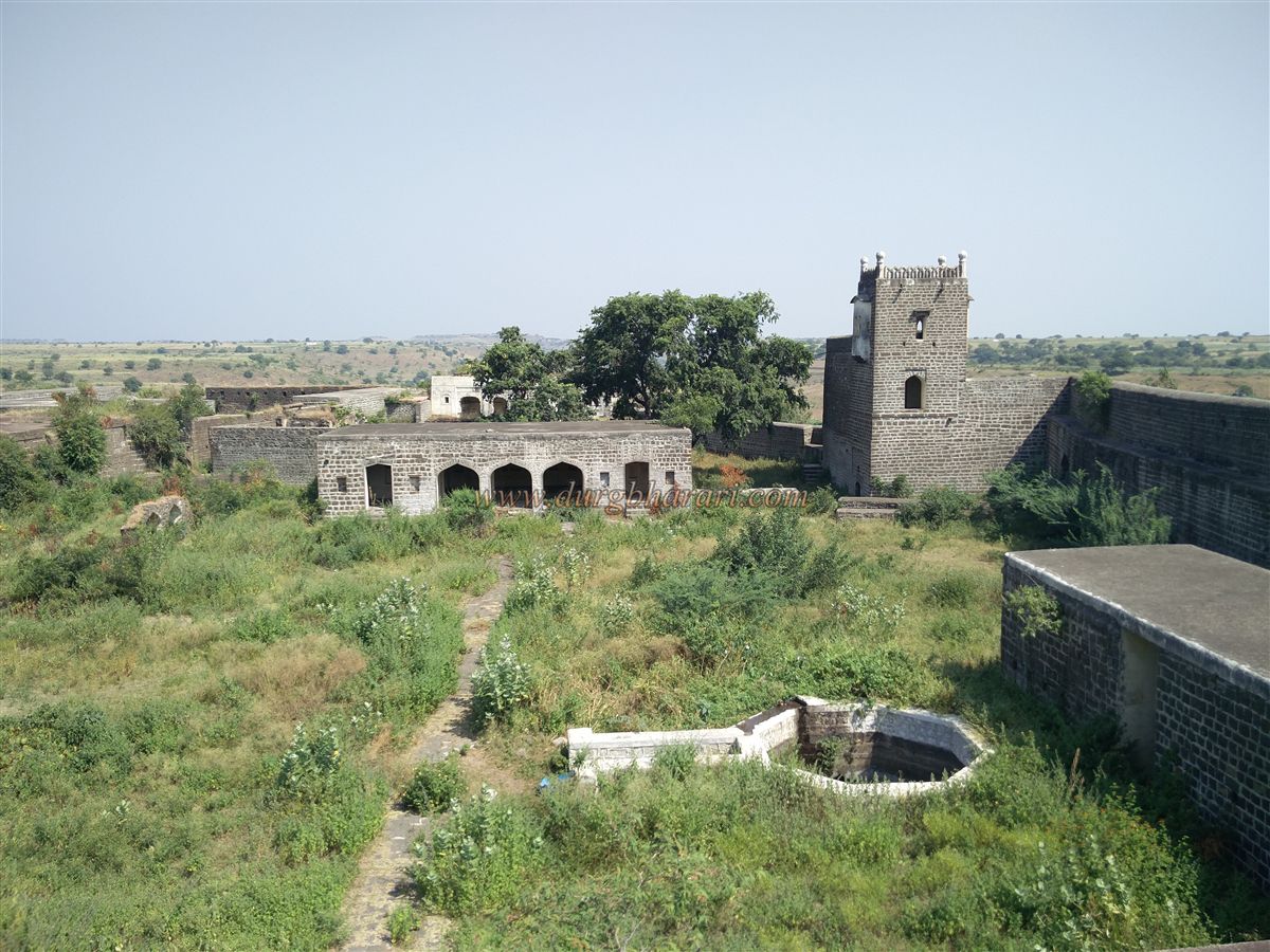
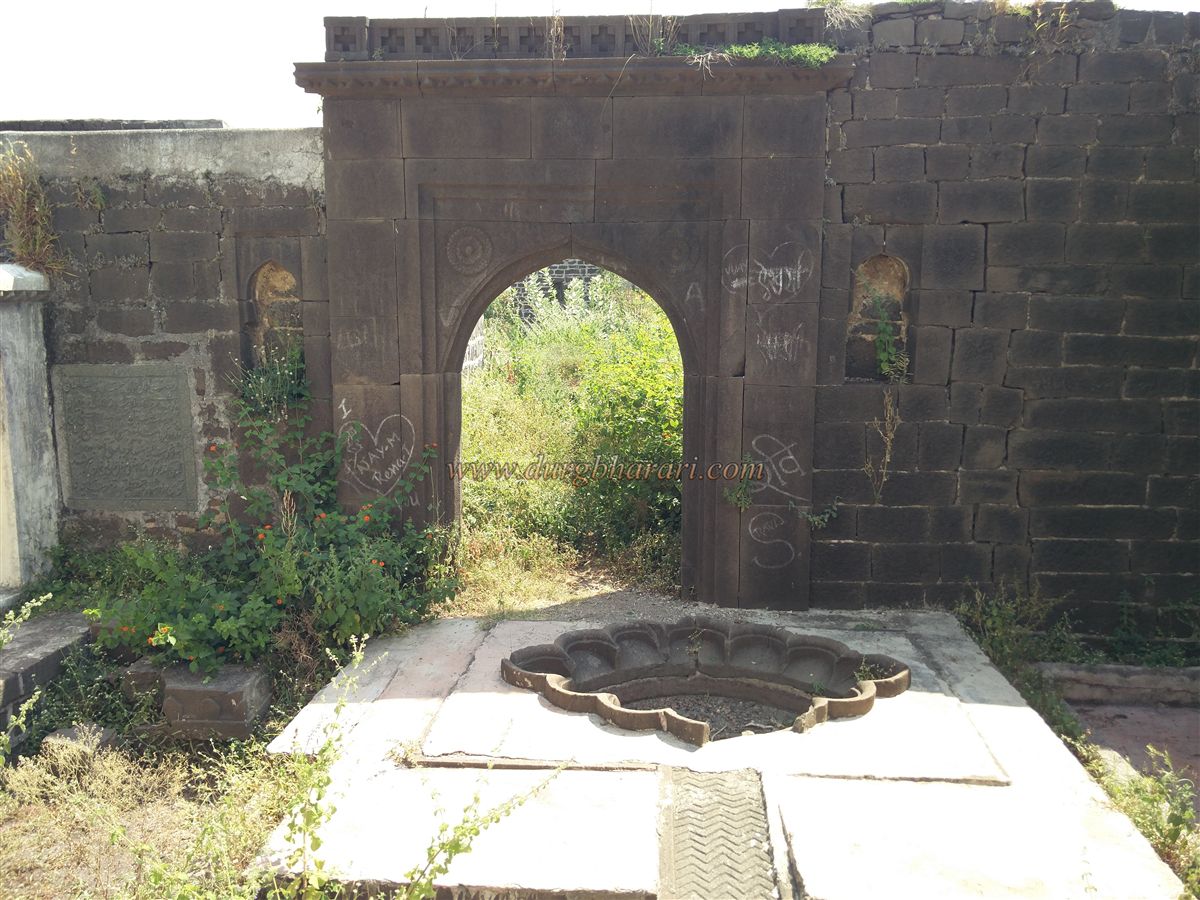
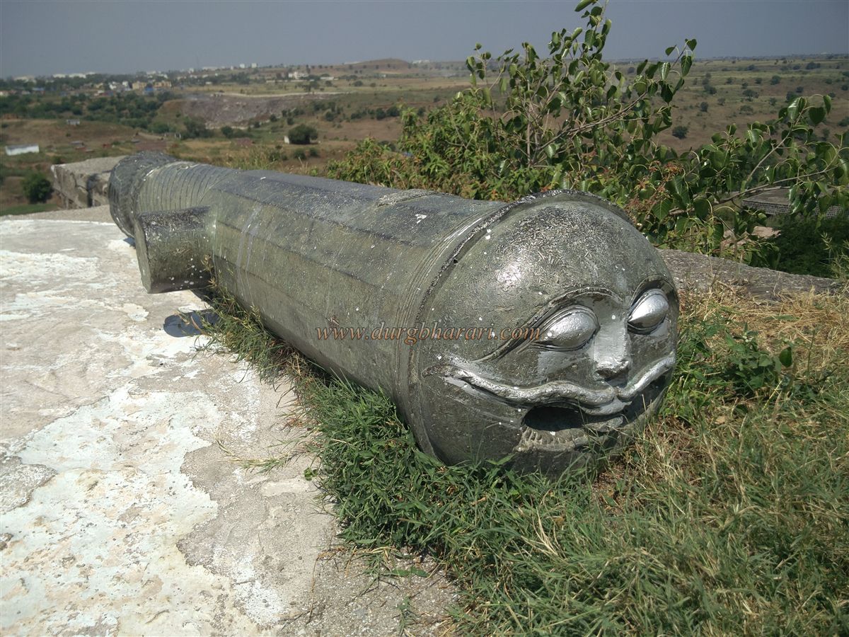
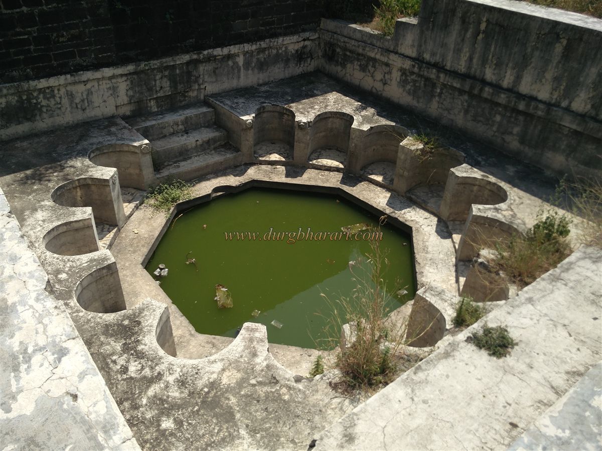
The third gate also faces east. Between the second and third gates lies an open courtyard, some areas of which feature carved lotus motifs. A path from the inner fort leads to this section. The fourth gate faces south, with large barracks between the third and fourth gates for soldiers. Apart from the main gate, a smaller gate provides access to the fort. Passing through it, one sees a tiger-faced cannon ahead. To its right is a structure with a large flower-shaped water tank, built to supply water to the fort’s internal structures, including the fountains. Using a siphon system, water was distributed through clay pipes to various buildings. A Persian inscription on this building states that it was constructed by Mir Khan Husain in the month of Muharram, Hijri 1092.
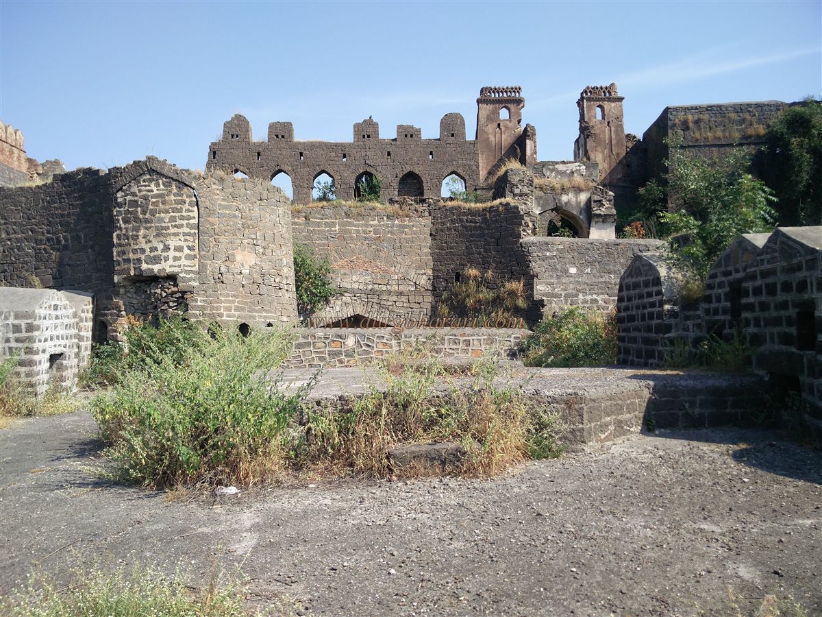
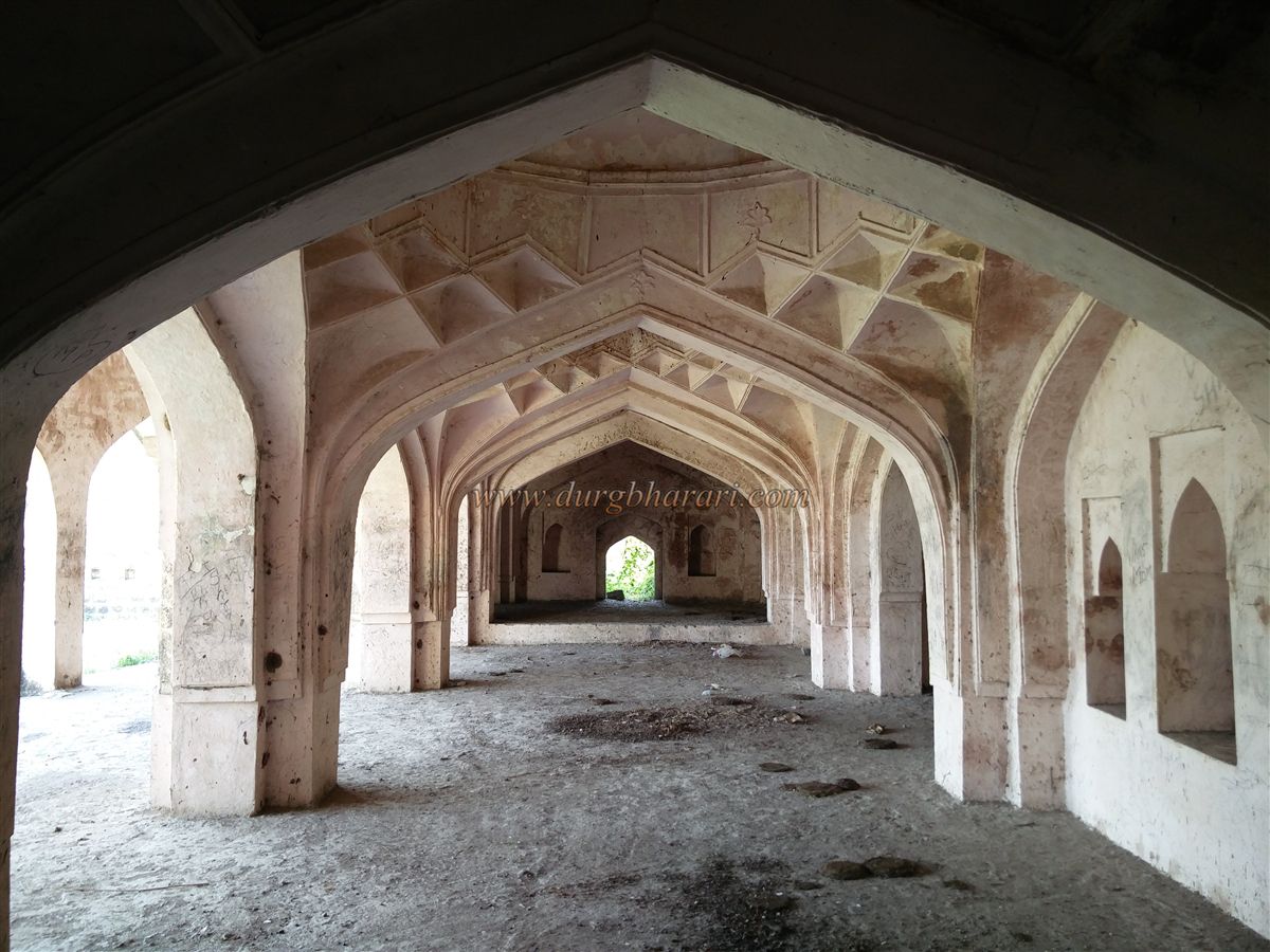
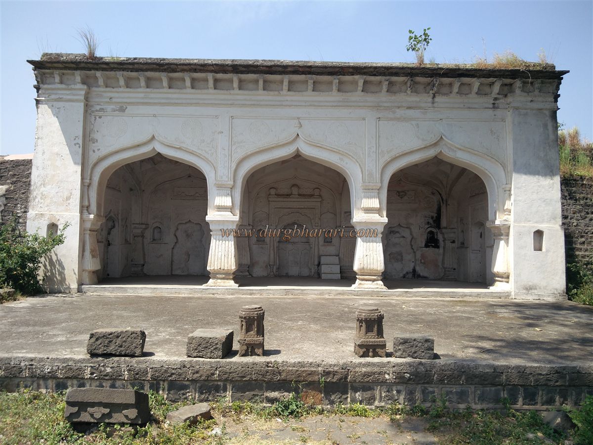
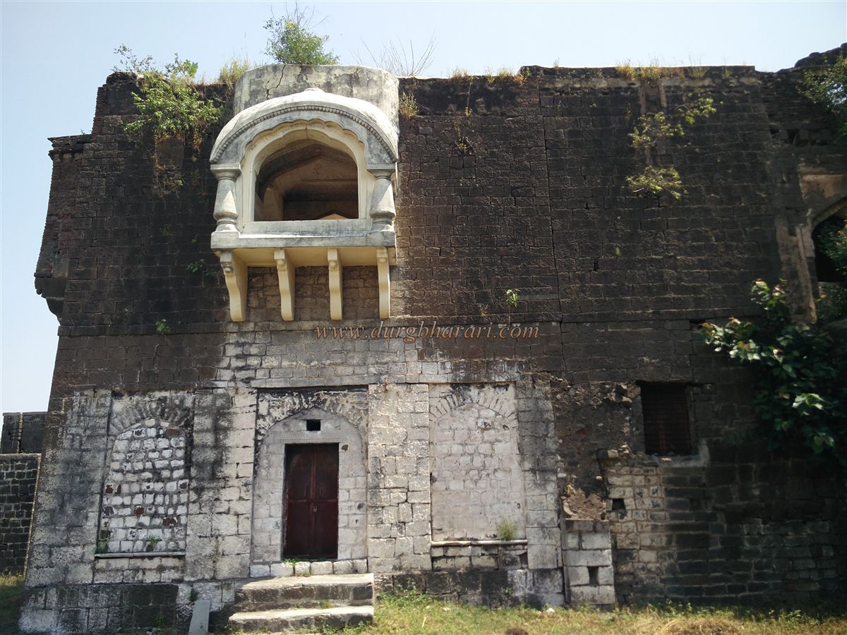
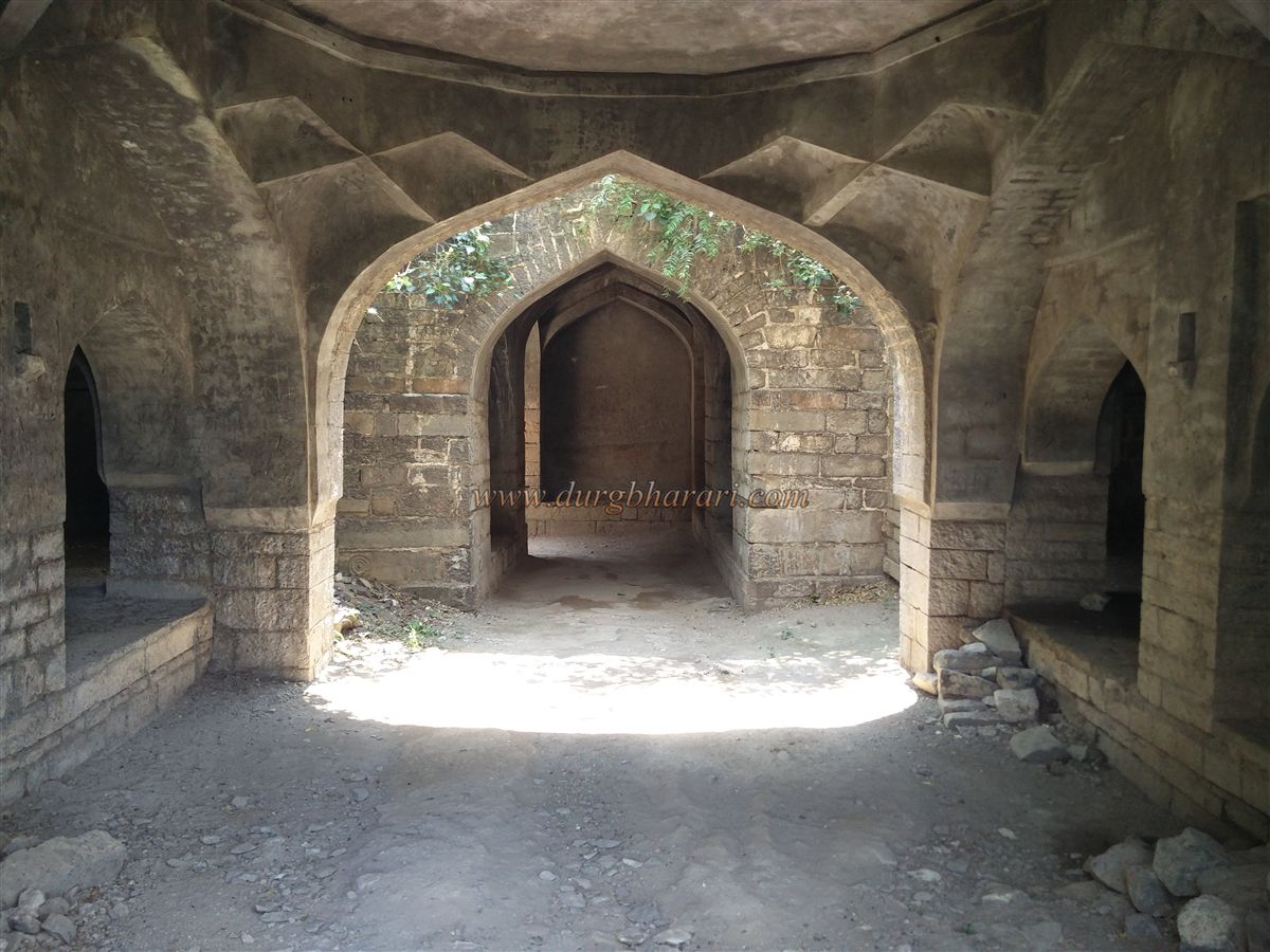
Behind this structure, a doorway leads to a beautifully ornamented palace with arched halls. A Persian inscription on the central arch mentions that the arches were custom-made and unique. Adjacent to the palace is a square water tank, and in front of it is an octagonal stepwell. Nearby are three arches and a two-hall building, and along the wall is a three-story watchtower with four corner minarets, offering a panoramic view of the entire fort. A subterranean passage leads out of the fort, now sealed with stones.
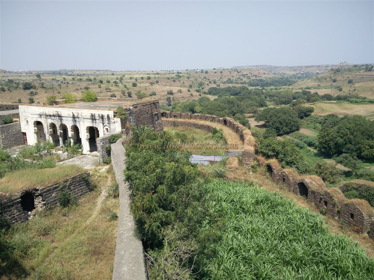
The palace upper section houses pigeon lofts and an adjacent five-arched, fifteen-pillared Rangmahal, with stairs leading to the south-east bastion. This bastion, called the Chandni Buruj, is octagonal, with a flag post and an eight-foot-long bronze cannon, decorated with Makara (crocodile) and Surya (sun) motifs, along with two Persian inscriptions. Returning from Chandni Buruj, visitors reach a hall near the south gate, from which a subterranean stairway leads back to the upper part of the gate. Here stands a five-arched building housing a Persian inscription. Stairs in front of it lead down, with a cistern to the right and the main fort entrance to the left.
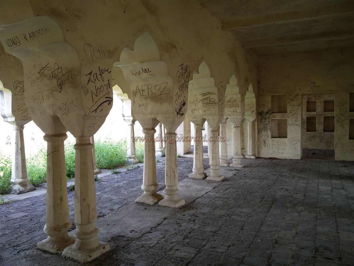
A full circuit of the fort takes approximately two hours. From the second gate, moving straight, the flower-shaped tank is seen on the right, and on the left, a three-arched mosque. Adjacent to the mosque is a small arched pavilion with a central water tank and a three-story Hawa Mahal, including a small hammam at its base. Returning past the mosque, visitors head straight toward the north end of the fort, which is enclosed by a circular bastion wall. To the left at this end is a two-story Rajmahal, beautifully balanced on five arches and ten pillars, with four deep square courtyards and a water tank in the central courtyard. Stairs on both sides of the arches lead to the upper floors of the palace.
The area in front of the palace has a courtyard with two mandapas, and between them lies a water tank. To the right of this palace is a replica structure, smaller in scale, with two surrounding buildings, each with basements. This is identified as the Nartaki Mahal (Dancer’s Palace). Adjacent to it are remnants of other residential buildings.
On the return route, visitors pass three sequential Amberkhana buildings on the right. Behind these is another palace connected to the mosque, structured similarly to the Nartaki Mahal. Following this path straight to the main gate completes the fort tour.
Udgir Fort has no internal drinking water supply, so visitors must carry adequate water. The fort remained continuously inhabited until recent times, and because no battles occurred here during British rule, the internal structures are well-preserved. The Archaeological Survey of India (ASI) has maintained the fort, though overgrowth from vegetation persists due to lack of active upkeep. A thorough visit takes about four hours, and the fort is open under ASI supervision from 9 AM to 5 PM. Udgir town provides lodging and food facilities.
Historically, Udgir is an ancient settlement with a heritage dating back to the 11th century. The Karbasveshwar text refers to this city as “Udaygiri/Udakgiri,” describing how Sage Udaling performed penance for Lord Shiva and established a Shiva Linga in one of the fort caves, giving the city its name.
Architectural evidence suggests that Udgir Fort was originally constructed during the Chalukya rule of Badami in the 11th century. Later, inscriptions from the Yadav period mention Udgir and its ruler Sahava Bhillam under King Singhanadev in 1178 CE. After the decline of the Yadavas, the fort came under the Khilji and then the Bahmani rule. In 1422 CE, Mahmud Shah Bahmani shifted the Bahmani capital to Bidar, increasing Udgir’s strategic importance.
In 1492 CE, Bahmani general Qasim Barid was assigned governance over Udgir, Ausa, and Kandhar forts. Following the fragmentation of the Bahmani kingdom in 1526 CE, he established the Barid Shahi dynasty, with Bidar as its capital. Being near the Adil Shahi territories, the region experienced frequent conflicts between the Adilshahi and Baridshahi.
In 1636 CE, Shah Jahan brought Udgir, Ausa, Paranda, and six other forts under Mughal control. However, there is no record of major battles at Udgir during the Mughal period. As the Mughal power waned, Nizam-ul-Mulk Asaf Jah took control, founding the Nizam state.
A notable battle occurred in February 1760, when Sadashivrao Peshwa led the Marathas against the Nizam at Udgir. The Nizam was defeated, and territories worth 8.5 million were annexed to the Maratha Swarajya. However, due to subsequent Maratha involvement in northern politics at Panipat, the Nizam regained some areas, including Udgir Fort. The Nizam later allied with the British, preventing the fort from suffering wartime damage.
Udgir Fort remained under Nizam’s control and in use until 17 September 1948, when the Hyderabad State merged with India after independence.
This detailed layout shows that Udgir Fort is not only a strong military structure with multiple defensive layers but also a marvel of architecture, water management, and Persian-influenced artistry, making it an essential site for historical exploration.
This history highlights Udgir Fort’s continuous strategic significance, remarkable architectural preservation, and layered political history from the Chalukya to modern India.
© Suresh Nimbalkar
GALLERY