TRINGALWADI
TYPE : HILL FORT
DISTRICT : NASHIK
HEIGHT : 2840 FEET
GRADE : EASY
Balwantgad, situated in the Sahyadri mountain range spreading west of Igatpuri, is surrounded by several forts such as Tringalwadi, Bhaskargad, and Harihar. Tringalwadi is an important watch fort in this range. Since ancient times, Nashik has been famous as a marketplace. To keep watch on the Thal ghat–Gondaghat–Amboli Ghat routes coming from North Konkan to Nashik, the Tringalgad Fort was built as part of a chain of forts on the ghats. To visit Tringalgad, one must first reach Tringalwadi, the base village. The distance from Mumbai to Tringalwadi is 130 km, and it can be reached from Igatpuri on the Mumbai–Nashik Highway. From Nashik, it is about 50 km, accessible via Takeghoti. Tringalwadi village is composed of three hamlets — Nishan wadi, Patryachi Wadi, and Talyachi Wadi — hence the name Tringalwadi. The nearest route to the fort is from Talyachi Wadi at the end of the village.
...
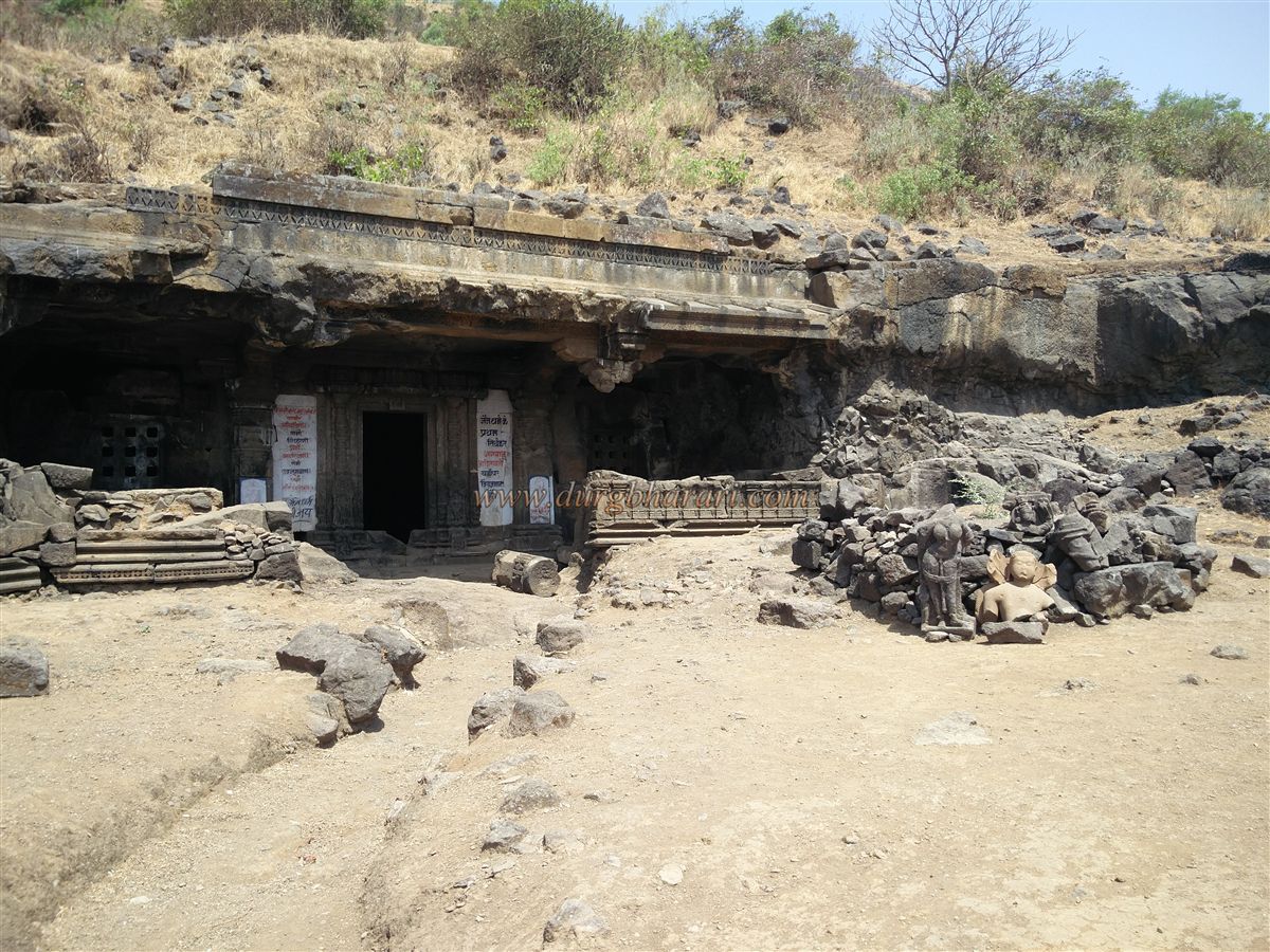
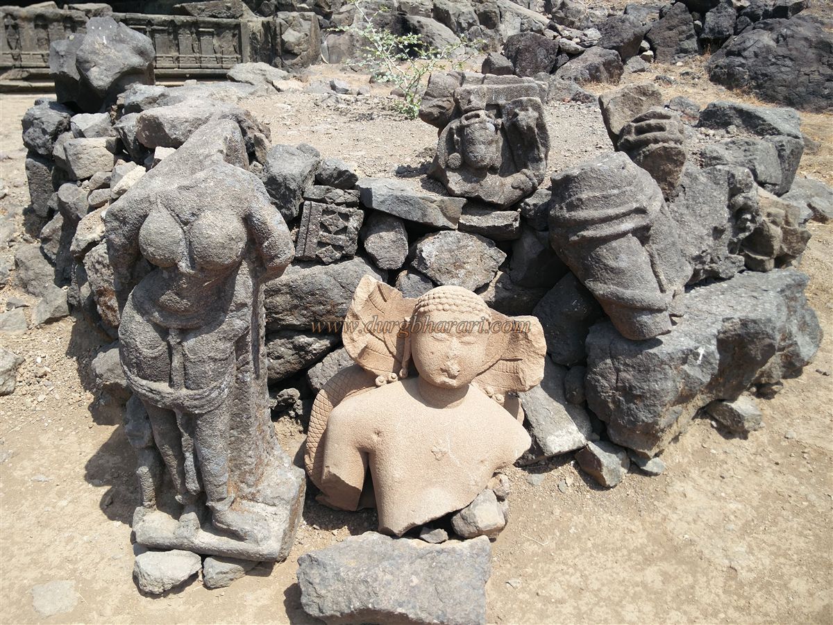
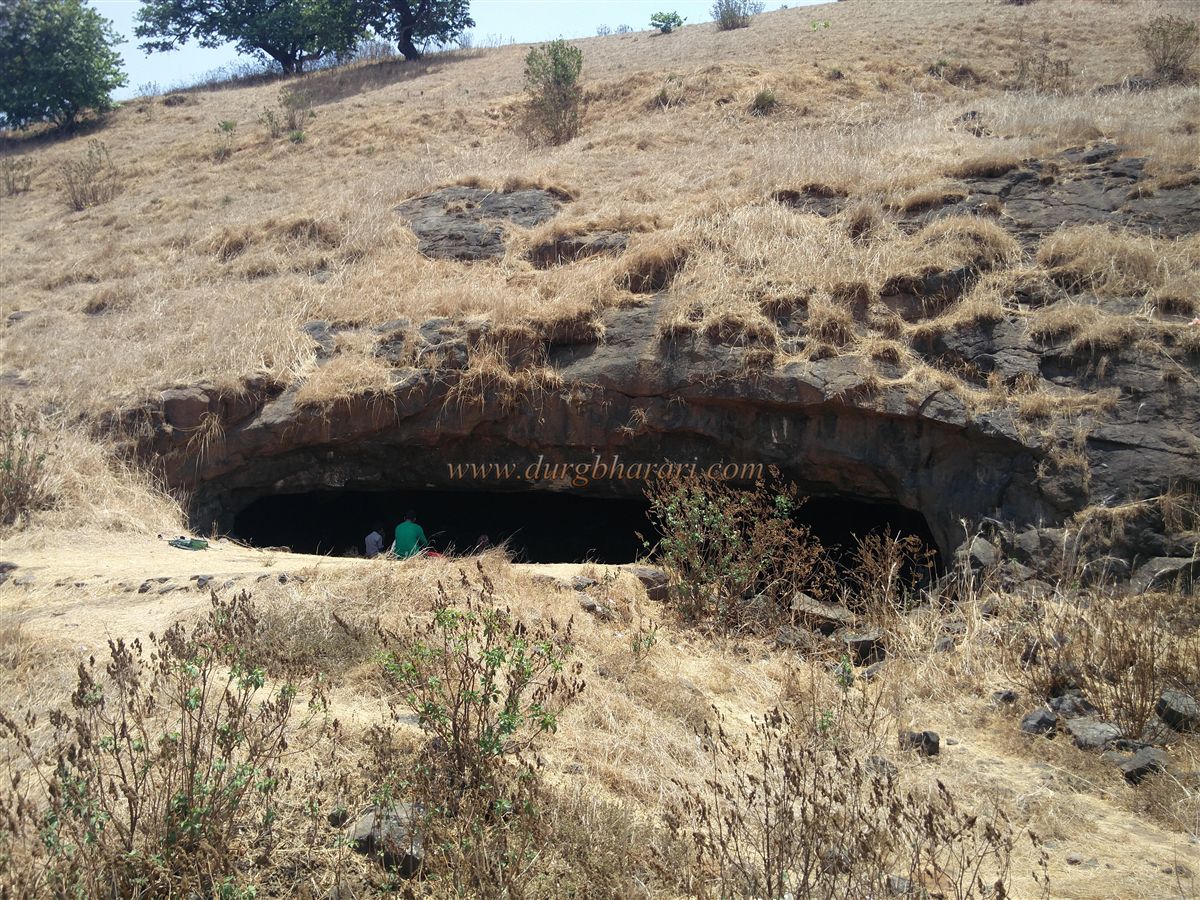
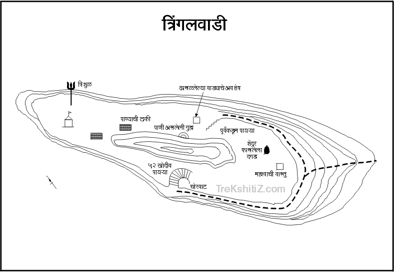
From here, taking the path along the tank behind the village and walking along the bund through the fields for 20 minutes, one reaches the Jain caves, known as Pandavleni, at the base of the fort, dating to the 10th century. These caves are currently under the Archaeology Department’s control, with excavation work ongoing. Outside the caves lies a heap of broken remains, with many fragmented idols visible.
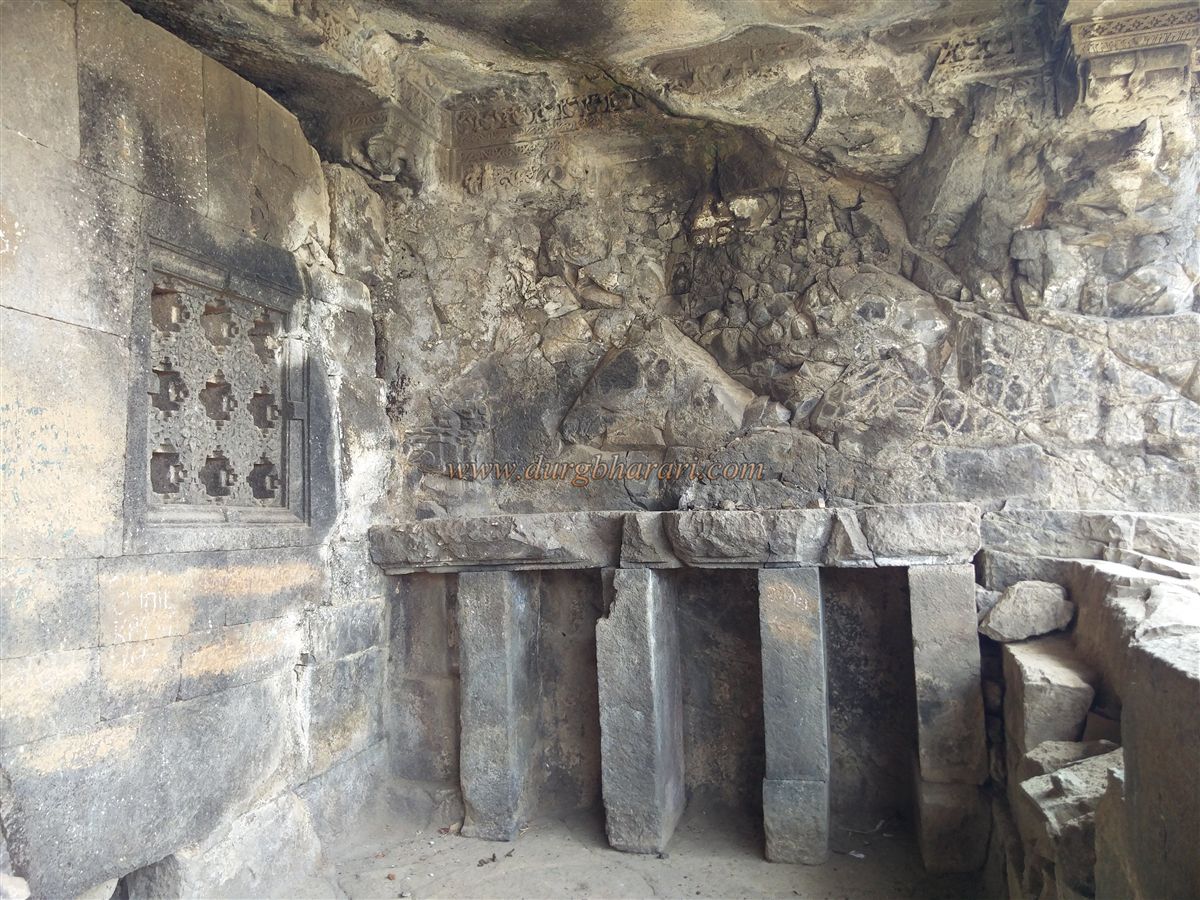
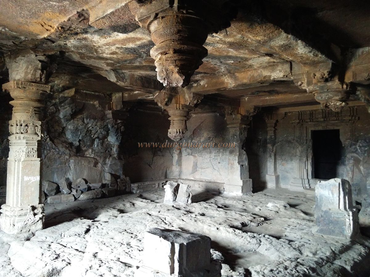
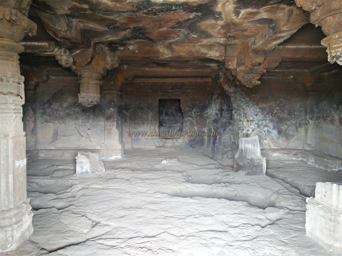
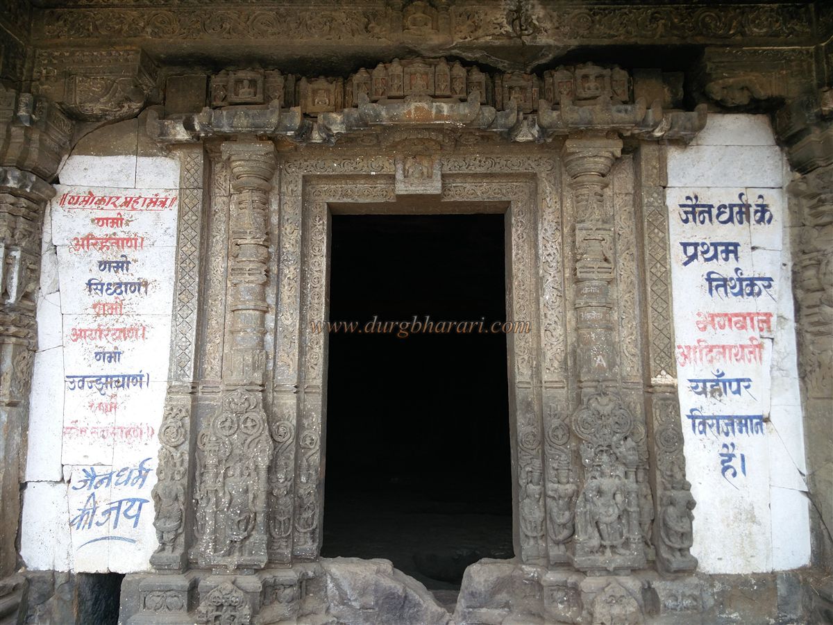
The Jains began constructing caves in Maharashtra in the 8th century. Inscriptions indicate that the Tringalwadi caves were carved in Shaka 1266. Rectangular in shape, the caves are divided into three parts: the veranda, the assembly hall (Sabhamandap), and the sanctum (Garbhagriha). On either side of the veranda are square seating areas, with sculptures of Tirthankaras and attendants carved below the door frame. The doorframe itself is beautifully carved, and both sides of the door have lattice windows to allow air and light into the assembly hall. On the veranda ceiling above the doorway, circular carvings depict Yakshas with interlocked hands.
The spacious assembly hall has niches in the inner walls with carvings. Of the four carved pillars supporting the hall’s ceiling, three have collapsed, with only the upper parts remaining, showing carved Yakshas. Inside the sanctum is a damaged idol of the first Jain Tirthankar, Lord Adidev (Rishabhanath), seated in the lotus posture. The pedestal bears a worn Sanskrit inscription in Devanagari script. Beside the caves is a water cistern.
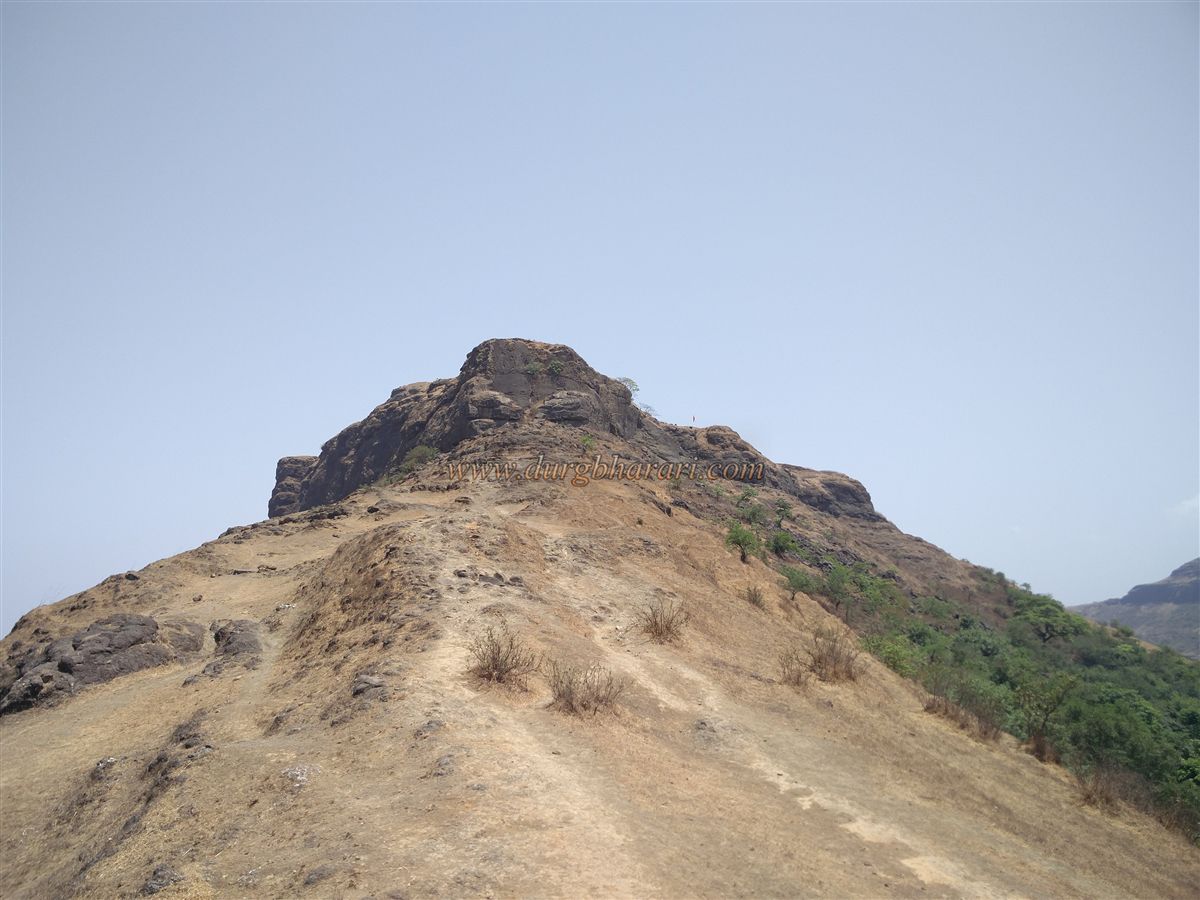
Above the caves lies Tringalwadi Fort itself, with a path to the fort on the left side of the caves. After about a 30-minute climb, one reaches the machi (plateau) below the fort. From here, one can see a ridge extending from the fort. A 15-minute walk from the machi leads to this ridge, where steps buried under soil become visible. Ahead rises the rock pinnacle of Tringalwadi Fort. The fort, extending north–south, has two gates — one to the east and the other to the west. The western gate is known as the Konkan Darwaja. Two paths lead to this gate from below the cliff — one from the right and one from the left.
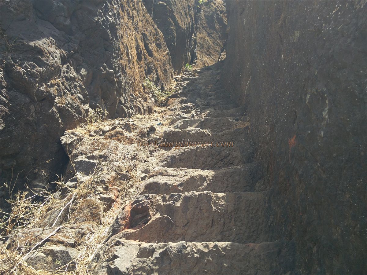
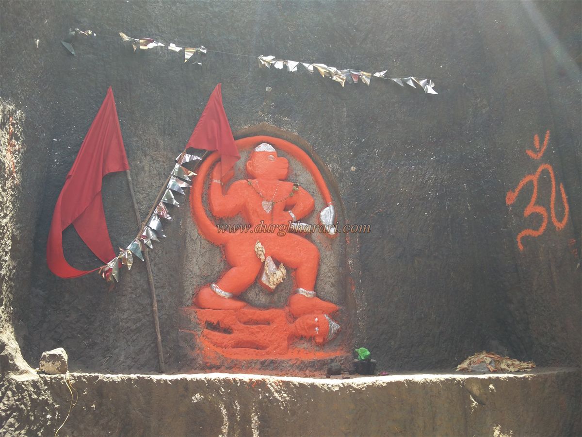
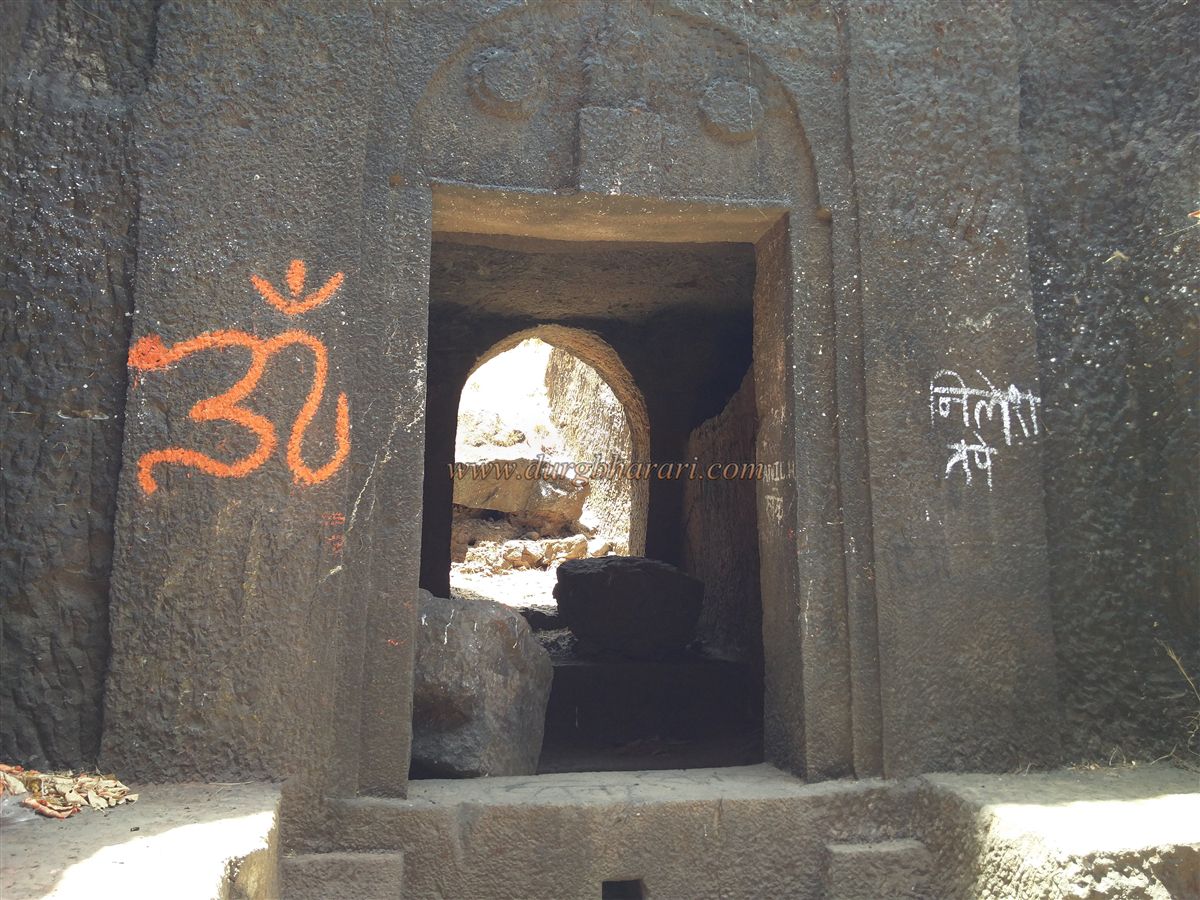
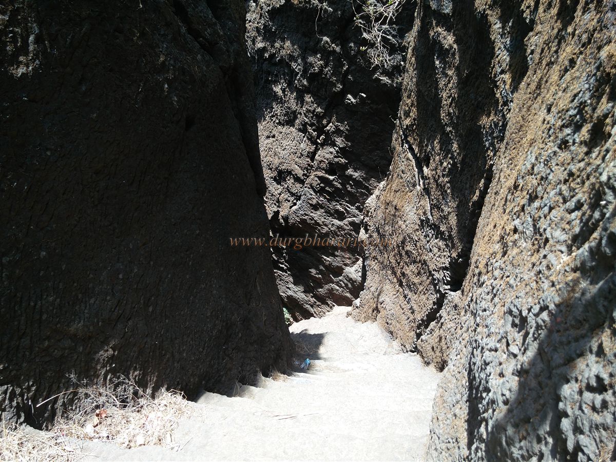
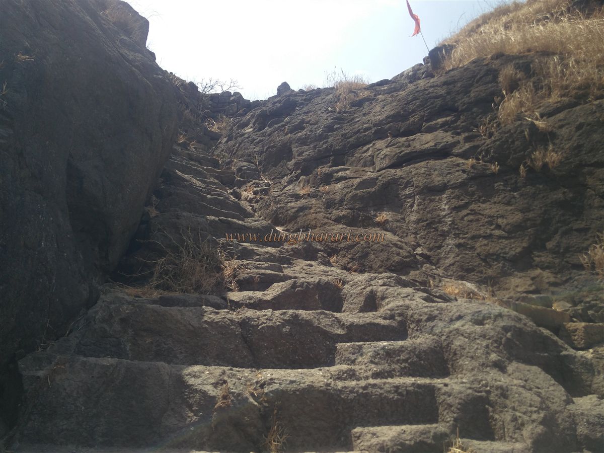
The best way to explore the fort is to ascend via the western (Konkan) gate and descend via the eastern gate. The left-hand route to the Konkan gate keeps the cliff on the right and the valley on the left, passing a simple rock patch to reach the stone steps of the fort. About 60 rock-cut steps, each about 1.5 feet high, lead upward. At the top, on the right side, is a south-facing gate carved into the rock, with a six- to seven-foot-tall idol of Hanuman on the platform in front. On both top corners of the gate are carvings of Sharabh, with sun and moon symbols beneath. Inside, there are half-carved guard chambers on either side.
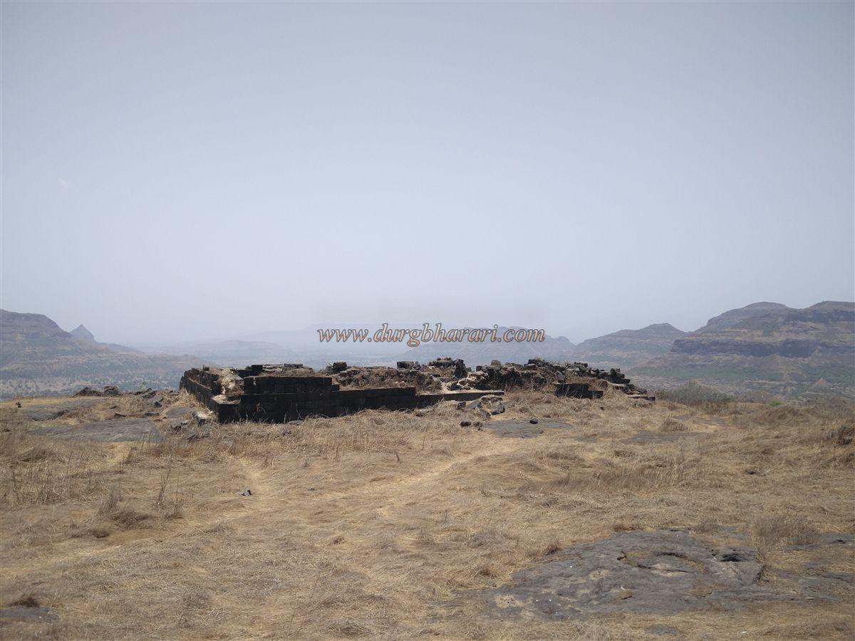
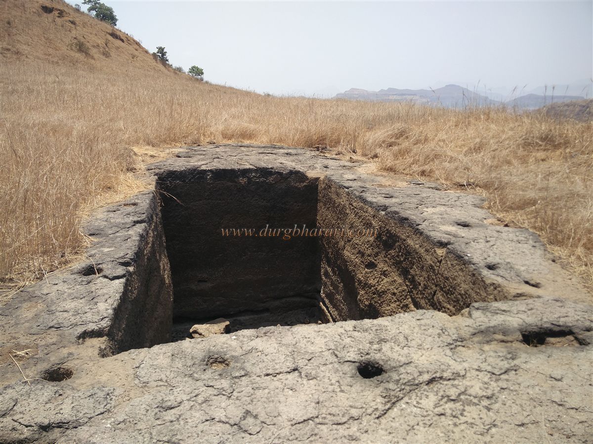
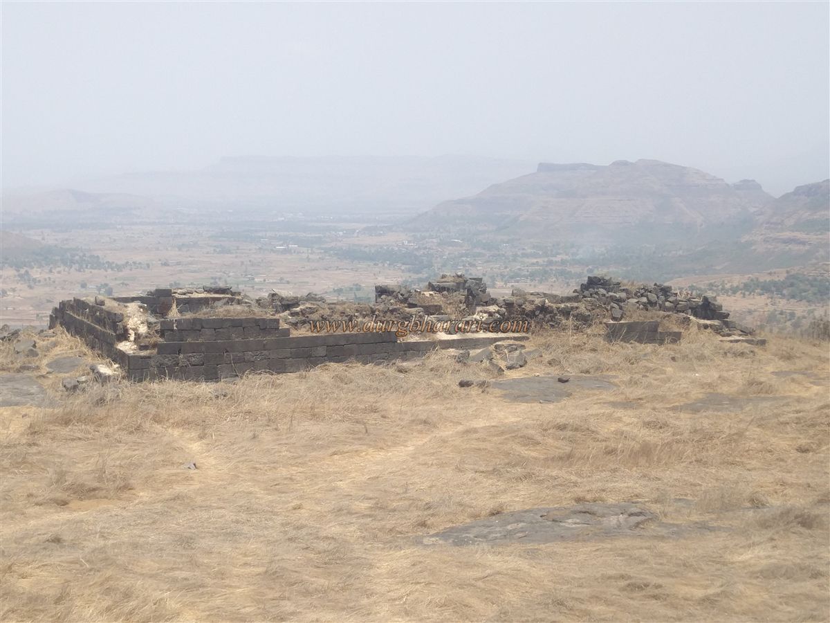
Beyond the gate, the path is obstructed by fallen boulders. To the right lies a valley, and to the left rises the cliff of the citadel (balekilla). A path leads upward along the cliff base, where there is a large rock-cut twin tank, now dry and filled with stones. From here, the trail loops around the citadel to reach the eastern side of the fort, which has a relatively flat expanse where most of the fort’s remains are located. The fort’s altitude is 3,148 feet above sea level, covering about 24 acres.
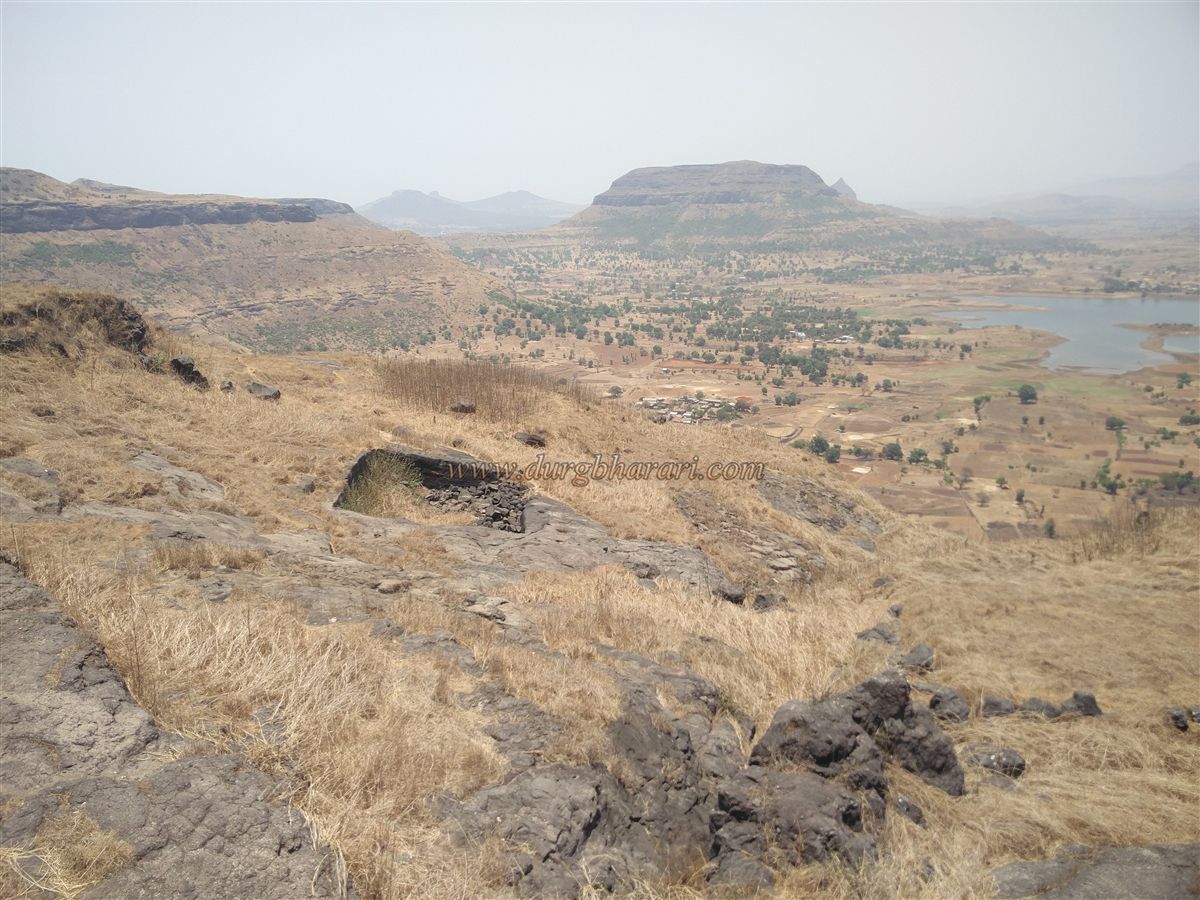
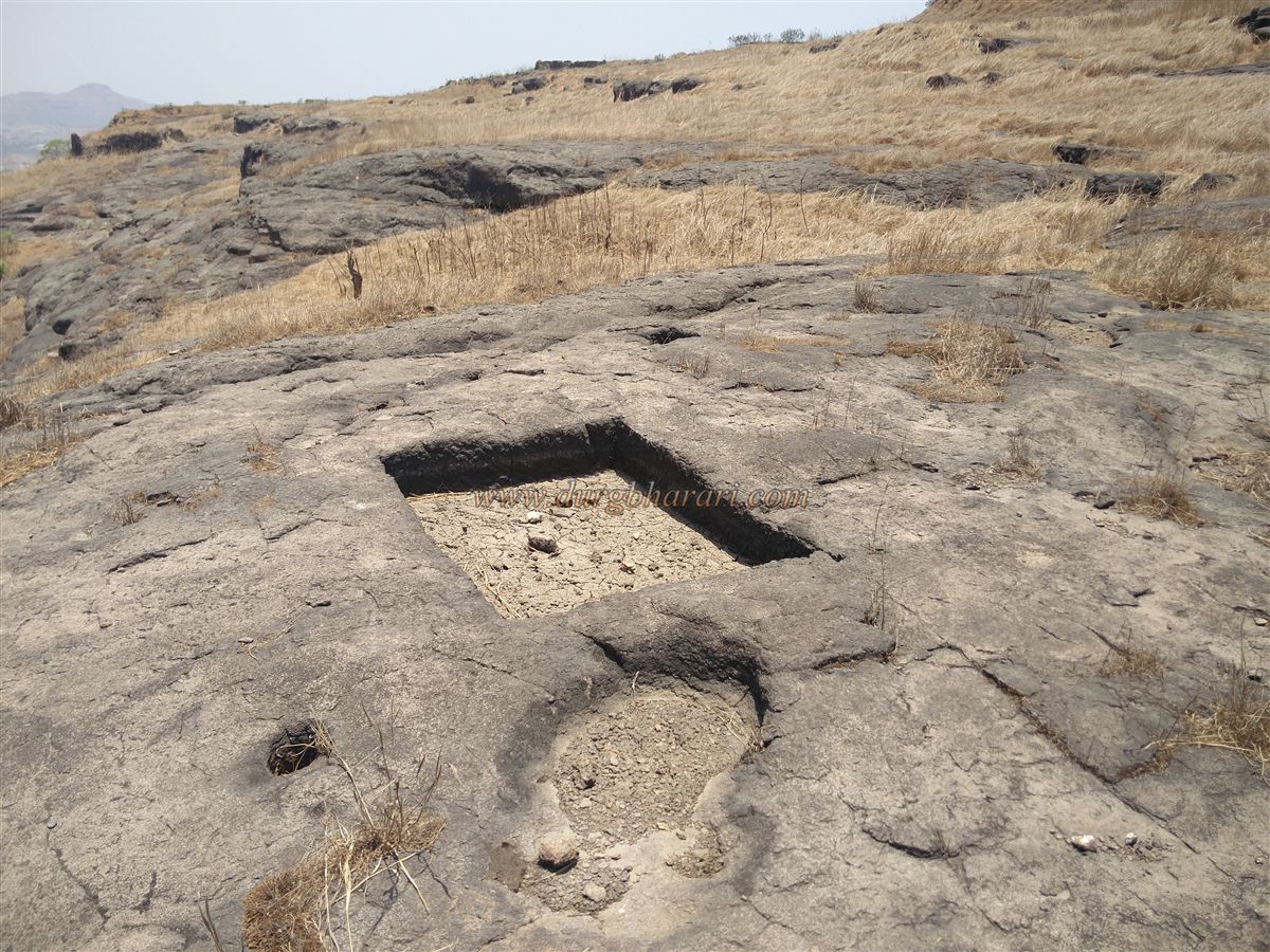
Here stand the remains of a large mansion, behind which is the southern bastion offering views of the ridge used to climb up. In front of the mansion are remains of another structure. Below this lies the eastern gate of the fort, but before descending, it is best to explore the machi area. This area has rock-cut pits and house remains, indicating habitation.
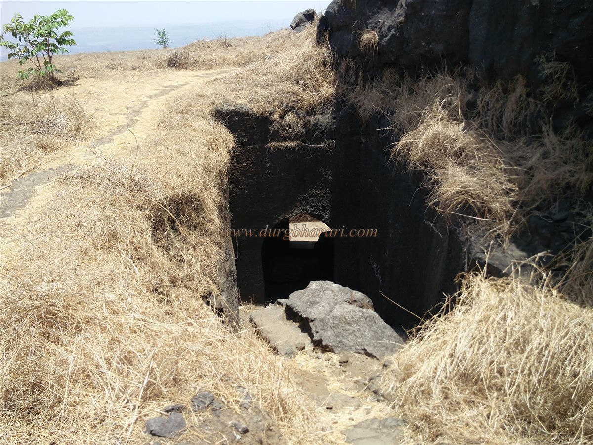
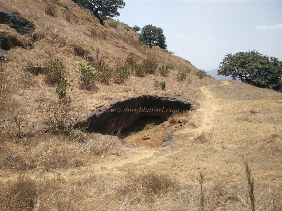
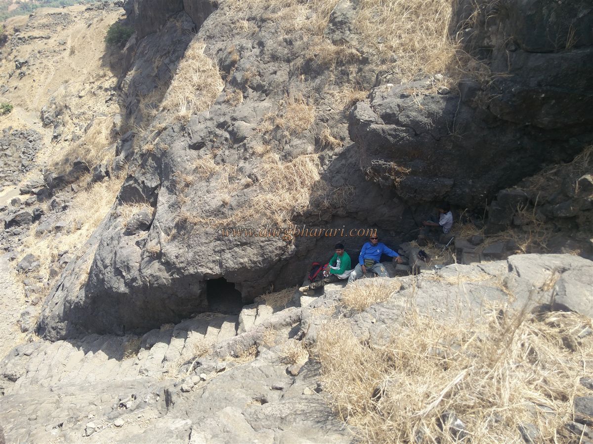
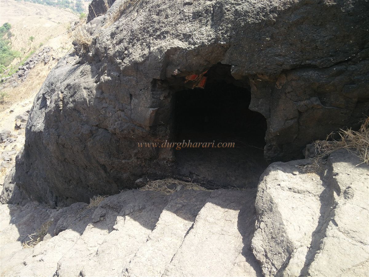
Further along, a path descends to meet the eastern gate path. Continuing ahead, one finds a dry tank carved into the rock on the right, followed by a smaller silted tank. At the cliff edge to the right are remains of a sentry post, and to the left lies a water pond. Above it, on the citadel slope, is a blocked tank and a partially sealed cave. Climbing up, one finds another large cave carved into the rock, capable of sheltering 20–25 people.
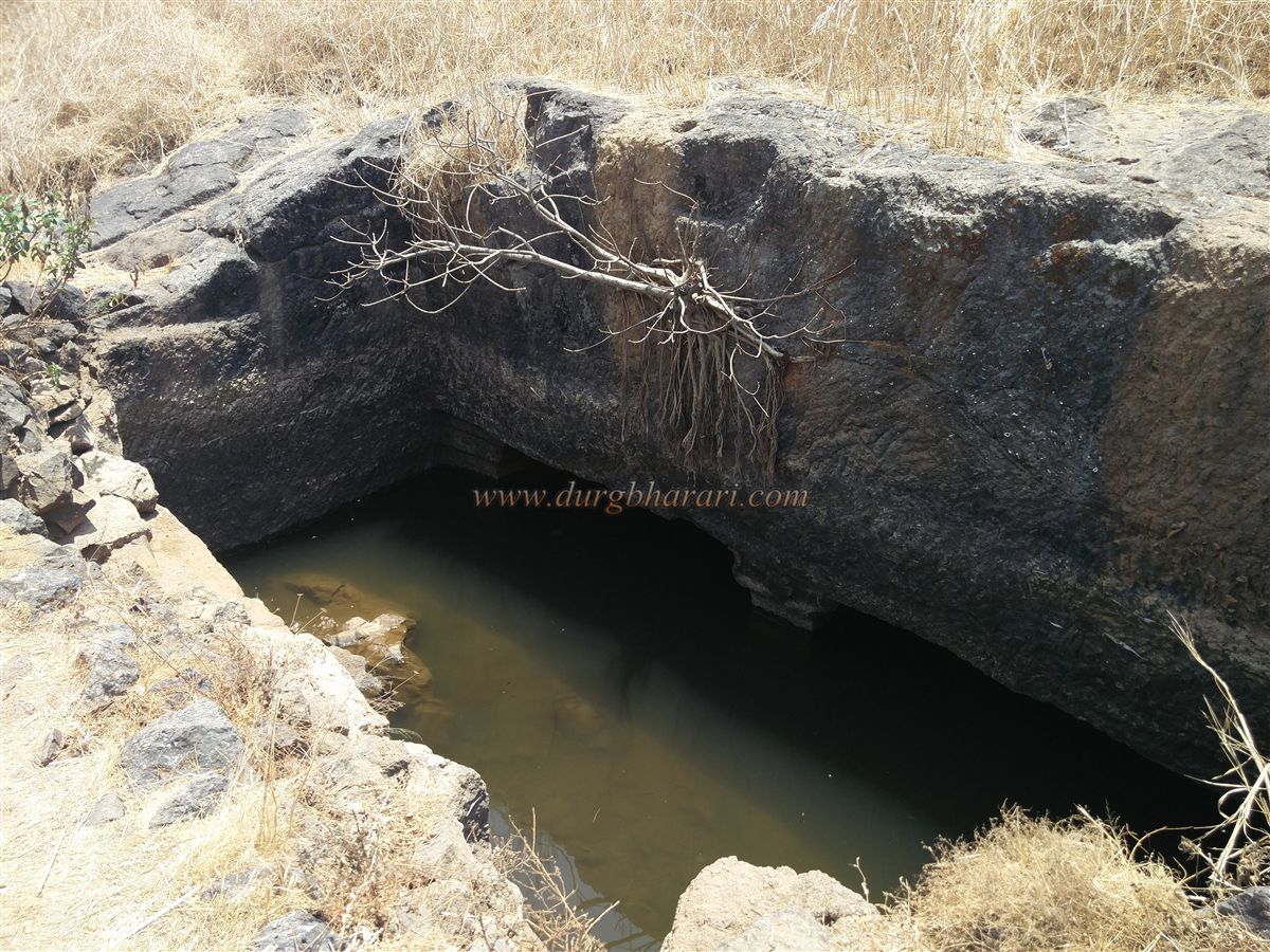
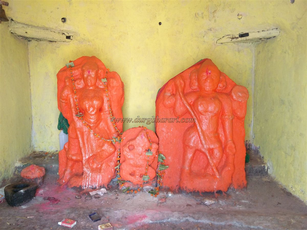
Beyond these caves are two dry tanks, followed by a perennial drinking-water cistern — the only year-round water source on the fort. The path from here leads to a domed Bhavani temple at the northern tip of the fort, housing idols of Bhavani, Ganesha, and Bhairav covered in vermillion. Outside is a Shivling, and in front, a hero stone (virgal) is placed. From the northern bastion, one can see Kalsubai to the east, and Harihar and Basgad to the north.
From behind the temple, a path climbs to the balekilla, allowing descent on the opposite side. The balekilla has no remains but offers views of the entire machi. The fort’s summit has sparse fortification, but from here one can see the Sahyadri range, the Tringalwadi reservoir, Igatpuri to the south, the Vaitarna valley, Tryambak range, Kavnai, Mordhan, Alang, and Kulang.
From the balekilla, the path descends back to the mansion seen earlier, and then to the fort’s eastern gate. The gate here is completely collapsed, with only the walls remaining. Rock-cut steps descend from here, passing a small cave on the right, and another cave opposite after the steps. At the bottom, the fort circuit is complete. It takes about 2 hours to tour the fort.
From the 10th-century Jain caves at its base, it can be assumed the fort was built around that time. The poet Jayaram Pinde mentioned Tringalgad in his work Parnal Parvat–Grahanakhyan: “Alankurangatingalavatika namathoddhatam | Ahivanto’chal Giri Markandeyabhidhanakah ||"
It is not known exactly when the fort came under Maratha control, but it is believed that Moropant Pingle took it during the capture of Nashik province. In 1688, the Mughals captured the fort from the Marathas through treachery. In a letter to Aurangzeb, Matbarkhan mentions laying siege to Tringalgad. On 20 April 1744, during Peshwa Bajirao I’s reign, Karnaji Shinde is recorded as having captured the fort. In 1818, after taking control of Tringalgad, Captain Briggs destroyed the fort with cannon fire and explosives.
© Suresh Nimbalkar
GALLERY