TRIMBAKGAD
TYPE : HILL FORT
DISTRICT : NASHIK
HEIGHT : 4200 FEET
GRADE : MEDIUM
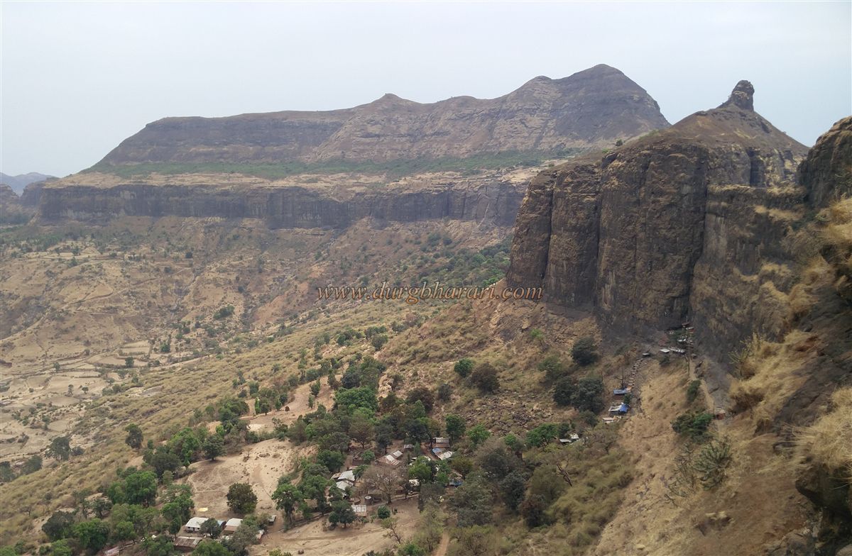
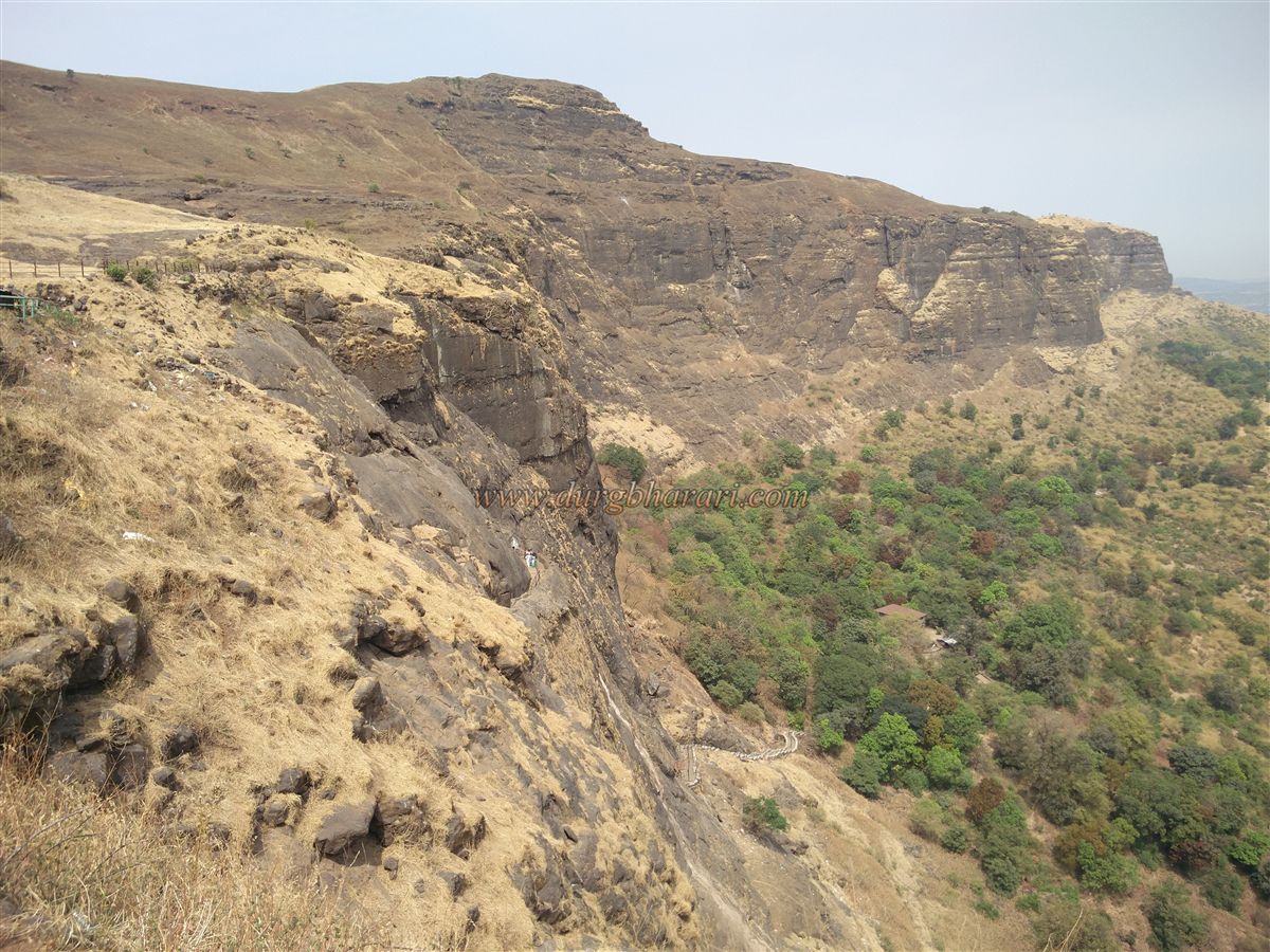
Trimbakeshwar in Nashik is one of the twelve Jyotirlingas in India. Originating from Bramhagiri fort, the Godavari River flows towards the south and meets the Bay of Bengal at Rajmahendri in Andhra Pradesh. The Brahmagiri mountain, one of the twelve Jyotirlingas and the source of the river Godavari, is always crowded with devotees. This fort, which once played an important role in history, is now known only as of the origin of Godavari and has lost its original identity. However, we will visit Brahmagiri mountain as a fort and we will look at it from the same point of view. During the Satavahan period, the Brahmagiri aka Shrigad fort was built to protect the trade route from Maharashtra to Gujarat passing through the Trimbak mountain range. Trimbakeshwar is one of the twelve Jyotirlinga at the base of the fort and is better known as Trimbakgad.
...
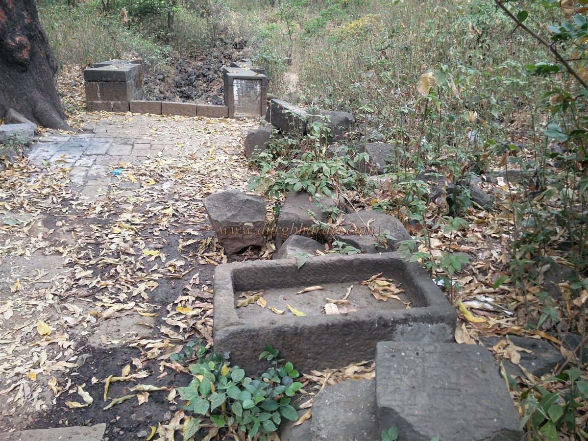
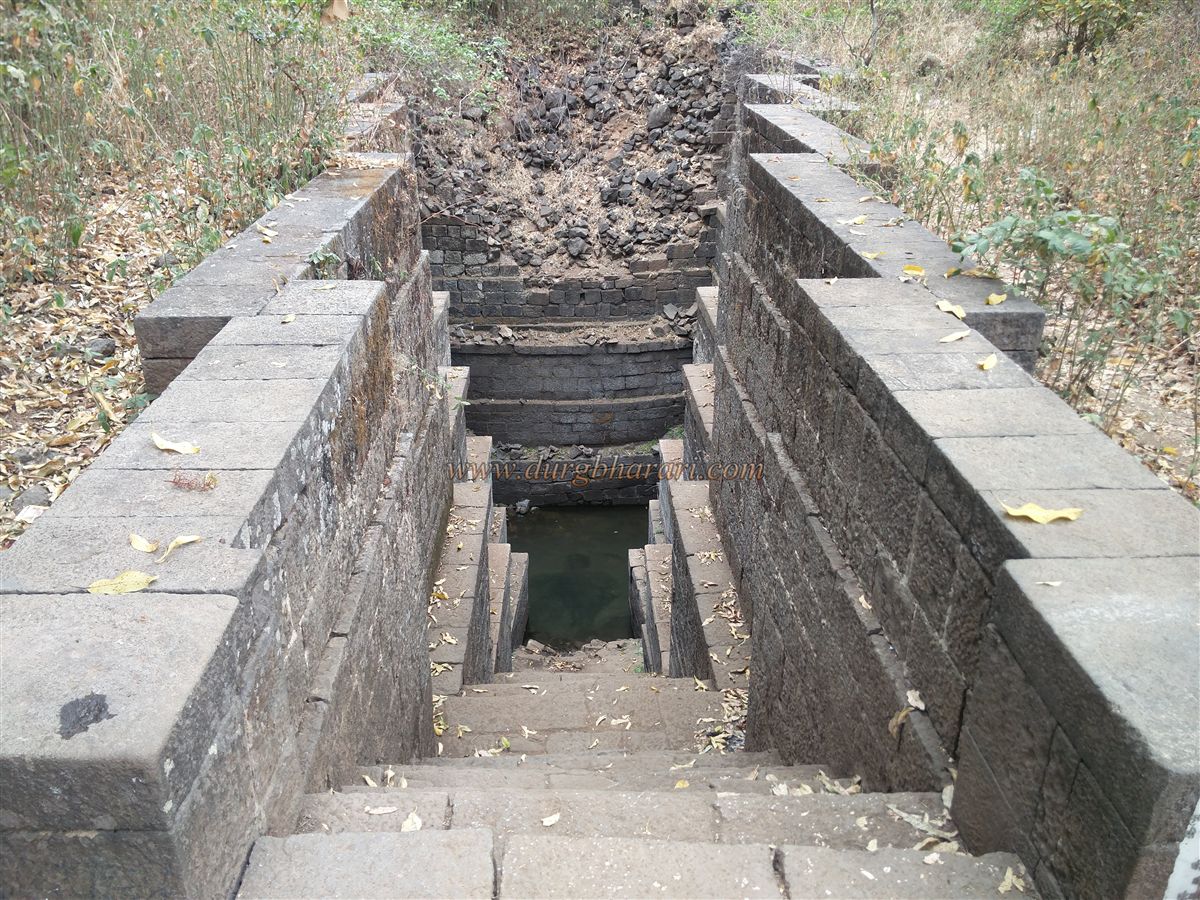
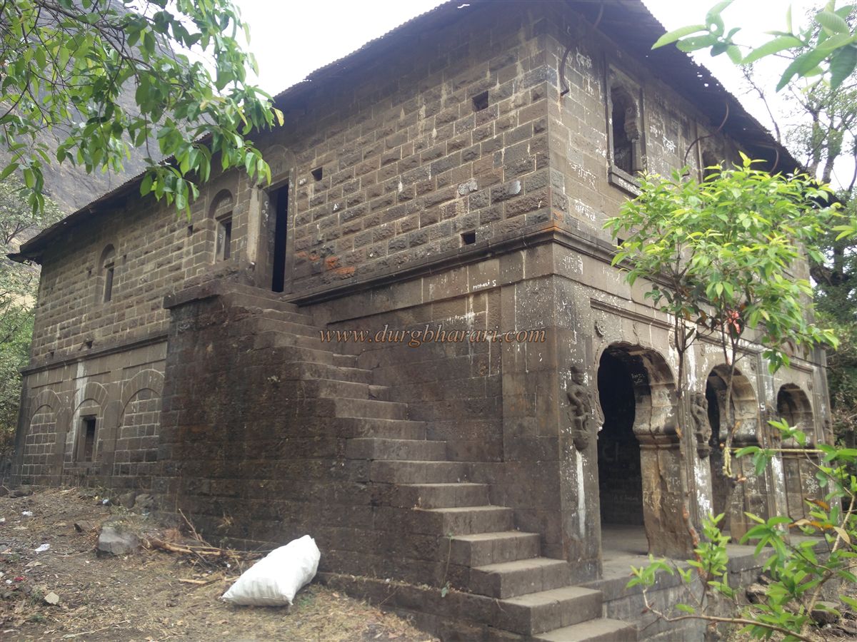
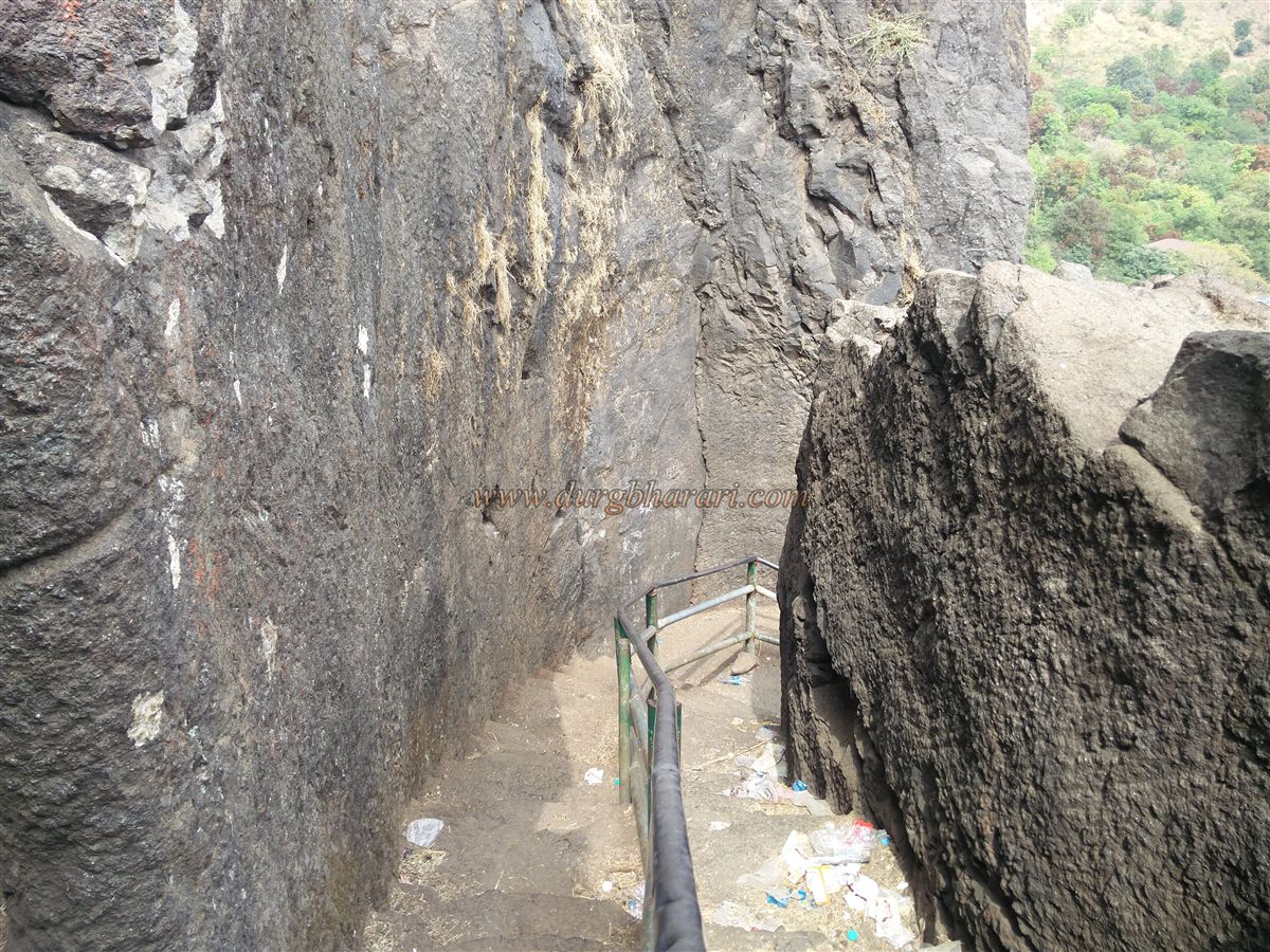
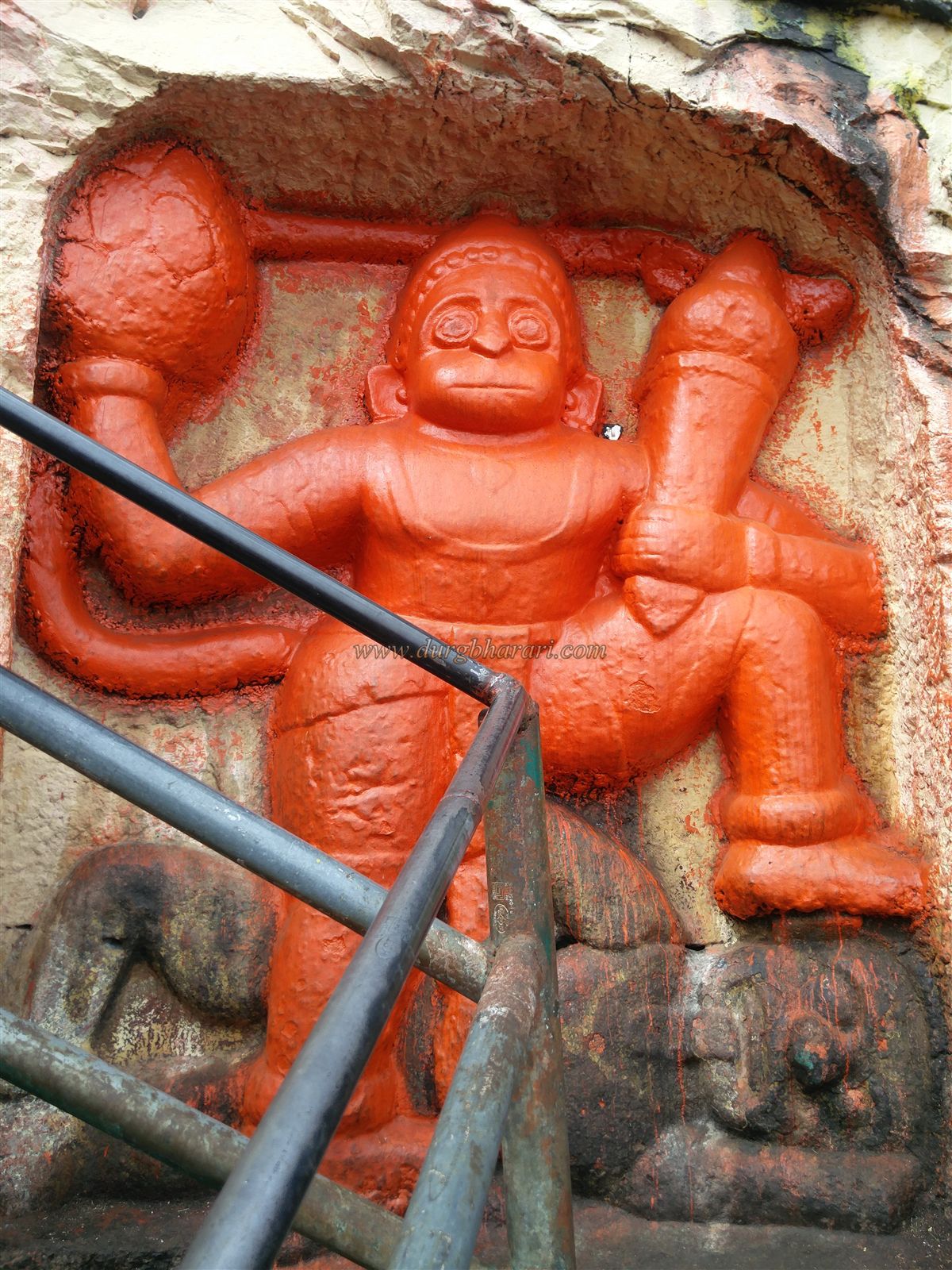
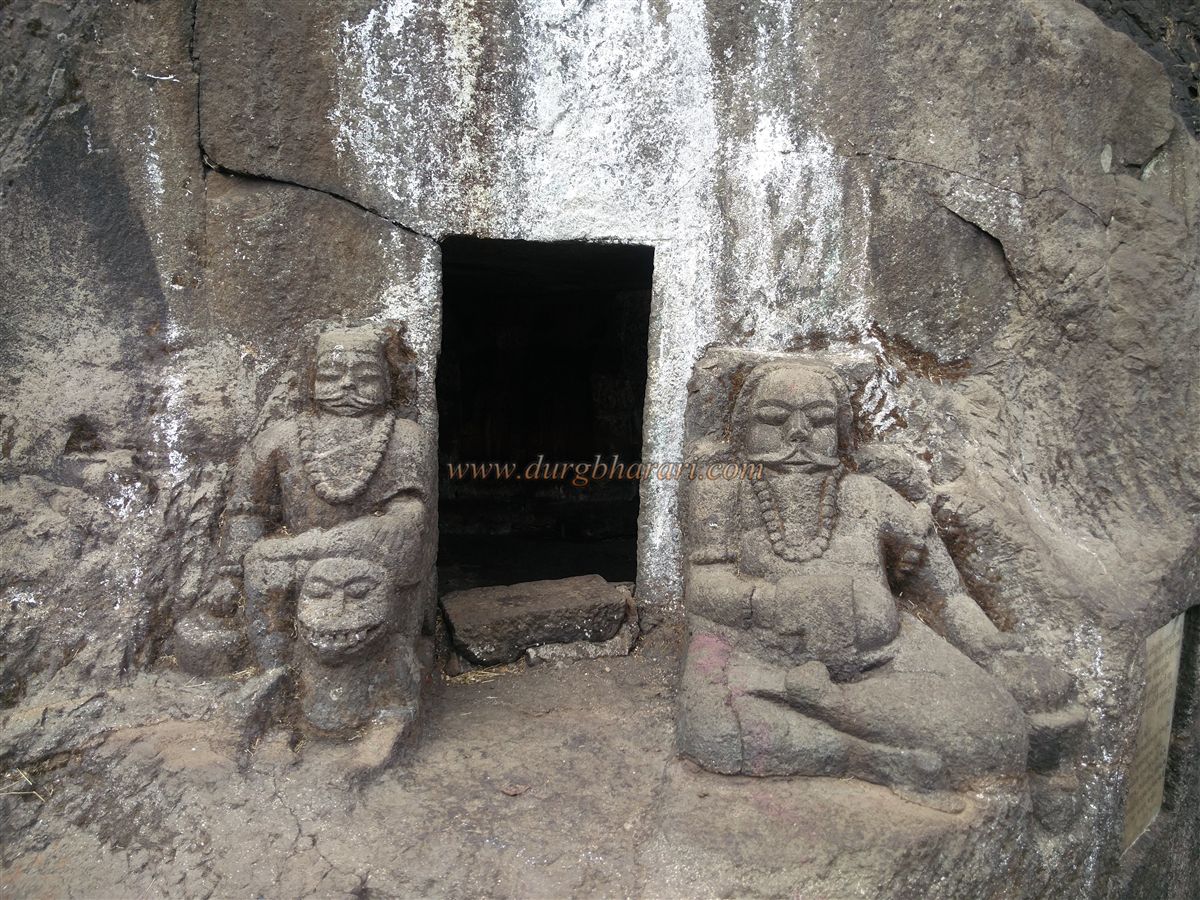
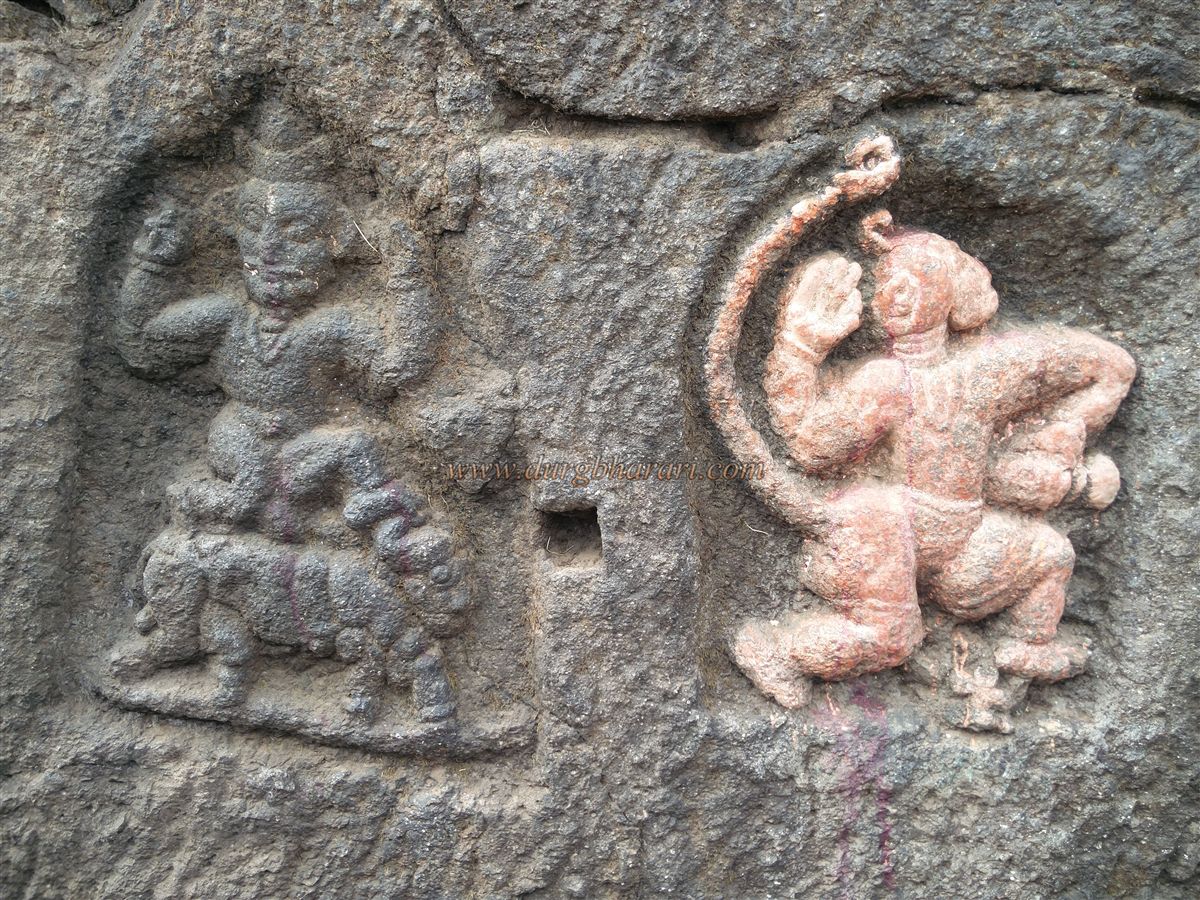
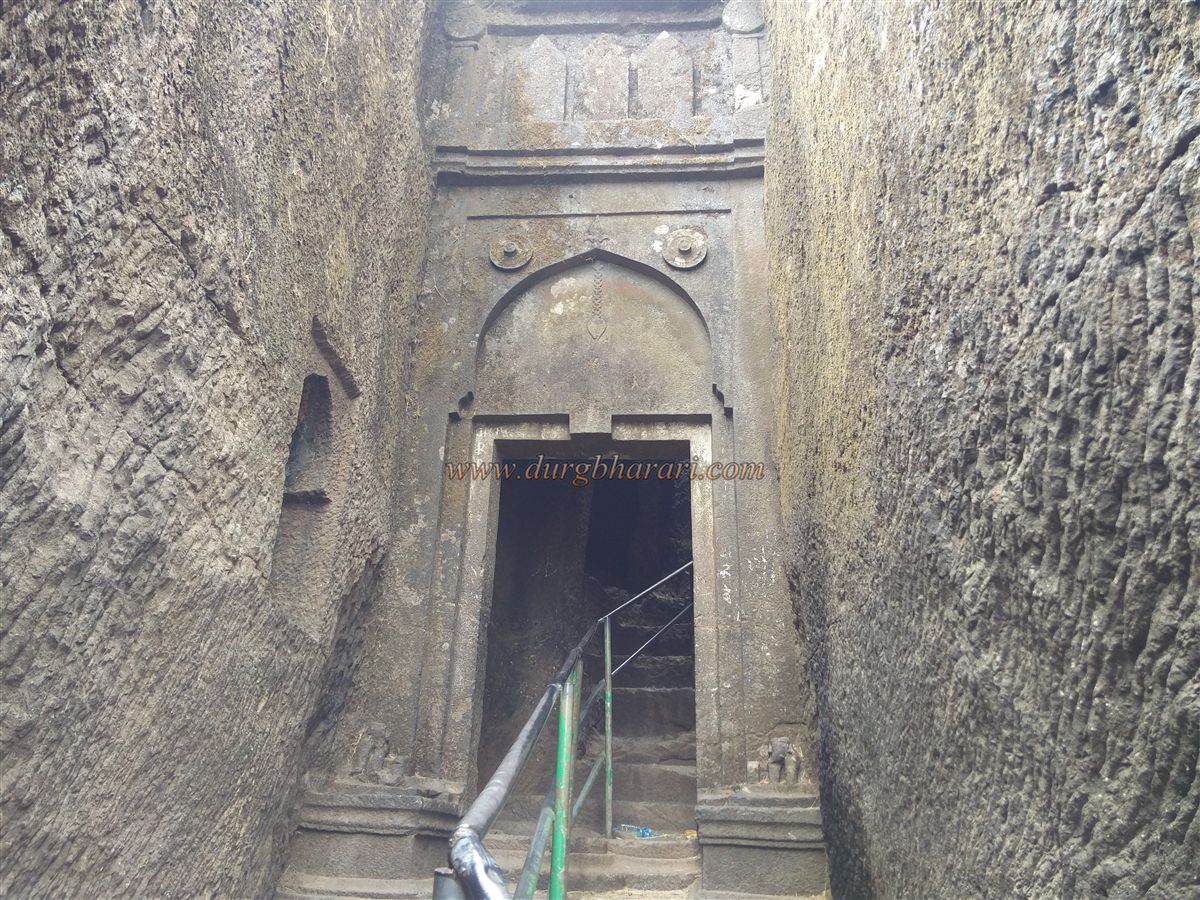
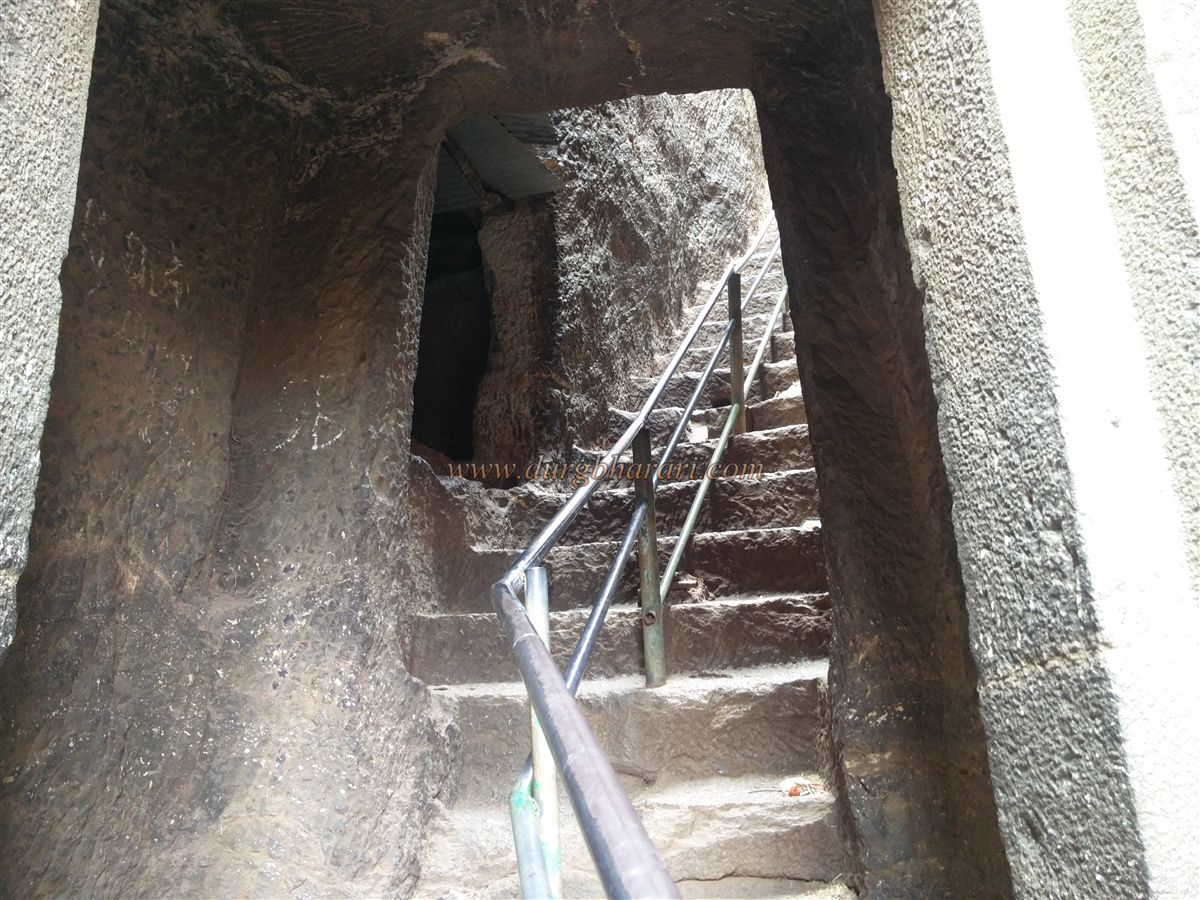
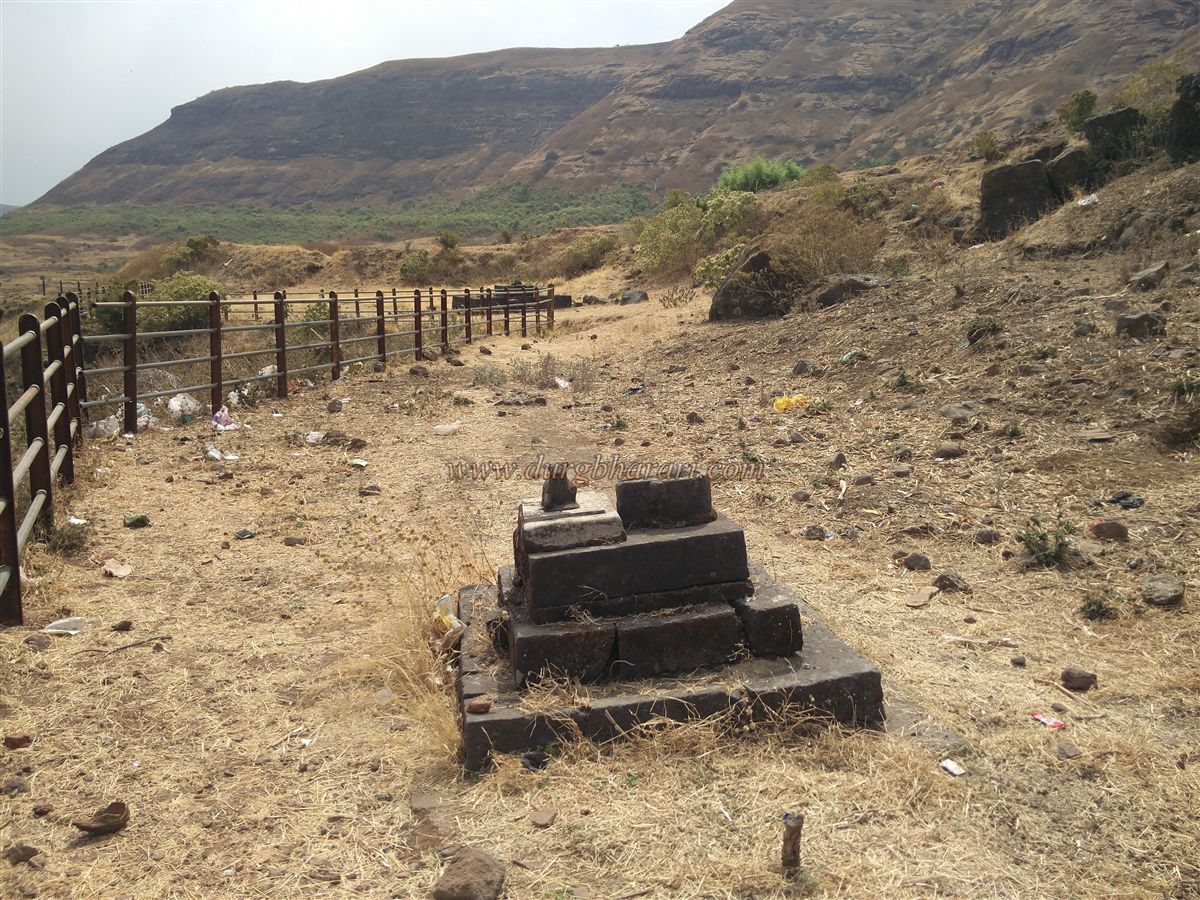
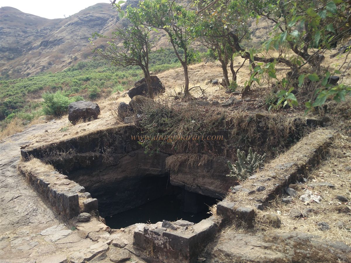
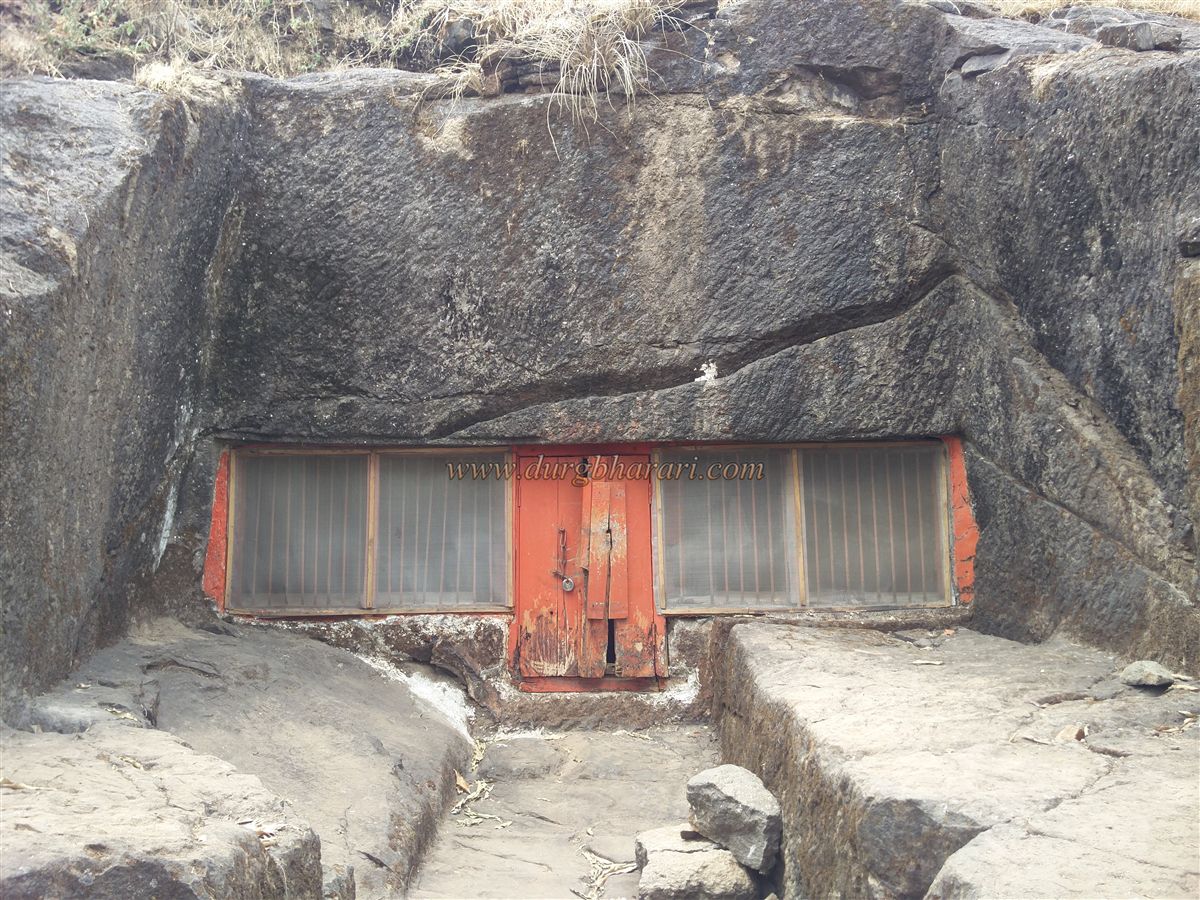
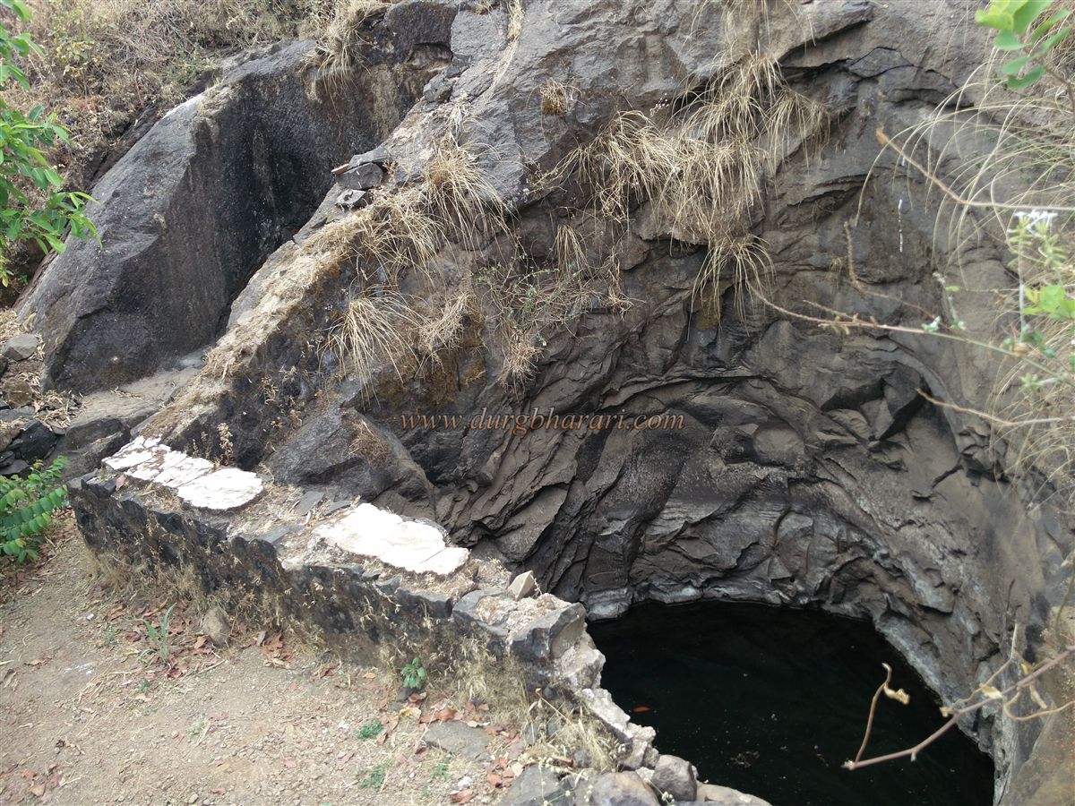
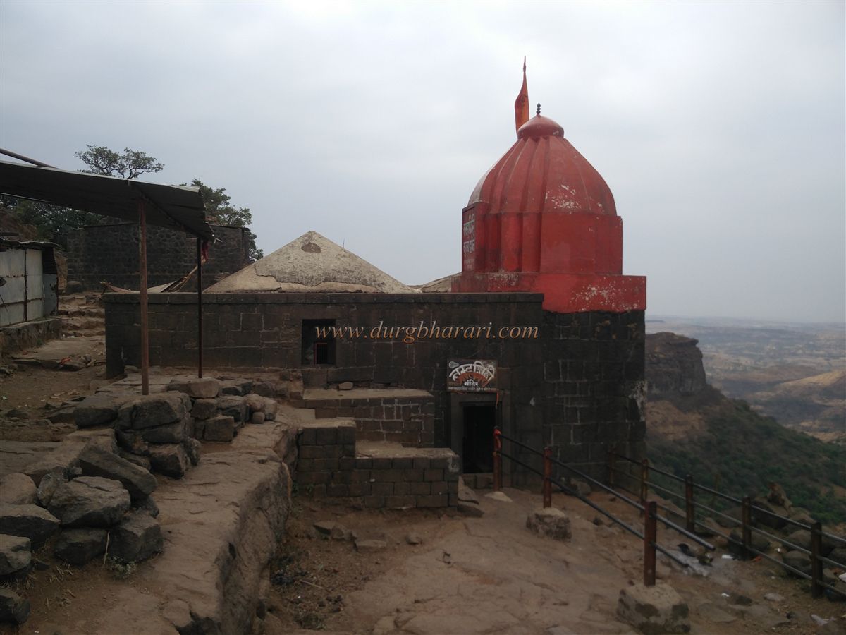
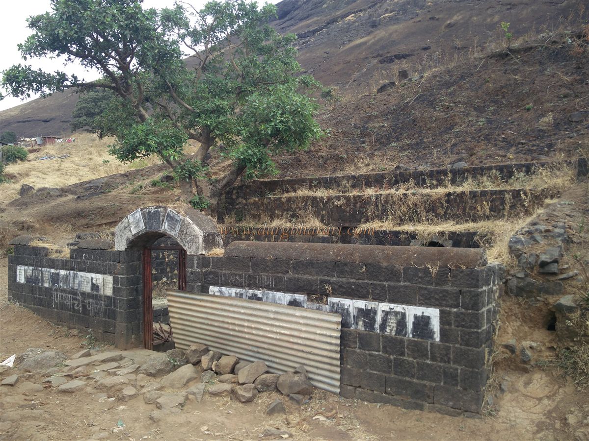
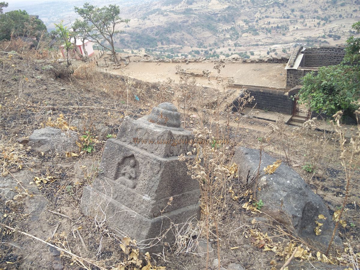
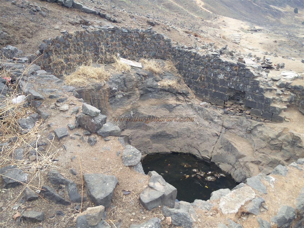
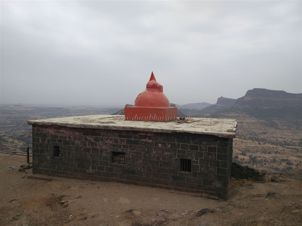
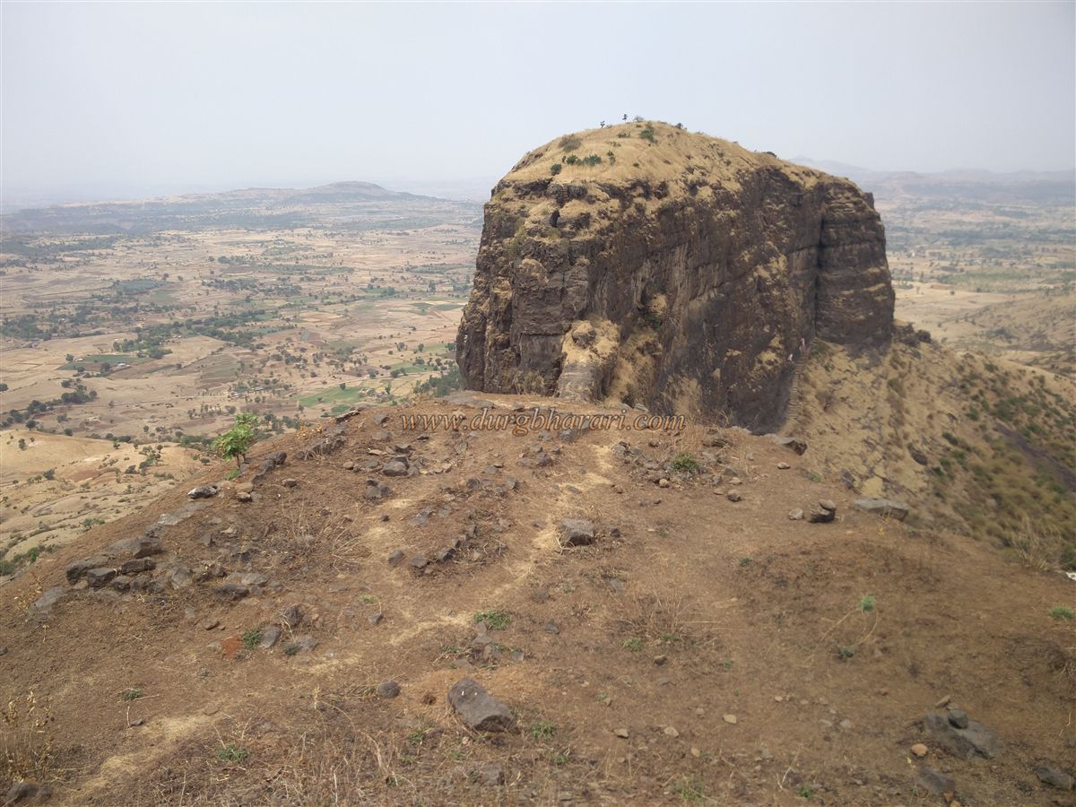
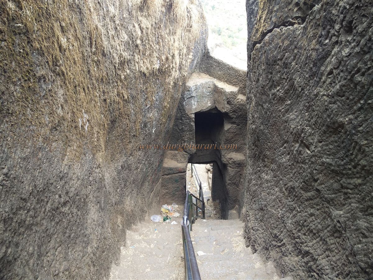
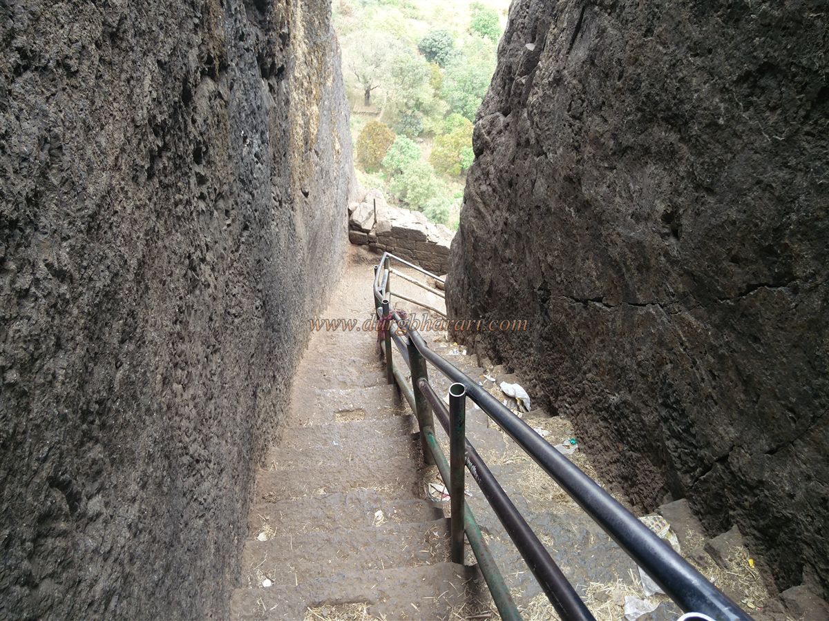
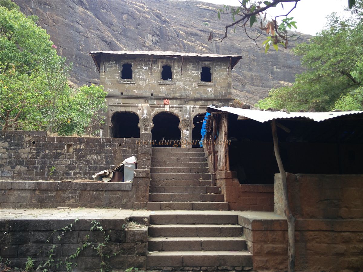
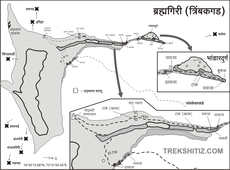
There are many transportation options available to reach Trimbakeshwar. There are two ways to reach the fort, out of which the Hattimet road comes up from the edge and the other main road of the gate comes up from Trimbakeshwar village by a carved footpath in a hill. The first one of these Hattimet was not in use and the door on this road has been buried under a rock and this road has become dangerous. The second way to the fort is easy and is constantly being used. On the way to Gangadwar from Trimbakeshwar temple, a footpath is seen on the left. After proceeding on this path, this path meets the second footpath coming from the village, and your journey to the fort begins. After climbing about 500 steps from the bottom, the plain path starts. A short distance away, on the left side of the road, you can see a dilapidated stone temple. The Ganesha sculpture at the entrance suggests that it is a Shiv temple but an idol of a goddess has been installed inside the temple. There are remnants of some ruined buildings and two small wells in the bushes along the road and it seems that there should have been some settlements in this area in the past. In front of the temple, there are two ruined bastions on the side of the road and some ramparts can be seen next to them. This is a guard's outpost on the way to the fort. On the right-hand side, there is a two-storied structure of stone construction on a quadrangle structure and there are idols of Ganesha and some sculptures carved in its facade. This building is a monastery built by Multani Lalchand Bhambhani, a trader from Sindh province, in 1913 to accommodate the pilgrims. Along with this structure, they also built some steps leading to the fort. Both the floors of the monastery are divided into two parts and at the back, there is a separate building for having meals and performing rituals. The premises of the monastery is built of stone and there is a staircase on the outside to go upstairs. At the back of the monastery, there is a beautifully well with designs carved on it and 70-80 feet deep steps of stone construction. On its edge, a stone basin and a worn out inscription can be seen. There is an idol of Hanuman in the open in front of the monastery and this idol is likely to be from the stone temple outside the outpost. From here, there are stone steps built at the beginning of the next path. The steps are one and a half feet high and are supported by iron bars. Fifteen minutes of climbing from here lead to a guard's cave carved in the rock. There is a room in this cave and currently, the idol of God Brahma is present in this cave. There are a large number of monkeys on this road and it makes a challenge for tourists to eat. From here, on the next turn, there are a ten feet high idol of Hanuman carved in the rock, in which Hanuman is holding the demon under his feet. From here, another cave is seen on the way. A small door is carved along the steps to enter the cave and idols of two sages are carved on either side of the door. The side of the cave is completely open and there are two carved idols in the cave. After some distance from here, the first gate of the fort comes in front. There are two carvings on the right side of the door which seem to be of recent times. This door carved is entirely carved out of rock which reminds us of the Satvahan period. After going up a few steps through this door, another rock-carved door of the fort comes in front. Both the gates of the fort are facing north and the first gate doesn’t have many carvings on it while the second gate is heavily carved. Outside the door, on the lower side, there are two elephants carved on a quadrangle structure, and on the upper side, the door frame, flowers, and various designs are carved. Outside the door, on the left side, there is a temple carved with a sculpture of a goddess, while on both sides inside, there are guard porches. After climbing a few steps through this door, we reach the top of the fort. It takes an hour to reach here from the foothills. Trimbakgad is 4248 feet above sea level and is spread over an area of more than 400 acres. The head of Trimbakgad is a hill in the middle and a wide plateau around it. This fort has a simple rectangular shape with three trunks, one of these trunks has the Hattimet while the other trunk has the Durgbhandar fort. There is no protection on the third trunk as it has straight edges. When you reach the top, you can see the ramparts of the fort in the vicinity of the gate. From here, the path on the right and left side lead to the Machi of the fort, while the path in front leads to the hill of the citadel in the middle of the fort. Starting from the path on the left, you first see two gravestones built of wrought stone. There is a large lake on the upper side of these tombs and it is currently dry. On the upper side of the lake are the remains of a mansion and on the lower side of the bastion are the remains of an outpost. Ammunition depots and many other remains can be seen at a distance of 500 feet from the lake. Seeing that, come to the main road and go to the hill of the citadel. A closer look at the steps leading up to the road reveals the remains of a rampart and a bastion. The fortifications of the citadel start from here. Further on this road, on the left side, a limestone wheel is visible. When you leave the path and go to the top of the wheel, you can see a pillared water cistern from the Satvahan period. The water in it is drinkable. After seeing the cisterns and proceeding along the main road, an ashram is seen on the left side. At the back of this ashram, on the fort, there is a huge ruined structure that still has many remains. This building is the granary on the fort. A paved path leads from the granary to the hill through the bushes in front. At the end of this path is a large cave carved in the belly of the mountain. Currently, a monk is staying in this cave. Next to the cave is a circular cistern or well carved in the rock. Seeing this, we have to get back to the main path. This way we reach the hummock in the middle of the fort. From here the path on the left leads to Godavari temple and the path on the right leads to Jatashankar temple. Continuing on the left, once again you see the ruined ramparts of the citadel. On the way, we reach the Brahmagiri temple, the source of the river Godavari, in 5 minutes. This temple, adjacent to the edge has walls on all four sides, square-shaped water cisterns in the center, and rooms on three sides of the cistern and the idols of gods in it. There are two water cisterns carved in the rock above the temple and one of them is closed with stones. The water in this cistern is used as Gangatirtha. There is a Samadhi stone on the upper side of the cistern and ruined ramparts and other remains can be seen on the lower side. The way to the fort from Hattimet Darwaza is the same way you came here from. After seeing this area, we reach the Jatashankar temple by taking a straight path. In this place, it is believed that Lord Shiv slammed their hair and brought the Ganga River to the surface. At the back of the temple is a water cistern carved in the rock. A small footpath leads to Durgbhandar fort at the back of the temple. There is a water cistern carved in the rock on this road and the remains of an outpost can be seen on the ramparts and at the end of the bastion. At the end of the fort, there is a beautiful footpath carved in the rock to reach the Durgbhandar fort. By this route, we take a detour to the hill and reach where we started in the machi of the fort. Remains of a large number of settlements can be seen in this part of the fort. This is where your fort round ends. It is not possible to walk around the entire area of the machi due to its size, although it takes two hours to walk around the main part of the machi where all the remains are located. Looking at the overall structure of the fort, it seems that there should be a large population living on the fort previously. Anjaneri, Harihar, Basgad, and Tringalwadi are seen from the top of the fort. To experience the adventure, one has to visit Brahmagiri-Durgbhandar fort at least once. Brahmagiri fort is first mentioned in Puran. To remove the sin of cow slaughter, sage Gautam performed penance on Brahmagiri and pleased Mahadev, and demanded Ganga on Earth. But when Ganga did not agree, Mahadev slammed his hair on Brahmagiri and brought Ganga onto the Earth. There is also a story behind the name Brahmagiri of the fort. Lord Brahma decided to search for Lord Shiv's head and Lord Vishnu decided to find his footsteps to get his knowledge. But when their efforts were not successful, Brahma, by His power, created cows and ketkipushp and gave them false testimony. Brahma said that he has discovered Lord Shiv's head and anointed him with Ketaki flowers and milk. When Lord Shiva came to know about Brahma's conspiracy, he became angry and cursed Brahma that no one would worship him on earth from today. On this, Lord Brahma cursed Lord Shiv to remain as a mountain on earth. The Brahmagiri mountain is the same mountain that Lord Shiv took the form of on the Earth. Considering the construction style of the Brahmagiri fort, this fort may have been built during the ancient period but the history of the fort is known from the Yadav period. King Ramdevrai Yadav ruled over this area from 1271-1308 AD. In the thirteenth century, when Vitthalpant, the father of Saint Dnyaneshwar, came with his children to visit Trimbakeshwar, it is said that Nivruttinath saw Gahininath performing penance in a cave on the Brahmagiri mountain. Later, the fort came under the rule of the Bahmani dynasty. Malik Ahmed, who established the Nizamshahi after the fall of the Bahmani Empire in 1485, captured the fort in 1487 but later moved to Mughal. In 1629, Shahaji Raja conquered this fort and its environs. Shahjahan sent eight thousand cavalries to retake the area. In 1633, the fort of Trimbakgad went to the Mughals. On June 17, 1636, the Mughals and the Adilshahis came together and conquered Nizamshahi and imprisoned Nizamshah. In 1636, Shahaji Raja was defeated at Mahuli while facing huge northern forces and Trimbakgad was handed over to Khanjaman, the Mughal general. In 1670, the Marathas under the leadership of Moropant Pingale conquered Trimbakgad. Around 1682, the Mughal army of Muzaffar Khan, son of Khanjaman, burnt down three settlements at the foot of the fort. In February 1683, Radho Khopda betrayed and tied up with Mughal Sardar Anamat Khan. His attempt to betray the fort keeper of Trimbakgad failed and he was captured by the Mughals. In November 1684, Akram Khan and Mahmat Khan set fire to the foothills of Trimbakgad and looted the settlements and animals. From 1682 to 1684, all attempts to conquer the Mughal fort failed. In August 1688, the fort was besieged by the Mughal emperor Matbarkhan. In a letter to Aurangzeb, he said, "I have set up check posts around the fort of Trimbak and the fort has been closed for the past six months. So the people in the fort will be forced to surrender. On this, Aurangzeb, in his letter of encouragement, says that it will be your job to make every effort to capture the fort of Trimbak. On this Matbarkhan informs Aurangzeb in a letter how he took the fort. Since our army was less in Gulshanabad i.e. in Thane district of Nashik, I promised royal favor to the fort keeper of Trimbak. On 8th January 1689, the fort officials Telangrao and Shyamraj came down from the fort and handed over the fort to the Mughals. For this, they should be rewarded which is included in the list. His application and gold keys to the fort have been sent. Apart from this, Harisingh, the son of Shyam Singh, the fort chief of Aundha, has done a great job in this campaign and has given him three hundred cavalries and a thousand infantry to take charge of Trimbakgad. As rewards were given while capturing the fort of Salher, rewards should also be given to the fort keepers of Trimbak, Telangrao, and Shyamraj. In the decree sent on this, Aurangzeb writes that your application has been received. We learned that we had conquered Trimbakgad and laid siege to Tringalwadi fort. I have received the Trimbak keys you sent and I like how you performed. Your salary has been increased by five hundred and you are being given a respectful costume and thirty thousand rupees. Later, around 1691, Mukarrabkhan an official from here, writes to Aurangzeb that the fort keeper of Trimbak died and his son fell in debt. He is being harassed by a moneylender and cannot handle Trimbakgad. Someone should send a noble and experienced man as the fort keeper otherwise crisis will fall on the fort. In 1716, Shahu Maharaj demanded this fort from the Mughals but it was rejected. In 1730, the Koli people revolted and took over the fort and it remained under the control of the Peshwas till 1818.
© Suresh Nimbalkar
GALLERY