TORNA-PRACHANDGAD
TYPE : HILL FORT
DISTRICT : PUNE
HEIGHT : 4603 FEET
GRADE : MEDIUM
If Sinhagad is the lion’s den, then Torna is the eagle’s nest!
With such a remarkable metaphor, British officer James Douglas once praised Torna — the tallest fort in Pune district, also known as Prachandgad. Sir James Douglas (1826–1904), an officer in the East India Company, had visited many places in and around Mumbai and written about their then-current state. In this context, he visited Torna Fort in 1880.
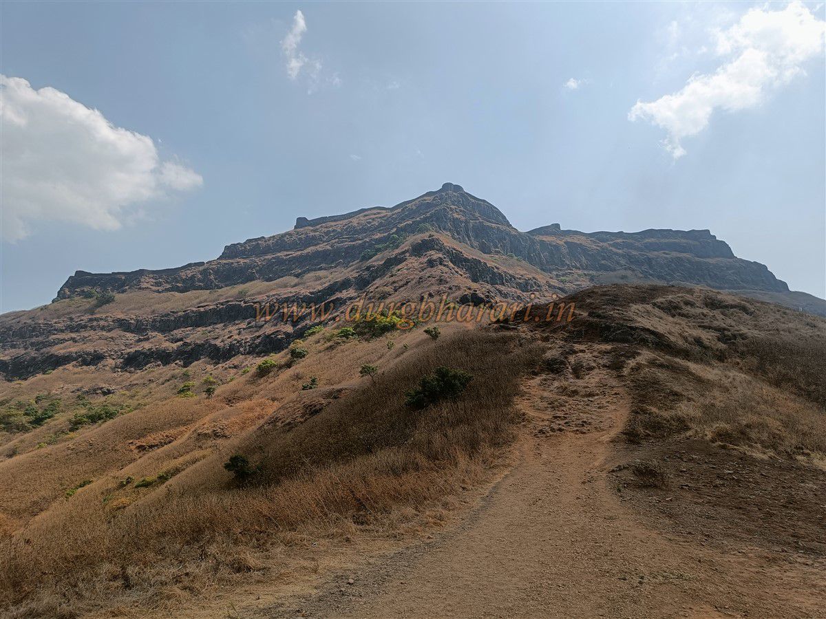
In both height and size, the fort is vast, and climbing it tests the determination of fort enthusiasts. Seeing its massive scale, it is likely that Chhatrapati Shivaji Maharaj named it Prachandgad (“the gigantic fort”).
In Velhe taluka of Pune district, two spurs of the Sahyadri mountain range extend eastwards — with Torna and Rajgad on one spur and Purandar Fort on the other. Velhe, the taluka headquarters, lies at the base of Torna. Today, there are four main routes to the fort:
...
1. From Velhe village — the most convenient, requiring less time and effort.
2. From Rajgad to Budhla Machi (Bhagat Darwaza).
3. From Bhatti village to Budhla Machi (Valanjai Darwaza).
4. From Met Pilware to Budhla Machi (Konkan Darwaza).
Locals know of two other routes, but they are rarely used and dangerous. The fort lies in the Kanand Maval region, with the Velvandi River to the south and the Kanand River valley to the north. To the west lies the Kanand pass, and to the east the Baman and Khareev passes. The distance from Pune to Velhe via Nasrapur is 63 km, with buses available hourly from Swargate bus stand.
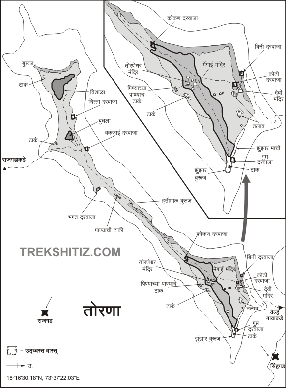
West of Velhe, a small plateau extends from a ridge leading up to the fort, and now a motorable road reaches this plateau. Private vehicles can go up to this point. Between Zunjar Machi and Budhla Machi lies the balekilla (citadel). Approaching from Velhe, one passes through two gates and directly enters the citadel. From the plateau, the climb to the top takes about two hours. There is no water along the route, so one must carry sufficient water.
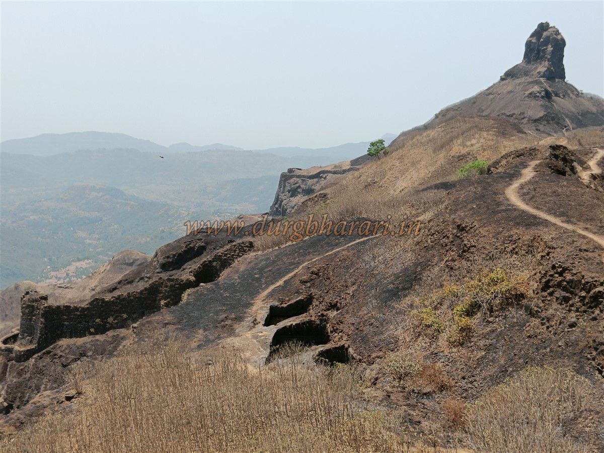
Before reaching the main hill of Torna, two smaller hills must be crossed. In earlier times, such outposts on these hills served as checkpoints, where anyone wishing to enter was questioned and searched. Torna once had seven such posts — Varli Peth, Waghadra, Bhatti, Barshimala, Pilware, etc. — guarded by families like the Bhuruk, Devgirikar, Kokate, and Pilware.
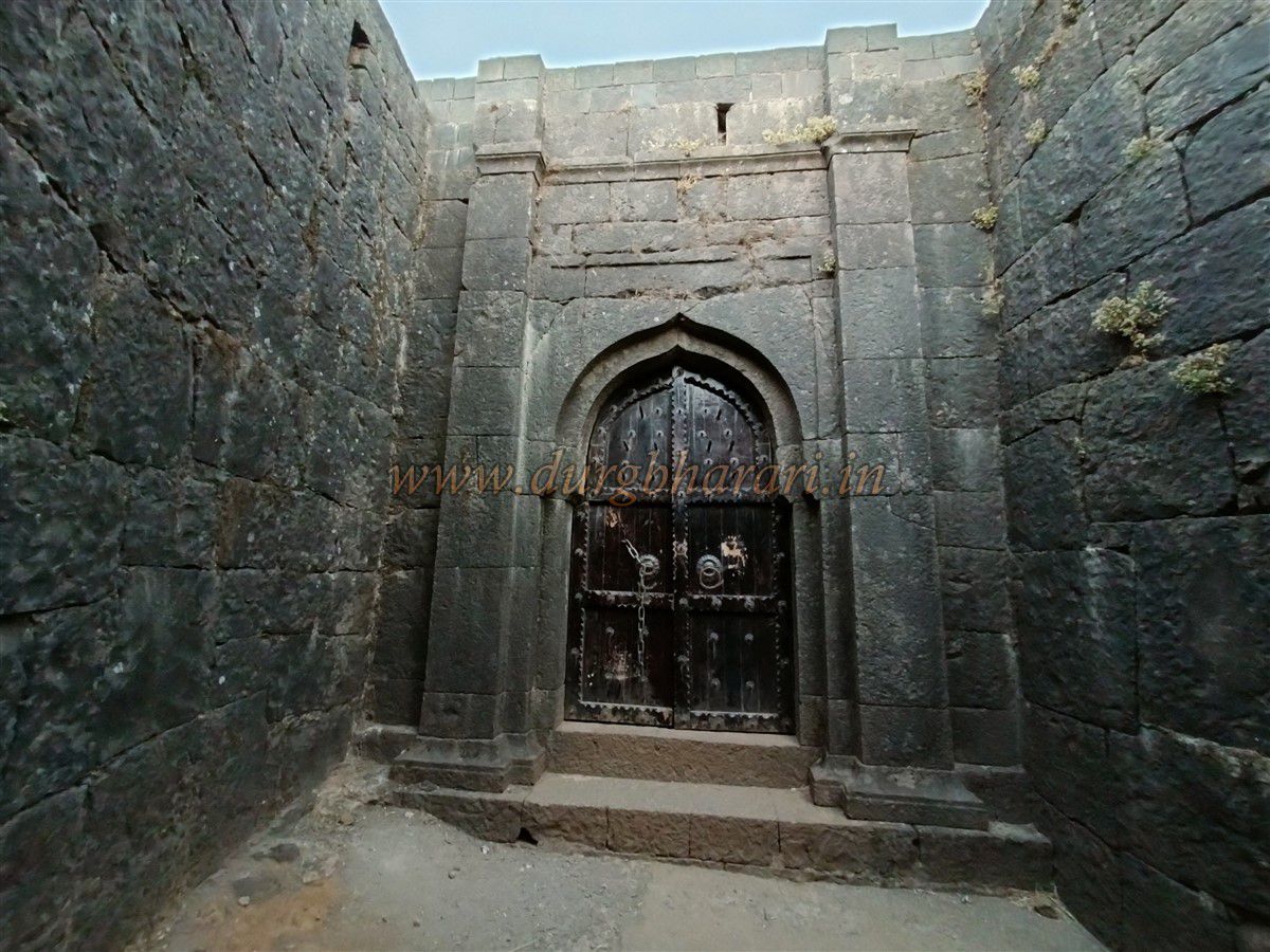
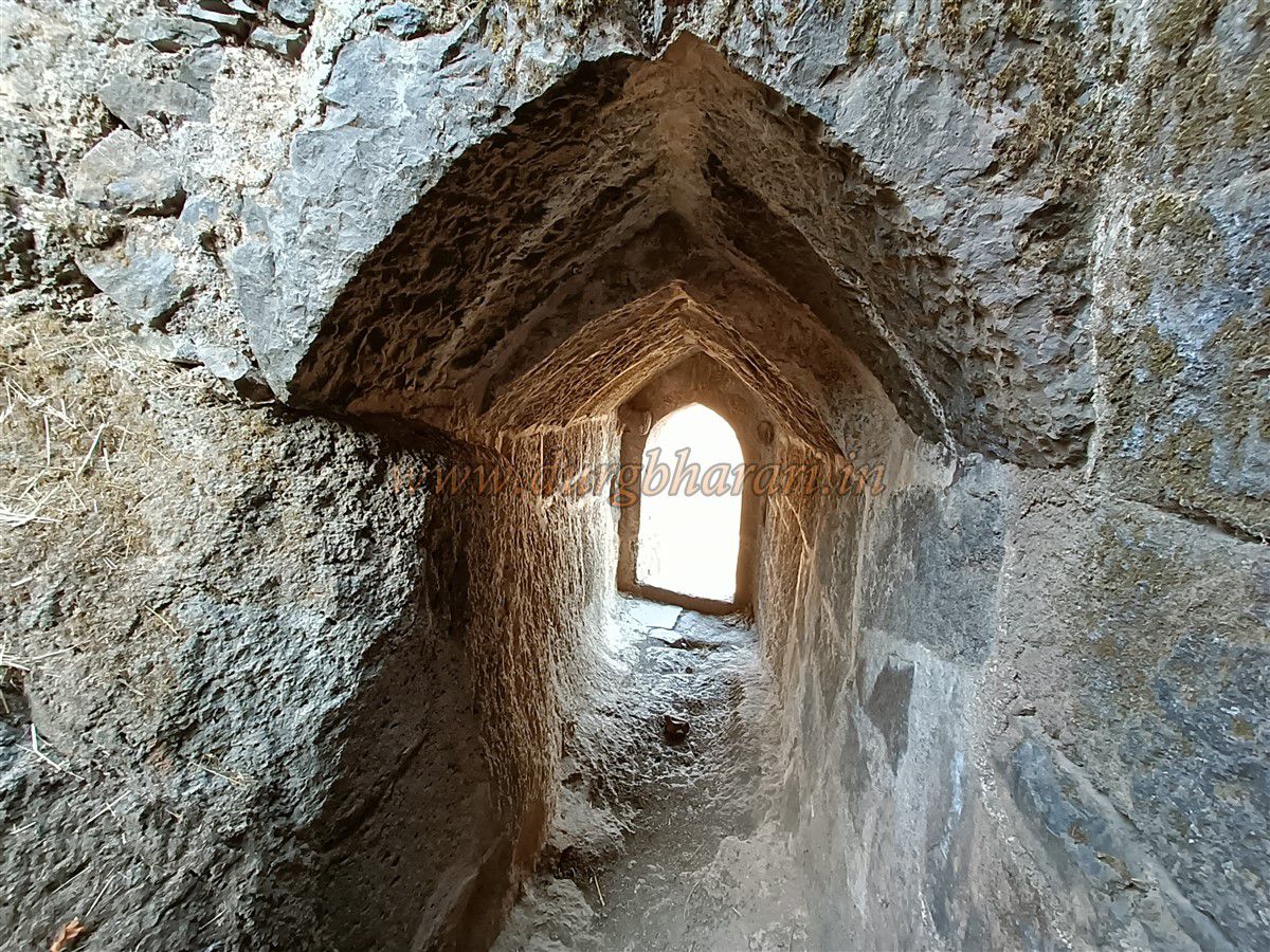
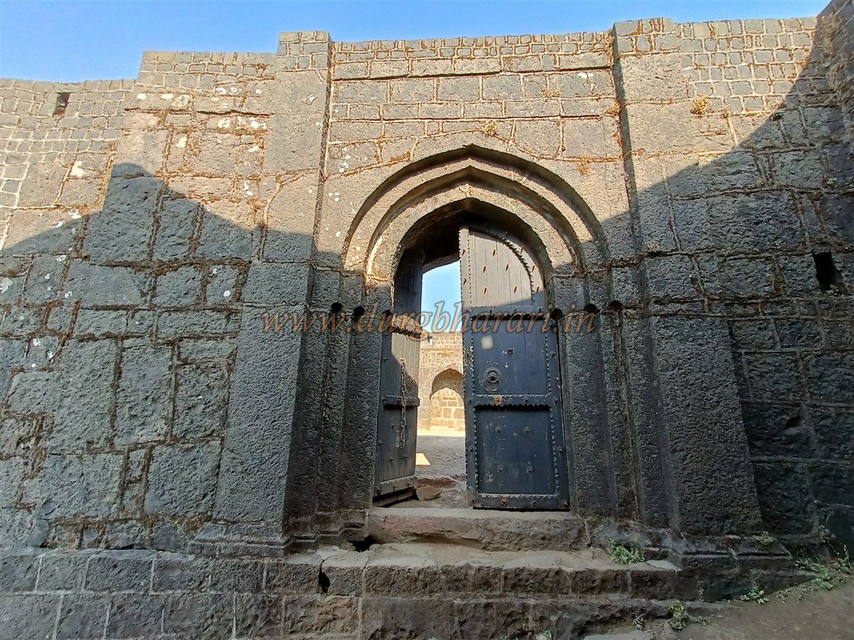
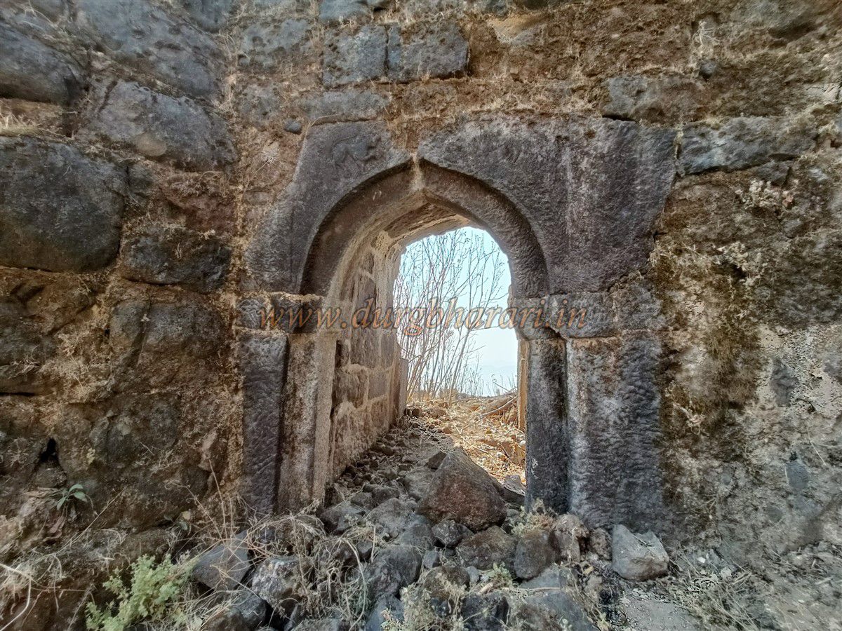
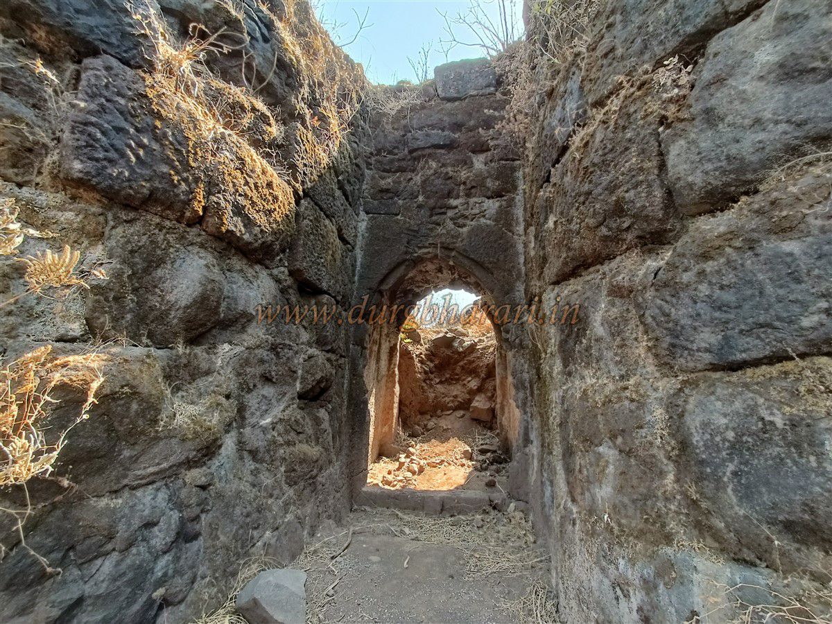
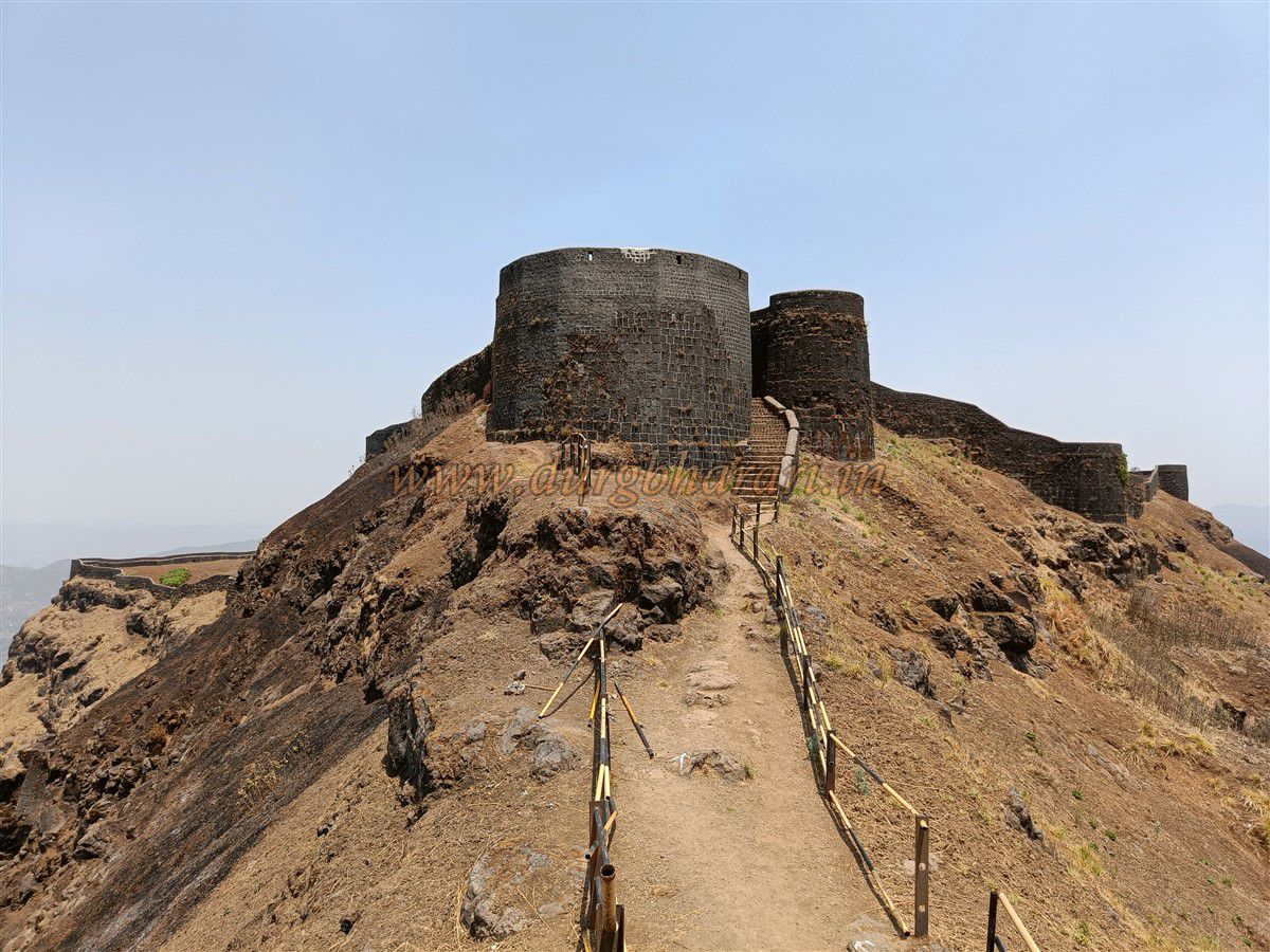
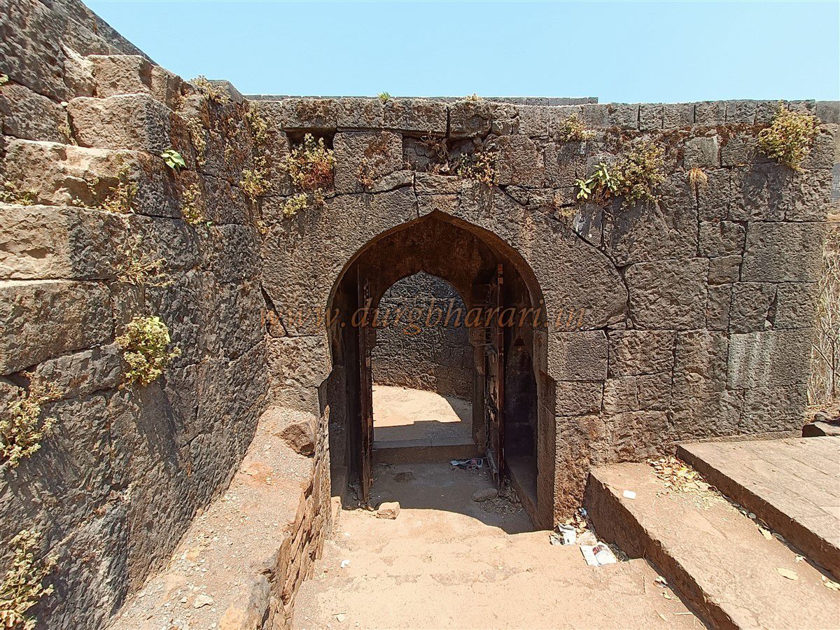
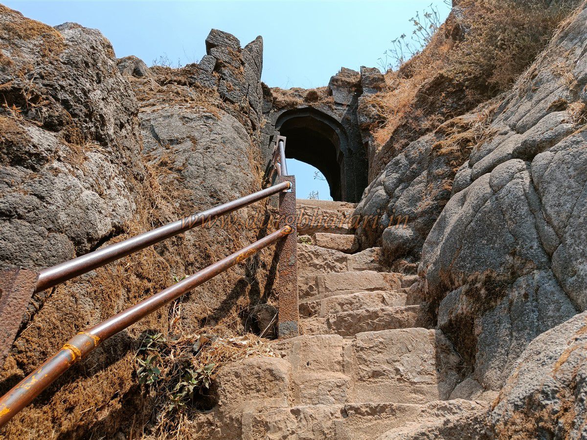
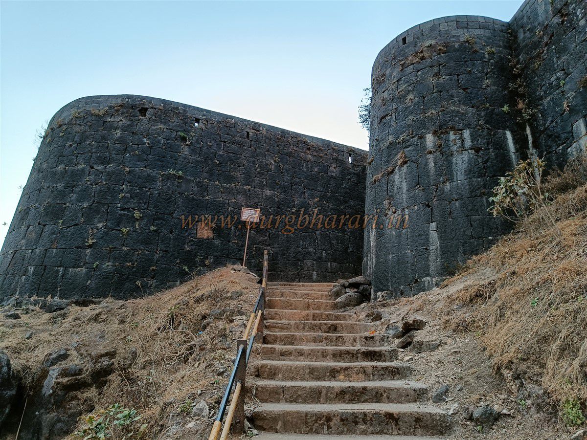
Dangerous sections now have iron railings installed by the Archaeological Department, making the climb safer. At the base of the main rock face, before the carved steps begin, there is a rock-cut water cistern, now green and unused. From here, 30–40 rock-cut steps lead up to a gate flanked by two small bastions — a guard gate for the main entrance. Another 50–60 stone steps lead to Kothi Darwaza, the main citadel gate, hidden between two large bastions and now fitted with a wooden door. Guardrooms flank the inside of this gate.
Starting the tour from here, one first sees a stone dome housing idols of Toranjai and two other deities. It is believed that Shivaji Maharaj found treasure here. Ahead is a small dry stone dam once used to collect water, followed by a drinkable water tank. Along the walls, one sees old latrines and defense positions. At the eastern end stands Hanuman Bastion, housing a Hanuman idol.
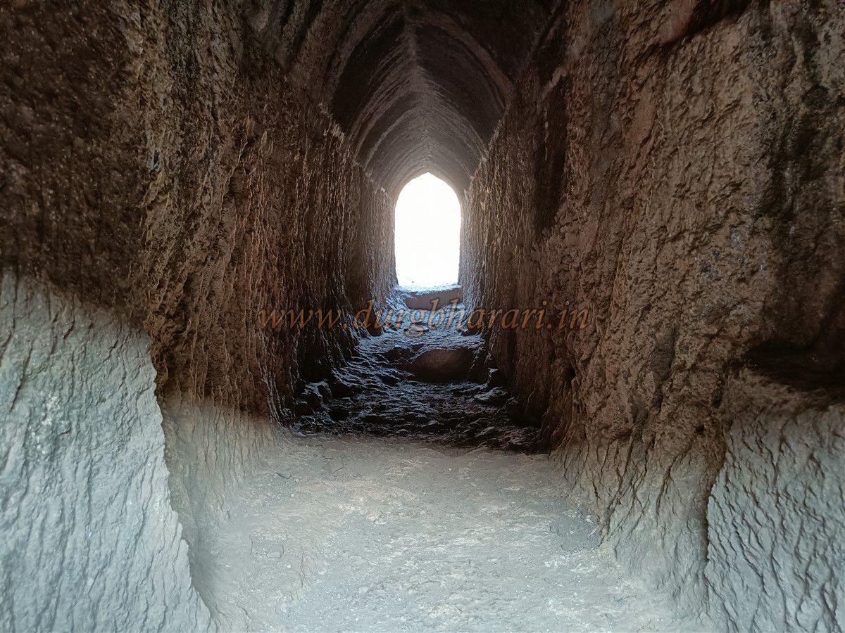
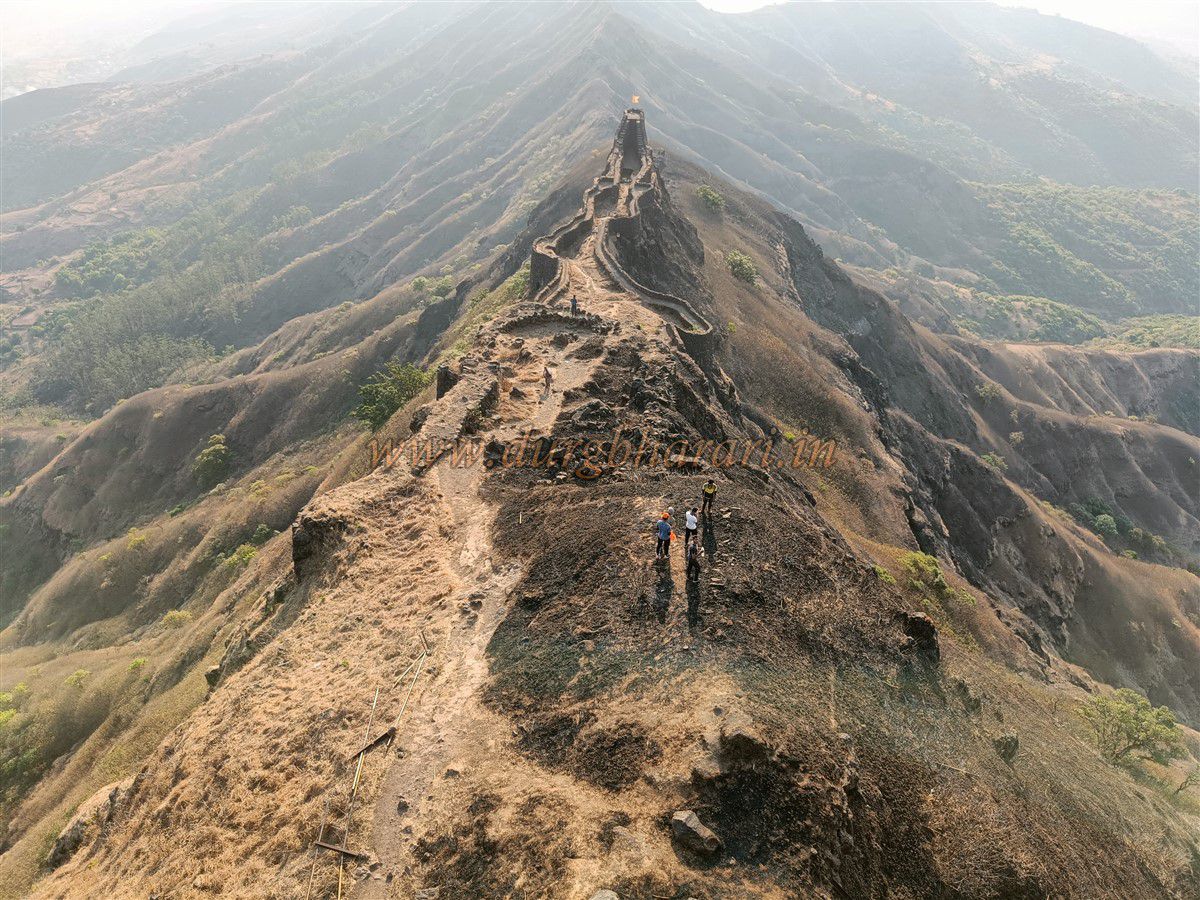
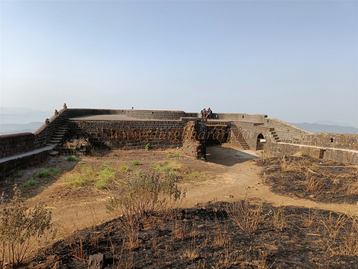
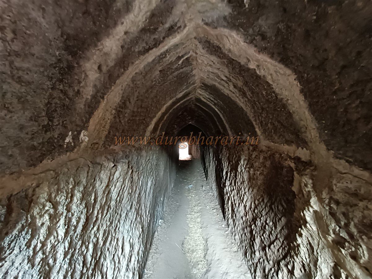
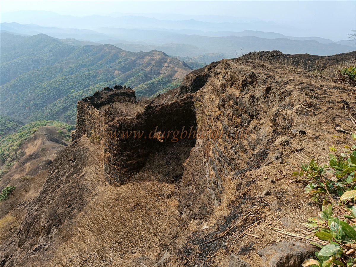
Continuing further, one reaches Bhel Bastion, at the start of a long narrow ridge called Zunjar Machi. This ridge has two descending levels, each fortified with bastions and walls. An iron ladder from Bhel Bastion leads down to Zunjar Machi, but inexperienced trekkers should avoid it. The route includes a descent to a bastion with a built-in underground doorway, and further down to ruined gateways, cisterns, and defense positions. At the tip of the ridge lies Zunjar Bastion, with steps to the top and an underground rock-cut passage leading outside.
From here, Rajgad Fort can be seen in a unique view. In the monsoon, visiting Zunjar Machi is risky. Returning to Bhel Bastion, one finds a new flagpole, scattered ruins of houses, and a large rock-cut cistern known as Mengai Tank, likely part of an ancient cave complex.
Proceeding further leads to Takmak Bastion, with a water cistern, a small cave, and two stone jars traditionally believed to store oil or ghee. Nearby is a large memorial platform, and above it the recently restored Torneshwar Mahadev Temple. Within its courtyard are two tombs, a tulsi shrine, and a lamp pillar base. One tomb is said to belong to a Brahmin named Divekar from Dhanev, about whom locals tell ghost stories.
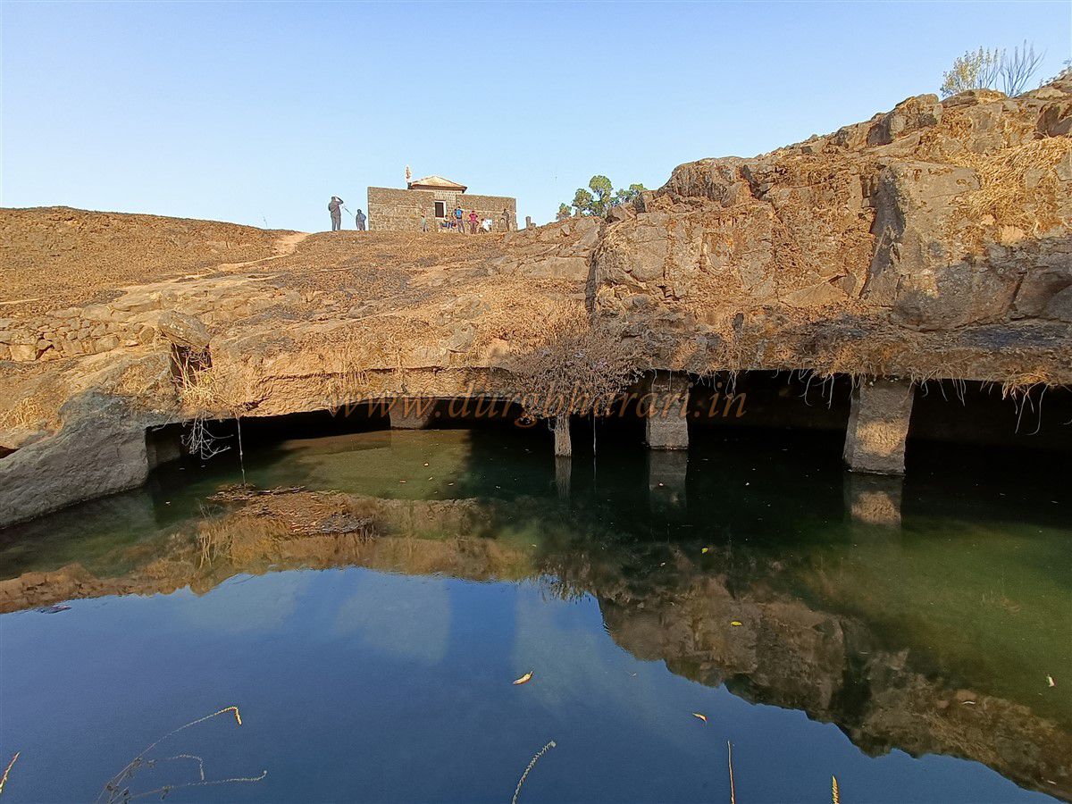
A short distance ahead is the restored Mengai Devi Temple, with a small dome containing her idol and three others. Nearby are ruins of houses, likely the original settlement area of the fort. This is the highest point on Torna, at 4,603 feet above sea level, and the fort covers an area of about 400 acres.
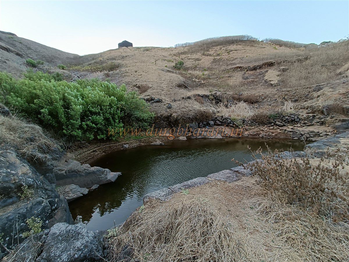
From this section, the entire fort’s expanse can be seen clearly, as well as the forts of Kenjalgad, Rohida, Sinhagad, Purandar-Vajragad, and Lingana. These are easily identifiable. On the slope on the other side of the temple stands a newly built wooden house and an “Amberkhana” (storage building). Next to it is “Khokaḍ Tank,” a well-constructed water reservoir. This tank has a perennial spring, making drinking water available year-round.
Near this tank are three domes—one large and two small. It is unclear whether these are memorials (samadhi) or shrines to deities. If water at nearby spots has run out, one should fill water here and take a short meal and rest, as there is still a long trek ahead.
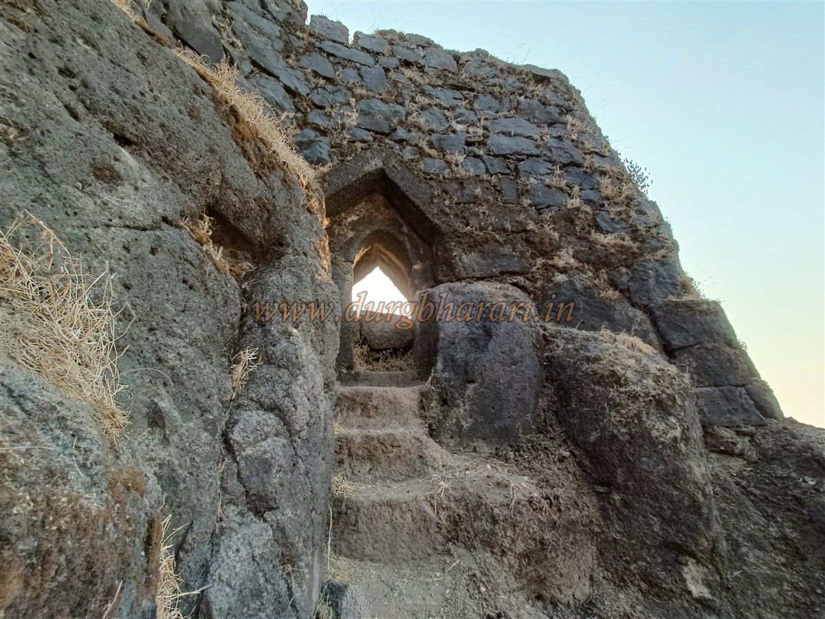
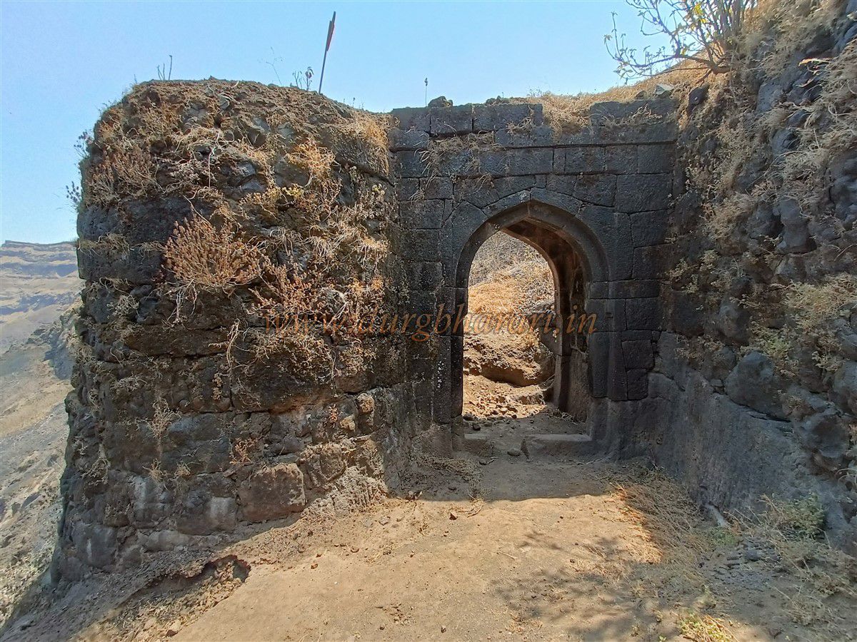
The next part of the exploration should begin from the wall to the right of the “Kothi Darwaja” seen ahead. Starting from here, the first stop is the “Safeli Bastion,” then the “Second-Maale Bastion,” and then the “Broken Bastion.” Continuing along, one reaches the “Konkan Gate.” Since this gate faces toward the Konkan region, it likely got its name from it.
From the bastion above the Konkan Gate, one can see the magnificent spread of Budhla Machi to the west of the fort. Before the gate, on a raised platform, are two rock-cut water tanks. One is called “Mhasoba Tank” and the other “Torna Tank.” Although they contain water, it is not suitable for drinking.
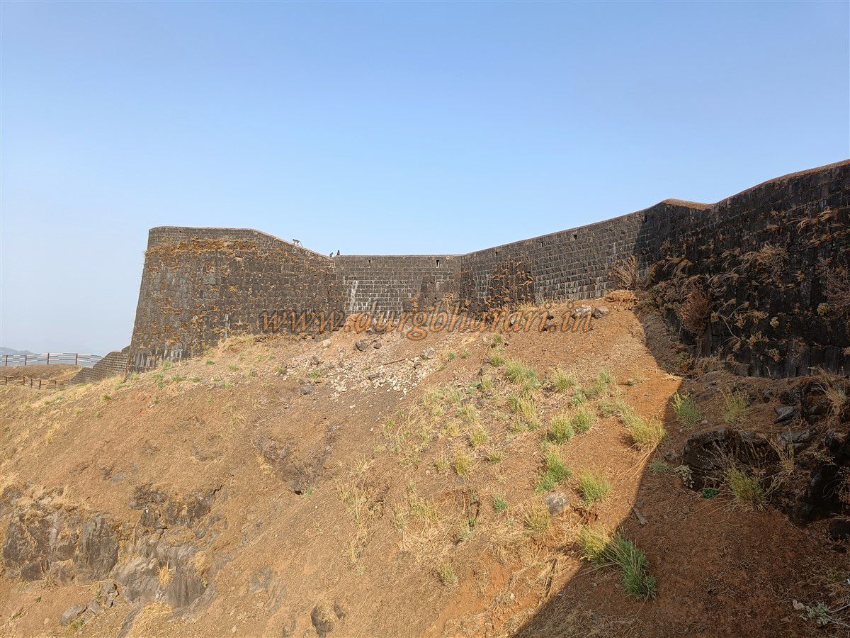
The Konkan Gate is quite spacious and east-facing. It is built between two bastions. To protect the main gate, the outer bastion is built in such a way that it creates a narrow passage in front, preventing large numbers of soldiers from gathering outside. Inside, the roof of the enclosed courtyard has now collapsed, but steps from here and from the adjoining fortifications lead to the upper parts. The stone arch of the gate is still intact, with new wooden doors fitted.
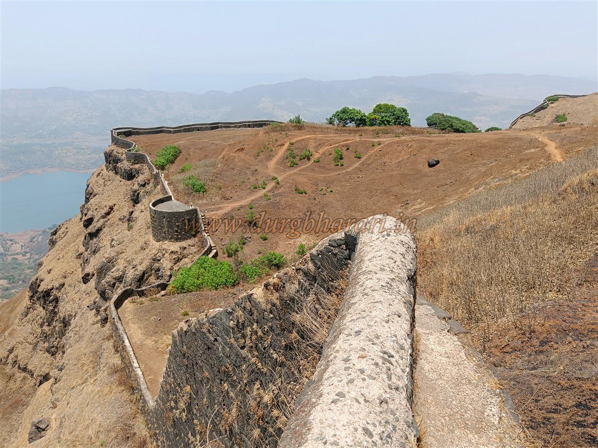
Exiting through this gate completes the tour of the citadel and begins the circumambulation of Budhla Machi. Budhla Machi is connected to the citadel by a narrow ridge. Descending 15–20 steps from the gate, one reaches the ridge. The path on the ridge is slippery, so for safety, the Archaeology Department has installed iron railings. The descent to Budhla Machi is in three stages.
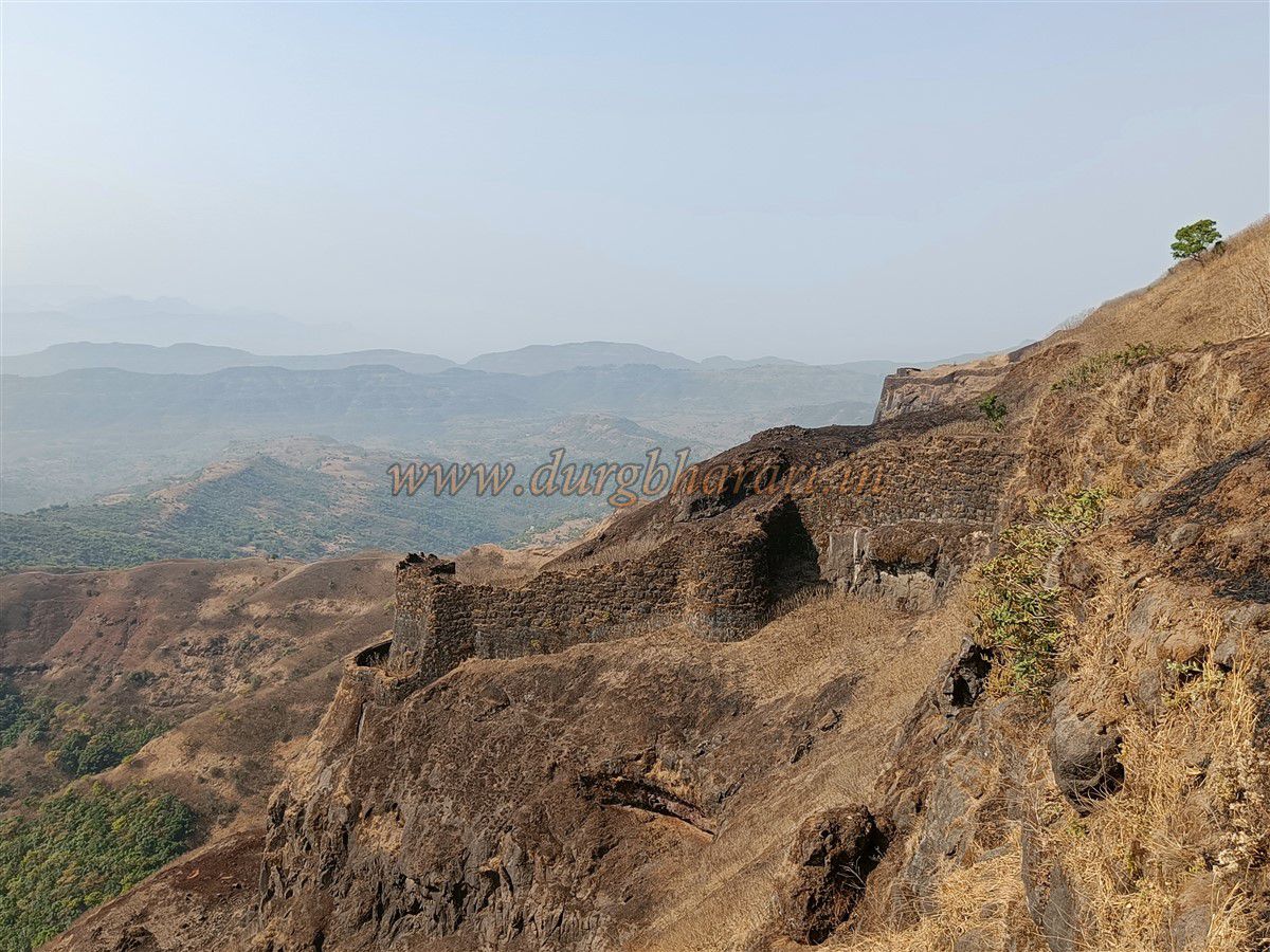
At the end of the first stage stands an armoured bastion similar to Zunjar Machi’s, known as the “Chilkhati Bastion.” There are steps on both sides to reach it, and a rock-cut tunnel leads to the outer fortified wall. This wall is partly rock-cut and partly built with provisions for firing guns. Skirting this bastion to the right leads to the second stage of the ridge.
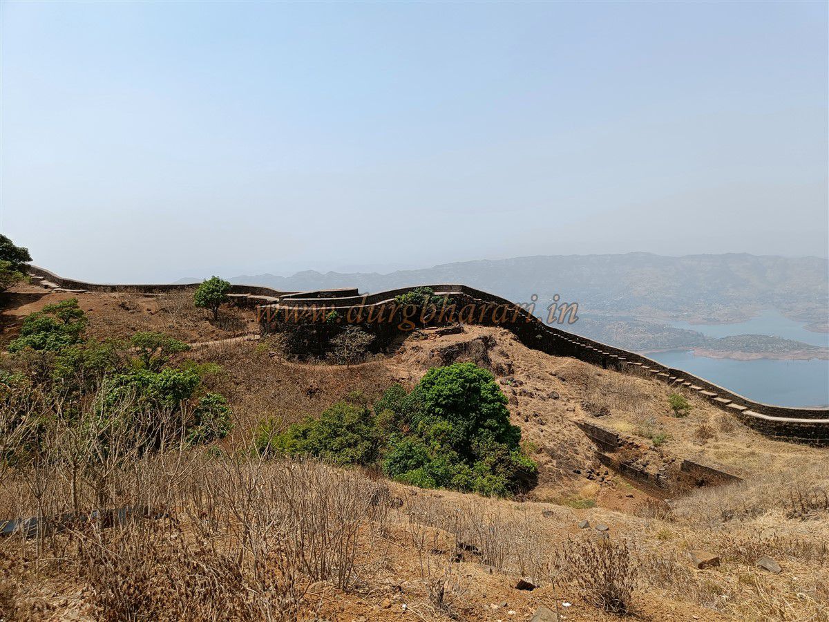
On both sides of this stage are steep slopes with fort walls, with bastions at the middle and end. As one descends, the ridge widens. This section is called “Hatimal.” At its start is a transverse wall that may once have had a small gate. The bastion at the end is now completely destroyed, with only traces remaining. Bypassing it on the left leads to the third stage—the main plateau of Budhla Machi.
Descending here, on the right, is a small gate blocked with stone and mud, known as “Chinla Gate.” The approach to it is steep and slippery, making it dangerous. A bit further, on the left, are three rock-cut tanks named Mahalunge, Vetal, and Patal Ganga. Nearby lies a stone trough. Continuing along the fort wall through shrubbery leads to another buried tank called “Shivganga Tank.” From here, one can spot an armoured bastion on the slope ahead, and just before it, the “Bhagat Gate.” There is no proper path to Bhagat Gate—it must be reached by pushing through the bushes. This was once the royal route from Torna to Rajgad, but the path below it is now completely broken.
Bhagat Gate is an ancient north-facing gateway on Budhla Machi, with two carved “Sharabh” (mythical beasts) on its arch. One carving is badly eroded, but the other remains intact. A little distance away is another small gate leading down to the outer fortified wall, now nearly buried. Descending there, one finds another blocked inner gate.
From here, climbing up a worn path leads to a plinth that was likely Budhla Machi’s gunpowder store. Ahead, a path branches down toward the fort wall, reaching the west-facing “Valanjai Gate.” This gate, hidden by a curved bastion, is still used by locals and leads down to Bhatti village. Below it, under a cliff, is a rock-cut tank with non-potable water.
Returning to the main path, two routes—right and left—circle around Budhla and Vishala pinnacles and rejoins. The right-hand path passes the trail to Budhla pinnacle, which has no ruins but can be climbed with mountaineering gear. Continuing ahead, one reaches the west-facing “Chitta Gate,” built between two small bastions.
Further along, on the left, is a rock-cut water tank now partially silted up, known as “Khamb Tank” or “Kapurlene.” This still holds potable water and is worshipped by locals, suggesting a goddess temple once stood here. Historical mentions of Ganga-Jai, Ghangal-Jai, and Varadayini temples on Budhla Machi exist, but their exact locations are uncertain.
From Kapurlene, skirting Vishala hill leads to “Ghodjin Point” at the left end of Budhla Machi. Vishala hill has no remains, but it offers views of Lingana and Raigad, making it worth the climb. Ghodjin Point has a spacious bastion with double walls and two small gates, now partially buried. One can crawl through one of them to reach the outer wall. Nearby are remains of a building.
The path then turns left, skirting Vishala hill and leading to the right end of Budhla Machi. Here, remains of a guard post are visible. This end is fortified with a large bastion similar to Zunjar Bastion, with double walls. The two gates to the outer wall are blocked by debris, preventing access. This bastion has no specific name today, but historical sources mentioning a “Bhed Bastion” on Budhla Machi likely refer to this one.
After seeing this bastion, instead of turning back along the same path, circle around the Vishala pinnacle and continue ahead. Here, the cliff is fortified with a thick circular wall, and on the inside, rock-cut water tanks have been made to store water. This arrangement served both defensive and water-storage needs. Another similar tank can be seen further ahead along the path, but this one is filled with a large amount of silt. Near this tank is a stone sculpture of the Saptamatrikas (seven mother goddesses) smeared with vermilion. The map in the Mengai Temple refers to this tank as “Khamb Tank,” but there is no underground tank visible here.
From here, circling around the Budhla pinnacle, one reaches the mountain spur ahead of the Bhagat Gate. On this spur is a rock-cut water tank. The lower part of the slope here is enclosed with a defensive wall, and another wall has been built higher up. These walls have gun loops and openings for cannon fire. Below the bastion at the front of the wall, there is an iron ladder. When coming from Rajgad, entry to Budhla Machi is via this ladder. Bhagat Gate is quite far from here. From this plateau, the route towards Rajgad is clearly visible.
Circling again around Budhla pinnacle, one reaches a fork in the path. From here, approaching the Konkan Gate marks the completion of the fort circuit. It takes roughly six hours to see the entire fort.
Torna Fort is recognized as one of the key forts in the Swarajya established by Chhatrapati Shivaji Maharaj. The exact date of its construction is unknown, but the presence of “Khamb Tank” on the citadel and “Kapoor Tank” on Budhla Machi suggests that its origins lie in ancient times.
During the Bahmani period, between 1470–1486 CE, Malik Ahmad captured this fort. After the breakup of the Bahmani kingdom, it came under the control of the Nizamshahi dynasty. In this era, it was referred to as Taroni or Torna. In Abdul Hamid Lahori’s Badshahnama, it is called Nurund. Contrary to what is taught in schools, the true history is somewhat different. It is believed the fort got the name “Torna” because of the abundance of toran fruit trees within its perimeter.
Before capturing Torna, Shivaji Maharaj already held Purandar, Kondhana (Sinhagad), Rohida, and Murumbdev (Rajgad) forts. In 1624, under the Adilshahi rule, Kanhoji Zunjarrao Maral, the Deshmukh of the Kanand valley, oversaw the fort’s administration. By using a friendly, non-violent strategy, Shivaji Maharaj captured the fort from the Adilshahi in 1647 without spilling a drop of blood. Seeing its vastness, he renamed it Prachandgad (“The Gigantic Fort”).
While repairing the fort after its capture, a large treasure was found near Kothi Gate. This wealth was used for repairing Torna and for the construction of Rajgad. In 1648, Balvantrao Kokate was the fort commander. Since Torna was very close to the capital Rajgad, Shivaji kept it under his control even during the Treaty of Purandar.
After escaping from Agra in 1671–72, Maharaj repaired many forts in his possession, spending 5,000 hon (a currency) on Torna. Some buildings were constructed on the fort at that time.
In 1689, after the assassination of Sambhaji Maharaj, the fort fell into Mughal hands during the political turmoil. Aurangzeb appointed Hatamkhan as its commander, giving him the title Killadarkhan. A letter from Hatamkhan to his guru Ataullah describing the fort still survives. In it, he writes:
“After bidding farewell to the princes, I crossed difficult paths and dangerous passes to reach the base of Torna Fort. From the base to the top, the route is partly rideable on horseback, partly walkable on foot. Beyond that, there is no proper path for riding or walking. On one side is an abyss that looks like the hell of the underworld itself. The way forward is extremely difficult — steep, irregular stone steps that even strong and agile men struggle to climb. How then could an old and frail man like me manage? This fort’s path twists and turns crazily, and it seems to compete with the sky in height. By some cruel twist of fate, I have ended up here. This place is detestable — a dwelling for ghosts and demons.”
In July 1690, Kanhoji Zunjarrao recaptured the fort, killing Hatamkhan in the battle. In 1694, fort commander Abaji Vishwanath Prabhu was killed during a siege by Shahabuddin. On March 10, 1704, Mughal forces under Amanullah Khan, his brother Ataullah Khan, and Haminuddin Khan captured it again, killing Commander Hari Bapuji.
Interestingly, Torna was the only fort that Aurangzeb took from the Marathas through battle — most others were obtained through bribery or deceit. Aurangzeb renamed it Fateh-ul-Ghaib (“Divine Victory”) and appointed Abdullah Lodi Khan as commander.
In 1708, during Chhatrapati Rajaram Maharaj’s reign, Sarnobat Nagoji Kokate scaled the fort with his Mavlas and recaptured it for the Marathas. In reward, he was granted Chapat village as an inam (gift).
The fort later came under Shahu Maharaj’s rule, and in 1818, it fell to the British, who handed it over to the Bhor princely state. Until the merger of Bhor, it remained under the Pant Sachiv of Bhor, after which it became part of independent India.
Note: While the fort has water and some shelter, overnight stays are prohibited. The gates close at 5:00 pm and reopen at 8:00 am the next morning. To see the entire fort properly, it takes about 6–7 hours. For convenience, arrive in the village early in the morning by private vehicle and start the trek promptly. Since vehicles can now reach the plateau below the fort, this saves about half an hour and reduces the climbing effort.
© Suresh Nimbalkar
GALLERY