TIPAGAD
TYPE : HILL FORT
DISTRICT : GADCHIROLI
HEIGHT : 1903 FEET
GRADE : MEDIUM
Gadchiroli is a tribal-dominated district with its own distinct cultural identity. Due to the dense forests in this region, the tribal communities primarily reside within the jungles. These people worship local deities, most of which are located in forests or atop hills. One such sacred site is the Gurubaba Temple situated on Tipagad Fort.
Tipagad is indeed a fort, but there is very little historical information available about it. Being in a region long affected by Naxalites insurgency, very few fort enthusiasts have ventured here, resulting in many forts losing their recognition and identity. Although the Naxalites threat has significantly reduced, the area still lacks major tourist destinations, which is why it remains mostly unexplored by travellers.
...
However, it is encouraging to note that this tribal society, which has long remained disconnected from urban life, is now beginning to integrate with mainstream society.
Due to the surrounding dense forest, it's difficult to classify the forts in this region as either hill forts (Giri Durg) or forest forts (Vandurg). The forests here are so dense that even during mid-day, one may feel as if it's evening due to the dim light. Being part of a sparsely populated region of Vidarbha, private vehicles are rare, and even public transport is hard to find. Therefore, while exploring these forts, it is advisable to use a private vehicle for both travel convenience and safety—otherwise, even covering a single fort in one day can be difficult.
In our Gadchiroli fort expedition, we attempted to document these lesser-known forts and bring their diminishing identity to light. Tipagad Fort is located in the Korchi Taluka, at the far end of Gadchiroli district. Due to its location deep within dense forest and once-Naxal-affected region, it was long believed to be inaccessible. But now, that’s not entirely true.
The village Motazaliya, at the base of the fort, is about 42 km from Korchi (the Taluka HQ) and 98 km from Gadchiroli via Dhanora. When visiting from Korchi, one can halt overnight at Kurkheda and then proceed to visit three forts the next morning—Jhaparagad, Tipagad, and Bajagad—ending the day at Dhanora or Gadchiroli. However, having a private vehicle is essential for this route. Between Jhaparagad and Tipagad, one briefly crosses into Chhattisgarh territory. This route can be done in reverse too, but it's important to note that Korchi lacks lodging facilities.
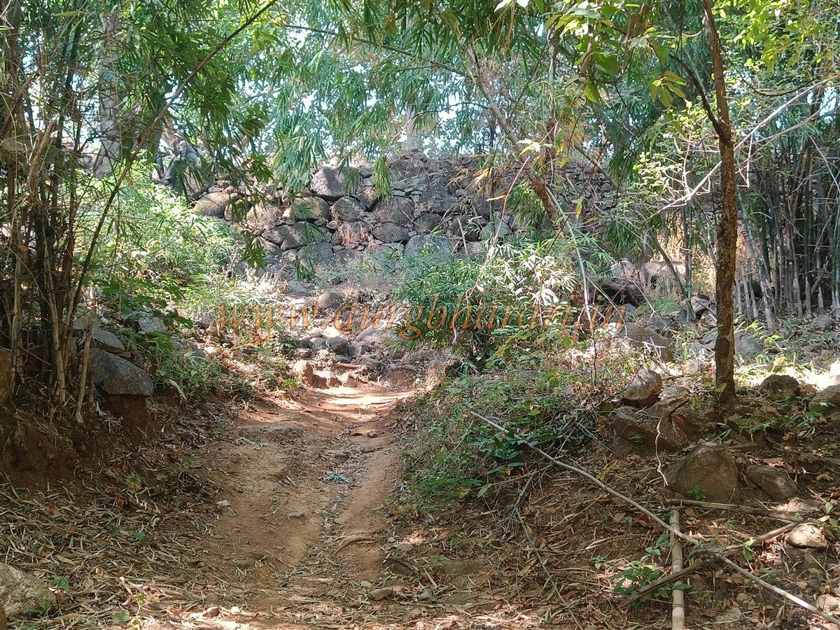
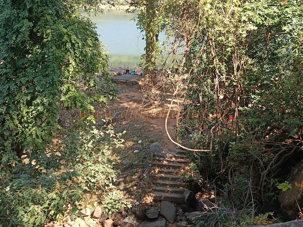
The paved road to Motazaliya ends near a river outside the village. After crossing the river, a dirt trail leads toward the fort. Earlier, jeeps could go halfway up this trail, but now much of the road has eroded and turned into a narrow footpath. While a guide may not be strictly necessary, the remnants on the fort are not easily visible, so it’s advisable to take a local guide along.
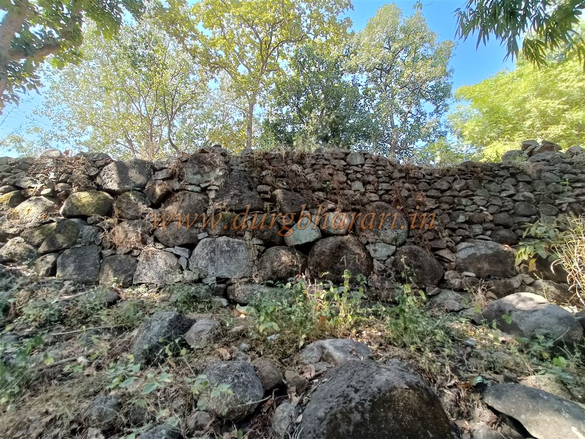
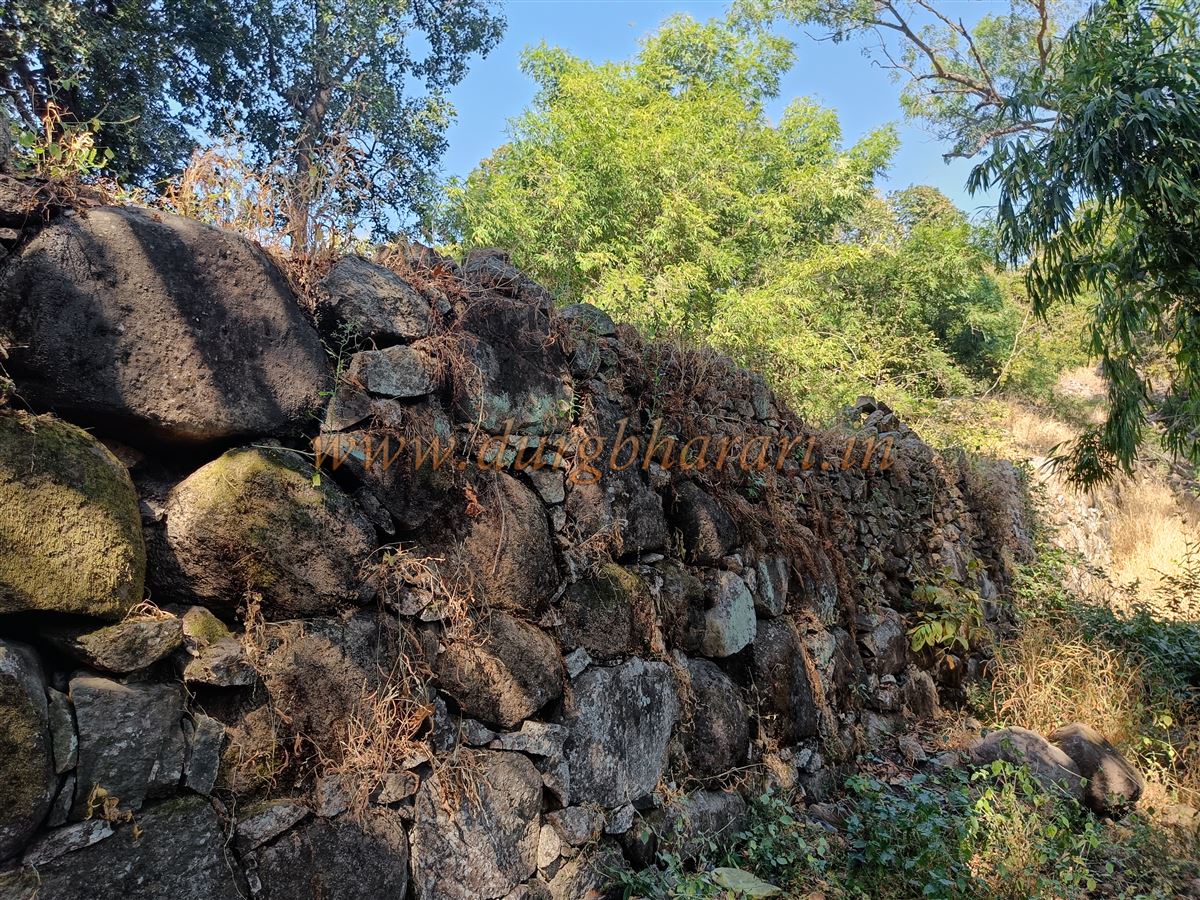
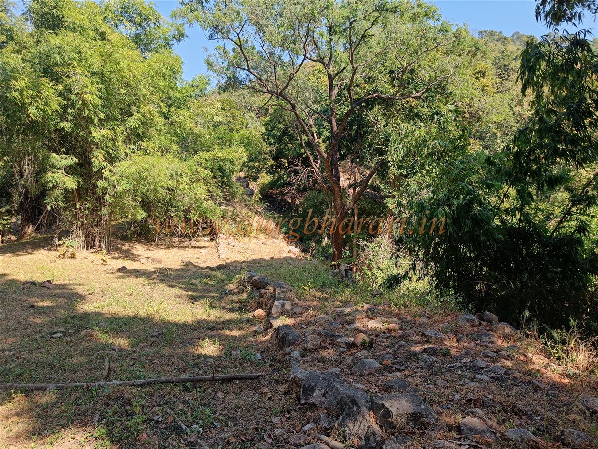
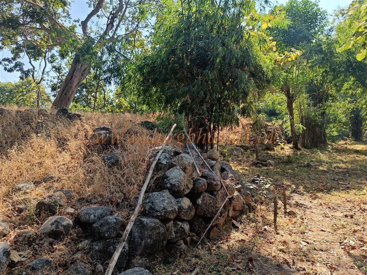
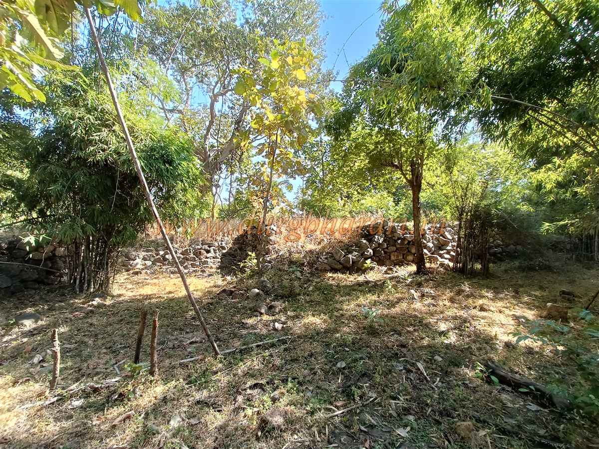
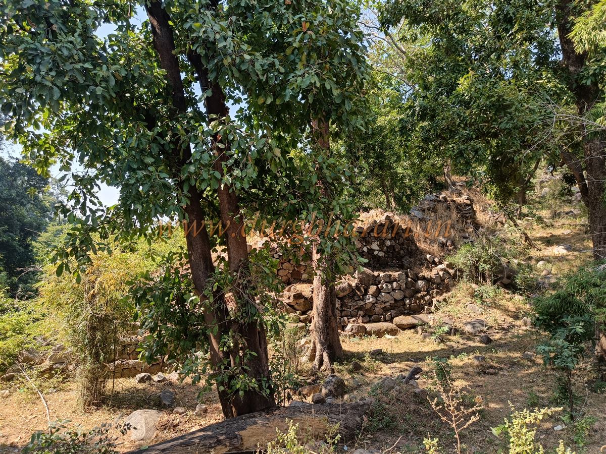
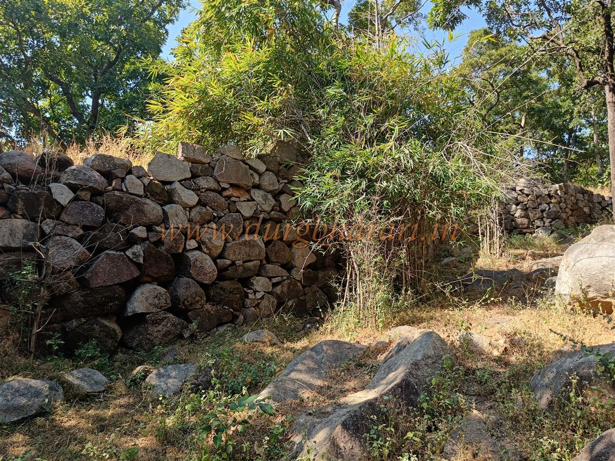
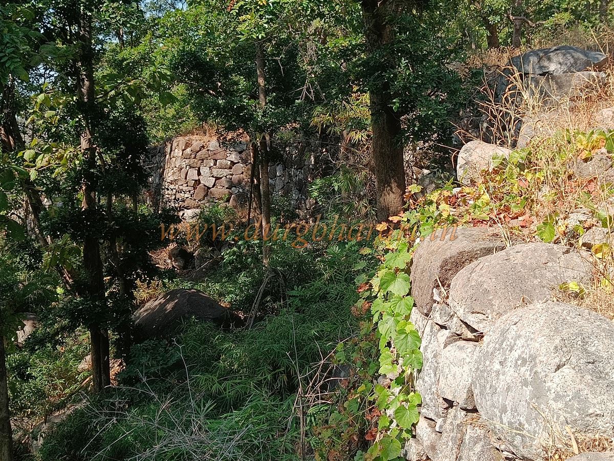
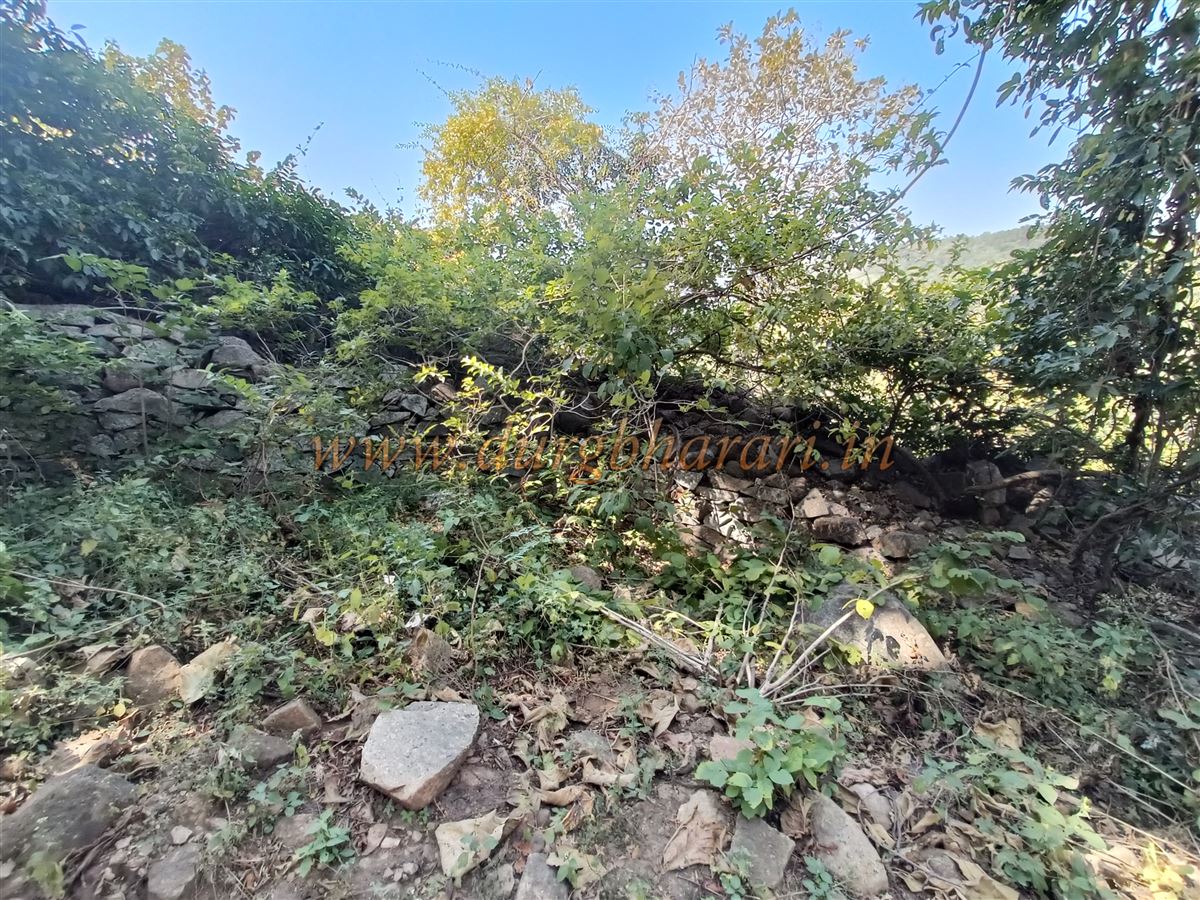
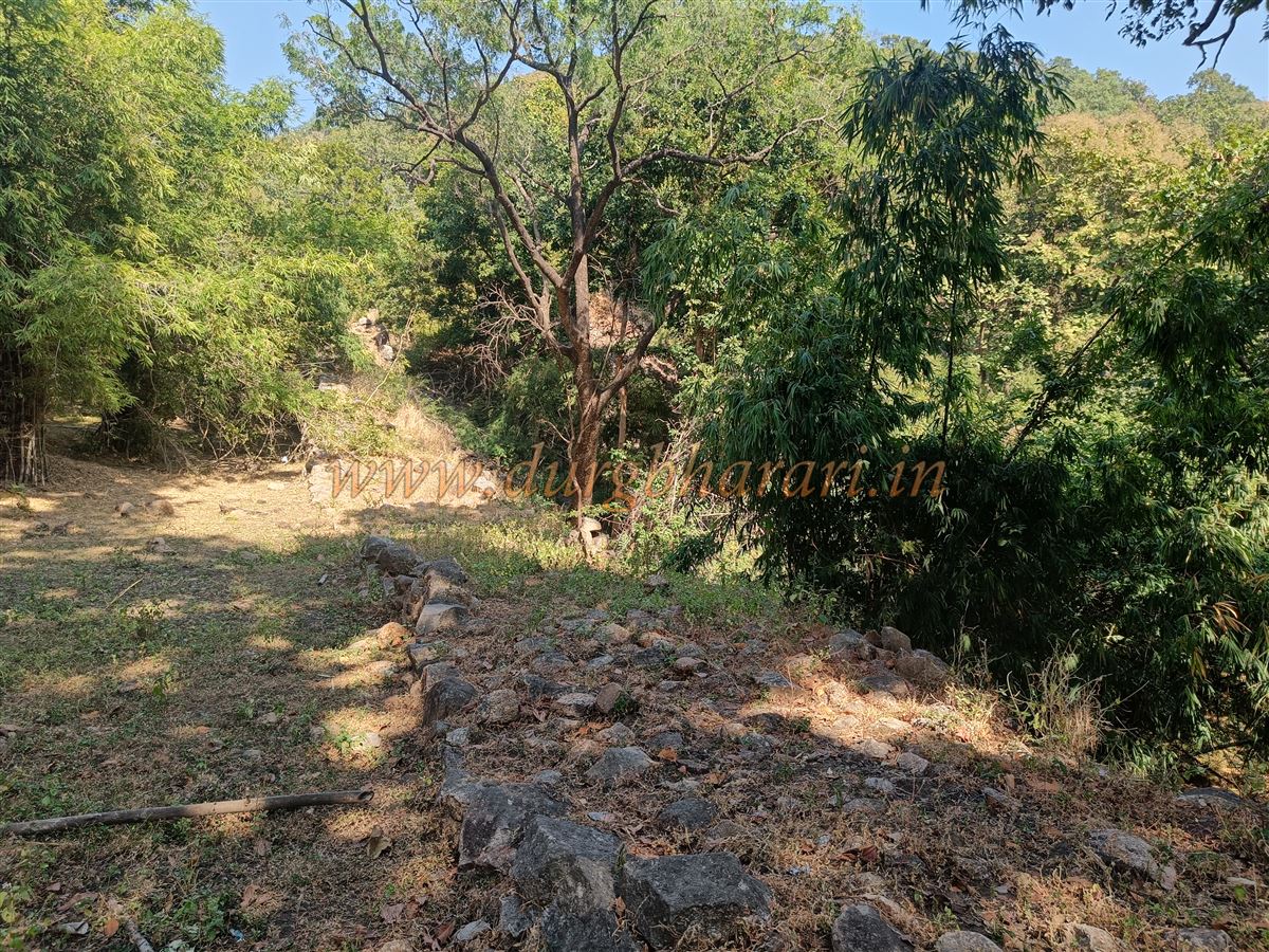
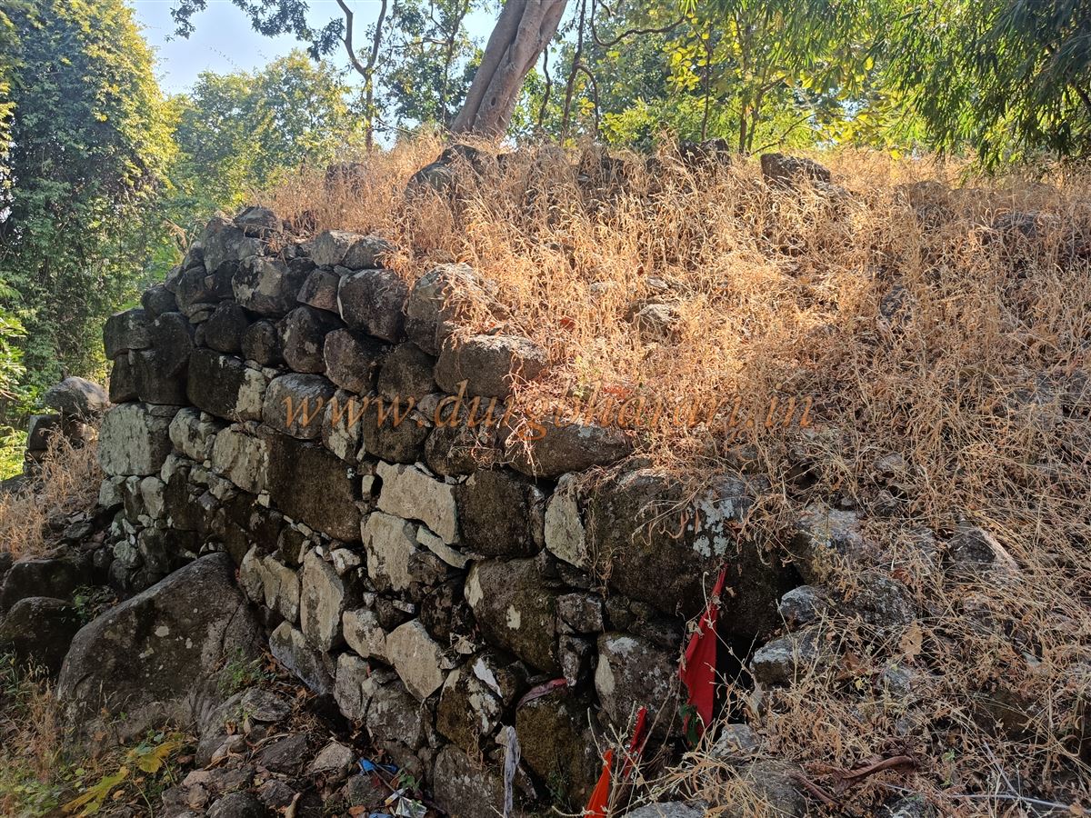
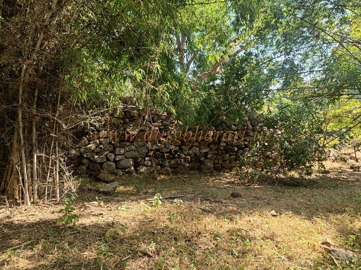
From the village, a one-hour trek through dense jungle brings you to the fort’s outer wall. Because the trail passes under thick forest canopy, sunlight and fatigue are barely felt. The original pathways leading to the fort's gates have crumbled, and the current route is the only one in use. A few newly constructed steps under the fortification wall allow access to the fort. The stone masonry is nestled between two hill slopes, with walls measuring about 5–6 feet wide and 8–10 feet high, interspersed with rounded bastions. Though the stonework is neat, the stones used are massive in size. The wall extends up both hillsides.
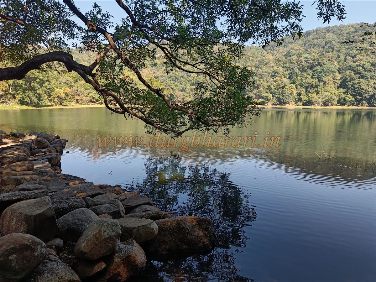
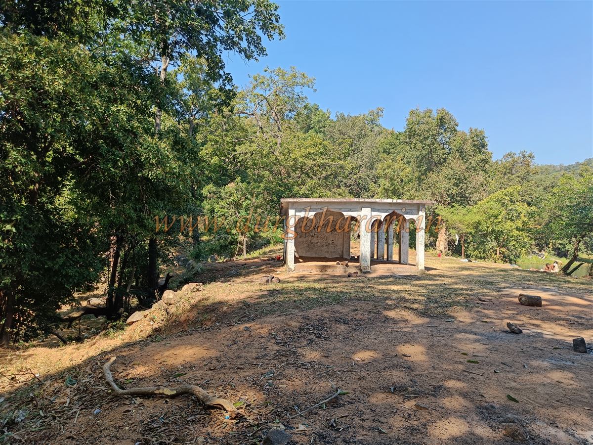
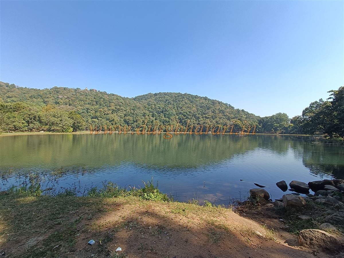
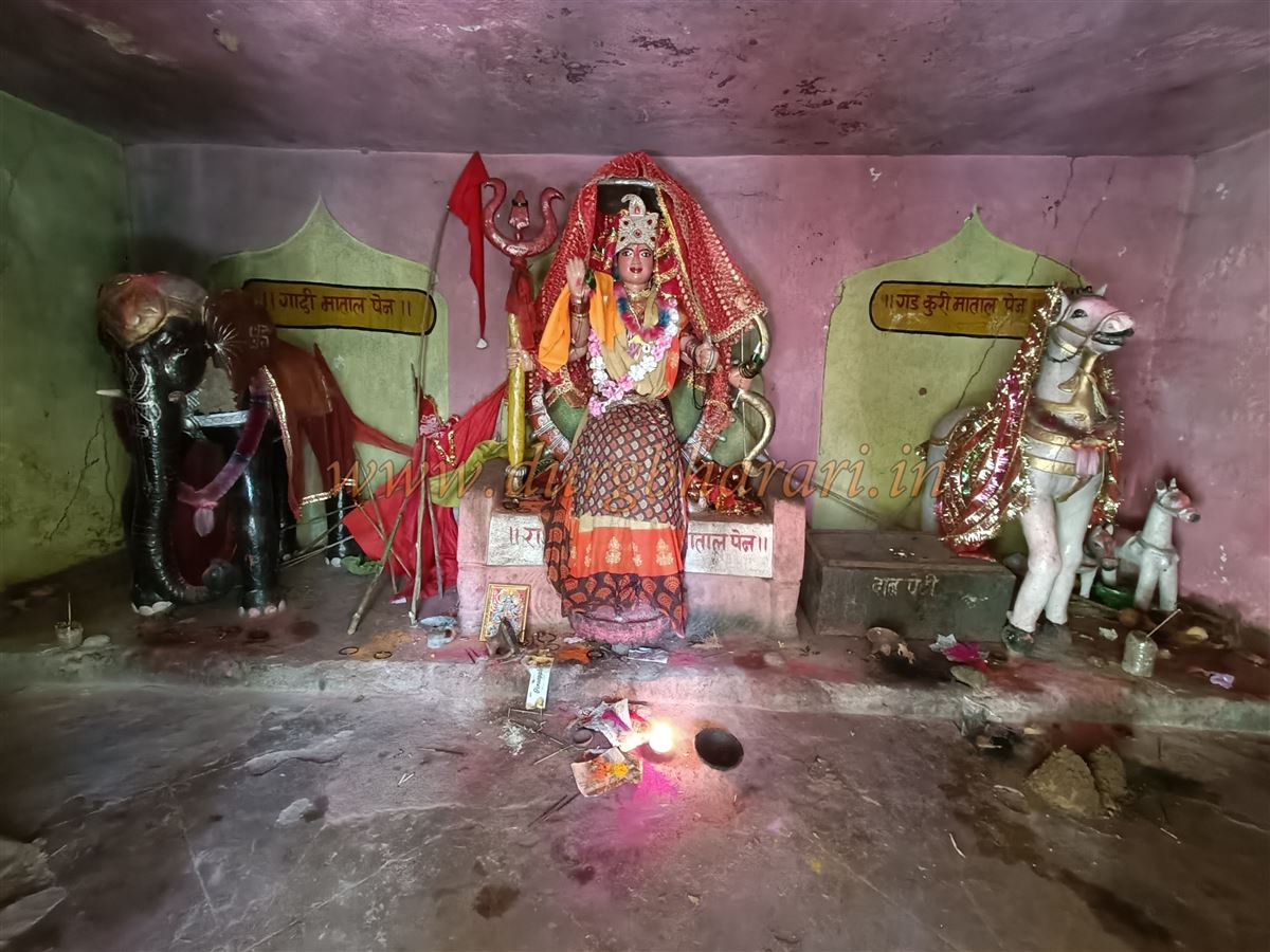
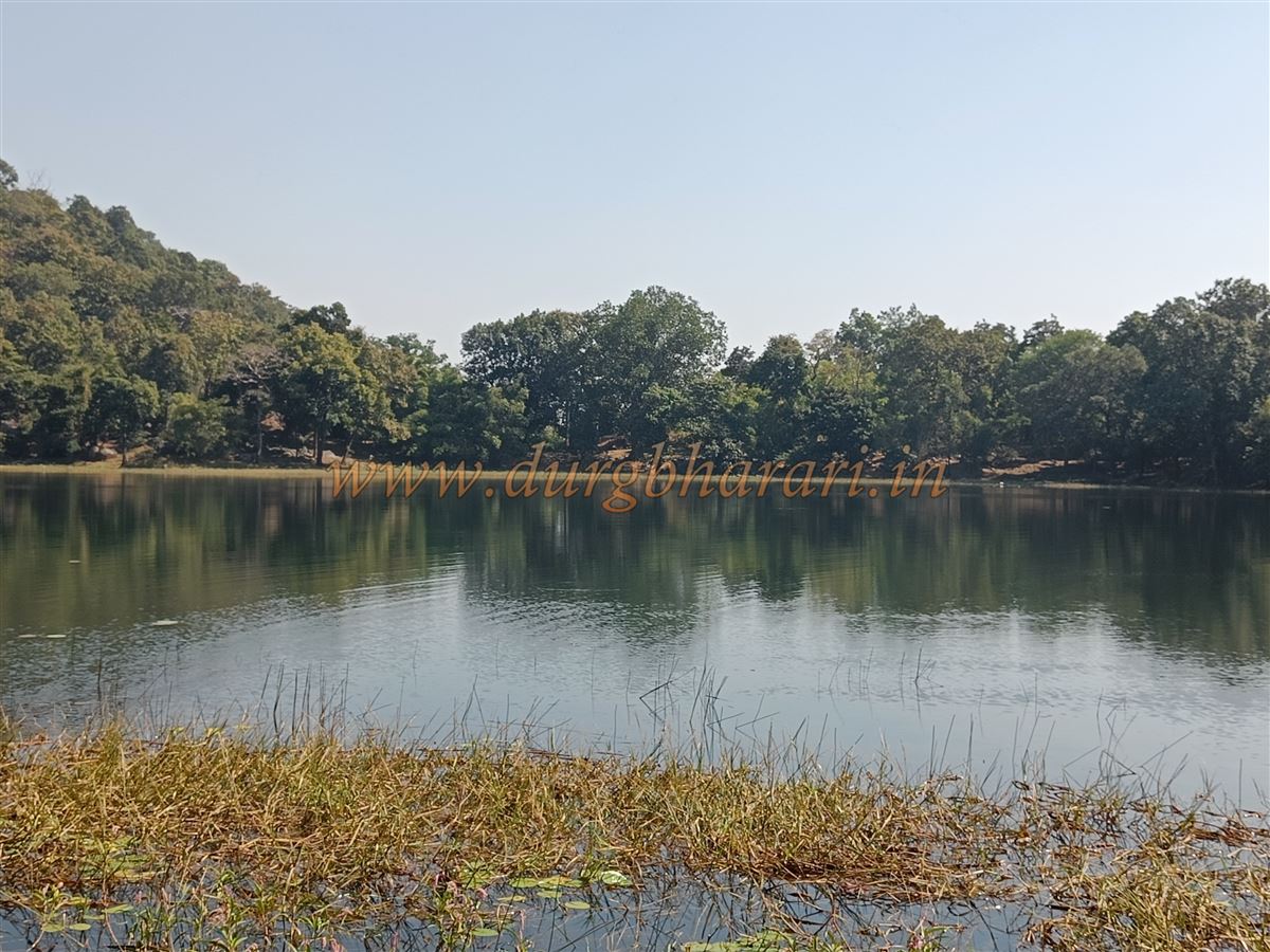
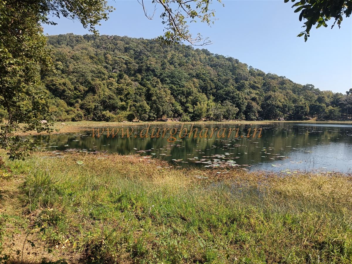
A large lake, spread over more than 12 acres, comes into view upon entering the fort. This lake, nestled between two slopes, remains filled year-round, and a wonder considering its mountaintop location. From the left side of the lake, a trail leads to two structures—one of which is a forest department shelter, while the other is a temple dedicated to the fort deity, known locally as Gadkuri Mata. A little ahead, another small temple contains stone idols of Shiva, Ganesha, Hanuman, and cement statues of other deities.
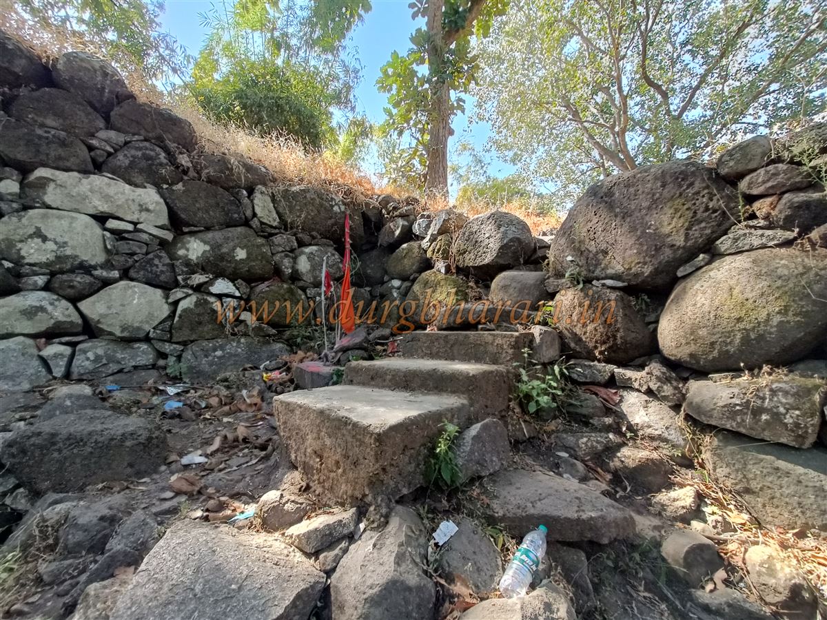
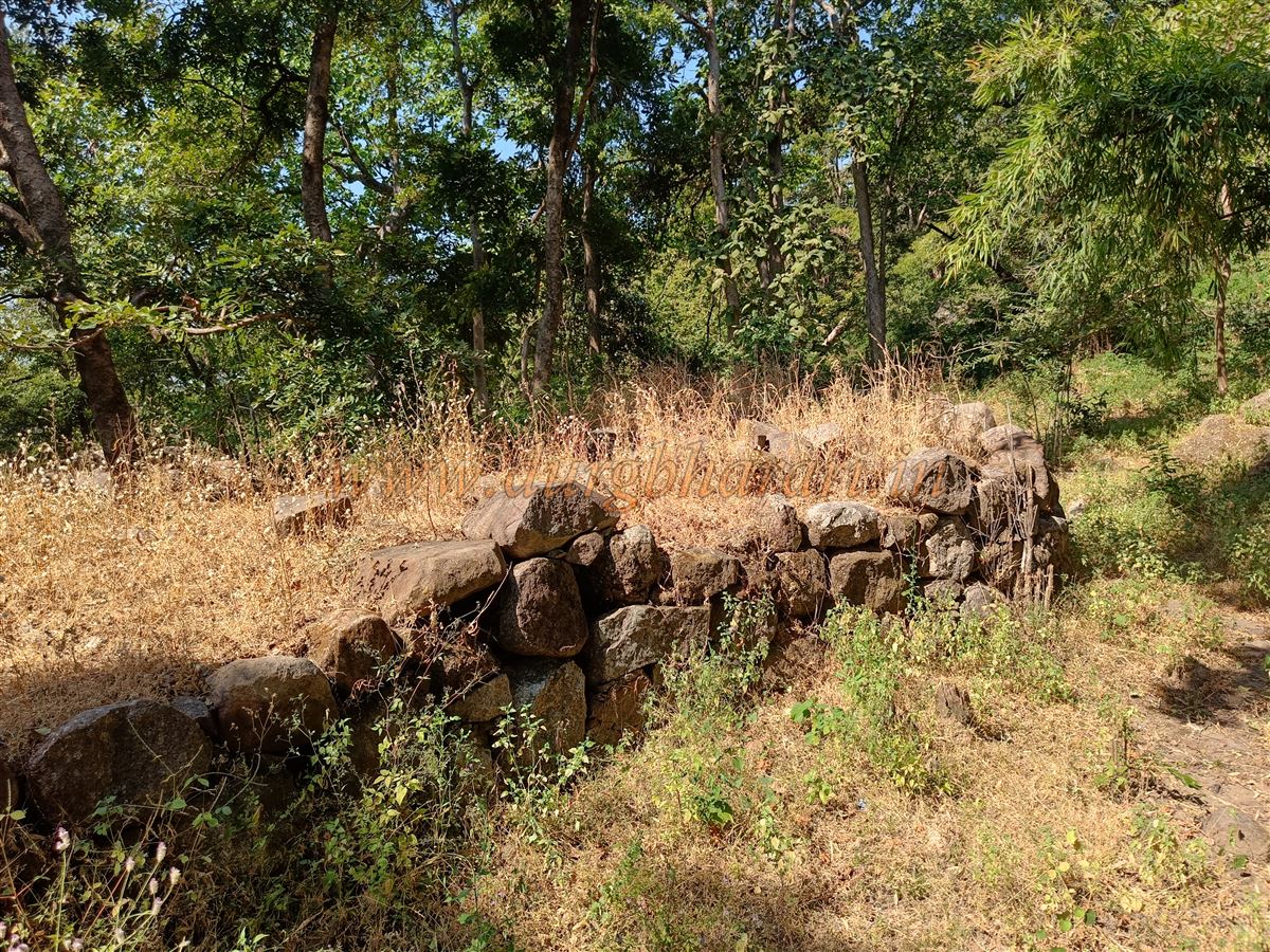
From here, return to Gadkuri Mata Temple and climb the fort wall seen ahead. This section of the wall is built along the mountain slope, featuring several round bastions. The height of this wall ranges from 15 to 25 feet. After viewing this section, retrace your steps to the dam area where the steps begin. These steps lead to a smaller gate within the wall, likely not the fort’s main entrance. Step outside to observe this gate, then re-enter and begin ascending beside the wall.
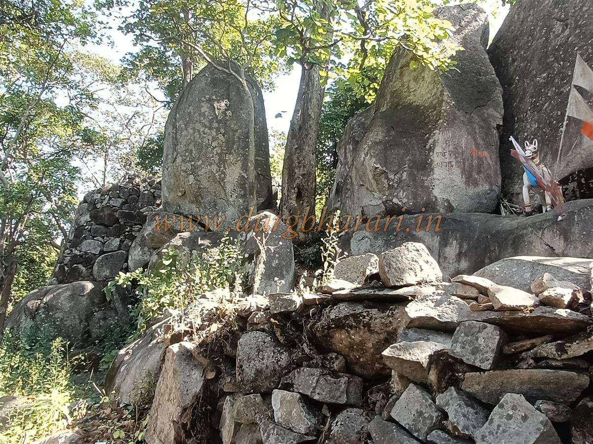
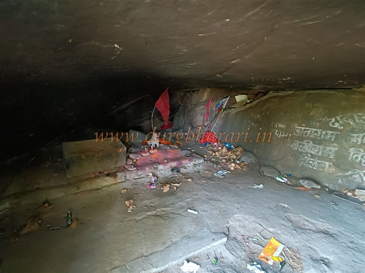
A steep 10-minute climb brings you to a large cave beneath a massive rock. This cave holds the Samadhi (final resting place) of Guru Tipababa. Above the cave are the fort walls and bastions. A little further and you reach the mountaintop—but due to thick forest, nothing is visible there. Returning back to the dam completes your fort tour. Around 1.5 hours is enough to explore the entire fort.
As with many forest forts in Gondia and Gadchiroli districts, little historical information is available on Tipagad. During the early and late medieval periods, several dynasties ruled Vidarbha and built forts. Around the 6th century, the Rashtrakut ruled this region. In the 11th–12th centuries, the Yadav’s of Devgiri took over. The Gonds rose to power in the mid-13th century and ruled this area for nearly 350 years. During their reign, they built around 20 forts in the Chandrapur-Gadchiroli region.
The word Tipa in the Gondi language means island. A Gond king named Puramshah once ruled here and had conquered much of modern-day Chhattisgarh. After his death, many sought the treasure believed to be hidden in Tipagad Fort, putting immense pressure on the then-saint Guru Baba, who, unable to bear it, is said to have taken jal-samadhi (water burial) in the fort’s lake. This local legend is still recounted in the Tipagad area.
To truly experience the unmatched natural beauty of Tipagad, one must visit this fort at least once.
© Suresh Nimbalkar
GALLERY