TIKONA / VITANDGAD
TYPE : HILL FORT
DISTRICT : PUNE
HEIGHT : 3310 FEET
GRADE : MEDIUM
Tikona Fort — the first fort that marked the beginning of my fort-trekking journey. At the age of seven, I visited this fort for the very first time, and after that, I kept going back. I’ve lost count of how many times I have climbed this fort, but it was this place that gave me the obsession for forts and wandering through them.It was the year 1979 when I first visited it — my very first fort — along with my grandfather. This fort is also known as Vitaṇḍagad or Aminagad. That day marked the beginning of my fort-trekking life. If I were to write down all my visits and experiences here, I could easily fill a 50-page booklet.When my grandfather first took me there, he was around seventy years old and had been visiting the fort since his own childhood. He had seen and remembered many of the structures that stood there in earlier times.
...
Let’s begin the story.At the base of the fort, you can see the village of Gevhande and Tikona Peth. But before 1971, these settlements did not exist in their current locations. Gevhande was originally situated on the slope below the hill where the Pavana Dam catchment area is now. I was born in that very spot.
Between Tikona Fort and the facing Mandvi Hill lies a pass, which was once the main entry route to the fort. At the foot of Mandvi Hill and at the mouth of this pass, you can still see four or five houses today. The original Tikona Peth was located here, and some houses were situated along the path to the fort, below where the parking area is now.
In 1980, during the monsoon, a landslide caused much of Vitaṇḍagad’s ramparts to collapse. The debris fell on this settlement, completely destroying three or four houses. The remaining families relocated to the roadside — this is how the present-day village came to be.
The first time I came here, I was with my grandfather for a religious ceremony at a house in the old Tikona Peth. It was here that I first heard from him the story of Tahaldeva’s origin. In the pass, there used to be a stone, and every traveller would offer a small branch (tahali) from a tree to it. My grandfather explained that Tahaldeva shrines were always found in narrow passes along hill paths. The purpose was twofold: branches from overgrown trees along the path would be broken and placed at the shrine, keeping the route clear; and for a lone traveller in such eerie, narrow spots, the presence of a guardian deity would inspire confidence.
Today, a motor road passes through the pass, and the place where Tahaldeva once stood now holds a Bhairav temple. Tikona and Mandvi Hills together form the boundary between the Maval valley (to the north) and the Paud valley (to the south). The fort is clearly visible from the present expressway. It is located near the Pavana Dam — about 126 km from Mumbai and 60 km from Pune — and stands roughly 3,850 feet above sea level.
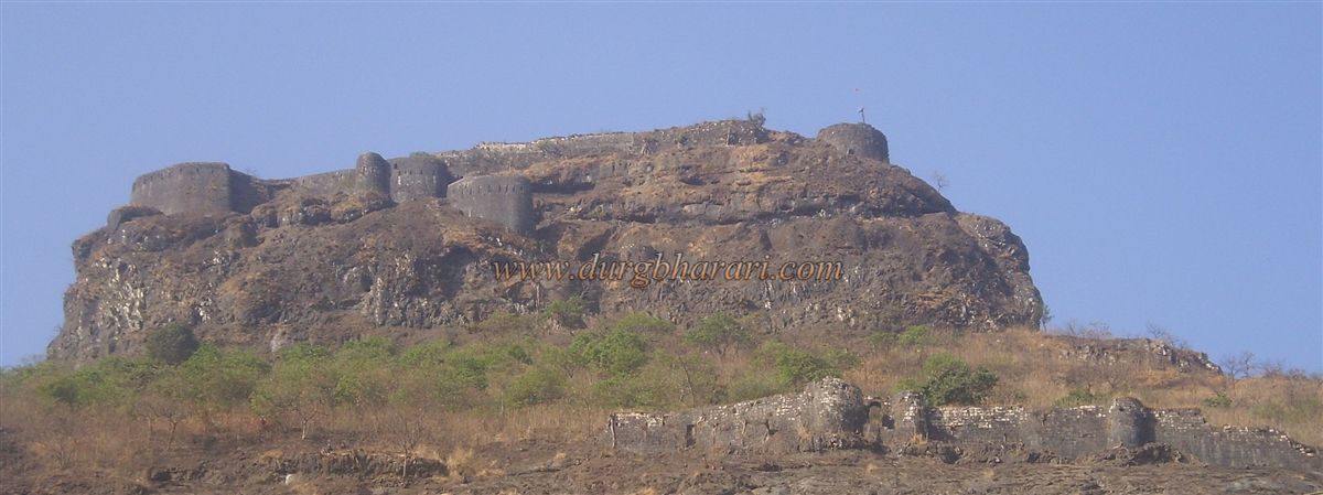
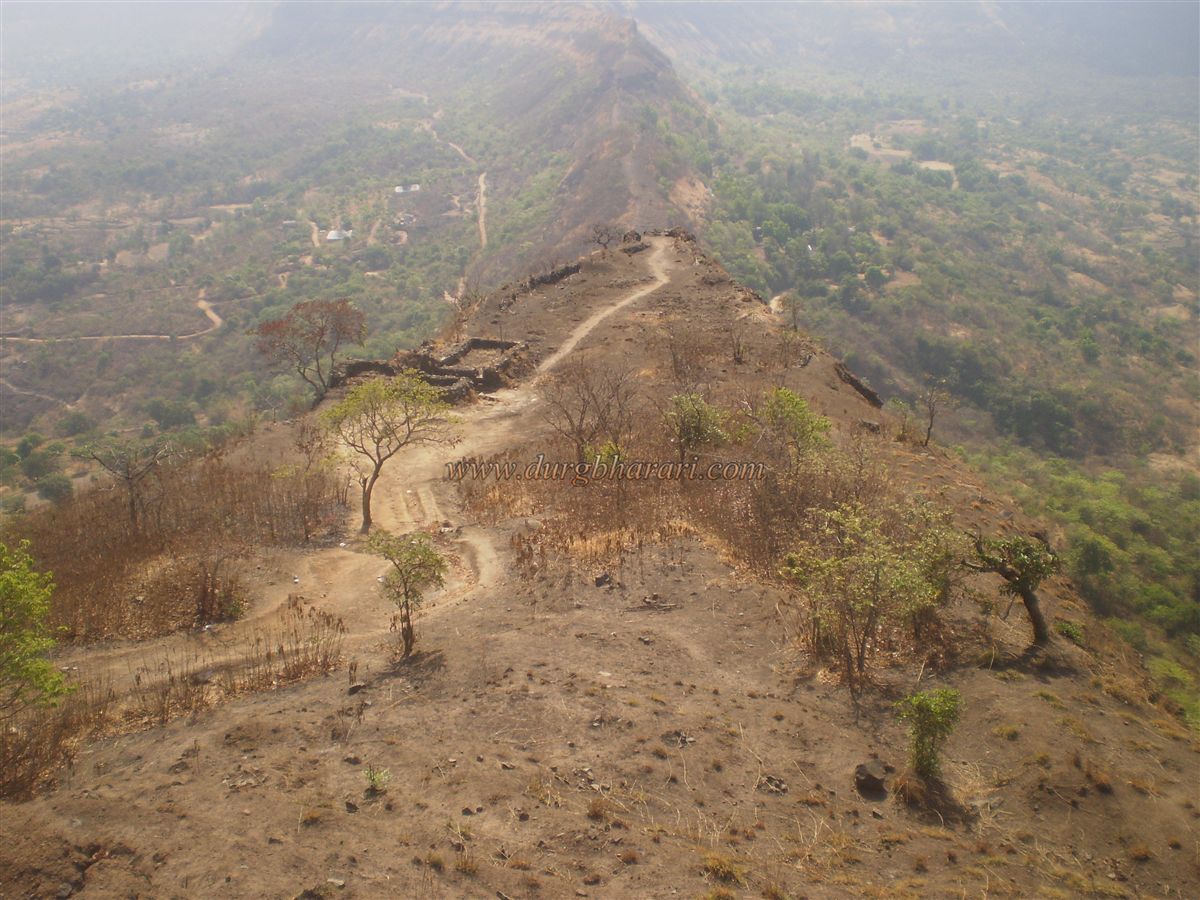
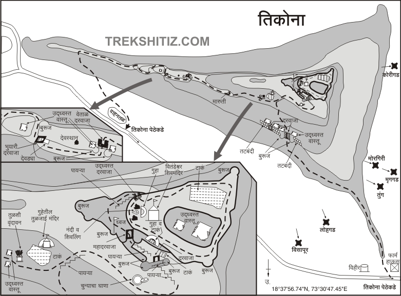
The name Tikona (“triangular”) comes from the triangular shape of its citadel. The fort has three spurs (sond), of which two have gateways and bastions allowing entry. The third spur is defended by a moat and rampart fitted with cannon and musket holes, making entry from that side extremely difficult.
There are two main gateways to the fort’s machi (plateau) — one to the east and one to the north. Paths to the fort start from Gevhande and Tikona Peth. Either way, you first reach the machi. The climb is very easy.
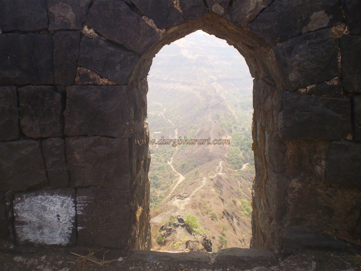
From the main road, a rough path leads towards the fort. One old route goes directly up to a gateway along a cliffside; rock-cut steps are carved here. It’s a more adventurous approach, known as the Vetāl Gate. Because of landslides and overgrowth, it is rarely used now and might soon vanish due to neglect. For safety reasons, children should not be taken via this path.
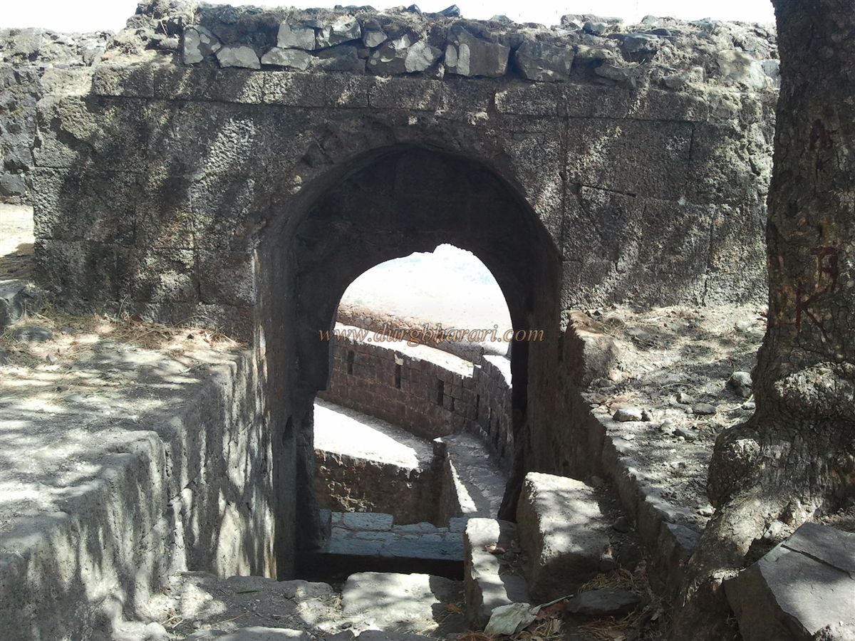
The second path — the one most trekkers use — is well-worn and takes about 45 minutes to reach the first gateway, known as the Pālthā Gate. This is a tunnel-like entrance with a long, wide cave inside. Just beyond it is a filled-in moat, which was once much deeper. Above the tunnel is a bastion. The gate is called Pālthā (“upside-down”) because it once had a drawbridge-like gate that could be lowered flat over the moat to serve as a bridge. Inside, there are guardrooms, and from here a well-paved royal path continues upward.
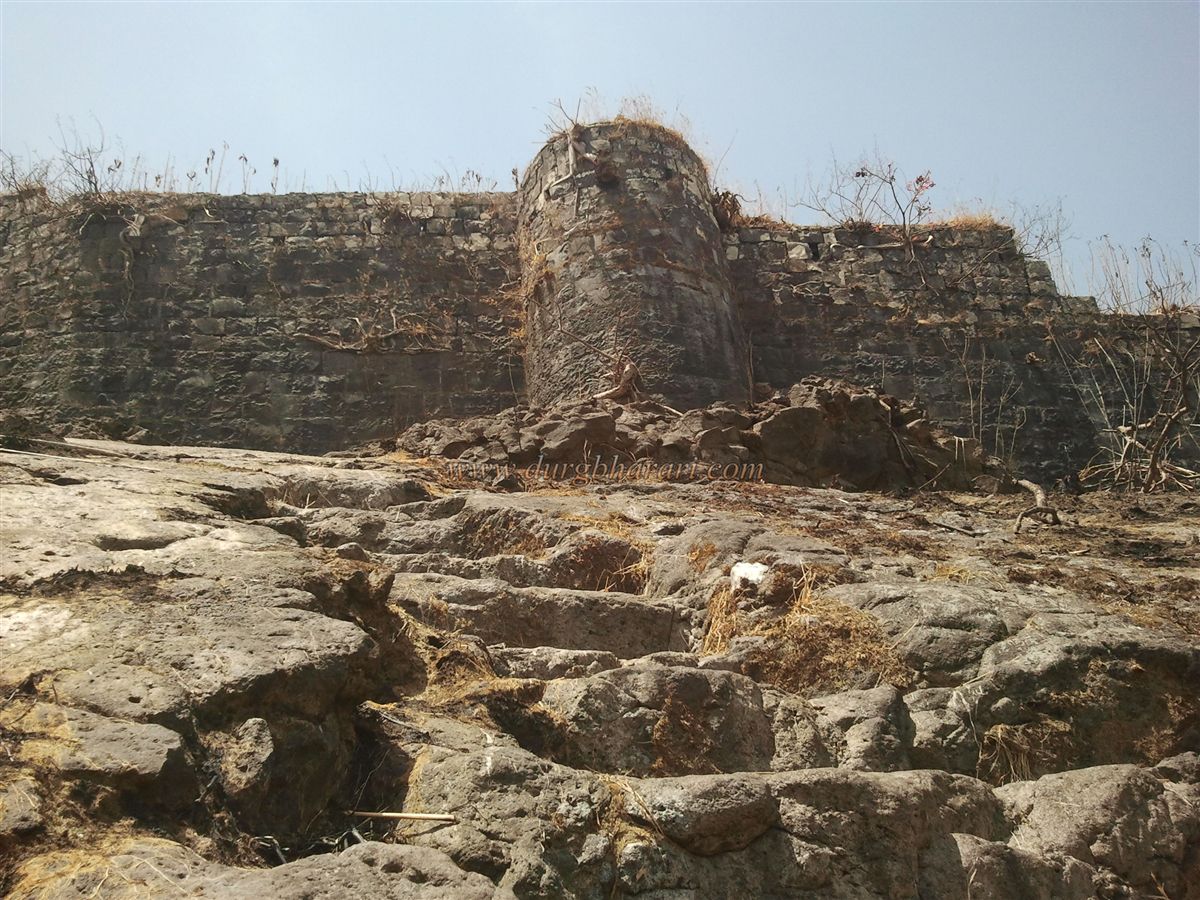
The next stage has a second gate, flanked by two bastions. The arch has collapsed, and the area is strewn with ruins. This spot is under direct observation and cannon range from the main citadel.
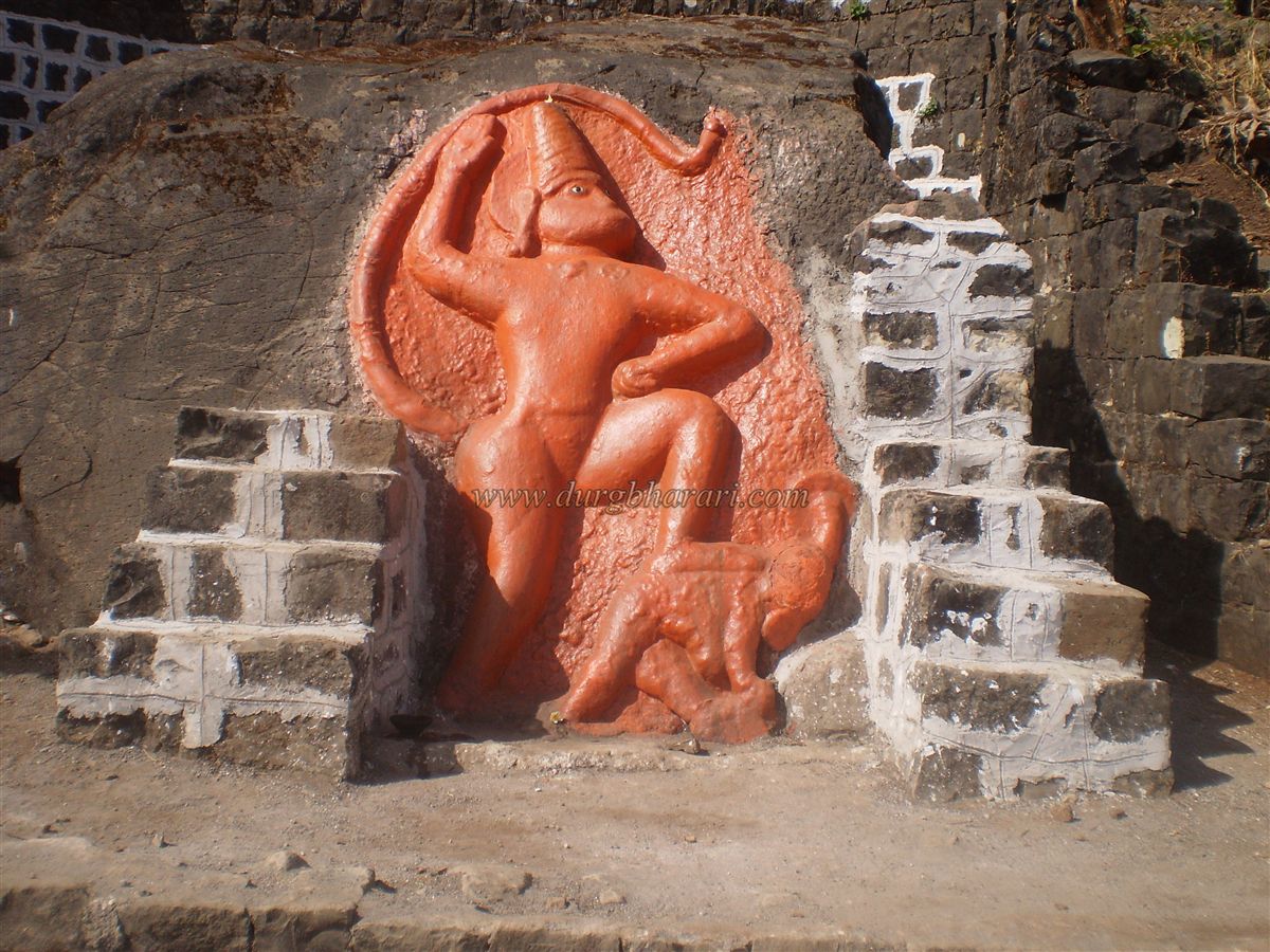
A little further on, you come across a striking idol of Maruti (Hanuman), about 7–8 feet tall, carved from a single stone. Unlike typical Hanuman idols holding a mountain in one hand, this one shows him trampling the demon Panvati underfoot in a victorious pose. Such statues are known as Chapeddaan Maruti. Nearly every fort in Maharashtra has some form of Hanuman idol within its premises.
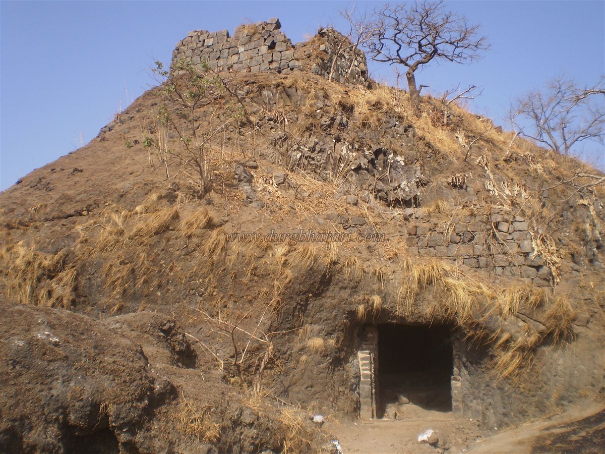
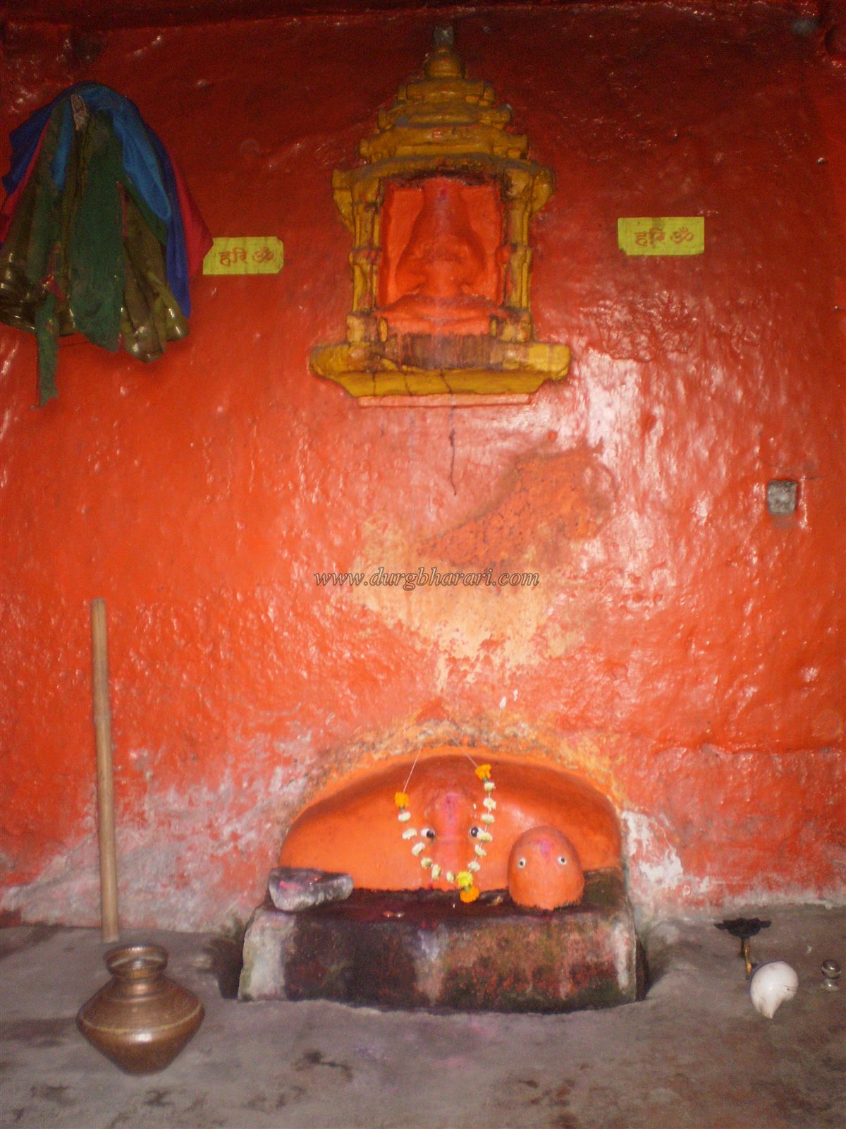
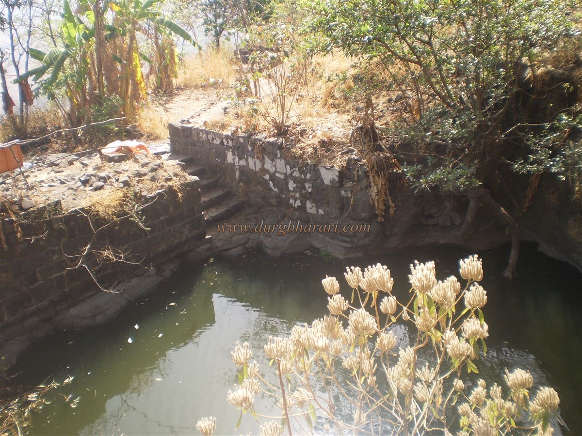
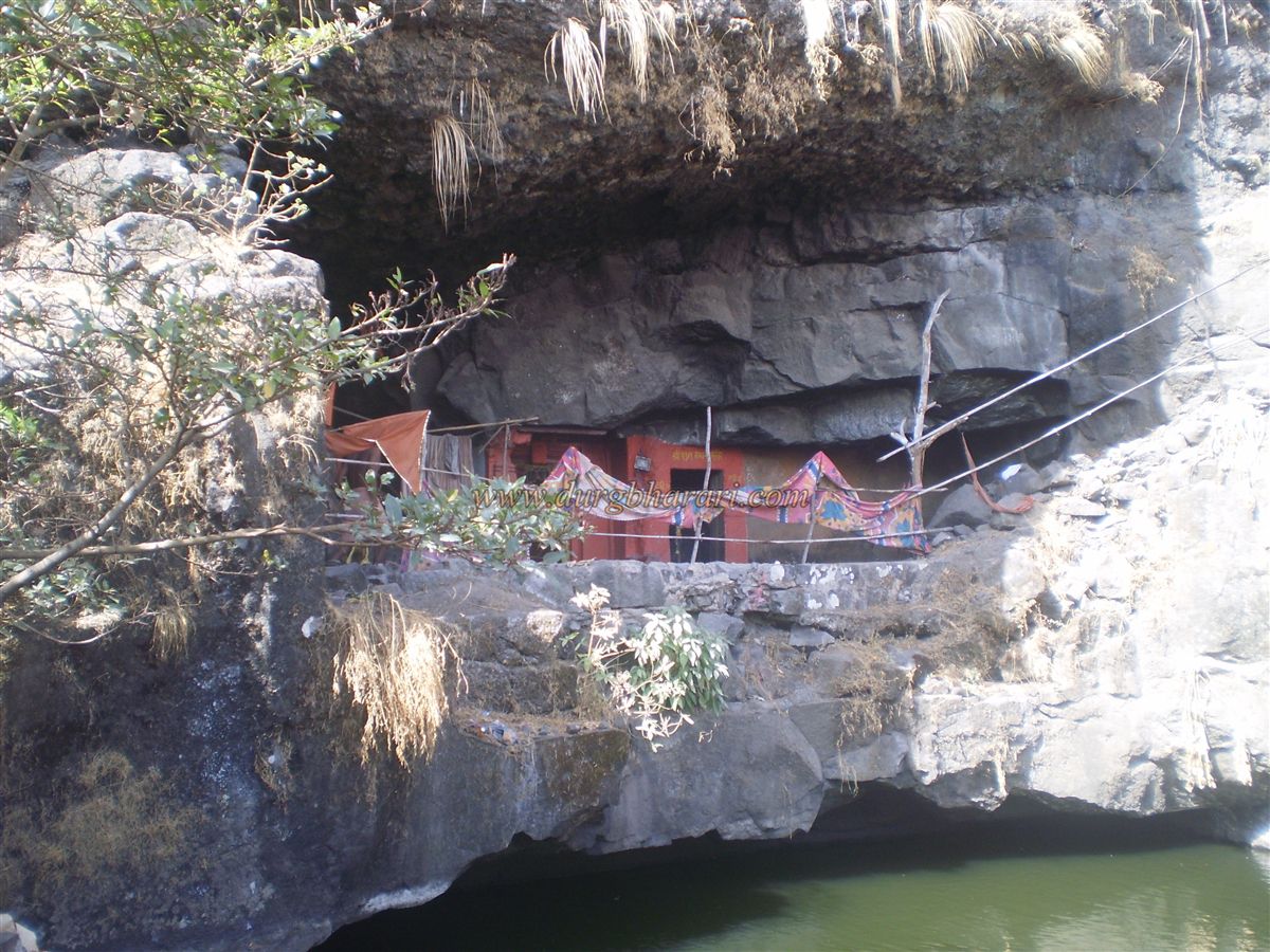
Maruti is the deity of strength and destroyer of enemies. Therefore, it is quite natural for her to be established at such a location! Moving ahead, a vertical cliff reveals an ancient cave. The ruins in front of this cave are the remains of the fort’s main entrance area (sadar). This sadar existed as long as the fort was under the control of the Bhor princely state. The cave temple in front is likely from the post-Satavahana period. Locals know this cave as the Taljai Temple. This cave is divided into five chambers, and in one of them, the idol of Taljai is installed. Inside the cave, the goddess is worshiped in the form of a grain-shaped stone with eyes and nose, and on the ceiling is a beautiful carved lotus. Beside the cave is a carved water cistern, and in front lies a pond. However, the pond’s water is not potable. The cave can accommodate 10–15 people, but during the monsoon it becomes unfit for living.
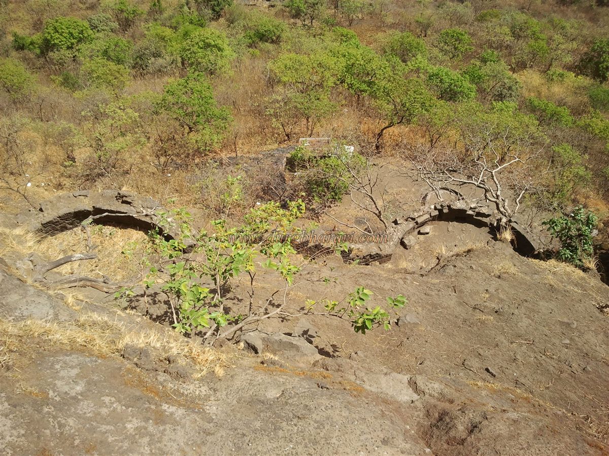
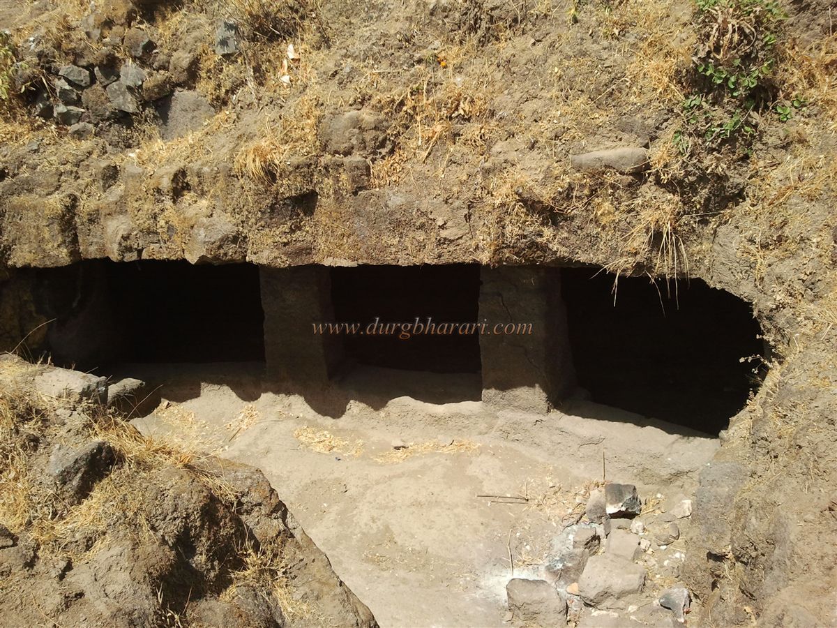
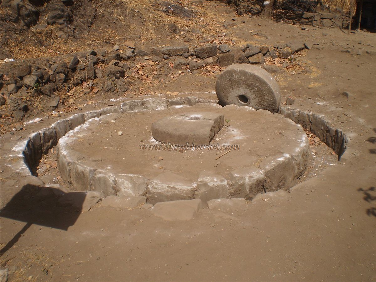
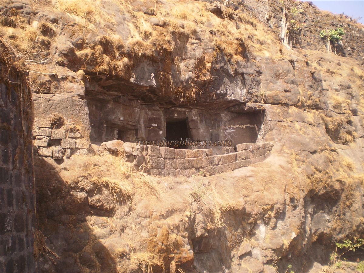
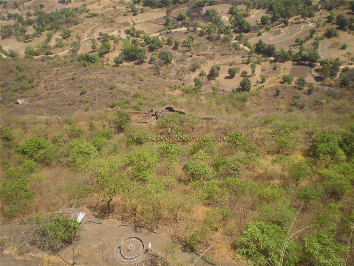
From here, you proceed toward the main fort (balekilla) of Tikona. On the way, you can see old lime grinding pits (used in construction) and remnants of houses. About 1.5 km at the base of the southern cliff of the balekilla lies another set of caves, mostly neglected and unknown even to locals. Many confuse these caves with the main ones mentioned earlier, but they are entirely different. This abandoned three–four chambered cave, though filled with mud and a musty smell, is an excellent example of Buddhist-era caves in the Maval region. Built in such a location that it overlooks a vast area, the site also shows signs of ancient water management. This cave was discovered by a team from Deccan College — Dr. Sankalia, Prabhakar Kulkarni, and Dr. Shobhana Gokhale. They also found a Satavahana-era grinding stone in the area, indicating the cave dates back to that period.
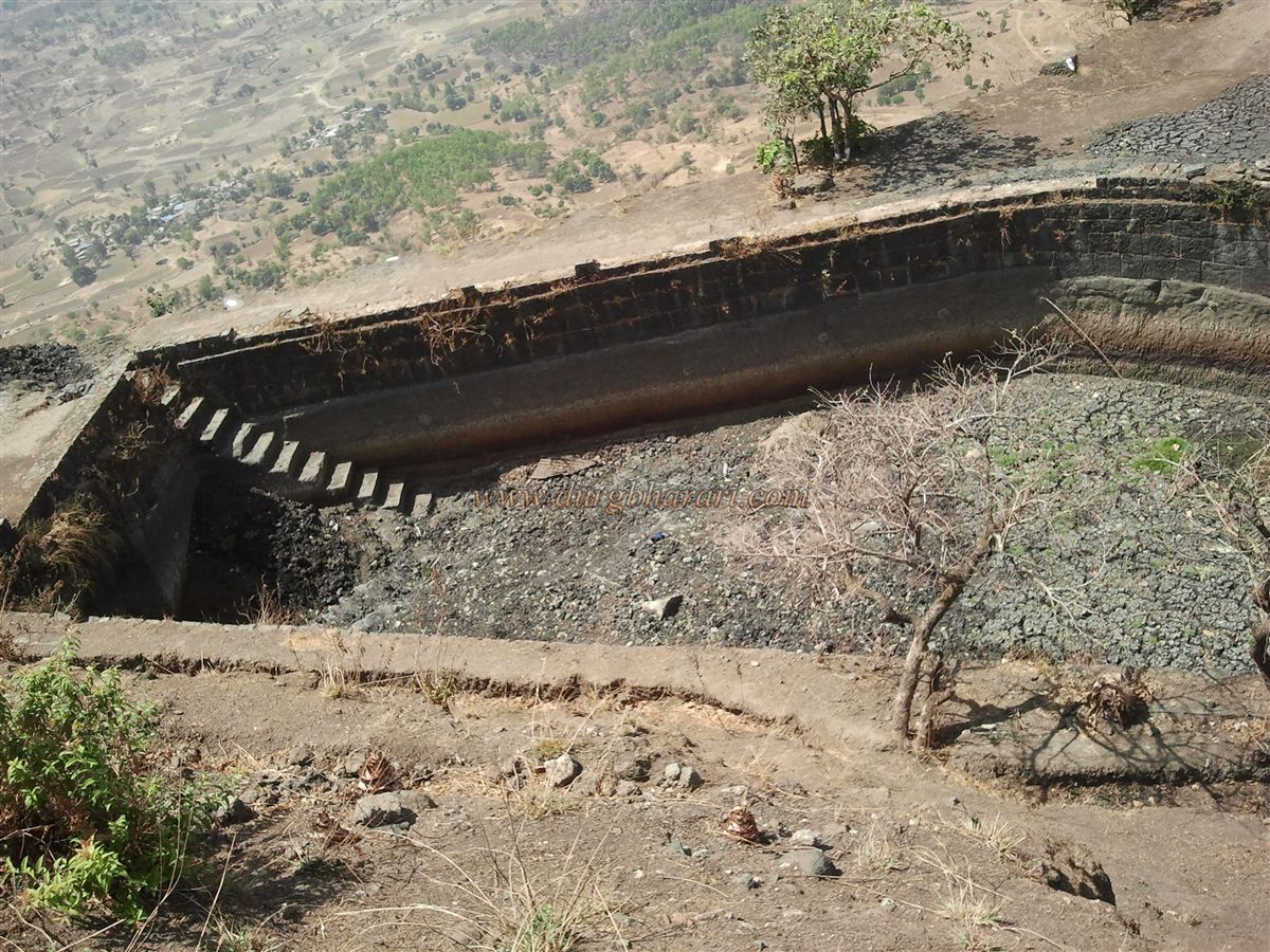
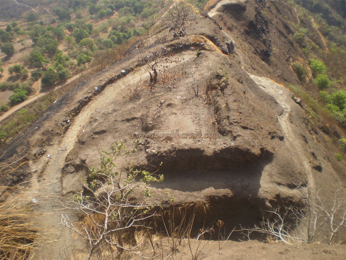
In the western part of the fort is a rock-cut cistern that collects rainwater from the top. Because it is carved into rock, the water does not evaporate quickly. In front of this cave is a memorial stone (Sati shila) with carvings in two sections — in the first, a man is shown with a woman seated at his feet, and his lower body draped in cloth; in the second, two women stand holding garlands. This suggests the carving is ancient.
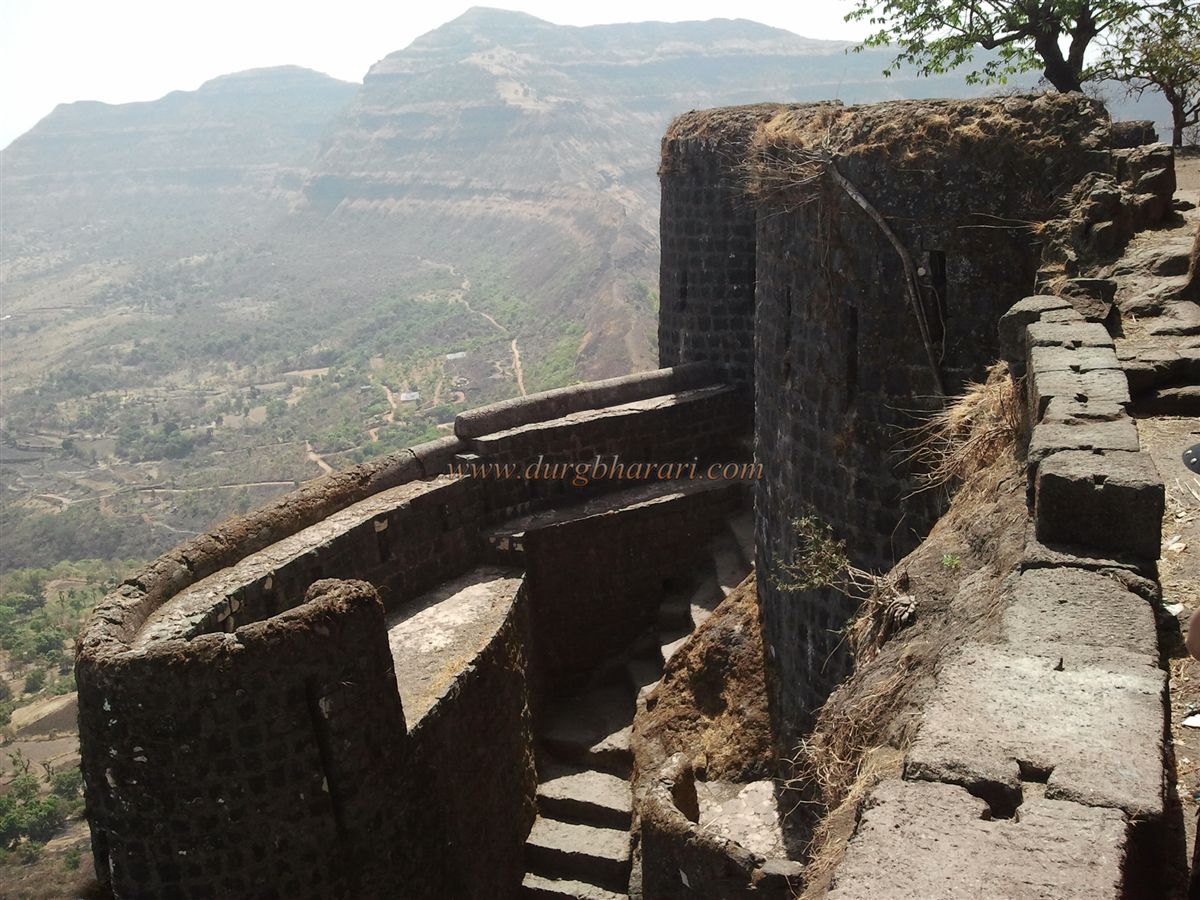
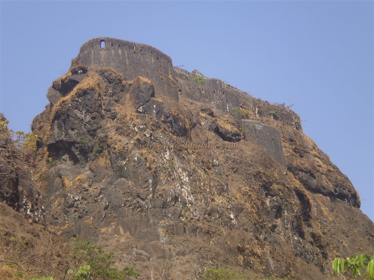
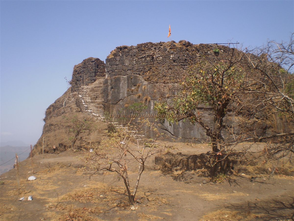
Just ahead of the fort is the hill of the Bedse Caves, which are much older — perhaps inspiring the carvings here. To enter the balekilla, you must cross four gates. The path is steep and narrow, with high steps that make the climb tiring. After ascending about 50 rock-cut steps (1–1.5 feet high), you reach the first gate. Immediately to the right is a rock-cut water tank with excellent-tasting water. Each fort has its own distinct water taste. The path from the first to the second gate is carved directly into the vertical cliff — a narrow 2–3 foot wide trench, 10–15 feet high. The narrowness, high steps, and looming cliff walls meant only one person could enter at a time, tiring them out and making it easy to capture them. This showcases the defensive strength of historical forts.
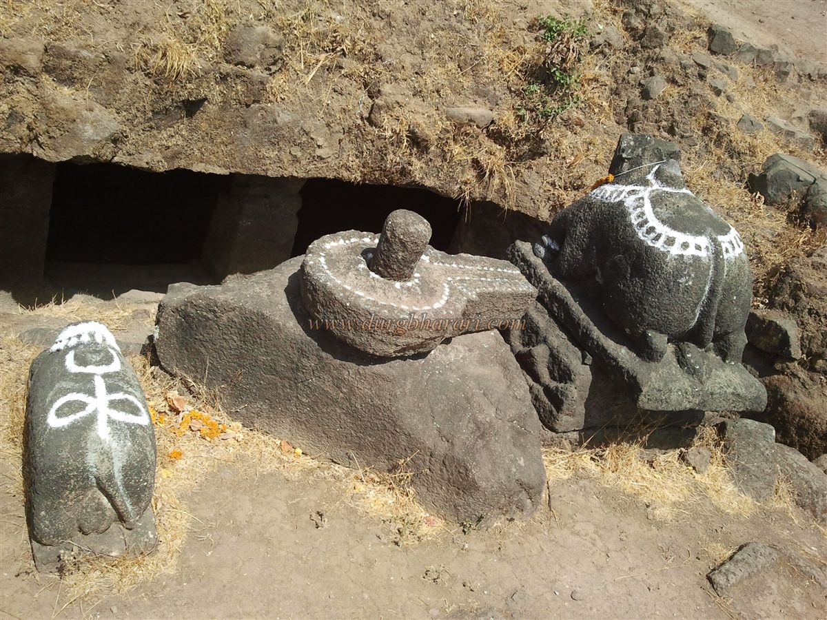
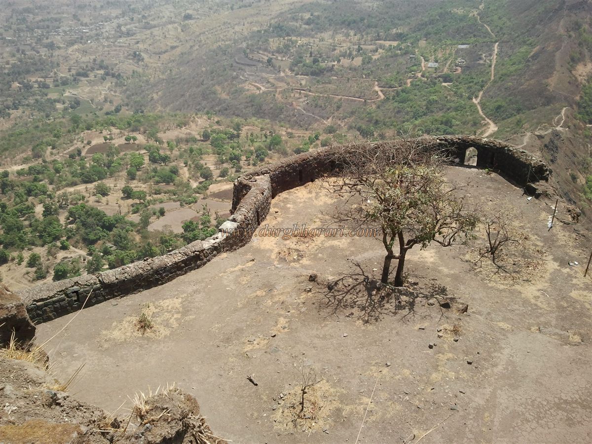
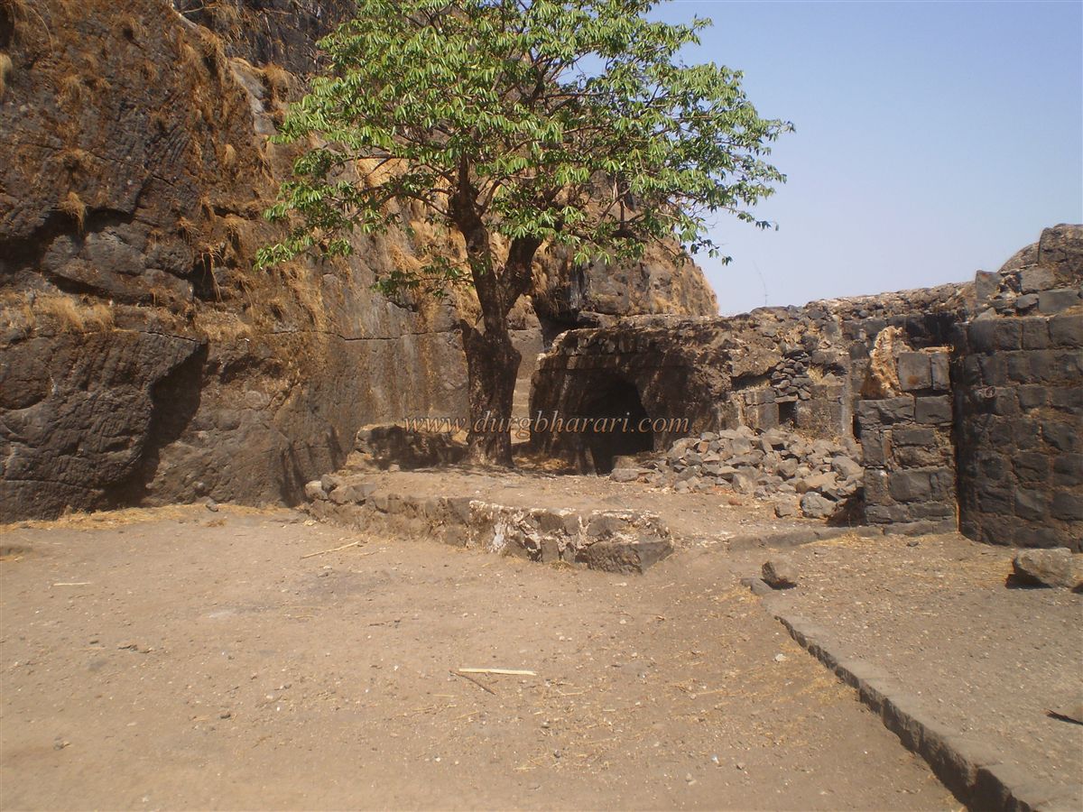
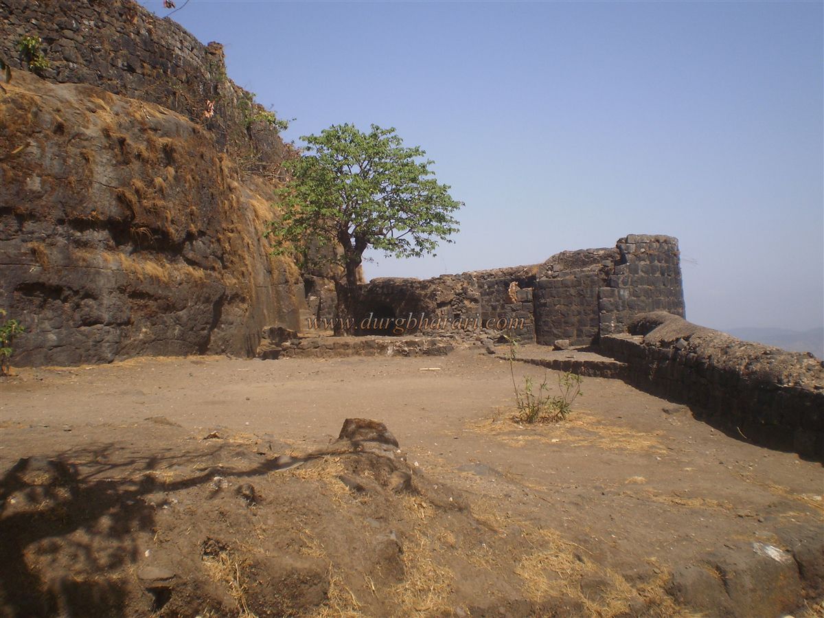
The second gate is larger and well-designed than the first, with a semi-circular bastion in front for added defense, and a seating ledge inside. Nearby, in the cliff to the right, are four connected water tanks — originally storage chambers that became tanks due to water seeping in. On the left, the ascending path passes a lone watchtower. After crossing the third gate, you enter the balekilla. There’s a courtyard-like area suitable for camping. Recently repaired steps lead directly to the summit. The summit entrance has no remains of its gate. Space here is limited, but it holds a Mahadev temple with a neatly shaped Shiva linga. Below the temple is a water tank with a pillar, and to the left are two cave entrances. In front are two broken Nandi statues and a Shiva linga, named by trekkers as Tryambakeshwar or Vitandeshwar. Behind the temple are remains of a wada foundation, now flying the saffron flag.
Beside the temple is a large pond. When I visited in 1979 and 1981, there was a wooden pillar in its center, which later collapsed. The water’s permanent yellow color has earned it the name “Varan Talav” (Lentil Pond). On the right cliff, at the site of the old flagpole, stands a solar light pole. This is the fort’s highest point, from where you can see Tung, Lohgad, Visapur, Bhatarashi, Morve, Jambhuli hills, and Pavana Dam. The entire Maval region is visible from here. The whole fort can be explored in about four hours.
Tikona Fort’s recorded history is scarce. Based on the nearby Hinayana Buddhist caves of Karla, Bhaje, and Bedse, the fort was likely built between 800–1000 CE. In the late 15th century, Malik Ahmad Nizam Shah attacked Junnar (c. 1482–83), captured much of it, then took Lohgad and turned toward Tung and Tikona. In 1585, he took Tikona into Nizam Shahi control, where it remained until the dynasty’s end. Under the 1636 treaty between Mughal Emperor Shah Jahan and Bijapur’s Muhammad Adil Shah, Tikona came under Adil Shahi rule. On September 4, 1656, Shivaji Maharaj captured Tikona, renaming it Vitandagad. It was used to monitor the Pavana Maval region. In 1660, Netaji Palkar was appointed to guard it.
Under the 1665 Treaty of Purandar, Tikona was among 23 forts given to Jai Singh. On June 18, 1665, Kubad Khan took charge of the fort, but by 1670 the Marathas had recaptured it. In August 1682, Sambhaji met Prince Akbar here, after which Akbar stayed at Tikona for a while but later moved to Jaitapur due to the climate. In 1702, Mughal commander Amanullah Khan captured Tikona and sent its golden keys to Aurangzeb, who renamed it Amangad — but this was short-lived. After Aurangzeb’s death, the Marathas regained control, holding it until the Anglo-Maratha War of 1818.
In 1818, the British fought briefly at the fort, causing significant damage. Colonel Prother captured it but later returned it to the Bhor State, so in a way, the Maratha flag remained. The last fort commander (Havaldar) under the Bhor State, Shinde Sarnayak, had a wada in Kashig village at the fort’s southern base — still standing today.
© Suresh Nimbalkar
GALLERY