TAKMAKGAD
TYPE : HILL FORT
DISTRICT : PALGHAR
HEIGHT : 1895 FEET
GRADE : MEDIUM
Mumbai has divided the Konkan region into North Konkan and South Konkan. South Konkan includes the districts of Raigad, Ratnagiri, and Sindhudurg, while North Konkan includes the districts of Thane and Palghar. Blessed with natural beauty and being close to Mumbai, North Konkan has all kinds of forts — sea forts, hill forts, forest forts, and land forts.
Along the Mumbai–Ahmedabad highway, passing through the former Thane (now newly formed Palghar) district, lies the Takmak Fort in Vasai Taluka, surrounded by dense forest. Although close to Mumbai and Thane and not too difficult to climb, the thick forest at its base adds to the fort’s remoteness. A day trip to Takmak Fort from Mumbai is possible either by train or private vehicle.
The base village, Sakwar, is located right along the Mumbai–Ahmedabad highway, 80 km from Mumbai, on the right-hand side of the road. If traveling by train, one must reach either Vasai or Virar station on the Western Railway. Sakwar is 22 km from Vasai station and 20 km from Virar station.
...
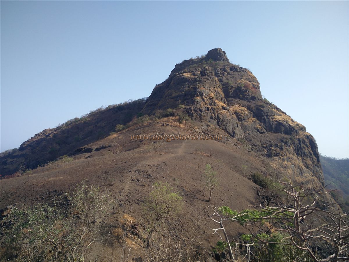
As you enter Sakwar village, behind it to the east lies a north–south-stretching hill — this is Takmak Fort. Its southern spur descends toward the village, and the route to the fort runs along this spur. Although the path to the fort is well-trodden, the 15-minute walk across flat fields from the village to the base of the spur can be a little confusing, so it’s best to ask for directions in the village or take a guide until you find the trail. Once on the trail, it’s almost impossible to get lost.
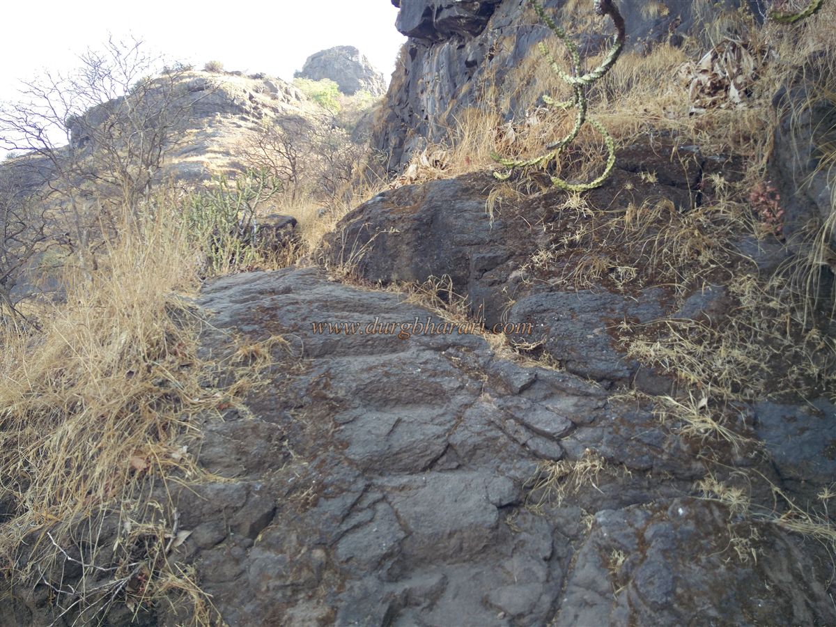
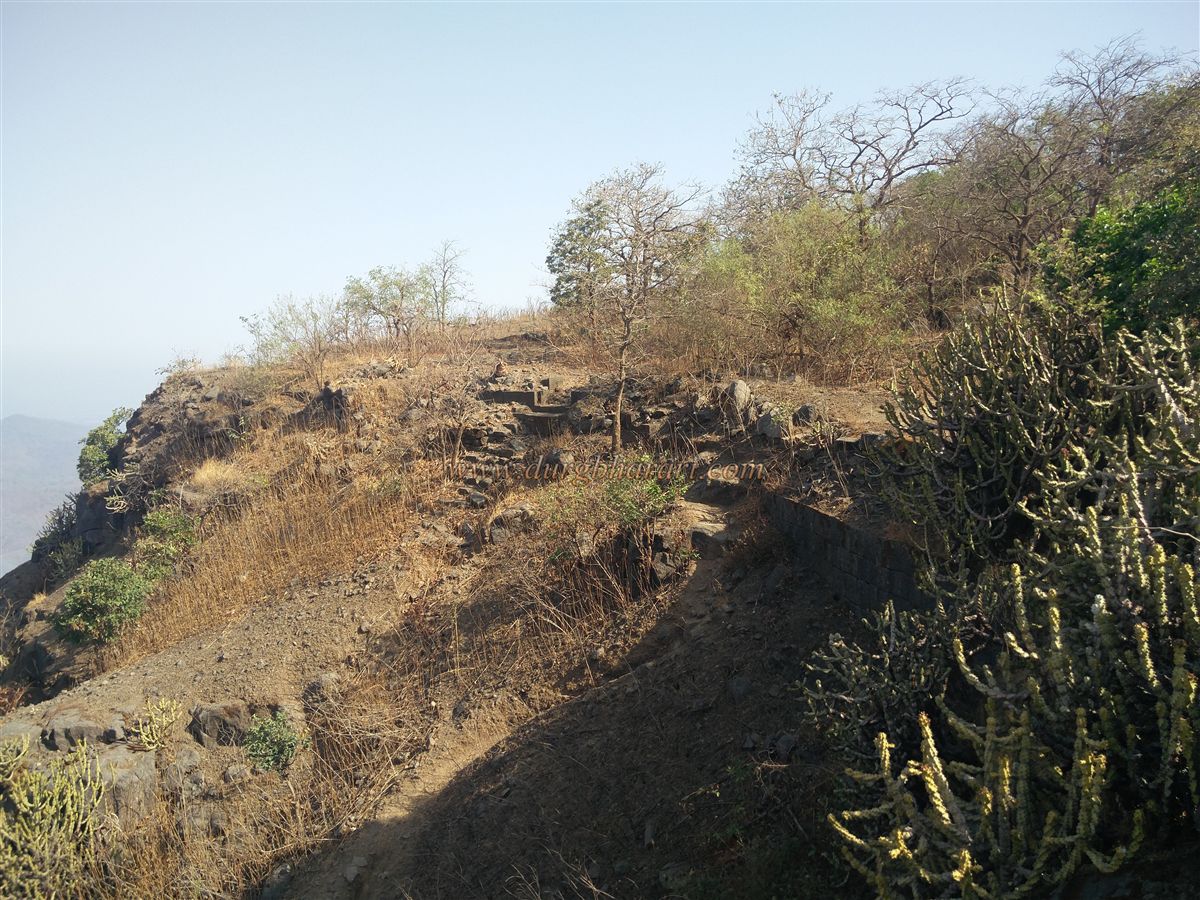
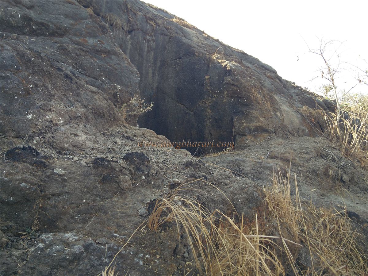
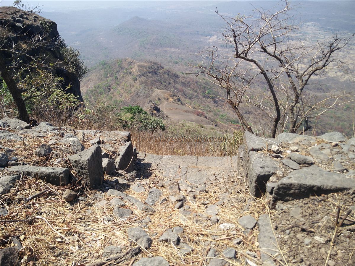
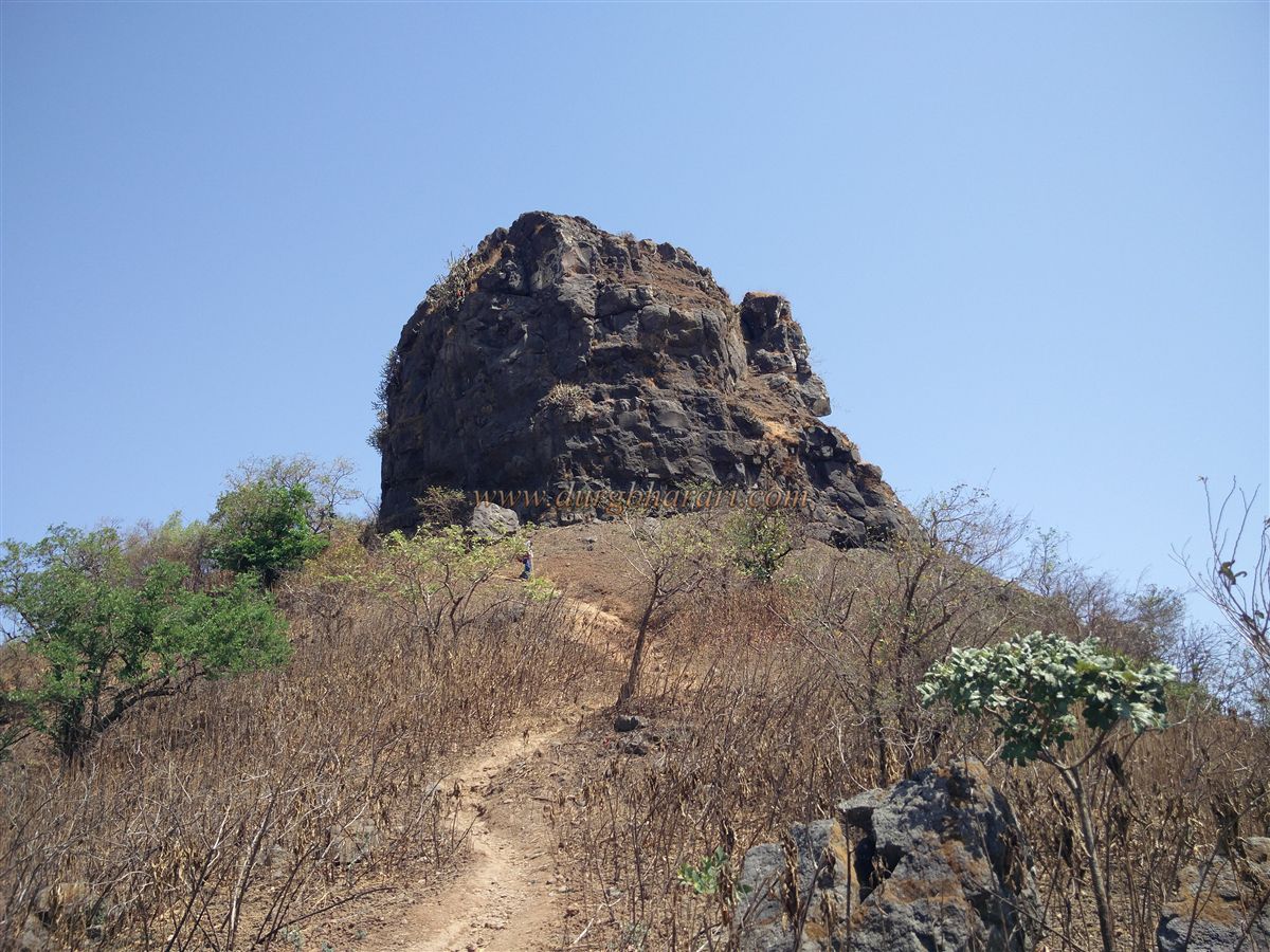
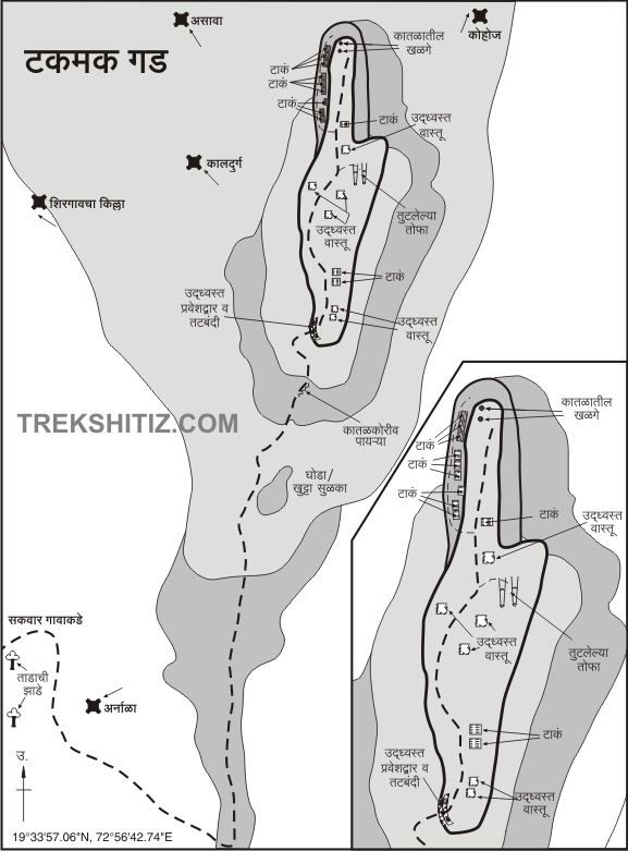
This path leads directly to the fort. Though it is uphill, the one-hour climb passes through dense forest, which lessens the feeling of fatigue. The later section, however, passes over an open plateau and is more tiring. This route brings you to the base of a pinnacle at the fort’s southern tip. It takes about one and a half hours to reach here from Sakwar. Skirting around the pinnacle, the path ascends toward the hilltop. At certain points, steps have been carved into the rock. In about ten minutes, you pass through the fort’s ruined fortifications and enter the fort.
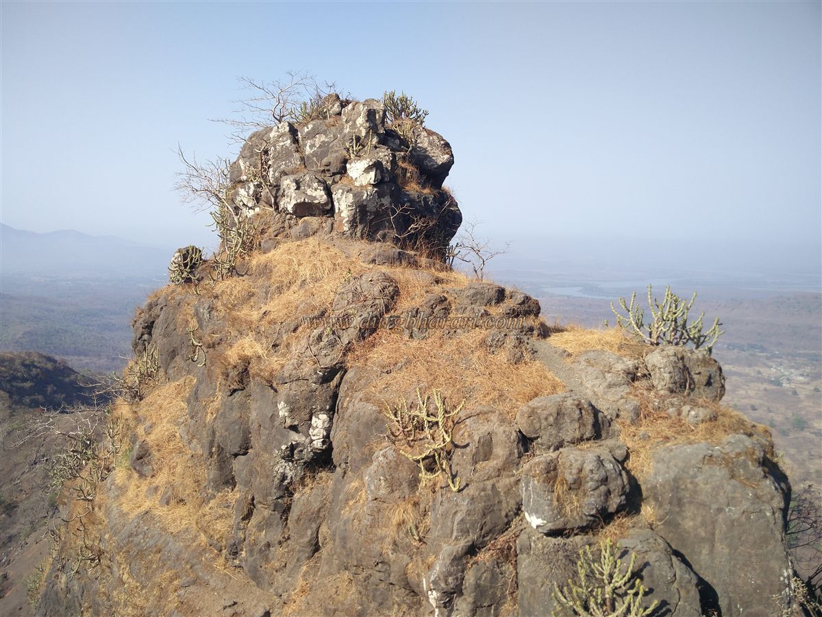
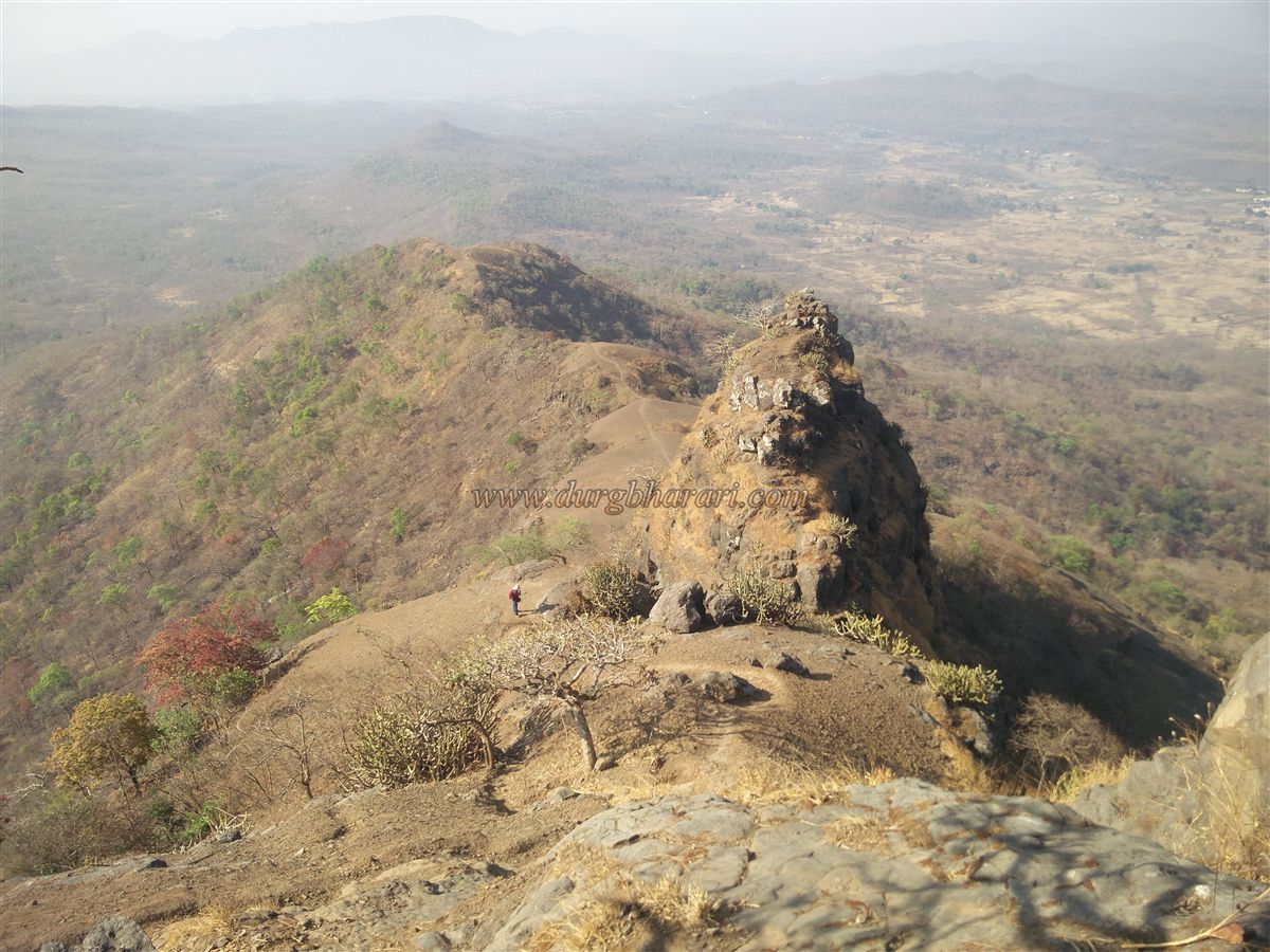
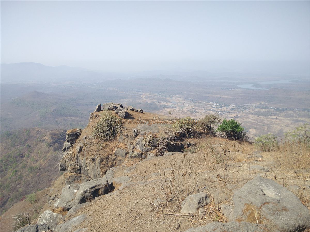
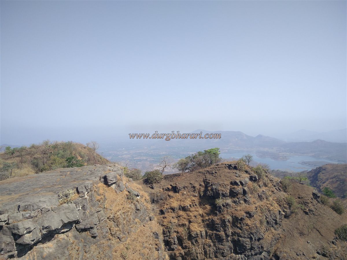
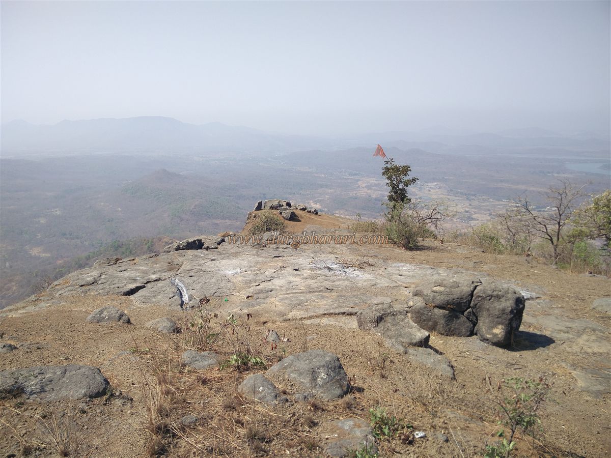
To the left along the wall is a ruined north-facing gate with some buried steps below it. Judging by its size, this was probably not the main entrance. The path to the right from here leads to the southern tip of the fort — a watchtower point from where you can see the entire route from Sakwar village, as well as the southern landscape. The fort’s top covers about seven acres and is 1,780 feet above sea level.
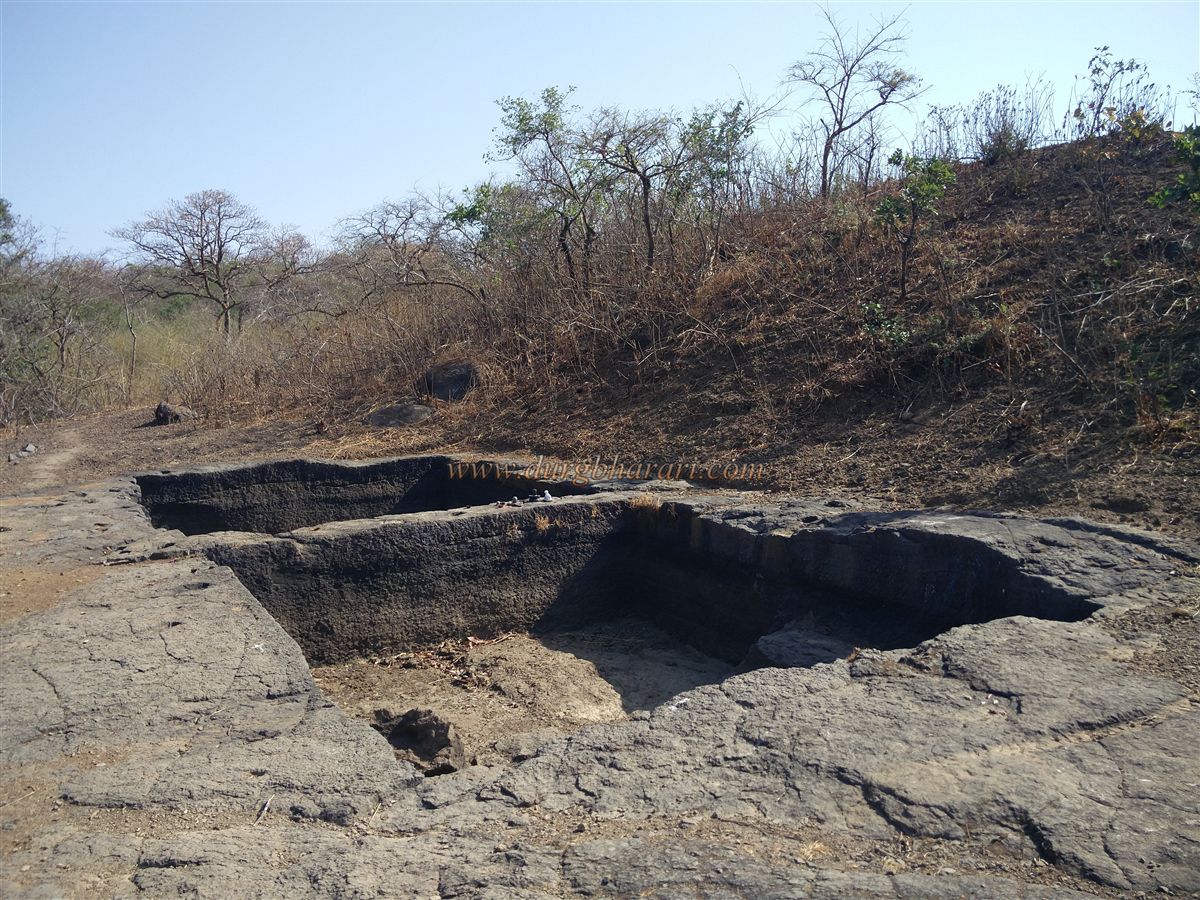
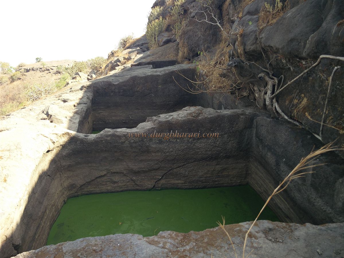
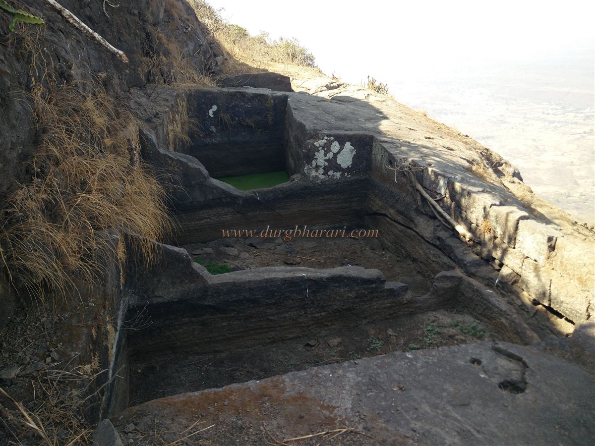
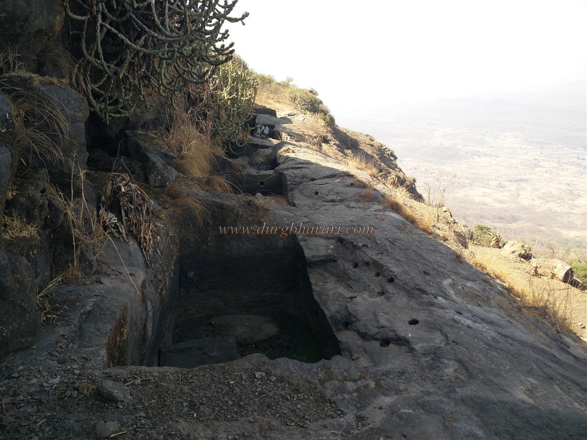
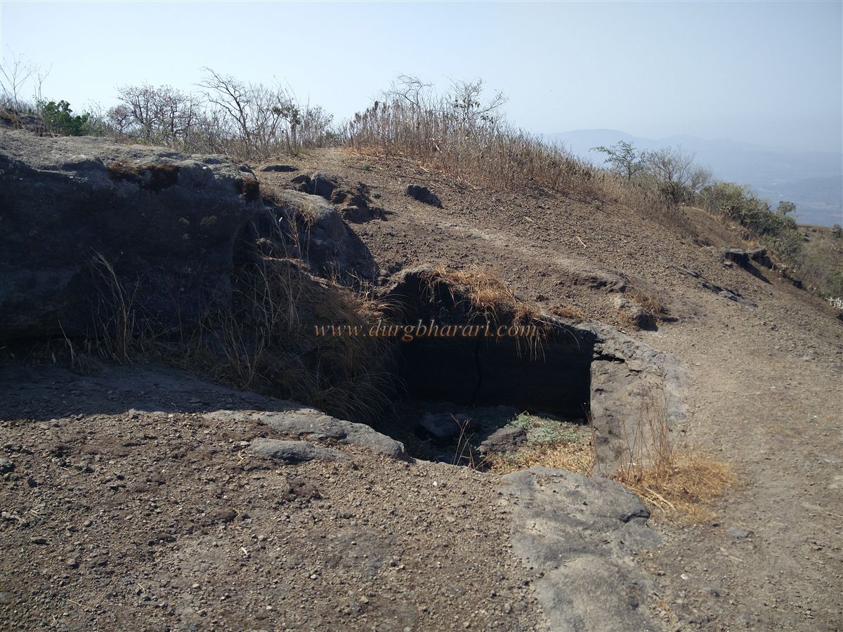
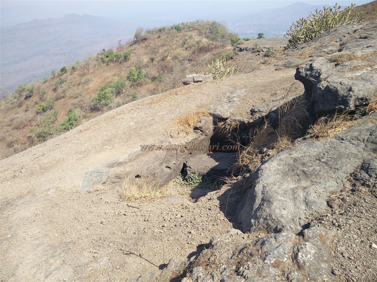
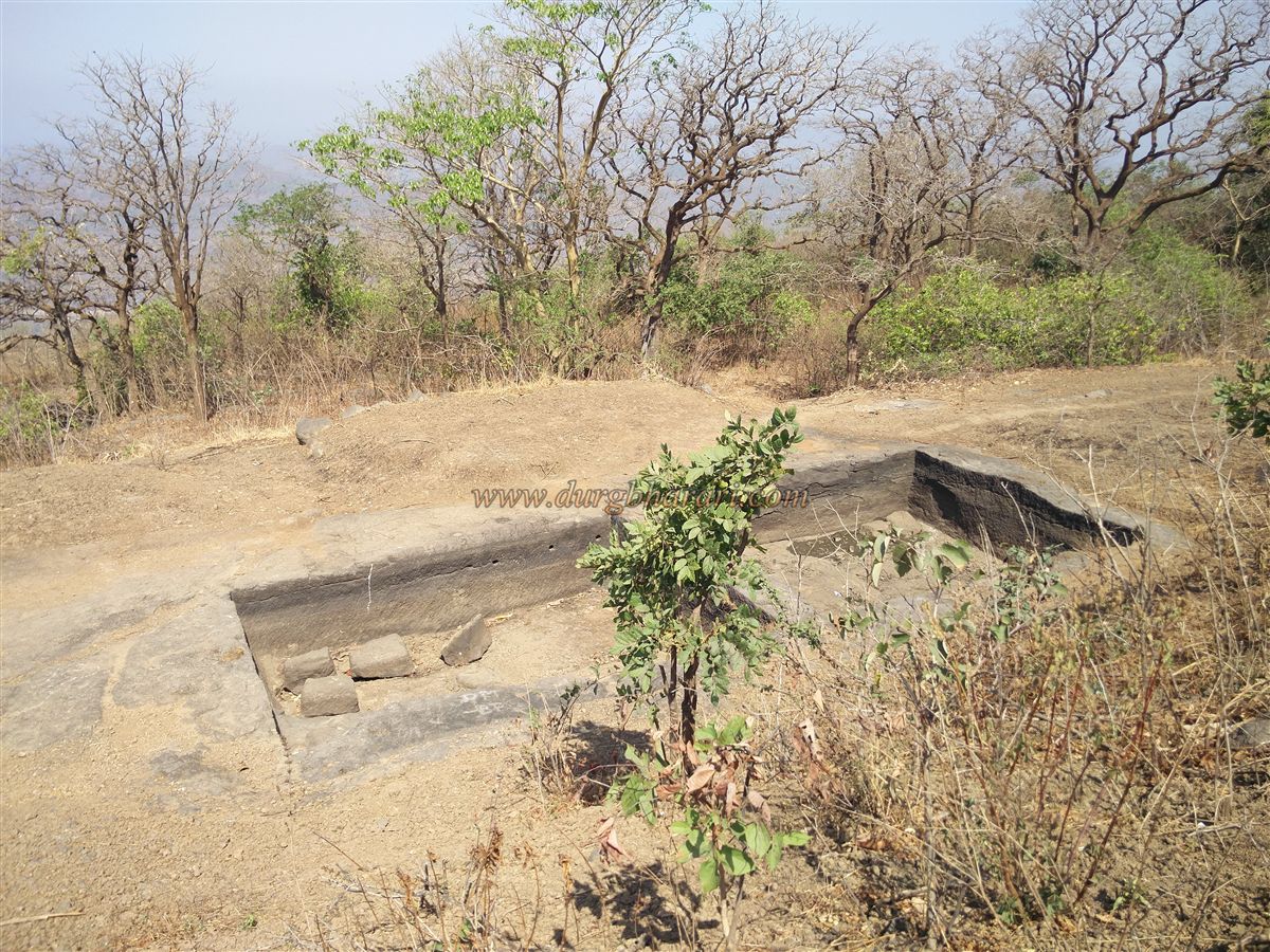
Returning from here to the wall and following the main trail begins the fort circuit. On a rise at the start are two rock-cut water tanks, which hold drinking water until February. Beside them are rock-cut trenches and holes — likely foundations for walls and sockets for wooden pillars.
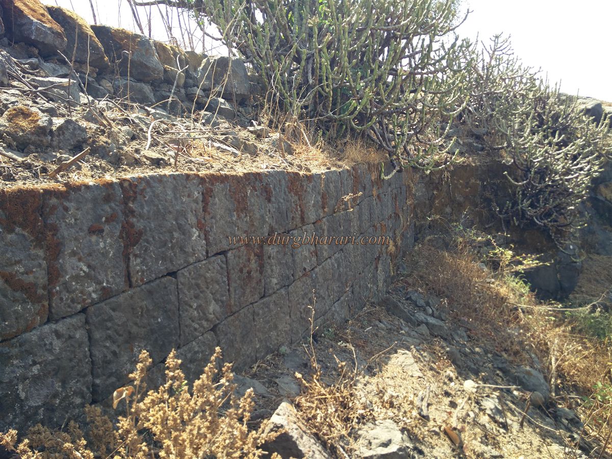
Continuing left, the path runs between dense karvi bushes, where many ruined plinths of structures can be seen. Ahead, near a cliff, are remains of a guard post, with a side path to the right leading to two broken cannons and the ruins of a small temple.
Back on the main trail, one path follows the cliff edge, the other climbs the plateau. Along the cliff path are three moss-covered water tanks, and above them, an unfinished tank. Further on, six tanks are cut in a row, now filled with stones, with blast holes showing they were destroyed deliberately. Many fallen stones from the wall are scattered here.
Skirting around from the last tank, you reach a rise at the fort’s northern tip, from where a saffron flag can be seen on a nearby hill. During a battle between the Marathas and the Portuguese, the Marathas are said to have fled toward the gate from here. The northern gate has since been completely destroyed or buried. On this rise are two large circular pits, likely the site for the fort’s flagstaff.
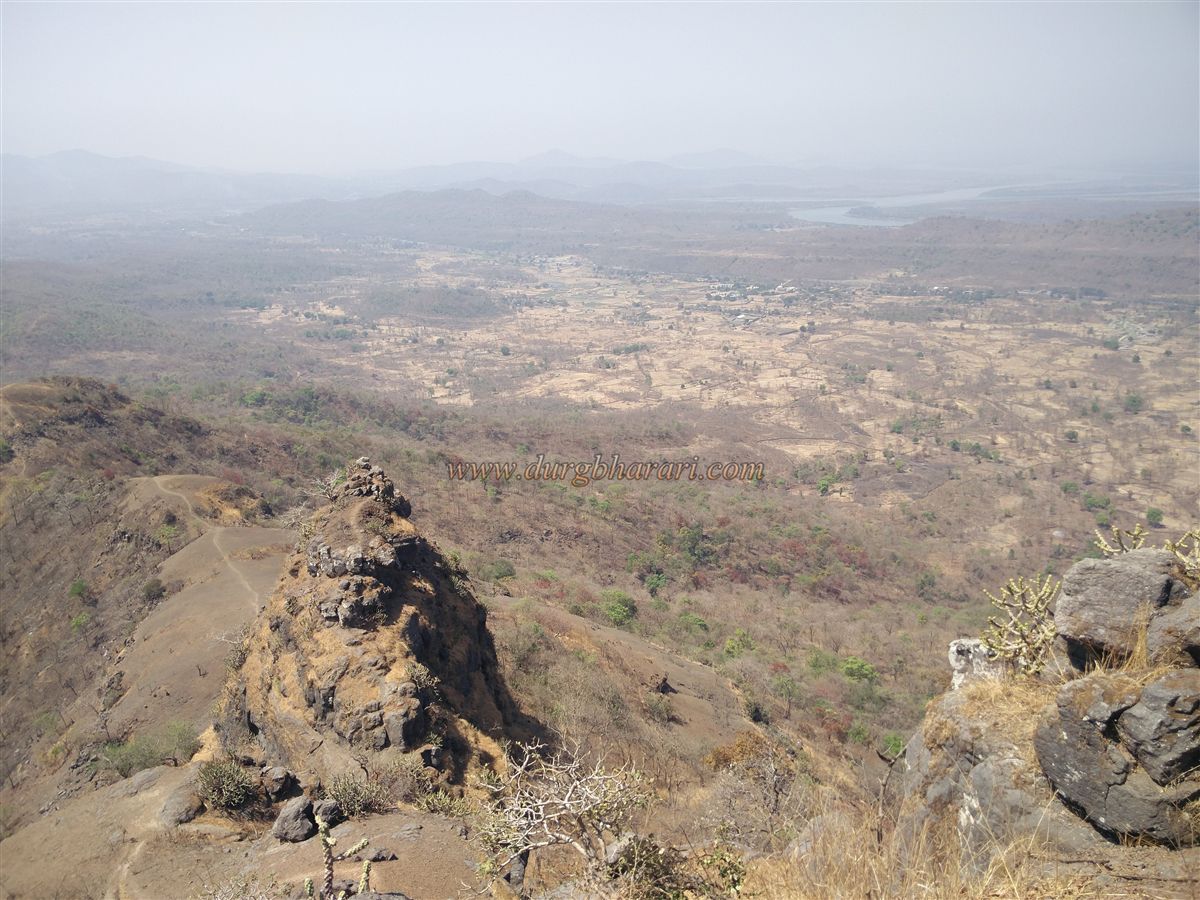
Following the wall back on the left, you pass two more rock-cut tanks and one earth-filled tank, eventually returning to the first two tanks — completing the fort circuit in about an hour. From the top, Kamandurg is visible to the south and the Vaitarna creek to the west. After February, there is no drinking water on the fort, so one should carry enough water from Sakwar village.
Takmak Fort was built in the 12th century by King Bimbadev, son of King Bimbadev, to watch over the trade route from the then capital Mahikavati (now Mahim/Kelve) to the Ghats. Later, it passed into the hands of the Sultan of Gujarat. Along with Kohoj and Asheri forts, it was captured by the Marathas but eventually fell to the Portuguese.
In the first phase of the Vasai campaign in 1732, the Marathas took Takmak Fort from the Portuguese, but under treaty terms, it was returned to them. Later, on April 8, 1737, during the Vasai campaign, Pantaji Moreswar captured it again, and Chimaji Appa granted him 25 villages as a fief for the fort.
In the early 18th century, the British used it as a prison. But after the 1857 uprising, like many other forts, its buildings, tanks, and approaches were blown up and destroyed.
© Suresh Nimbalkar
GALLERY