SUTONDA
TYPE : HILL FORT
DISTRICT : AURANGABAD
HEIGHT : 1730 FEET
GRADE : MEDIUM
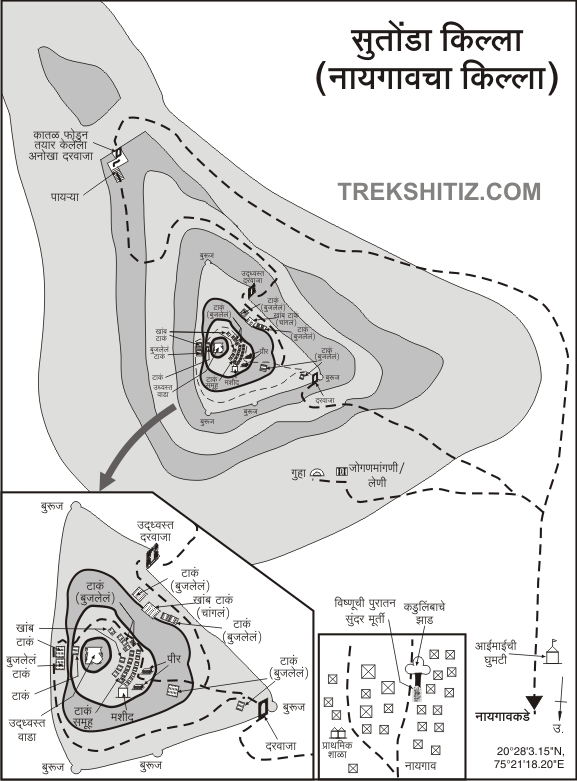
There are many forts in the Satmal mountain range from Pitalkhora to Ajanta in Aurangabad district, but apart from famous forts like Daulatabad Antur, other forts are just as unfamiliar. Known as the tourist district of Maharashtra, except for some roads joining the famous tourist destinations and highways, the district is in dire straits in terms of roads. That’s one of the reasons why no one visits these forts. The fort of Sutonda aka Naigaon in Soygaon taluka is a beautiful fort that is unfamiliar despite having many such architectural remains like ramparts, bastions, gates, water cisterns, caves, etc. To visit the Sutonda fort, you have to reach Naigaon, a village at the base of the fort. As mentioned the dire condition of the roads here, going from Mumbai to Pune via Chalisgaon is a better option. Chalisgaon Sutonda is at a distance of 48 km and can be reached from Chalisgaon-Nagad-Banoti-Naigaon to the base of the fort.
...
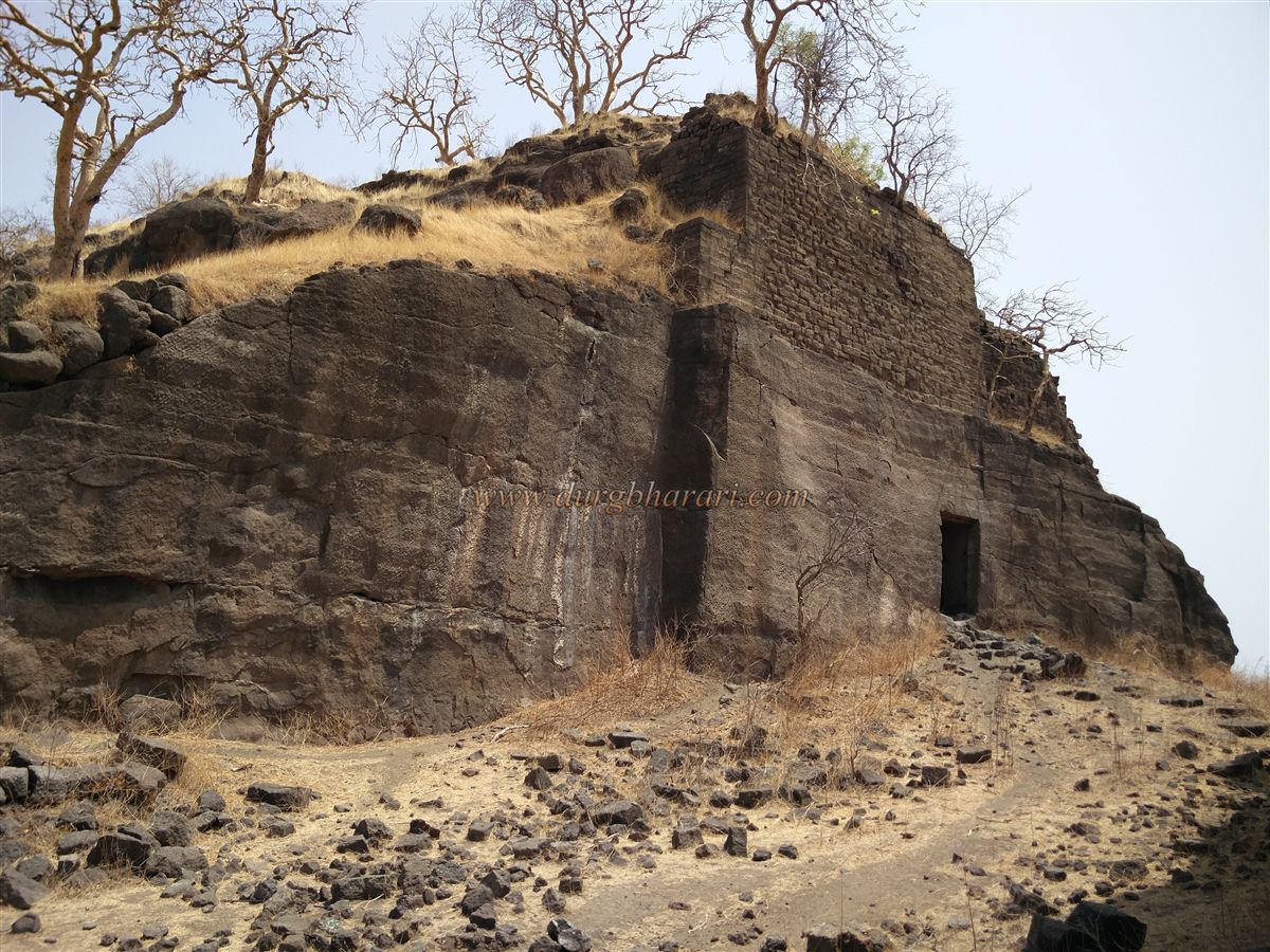
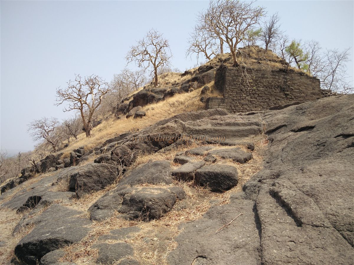
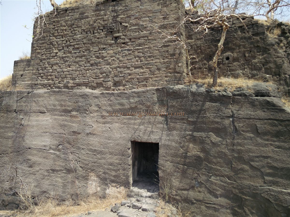
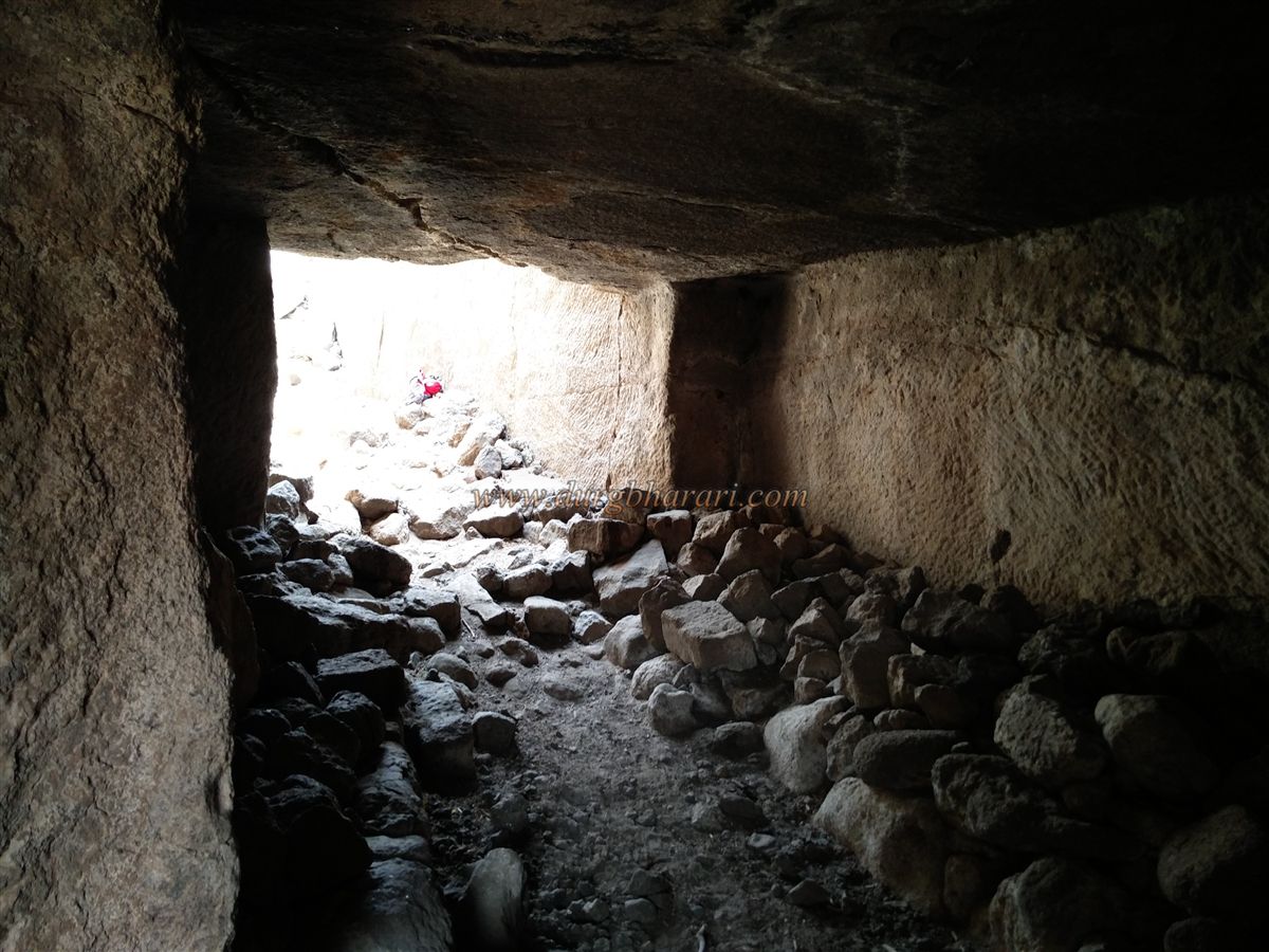
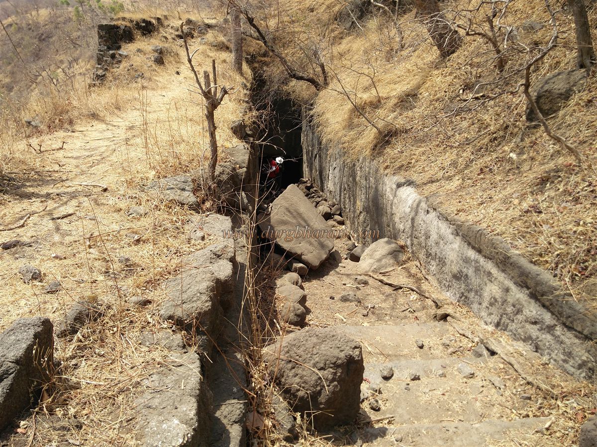
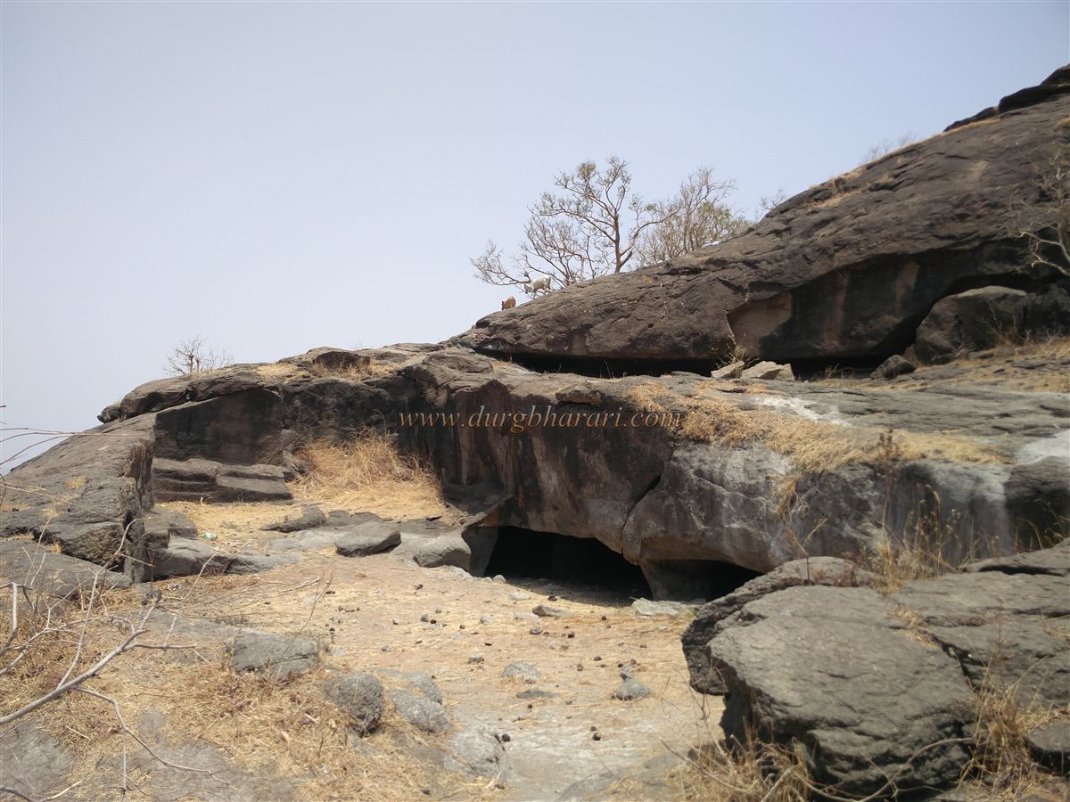
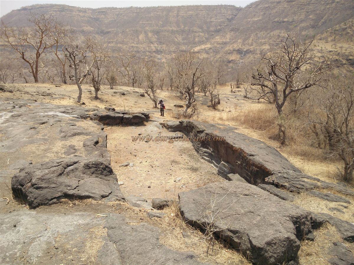
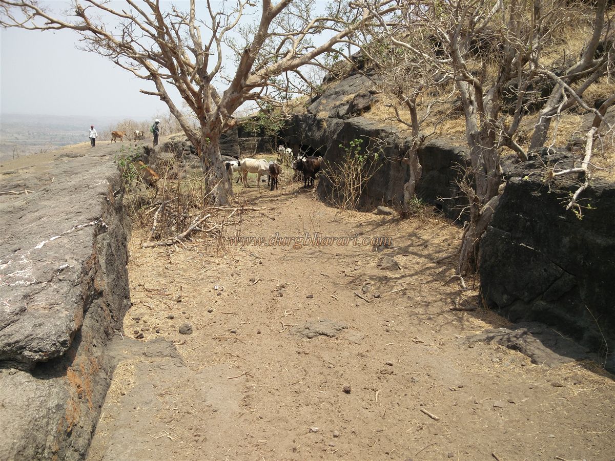
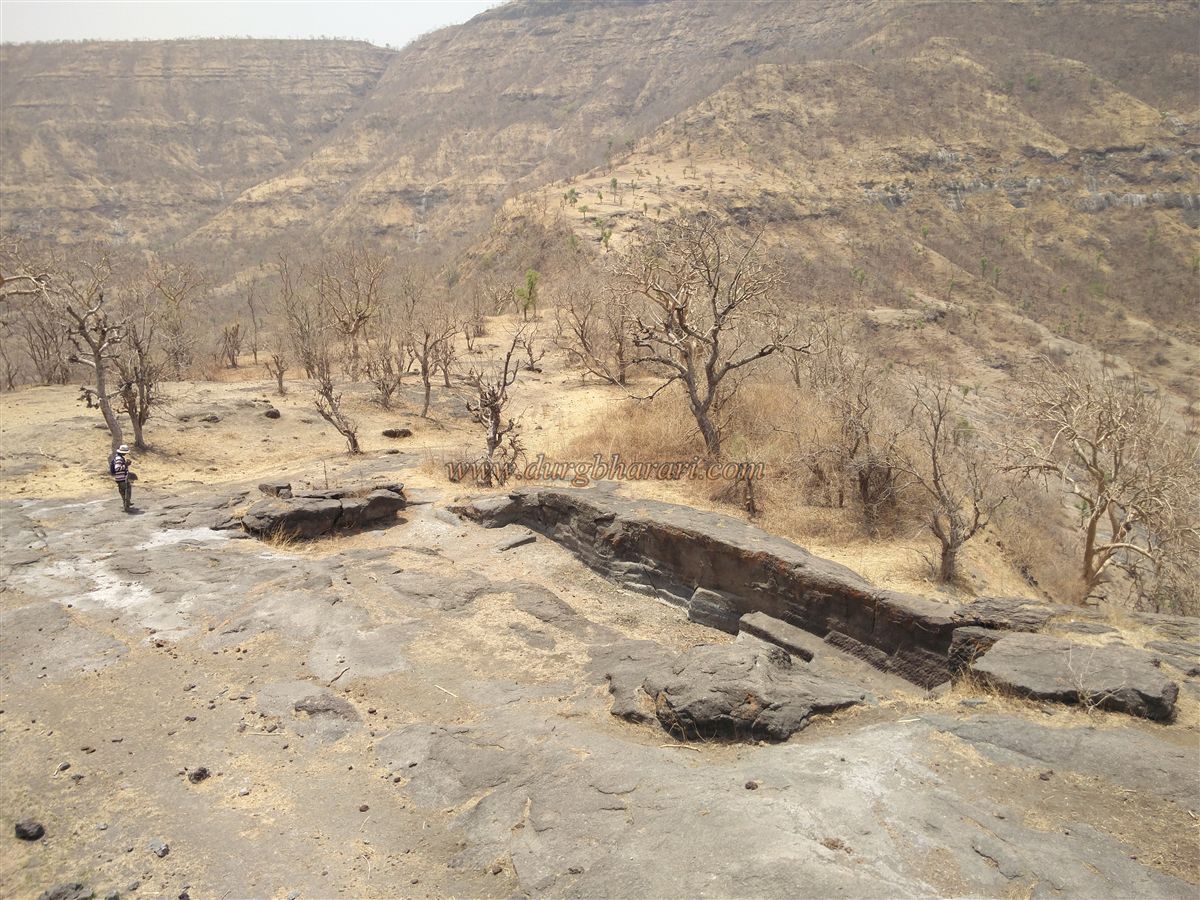
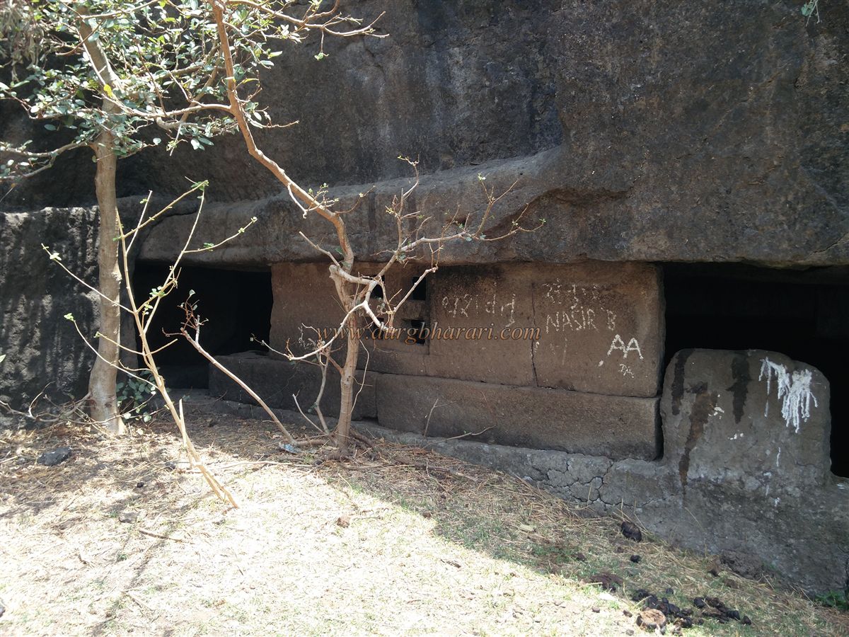
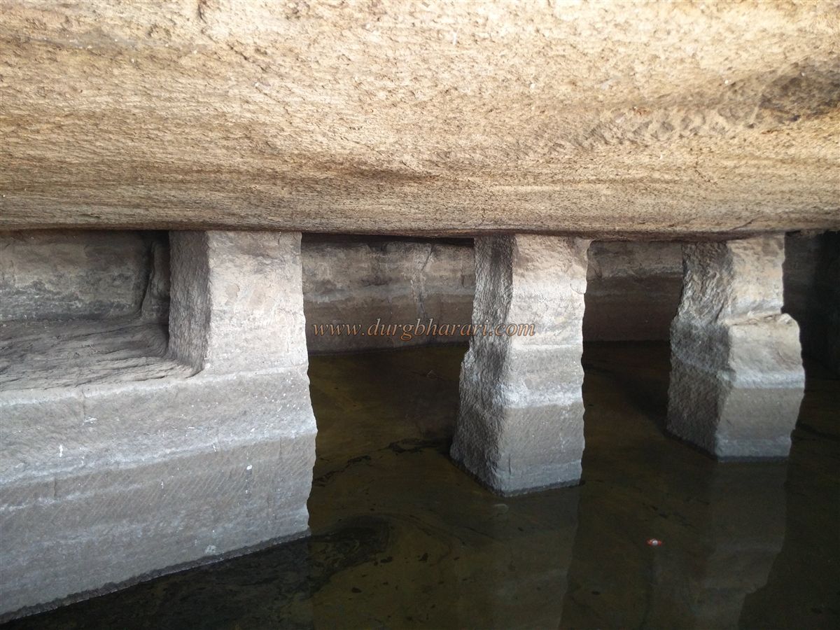
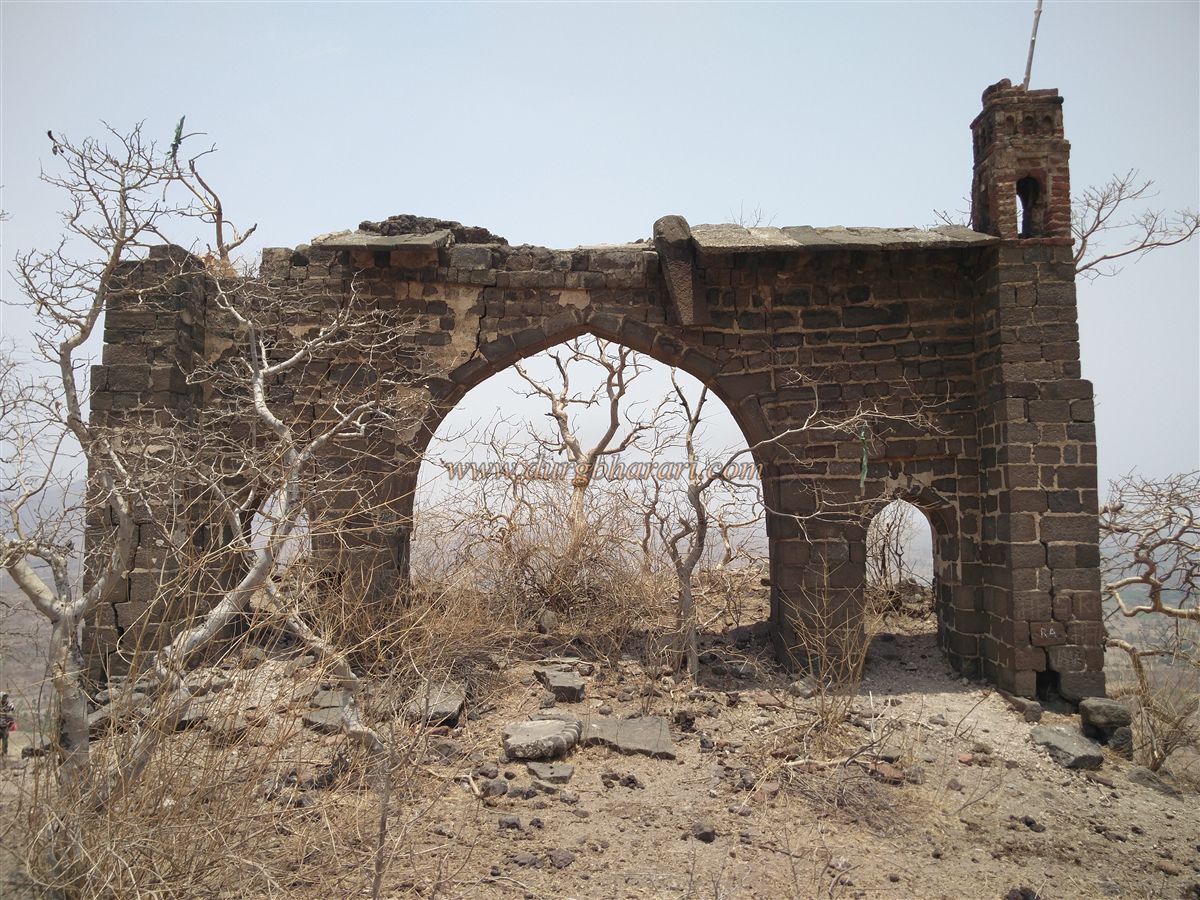
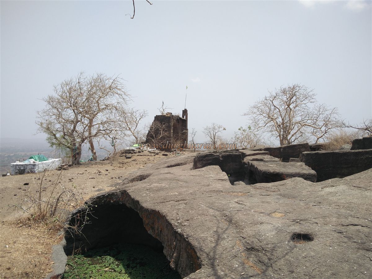
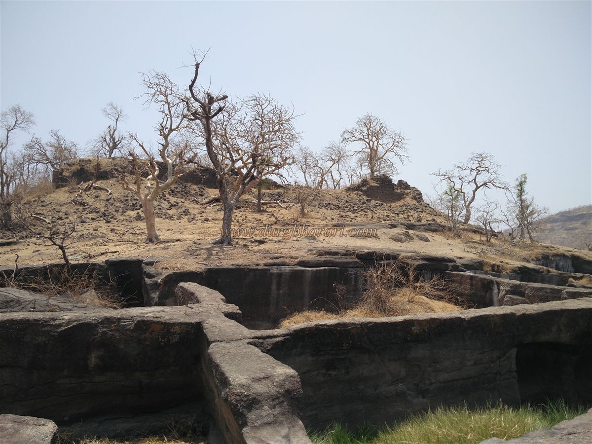
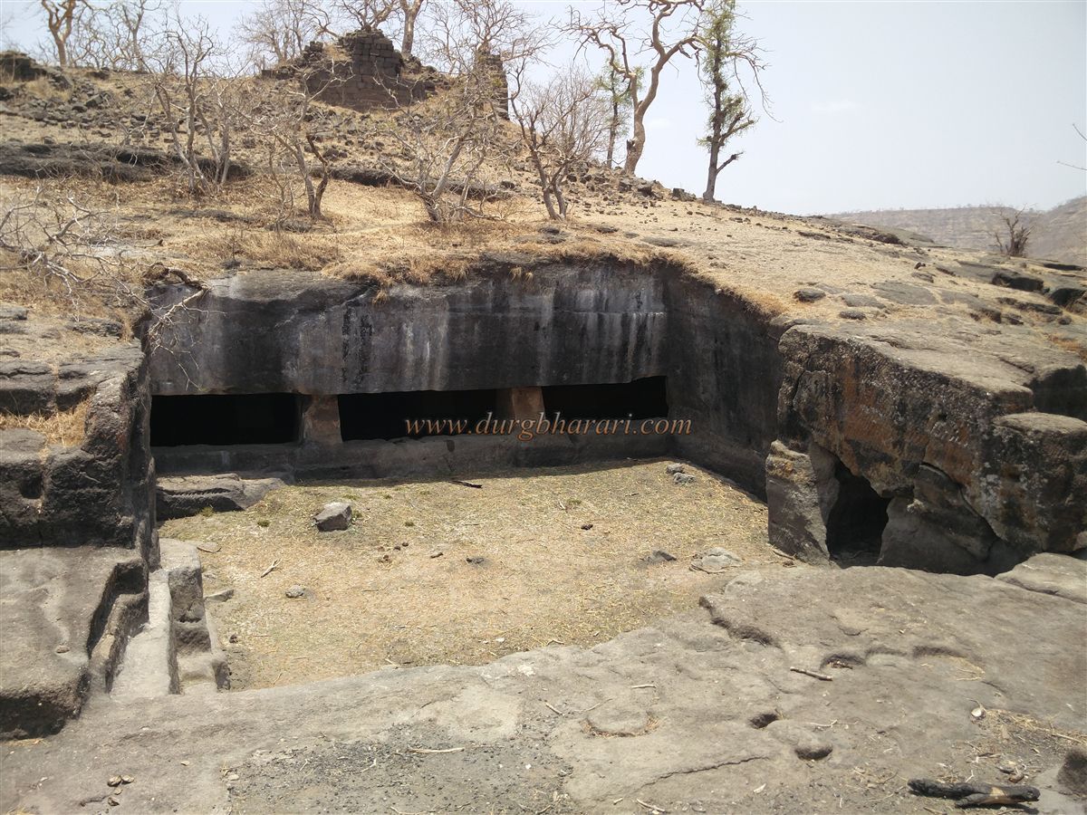
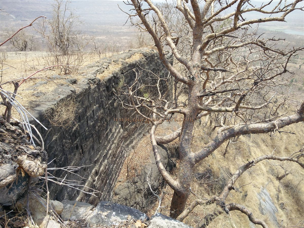
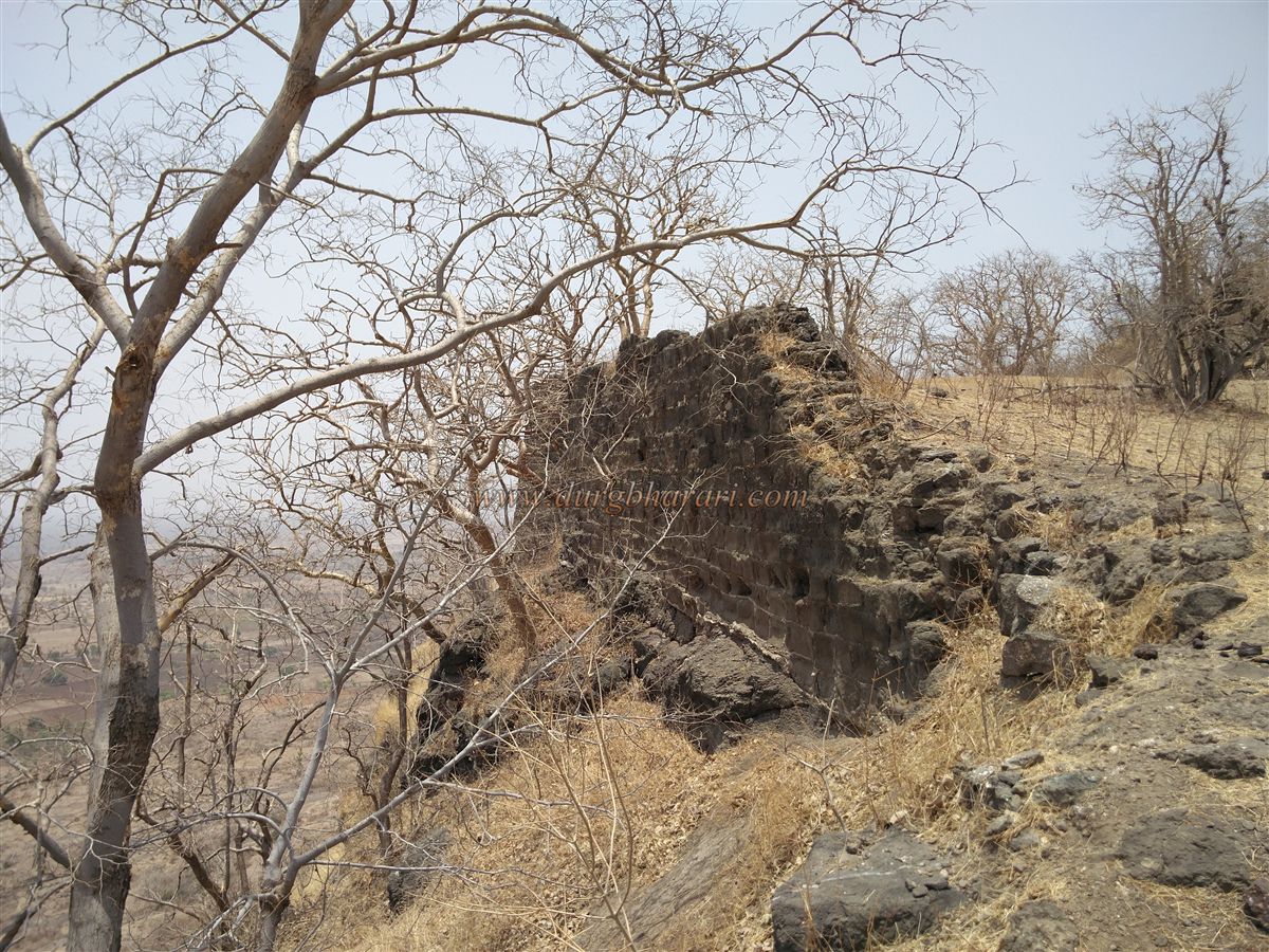
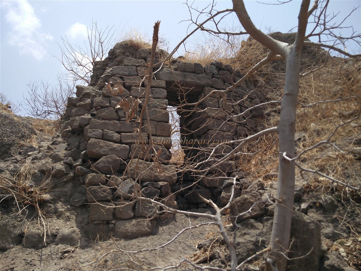
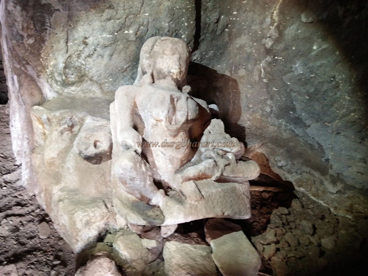
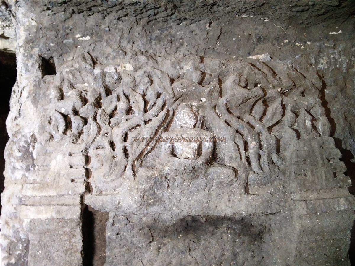
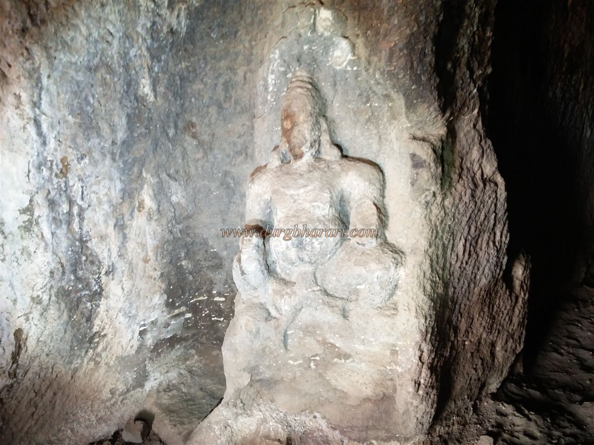
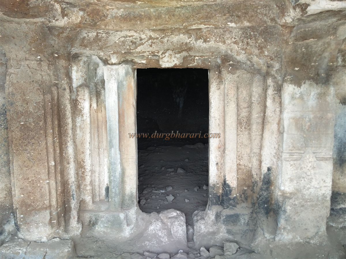
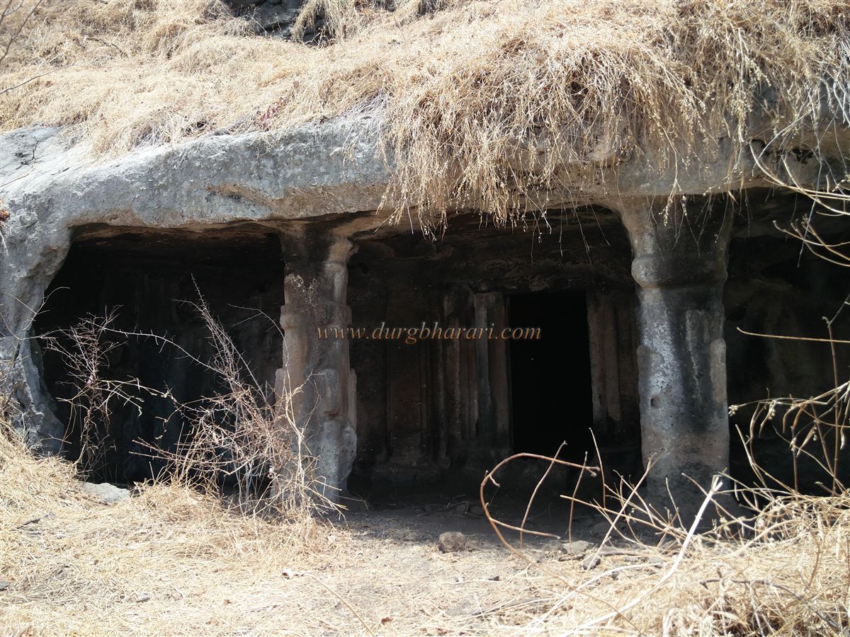
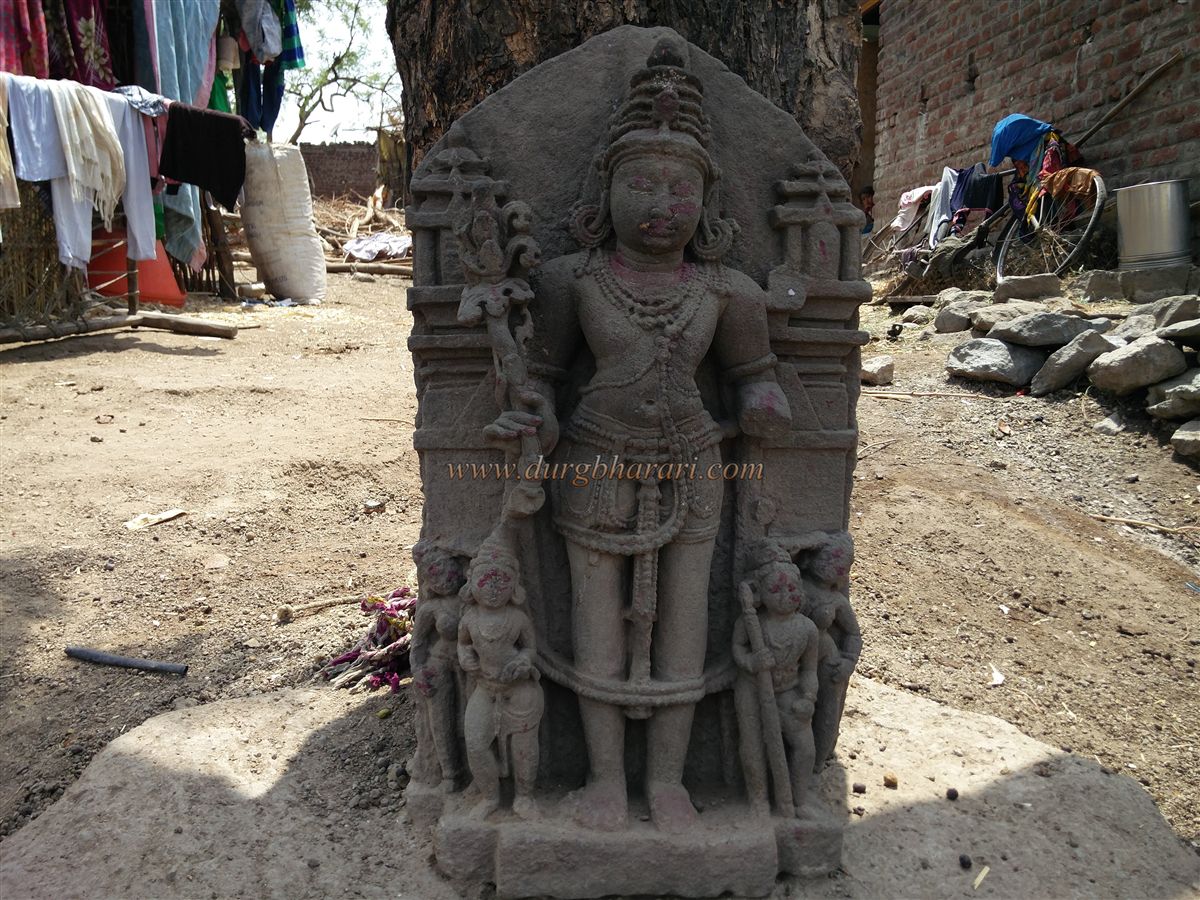
If you come from Aurangabad, the distance is 121 km and it takes 5 hours to reach Naigaon via Aurangabad-Verul-Kannad-Nagd-Banoti road. The public transport is only available up to Banoti and if you do not have your vehicle, you have to cover this 4 km distance from Banoti to Naigaon on foot. As you enter the village, you can see a beautiful idol of Vishnu under a tree in the alley in front of the school. We get amazed for a while seeing the huge hill at the back of Naigaon village, but if we look closely, we can see the remnants of the ramparts and other structures on the small hill below this huge hill. Sutonda fort is not on the main hill of Raktai but a high hill of the adjoining mountain range and it is connected to this hill to the south. On the way from the village to the fort, outside the village, there is a Hanuman temple built in a tin shelter, in which many broken ancient idols are kept. The road leading to the fort is paved and the road leads to the plateau below the fort. The rocks and quadrangle structures scattered at a far and wide distance on the plateau gives an idea that there was once a large settlement here. Here you can see a small door at the top of the ramparts. There is a steep climb to the fort from here but there are two ways to get to the fort, the second path is easy and takes a detour around the hill to reach the main gate of the fort from the backside. If you go the other way and go down through the small gate in this rampart, you can say that you have completely seen the fort. The second way takes a detour around the fort from the right side and reaches a man-made gorge. This gorge is a moat dug to separate the fort’s hill from the main Raktai hill. The main gate of the fort is present inside this moat. The length of the moat is 60 feet and the width is about 30 feet. The height of this moat is 25 feet near the hill and 40 feet near the gate. Steps are leading to the top of the hill in front of the door and a dry water cistern is present on it. Seeing this, we come to a 7 feet high north-facing door carved in the rock of the fort. The stones obtained while digging the moat were used to build a rampart on the upper side of the doorway. In this rampart, you can see a Sharabh sculpture and a mortar. Inside the door, you can see the stone hinges and patches in the door to lock it. Upon entering through the door, the carved tunnel path turns at a right angle. There are porches for the guards here and the road is carved into the rock 40 feet long inside. After entering through the door, go ahead, turn left and go up, then you come to the top of the gorge. It takes an hour to reach here from the foothills. A little further up, there is another ruined west-facing gate with some fortified ramparts. Coming straight through this door, one sees a ruined pillared cistern that looks like a cave. In front of this cistern, at some distance, on a hill slope, you can see another large, dry cistern. In the corner of the cistern is a large cave with a collapsed pillar and a carved window can be seen in the wall of the cave. Water is stored inside the cave. From this cave, you can see two more dry cisterns on the way down the hill. There is another pillared cistern which is like a cave in the next part of the road and a room is carved inside this cistern. In the upper part of this cistern, two ruined joint cisterns can be seen. From here, one can see the Idgah-like structure with a large arch in the middle and two small arches next to it, and a small bastion at the end. There are two tombs on the left side of this building and a group of 20-22 cisterns can be seen in front. 6-7 of these cisterns are carved in the rock and are connected from the inside. The cisterns have a smallmouth on the upper side to prevent the evaporation of water. In the center of this cisterns group is a semi-carved cave with two pillars and at the top of the cave is another half-carved cave with four pillars. Both these caves have water storage and some sculptures and carvings can be seen on the pillars of these caves. After climbing up from the second cave, we reach the highest part of the fort. The height of the fort is 1740 feet above sea level and the triangular-shaped fort is spread over an area of about 15 acres from south to north. Seeing this, after descending a little towards Naigaon, turning right, we reach the bastion at the northern end of the fort. Turning back from this bastion, you get to see two more large water cisterns. One of these cisterns is a cave-like cistern and has 8 pillars. Considering the total structure of the three cave cisterns on the fort, this water cistern should have originally been a cave or a barn and due to water logging, this cave or barn would have been transformed into a water cistern. As the footpath leading from here is broken, turn back and come to the lower side of Idgah by taking a detour from the ramparts towards Naigaon. The ramparts in this part of the fort are still largely intact. In this rampart, you can see a total of 4 bastions. On the bastion at the end towards Naigaon, there is a door that can be seen from the plateau below when you start climbing the fort. This 5 feet high door is built without using any mixtures like cement or lime. In 15 minutes we reach the base of the fort through this gate. On the way down, you can see the Jain caves known locally as ‘Joganmaiche Gharte’ or Jogwa Maganrani's House. After descending half a fort on this path, you can see a path parallel to the ramparts on the right side. After walking for 5 minutes along this path, you can see two caves carved in the rock on the upper side. The first cave has two sections, the gallery, and the prayer hall, and the gallery has two pillars carved into it. The image of Tirthankar is carved in the center above the door frame of the room. In this room, on the right side, there is an idol of Ambika Yakshi on her knees with a child, this idol is 2.5 feet high and on the upper side, there is an image of Mahavir carved on the wall. In the room on the left, there is a 2 feet high carved image of this Yaksha. The inner room is square-shaped and there are no carvings in this dusty room. The next part of the cave has some steps carved in the rock and when you go up these steps you can see another cave with two pillars. There are water cisterns outside the cave and the cave is filled with a large amount of mud. When you see this cave and come to the original path, your journey is complete. Half an hour is enough to reach back to the village from here. Looking at the caves and water cisterns on the fort, it must have been built in ancient times i.e. in the 4th-5th century. Considering the construction of the ramparts, they might have been built during the Bahamani period. This fort came under the control of the Nizamshahis who became the rulers after the disintegration of the Bahamani kingdom in the 16th century. In the book Badshahnama, on the orders of the Mughal emperor Shah Jahan, the Mughal chief Sipahunder Khan In 1630-31, with the help of a large army, invaded Sutonda fort, and Siddi Jamal, the fort keeper, surrendered. The fort is referred to as Saitenda in the Aurangabad British Gazette and is said to be 26 miles northeast of Kannada. The gazette also mentions that Aurangzeb had rewarded some Deshmukhs for the fort.
© Suresh Nimbalkar
GALLERY