SURJAGAD
TYPE : GROUND FORT
DISTRICT : GADCHIROLI
HEIGHT : 0 FEET
GRADE : EASY
When one hears the name Gadchiroli, an image immediately comes to mind of a Naxal-affected, predominantly tribal and underdeveloped district. Because of this perception, despite having abundant tourism potential, this region rarely attracts tourists. Not only have that, but even historians seldom visited, leaving the area’s historical heritage largely unexplored. However, in recent years, with development gaining momentum, this picture has started to change, which is indeed heartening. As tourists and researchers are beginning to visit, many new aspects of this region are coming to light.
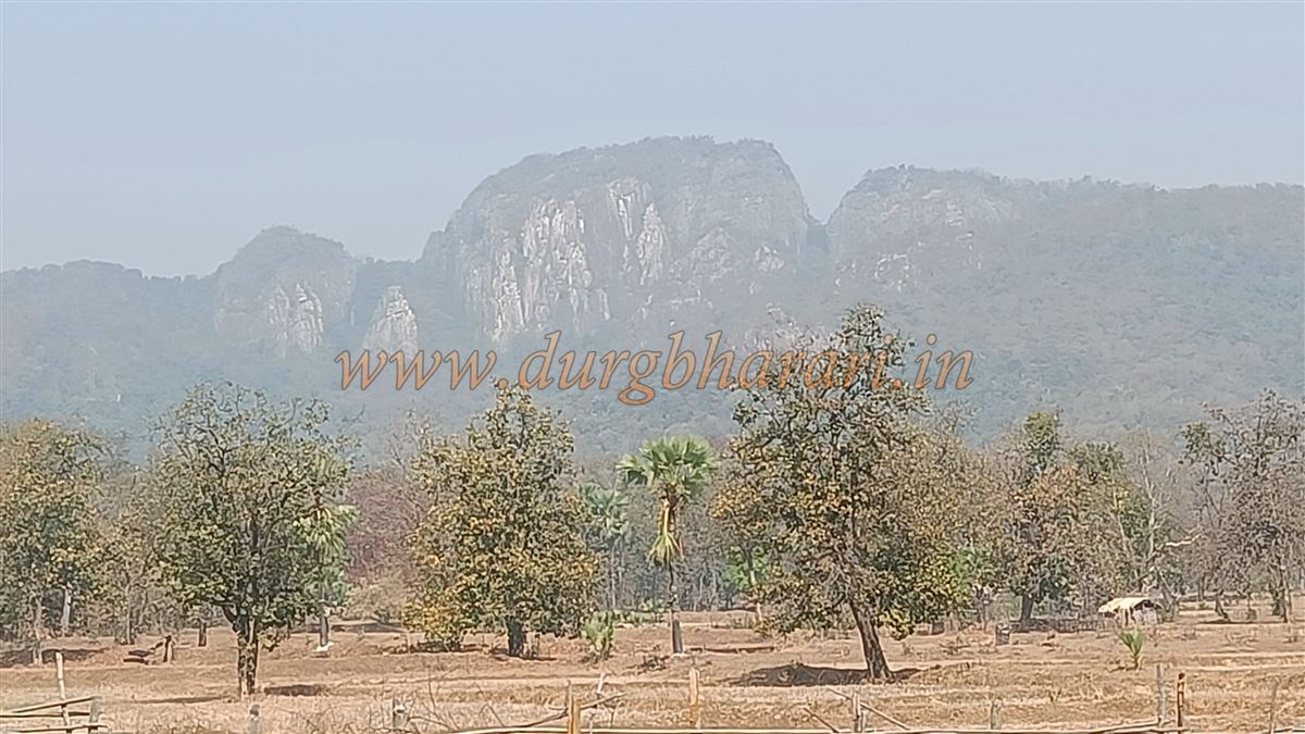
In the Etapalli taluka of Gadchiroli district lies a small village called Surjagad. Nestled in this village is a hill fort of the same name. Rich in natural beauty, dense forests, and tribal culture, this village was once marred by the stain of Naxalism.
...
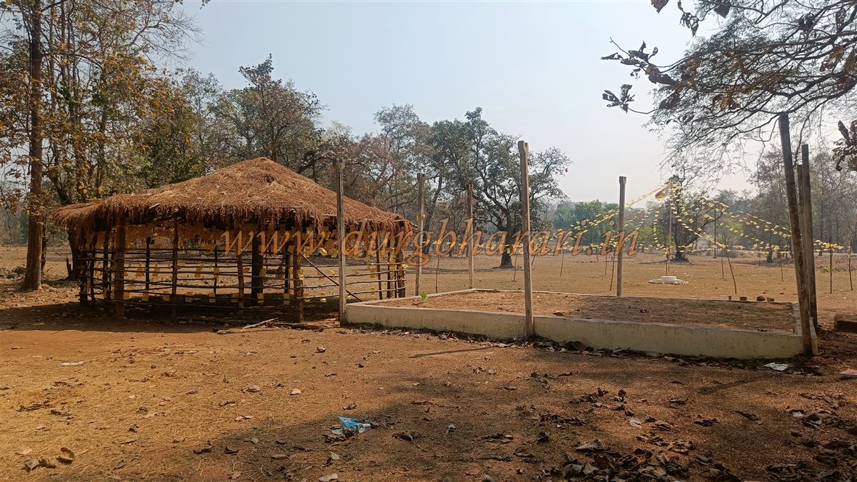
Though Naxalism has now been eradicated, a shadow of fear still lingers in the minds of locals. On two previous expeditions to explore forts in Gadchiroli, we were unable to climb this fort because the locals refused to accompany us. At that time, someone had told us that the locals only climb the fort on Mahashivratri, and that would be the right time to visit. So, this year (2024), we came to Surjagad on the occasion of Mahashivratri, but once again, disappointment awaited us. Upon reaching the village, we were informed that the annual fair of Thakur Dev takes place every year on the 5th and 6th of January, in the first week of the month. This is the main festival of the tribal communities of Gadchiroli and neighbouring districts. It is only on these two days that the locals climb the fort; no one climbs it on any other day.
Surjagad Fort is located in the Maharashtra–Chhattisgarh border region in Etapalli taluka. To reach the fort, it is essential to stay overnight in Surjagad village at the base. The distance from Gadchiroli to Surjagad is 123 km, while from Etapalli, the taluka headquarters, it is 26 km. Apart from a government rest house at Etapalli, and there are no options for food or lodging. Public transport is also limited, so it is advisable to travel by private vehicle, preferably during the daytime. While there are a few scattered settlements between Etapalli and Hedri, the stretch from Hedri to Surjagad has no human habitation.
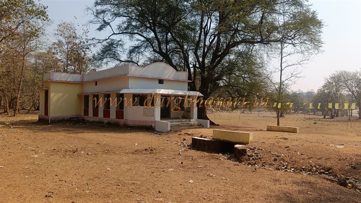
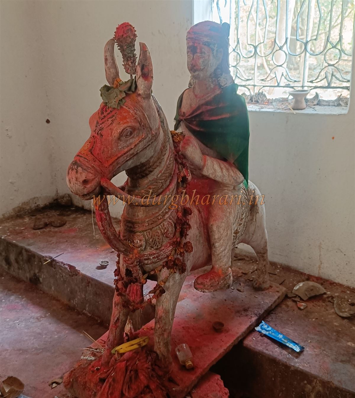
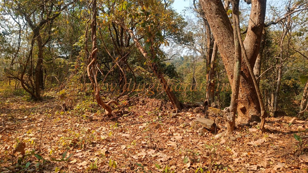
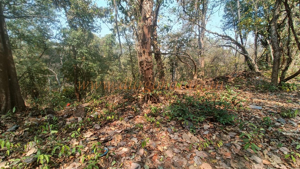
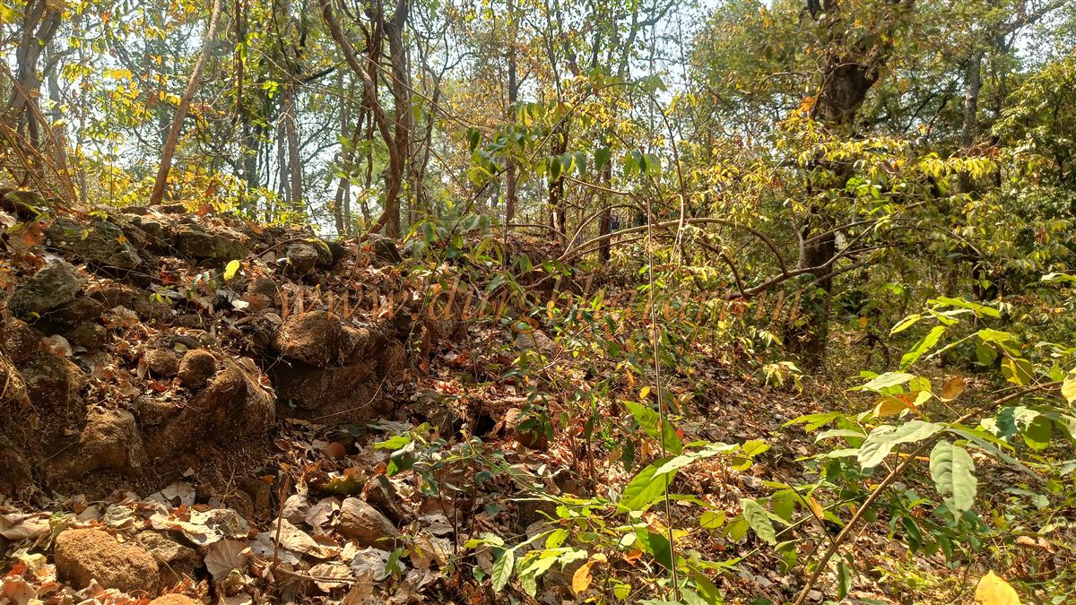
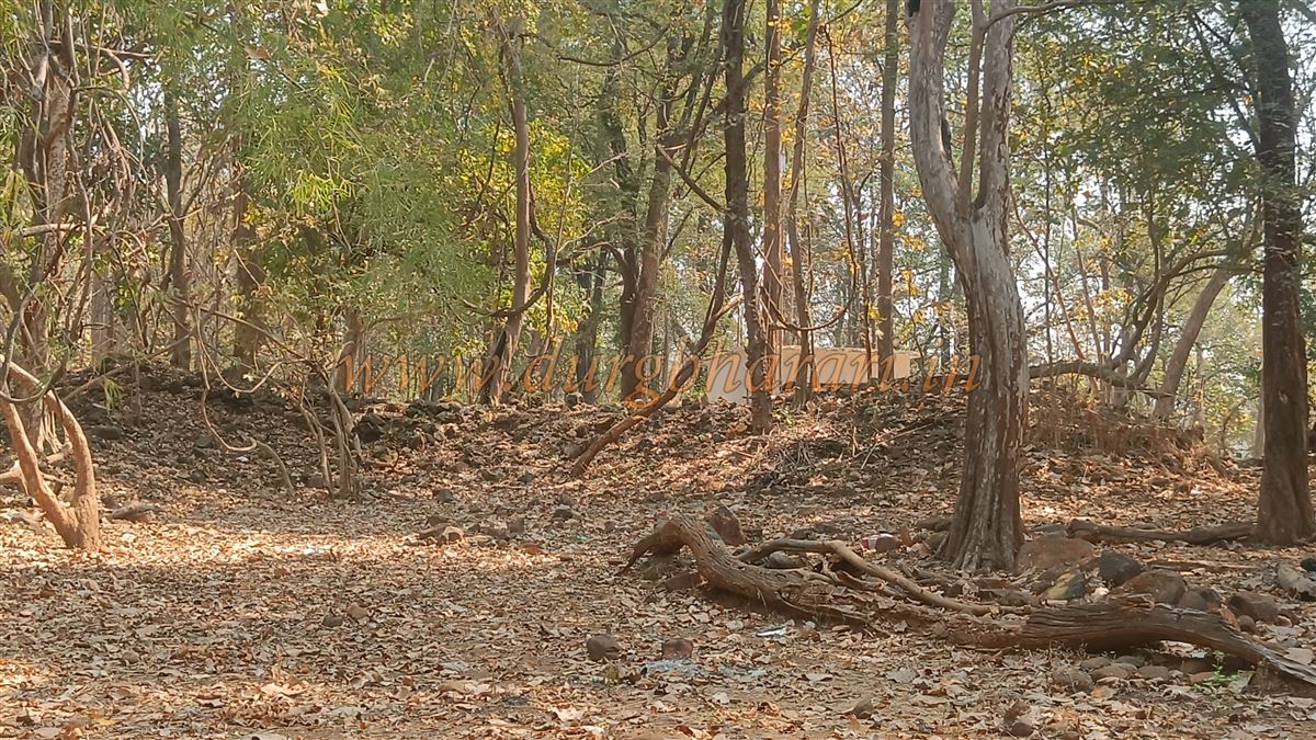
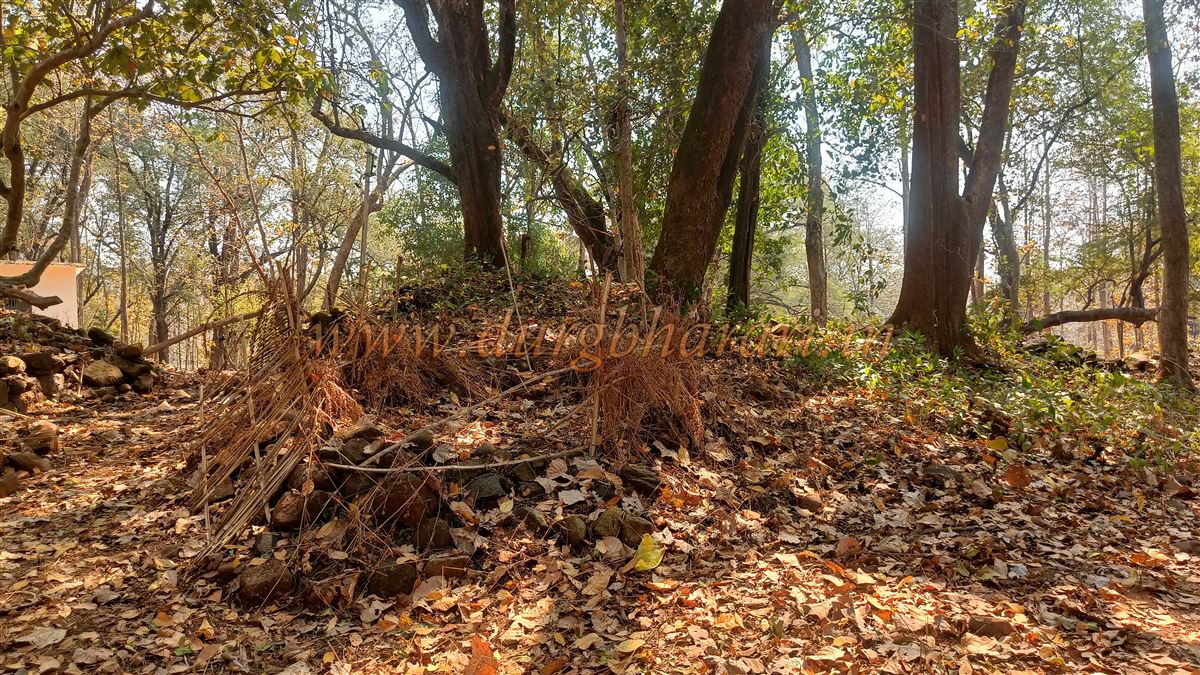
Just before reaching the village, on the left side of the road, stands a small temple dedicated to Thakur Dev, where the annual fair is held. Since no one was willing to accompany us to the fort, we at least decided to visit the temple for Thakur Dev’s darshan. The temple houses an idol of Thakur Dev mounted on a horse. Behind the temple, there is a path leading to the fort, but looking at the dense jungle ahead, we decided not to attempt the climb without a guide. However, our visit to the temple was not wasted.
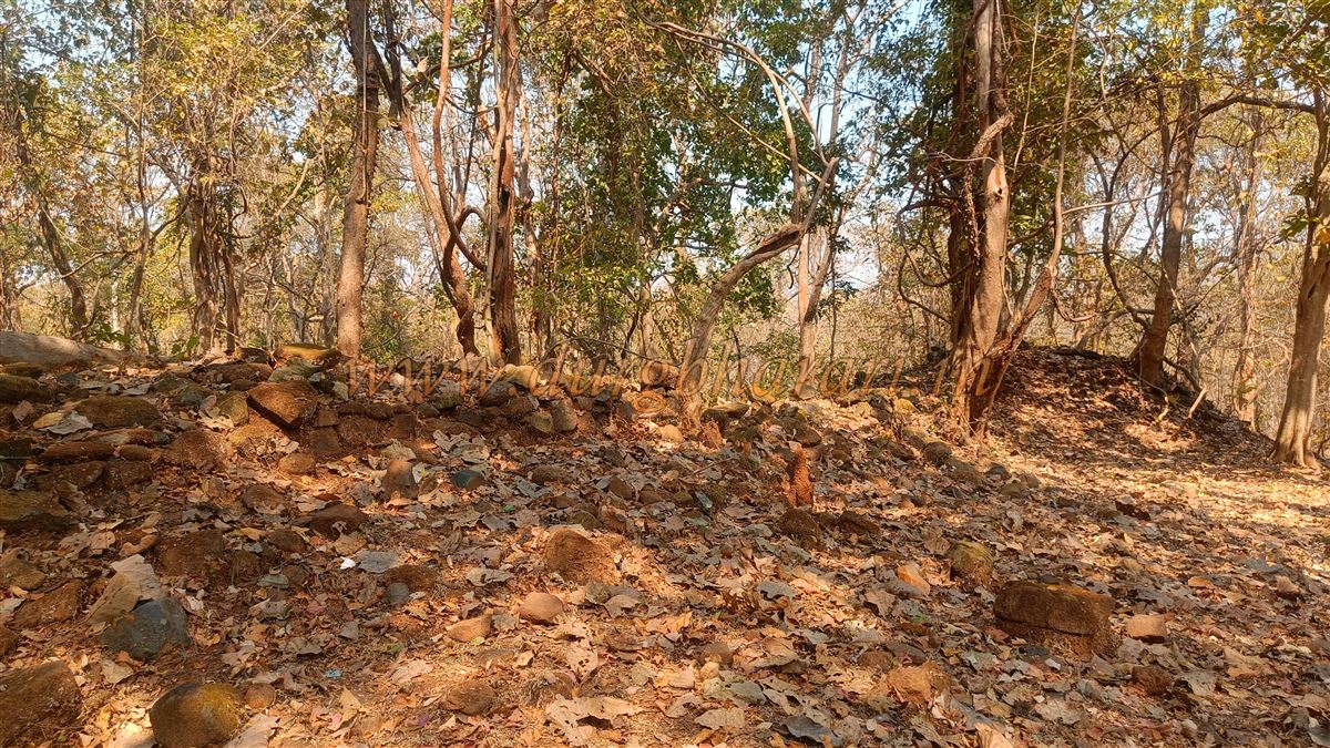
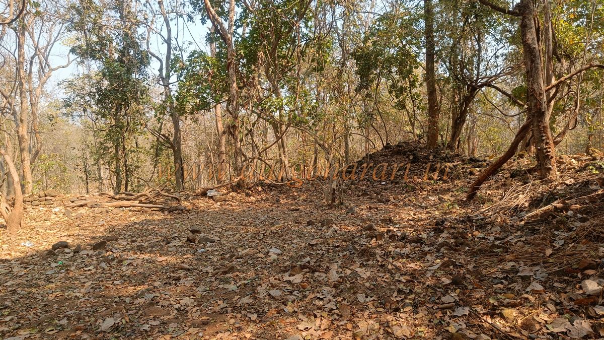
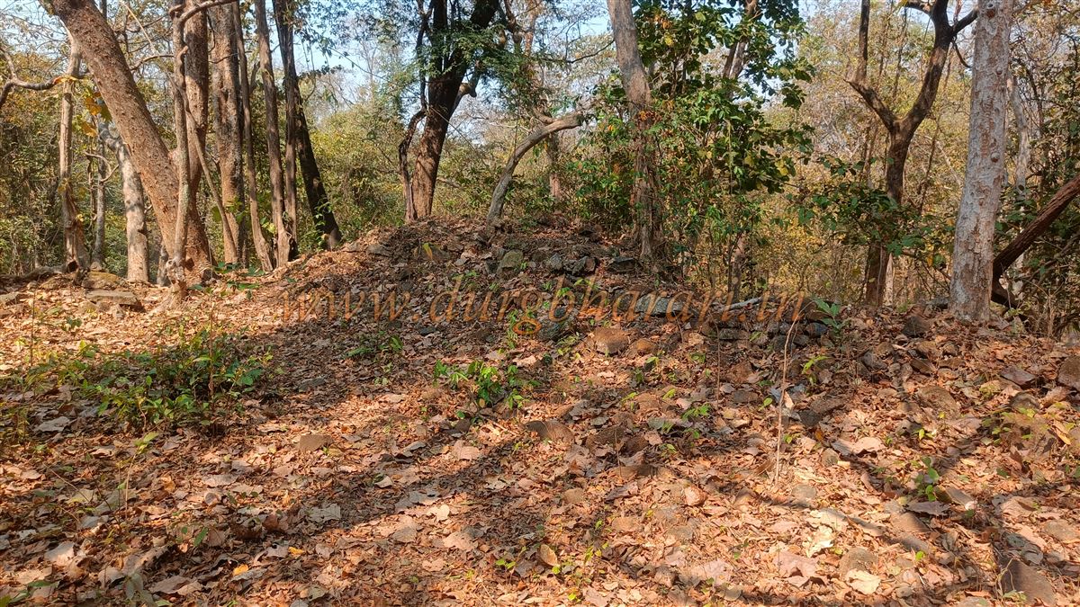
In front of the temple is a mound-like elevation, roughly about one acre in size, surrounded by fortification walls. Among the six bastions on this ruined wall, one has been newly repaired with a cement platform covered by a green sheet. There is only one entrance to this enclosure, now completely collapsed. The pile of stones at the base of the broken wall, standing 5–6 feet high, suggests that the fortification was once fairly tall. Inside this fortification, apart from the ruins of a single large structure, no other remnants remain. Looking at the layout and size, this structure appears to have been either a ground fortification or a fortified mansion. It takes about 15 minutes to explore this site. From here, the climb to the top of Surjagad Fort reportedly takes 3–4 hours, as informed by the locals.
Historically, Gadchiroli lies on the banks of the Wainganga River and was part of the prosperous Vairagad province. Kautilya’s Arthashastra mentions diamond mines and elephants in this region. Over the centuries, it came under the rule of the Maurya, Satavahana, Kalchuri, Rashtrakut, and later the Kakatiyas. The Kalchuri rulers built the famous Markanda temple complex on the banks of the Wainganga, a testament to the area’s prosperity. Akbar’s Ain-i-Akbari also records the presence of elephants in this region. The Cholas, Yadavas of Devgiri, and the Adilshahi of Bijapur all launched invasions here for its resources.
Later, this area came under the rule of the Nagavanshi Manas and then became part of the Gond kingdom of Chanda, within the Vairagad province. Between 1447 and 1472, Gond king Surja Ballal Shah ruled the region, and Gadchiroli is mentioned in the list of 52 Pargana under his control. The exact date of Surjagad construction is unknown, but according to local belief, it was built by King Surjat Badwaik, who succeeded Kurum Prahod. Since it was completed during his reign, the fort was named after him.
The name “Gadchiroli” is believed to have originated from the Chiroli hills in this region. On April 20, 1795, British officer Captain J. T. Blunt, tasked with charting a route from Odisha–Chhattisgarh–Gondwana to southern India, visited Gadchiroli. He described it as a “large village” (Chiroli Fort) with limited trade activity. He noted that the area from Kanker to Baster was extremely dangerous, inhabited by extremely primitive tribes who even practiced human sacrifice. Apart from the Vanjari, who supplied salt and grain, no one dared travel through this region for fear of losing their lives.
© Suresh Nimbalkar
GALLERY