SURGAD
TYPE : HILL FORT
DISTRICT : RAIGAD
HEIGHT : 970 FEET
GRADE : MEDIUM
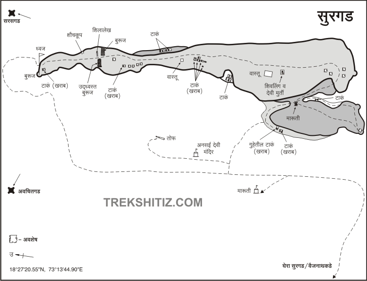
On the way to Konkan from the Mumbai-Goa highway, the mountain range of Sahyadri on the left side of the road is constantly with you. While passing through the Raigad district, many forts like Karnala, Sankashi, Mirgad, Surgad, Songad, and Chambhargad are easily visible. Surgad is the fort with the most amount of remains among all these forts. After crossing the Sukeli gorge of Nagothane on the highway between Nagothane-Kolad, one can see the Surgad fort, which extends from the main Sahyadri range to the left. To visit this fort located in Roha taluka of Raigad district, you have to reach Khamb village on Mumbai-Goa highway at a distance of 107 km from Mumbai. 2 km from Khamb village is the village of Vaijnath and at a distance of 1 km from there is the Gherasurgad village located at the base of the fort.
...
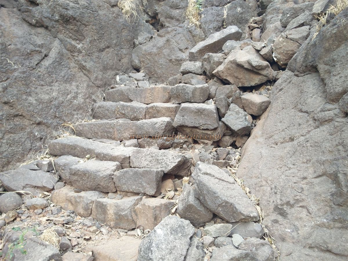
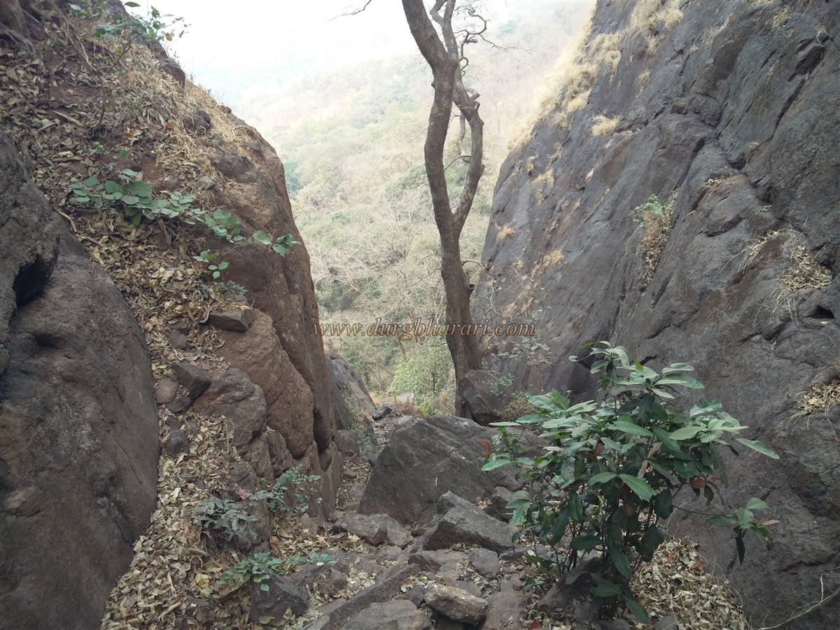
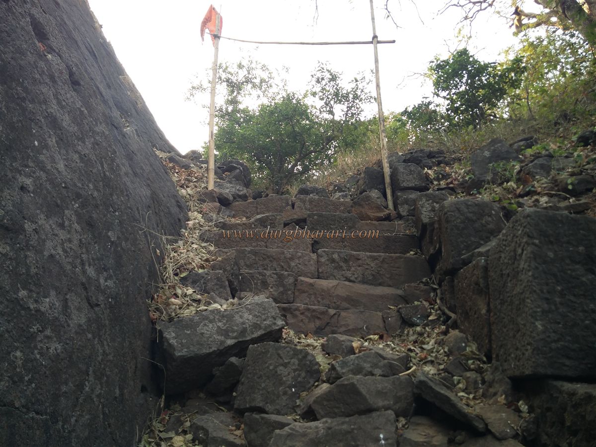
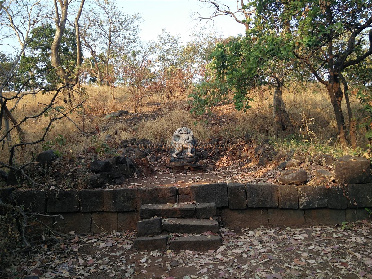
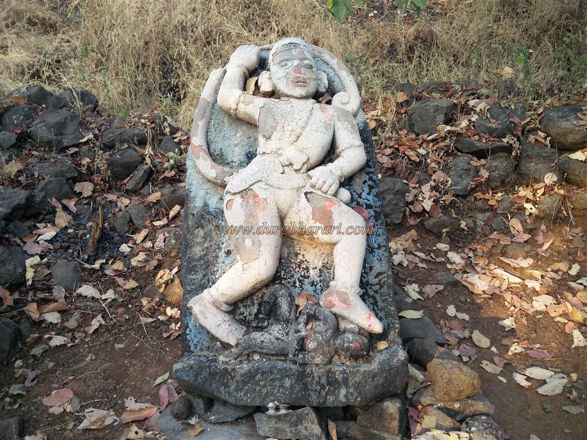
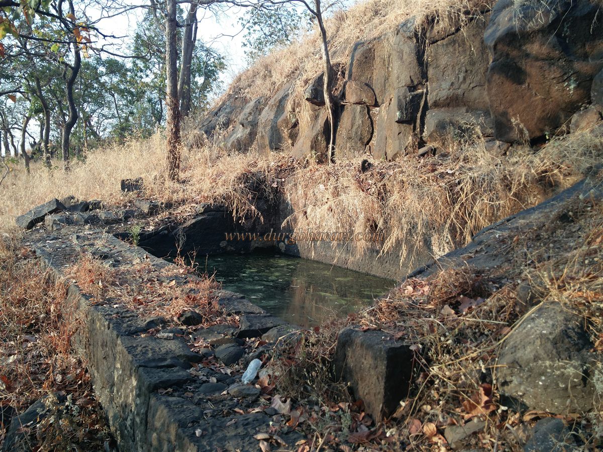
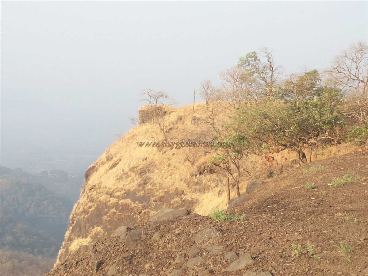
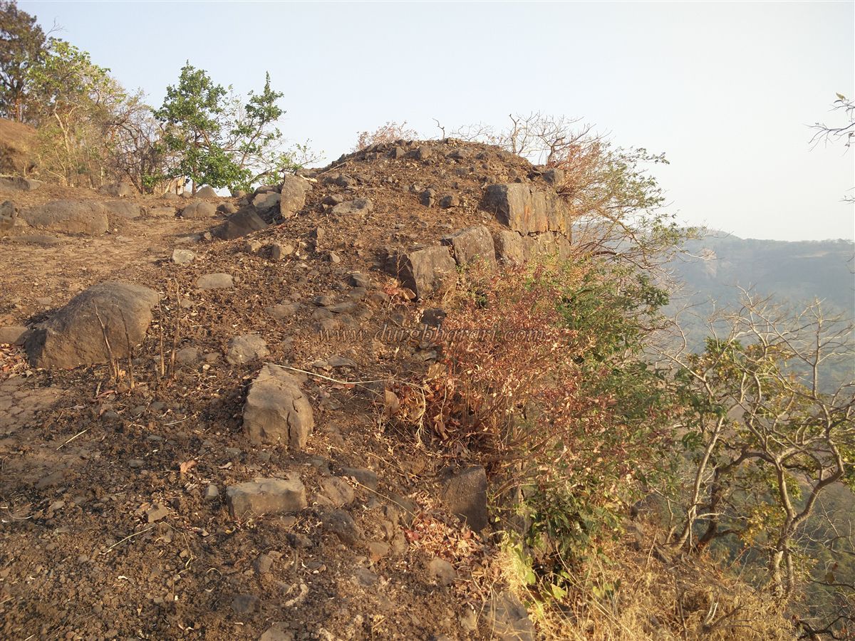
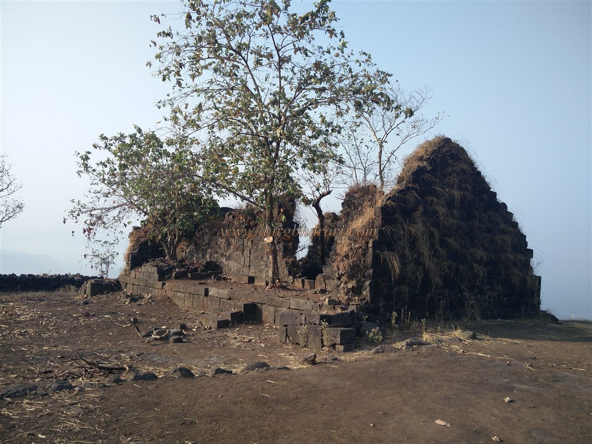
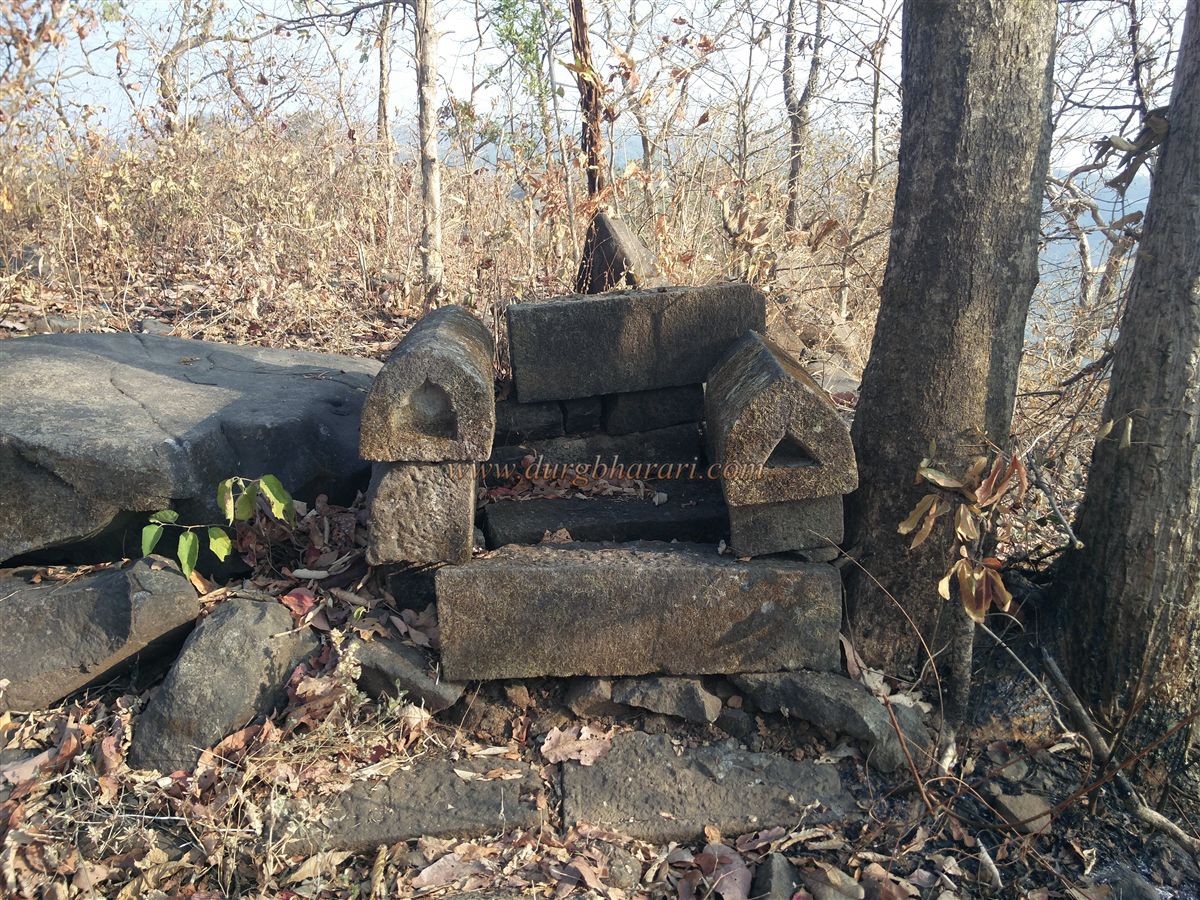
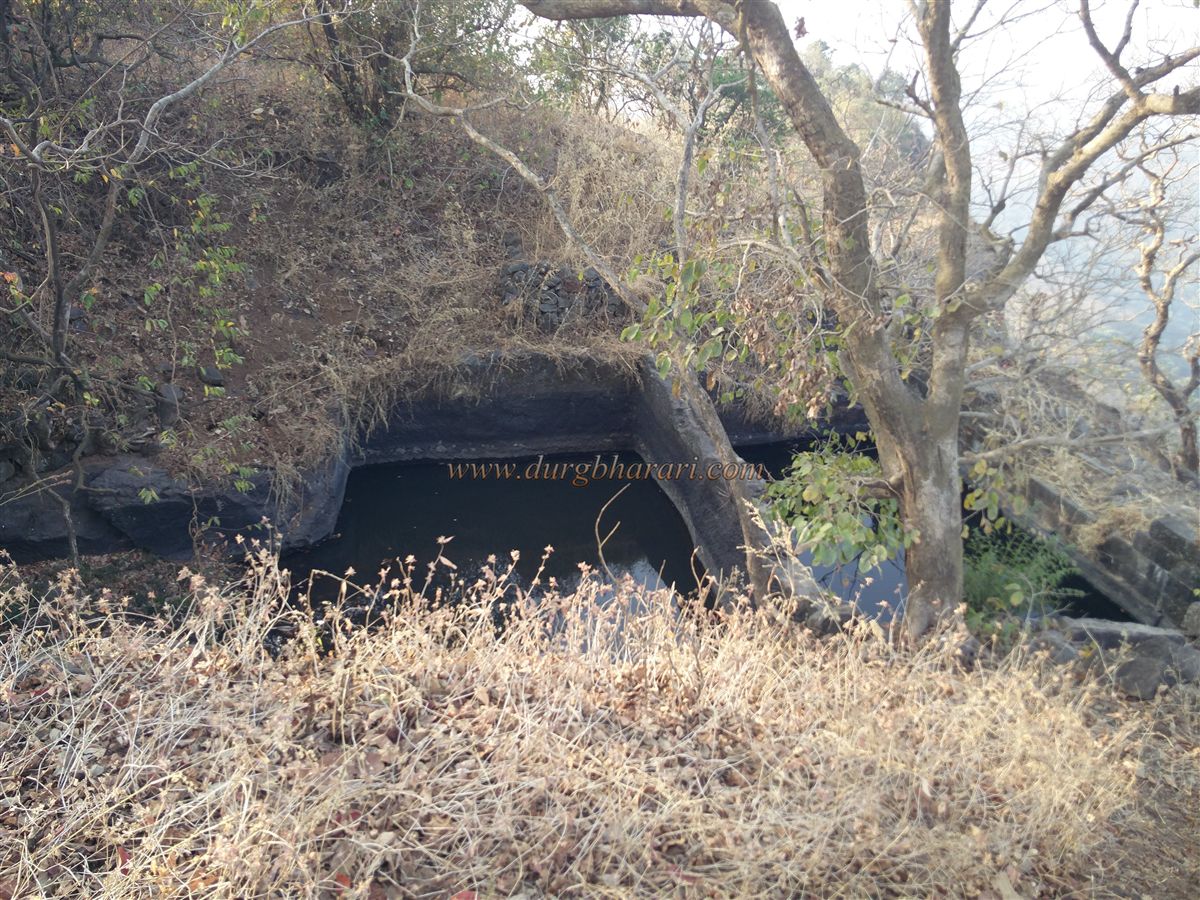
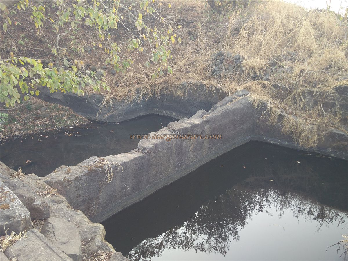
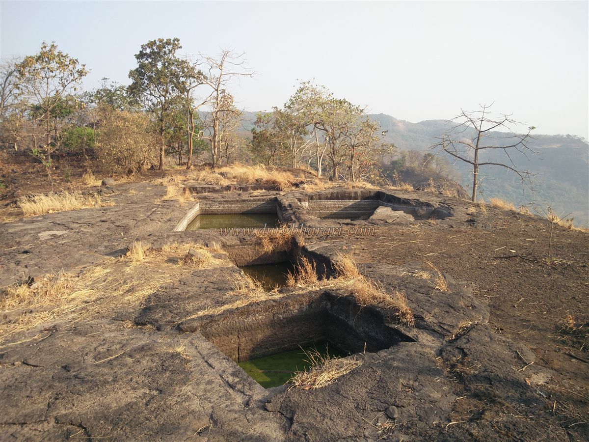
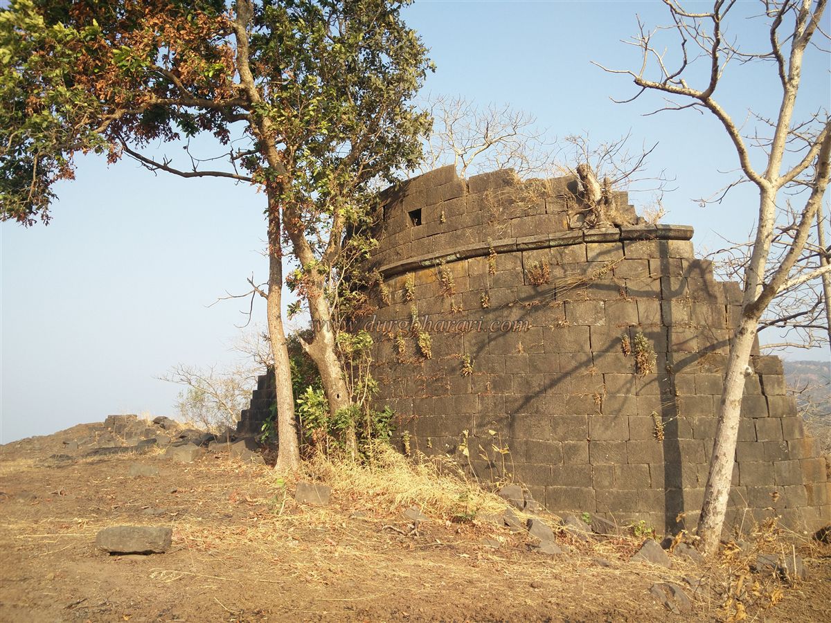
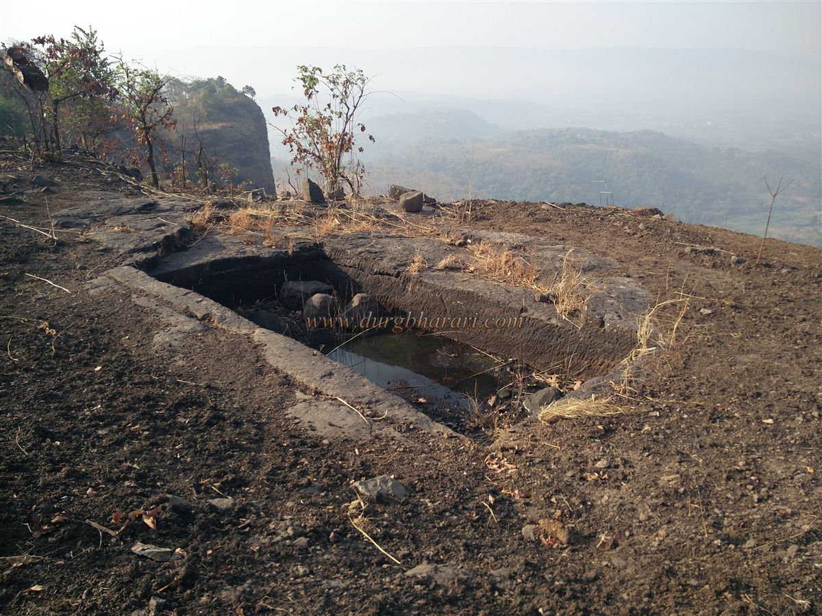
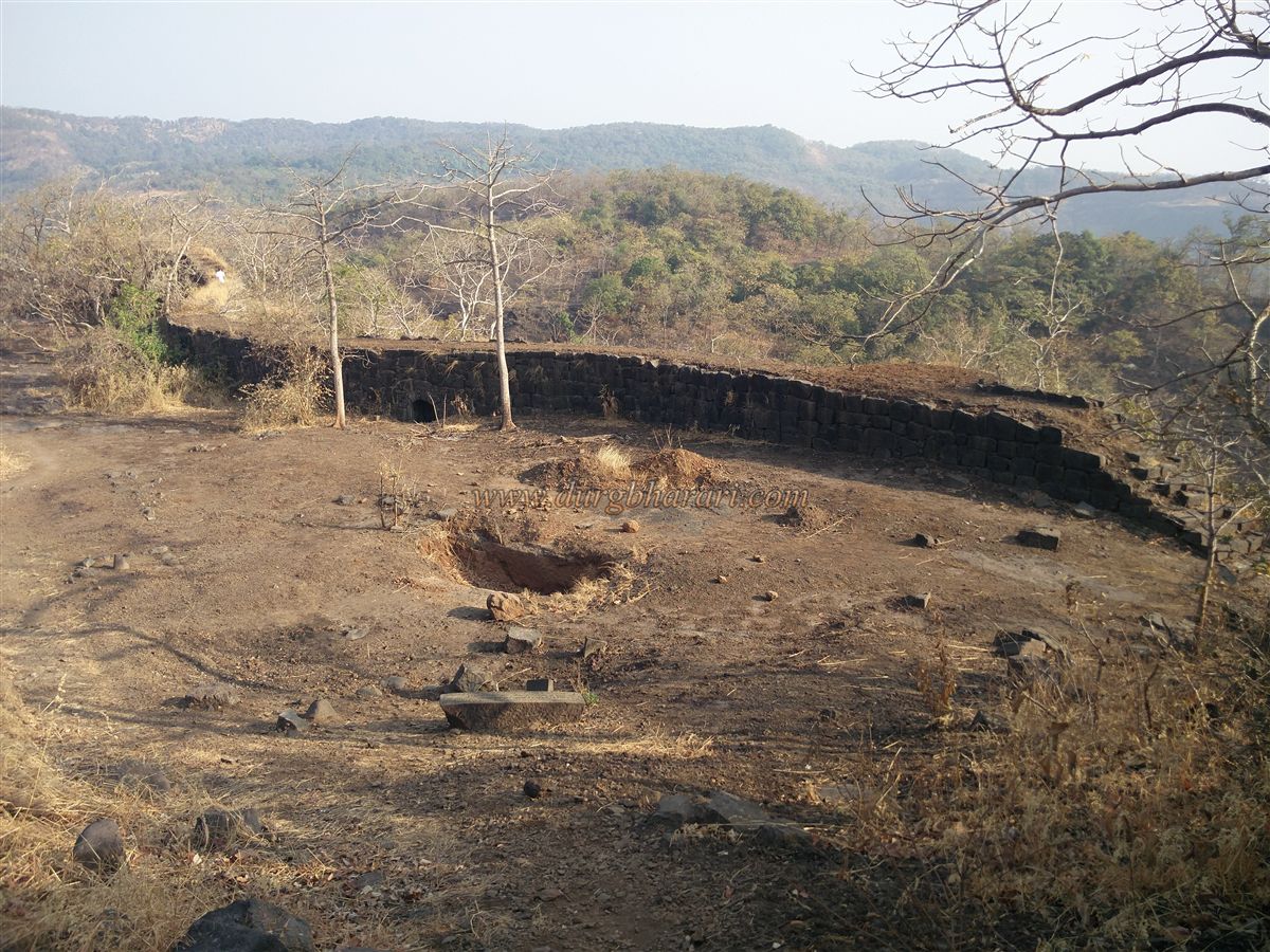
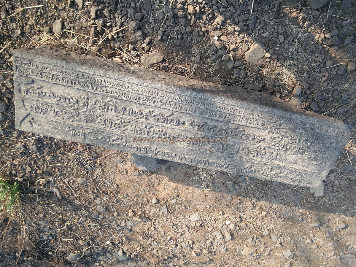
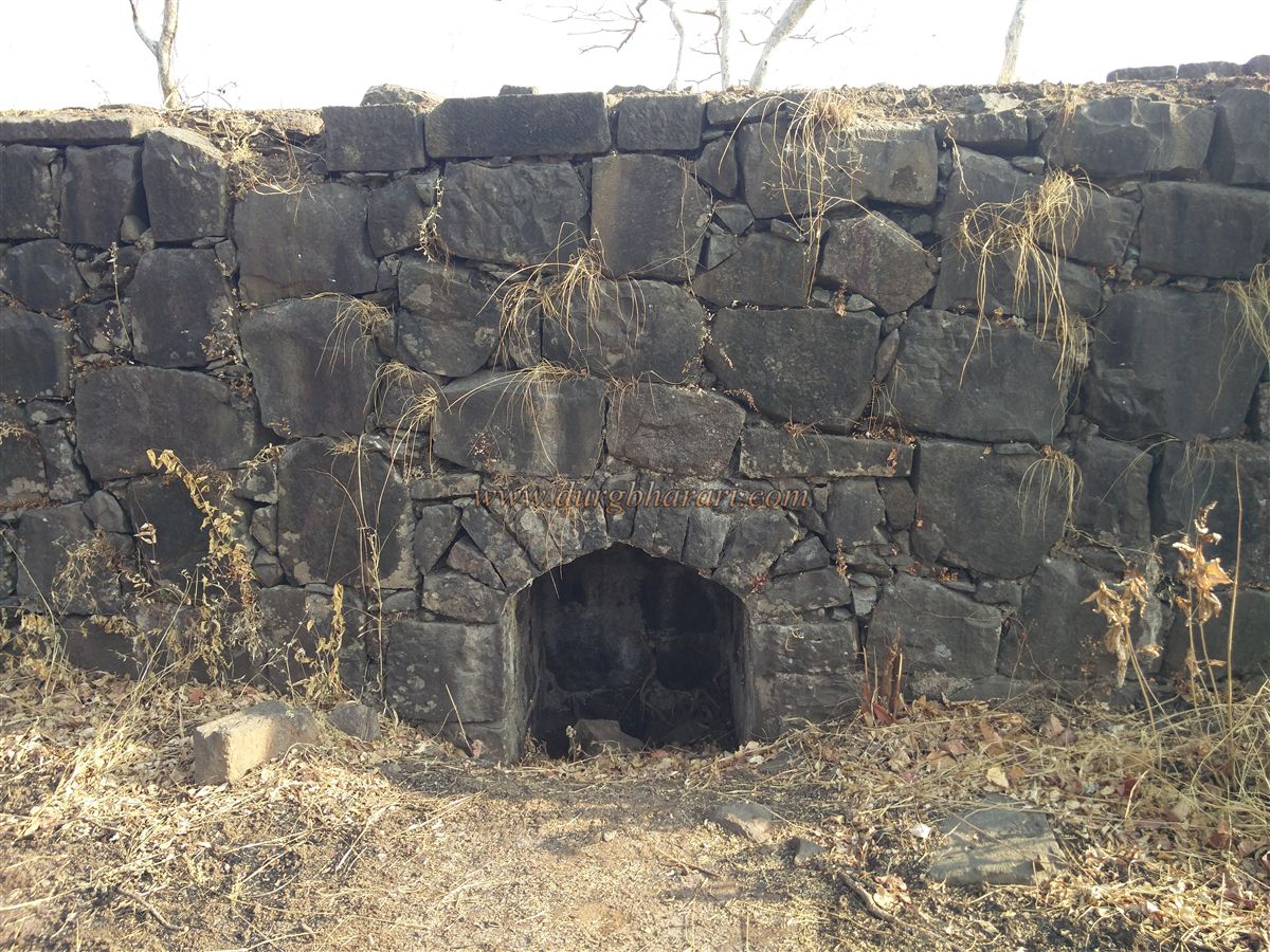
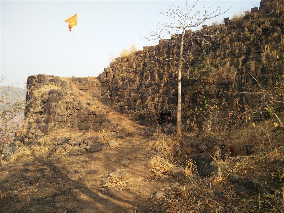
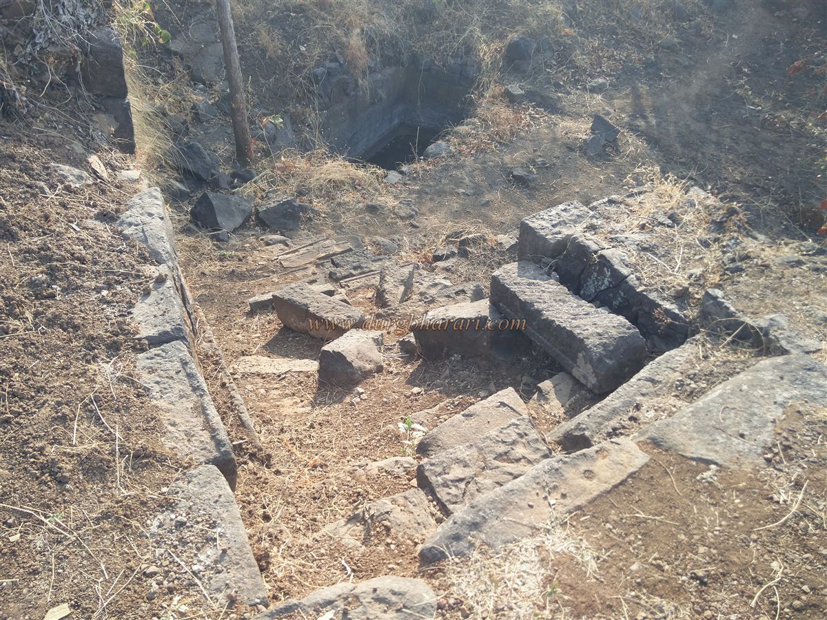
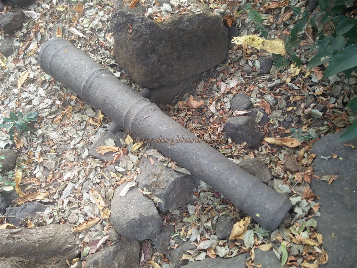
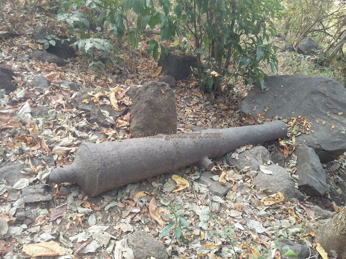
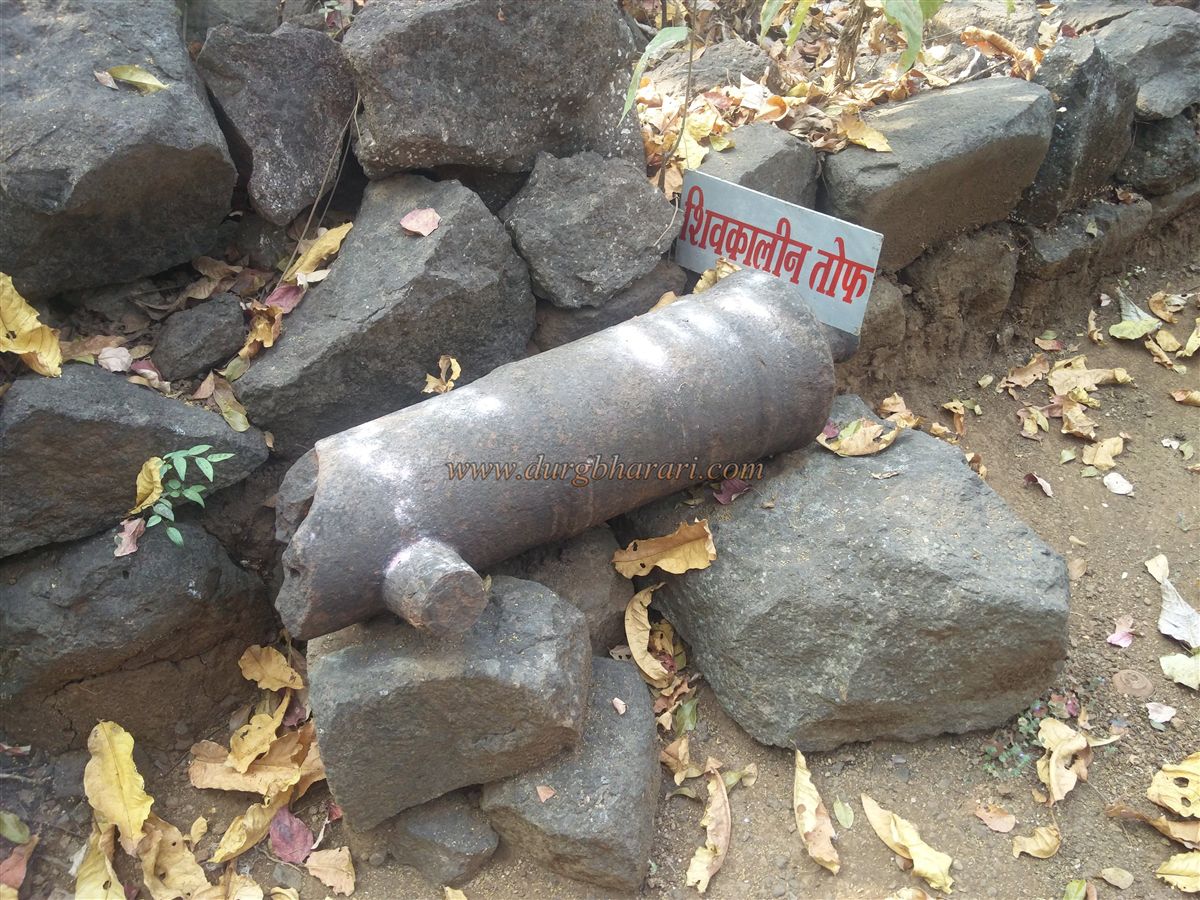
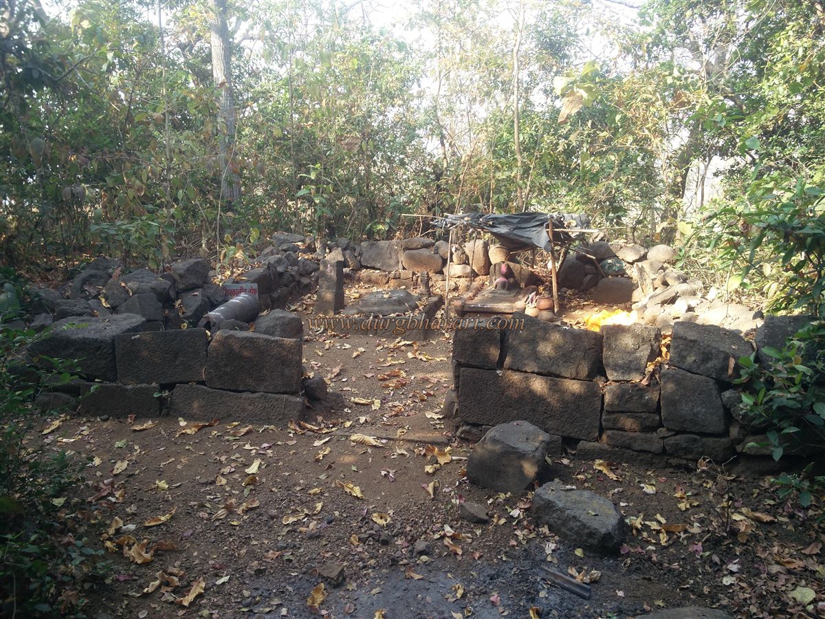
As there is a paved road to reach Gherasurgad village, it is better to have a private vehicle with yourself, otherwise, you have to cross this 3 km distance by walking. There is a clear path near the Hanuman temple in Gherasurgad village to reach the fort. At the beginning of this path, there is a well and after walking 5 minutes from here, you see another well near the bank of the stream. After crossing this stream, there is a path on the right side of the well to reach the fort. This 15-minute trek through the forest takes us to the plateau below the fort. When you reach the plateau, you can see the top of Surgad situated on two hills in front. This plateau is covered with a large number of rocks and when you reach the plateau, the path turns to the left. A little further along this path, there is a fork on the right side and the straight path leads to Ansai temple, while the path on the right leads to the gorge in the mountains. Durgaveer Pratishthan is constantly working for the conservation of this fort and they have put up directional and informative boards at various places. The fort can be reached by both of these routes. The straight path takes a detour to the fort, while the path on the right leads directly to the top of the fort through the gate in the gorge. This is the main entrance to the fort. Starting from the path on the right, in 10 minutes we reach a small cave at the base of the gorge. This is the main way to reach the fort and as the door and other structures have collapsed, the stones used in their construction are scattered here and there in this area. From here we climb a small cliff and reach the upper part of the gorge. There is a water cistern carved in the rock on the right side but it is not visible from the road. In some places, while climbing the cliff steps have been built while in some places they have been carved in the rock. The upper part of the gorge is enclosed by a rampart and the north-facing door in it is destroyed. The steps under this door, however, remain today. Climb these steps to enter the fort. An hour is enough to get here from the village. The top of the fort is located at an altitude of 860 feet above sea level and is spread over about 15 acres on two hills. The hill on the west side is very small and there are no remains over there except the bastion, a few ramparts, and a water cistern. Upon entering the fort, one can see the idol of Hanuman placed on a quadrangle structure on the right side. The idol has a different style with a Panwati under the feet, a sharp mustache, and a dagger at the waist. A little further on from the quadrangle structure is a medium-sized cistern filled with mossy water carved into the rock. Ascending from here, we reach the bastion at the end of this hill. From this bastion, one can see Ghosalgad, Avchitgad, Mirgad, and River Kundalika. Since there were fewer remains on this hill, come back to the door from here and start your next fort round on the left side. From here, while climbing the steps carved in the rock, you can see the ramparts on the other side of the gorge. On the right side of the top of the fort, there are quadrangle structures of some houses. From here your journey starts towards the north of the fort. On this road, you can see a roofless structure built in wrought stone. There is a structure with a ruined wall next to this building and there are two idols of Shivling and Bhairav-Bhavani in this building. Remains of a large number of houses can be seen in this area. On one side of the road, there are a large number of wrought stones and someone has laid some of them like a throne. From here onwards, on the left side, there are two cisterns carved in the rock one after the other and ramparts have been erected in front of this cistern. The water in this cistern is drinkable. Coming from here, there are 5 water cisterns carved in the rock on the plain surface. Two of these cisterns are dry and three cisterns have green water. When you look at the cistern, you will see a huge quadrangle structure built of wrought stone on the left side. This structure should probably be of the administrative office of the fort. On the front side of this building is a small quadrangle structure hidden in the grass. At the bottom of this quadrangle, there is 3 pillared water cistern carved in the rock on the slope. On the way from here, there are many collapsed quadrangle structures and dry water cisterns on the left side. There is a rampart over here which divides the fort into two parts and on the left side of this rampart is a quadrangle structure while on the right-hand side there is a beautiful bastion. The next part of the fort is sloping and the bastion must have been built to guard both the inner parts of the fort. On the way down the bastion, there is an inscription carved on a rectangular stone. This inscription was present in a building and has fallen apart due to the collapse of the building. The inscription is engraved in both Persian and Marathi. According to the text, Tukoji Haibtrao was the constable of the fort at the time when Suryaji built the fort on the orders of Siddi saheb. Compared to the construction in other parts of the fort, the bastions we have just seen and the constructions in this part of the fort are still in good condition. This suggests that the construction of these structures may have been carried out in the later period. There is a toilet built in this rampart and steps are built in two places to reach the rampart. At the north end of the fort, at the end of the ramparts, there is a shielded bastion on which the saffron flag is fluttering. There are steps to reach the bastion and there is a water cistern at the bottom of this bastion. From this bastion, one can see a memorial on the hill in the front. There is a path leading out of the fort from this rampart and steps are carved in some places on this path. This descending path takes a detour to the fort and leads to the Ansai temple on the plateau. After descending the hill of the fort without descending completely down this path, a path leads to the forest next to this hill. After walking for about 15 minutes on this road, you can see an 8 feet long cannon lying in the valley below. Descending from this cannon, we reach the Ansai temple. The idol of Goddess Ansai and a quadrangle structure are carved in the same rock and there is another carved idol at some distance. A broken cannon is lying on the temple premises. From here, your journey to the fort is complete when you reach back to the plateau. An hour and a half are enough to see the area from the top of the fort to Ansai temple. Although the size of the fort is not very large, considering the total number of water cisterns on the fort and a large number of architectural remains, the fort should have had a large amount of population in the previous times. This fort that we see today which is full of remains is due to the hard work of Durgveer Pratishthan of Mumbai. They have done a lot of conservation work of the fort and cleared all these structures from bushes and soil. The roads leading to the fort have been repaired and the cisterns have been cleaned. Their work is appreciated a lot. Looking at the pillared water cistern on the fort, it must have been built before Shivaji Maharaj’s period. Along with Tala and Ghosalgad, Surgad also joined the Swarajya in the Konkan expedition carried out by Shivaji Maharaj in 1656. Surgad is one of the 111 forts newly built by Shivaji Maharaj. During the reign of Rajaram Maharaj, Shankaraji Narayan conquered Surgad from Siddi but later it fell back to Siddi. In 1733, according to the treaty between Siddi and Peshwa, the Surgad fort came under the control of Marathas. Records of the prisoners on the fort at that time are available to date. The Persian and Marathi inscriptions on the fort mention that some construction on this fort was done during Siddi's time. This construction was done by Suryaji and during this period Tukoji Haibtrao was the constable of the fort. The fort was later conquered by Colonel Prother in February 1818.
© Suresh Nimbalkar
GALLERY