SUMARGAD
TYPE : HILL FORT
DISTRICT : RATNAGIRI
HEIGHT : 3010 FEET
GRADE : HARD
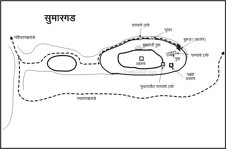
Just like the famous Alang–Madan–Kulang trio, another lesser-known but equally thrilling set of three forts for trekking enthusiasts is Mahipatgad–Sumargad–Rasalgad. These forts, perched close to each other along a single mountain ridge, are located about 25 km from Khed in Ratnagiri district. Among them, Sumargad lies between Mahipatgad and Rasalgad on a rugged spur. Its difficult approach has kept it largely neglected and rarely visited. Despite its name “Sumar” (meaning mediocre), the fort is anything but ordinary—it is challenging and adventurous. While Mahipatgad and Rasalgad can be explored with relative ease, reaching Sumargad is physically demanding and strenuous. Some trekkers have dismissed it as unremarkable, but this impression likely stems from incomplete explorations hindered by dense grass and thickets of karvi shrubs. In reality, though smaller in size, the fort boasts numerous remains, including water tanks, caves, bastions, storerooms, and platforms.
...
Villages like Vadgaon, Malde, Rasalwadi, and Jaitapur surround Sumargad, with routes leading up from Malde and Wadi Jaitapur. From Malde, it takes around 4 hours to reach the fort via Gurkhind, while the Rasalgad wadi route via Mharkhind–Gurkhind takes about 6 hours. Comparatively, the approach from Wadi Beldar is much easier and requires about 2.5 hours, but it is best undertaken with a jeep or similar vehicle. The mountain on which Sumargad stands has a spur sloping toward Wadi Beldar, and thanks to the jeep able dirt road connecting Wadi Jaitapur to Wadi Beldar, one can drive up to the point where this spur meets the road. Without a vehicle, walking the 5 km uphill stretch would take about 1.5 hours. This route, requiring less climbing effort, is more convenient, though a vehicle is strongly recommended; otherwise, the approach from Malde is preferable.
A signboard at the pass points toward Sumargad, which is about half an hour away from Wadi Beldar. This small hamlet of 10–12 houses offers good arrangements for tea, snacks, and meals, and the local Maruti temple serves as accommodation for trekkers. Experienced trekkers can proceed without a guide from here, but novices should hire a local guide from Wadi Beldar.
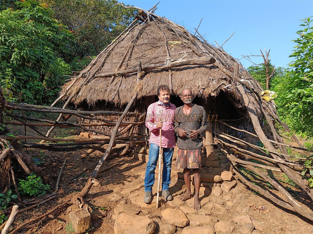
The trail starts from the pass and, after two ascents, leads in about 45 minutes to a hut belonging to Raya Dhangar—a legendary figure of Sumargad. Much like Babuda of Rajgad or Budha of Rajmachi, Raya, now 75 years old, has spent decades living in this remote wilderness with his cattle. Known to many trekkers through their travelogues, Raya possesses deep knowledge of the forest terrain. If time permits, he may even accompany visitors partway up to the fort, at the very least guiding them along the correct path. One must not miss tasting the buttermilk he generously offers, without expecting anything in return.
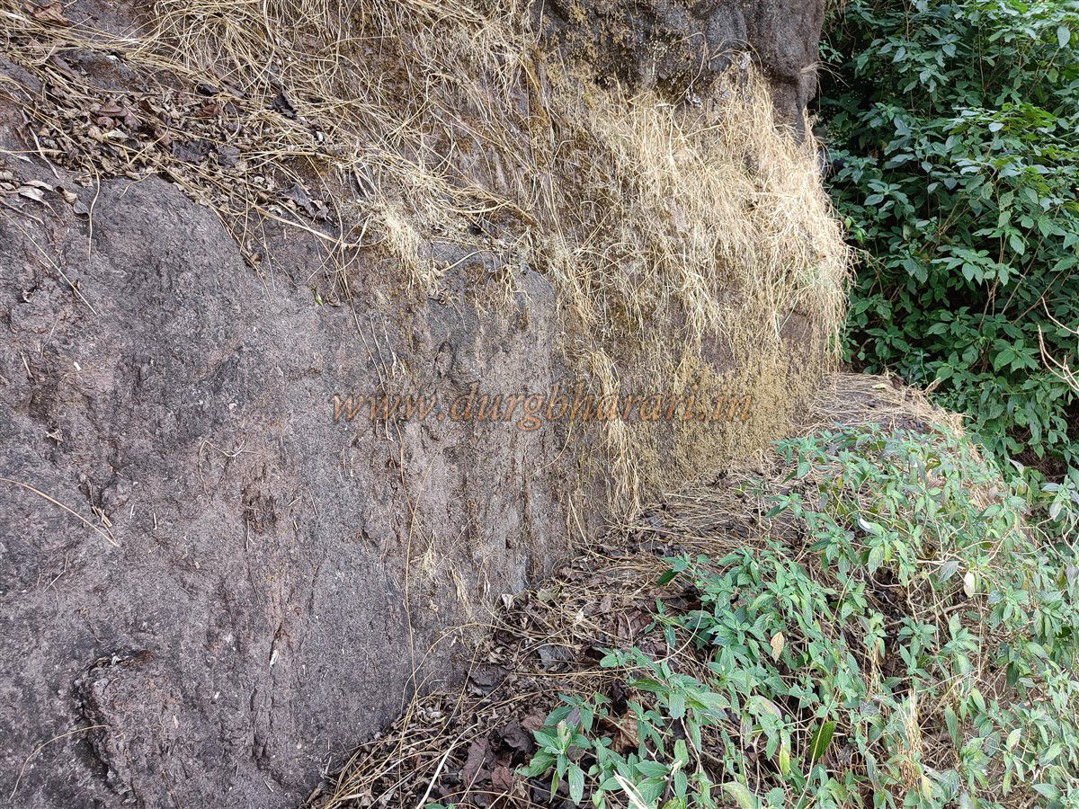
From here, the trail cuts through dense forest. It is essential to carefully follow the main path and avoid cattle tracks, as numerous grazing routes crisscross the area. The trail circumvents three hills on the left before climbing obliquely up the last one to reach Gurkhind after about an hour. Gurkhind is a small pass shaped by water flow and cattle movement. The descending path from here leads toward Malde and Rasalgad, while the uphill trail on the left, through thick karvi shrubs, ascends toward Sumargad. Climbing this steep, narrow path brings trekkers to a narrow ridge opposite the fort. This ridge connects Sumargad and its adjoining hill via a thin neck of land. From here, the fort’s eastern tip and its bastion come into view.
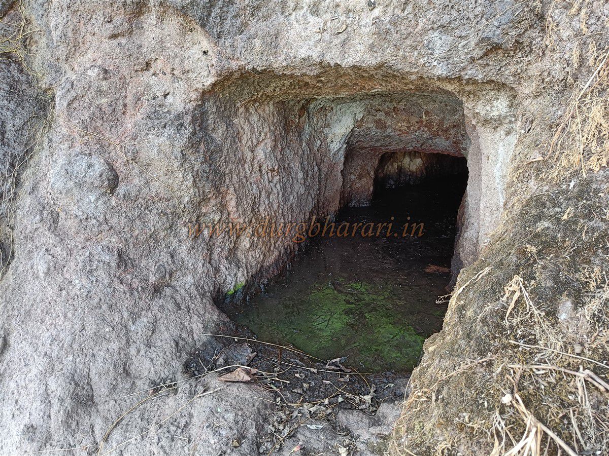
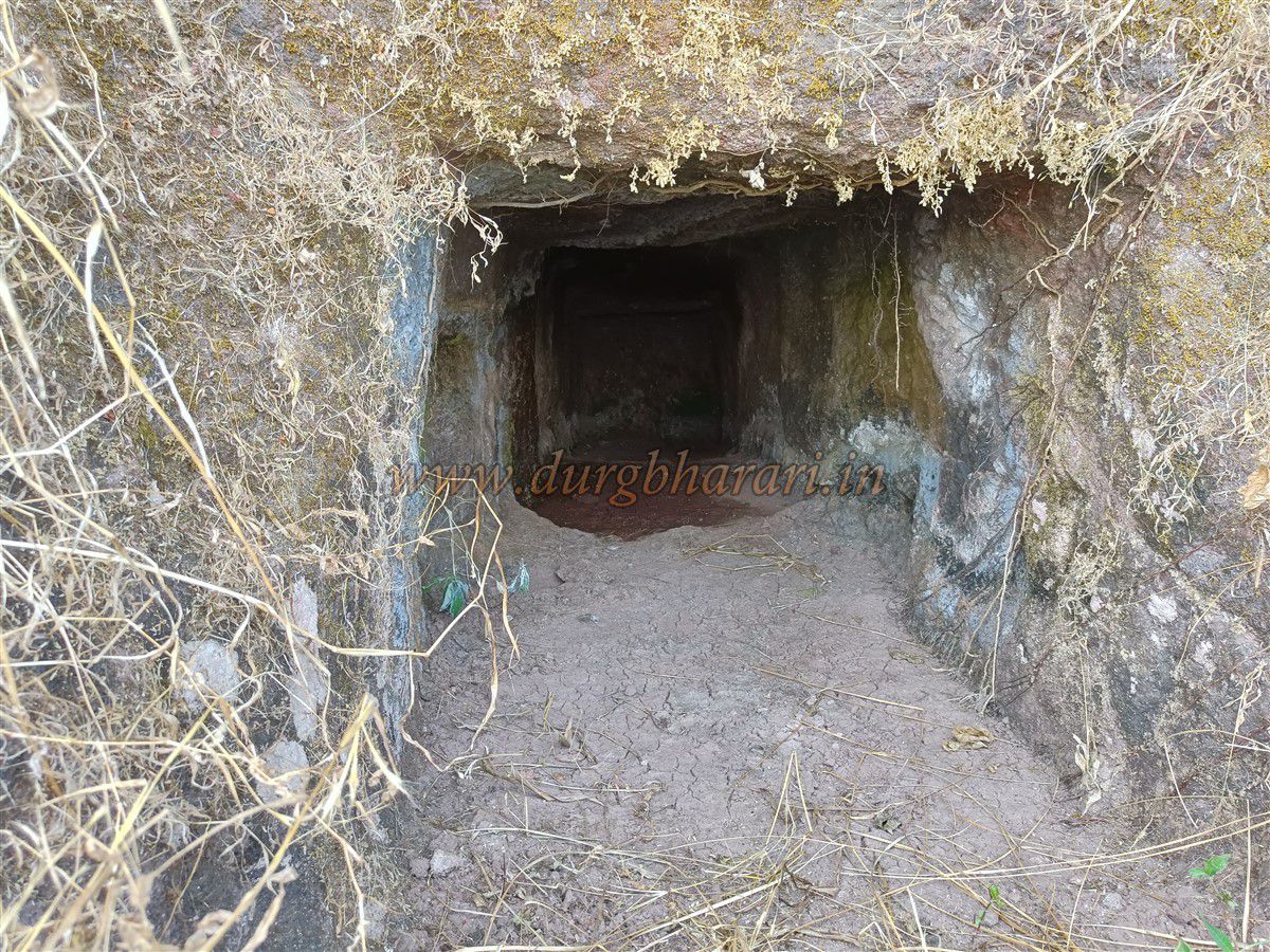
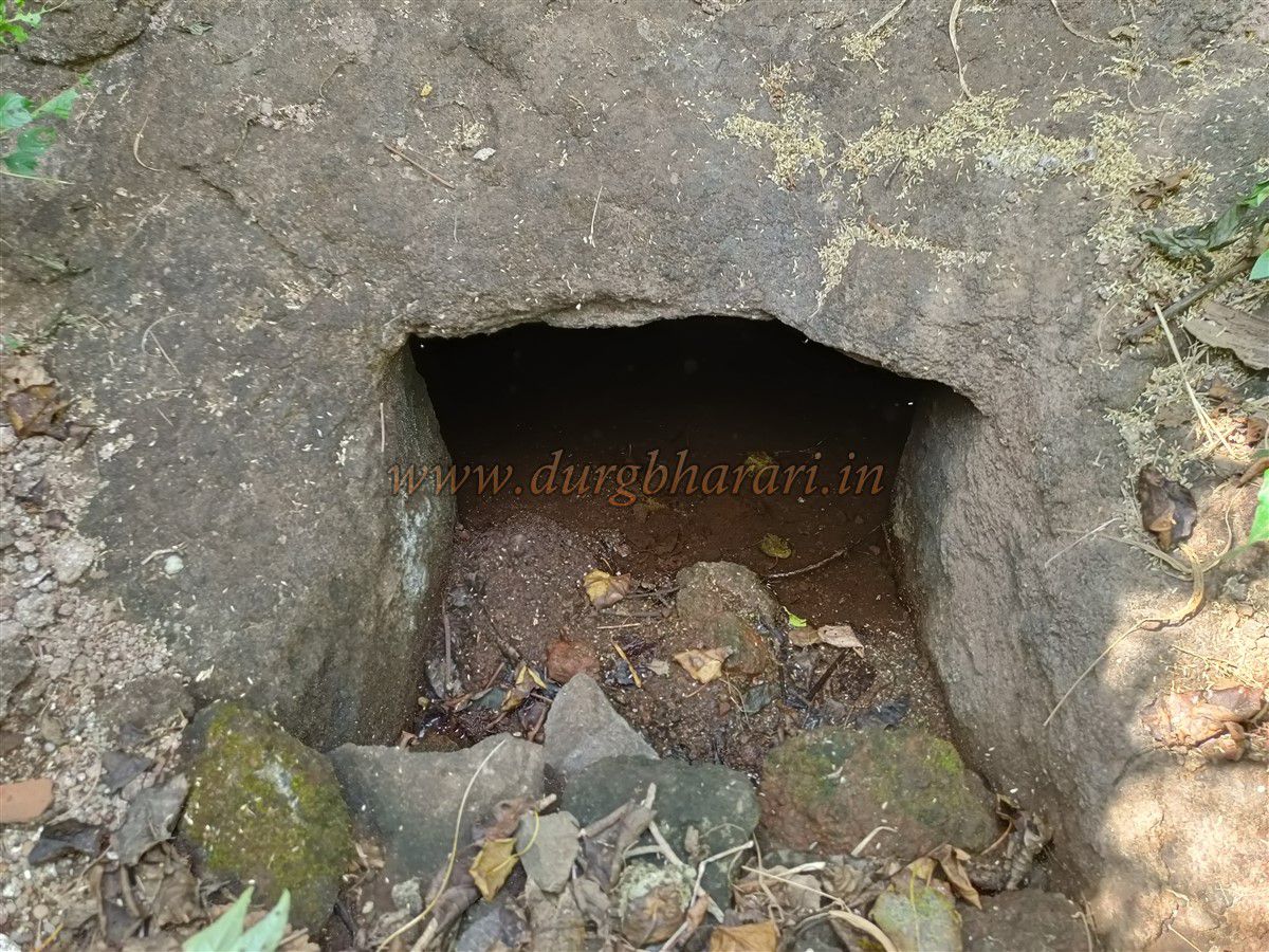
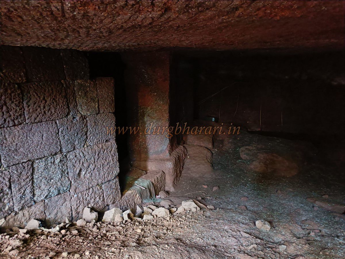
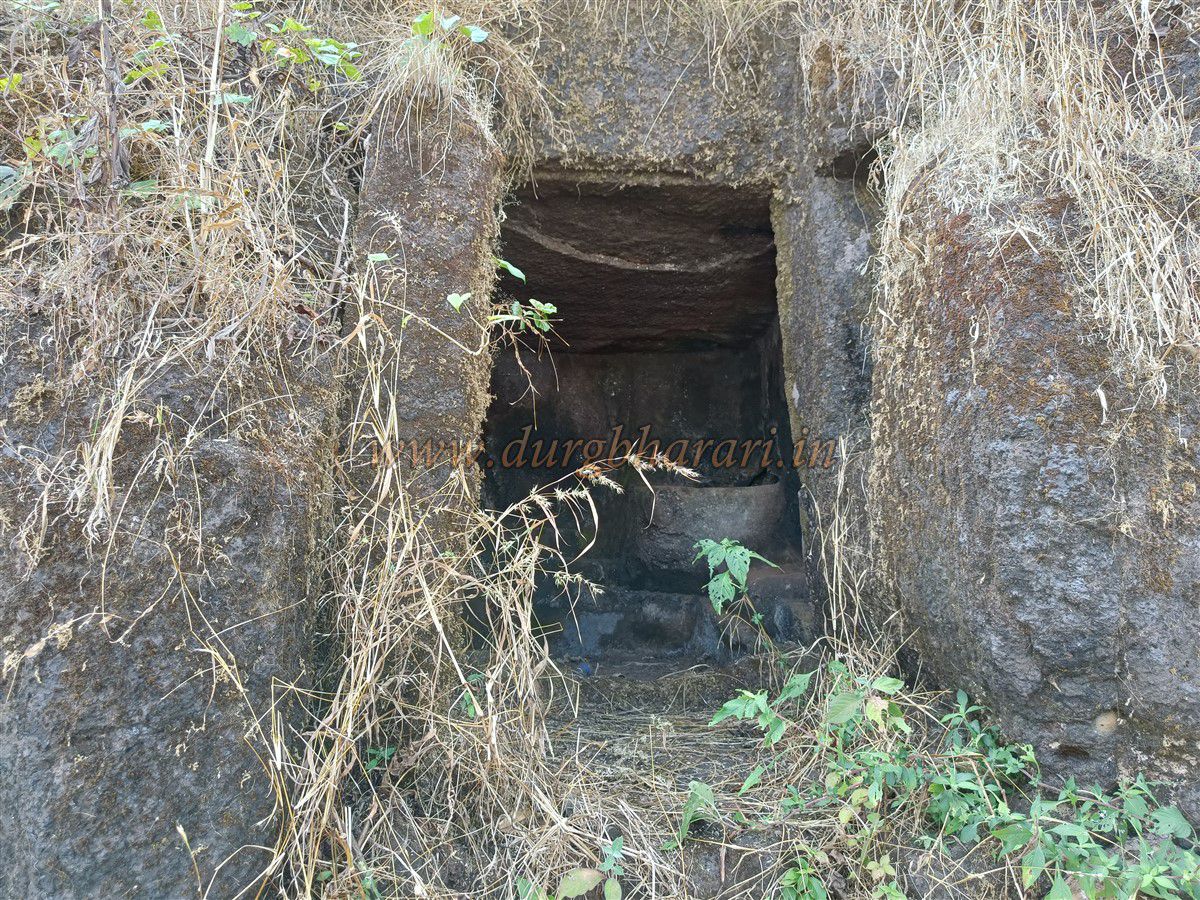
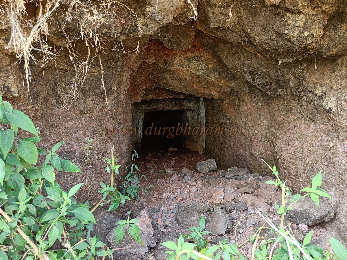
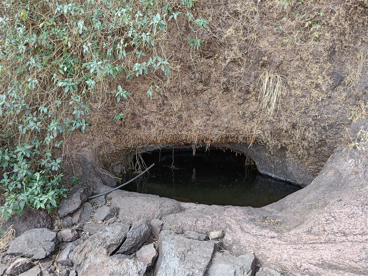
Proceeding carefully along the ridge, one reaches the cliff edge, where a rock-cut path carved into the Cliffside leads toward the entrance. For safety, heavy gear should be left here, and a rope can be helpful for negotiating this section. The path, barely a foot wide, clings to the rock face, and at one point narrows further to the width of a palm, forcing climbers to press their backs and stomachs against the cliff to pass. An iron peg provides support at this critical spot. Near the start of this path lies a buried rock-cut tunnel, its entrance blocked by earth, making entry impossible. A little farther along is a 4x4 ft cave partially filled with water, making exploration difficult. A third cave lies beyond, featuring step-like cuts leading inward and turning right into a rock-cut storeroom. It is likely similar in design to the previous water-filled cave.
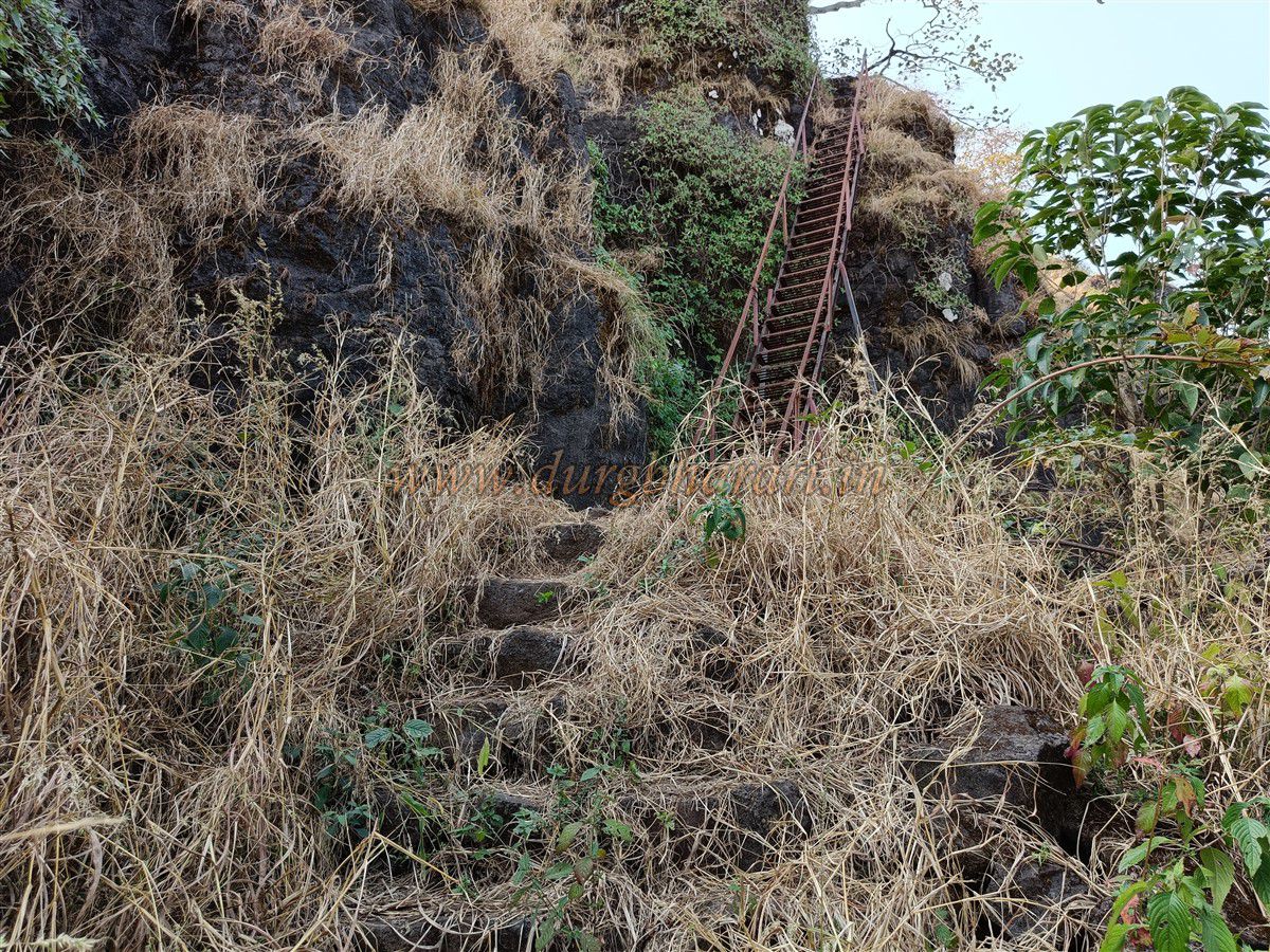
Continuing ahead, one reaches the newly installed ladder. Beneath it are remnants of the original stone steps—only 5–6 survive today. Since the original approach was destroyed, the Ba Raigad Parivar and the Sumargad Conservation Committee jointly installed this ladder in 2016. This spot matches the description by fort enthusiast G. N. Dandekar, who wrote that one had to grab the roots of a banyan tree to ascend the cliff—now replaced by the ladder.
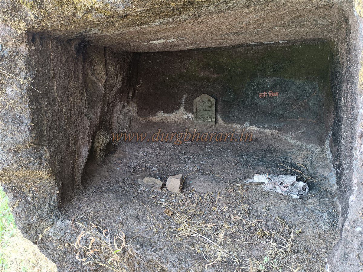
Instead of climbing up immediately, proceeding straight along the cliff reveals a fourth cave, and beyond it, a rock-cut water cistern. Returning to the ladder, the climb begins. At the top, on the left, is a rock-cut guard post containing a sati stone. Farther ahead is another cave resembling a rock-cut hermitage, with a carved Shiva ling. Above this lies the fort’s stone masonry wall, with a bastion at the corner. This section of the path skirts the edge of a ravine and is slippery with loose soil, requiring caution.
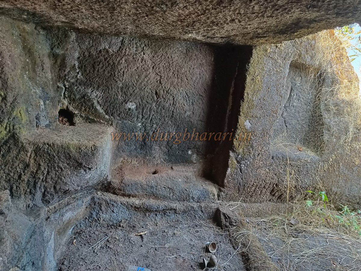
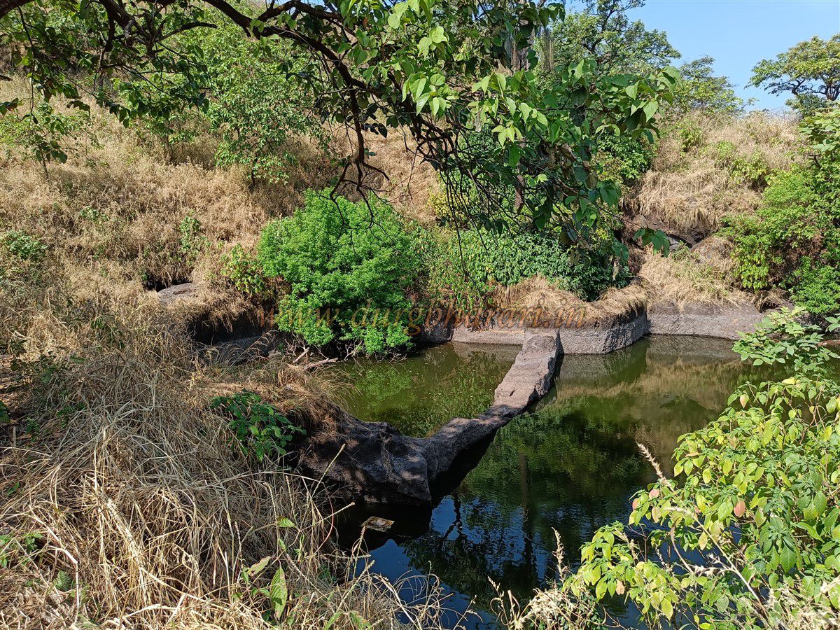
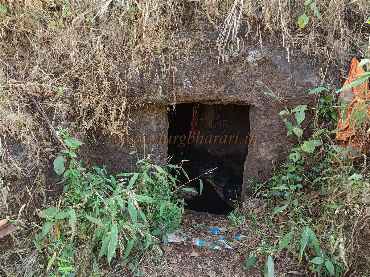
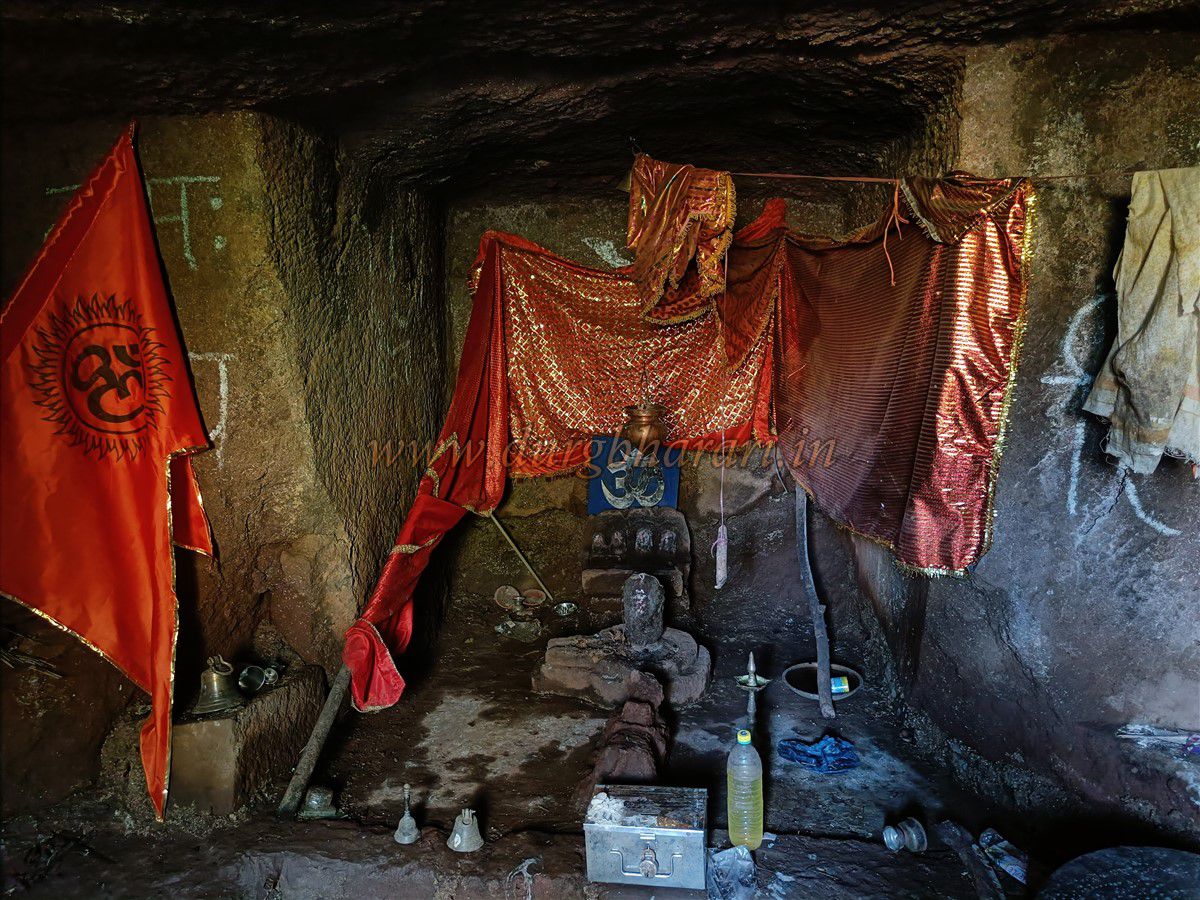
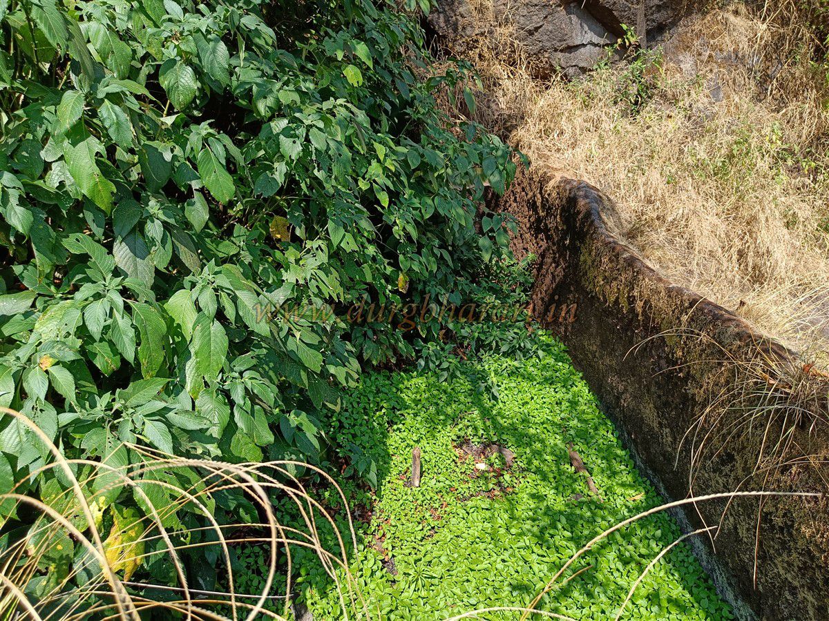
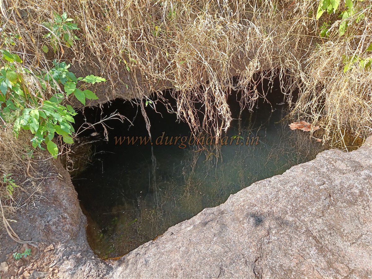
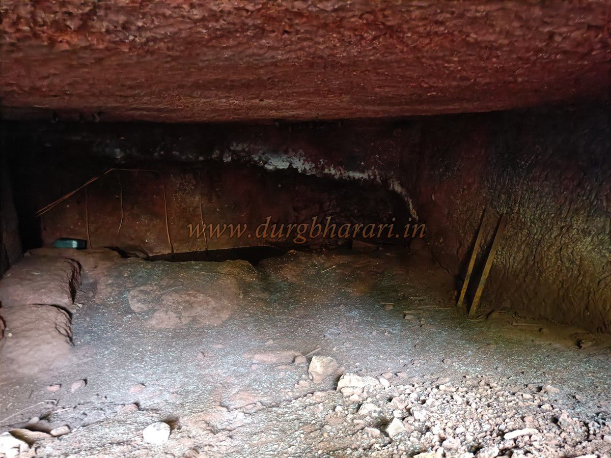
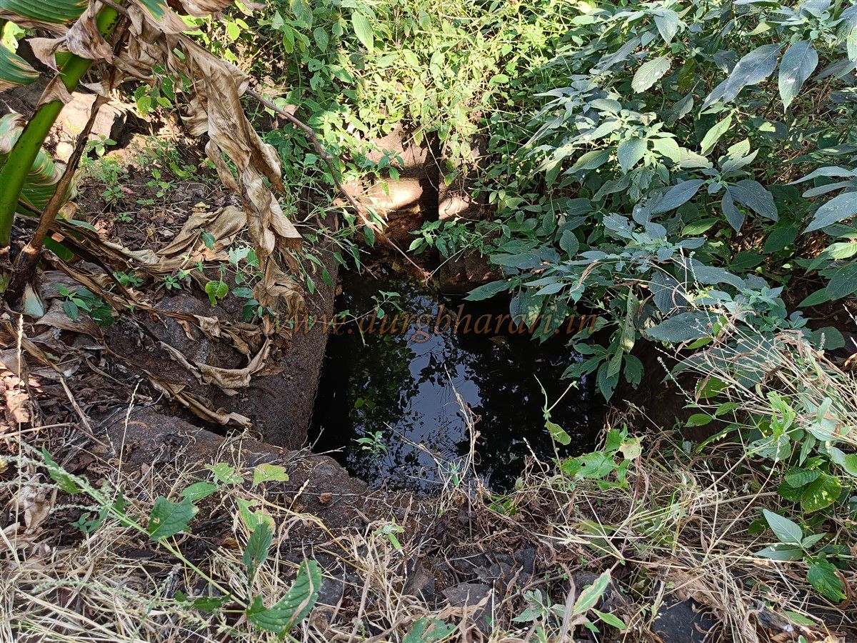
Further along, the trail turns left, passing through dense karvi shrubs, where a subterranean rock-cut cistern with steps can be found. Above this lies a large cave within the citadel hill, containing two built storerooms, though now filled with earth. Returning to the path, one encounters three large rock-cut cisterns, two of which hold water, while the third is dry—likely quarried for fort construction. Near the cisterns is another with potable water. Adjacent to this is a cave shrine with a Shiva lingam, a Nandi, a stone platform (chaurang), and carvings of four goddess faces. This cave also stores utensils for cooking and tools for fort conservation.
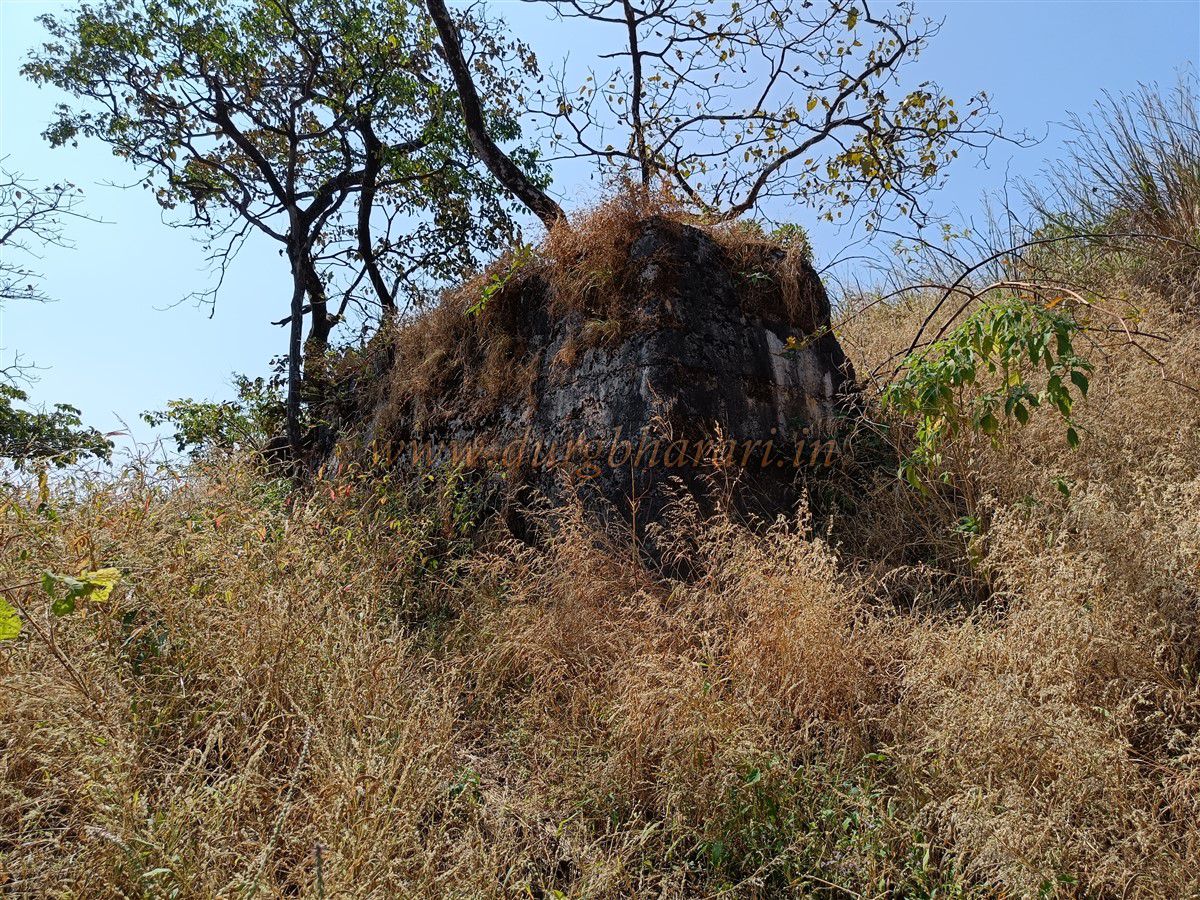
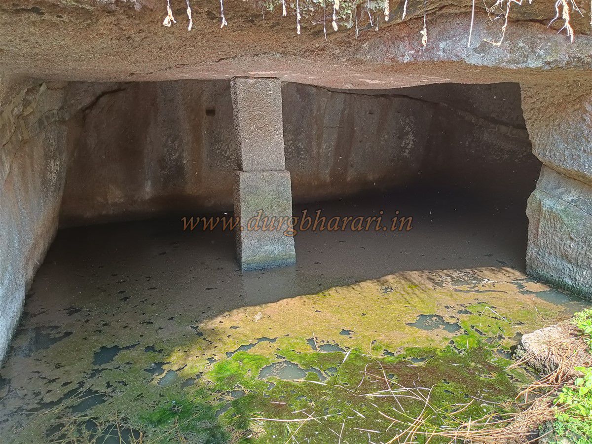
Nearby, a grassy platform hides another chaurang and a Bhairav idol. Continuing along the path reveals structural ruins and a small square underground tank (balad), now filled with water. A huge heap of lime and a water-filled tunnel mouth stand nearby. Ascending toward the citadel hill, one sees remnants of a large mansion and a rock-cut cave with square pillars, accessed via steps.
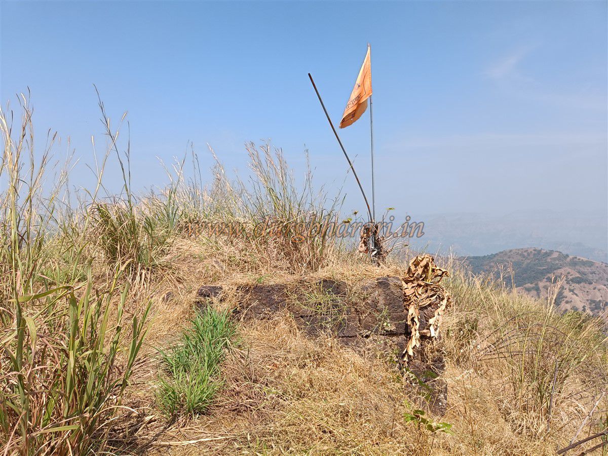
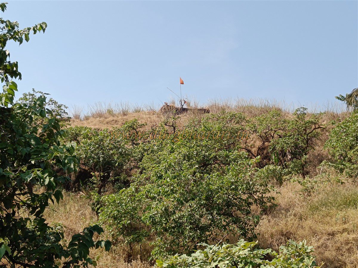
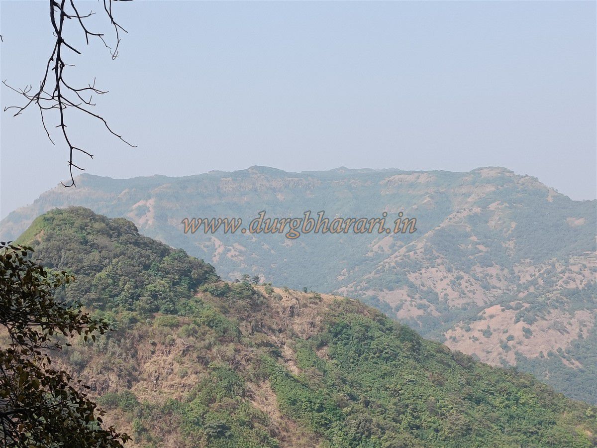
At the summit lies a massive stone platform with a saffron flag proudly fluttering above. From here, one can enjoy breath taking views of the Jagbudi river valley, the Mahabaleshwar range, Hatlot Ghat, Chakdev, Parbat, and nearby forts like Pratapgad, Madhu-Makarandgad, Vasota, Rasalgad, and Mahipatgad. The entire fort spans about 4 acres at an elevation of 3,010 ft above sea level. Exploring the fort from the ladder takes roughly an hour.
The abundance of water tanks and other features suggests that Sumargad has been in use since ancient times. It likely became part of Swarajya around 1661 along with Mahipatgad and Rasalgad. In the Satara Shahu Maharaj archives, the fort appears as "Sumerugad." After 1770, the Peshwa reportedly used it as a prison. A British survey of 1862 recorded 16 cannons on the fort, though none remain today.
© Suresh Nimbalkar
GALLERY