SULTANPUR
TYPE : GROUND FORT
DISTRICT : NANDURBAR
HEIGHT : 0
GRADE : EASY
Once a part of Khandesh, Nandurbar came into existence as an independent district after the division of Khandesh. The Tapi River flowing through Nandurbar divides the district into northern and southern parts, with its boundaries touching the states of Madhya Pradesh and Gujarat. Predominantly a tribal district, Nandurbar once had not one or two but as many as fifteen forts in the forms of hill forts, land forts, and fortified mansions. Apart from the seven forts mentioned in Pramod Mande’s book Maharashtratil Gadkille, there is hardly any reference to these forts anywhere else. Among these is a brief mention of Sultanpur Fort, though information about it is scant. Even in today’s digital age, very little about these forts is available on the internet. Our group, Durgbharari, undertook a detailed exploration of all these forts, and I have attempted to present the information gathered on this website.
...
These include thirteen fortified mansions, of which one is a hill fort, three are land forts, two are fortified towns, and the remaining seven are small forts. Local indifference is largely responsible for the decay of these forts.
Among the forts in Nandurbar, Sultanpur remains the one that still holds the most visible remnants. Once a part of Khandesh, this village became part of Shahada Taluka in Nandurbar district after the division of Khandesh. Sultanpur Fort is located in southern Nandurbar, along State Highway No. 5, about 13 km from Shahada. To visit Sultanpur, one must first reach Nandurbar or Shahada. The distance from Nandurbar to Sultanpur is 53 km via Prakasha–Utwad–Dhadgaon Phata. The fort is located near the village’s Ashram School, and a path from the school premises leads to the fort.
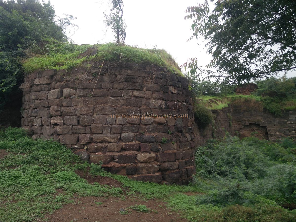
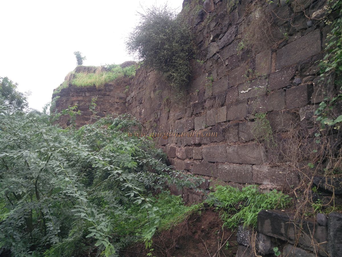
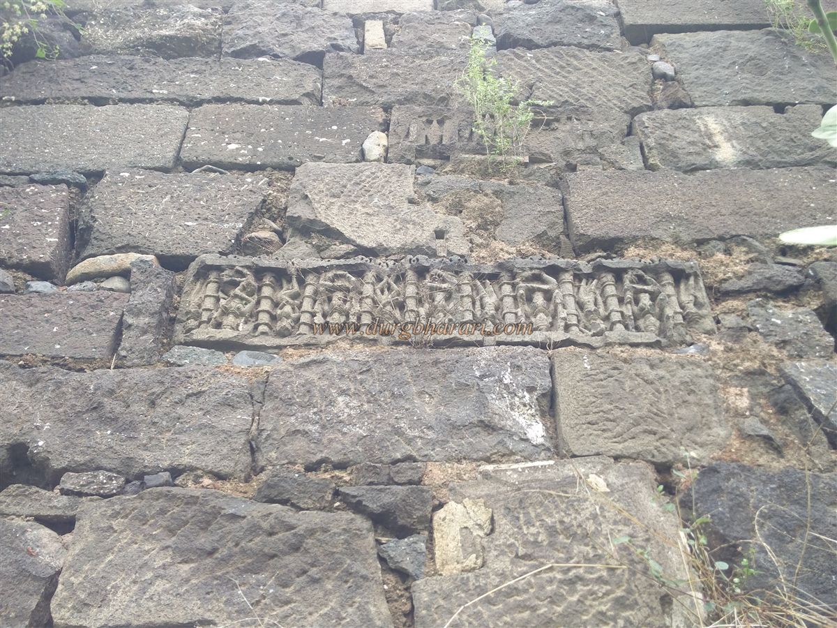
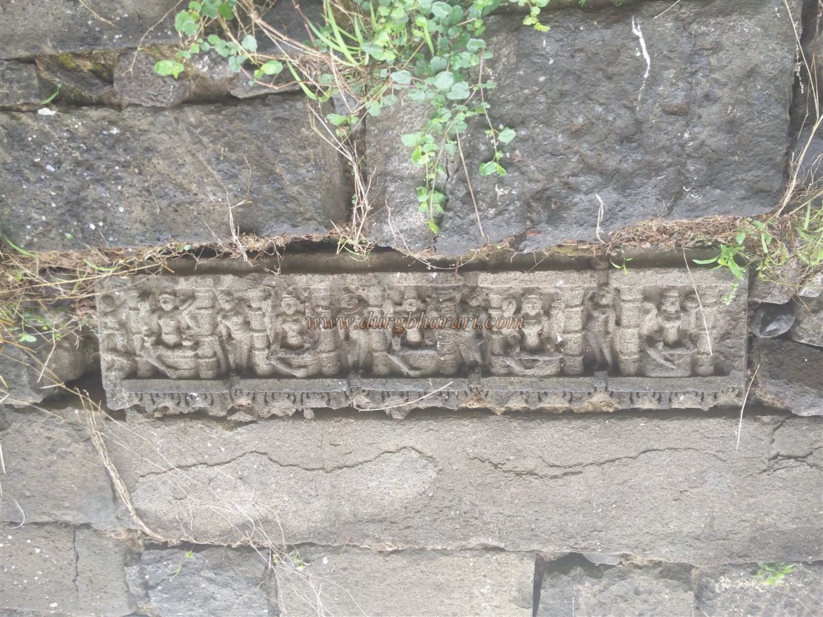
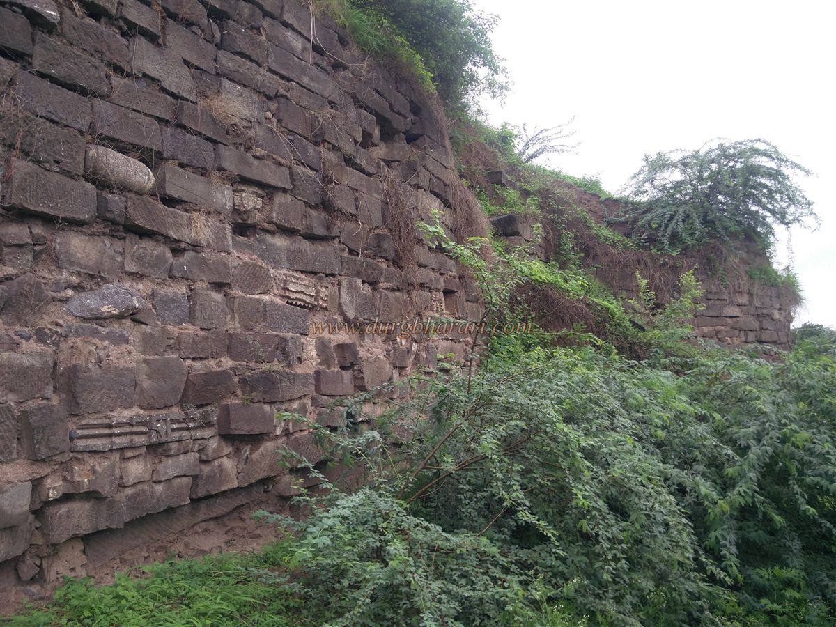
The fort, roughly semi-circular in shape, is situated on the banks of the Gomati River, a tributary of the Tapi. One side of the fort is naturally protected by the river, while on the other side, a moat was dug and filled with river water to fully secure the fort. Today, the landward moat is used for farming, which has resulted in much of the fortification on this side being eroded. The stone fortifications on the riverside still remain, showcasing a considerable number of carved stones and sculptures. Among these is a sculpture of the Saptamatrikas, along with a fallen lintel featuring a Kirtimukh and carved guardian deities. Due to the dense thorny vegetation along the riverbank, it is not possible to walk around the entire wall, but five bastions can still be counted along the surviving fortifications.
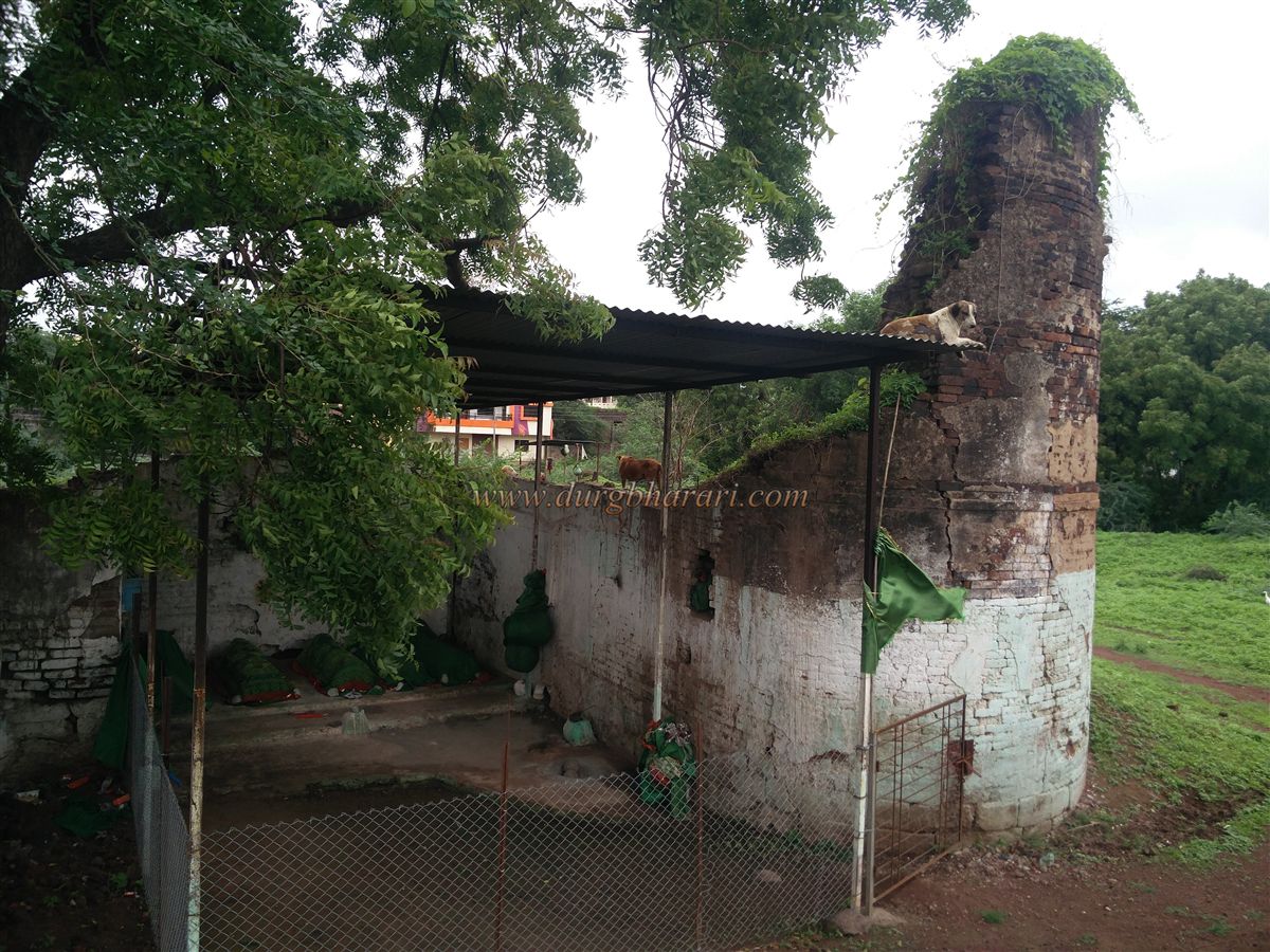
Proceeding from the Ashram School premises, one enters the fort through a ruined gateway on the northern side. The fort covers an area of approximately six acres. The main gate and archway are completely destroyed, with only the base remnants visible. The bastions adjacent to the gate are in ruins, with one of them bearing a tomb. Moving further along this path, one comes across a dilapidated structure and an adjacent partially collapsed bastion about 25 feet high. This interior bastion likely served as a watchtower for monitoring both inside and outside the fort. Within this structure are five tombs, collectively known as the Panchpir.
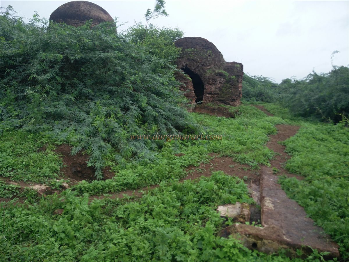
Further into the fort, the right side is heavily overgrown with vegetation, while the left side has been cleared for cultivation, levelling most of the remnants. Another significant surviving structure on the fort is the Hamamkhana (bathhouse). This bathhouse has two chambers, each topped with a dome. Constructed entirely of bricks, the interior walls are coated with lime plaster. Inside, one can still see the water tanks, niches, arches, a hearth for heating water, and terracotta pipes used for water supply. Some additional ruins are visible amidst the thorny bushes, but they are difficult to access.
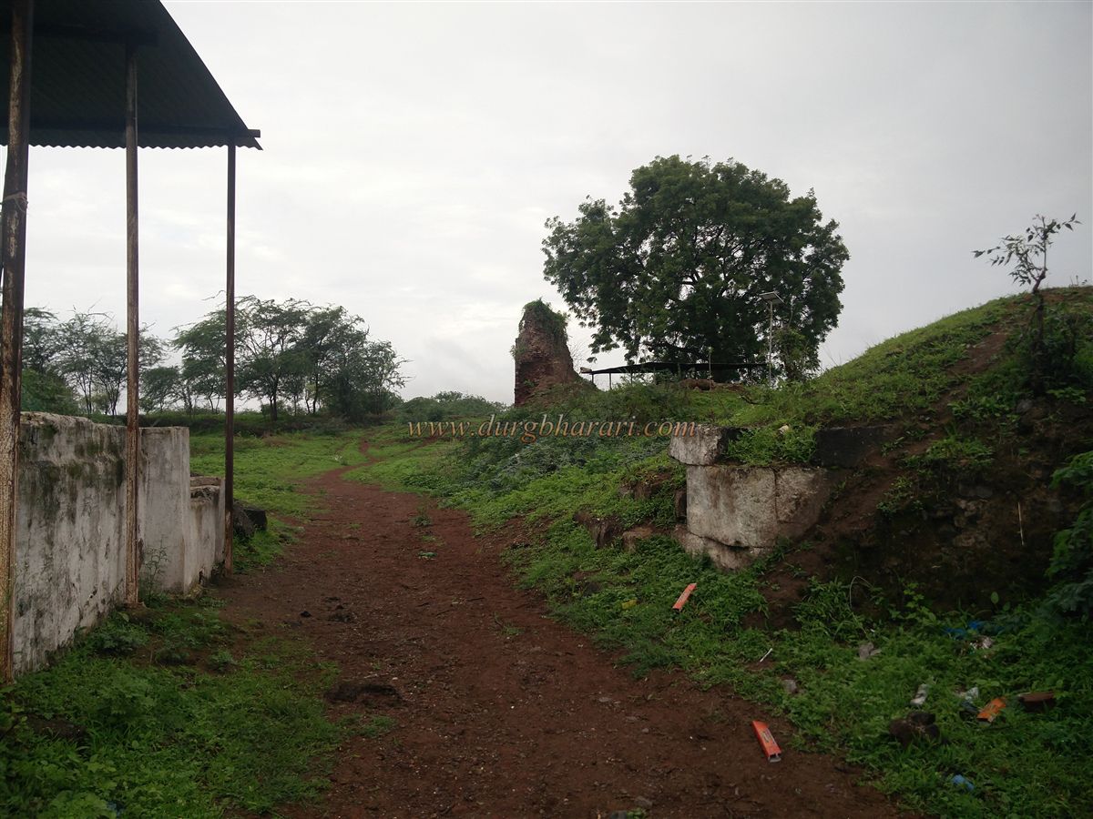
A large mound of earth has accumulated as the buildings collapsed, burying many remnants beneath. This mound reaches as high as the parapets of the fort walls. Excavating this debris could reveal several hidden remains. This completes the exploration of the fort, which, due to its limited surviving structures, can be thoroughly visited in about half an hour.
Historically, the first Sultan of Khandesh, Farooqui Malik Raja, captured Sultanpur, Nandurbar, and the surrounding areas in 1530. However, a subsequent invasion by Gujarat’s Sultan Muzaffar forced Malik Raja to retreat to Thalner. In 1536, when Mahmud Shah III Begada of Gujarat ascended the throne, he granted Sultanpur, Nandurbar, and the nearby regions to Mubarak Khan Farooqui, honouring a promise made to him during his captivity at Asirgarh. Later, the Mughals took control of this area. According to the Dhule District Gazetteer, in 1634, Shah Jahan annexed Sultanpur and Nandurbar to the Malwa province, with Burhanpur as their administrative center.
Another entry in the Gazetteer notes that Laxmanrao Desai, the chief of Sultanpur, refused to acknowledge the Holkar as his rulers and moved his camp to Chikhli, a village six miles west of Sultanpur, where his Bhil ally Jugra Naik resided. When the Holkar demanded 500 rupees as chauth in a letter, Laxmanrao sent them a defiant reply. Out of fear of Holkar retaliation, a wealthy and prominent local merchant, Kriparam Dagaram, personally paid an advance of 500 rupees to appease them. Despite this, the Holkar’s Bhil forces entered the town, seized Desai’s house and outposts, and burned the entire settlement except for one house. The well-planned streets, mansions, and gardens of what was once a thriving regional capital were reduced to ruins.
© Suresh Nimbalkar
GALLERY