SONGADH
TYPE : HILL FORT
DISTRICT : TAPI
HEIGHT : 1075 FEET
GRADE : EASY
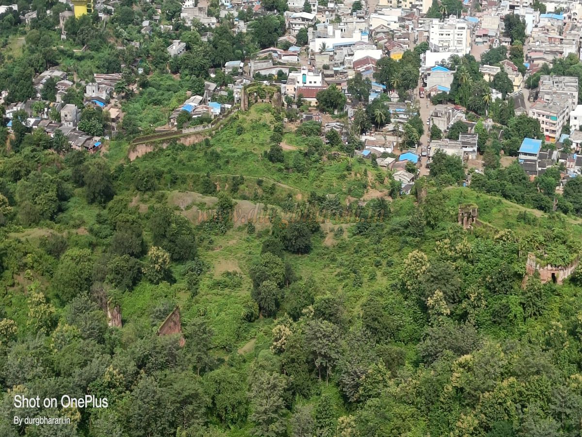
Many forts located in the border region of Maharashtra and Gujarat bear the footprints of the Marathas. Among them, the Maratha fort of Songadh in Tapi district on the Gujarat–Nandurbar border is particularly notable. This fort was established by Pilaji Rao Gaikwad, the founder of the Baroda State. The fort has given its name to the entire taluka. Songadh, being the taluka headquarters and a fairly large town, is directly connected to many other cities, making transportation convenient. From Surat, the route to Songadh is Surat–Bardoli–Vyara–Songadh, covering a distance of 82 km, while from Maharashtra, the nearest city is Nandurbar, with the Nandurbar–Songadh route covering 87 km. As one enters the town of Songadh, the grand fort behind the settlement immediately comes into view. Its design slightly reminds one of the structure of Daulatabad Fort. The base of the fort is about 2 km from the Songadh bus station, and rickshaws are available to reach there.
...
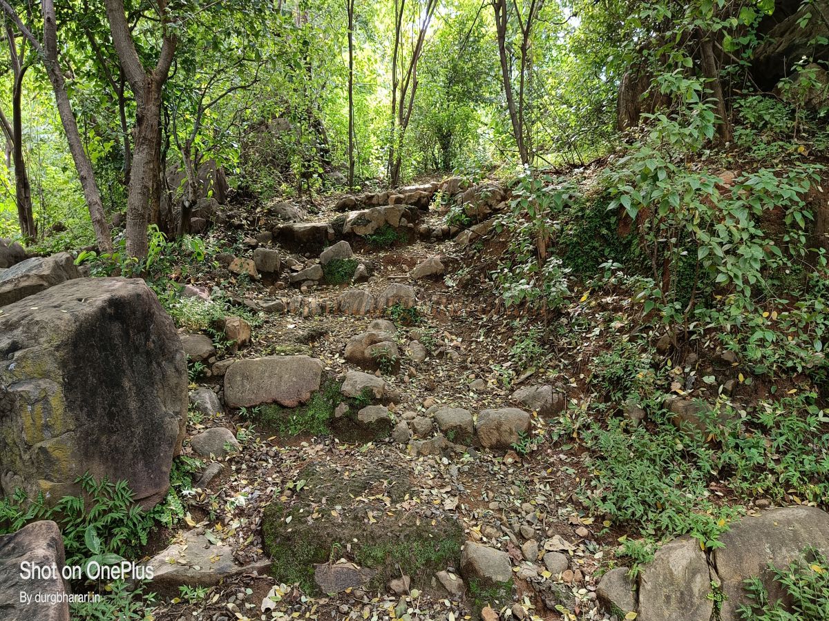
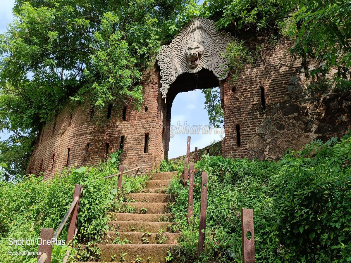
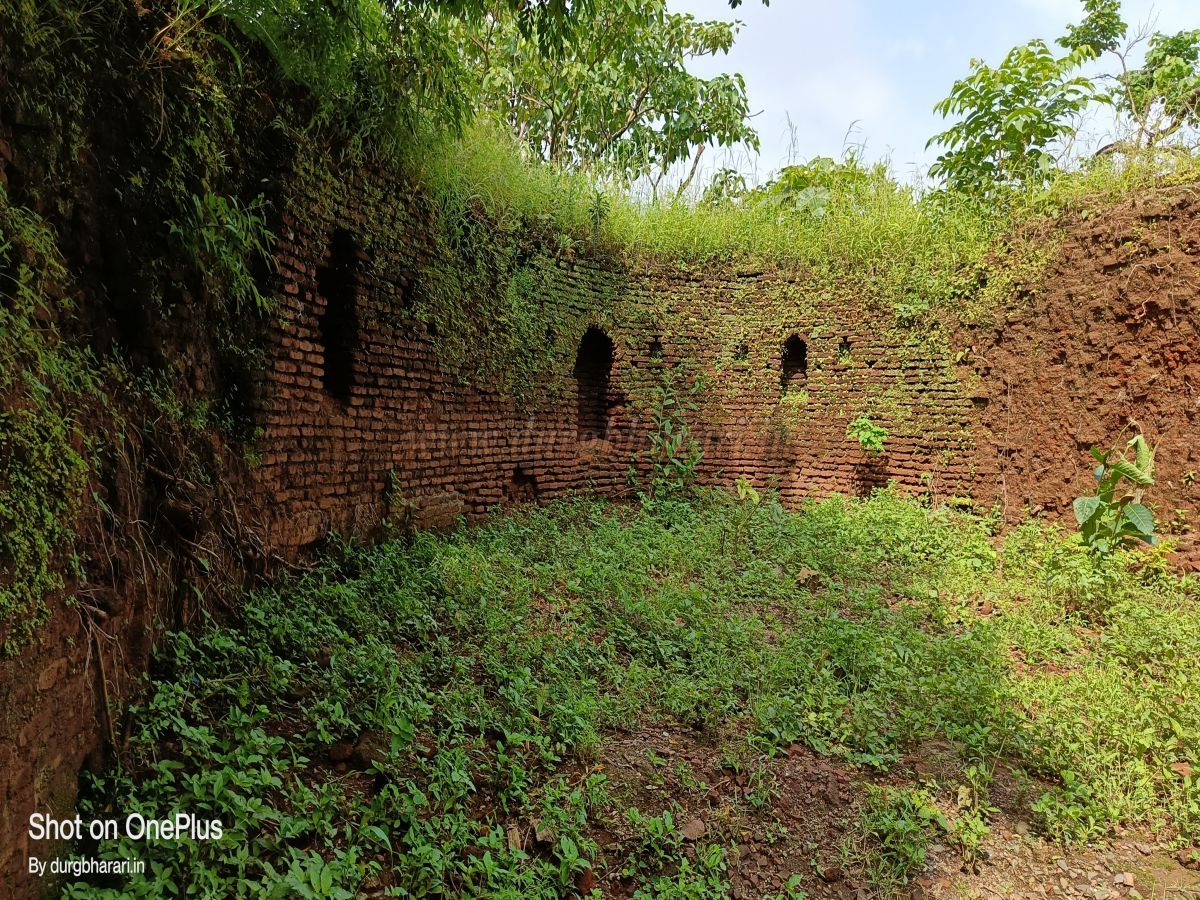
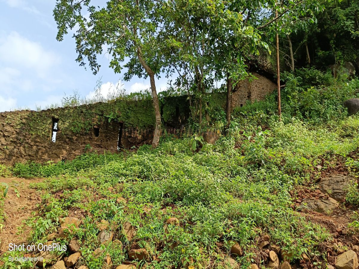
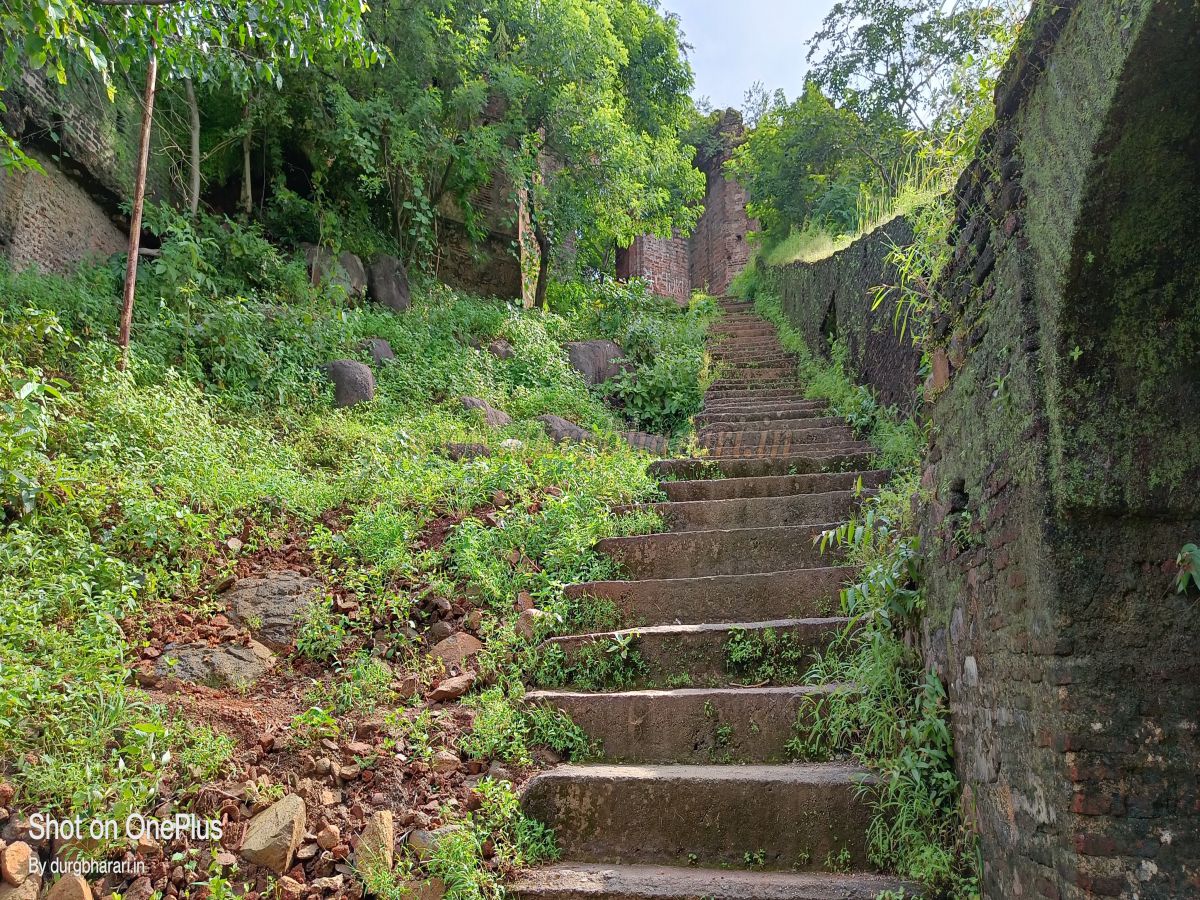
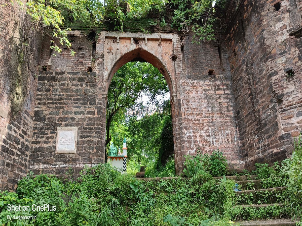
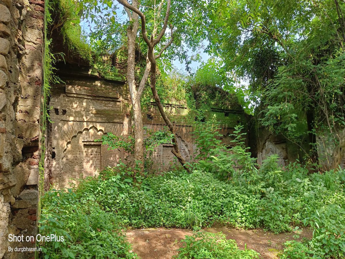
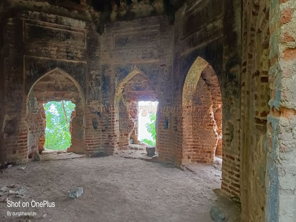
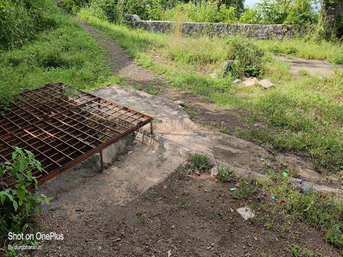
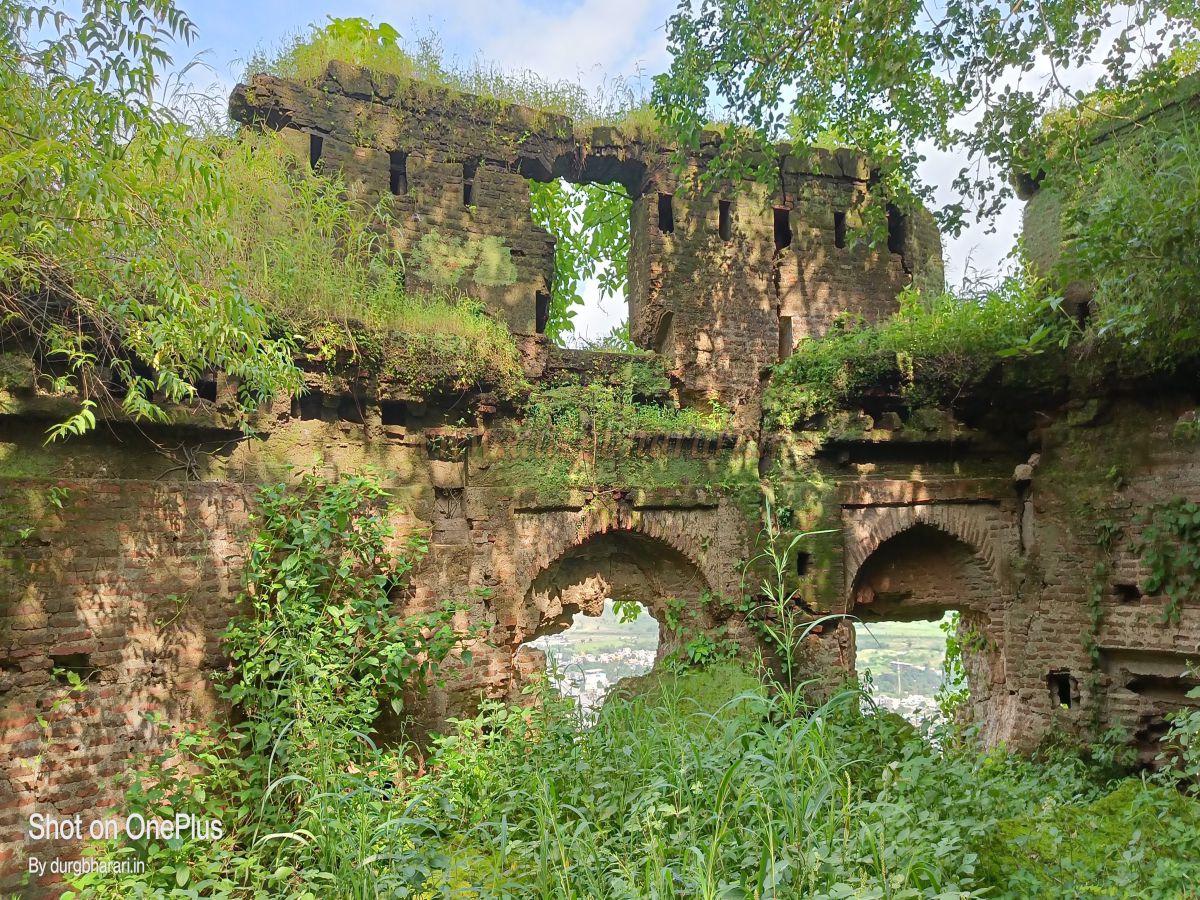
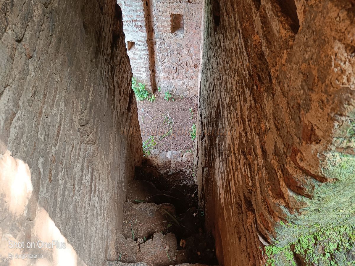
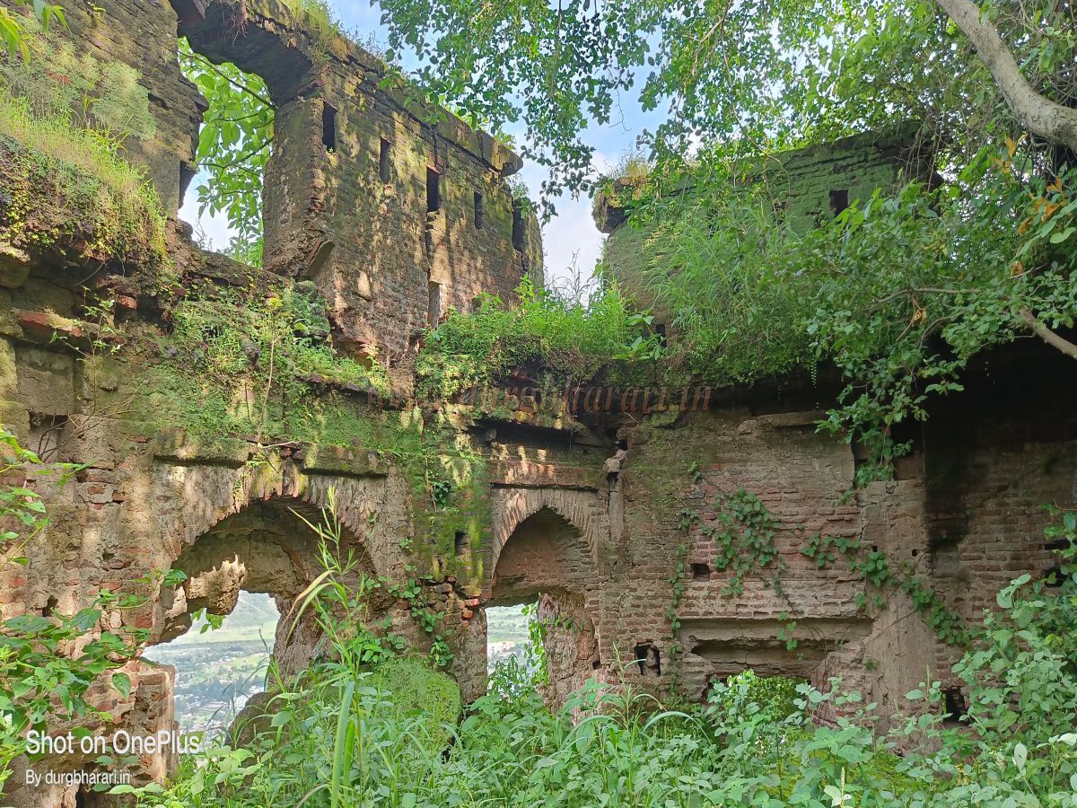
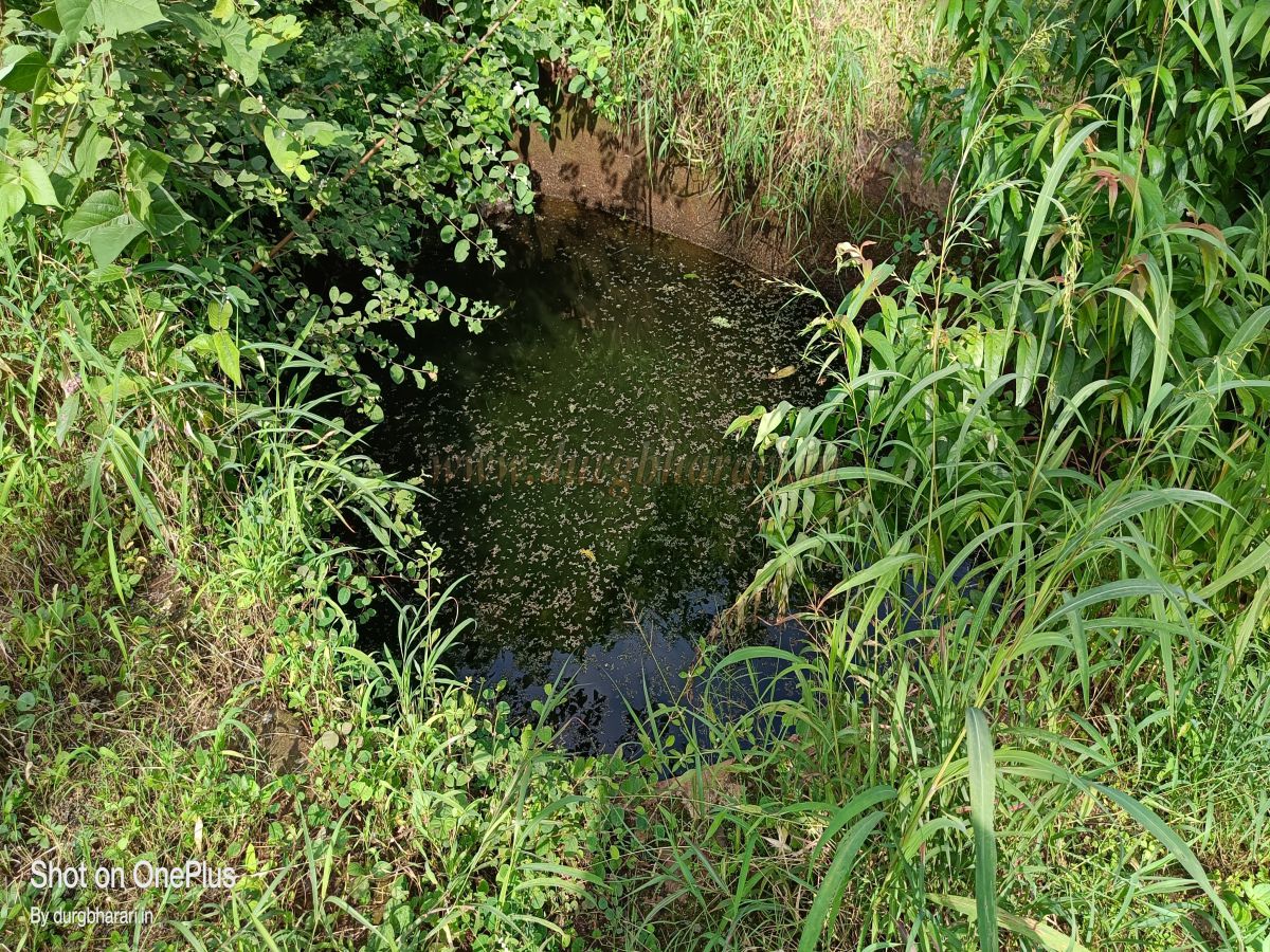
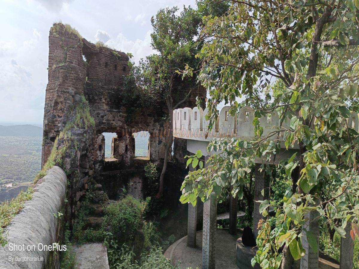
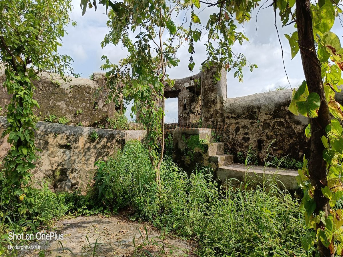
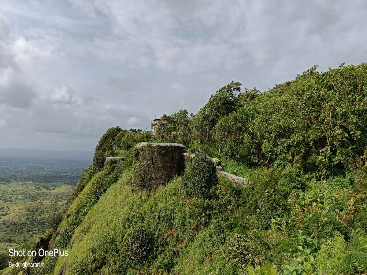
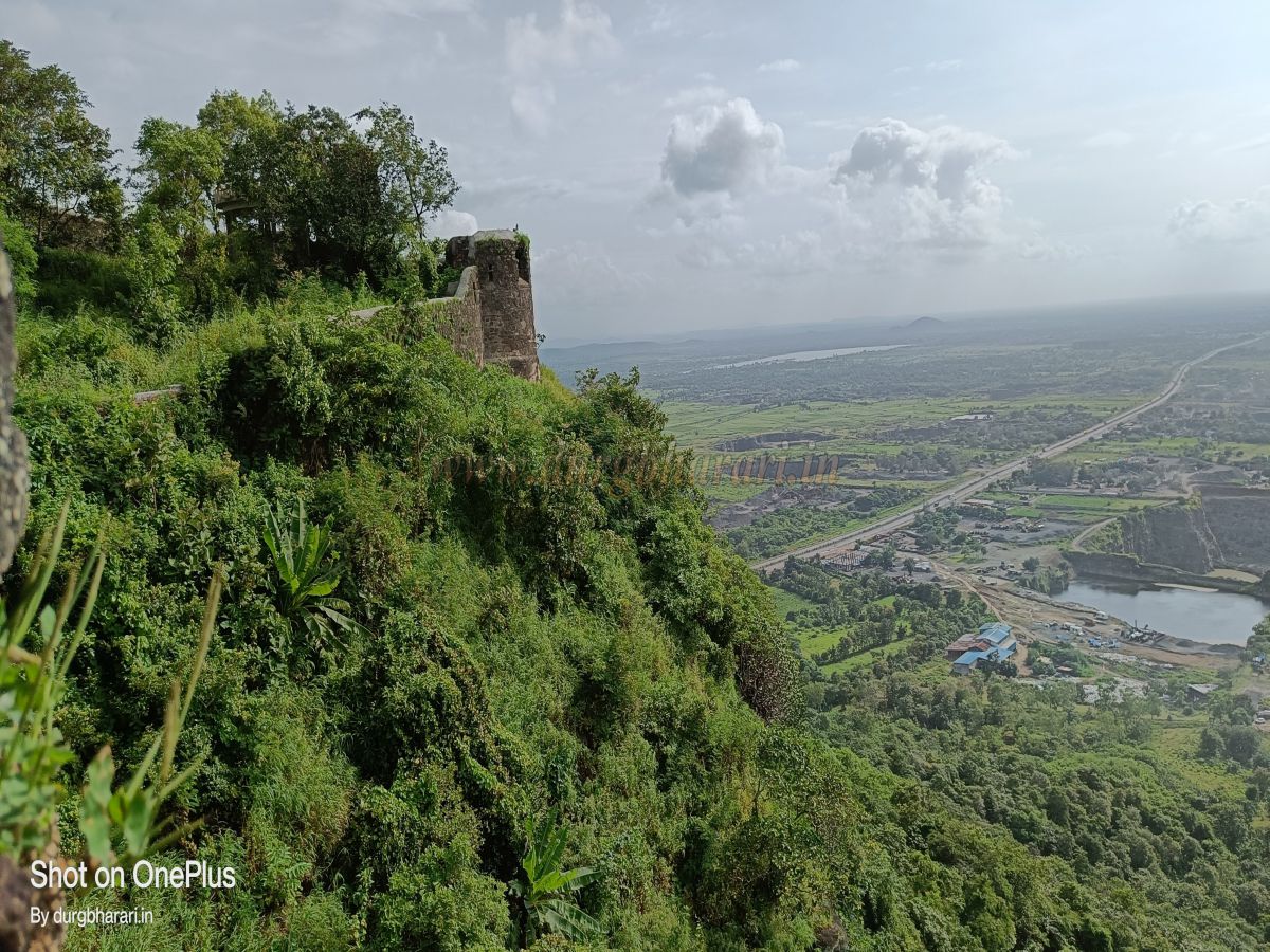
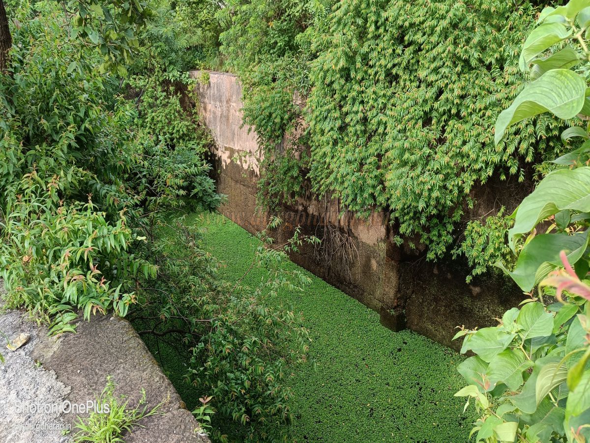
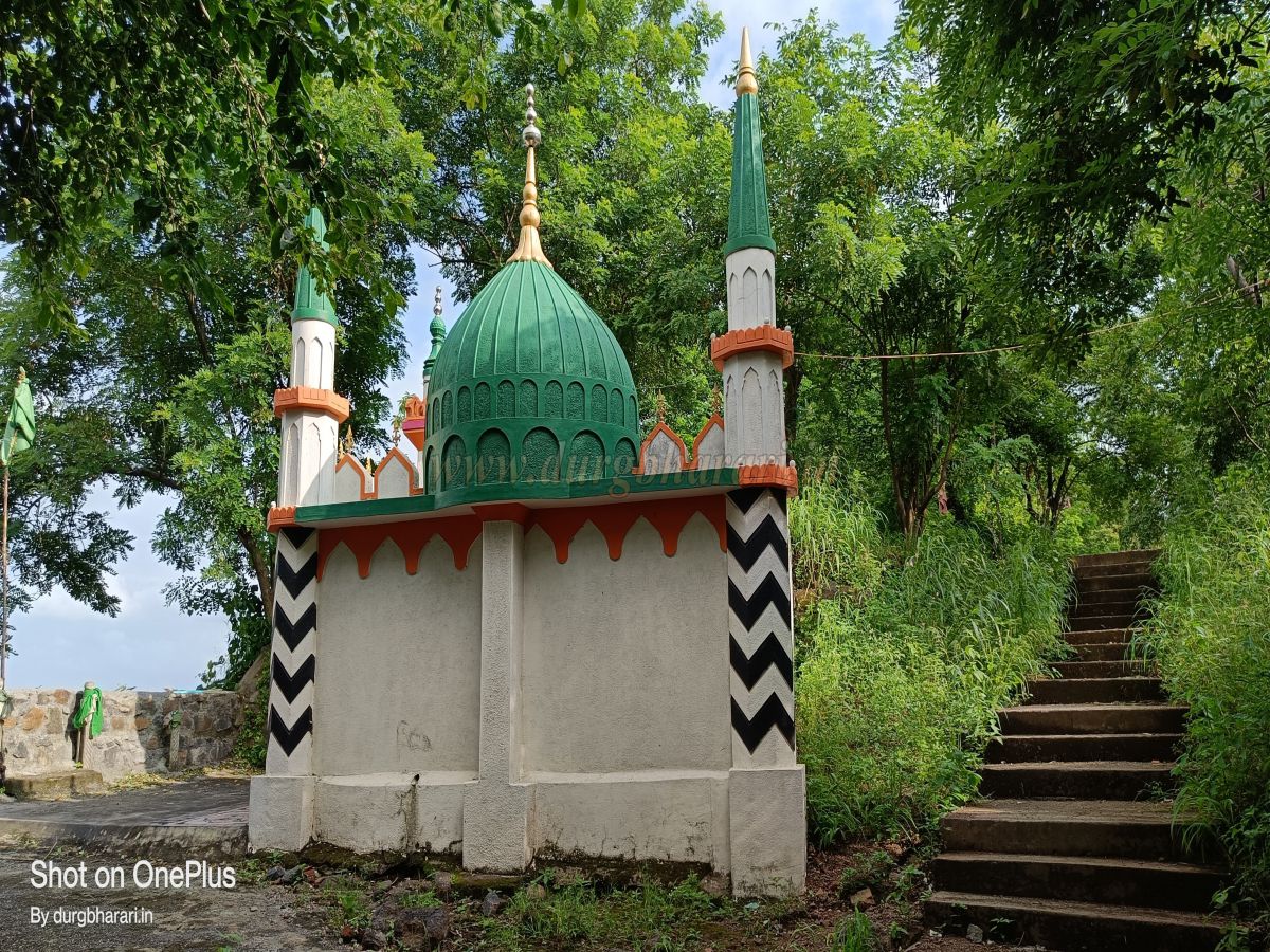
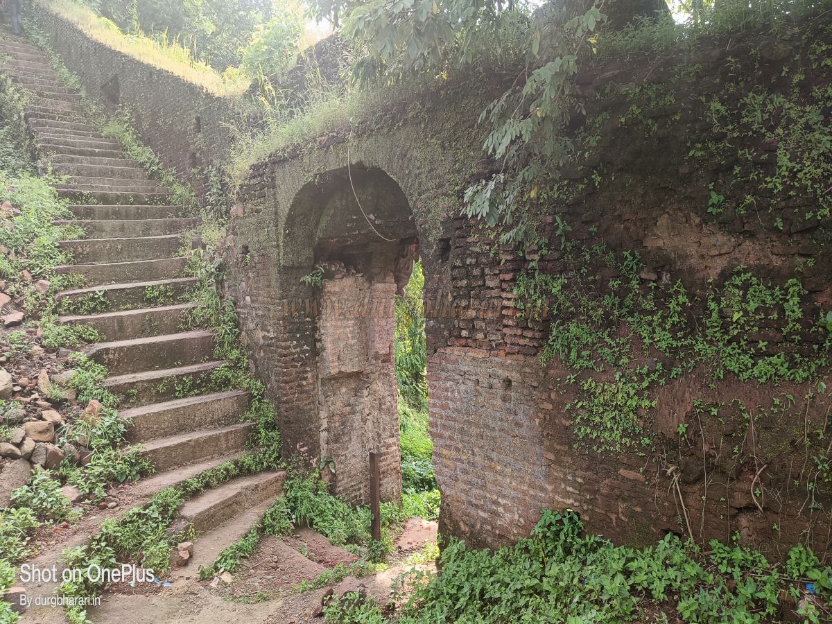
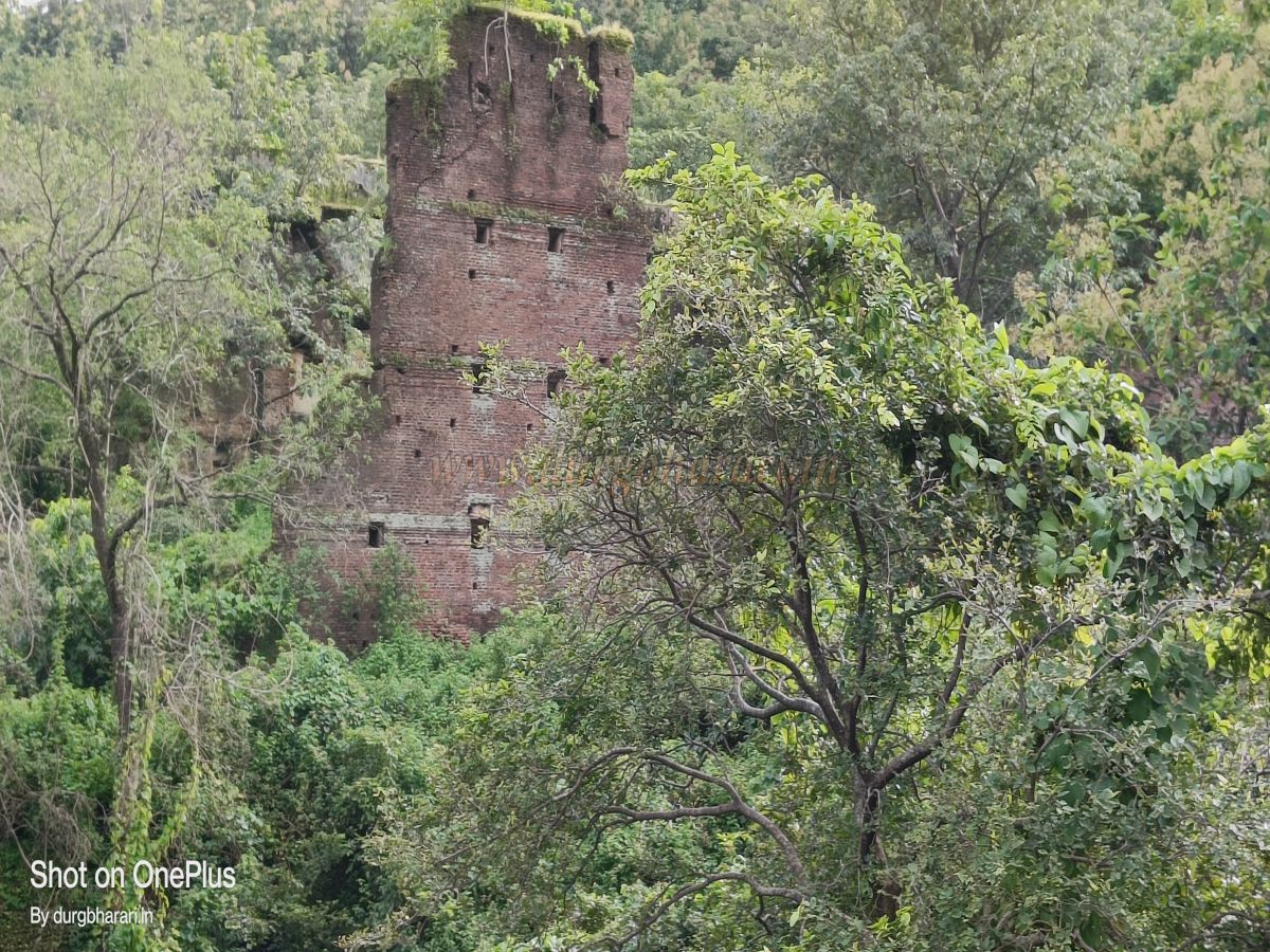
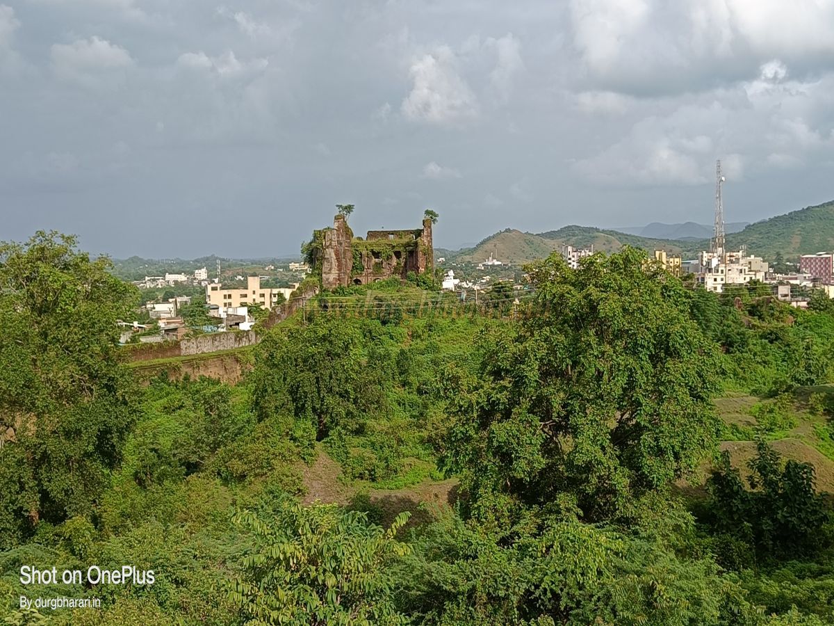
From that point, the forest department has built a rough road leading up to the fort, which can only be traversed by jeep-like vehicles. However, instead of using this road, one should take the footpath leading up to the fort. This is the original pathway, where one can still see stone steps and paved sections in some places. Following this route along the ridge, one enters the fort enclosure through a broken section of the outer wall. On the right side of this path, several sections of the broken wall along the ridge can be observed. This wall connects to a large bastion located on the slope of the inner fort. After about half an hour of climbing, one reaches the first north-facing gate of the inner fort. From there, turning right leads to a second east-facing gate. The narrow section between these two gates is enclosed by walls, resembling the inner passage near the Pali Gate of Rajgad. After entering through the first gate and climbing 25–30 steps, one reaches the second gate. This gate is built between two hexagonal bastions, which are two-storied. Inside, one can still see the arrangements for habitation in these bastions. Along the inner side of the wall, there are platforms, suggesting that this section might once have been completely covered with a roof. Moving further, there is a dargah on the left and a newly built temple on the right. This temple houses a Shiva lingam and a few rice-grain-shaped deities. From the temple, one can climb to the main gate and the tops of the adjacent bastions. Further ahead, on the left, stands a newly constructed Mahalakshmi temple. Moving on, a path slopes down to the left, while alongside the straight path, there are several new buildings, including those belonging to the police outpost, the railway wireless center, and the forest department. Instead of going straight, one should turn left. Near the wall here is a well-like underground water cistern with steps leading down, though some steps have collapsed, so the path is blocked with a net. However, water can still be drawn using a bucket. A little further ahead is a large bastion on the upper side of the second ridge of the fort, which has suffered significant damage. The wall built on the slope beneath this bastion extends down to the ground. There is a closed staircase within this bastion leading outside the fort enclosure. Near this bastion is a rock-cut water cistern. To its right stands another dargah, and in front of it is a temple dedicated to Khandoba. Moving further ahead, one reaches the southernmost tip of the fort, where near the wall is a small underground storehouse, which has now been converted into a temple. The entrance to this storehouse is at ground level, allowing only one person to enter at a time. Nearby, remnants of a mansion wall and platform can be seen. This is the highest point of the fort, with an elevation of 1,075 feet above sea level. Continuing along the wall’s edge, one comes across six bastions of varying sizes, one of which appears to have once been three stories tall. This path leads back to a section near the main gate. At this point, there is a large rock-cut tank measuring 30 x 60 feet, with its inner walls lined with lime plaster. The path in front of this tank leads back to the main gate, thus completing the tour of the inner fort. Below the fort, towards the west and south, there are numerous stone quarries. Blasting carried out for stone extraction has caused significant damage to the fort’s walls, weakening them. To see the ruins within the fort enclosure, one can descend via a secret pathway near the bastion beside the cistern or take a right-turning trail about halfway down, leading to the lower section of the enclosure. The fort is built on a medium-height hill, covering an area of about one square kilometer. The walls are constructed along two ridges that descend toward the plains, and at ground level, these two ridges are connected by walls, making the total length of the fortifications about 1.75 km. In earlier times, the village of Songadh might have been located entirely within this enclosure. Inside this fortified area are the ruins of Pilaji Rao Gaikwad’s seven-story mansion and a large reservoir, along with numerous other remains scattered throughout. Currently, thick vegetation covers the area, making it necessary to search for the ruins apart from the mansion and reservoir. The walls feature several bastions and small gates, with a massive circular bastion located at the edge facing the plains. The lower sections of these walls are built with stone, while the upper portions are constructed with bricks. A railway line to Ukai now cuts through the enclosure, dividing it into two parts. In 1531, this region, initially under the Farooqui Sultans, came under the control of the Gujarat Sultans until 1560, after which it passed to the Mughals and finally came under Maratha rule in 1730. The history of Songadh Fort truly begins in the Peshwa era. Pilaji Rao Gaikwad, who served alongside Sardar Khanderao Dabhade, was granted the title of Senasarnobat by Chhatrapati Shahu Maharaj and dispatched with the Peshwa to the Dang region of Khandesh. At that time, Surat was an important port, and the Surat–Burhanpur route held great significance. Goods arriving at the port traveled through Surat–Songadh–Nawapur to Khandesh and from there to Burhanpur and other destinations. This route through the Dang region was densely forested. In 1719, Pilaji Rao Gaikwad defeated the local Bhil tribes and took control of the Songadh hill, integrating the Bhil tribal population and establishing the Songadh Fort in 1721. To maintain better contact with Maharashtra, he made this border fort his main base. Initially functioning as a border outpost, the fort was later transformed into a capital-like settlement by Pilaji Rao Gaikwad, who built a seven-story palace within its walls. Later, as other regions of Gujarat came under their control, his son Damaji Rao Gaikwad shifted the capital to Baroda for administrative convenience, causing Songadh Fort to lose its grandeur. Songadh Fort stands today as an excellent example of medieval Maratha architecture.
© Suresh Nimbalkar
GALLERY