SHIV-SION
TYPE : COASTAL FORT
DISTRICT : MUMBAI
HEIGHT : 160 FEET
GRADE : EASY
In a metropolitan city like Mumbai, the mention of forts may come as a surprise, but at one time during the British era, there were as many as eleven forts in Mumbai. These were built during different periods by the Portuguese and the British. On the western coast of Mumbai stood the forts of Worli, Mahim, Bandra, and Madh, while on the northern coastline, a chain of forts—Kala Killa, Riwa Fort, and Sion Fort—was constructed. To the east, the Shivdi, Mazgaon, Dongri, and Bombay Forts guarded the city. Among these, the Mazgaon and Dongri forts have been completely destroyed, and only a remnant of the Bombay Fort remains. The remaining eight forts, however, can still be seen today.
While traveling from Sion towards Vashi, one can spot a tall hill on the right; this is the Sion Fort, located at the border (or "Shiwe") of the main Mumbai Island.
...
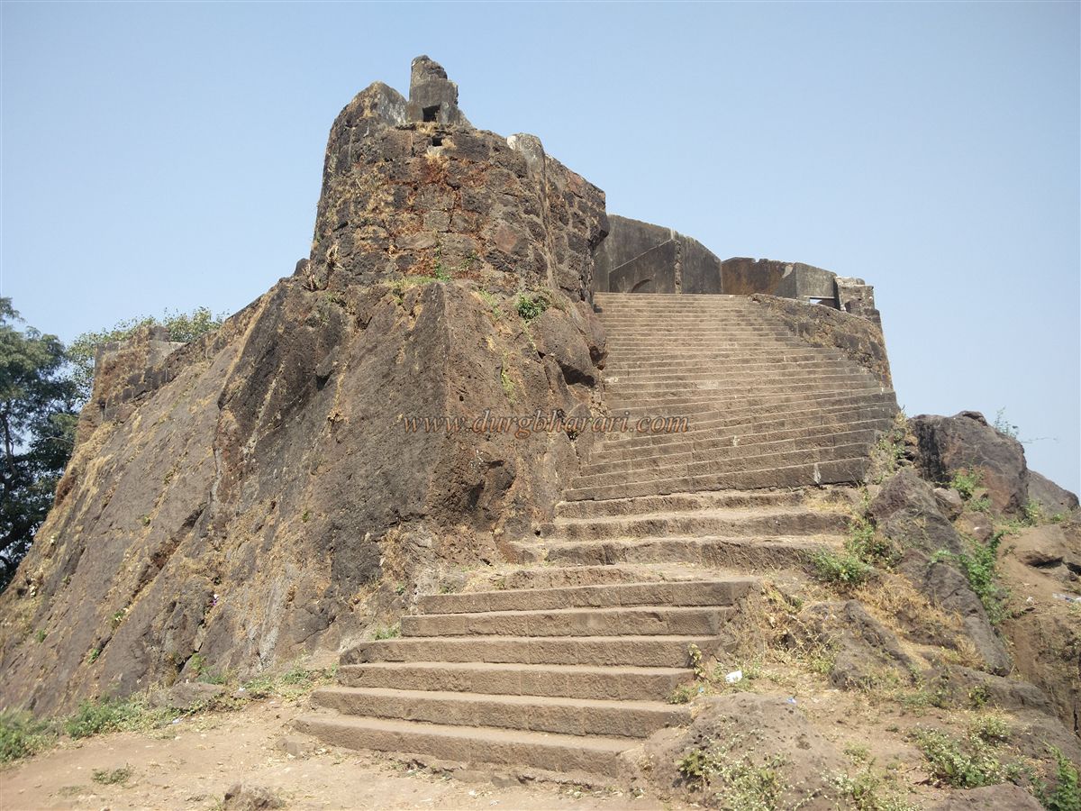
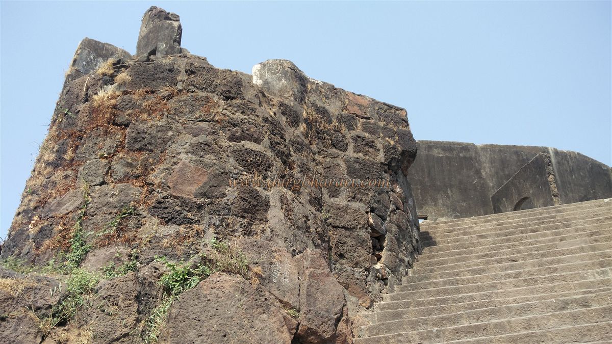
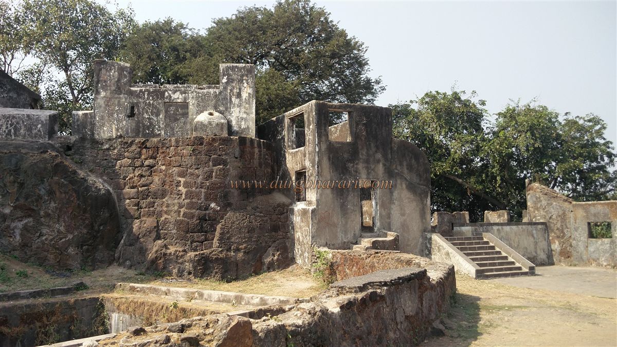
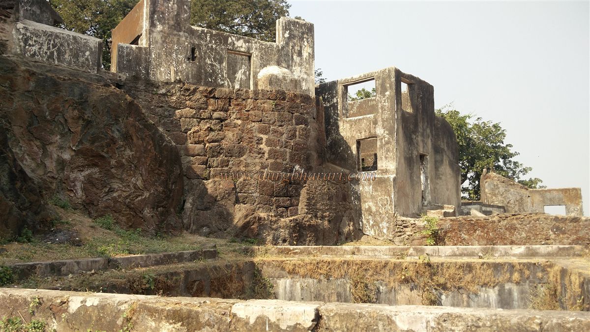
The British built the Sion Fort on a hill at the eastern mouth of the Mahim Creek. To reach the fort, one needs to get down on the eastern side of Sion railway station on the Central Line and walk along the road on the left. After crossing the Sion-Panvel highway, a road flanked by ancient trees leads to the foot of the fort. At the base lies the Nehru Garden maintained by the municipal corporation, and nearby stands the office of the Archaeological Survey of India. On a platform outside the office are mounted two cannons placed on wooden carriages. From the office entrance, a stepped path leads up to the fort. There are proper stairways to reach the fort, and it can be accessed from both the northern and southern sides.
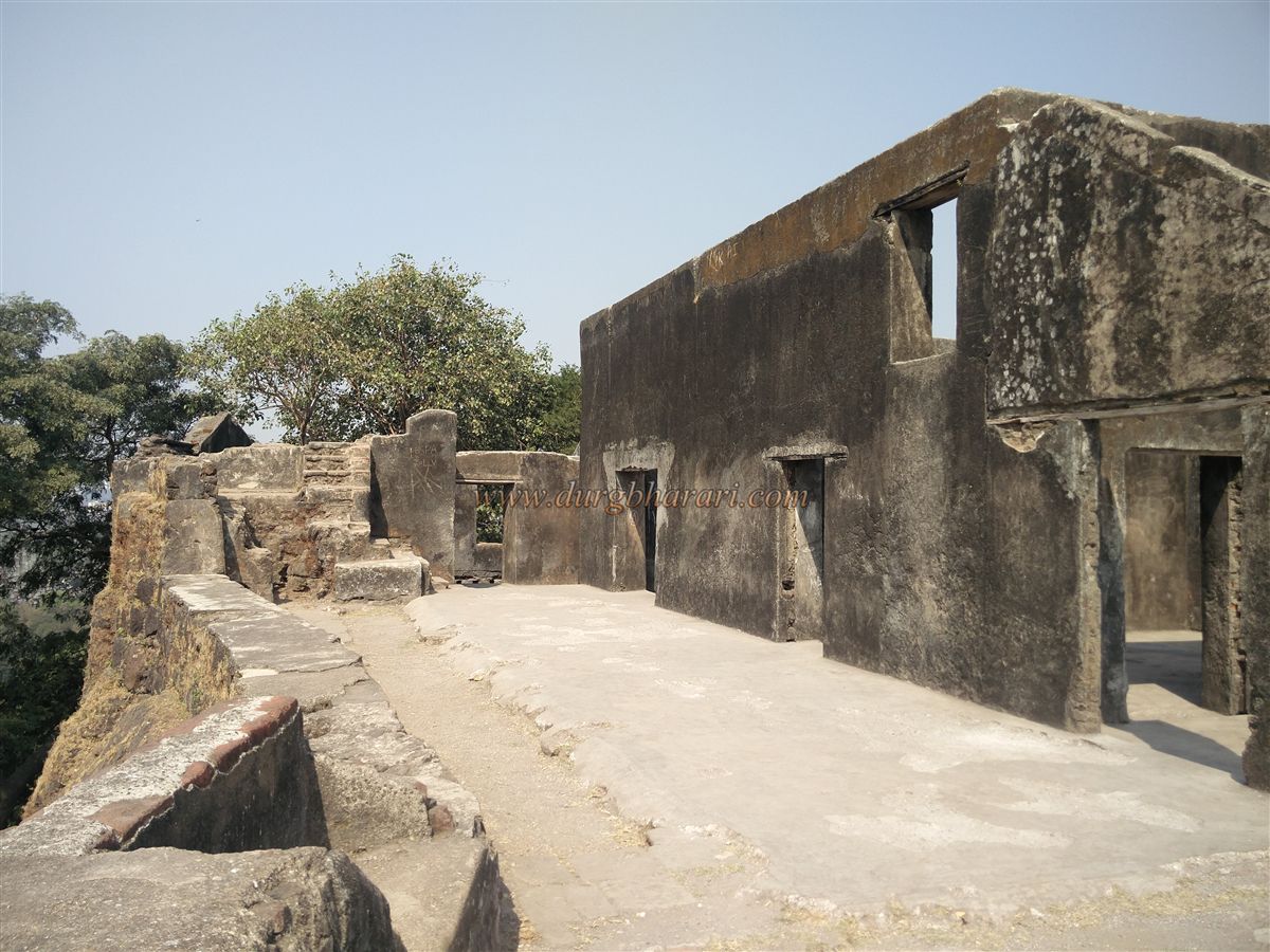
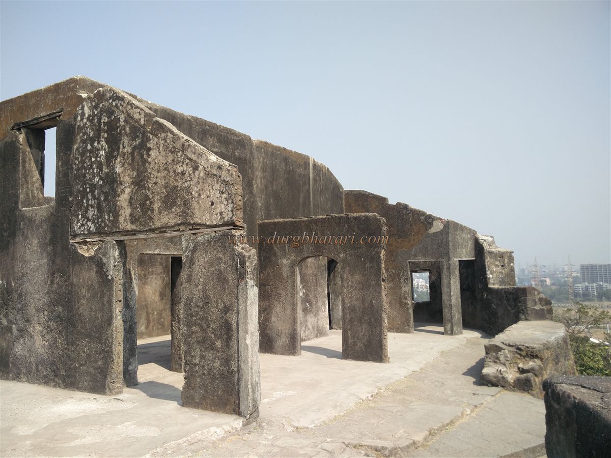
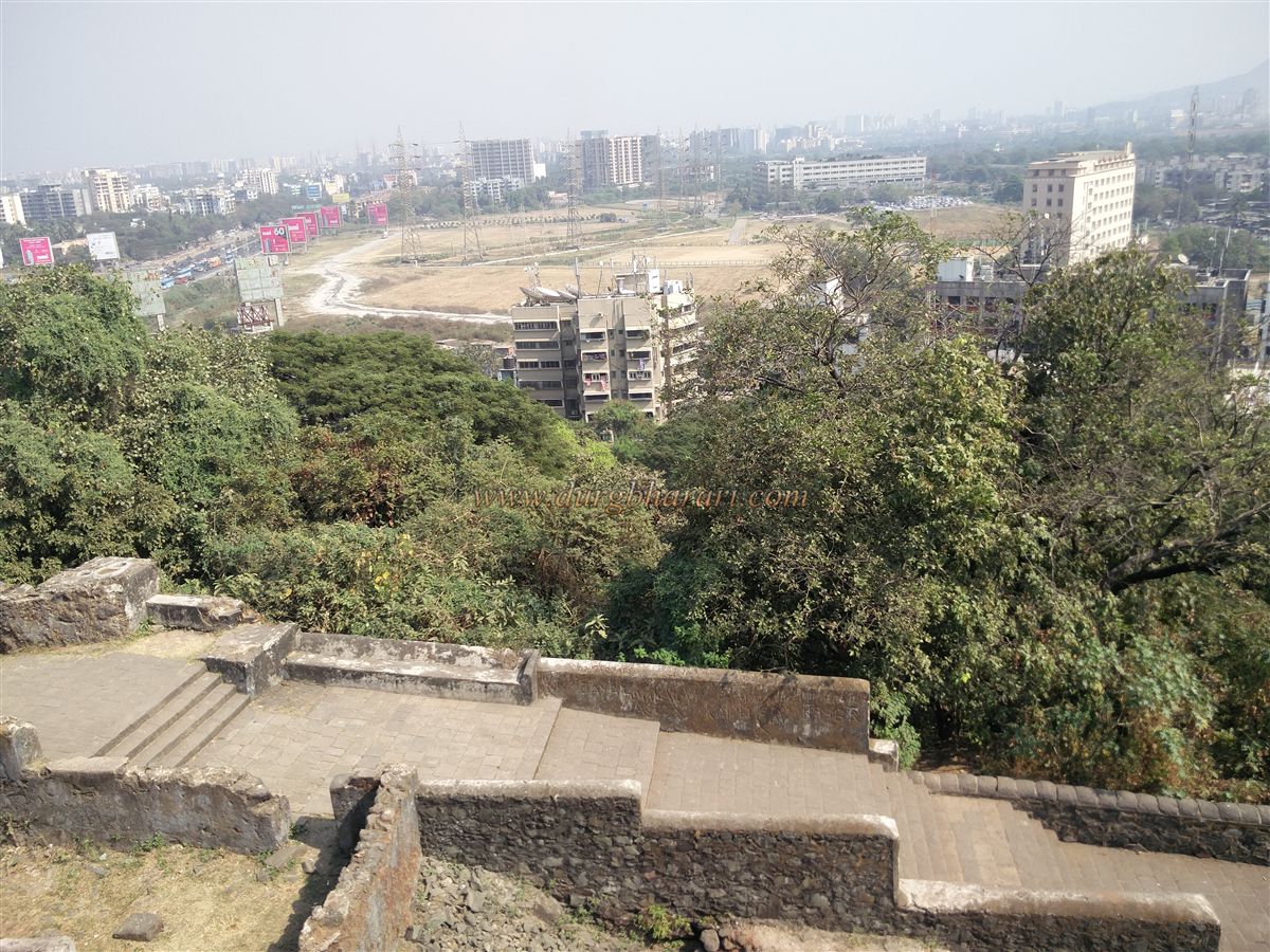
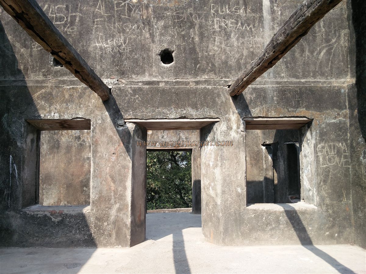
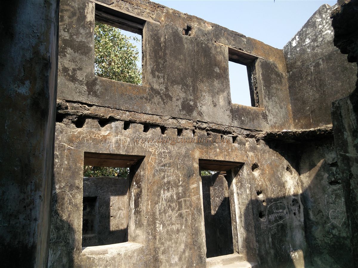
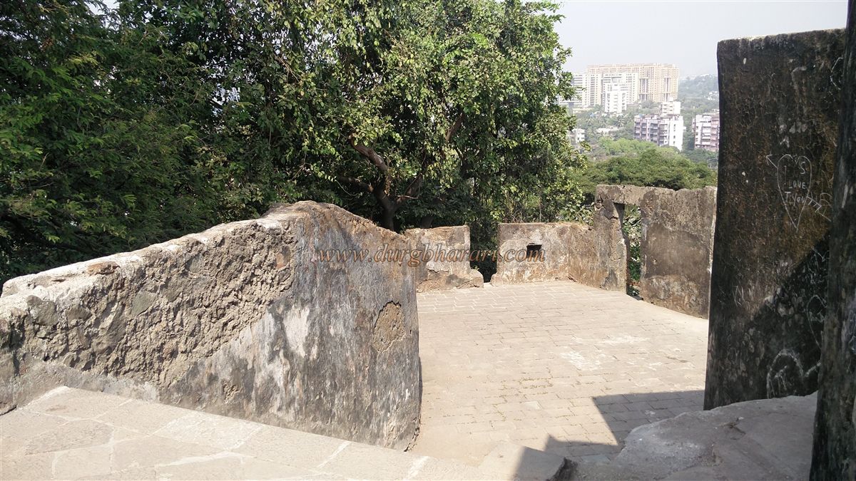
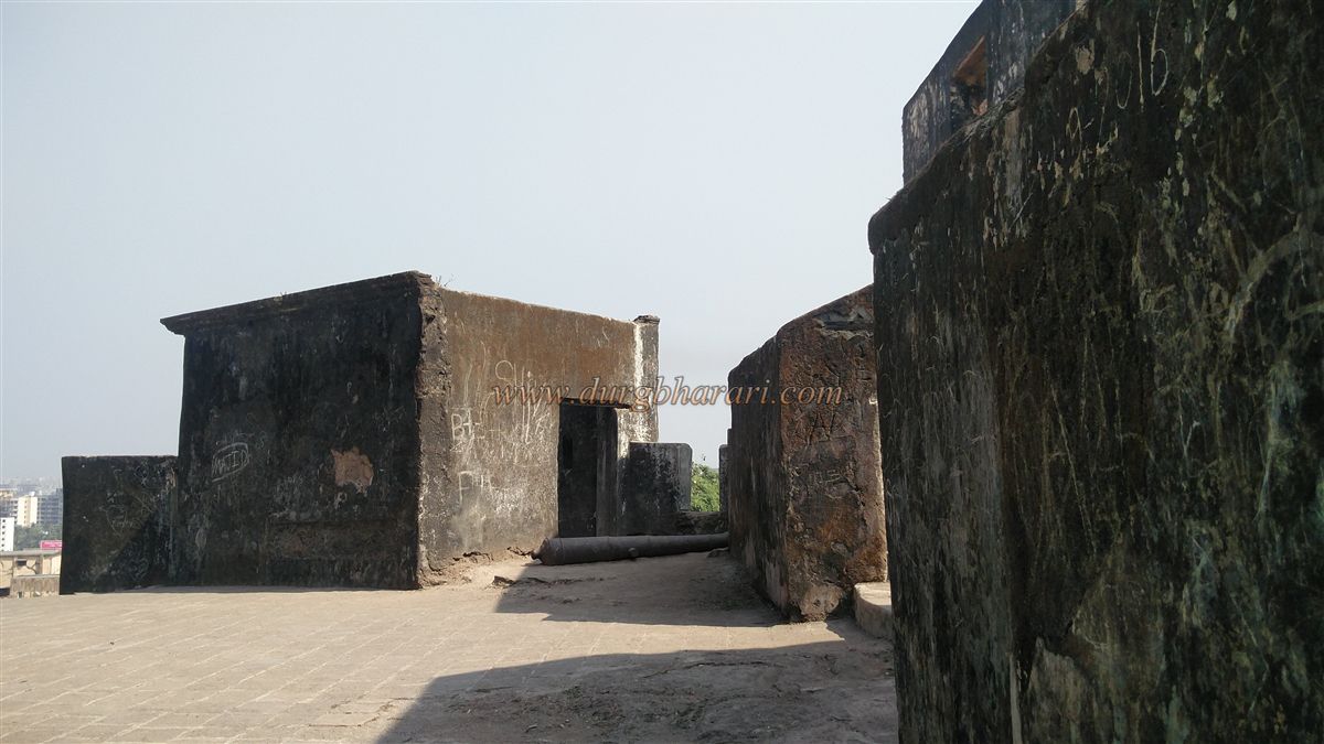
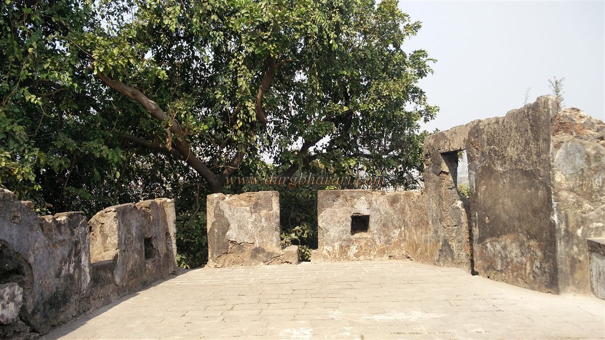
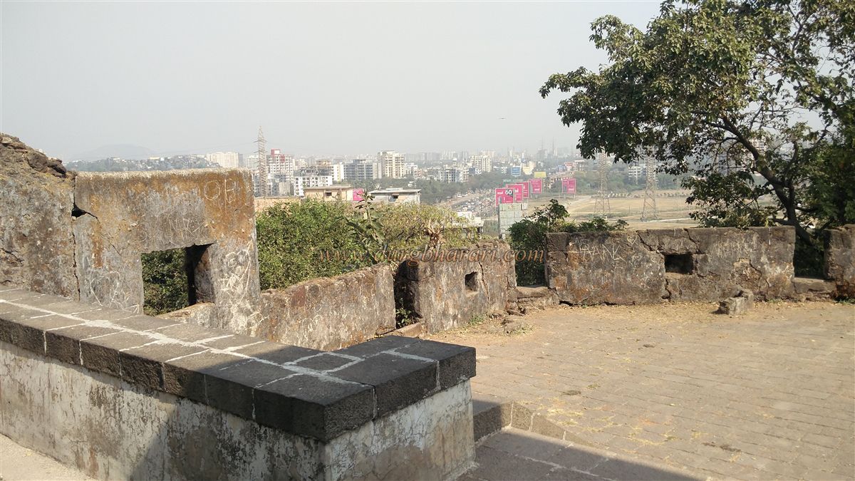
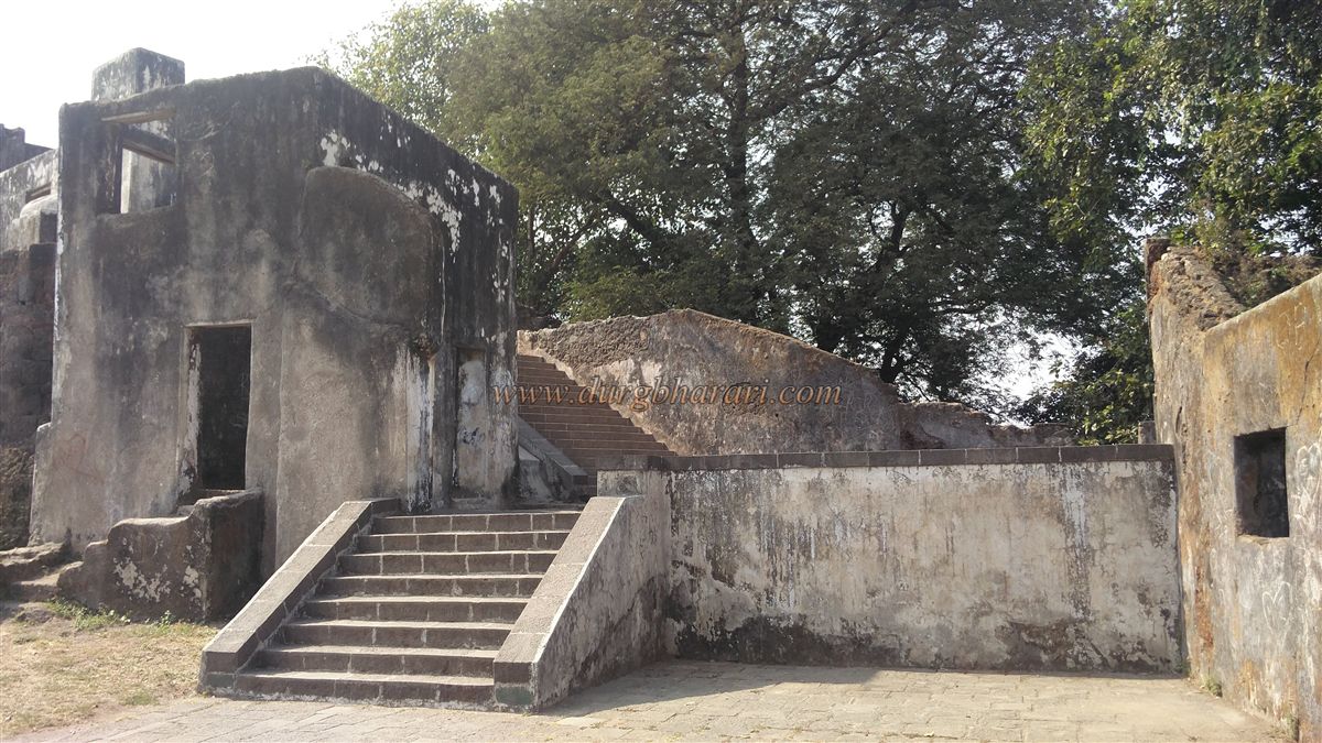
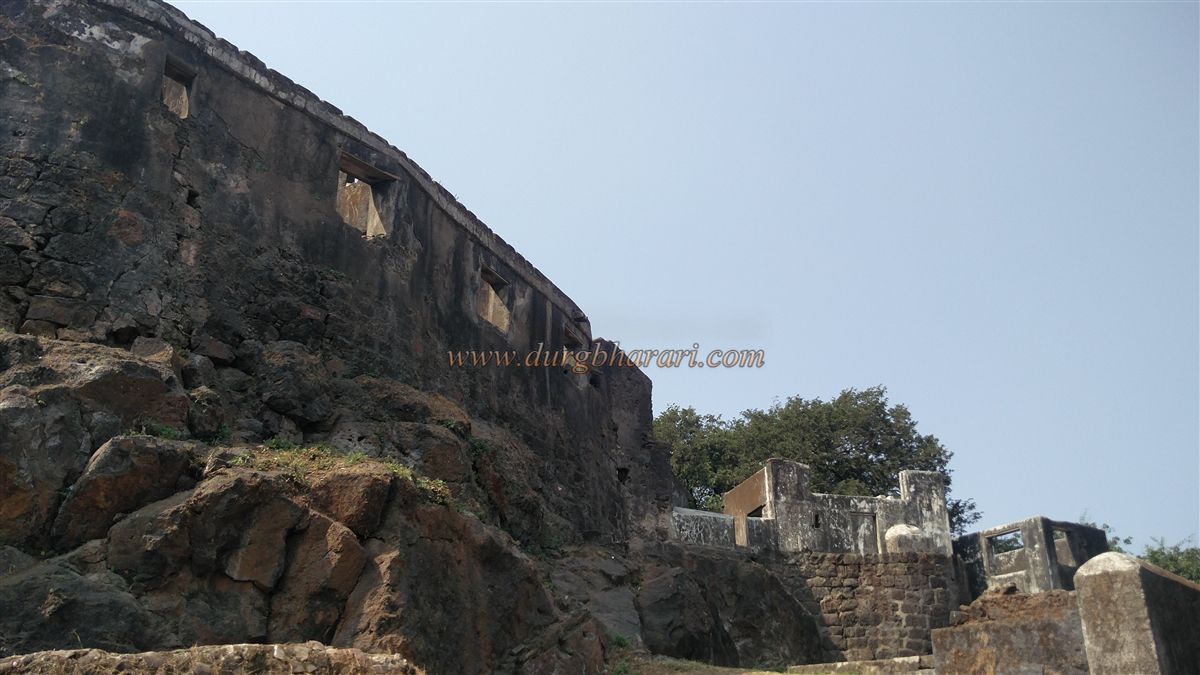
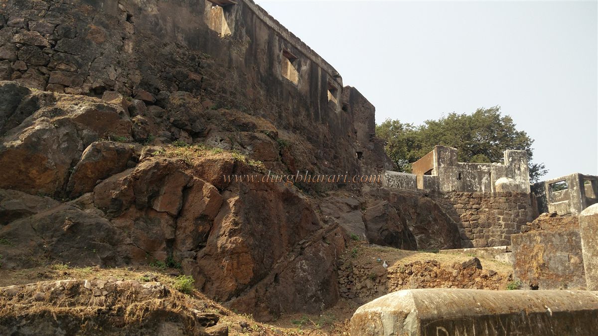
As soon as one climbs the hill, the remnants of the fort come into view. The Archaeological Department has maintained the fort well. Its construction is entirely in British style, and many of its remains are still visible. Parts of the fort’s outer walls still stand, and one can see structures built for defense within the fortifications. Based on the available remnants and historical references, it is believed that the fort was used not only for surveillance but also as an administrative outpost. The construction of the fort employed dressed and undressed stones along with lime. The presence of wooden beam slots in the walls indicates that the structure was partly two-storied and partly three-storied. At the center of the fort lies a medium-sized cannon. In addition, one can still see bastions, remains of office buildings, an ammunition storage room, and a large square water reservoir. From the central bastion, one can enjoy a panoramic view of the Mahim Creek and the surrounding areas.
The fort mainly served as a watchtower to monitor the Mahim Creek and the water traffic passing through it. Though dwarfed today by the high-rises around it, there was a time when from this fort one could see not only the Dongri and Mazgaon forts but also other forts in Mumbai. The presence of cannons suggests that the fort was equipped with considerable artillery to prevent enemy forces from entering the city. Every Mumbaikars should visit this fort at least once.
The Riwa, Sion, and Dharavi forts do not have a history of battles because they were built mainly for surveillance. Sion marked the boundary between Mumbai Island and the Salsette (Sashti) Island. The Portuguese captured the Mumbai islands from the Sultan of Gujarat in 1534. Later, in 1664, they officially handed them over to the British. The original seven islands of Mumbai were: Great Colaba, Little Colaba, Bombay, Mazgaon, Parel, Worli, and Mahim. As these seven islands began to merge, the British built three more forts—Kala Killa, Riwa Fort, and Sion Fort—on the northern boundary for the city’s defense.
The Sion Fort was built in 1670 by Gerald Augier at the border between Mumbai Island and the Portuguese-controlled Salsette Island. This fort was of great importance to the British, as it allowed them to monitor trade coming from the east and prevent enemy invasions. Until 1740, when the Marathas drove the Portuguese out of Salsette, the Sion Fort remained on the border between British and Portuguese territories. After the Maratha victory at Vasai, Salsette came under Maratha control, further increasing the strategic importance of the Sion Fort. Along with the Mazgaon Fort, this fort’s height made it significant for signaling dangers to other forts on the eastern and western coasts.
The Mahim Creek was once a water passage where the sea entered from Mahim and flowed out at Sion. At the mouth of the creek, the sea waves roared as they entered, but near Sion, the land level was slightly higher, making the sea shallower. This area was later reclaimed, connecting Sion to the villages of Chunabhatti and Kurla. The sea water continued to flow inland from Mahim, carving a path that became the old Mithi Creek, which is today the Mithi River. To travel from Bandra to Mahim in those days, one had to cross the creek by boat. As construction increased in these marshy areas, the creek gradually shrank, and eventually, the Mithi Creek transformed into what we now know as the Mithi River.
© Suresh Nimbalkar
GALLERY