SEGWAGAD
TYPE : HILL FORT
DISTRICT : PALGHAR
HEIGHT : 1210 FEET
GRADE : MEDIUM
Due to Mumbai, the Konkan region is divided into North Konkan and South Konkan. South Konkan includes the districts of Raigad, Ratnagiri, and Sindhudurg, while North Konkan includes the districts of Thane and Palghar. The Mumbai–Ahmedabad National Highway passes through Palghar district. Along this highway, in Dahanu taluka, surrounded by dense forest, stands Segwagad. A one-day trip from Mumbai to visit the fort pair of Segwa and Ballalgad can easily be done by private vehicle. To visit Segwagarh by train, one must reach Dahanu railway station on the Western Railway route. The village of Karanjvira, located at the base of the fort, is 32 km from Dahanu railway station and 16 km from Charoti junction on the Mumbai–Ahmedabad highway. Karanjvira village is located inward from the highway, and while traveling from Mumbai towards Ahmedabad, 15 km from Charoti on the right-hand side of the highway, there is a turn leading to the village.
...
A landmark to identify this turn is the large Ahura-Aram hotel on the left side of the highway, along with several other hotels in a row. From this turn, traveling about 1 km by private vehicle, one reaches near a brick kiln, from where a road leads to the village school. From Karanjvira, the Segwa fort is visible behind the village. Additionally, there is also a route to the fort from the nearby Shisne village, but climbing via this route is quite difficult and inconvenient.
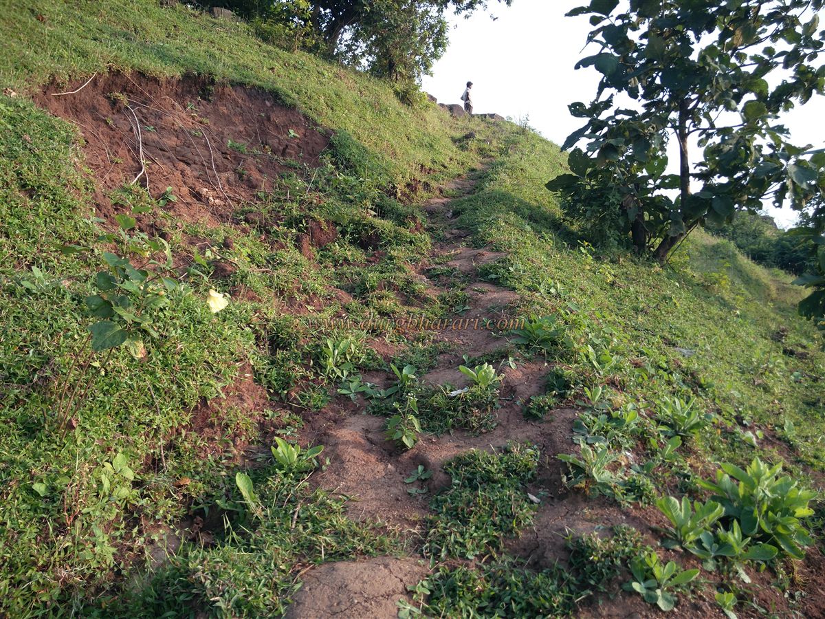
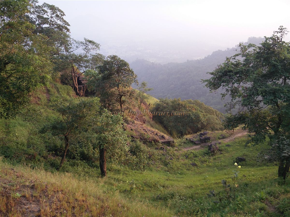
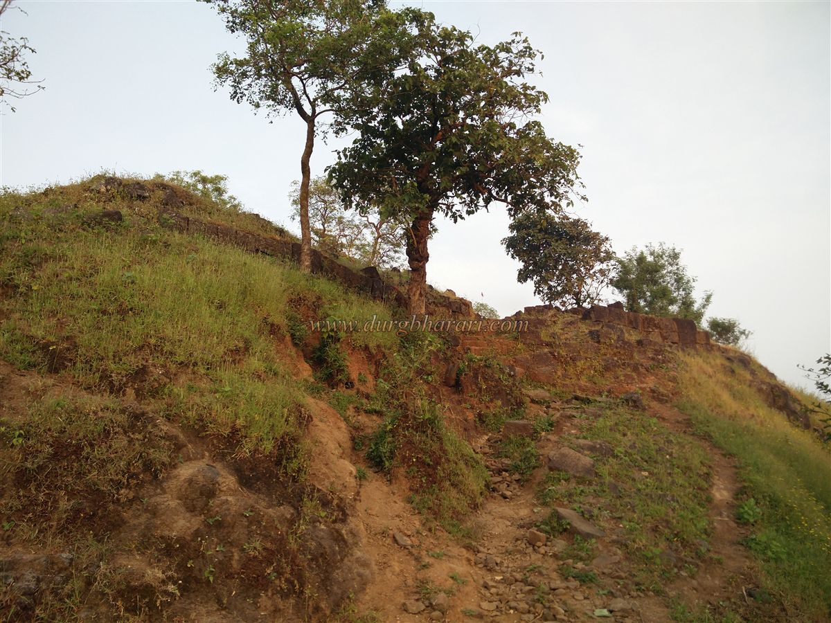
The trekking path to the fort begins from an Adivasi settlement at the edge of the village and ascends the fort from the left side of the hill. Since there is no potable water on the fort, one must carry water from the village before starting the climb. The path to the fort is well-trodden, though there are two misleading turns, so it is advisable to get proper directions from the villagers. There is some vegetation along the path, but due to the humid climate, climbing becomes quite exhausting. The route from Shisne eventually joins this same path. From the village, it takes about an hour to reach the base of the fort’s plateau. From here, a simple rock climb and a ruined fortification lead to the fort’s plateau.
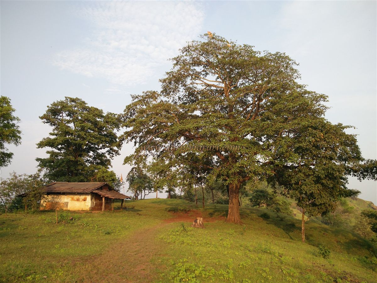
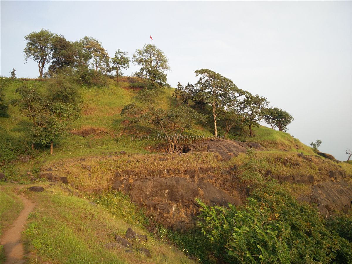
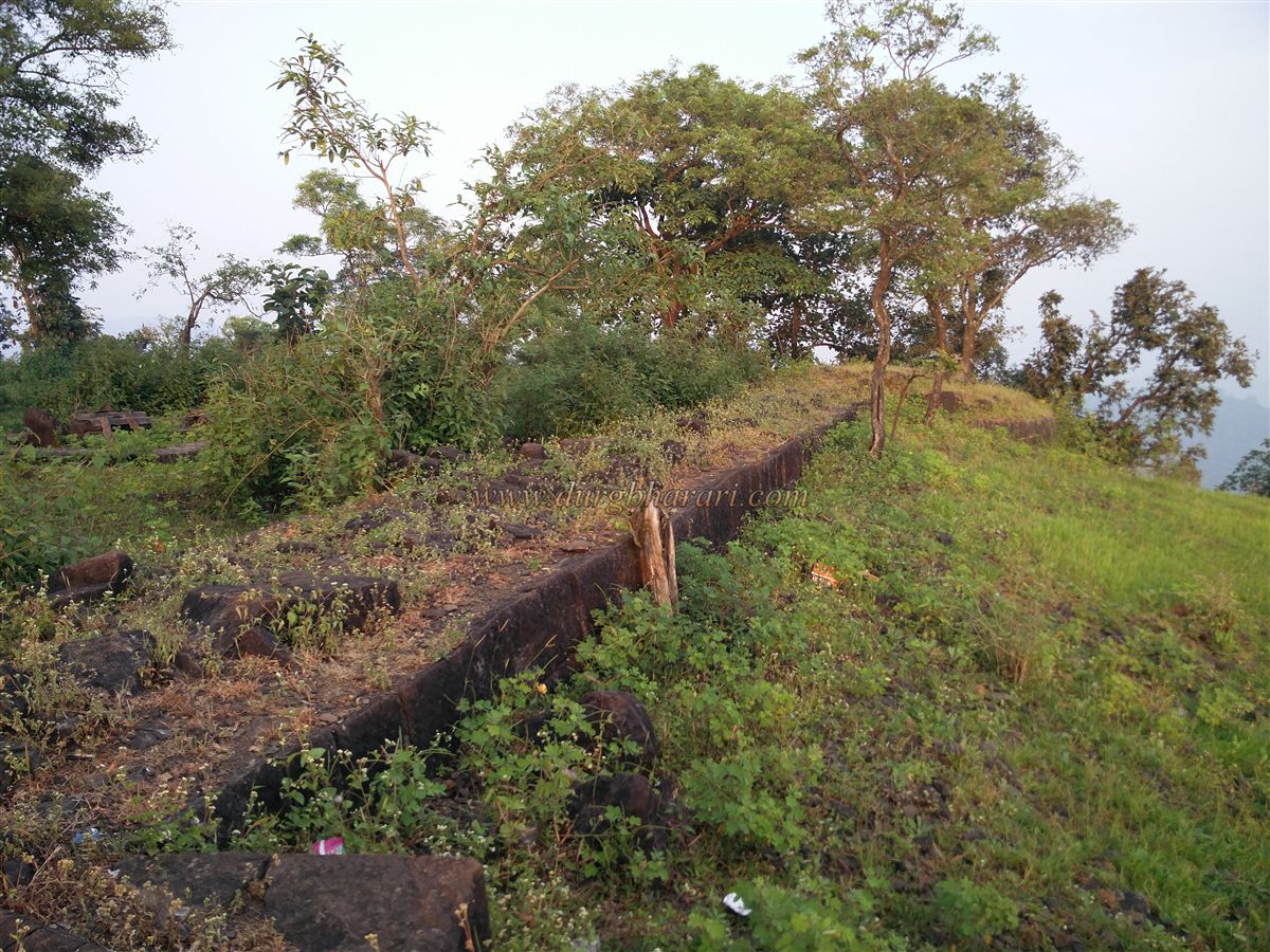
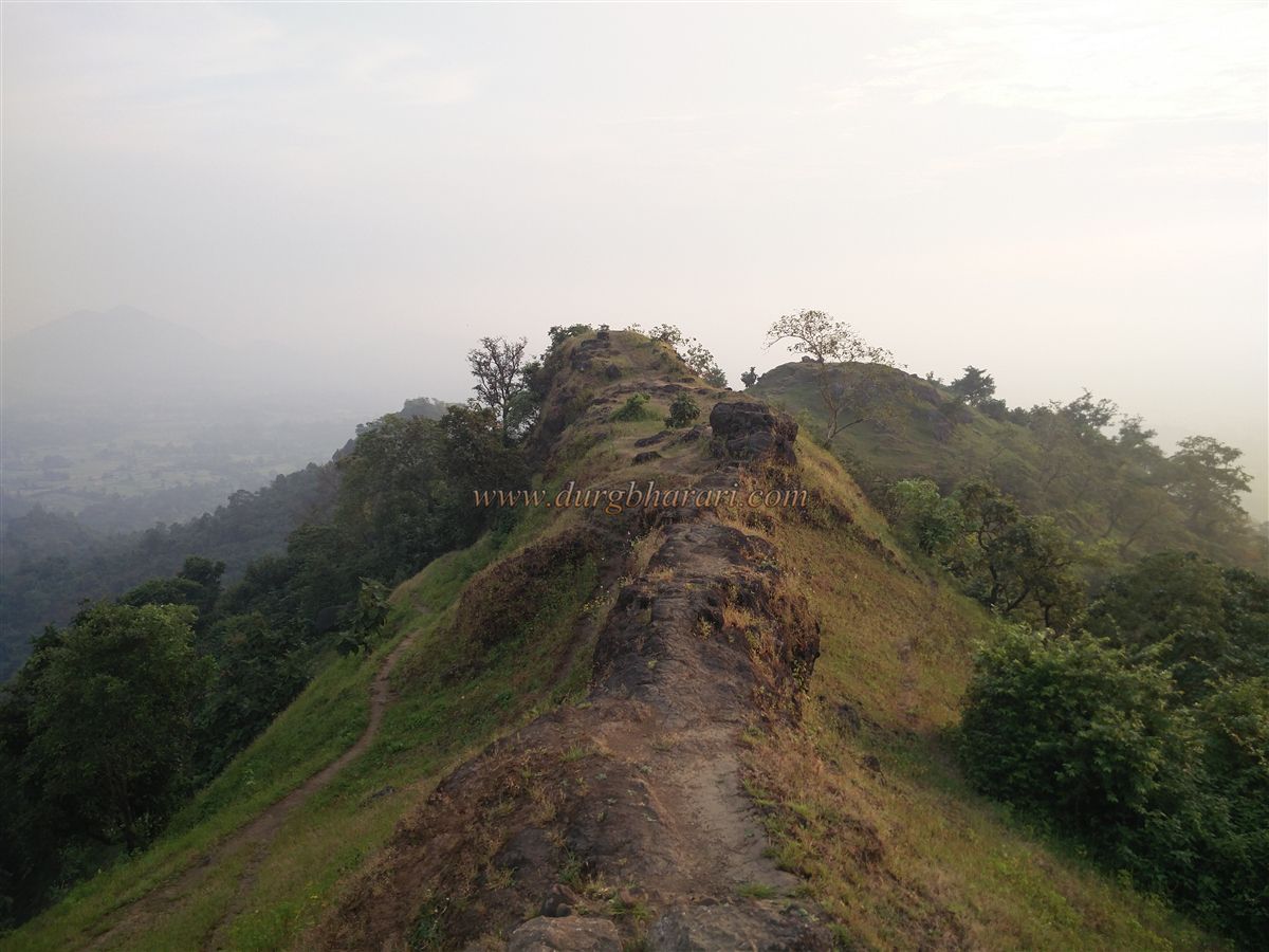
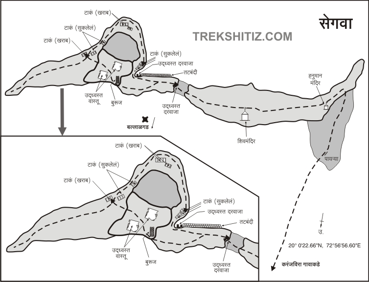
Segwagarh stands at an altitude of 1,080 feet above sea level and is divided into two parts – the plateau (machi) and the citadel (Balekilla). The fort covers an area of about 3 acres, with the plateau and the citadel stretching from south to north. At the entry point onto the plateau, on the right side is a small section with remnants of fort walls and the base of a circular bastion. From this spot, one can view the Mumbai–Ahmedabad highway and the Mahalakshmi pinnacle. After exploring this side of the plateau, one should head left to continue the exploration.
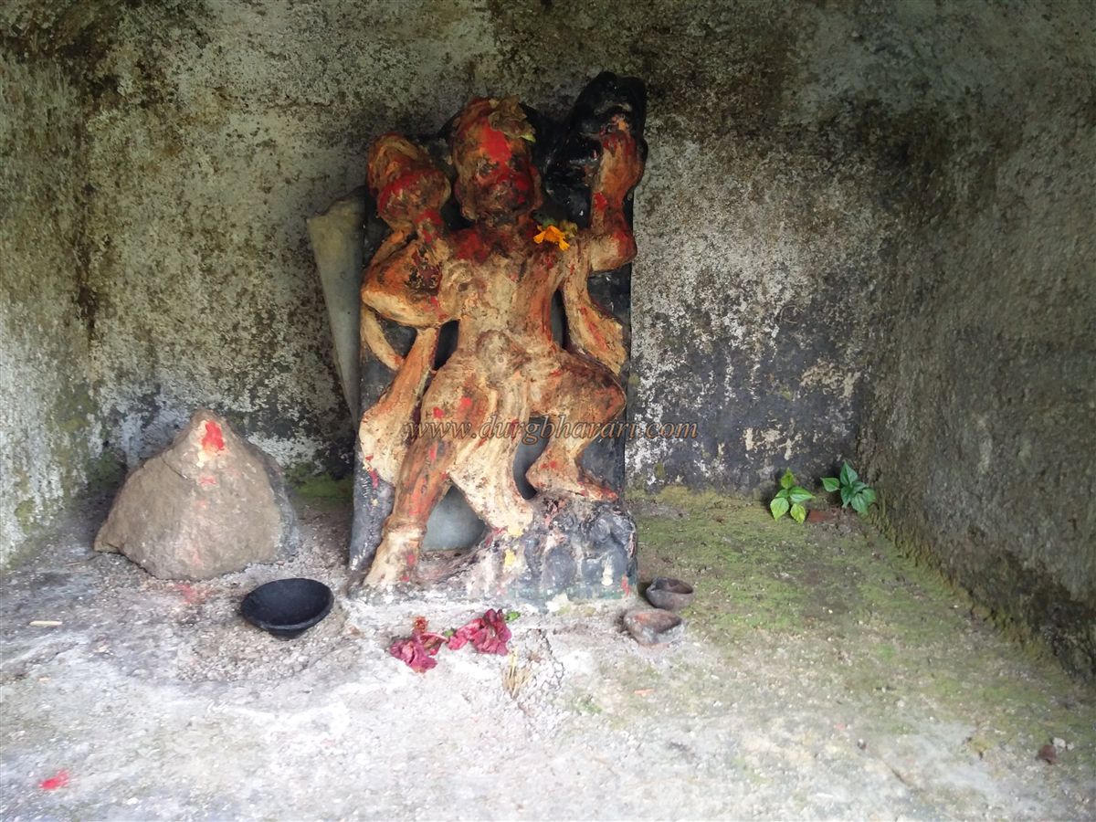
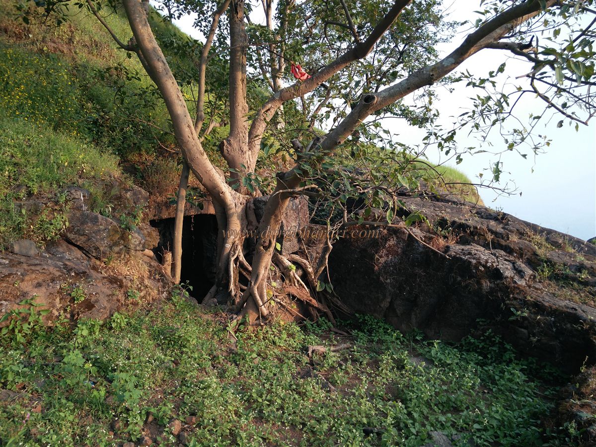
At the start of the path stands a cemented shrine with a modern idol of Maruti (Hanuman). A short distance ahead is a metal-sheet-enclosed shelter, which is actually a Mahadev temple. Inside are a Shiva lingam, a Nandi idol, a carved stone turtle, and stone vessels filled with water. This well-maintained temple can accommodate 7–8 people, except during the monsoon season. Moving ahead, one comes across a small gorge separating the plateau and the citadel. Crossing this gorge and climbing stone steps leads to the ruined western-facing entrance of the citadel and its walls. Beside this gate, only the foundation of an old bastion remains. Continuing on the right-side path, one sees remnants of the fort walls and eventually reaches the main northern-facing gate of the fort located at the edge of a gorge. This gate, built between two bastions, is now completely ruined, with only its lower section intact. In the gorge, numerous large cut stones from the fallen gate and walls are scattered.
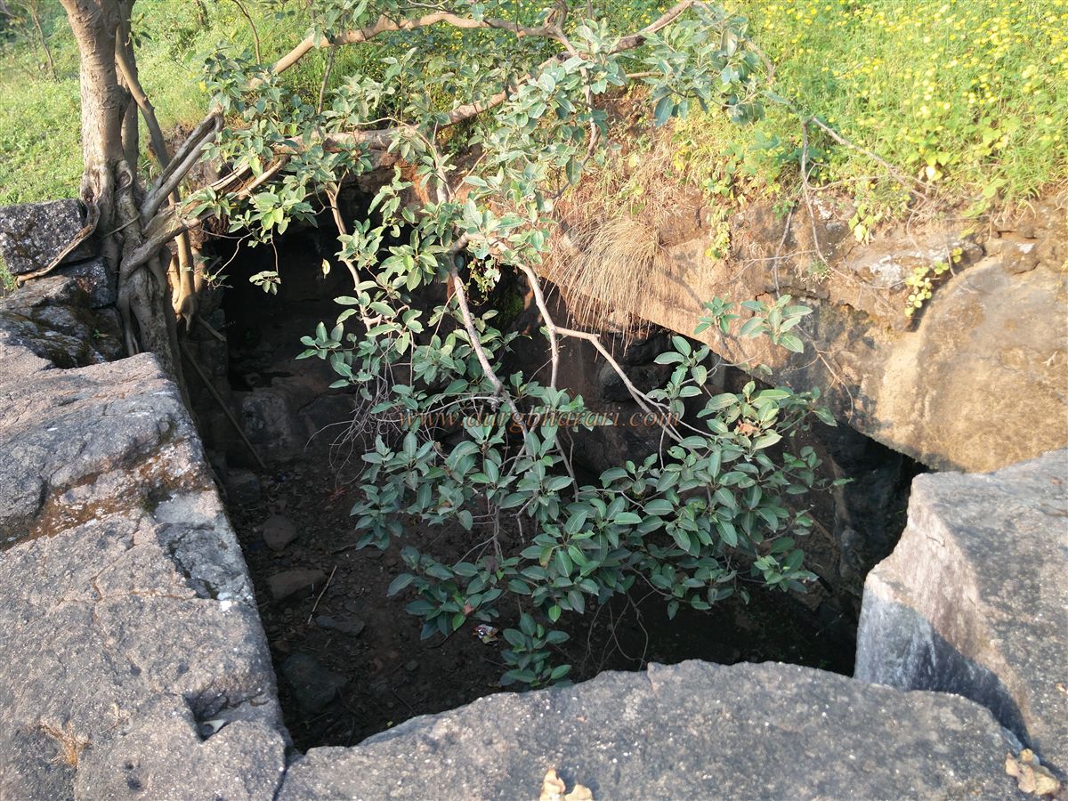
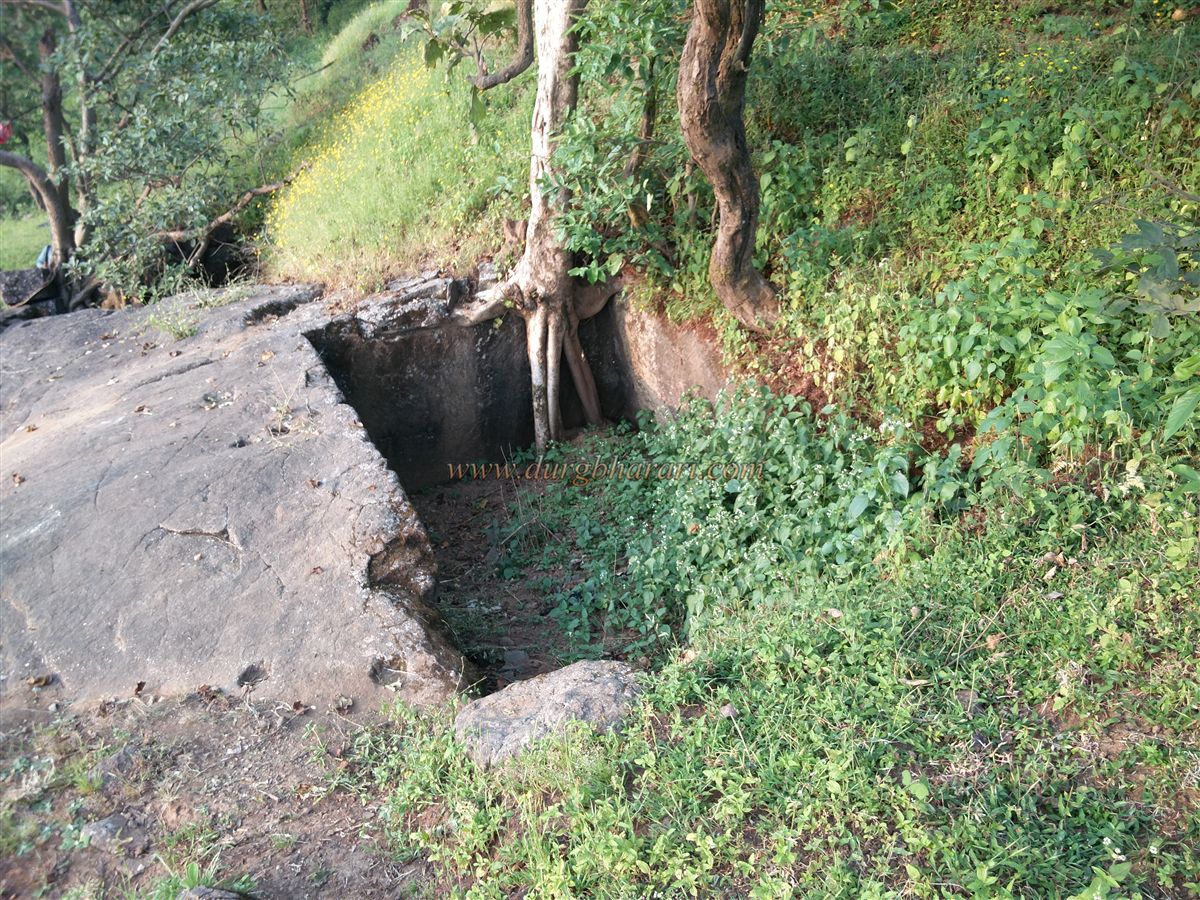
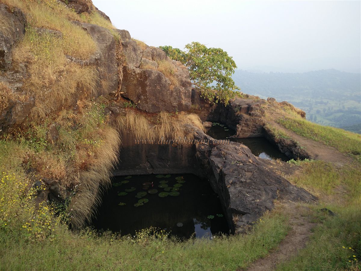
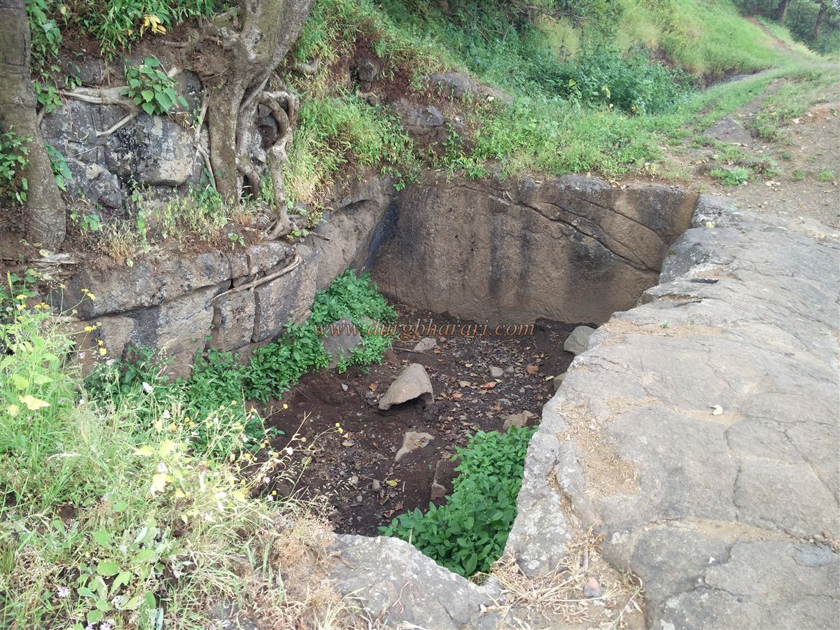
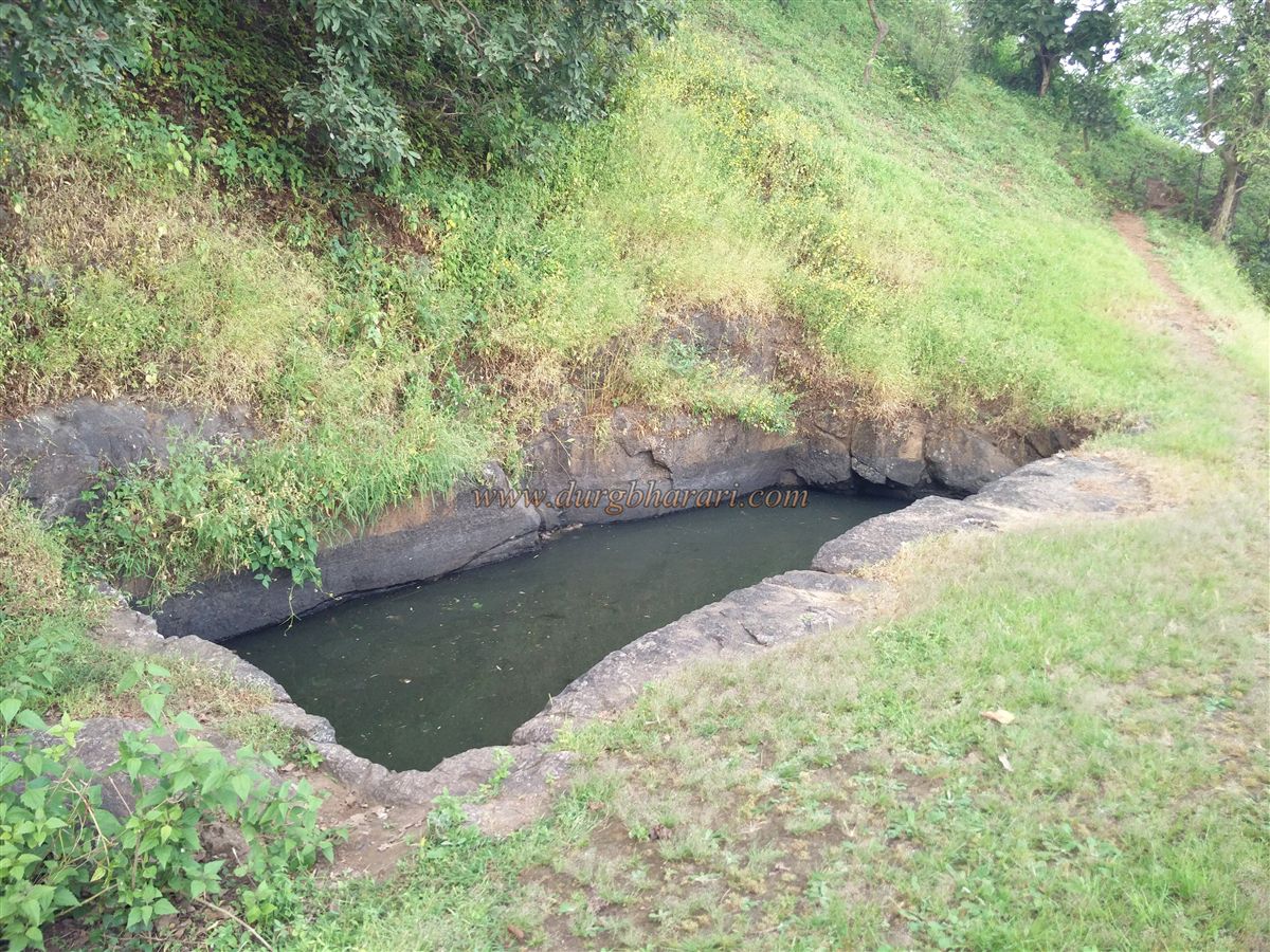
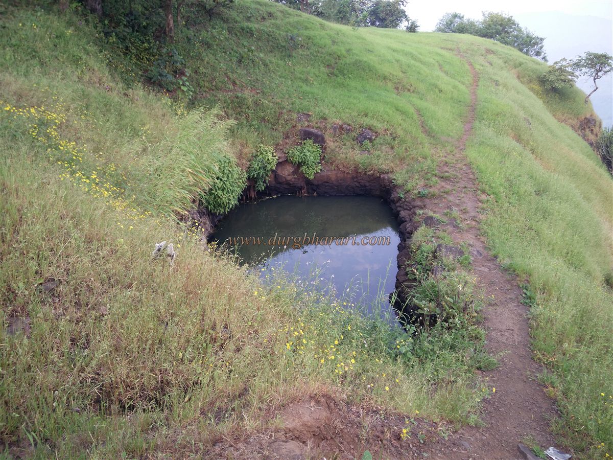
Further along, on the slope of the citadel, there are two rock-cut water cisterns, now dry and overgrown with large trees. Above these, there is another dried-up cistern, also overtaken by vegetation. Moving forward, there are two more cisterns, one of which is a twin cistern. These hold some water, though not potable. Further ahead are three more cisterns, one of which is filled with soil, while the others hold non-potable water. Though the fort has eight cisterns in total, none provide drinkable water.
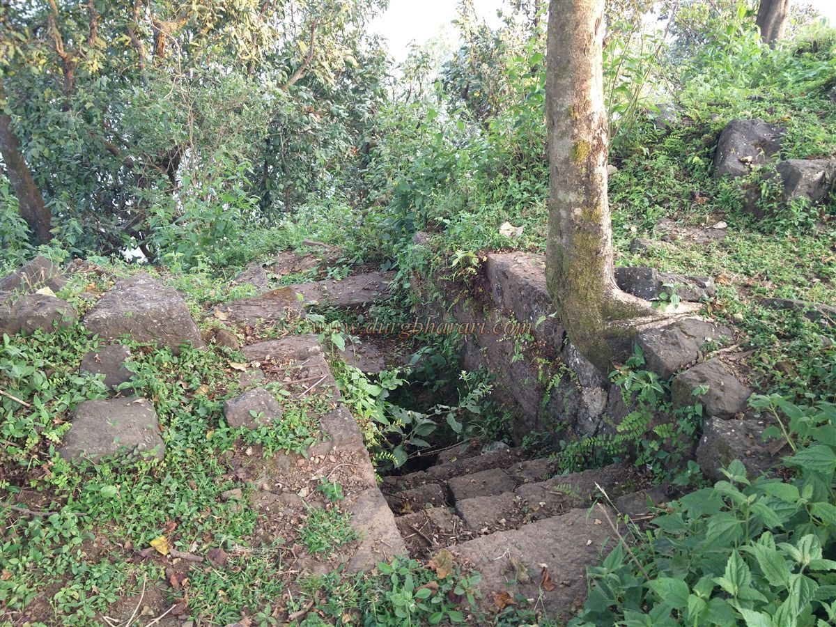
After viewing the last cistern, one reaches the southern tip of the citadel. From here, one must backtrack and take the upper path leading to the citadel’s summit. The summit is enclosed by four bastions and fort walls. The western section has a ruined gateway and arch, with remnants of steps still visible below. Inside, there are foundations of structures, one of which holds a Shiva lingam and a broken stone vessel. After exploring these remains, one can return along the right-hand path towards the gorge between the citadel and plateau. From the elevated citadel, the ruined fortifications on both slopes are clearly visible.
As the fort is small, exploring both the plateau and the citadel takes about an hour. Historical documents mention Segwa fort as "Segwa." According to the Mahikavati chronicles, in ancient times, King Pratap Bimb established his kingdom from Daman to Walkeshwar and chose Mahikavati (present-day Kelve Mahim) as his capital. Segwa fort may have been built during this period. In the 14th century, the fort and its surrounding area came under the control of the Sultan of Gujarat. Later, the region was ruled by the Koli kings of Ramnagar, who were vassals of the Mughals. Between 1672 and 1677, this region under the Koli kings of Ramnagar was annexed into the Maratha Empire, and Segwa fort became part of Swarajya. Some restoration work was carried out on the fort during this time. In 1688, during Sambhaji Maharaj's reign, the Ramnagar rulers, on behalf of the Mughals, recaptured the fort. For the next 61 years, the fort remained alternately under the Portuguese and Ramnagar rulers. In August 1739, during Chimaji Appa’s Vasai campaign, the Maratha officer Krishnaji Mahadev Chaskar captured Segwagarh. In 1754, the fort once again returned to the Ramnagar Koli rulers. According to the 1802 treaty, the fort came under the control of the Peshwa. In 1817, British officer Godard captured Segwagarh and destroyed its main gate.
© Suresh Nimbalkar
GALLERY