SARANGKHEDA
TYPE : GADHI
DISTRICT : NANDURBAR
HEIGHT : 0
GRADE : EASY
When one mentions Sarangkheda, the first thing that comes to mind is its famous horse fair. The fair held at Sarangkheda in Nandurbar district, Maharashtra, is well-known for its horse market. However, very few people know about the Rawal Fort (Rawal Gadhi) located here. In Nandurbar district, which has a predominantly tribal population, there once existed as many as fifteen forts in the forms of hill forts, ground forts, and fortified mansions (gadhis). During our “Durgbharari” group’s study tour of these forts, we gathered information that I am presenting on this website. Among these, the Hatmoida and Aste forts have been completely destroyed, while the remaining thirteen forts still stand, bearing their ruins and struggling against the passage of time. These thirteen forts include one hill fort, three ground forts, two town forts, and seven fortified mansions.
...
After the princely states were annexed, maintaining these privately-owned forts became increasingly difficult for their owners, leading to the ruin of many of them. Sarangkheda Fort is one such example. The local people’s indifference toward these historic structures has also contributed to their decline.
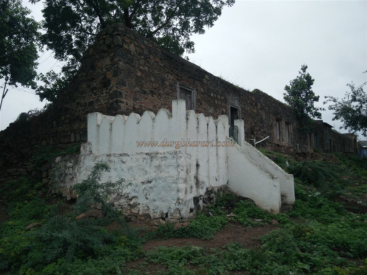
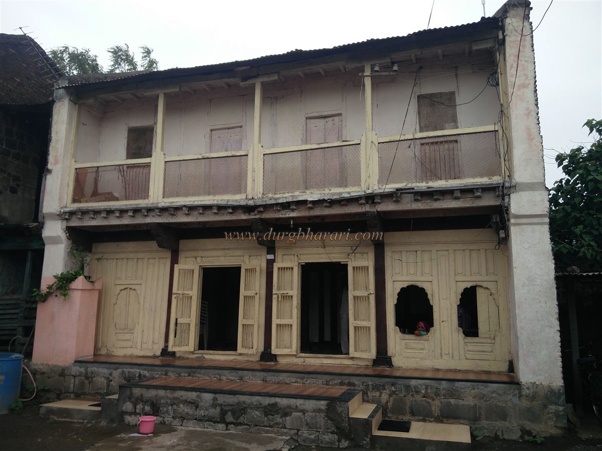
The Sarangkheda Fort lies in the southern part of Nandurbar district in Shahada taluka, about 15 km from Shahada and 42 km from Nandurbar. This fort is located at one end of the village along the banks of the Tapi River, and within the fort premises are the houses of the Rawal family. The fort’s wall on the side facing the Tapi River has completely collapsed due to water erosion, while the remaining two sides of the fortification are partially intact. No bastions can be seen along these walls. The interior has been completely taken over by the expanding houses of the Rawal families, leaving no original remnants of the fort intact.
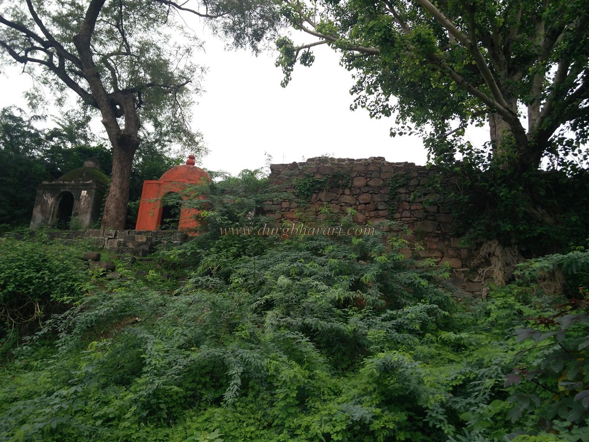
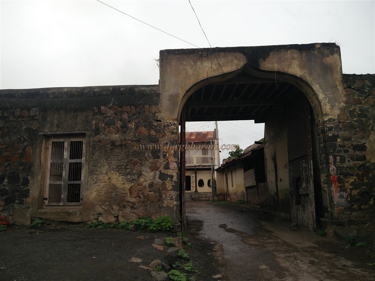
Covering roughly three-quarters of an acre, the fort has its main entrance at the northern corner, which does not appear to be very old. Inside the fort, there is a small shrine with vermillion-smeared stones, locally referred to as “Tandala.” The fort walls, about 10–15 feet high, are built of roughly cut stones. Outside the eastern wall, attached to it, are three domed tomb-like structures on a raised platform. From here, a path leads to the riverbed, and on the opposite side of this path, atop an elevation, stands a small, old Shiva temple. From the riverbed, one can enjoy a beautiful view of the dam built across the Tapi River between Savarkheda and Takarkheda. There is no evidence of a well inside the fort for water storage. From the higher points within the fort, one can see the vast expanse of the Tapi River and the distant landscape. Because of the inhabited settlement inside, any fort exploration has to be kept brief.
The Khandesh region is also known as the land of “Sade Bara Rawal” (Twelve and a half Rawals). “Rawal” was a title given to the local feudal lords of this area, belonging to various clans like Sisodia, Solanki, Parmar, and Pratihar. These twelve and a half estates were: 1. Dondaicha, 2. Malpur, 3. Sindkheda, 4. Aste, 5. Sarangkheda, 6. Ranjane, 7. Lambola, 8. Lamkani, 9. Chaugaon, 10. Hatmoida, 11. Ranale, 12. Manjare, and 13. Karvand. Since half of these estates were within Khandesh and the other half outside, they came to be known collectively as the “Twelve and a half estates.” Despite changes in political power over time, these Rawals retained their privileges, and successive rulers did not alter their authority.
After the Khilji invasions, 24 Rajput clans under the leadership of Abhaysingh Rawal moved toward Mandu. In the 13th century, Sangramsingh Rawal of the Tanwar family attacked Nandurbar, defeated the Gawli ruler, and took control of the region. His descendant, Jaisingh Rawal, later founded the village of Bhongara and established his jagir (estate) at Sarangkheda along the Tapi River.
© Suresh Nimbalkar
GALLERY