SANTOSHGAD
TYPE : HILL FORT
DISTRICT : SATARA
HEIGHT : 2890 FEET
GRADE : MEDIUM
The Man River, originating from the Sitabai Hills in Satara district, enriches a stretch of about 150 kilometres along its banks before merging with the Bhima River near Sarkoli, close to Pandharpur. The sub-range of the Sahyadri that runs east to west in this region is known as the Mahadev Range. To monitor the Molghat pass in the Phaltan taluka and the surrounding region at the source of the Man River, a fort was built on a spur of this range. This fort, known as Santoshgad, is also referred to as Tathawda Fort, named after the village of Tathawda at its base.
Some years ago, the fort lay buried in ruins, but through the continuous efforts and hard work of Shiv Sahyadri Durg Savardhan Sanstha, Pune, it has now been brought back to life in its original form. Their scholarly excavation deserves high praise.
...
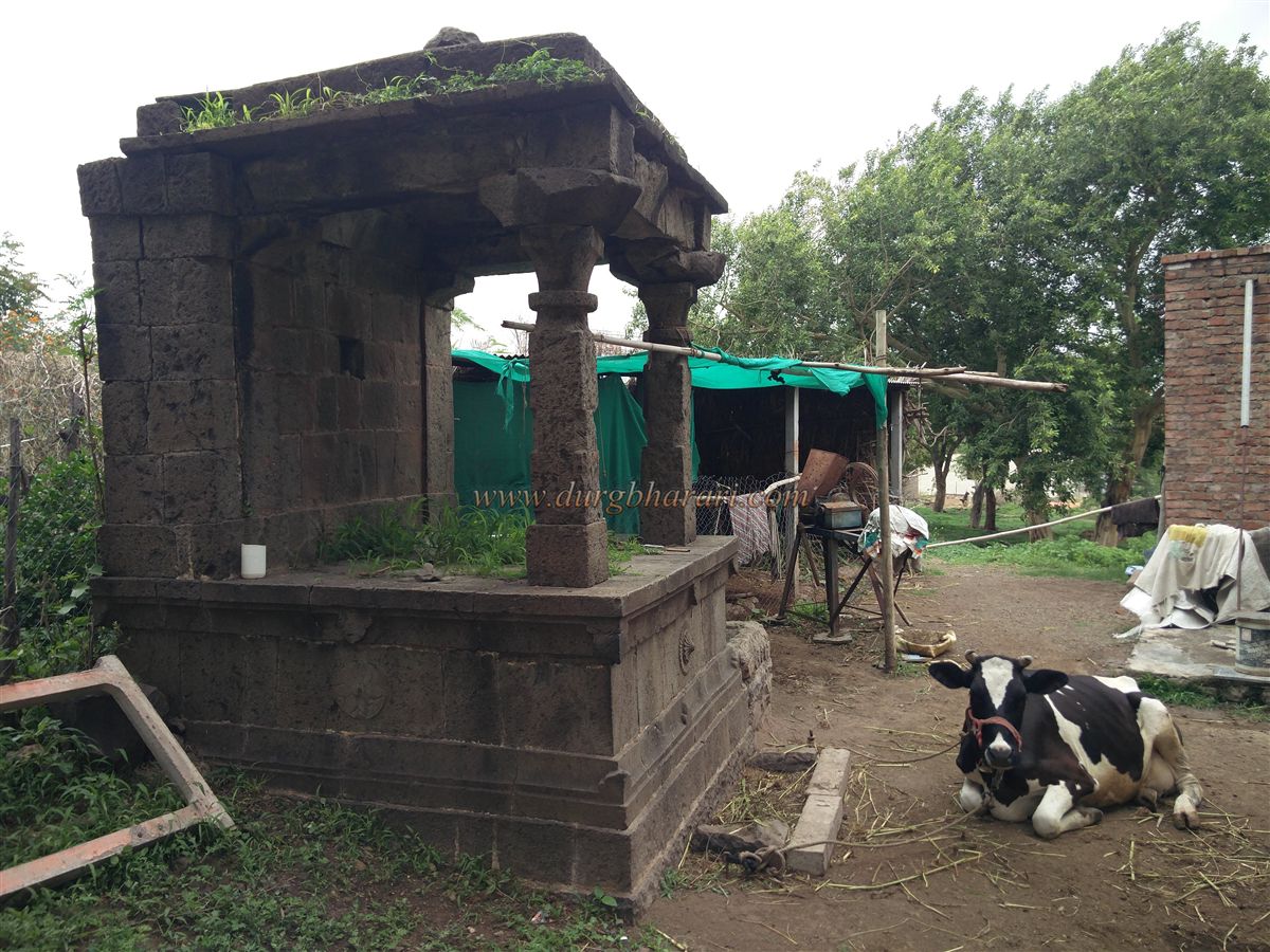
Santoshgad is located about 20 kilometres from Phaltan and approximately 120 kilometres from Pune, via Saswad–Jejuri–Lonand–Phaltan. Upon entering Tathawda village, the Maruti temple at the entrance, a stone platform under a tree, and a stone pavilion opposite bear testimony to the village’s existence since the medieval period.
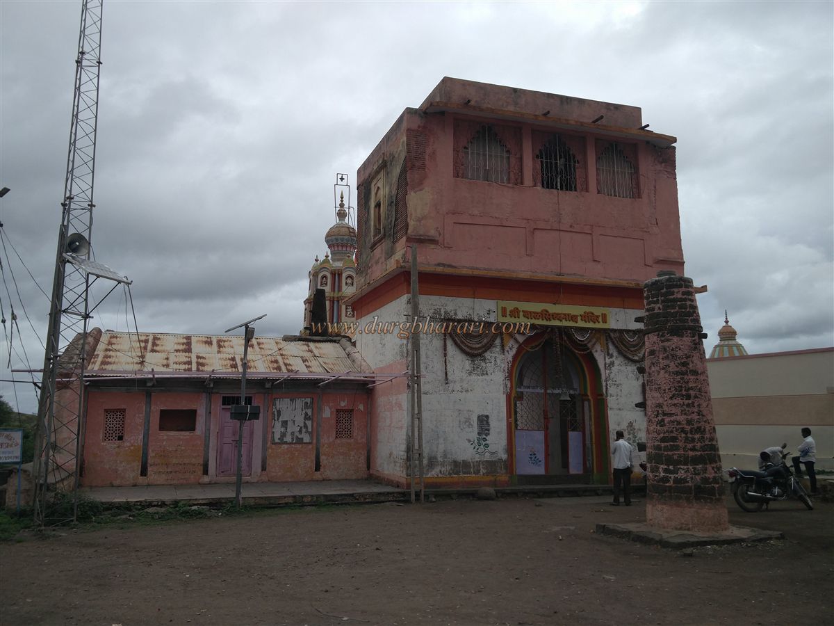
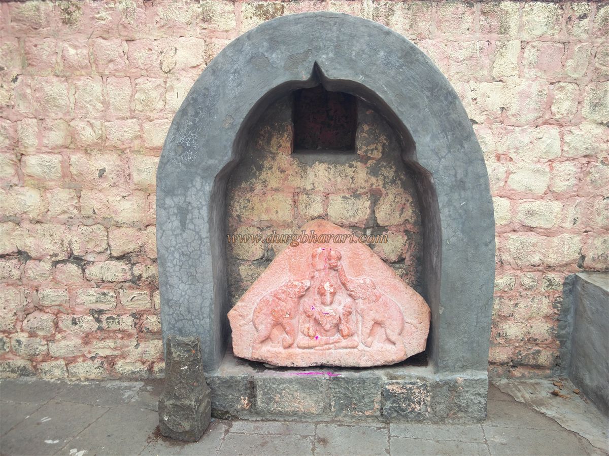
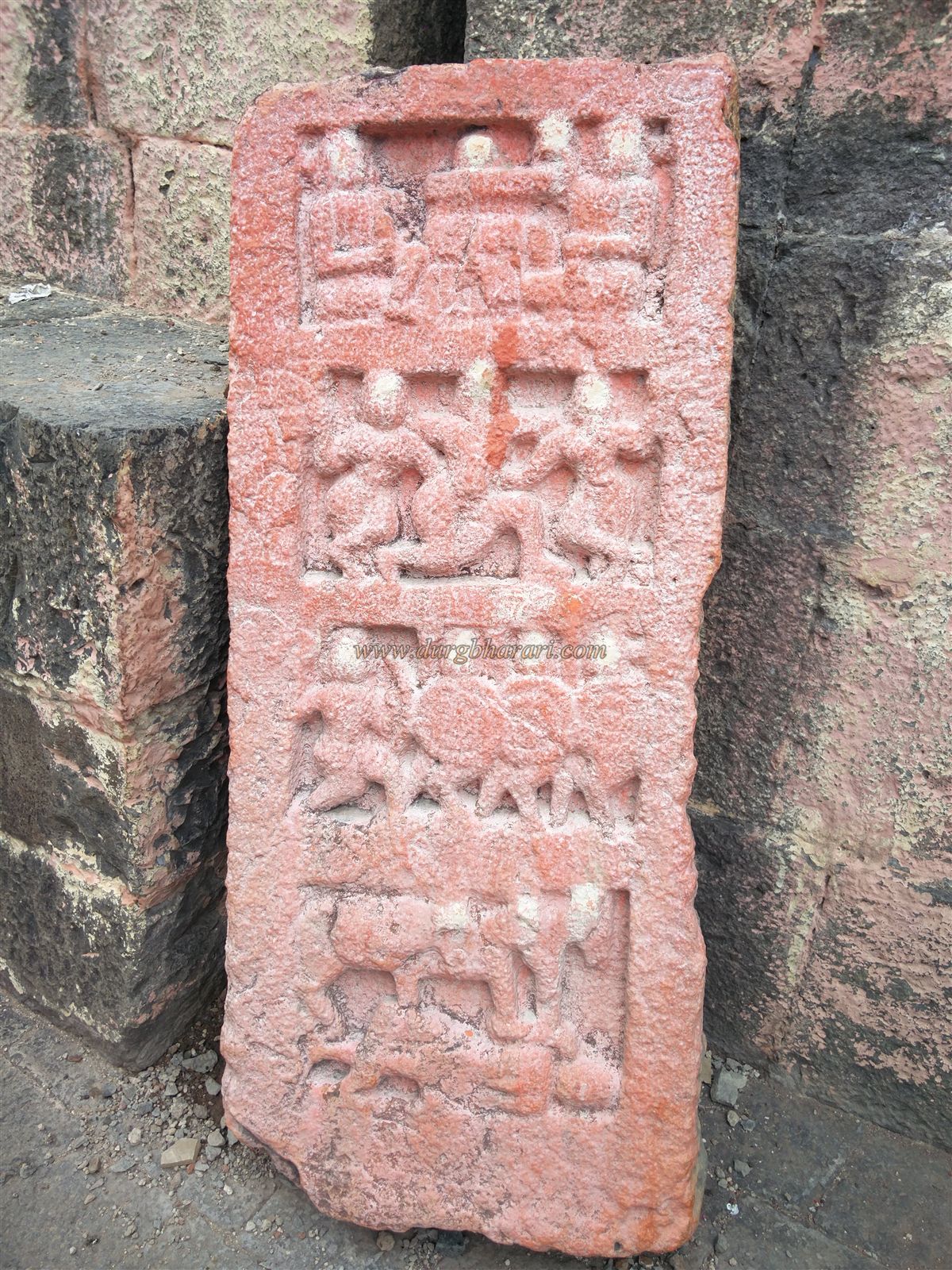
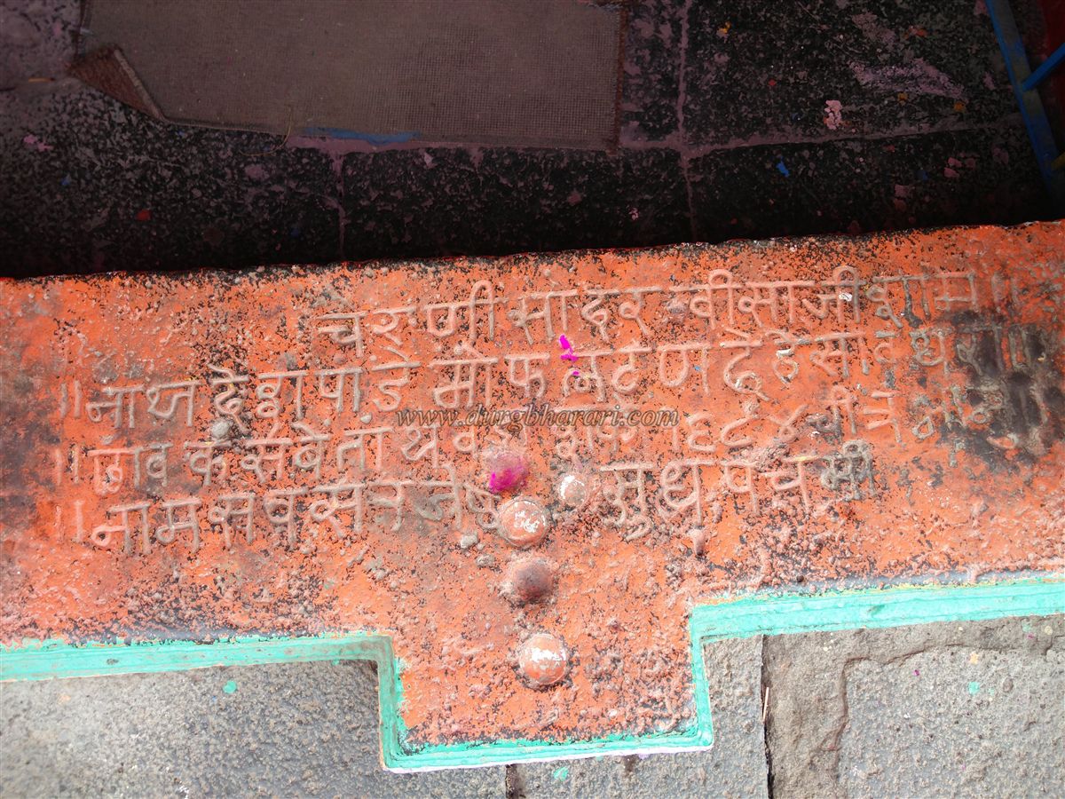
In Tathawda stands a beautiful temple dedicated to Balsiddha, along with temples of Prabhuram, Vitthal-Rakhumai, and Shankar. The Balsiddha (Bhairav) temple has a stone fortification and a deepmala (lamp tower) in front. There are two entrances to the temple courtyard, with a Nagarkhana (drum house) above the main gate. Inside the courtyard are a hero stone (virgal), a Gajlakshmi carving, and an image of Ganesha. An inscription on the temple steps records that the temple was built by Visaji Shamarao Deshpande on Jyeshtha Shuddha Panchami, in the Chaitra-Bhanu year, Shaka 1684 (CE 1762).
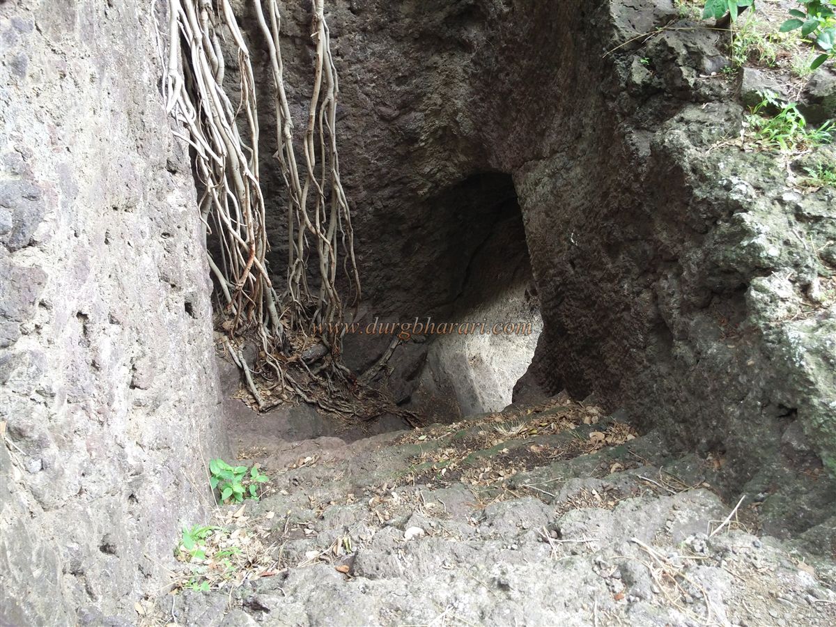
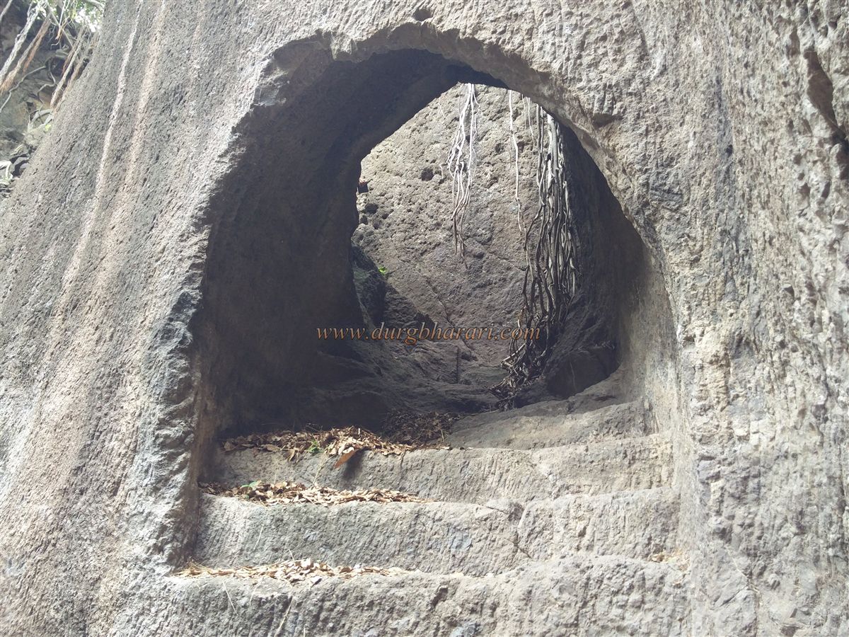
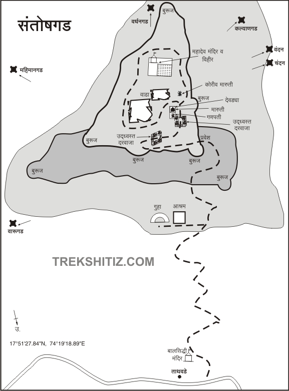
A simple trail from the village leads to the fort in about half an hour. After about twenty minutes of climbing, the path splits into two: the right leads to the fort, while the left takes one to the eastern side. It is advisable to first explore the ruins on the left. On this path stands an ashram beside two large caves descending into the hillside, though these are now in a dilapidated state. Water still collects in these caves, and one of them allows deeper entry. A short distance beyond the ashram lies a newly built Mahalakshmi temple, located at a bend and thus not visible from the ashram. Another cave lies along the path to this temple, but it requires guidance from locals.
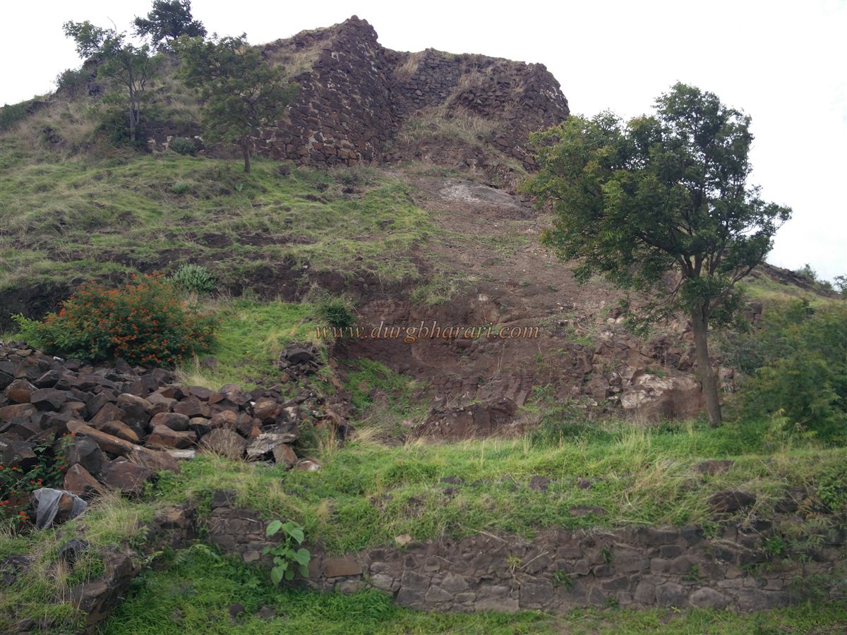
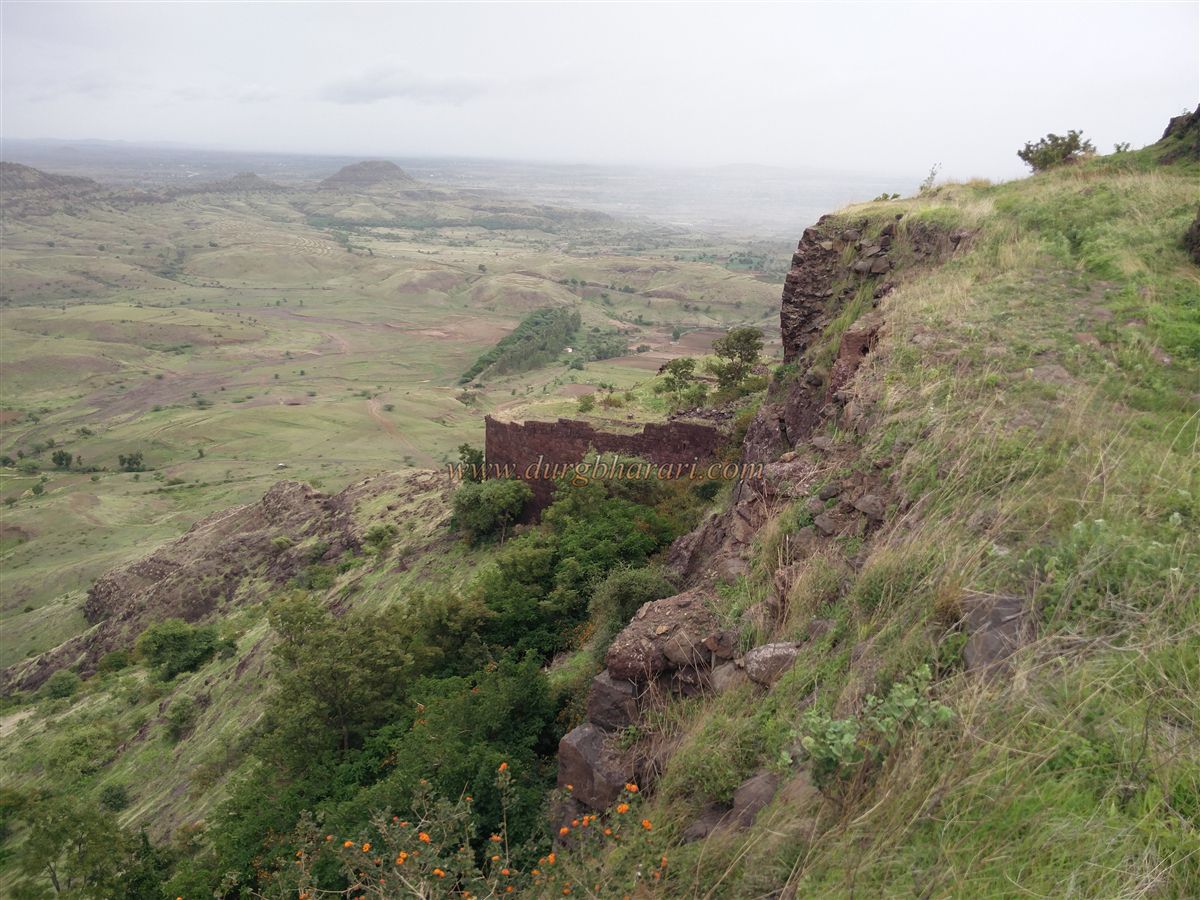
The site of the Mahalakshmi temple was once the fort’s original marketplace (met), and remnants of old structures are visible here. From this point, one can observe the entire layout of the fort. The fort, roughly triangular in shape, is divided into the machi (lower fortification) and the Balekilla (citadel), though the machi is not continuous. The path to the fort from the north western spur passes remnants of old settlements. From this path, a narrow trail descends to the eastern machi, which can also be accessed from the Balekilla, though this route has collapsed in parts and is dangerous. The third spur, within the Balekilla, is secured by double fortification walls.
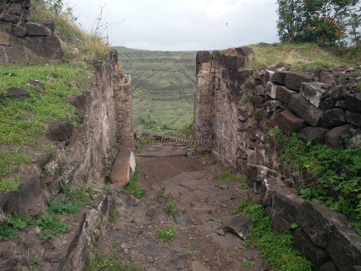
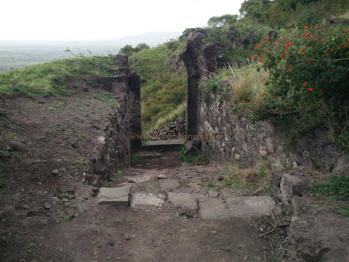
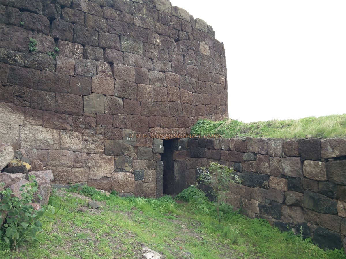
Returning to the main trail, one begins the climb to the fort, passing through three gates. The first, an east-facing gate, lies on a slope and is flanked by bastions, though only its frame survives today. A wall from the Balekilla fortification extends down the slope to this gate’s bastion. A paved path leads from here to the second gate, set within the walls, with its frame and half-arch still intact. Passing through this gate brings one to the western machi, where a newly unearthed platform and wall are visible. The machi fortification remains intact, with a bastion at its edge. A small arched gate once led down toward the main gate, but the path has collapsed. The machi wall stands about 20 feet high and 10 feet wide.
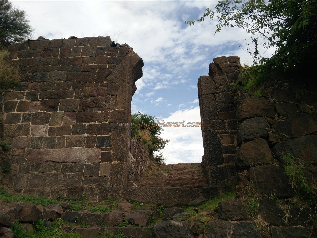
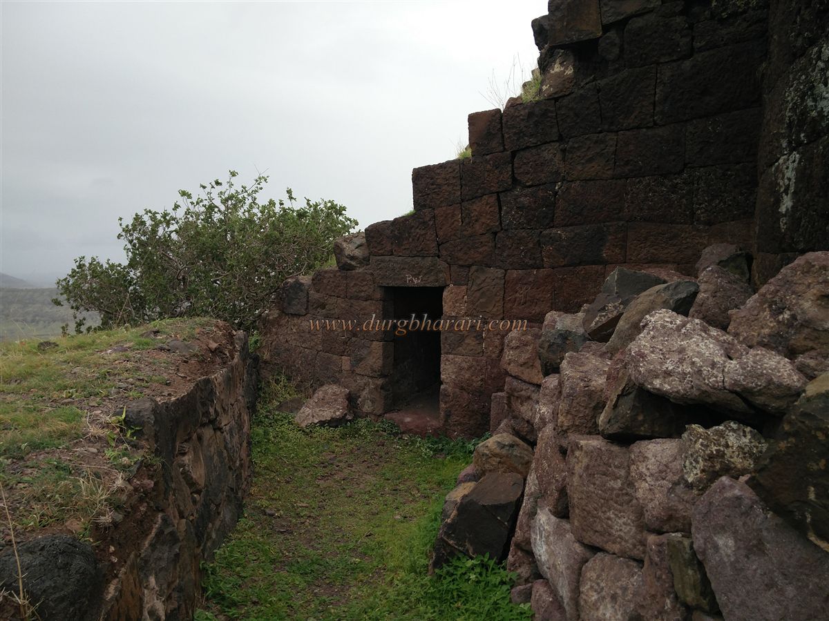
Crossing the machi leads to the west-facing, Gurmukhi-style gate of the Balekilla. To the left of this gate, a narrow trail leads to the eastern machi, though it is now overgrown with vegetation. Though half of the gate’s arch has collapsed, the guard chambers inside remain. Judging by its frame and design, this gate predates Shivaji Maharaj’s era. All three gates we see today were once buried under soil and have been painstakingly restored by Shiv Sahyadri Durg Savardhan Sanstha.
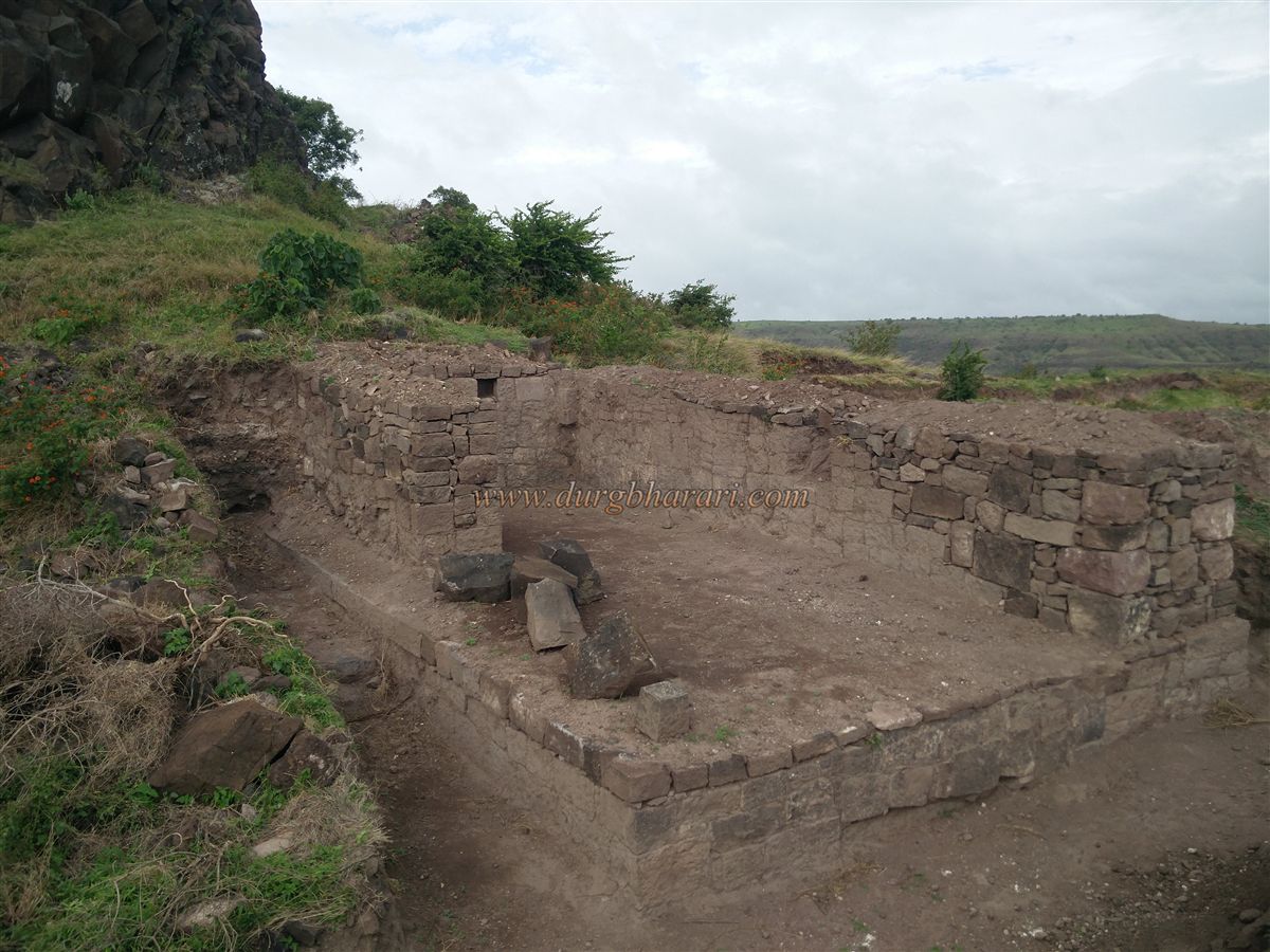
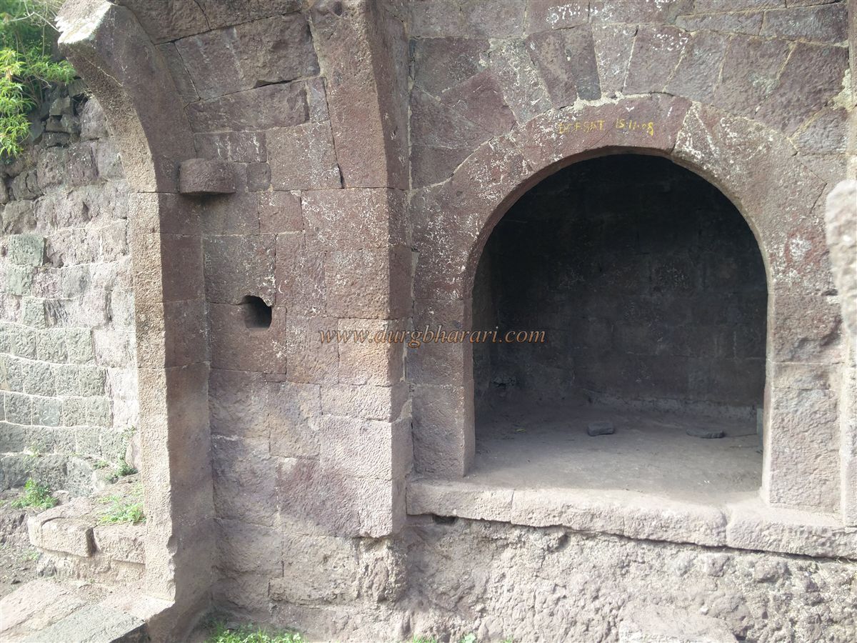
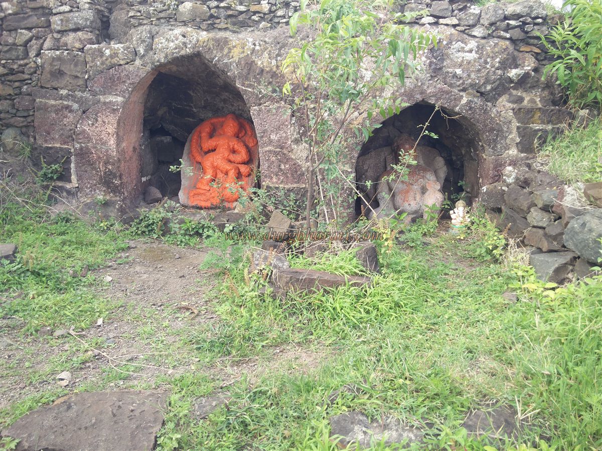
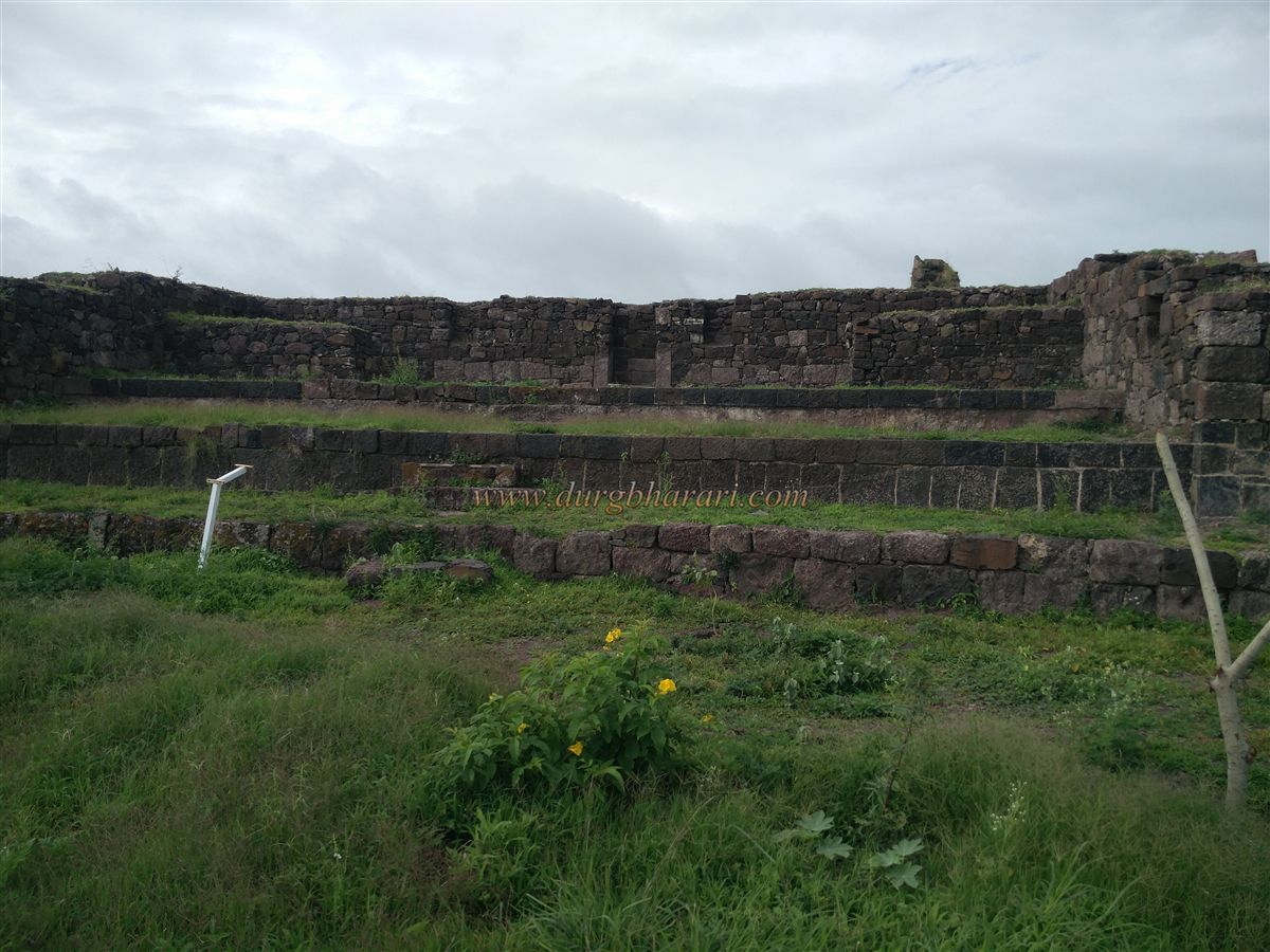
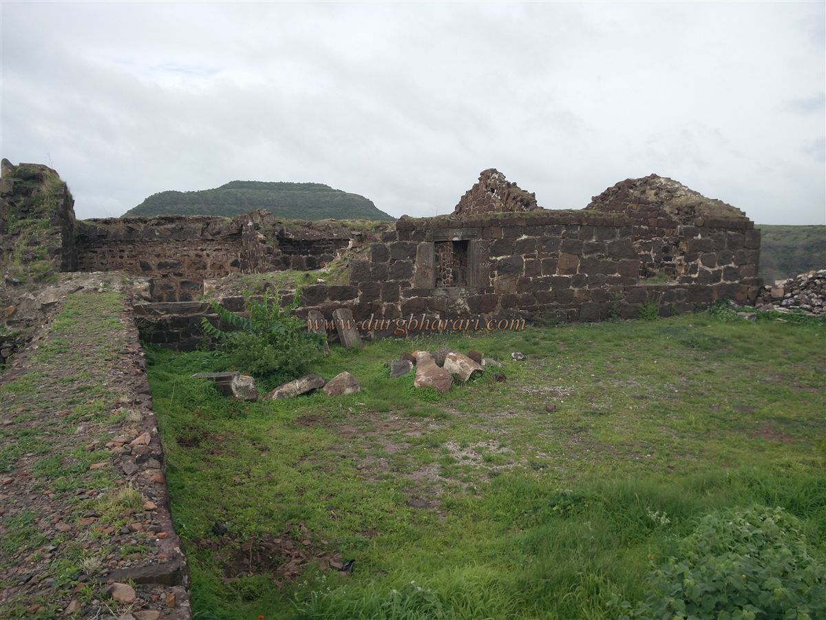
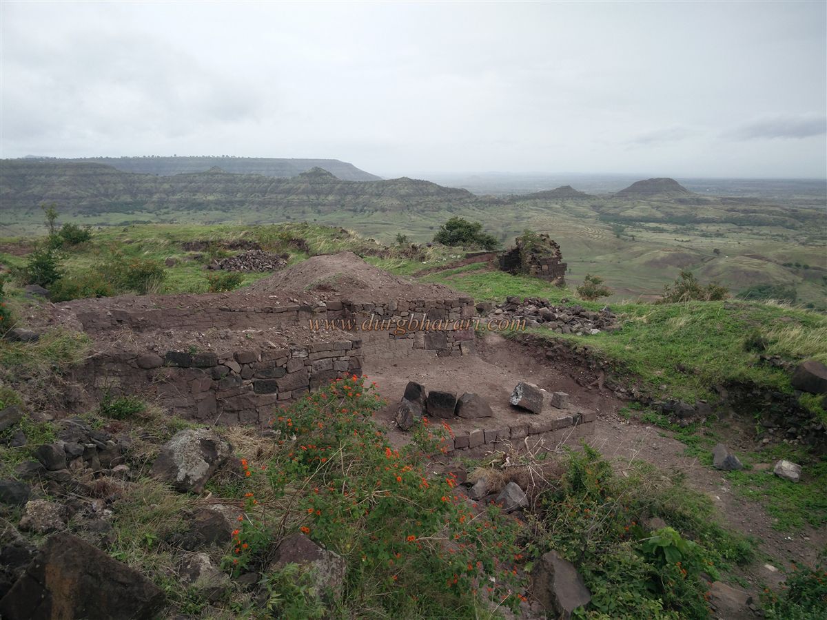
Santoshgad stands 2,894 feet above sea level, with a rise of 520 feet from its base. The triangular Balekilla has bastions at all three corners, with the southern bastion reinforced by double walls. Inside the gate are the remnants of houses and mansions, with shrines of Maruti and Ganesha in their niches. Turning left leads to a spacious hall (sadar), beyond which are the remains of the fort commander’s residence. The eastern bastion lies here, with steps descending from it to the machi, though a small gateway along this path leads to a now-destroyed route.
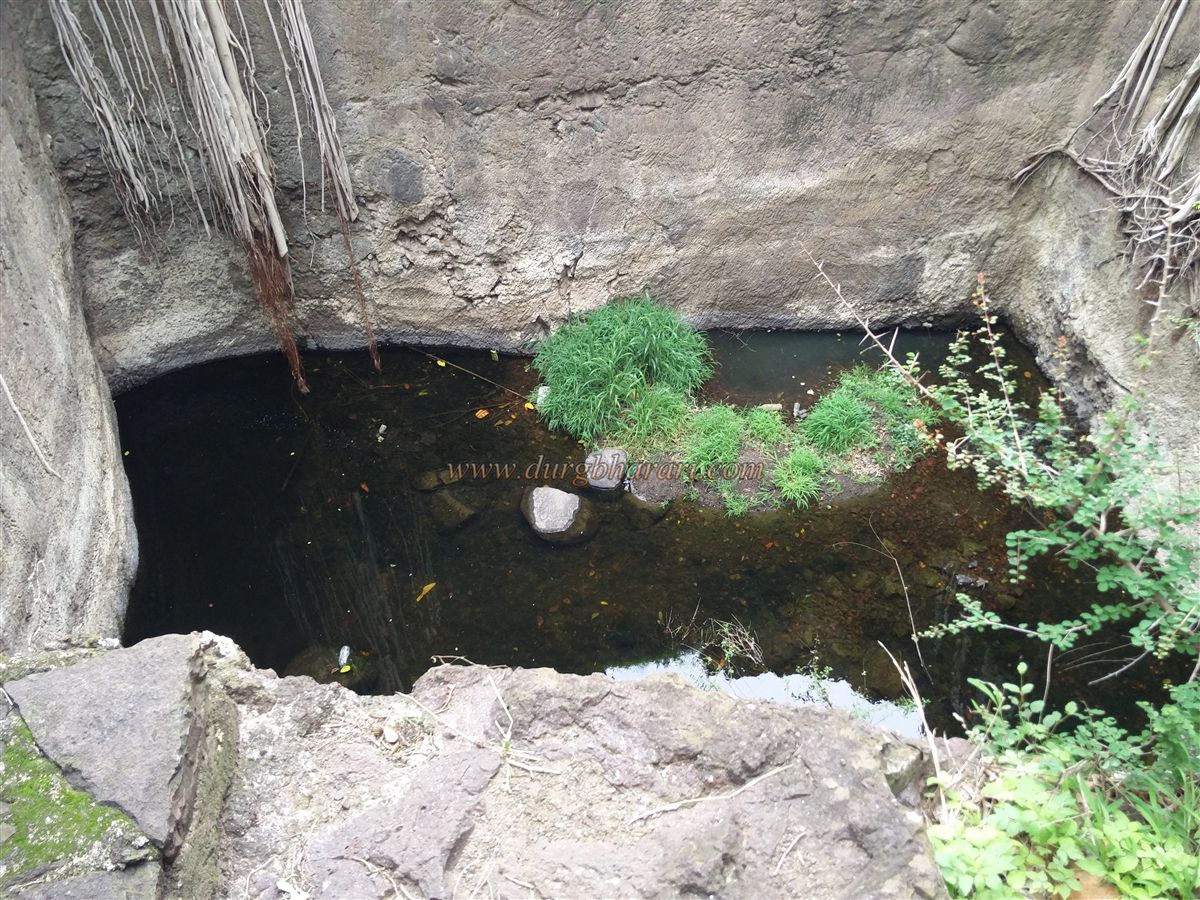
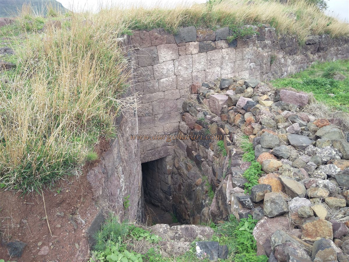
Behind the sadar is the ambarkhana (granary). Further behind lies a rock-cut water cistern measuring 50 by 40 feet and equally deep. The stone excavated here was likely used in the fort’s construction, and the resulting depression served as a water reservoir. Until 1993, water from this cistern was supplied by pipeline to Tathawda village. Today, only a small amount of water remains, though the Sanstha has removed much silt from it. Steps carved into the rock on one side of the cistern lead to a small Shiv temple within, which locals call Tatoba Mahadev.
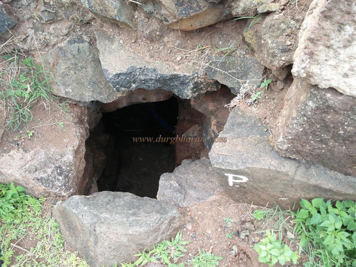
Proceeding further brings one to the southern bastion, below which lies the second wall. This wall has two gates leading into it, and on the left is a hidden escape gate (chor-Darwaja), which can still be entered, though debris blocks the way out. Exiting through this gate leads to the western part of the Balekilla, where a partially carved image of Maruti can be seen in a rock. From here, the Molghat pass and the western machi are visible. Continuing along this path leads back to the balekilla’s gate, completing the circuit. Exploring the fort from the ashram takes about two hours.
Historical references suggest that this fort existed before Shivaji Maharaj’s time. It is believed that Shivaji Maharaj renamed it Santoshgad. While the exact construction date is unknown, records confirm that it was once under Adilshahi control. In the 1657 Mughal-Adilshahi records, the fort is referred to as Tatora, while Maratha correspondence mentions it as Tathawda, Tanwata, Tathode, or Tathoda. In 1665, the fort, then under Bajaji Naik Nimbalkar, was captured by a combined Mughal-Maratha force on December 7 following the Treaty of Purandar. After its capture, Aurangzeb sent a ceremonial robe and a jewelled dagger to Shivaji Maharaj. Later, the fort and surrounding region returned to Adilshahi control until Shivaji Maharaj recaptured it in 1673, likely repairing and renaming it Santoshgad at that time. During Sambhaji Maharaj’s reign, the Mughals seized the fort in 1679, but by 1720, it was back under Maratha rule during the reign of Shahu Maharaj. The fort remained with the Marathas until 1818, when General Pritzler bombarded and captured it, destroying much of its structure.
© Suresh Nimbalkar
GALLERY