SANKASHI
TYPE : HILL FORT
DISTRICT : RAIGAD
HEIGHT : 750 FEET
GRADE : MEDIUM
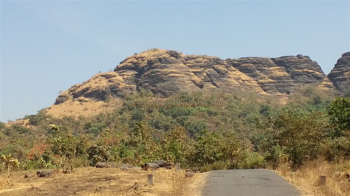
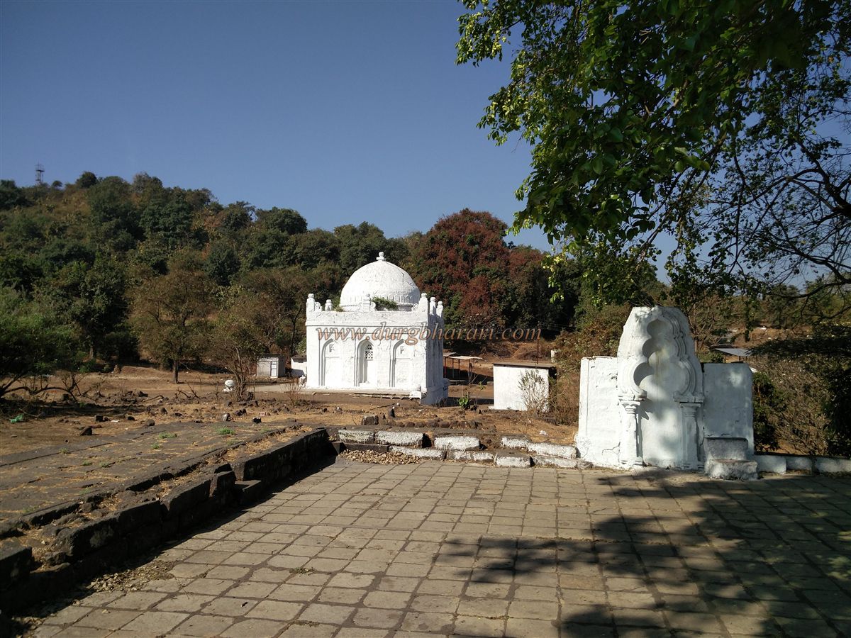
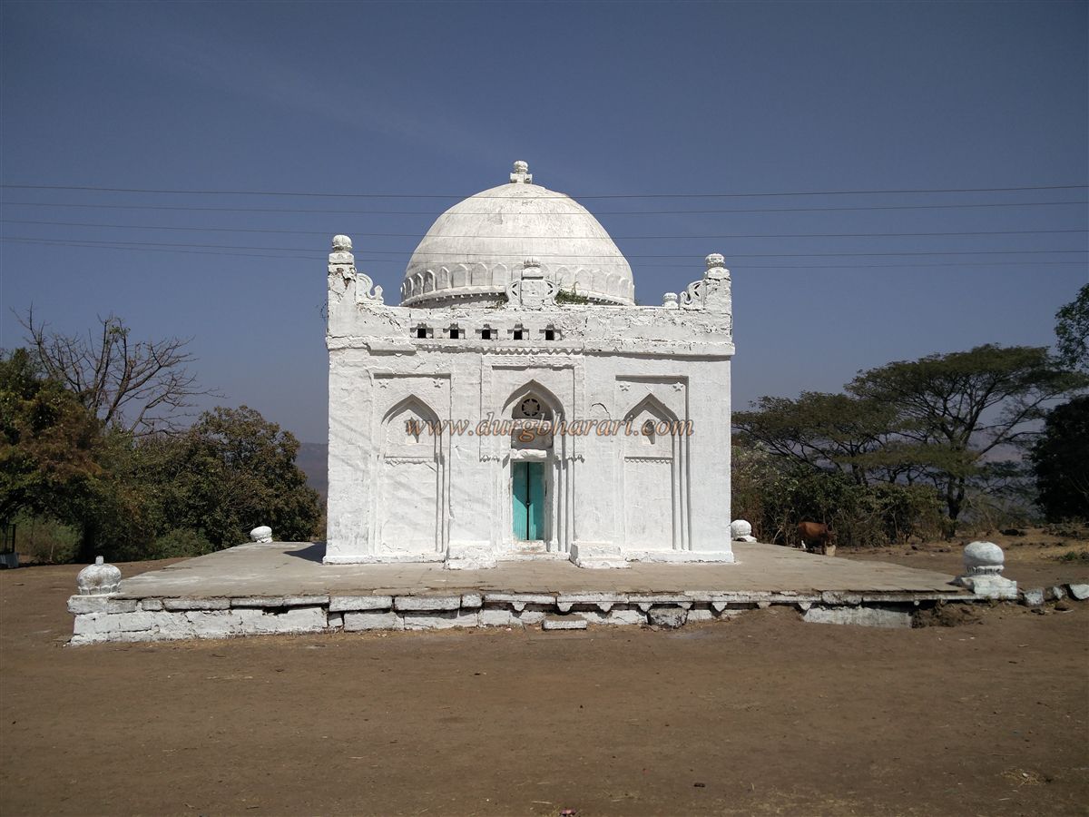
A range of the Sahyadri Mountains stretches west of Manikgad, before the Khandala pass. This range divides the valleys of the Patalganga River to the north and the Balganga River to the south. South of the Balganga Valley lies the Sankshi hill range. The Sankshi fort, located about 20 km from Panvel, is surrounded by dense forest. On one side lies the Mumbai–Goa highway, and on the other side are the Karnala Bird Sanctuary, Karnala fort, and Manikgad fort. It is believed that the fort was once in the possession of a king named Sank, and hence the fort got its name Sankshi. Due to the presence of the Badruddin Dargah at the base, it is also called Badruddin fort or Dargah fort.
This fort, located in Nidhwali village limits, stands on a hill about 800 feet high, but the access road to it passes through Mungoshi village. From Panvel, via Taranakhop and Mungoshi, the base point near the Badruddin Dargah is about 30 km away.
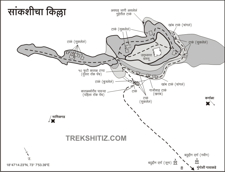
...
There are two dargah here, old and new. A prominent path to the fort begins from near the old dargah. A notable marker is a pipe that carries water from the fort’s reservoirs down to the dargah. This pipe runs alongside the easiest trail to climb the fort. The dargah itself is built on foundations made of temple stones, and scattered temple sculptures can be seen around. On the northern slopes of the hill, there are remains of what might have been a settlement.
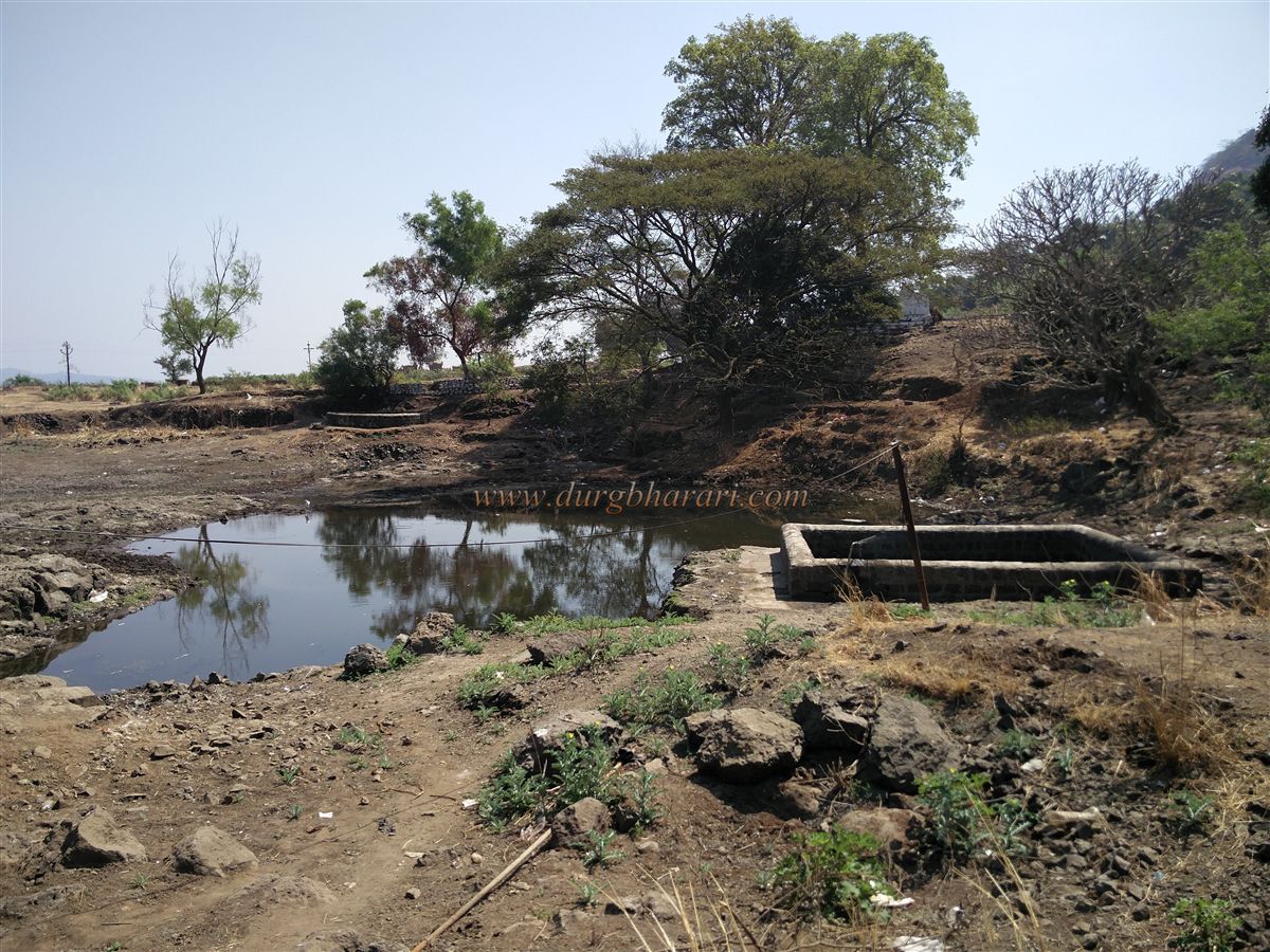
Near the dargah lies a roughly hewn rock-cut tank measuring about 20 x 10 feet. Though narrow at the entrance, it widens inside. Opposite this is the tomb of Ghazi Shah. After beginning the climb to the fort, within about 15 minutes one reaches rock-cut steps. To the right of these steps is a rock-cut water cistern called Datri, filled with water, with rock-carved steps leading to it. Climbing further, there are three more tanks, and to the left, a fourth one called Jagmata, about 10 feet deep and filled with soil. Above these tanks, in a rock-cut shrine, is the idol of Vajrai or Jagmata, said to be the daughter of King Sank who built this fort.
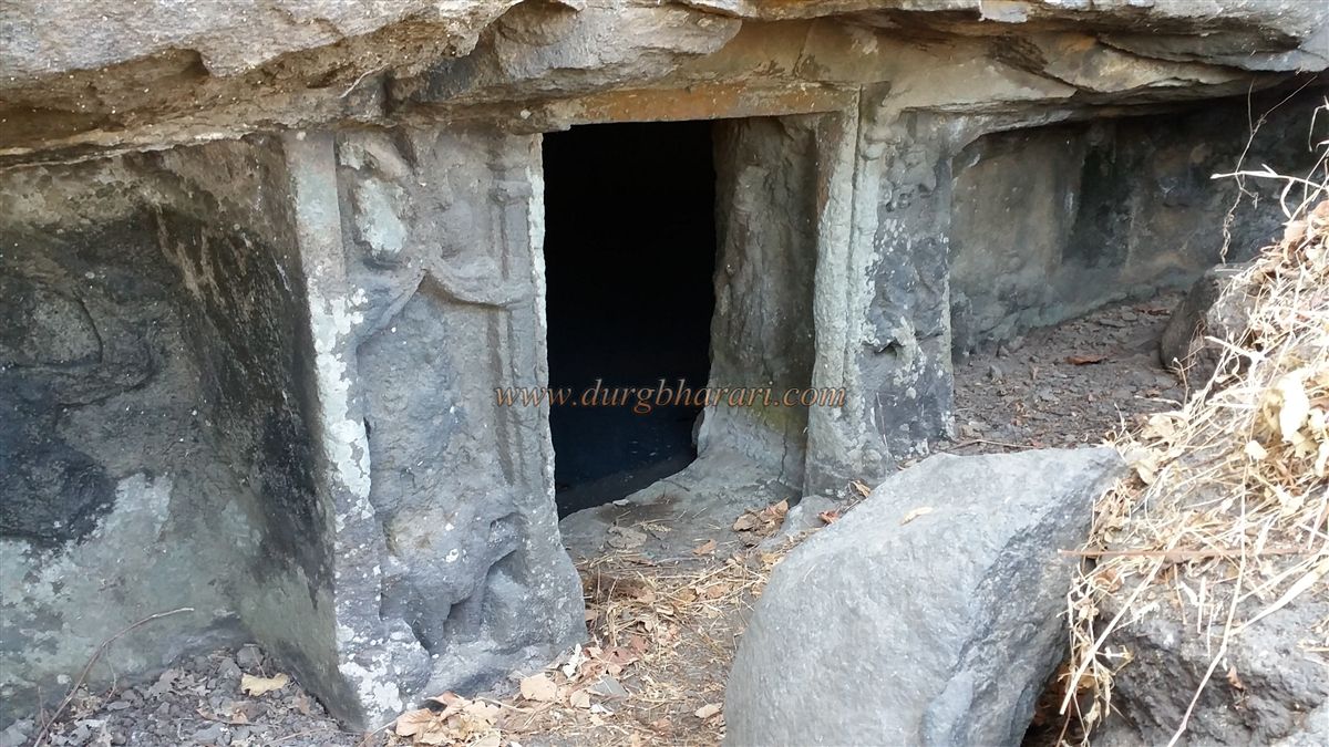
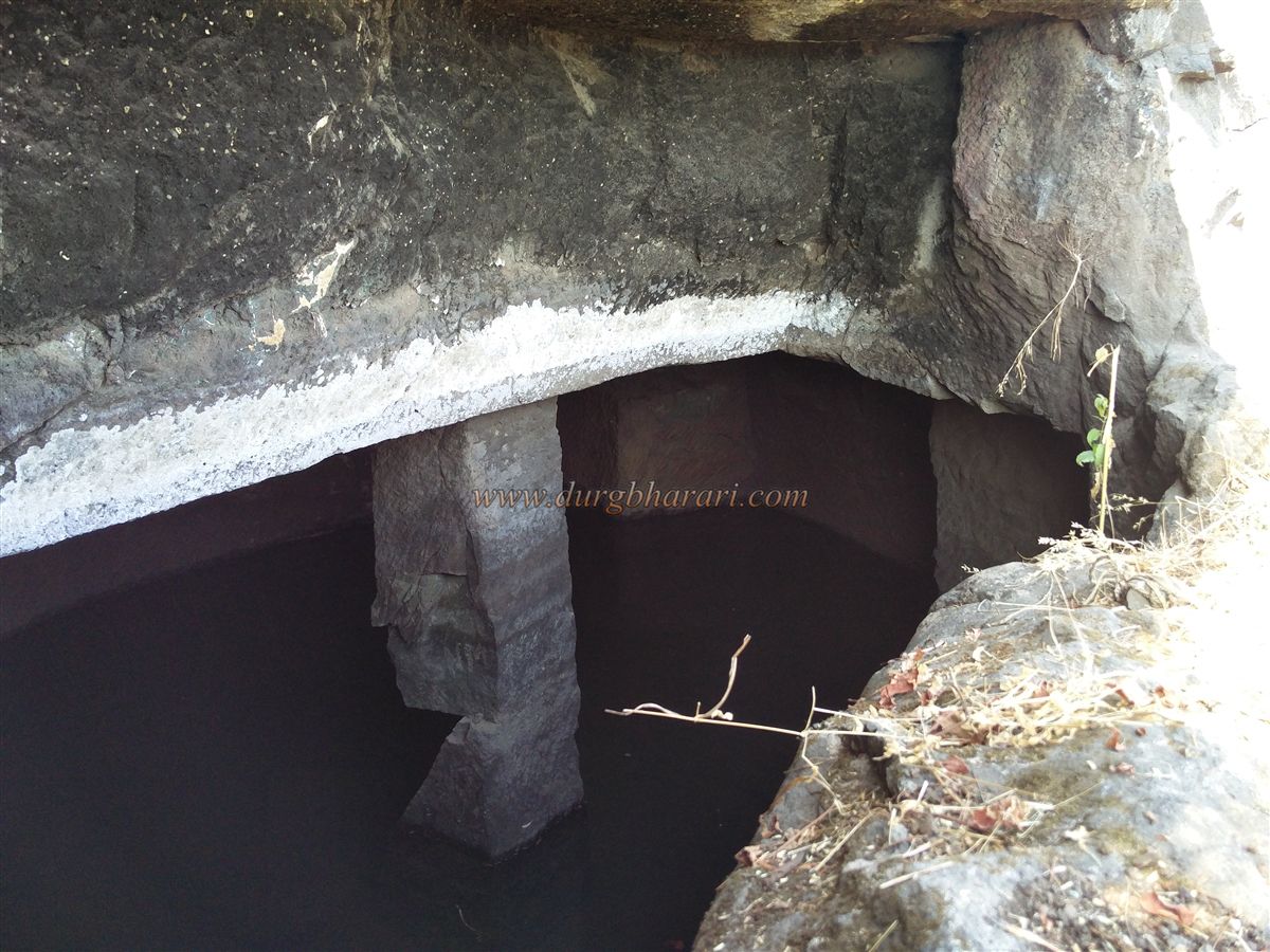
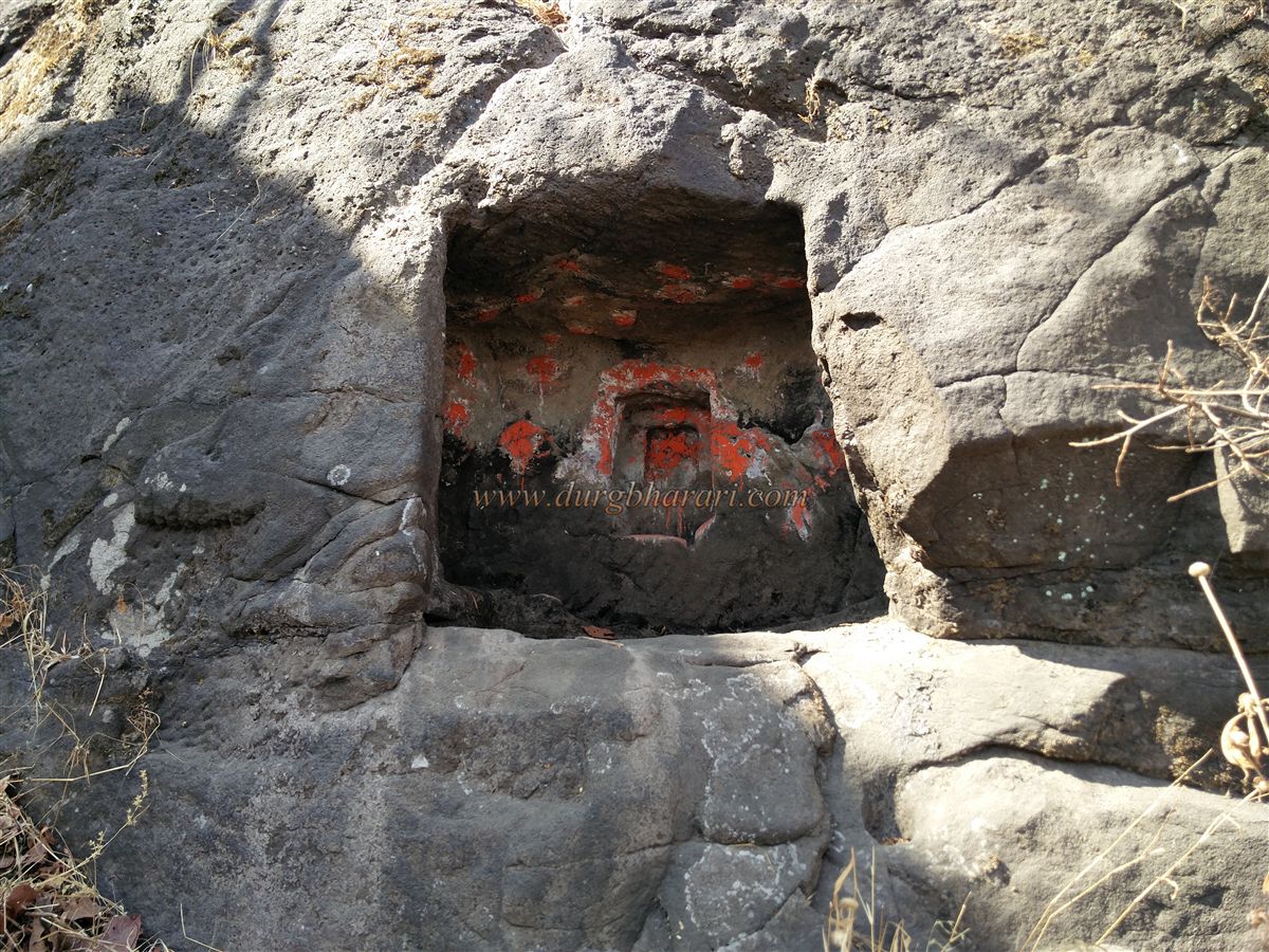
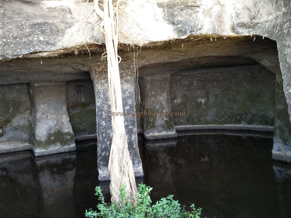
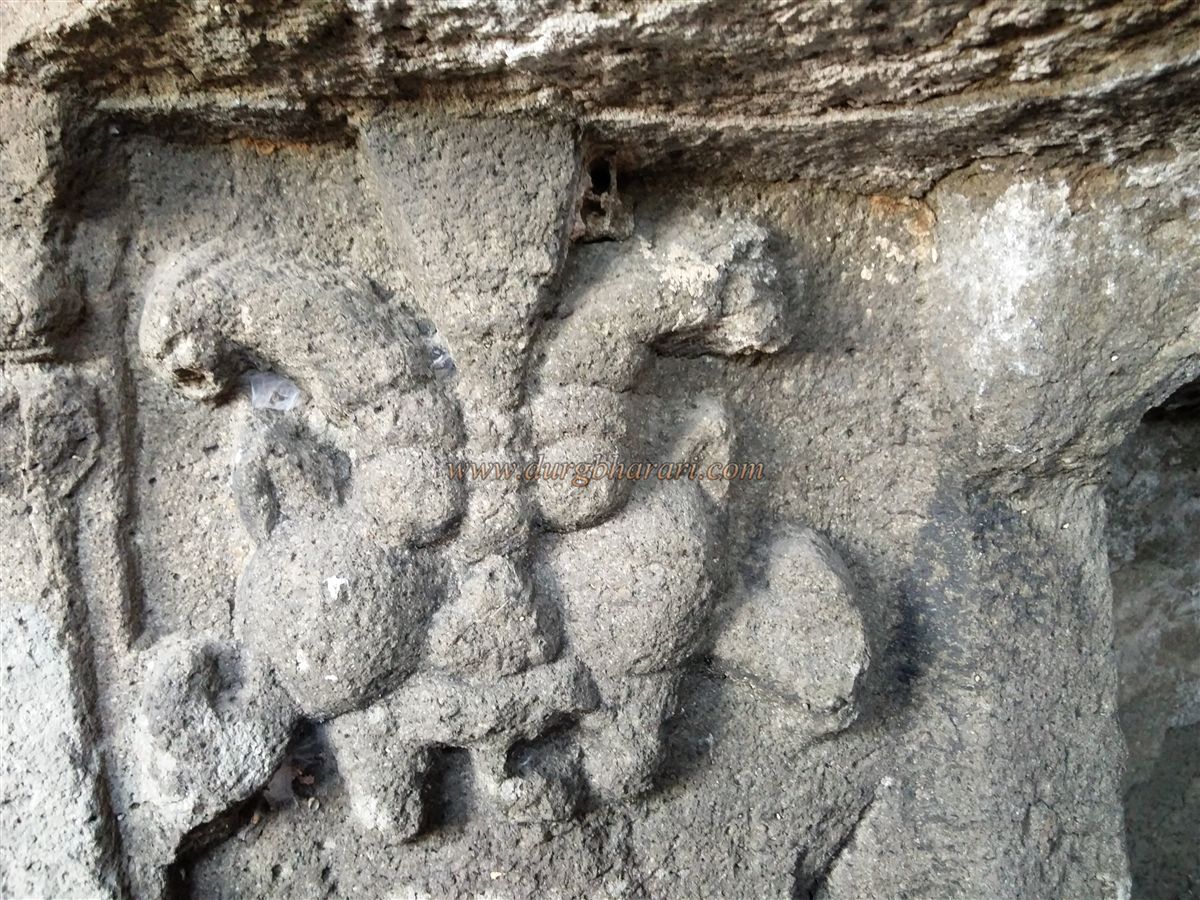
After seeing these, one reaches a small pass. The steps ahead have been destroyed, and rock-cut holds are carved into the stone to aid the climb, which must be done carefully. After scaling this rock patch, there are two paths to proceed – one straight ahead and the other winding along the right side of the cliff. To the right is the fifth tank, named Ghazi Shah, and at the same level towards the north are two large pillar-supported tanks known as Govni. These two tanks are divided into separate sections and contain potable water. To enter the last tank, a 3 x 3-foot rock-cut doorway decorated with leaf and floral carvings is seen. This structure resembles a cave due to the presence of carved dwarapal (gatekeepers) on either side of the door and a Kirtimukh motif above them. Nearby, there is a faintly carved figure of Hanuman in the rock.
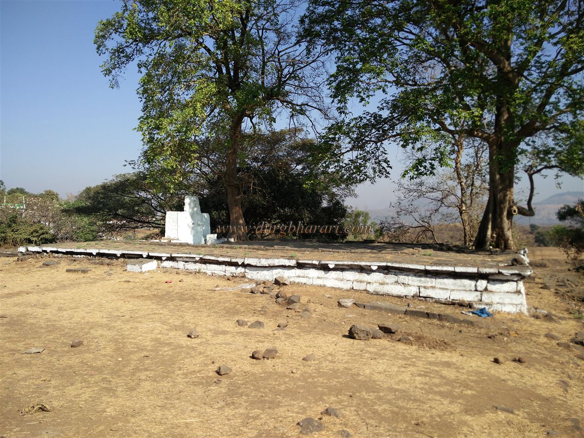
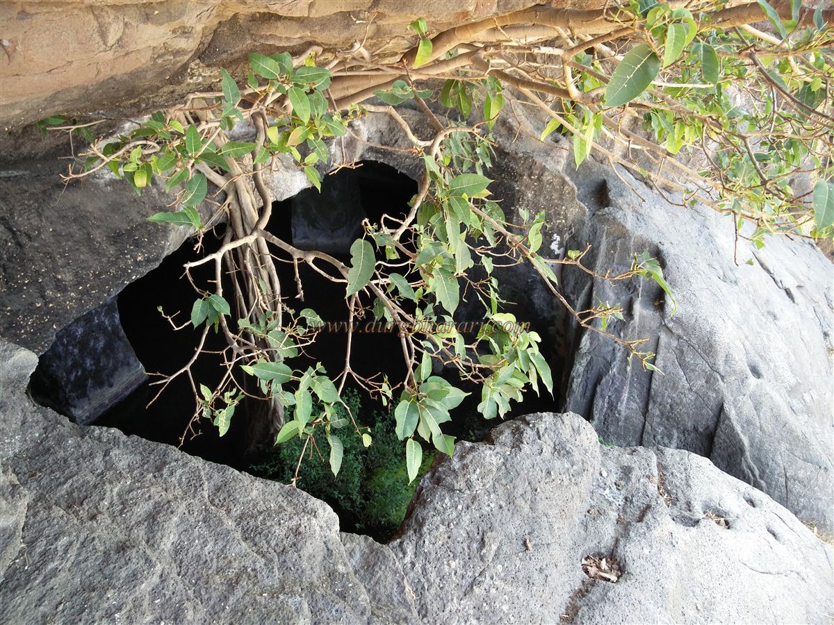
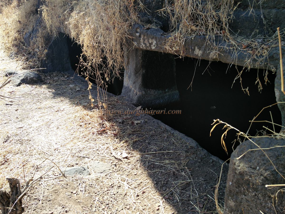
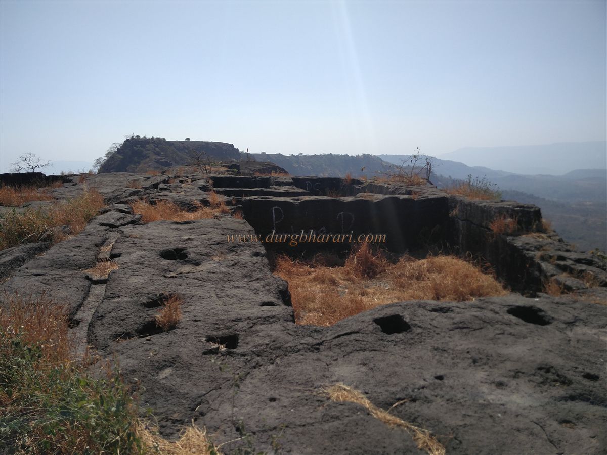
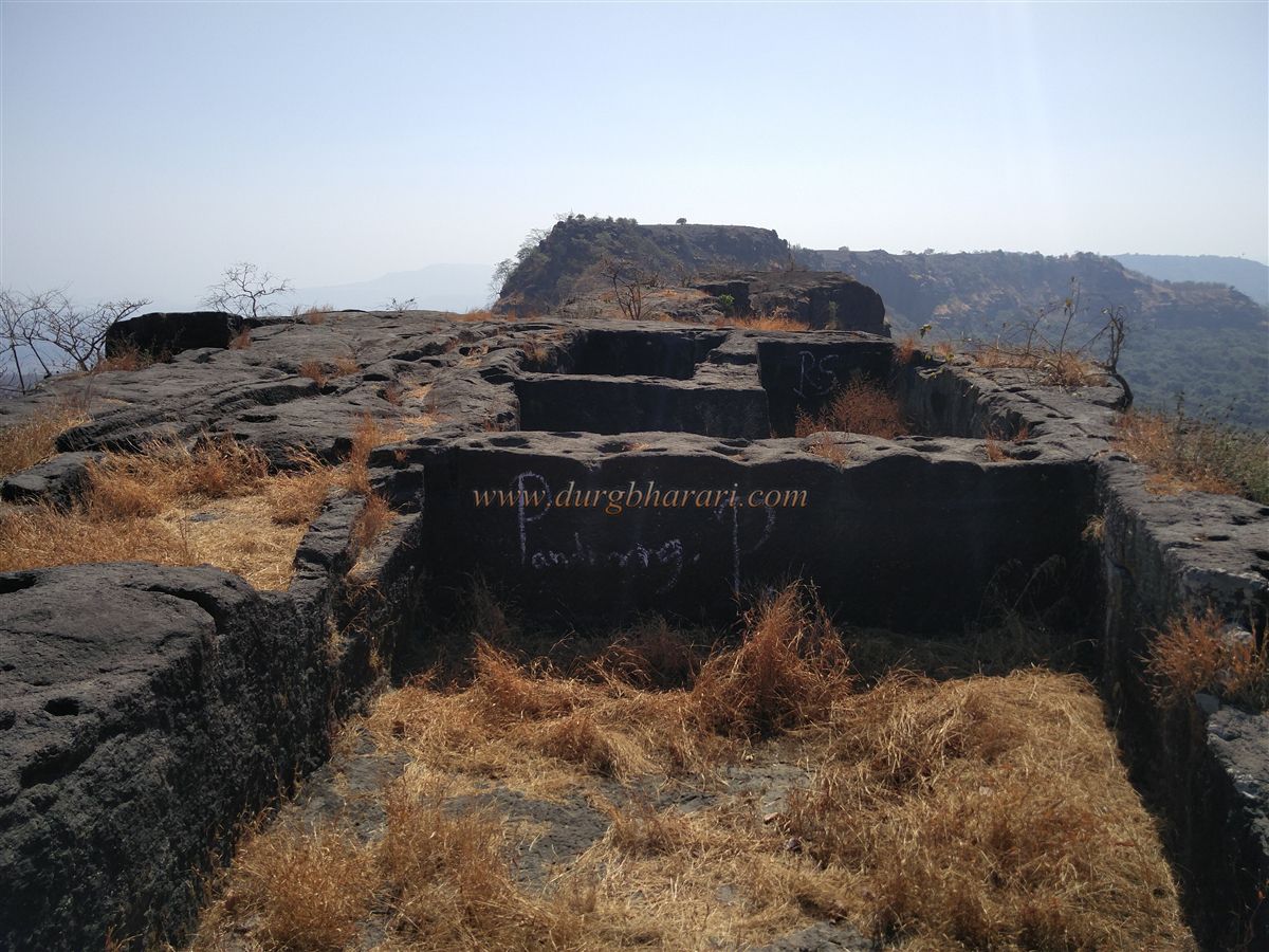
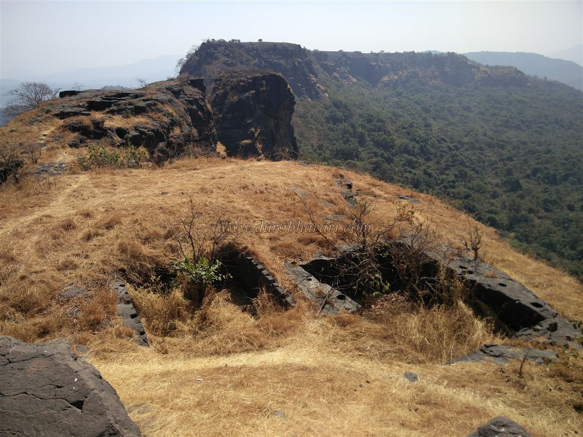
Circling the fort and moving ahead, a dry eighth tank is seen, followed by two more rock-cut dry tanks. Further along is a large cave-like structure measuring about 60 x 50 x 10 feet, supported by four pillars – likely used as a granary. There are also granaries on the western and southern sides of the fort. A cellar-like granary in the southern section is known as Chor Tank. Climbing another short rock patch from here brings one to the fort’s plateau. On this plateau is a dry water tank. Facing it is a hillock that forms part of the fort. On this hillock are remnants of a mansion, soldiers’ quarters, audience halls, and other structures.
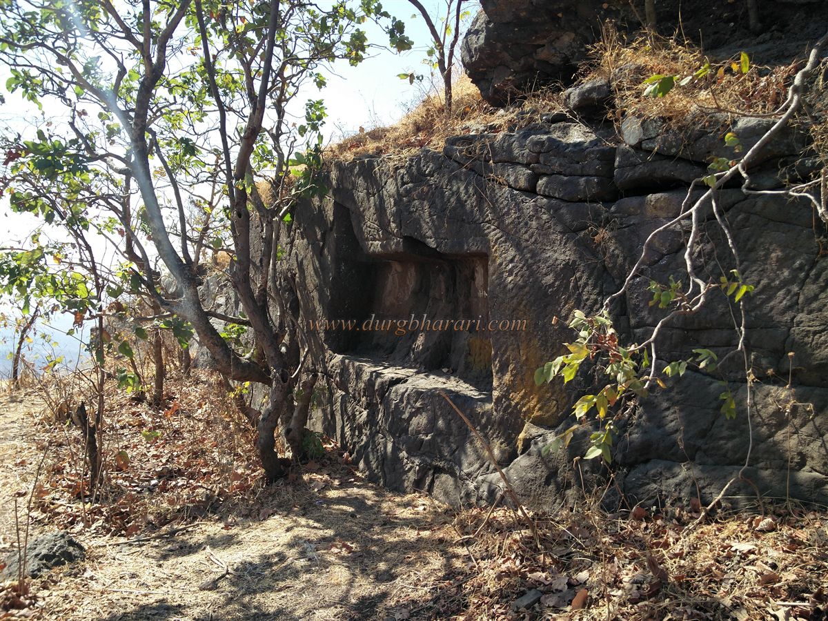
Descending the hillock on the right side, there is a projecting portion of the hill where another dry water tank is found. Moving ahead, two more dry tanks appear. Looking below the overhanging portion of the opposite hill, a cave is visible about 50 feet down, but reaching it requires rock-climbing skills and equipment. This cave measures about 40 x 15 x 6 feet and is supported by two pillars.
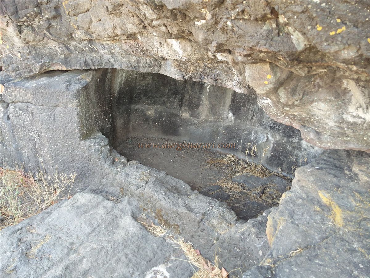
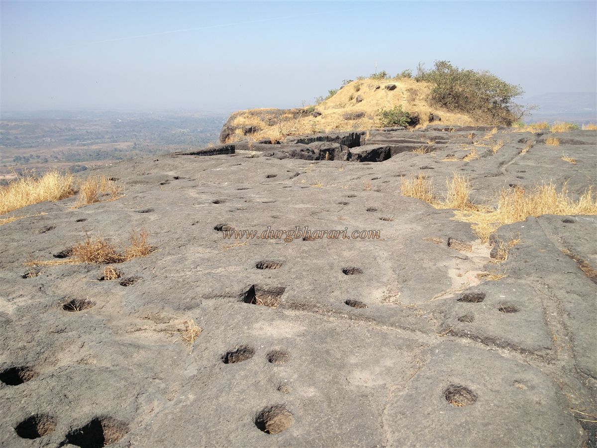
Proceeding further brings one to the second plateau of the fort, where five more tanks are carved into the rock. Numerous rock-cut channels and pits surround these tanks. These channels were designed to direct rainwater into the tanks, with sediment settling in the pits along the way. Near the edge of the fort, a large circular rock-cut cistern can be seen. From this edge, looking at the opposite hill makes it seem like the fort was once a twin fort, as two rock-cut tanks are visible on the opposite hill, separated from this one only by a narrow gorge.
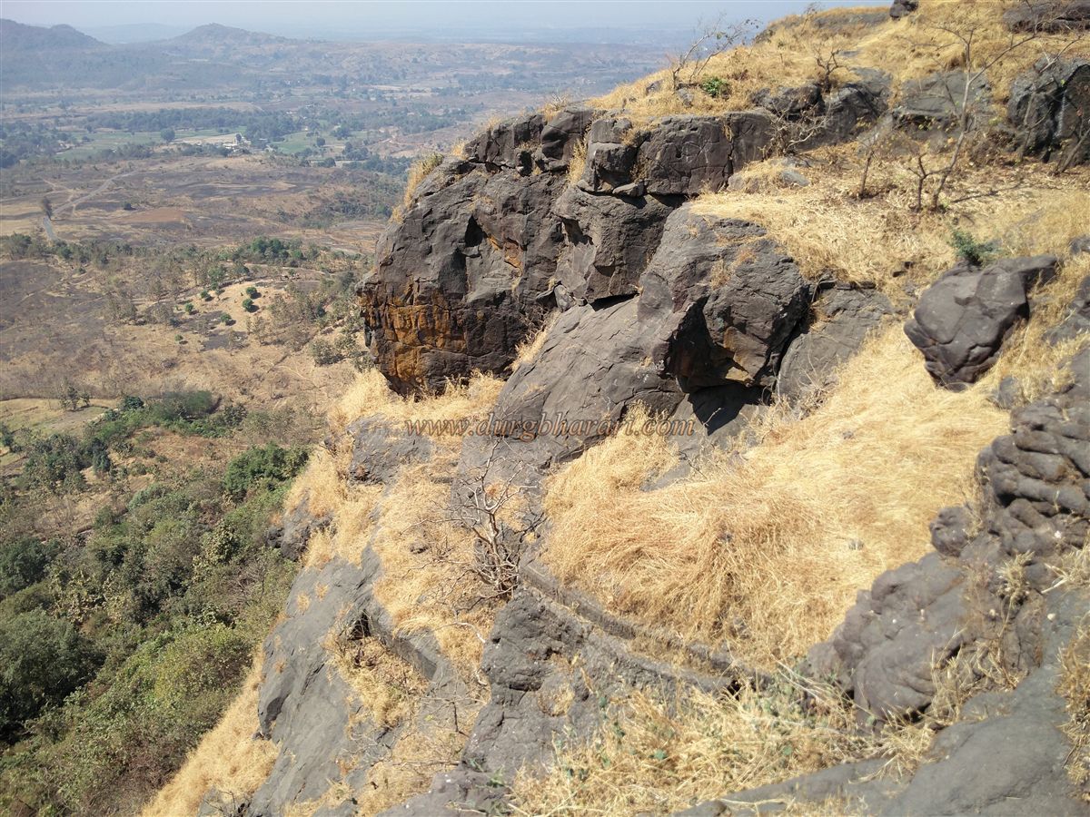
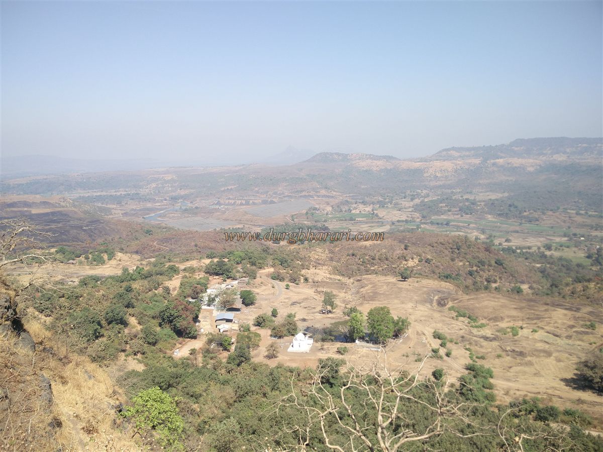
Thus, the exploration of the fort concludes. With so many water tanks, this fort can rightly be called a “fort of tanks.” Though small, it offers panoramic views of Miriya hill, Gharapuri, Mumbai, Karnala, Manikgad, and Nagphani. To the west, the serpentine course of the Bagasai River can be seen from its source to the sea. Descending through the gorge between the two plateaus leads back to the rock patch climbed earlier, and from there one can descend along the approach path.
It takes about two hours to explore the entire fort. Before Muslim rule, the Sankshi fort likely belonged to the Shilahara or Yadav feudatories of Konkan. Historical documents refer to Pen as the headquarters of the Sankse taluka under Avchitgad province, Kalyan. The fort was built by King Ranakans, whose capital was Herambpur (modern-day Hamrapur). During his reign, this fort served as the administrative center of Sankse taluka. The commander of Sagargad later invaded Sankshi, ending Ranakans’ rule.
In the early 16th century, the fort fell to Ahmad Shah, Sultan of Gujarat. In 1540, Burhan Nizam Shah I (1509–1553) of Ahmadnagar captured it from the Sultan of Gujarat. At the latter’s request, the Portuguese sent 300 soldiers to recapture the fort, forcing the Nizamshahi troops to withdraw. Later, the Nizamshahi army again attempted to reclaim the fort, prompting the Gujarat commander to hand it over to the Portuguese. D. Menzes, the Portuguese captain of Vasai, dispatched troops to garrison the fort, defeating the Nizamshahi forces in battle. A Portuguese soldier named Trancosa displayed exceptional bravery during this engagement.
However, to secure friendly relations with Nizamshah, the Portuguese Viceroy purchased the Sankshi and Karnala forts for 5,000 gold pardaus (about 17,500 rupees) from Burhan Nizam Shah I. Around 1670, Shivaji Maharaj’s commander Abaji Sondev annexed the fort to the Maratha Empire. In 1818, it passed into British hands. Records from 1827 mention skirmishes between the Ramoshis and the British at or near this fort. Until 1866, Sankshi served as the headquarters of a sub-division comprising 198 villages, after which the headquarters was shifted to Pen, reducing Sankshi’s importance.
© Suresh Nimbalkar
GALLERY