SALHER
TYPE : HILL FORT
DISTRICT : NASHIK
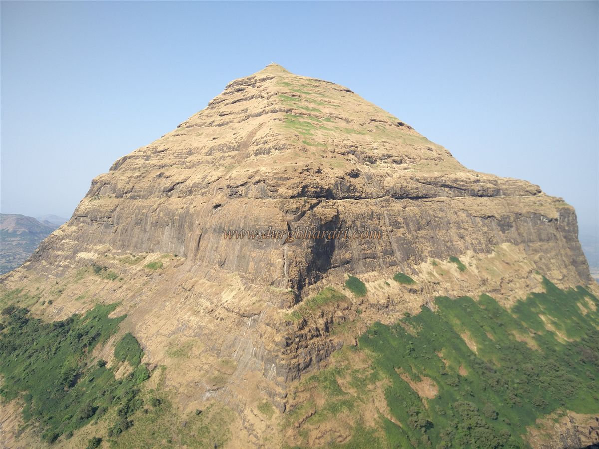
HEIGHT : 5167 FEET
GRADE : MEDIUM
Among the famous twin forts of Maharashtra known for trekking, the Salher–Salota forts in the Dolbari mountain range of Nashik district hold the highest position. Of these, Salher is the tallest fort in Maharashtra. Situated on an important trade route connecting the Dang region of Gujarat and the Baglan region of Maharashtra, Salher was of great strategic importance. While the fort is often referred to as the “watcher over the six ghats,” its true fame in Maharashtra stems from the historic battle fought at its foothills during the Maratha period. In this battle, Suryaji Kakde, a childhood companion of Chhatrapati Shivaji Maharaj, was martyred by a cannonball, etching the fort permanently into the history of the Maratha Empire.
Situated on the border between Gujarat and Maharashtra, Salher and Salota forts are separated only by a single pass.
...
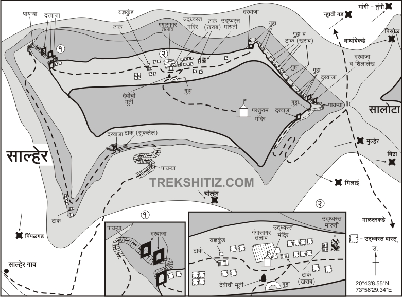
There are two independent routes to reach Salher – via Salher wadi and via the Vaghambe pass. The path from Salher wadi involves crossing six gates and takes about three hours to reach the top, while the Vaghambe route involves crossing four gates and takes about two and a half hours. Vaghambe pass can be accessed through three villages – Vaghambe, Kopmal, and Salher. One can ascend the fort by one route and descend by another to fully explore the fort.
For those wishing to cover both Salher and Salota in a single trek, the Vaghambe route is more convenient. This path allows trekkers to first climb Salota, cross through the pass, then climb Salher, and finally descend to Salher wadi. By starting early in the morning, both forts can be fully explored in a single day with minimal effort and time.
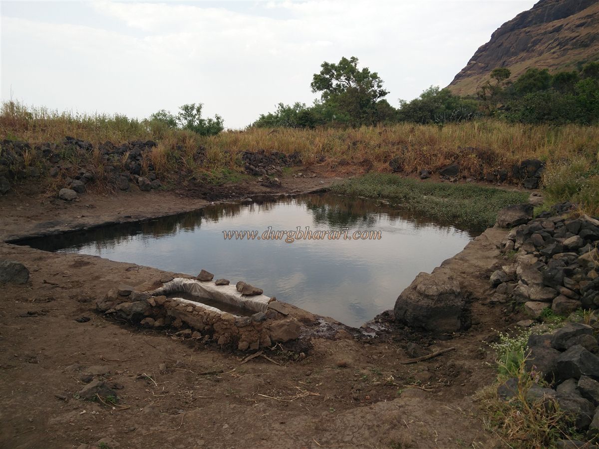
The village of Vaghambe, located at the northern foothills of Salota fort, is about 134 km from Nashik and 45 km from Satana via Taharabad. Salher wadi lies 7 km ahead of Vaghambe. From Vaghambe, a trail begins behind the small Saptshringi temple on the left side of the road, leading to the pass between Salher and Salota. As there is no water along the route beyond this point until the top of the fort, trekkers should fill their bottles at the tank near where vehicles are parked. It takes about one and a half hours to reach the pass from Vaghambe and about two and a half hours to reach the fort.
From Vaghambe, one can clearly see the right-side ridge of Salota descending toward the village; the trail to the pass climbs along this ridge. Since most trekkers use this route to Salher, the path is fairly well-trodden. On the plateau above this ridge, there are some ruined remains, likely an outpost built to monitor movement through the pass. Further along, a series of steps carved into the rock can be seen. Just before the pass, on the right side of the path, there is a small rock-cut water tank that retains water until January.
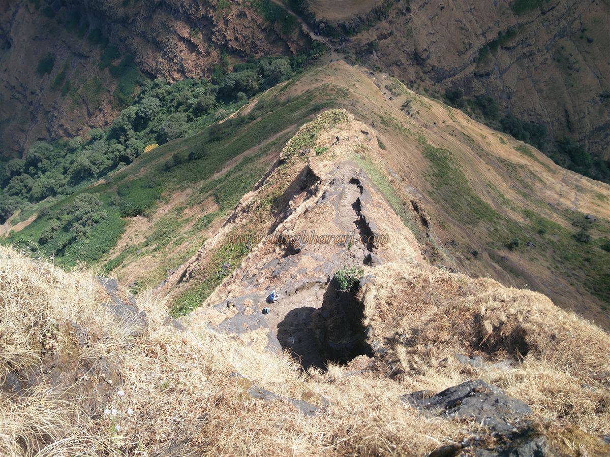
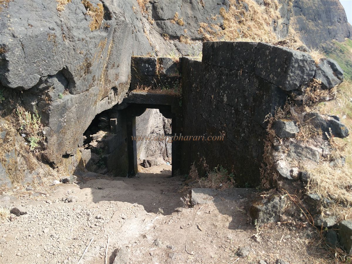
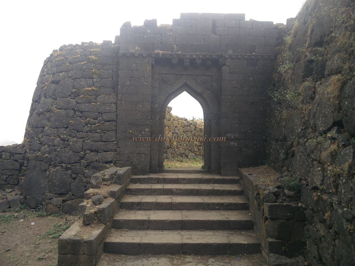
Upon reaching the pass, the left path ascends toward Salota fort while the right descends and leads to Salher. Looking toward Salher from here, one can spot a rock-cut staircase and a gate along the ridge, though there is no direct path to reach them. Continuing along the well-marked trail along the crest of Salher’s ridge for some distance, the path eventually turns back toward the rock-cut steps. These steps ascend along the cliff edge and lead to the first southern-facing gate of the fort. This gate is built on a small flattened platform carved out of the rock, with a steep cliff on one side and a deep valley on the other. It is constructed at an angle facing the valley, making it invisible from a direct approach.
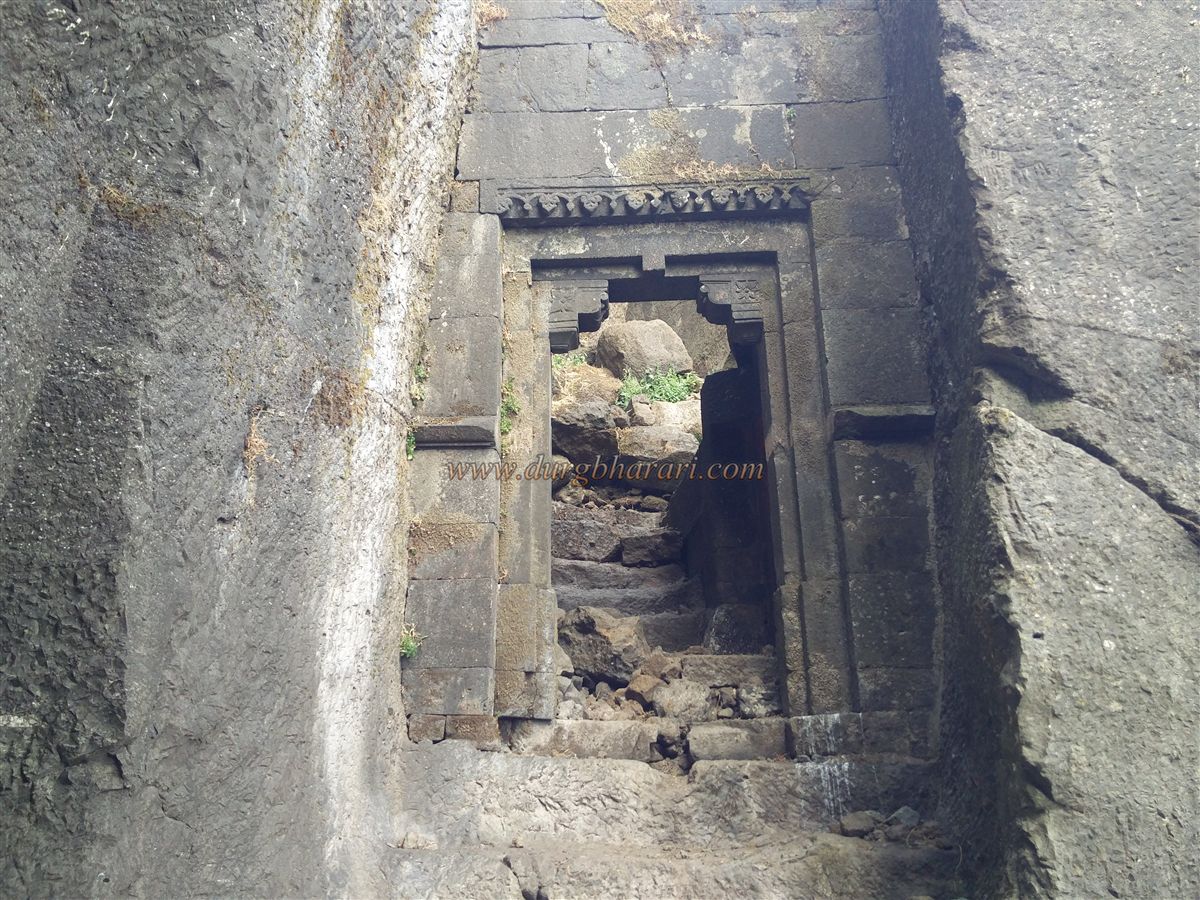
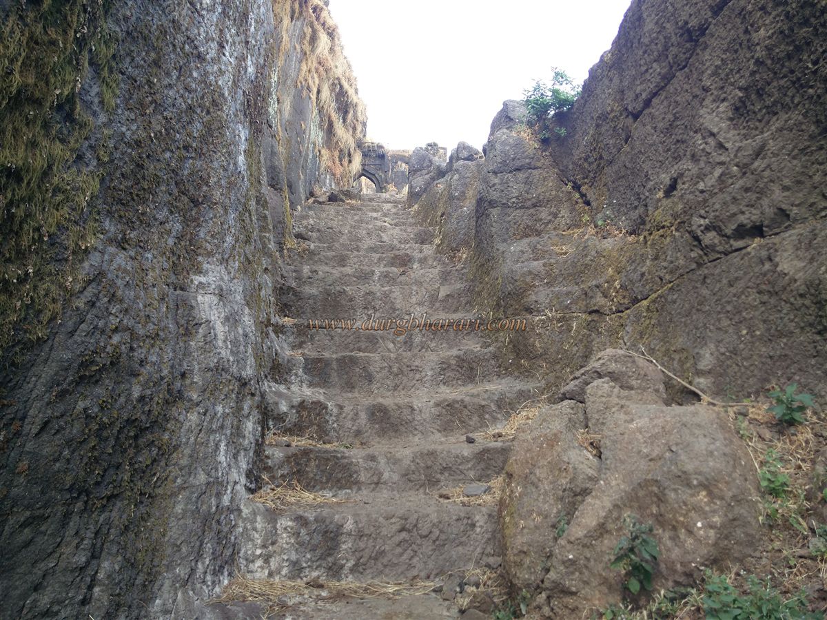
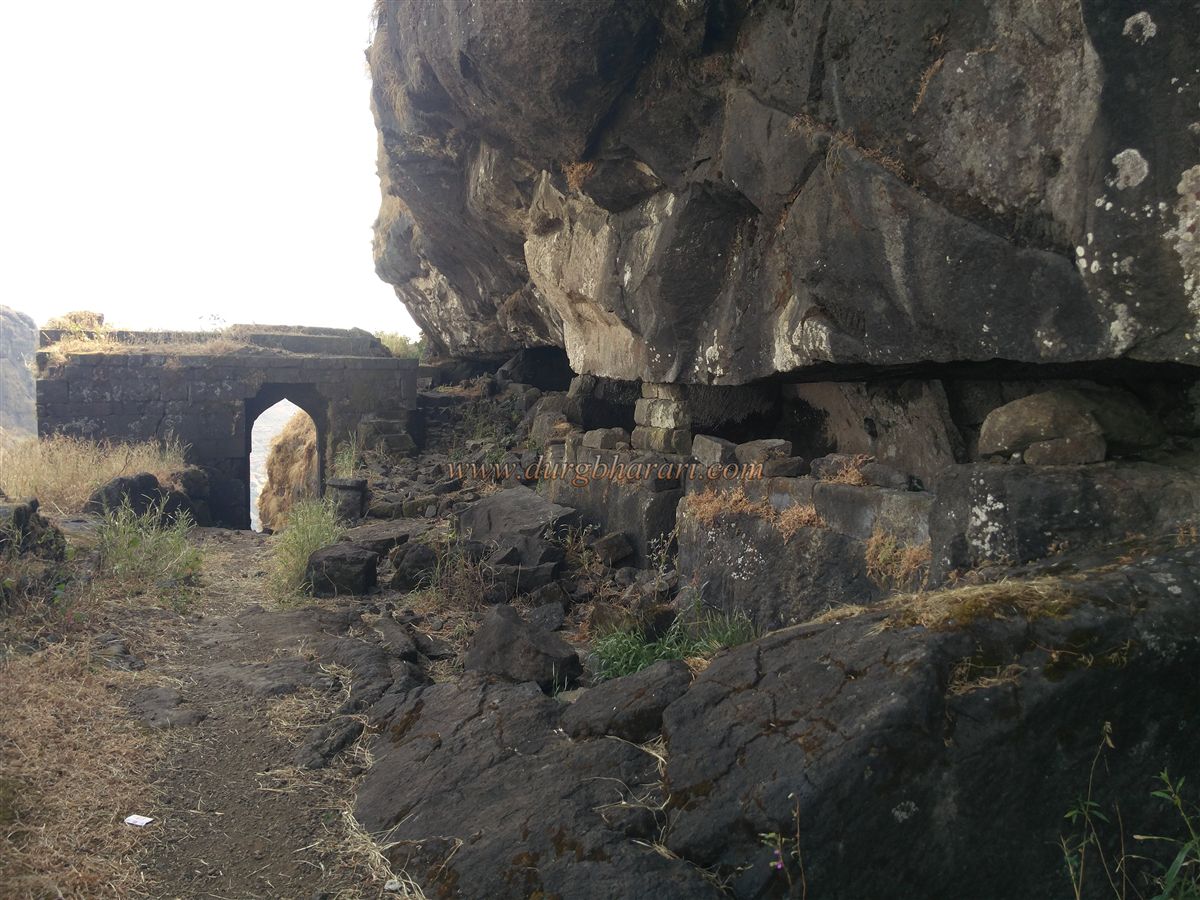
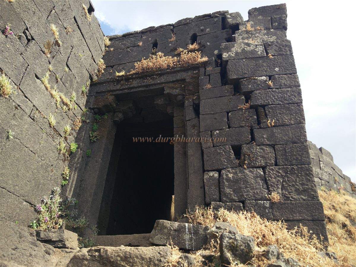
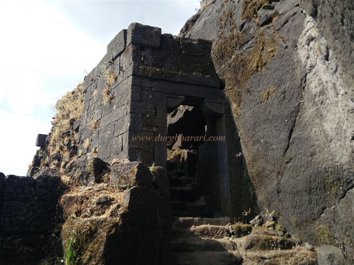
Passing through this gate, a rock-cut stairway begins, leading to the second northern-facing gate. On the rock near this gate, there is an inscription carved in a mix of Gujarati and Marathi written in the Devanagari script. The gateway itself has some decorative carvings and is flanked by rock walls carved to house its structure. Inside, on the left, there is a small guard chamber, and steps carved into the rock lead to the top of the gate. Climbing further brings you to the third arched northern-facing gate, which features floral carvings on both sides of its arch. Like the first gate, this one also has a cliff on one side and a rock wall on the other.
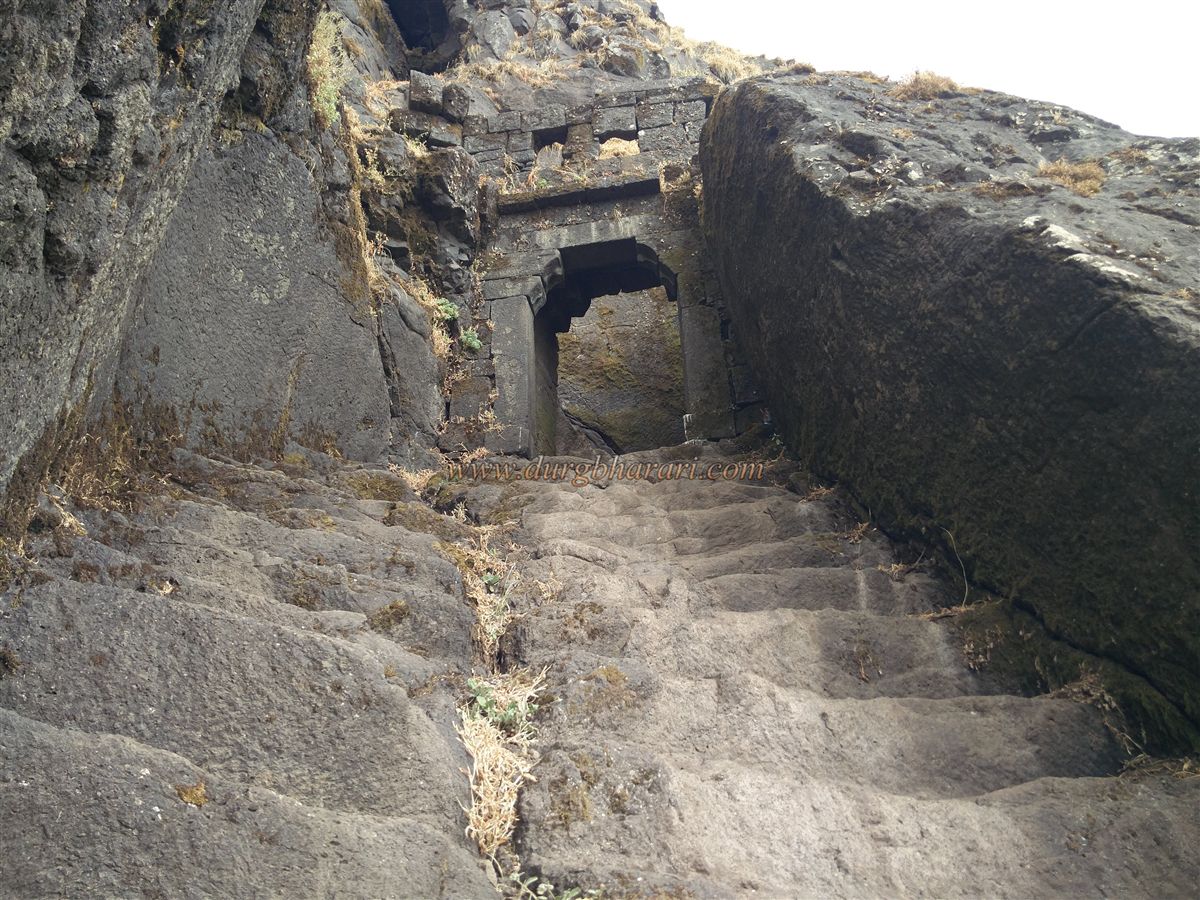
Beyond this point, the path leading to the fort is entirely carved into the cliff, with short protective stone walls in some sections. Along this route, there are about 20–22 rock-cut caves and 8–10 water cisterns. Most of these caves are in ruins, with some partially filled with water. Near one of the caves, there are carvings on the rock face. The tanks are also largely in poor condition, with only one containing potable water. Looking back along this path offers a beautiful view of Salota fort. After walking along this Cliffside path for about 10 minutes, you reach a circular bastion at the northern tip of the fort. From here, steps on the left lead to the fourth eastern-facing gate. Climbing the rock-cut steps of this gate brings you to the main plateau of Salher, known as the Gadi Plateau.
Just beyond the gate, on the right side of the path, lies a dry water tank. The plateau gets its name from the Gadi (administrative seat) of the Gaikwads, which once stood here. To the left of the trail, a large square platform with steps leading up to it is visible – this is the remains of the administrative structure. Along the path, ruined house foundations and platforms can be seen.
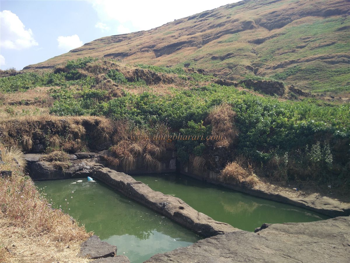
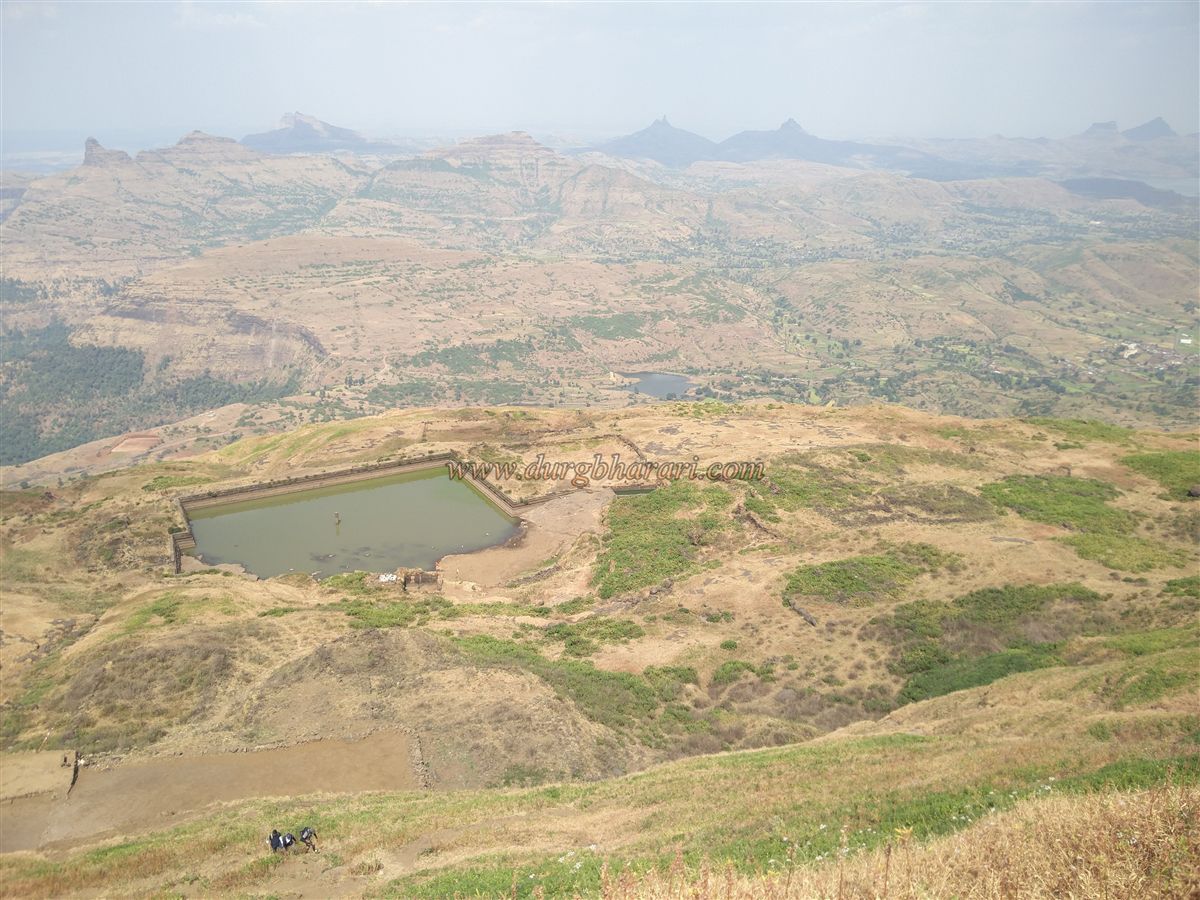
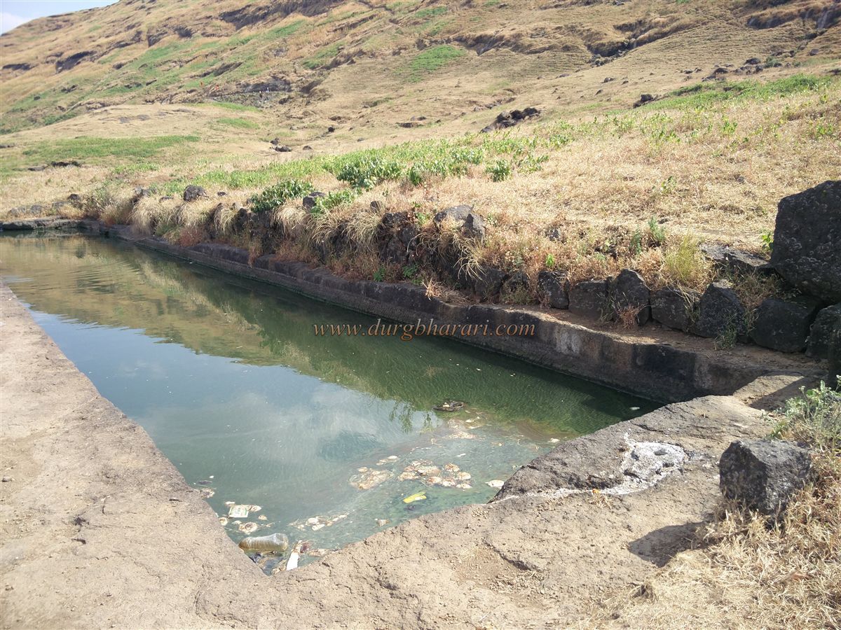
Proceeding further, you reach the large Gangasagar Lake, measuring 110 x 175 feet and constructed from dressed stone masonry. In the center of the lake, a stone pillar was placed to measure the water level. Near the lake, there are two large rectangular rock-cut tanks known as Ganga and Yamuna. While the lake is mostly silted up, both it and the two tanks contain greenish water that is not suitable for drinking. Adjacent to the lake, on its left bank, stands the ruined stone temple of Goddess Renuka. The sanctum of the temple still survives, though the walls of the collapsed Mandap, with their intricately carved pillars, hint at the temple’s former grandeur. Inside the sanctum is an idol of Renuka Mata, with a small Ganesh idol in a niche to the left.
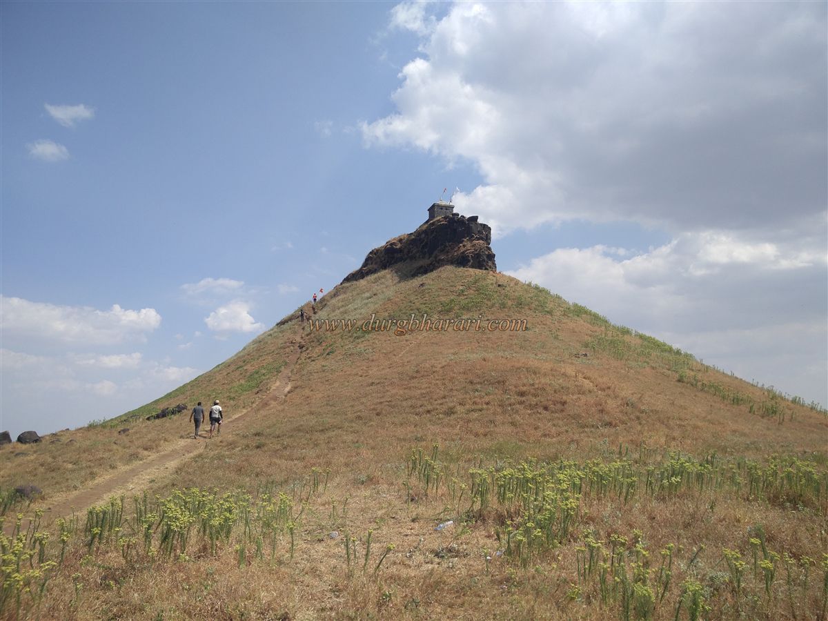
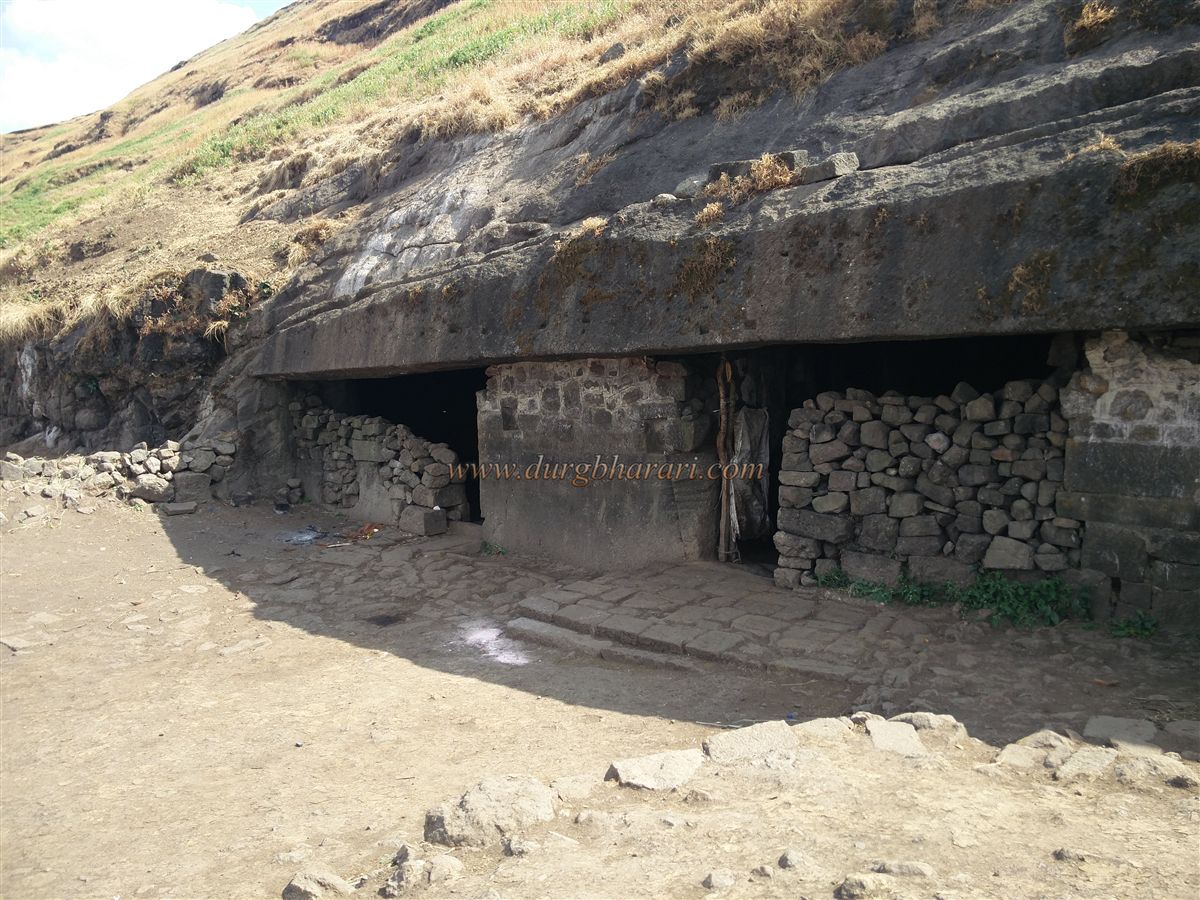
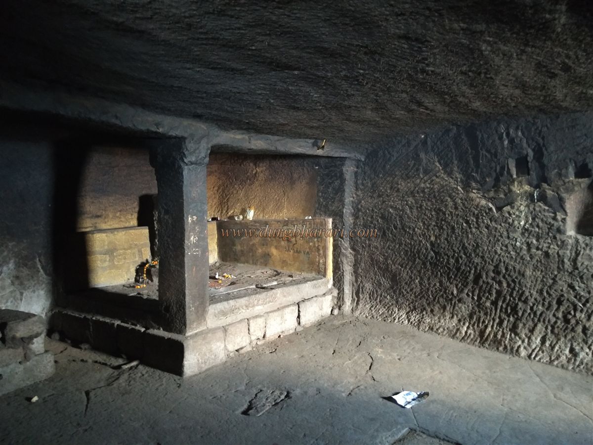
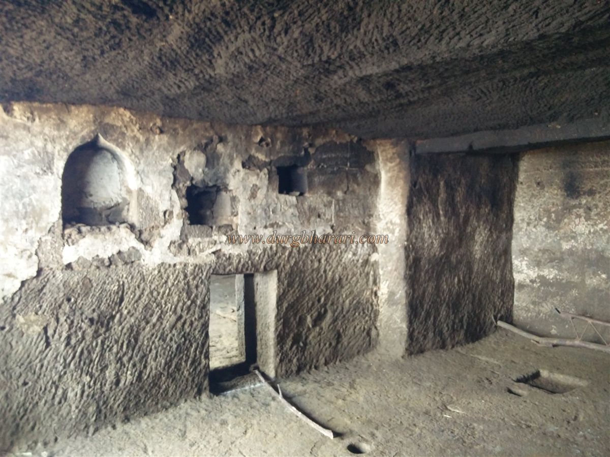
Near the temple, there is a small underground cistern known as Sanjeevani Tank, fed by a perennial spring, which provides potable water until March. From here, looking toward the hill on the left, one can spot a temple at its summit. On the way to this hill, at its base, there are three rock-cut caves in a row. Two of these caves are suitable for sheltering overnight. In the rightmost cave, a platform has been built housing idols of Hanuman and Dattatraya. A small carved doorway connects this cave to the next, which features small niches and an intricately carved pillar, suggesting that the other pillars were left unfinished.
Climbing further up the hill brings you to a plateau below the temple, offering a panoramic view of the entire route from Salher wadi up to the fort’s lower machi (settlement plateau) as well as the semi-circular cliff that encircles Salher. At the summit of this hill stands a newly built temple of Parashuram, with his stone footprints and two roughly carved idols installed on the original plinth. This is the highest point of the fort at an elevation of 5,141 feet above sea level, making Salher the second-highest peak in Maharashtra. From here, the entire Gadi Plateau is visible.
The plateau covers an area of about 112 acres. The presence of numerous structures and water tanks suggests that this area may once have been a bustling settlement. From this vantage point, one can see 20–22 nearby forts, including Achala, Ahivant, Markandeya, Saptshringi, Ravlya–Javlya, Dhodap, Kanchan, Rajdher, Chaulher, Bhilai, Mulher, Mora, Hargad, Mangi–Tungi, and Ratangad. Salota fort and the Takkara pinnacle are also clearly visible from here.
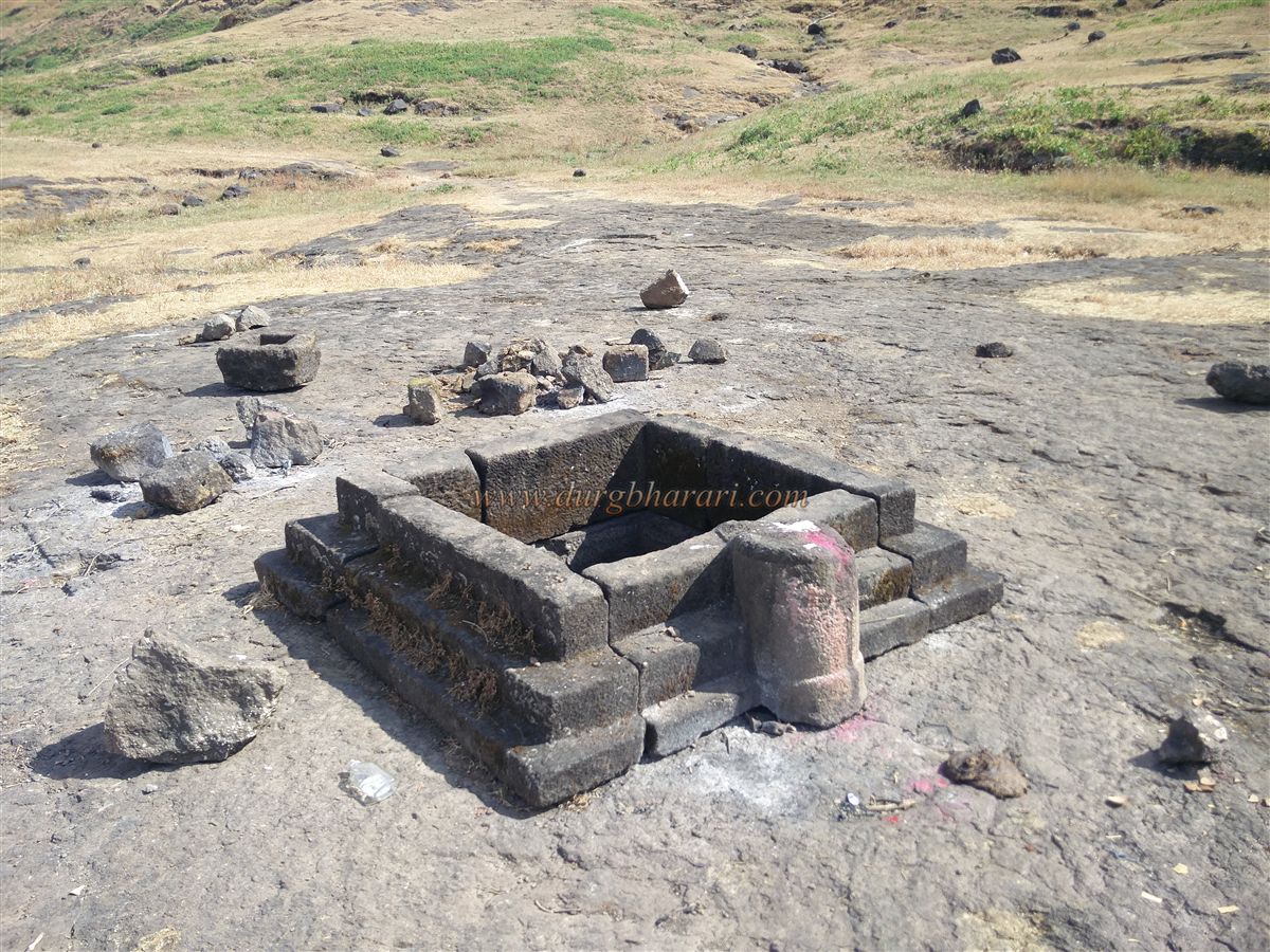
From the Parashuram temple hill, instead of returning to the caves, one should continue straight ahead to resume the exploration of the fort. Along this path, on the way to the opposite end of the plateau, you will come across a rock-cut yagna Kund (sacrificial altar) built with dressed stone blocks, alongside a small stone trough. A little further along, on the left side of the path, is a rock-cut cistern that holds potable water throughout the year.
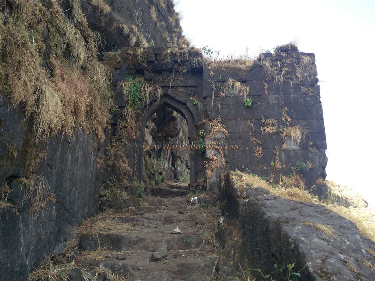
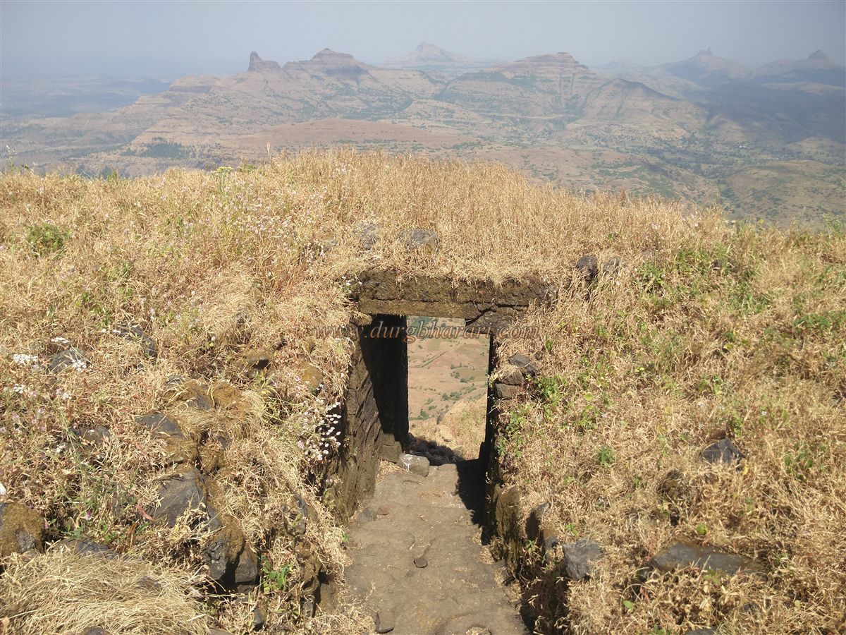
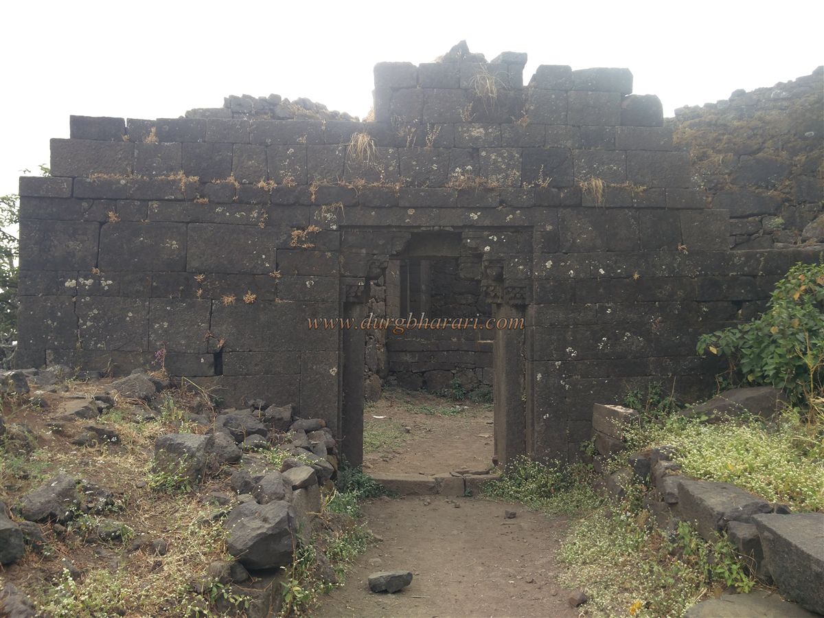
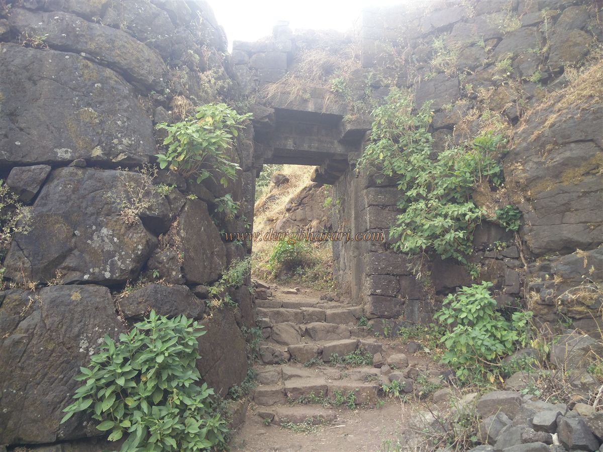
Proceeding from here, the left side of the trail features a large cluster of architectural remains, including two rock-cut cisterns, one of which contains drinkable water. After observing these tanks and the surrounding ruins, one can return to the path, which leads to the fort’s western edge. Here, built into the sheer cliff, is a west-facing gate. The upper portion of this gateway is enclosed by fortified masonry, and descending through it marks the start of the descent from the fort. Beyond this gate, rock-cut steps lead down to a second gate, which includes a guard chamber inside. Passing through this gate brings you to a third gate, and along the steps between them, a rock-cut granary can be seen.
This entire descending route has been skilfully carved into the rock, with a defensive sequence of three gates in succession, ensuring layered protection. After crossing these gates, you arrive at the lower machi (settlement plateau) beneath the main fort. This is the route from Salher wadi.
The machi still bears extensive ruins of houses, suggesting that it was once a significant settlement. Due to the lack of water, this population has since moved down to Salher wadi in more recent times. On the right side of the path here, there is a large rock-cut tank measuring approximately 50 x 20 feet, which holds potable water. Nearby are the remains of house platforms and a monolithic stone-built memorial platform with carved footprints and a cannonball placed in front of it. Next to this is a smaller platform, also with carved footprints. This section of the plateau also features a defensive wall built with dressed stone along the valley edge.
Continuing further, you encounter a sequence of three gateways providing access to the machi. The first gate is north-facing, with floral carvings on its arch, broad steps, and a parapet wall in front. This must have been the main entrance to the machi. On the left side of the arch, an inscription in Gujarati written in the Devanagari script can still be seen, though unfortunately it has been defaced by someone painting over it with lime. The second gate, which is east-facing, has some decorative carvings on its frame, and a ruined water tank lies opposite it. Between these two gates is an open space likely used for assembling troops. The third gate, also east-facing, is the main entrance to the fort from Salher wadi. It is a simple structure built between two bastions.
Descending through this route brings you into the forested area at the base of the fort. Here stands a modest but ancient temple dedicated to Siddhivinayak and Goddess Bhavani. Behind the temple is a well, and nearby, beneath a tree, a small Ganesh idol is enshrined in a niche. Scattered throughout the forest are numerous carved stone fragments and sculptures, remnants of the fort’s glorious past.
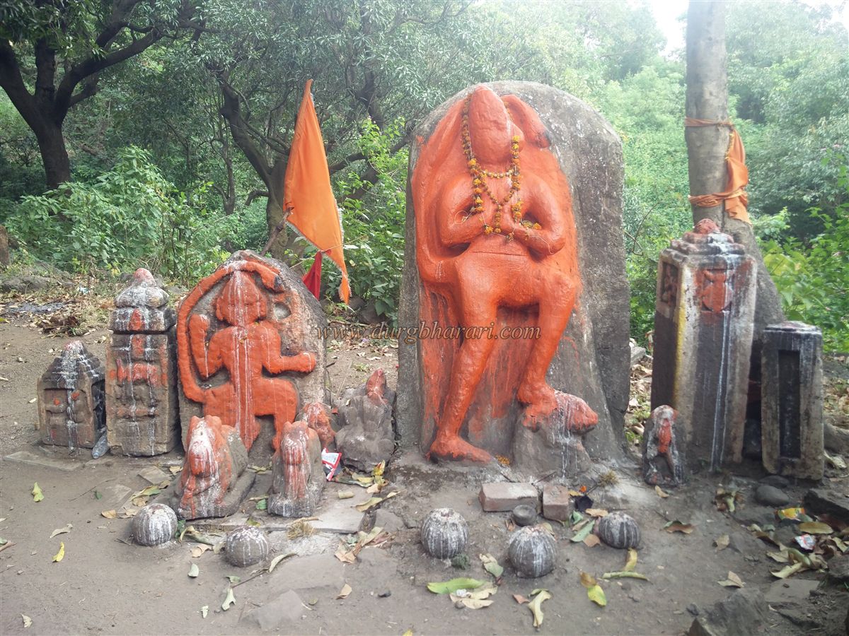
Additionally, there is a newly constructed temple dedicated to Gadkalika Devi, the residing goddess of Salher. Behind this temple are two Hanuman sculptures, along with four hero stones (virgal), two Nandi statues, several carved figures, and five cannonballs arranged nearby. Continuing along this route toward Salher wadi, a rock-cut water tank becomes visible on the right side of the path. Above this tank, amidst the thickets, a few more hero stones are scattered. This completes the circuit of the fort.
A full exploration of Salher, starting from Vaghambe, covering all the major points, and descending to the base, typically takes around eight hours. For accommodation, besides the caves atop the fort, one can stay in the temple at the base or, with prior arrangements, at the Forest Department’s guesthouse in Salher wadi village.
Salher fort is closely linked to mythology. It is believed to be the site of penance performed by Parashuram. According to legend, after donating the entire earth as alms, Parashuram created land for himself by shooting an arrow from here into the sea, causing it to recede. As proof of this tale, locals point to a nearby mountain called Kandana, which has a hole said to have been pierced by his arrow.
The presence of rock-cut caves and water cisterns suggests that Salher existed as early as the Satavahana period. Later, it came under the rule of the Rashtrakut, followed by the Yadavas, and subsequently the Gawli (Ahir) kings. In 1308 CE, Bagul king Nandev defeated Gawli king Mahesh and captured Salher and Mulher forts, bringing the region under Bagul control. For the next 350 years, the Bagul dynasty ruled this area.
The Tarikh-i-Firozshahi (1340 CE) mentions that Nandev Bagul held Mulher and Salher forts. Similarly, Abul Fazl’s Ain-i-Akbari (1590 CE) records Salher and Mulher as strong forts in the Baglan region. When Akbar conquered Khandesh, the then Baglan ruler Pratapshah Bahirji maintained friendly relations with the Mughals.
In 1610 CE, English traveller Finch referred to Salher and Mulher as prosperous towns and noted the presence of a mint where Mahmudi coins were struck.
When Aurangzeb was the Subhedar of the Deccan, in February 1638 CE, Syed Abdul Wahab captured Salher. The Baglan ruler Bahirji surrendered to the Mughals and handed over Salher, Mulher, and other strongholds to Aurangzeb.
Later, in 1670 CE, during Shivaji Maharaj’s Baglan campaign, the Marathas looted the town of Mulher, and Moropant Peshwa laid siege to Salher. After skirmishes between the Marathas and the Mughal garrison, the fort commander Fateullah Khan was killed, and on 5 January 1671 CE, the saffron flag of the Marathas flew over Salher.
Aurangzeb, enraged by this loss, dispatched Bahadur Khan, Diler Khan, Mahabat Khan, and Jaswant Singh with a force of 40,000–50,000 troops to reclaim the region. Bahadur Khan marched toward Salher, and his subordinate Ikhlas Khan laid siege to the fort.
This siege led to the famous Battle of Salher in 1671. On hearing of the Mughal encirclement, Shivaji Maharaj sent his generals Prataprao Gujar from the Mughal territories and Moropant Pingle from North Konkan to relieve the fort. The two forces engaged the Mughals in an open-field confrontation near Salher.
The Marathas, known for their guerrilla tactics, demonstrated in this battle that they could also defeat the Mughals in conventional warfare. This open-field victory greatly boosted Maratha morale and established their military prowess.
The battle resulted in a massive defeat for the Mughals, with the deaths of Ikhlas Khan, Bahadur Khan’s key commander, and heavy casualties across their ranks. Diler Khan, who was stationed nearby, retreated after hearing of the defeat.
The Marathas captured 6,000 horses, 6,000 camels, 125 elephants, enormous quantities of treasure, jewels, and rich fabrics.
Notably, in this battle, Suryaji Kakde, Shivaji Maharaj’s childhood companion and a Panchhazari (commander of 5,000 troops), was killed by a cannonball. Sabhasad compares Suryaji to Karna from the Mahabharata in his account.
Maratha commanders in this battle included Prataprao Gujar, Moropant Pingale, Anandrao Mohite, Vyankoji’s Datta, Rupaji Bhosale, Suryaji Kakde, Sidhoji Nimbalkar, Khandoji Jagtap, Godaji Jagtap, Manaji More, Visaji Ballal, Moro Nagnath, and Mukund Ballal.
Poet Bhushan, in his Shivabavani, writes of this victory: “Upon hearing of Shivaji’s triumph at Salher, fear gripped the hearts of his enemies. The heavens, earth, and netherworld resound with his glory.”
Following this decisive victory, the Marathas quickly captured Mulher and secured control over the entire Baglan region.
Later, during Sambhaji Maharaj’s reign, in 1682 CE, Aurangzeb sent his son Prince Azam to capture Salher. Despite great effort, the Mughals failed to take it by force. Eventually, Neknam Khan, the Mughal commander of Mulher, bribed Salher’s fort commander, Asaji Krishnaji, to surrender the fort. Khafi Khan, the Mughal historian, records that Asaji betrayed the fort for money and rewards. Mirza Farooq Beg was appointed as the new fort commander, and the fort was renamed Sultanagad.
In 1694 CE, Mirza Farooq Beg was replaced by Suratsingh as commander, followed by Muhammad Tahir and Pisar Muhammad. In 1699 CE, Bahroz Khan became the commander of the fort.
After the establishment of the Hyderabad Nizam’s dominion in 1724 CE, Salher came under his control.
In 1768 CE, following the Battle of Dhodap, the Peshwa granted Salher and its surrounding territory (with an annual revenue of 65,000 rupees) to Gahinabai Gaikwad, wife of Govindrao Gaikwad of Baroda. However, it seems the Nizam retained actual possession until 1795 CE when the fort was finally handed over to the Peshwa by the Nizam.
After the Third Anglo-Maratha War in 1818 CE, the British captured Salher on 15 July 1818. However, Baroda’s Diwan, Shrisamarth, presented documents proving the Gaikwad’s’ rights, and the British subsequently restored the fort to Baroda’s Gaikwad.
© Suresh Nimbalkar
GALLERY