SAGARGAD
TYPE : HILL FORT
DISTRICT : RAIGAD
HEIGHT : 1340 FEET
GRADE : MEDIUM
Alibag is known as the capital of Kanhoji Angre, the chief of the Maratha Naval fleet. Chhatrapati Shivaji Maharaj inaugurated the Army during the creation of Swarajya, while Chief Kanhoji Angre's prowess marked the strength of the Maratha Army. Kanhoji Angre not only defended the Konkan coast but also repulsed many attacks by the British and Portuguese, showing them the strength and prowess of the Maratha Army. Kheddurg aka Sagargad is one such fort near Alibag which preserves the memory of the heroic deeds of the mighty Chief Kanhoji Angre. Located at a distance of only 8 km from Alibag, this fort has not only seen the ascending graph of the Angre family but also experienced the tragic death of the Angre descendants.
...
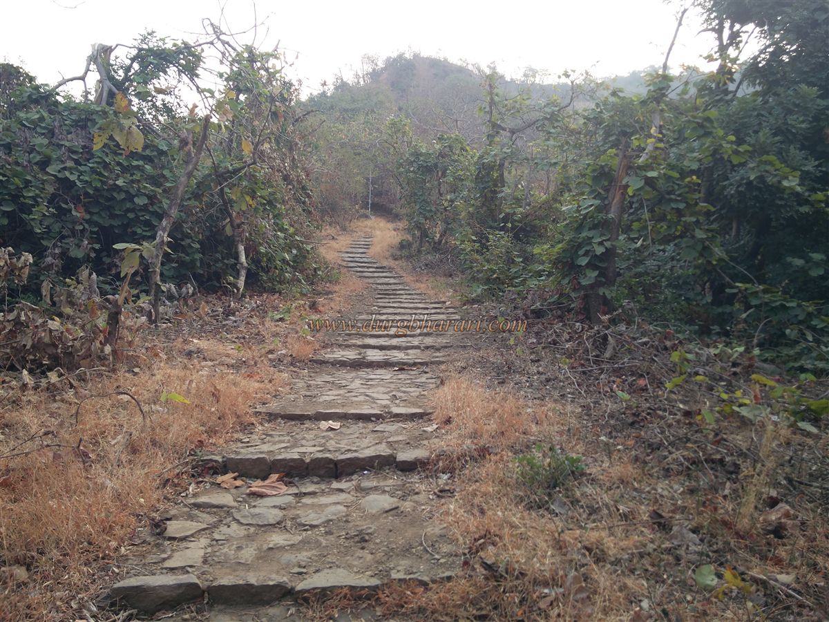
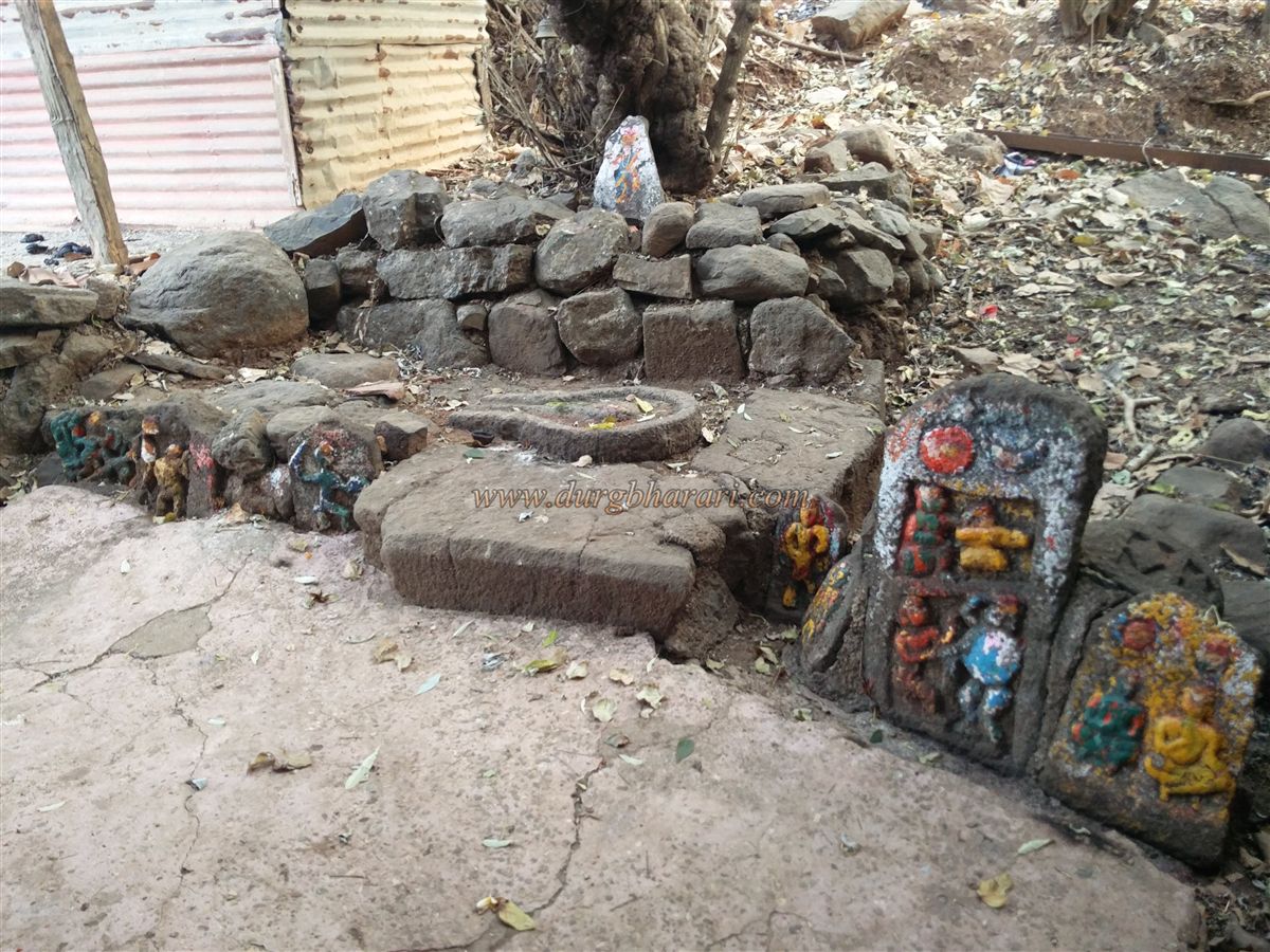
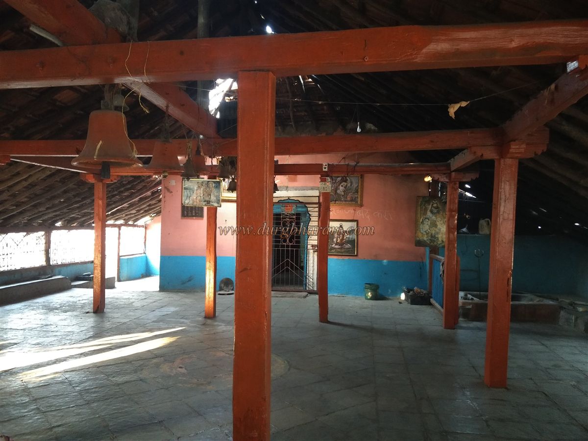
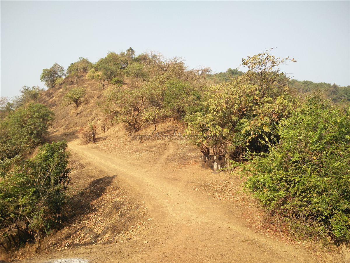
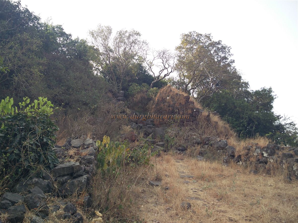
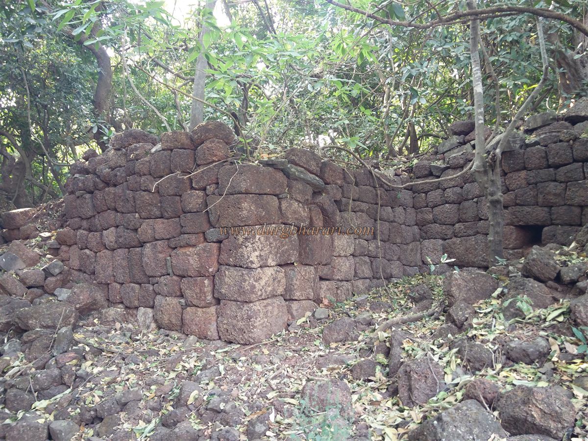
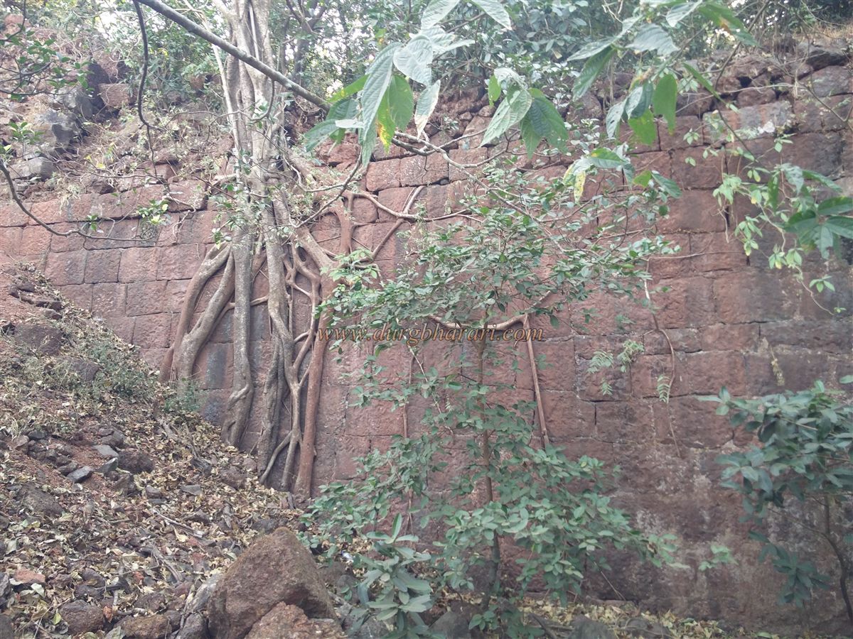
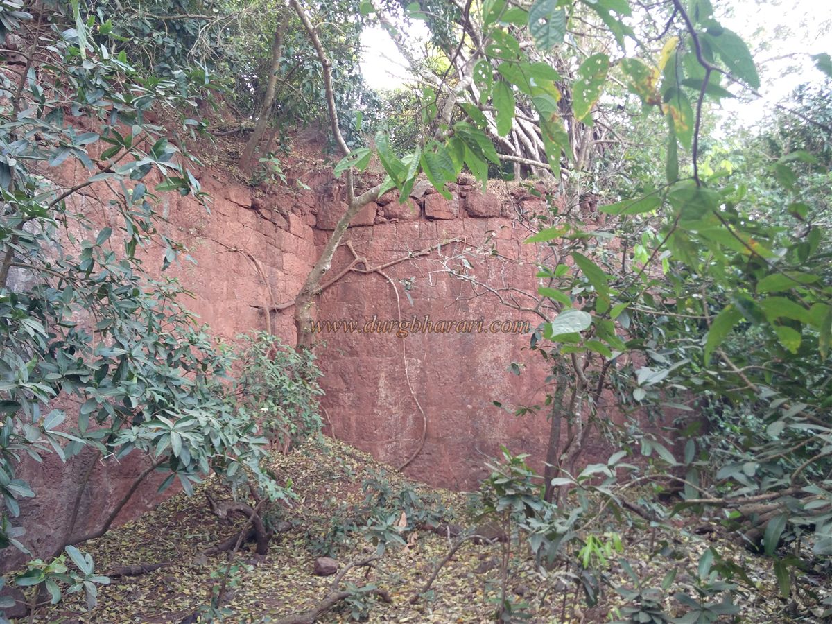
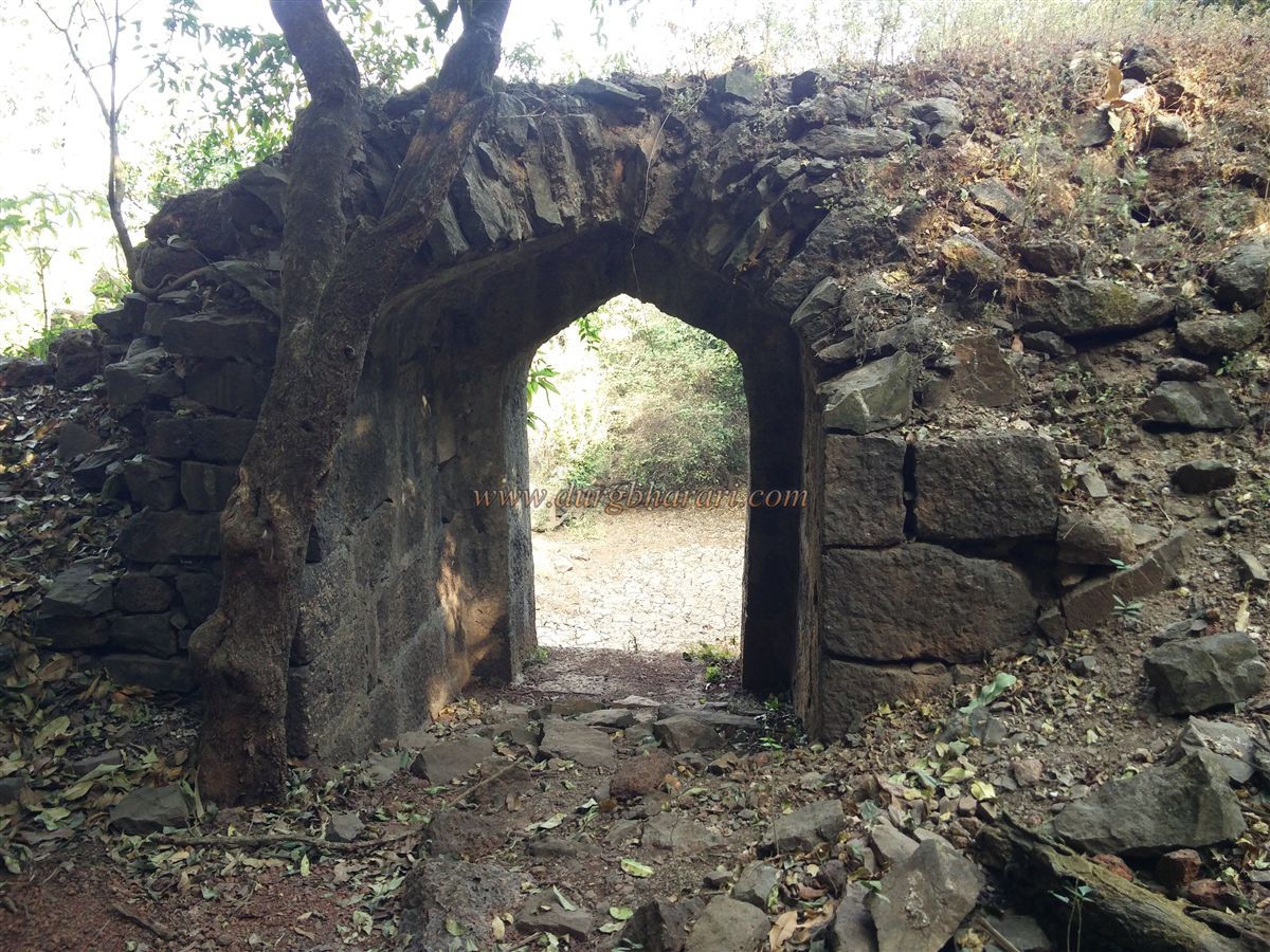
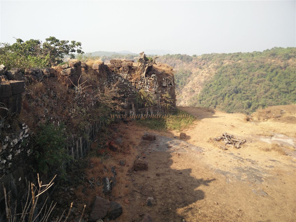
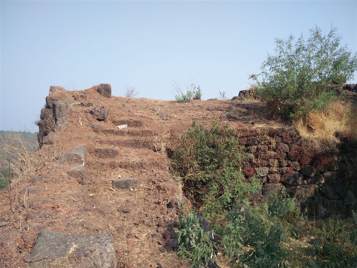
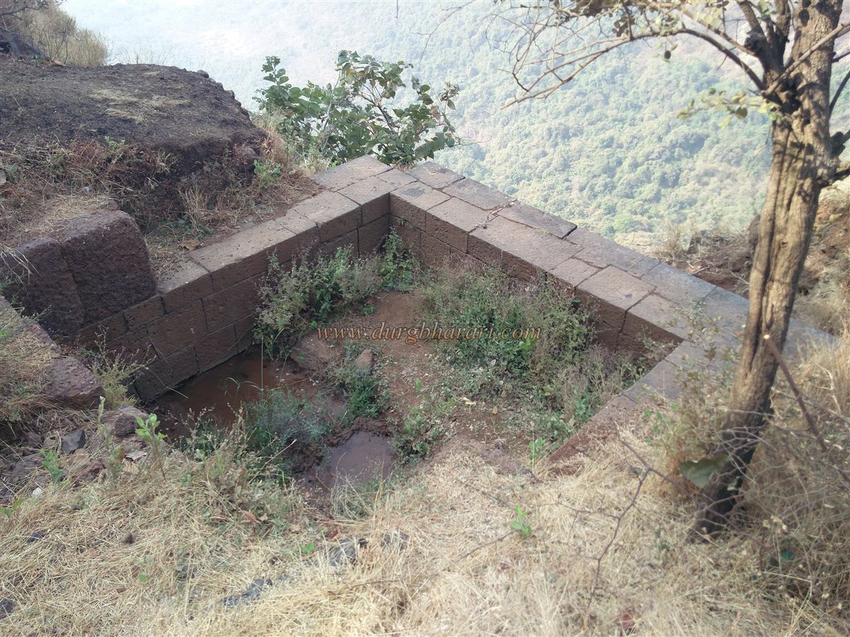
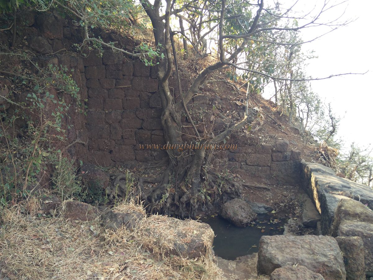
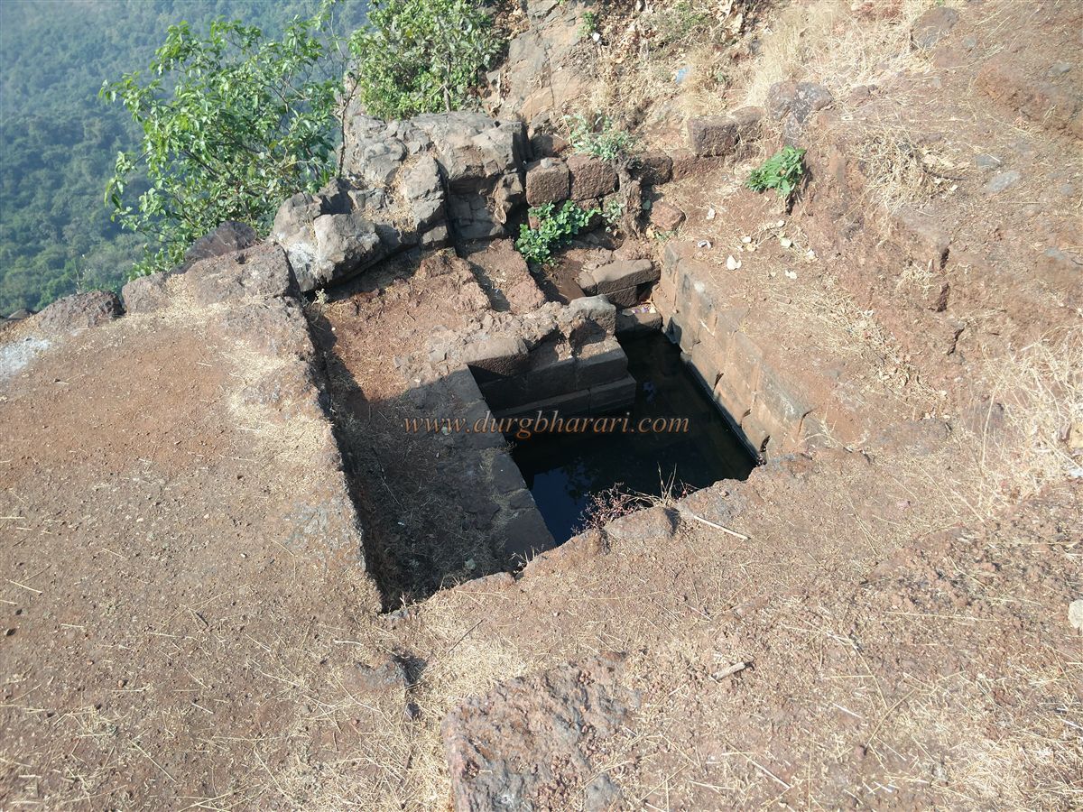
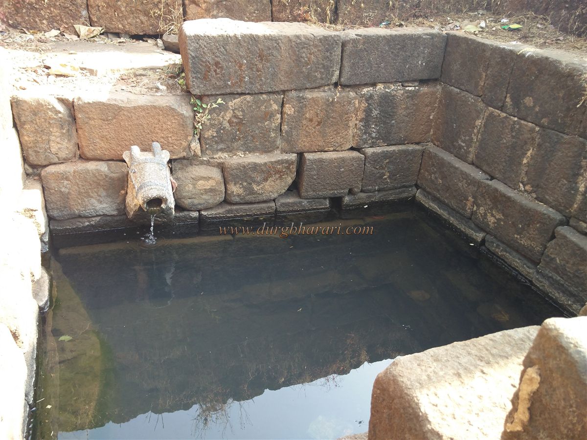
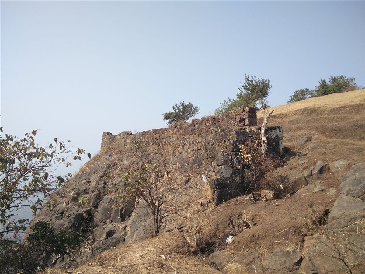
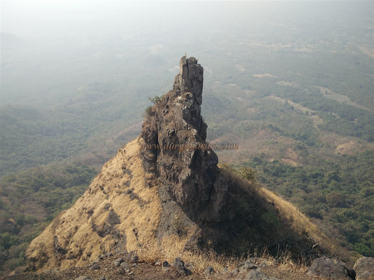
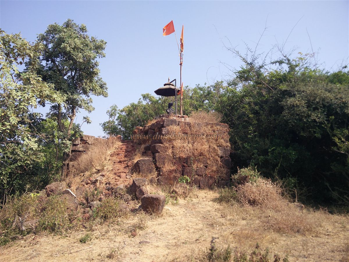
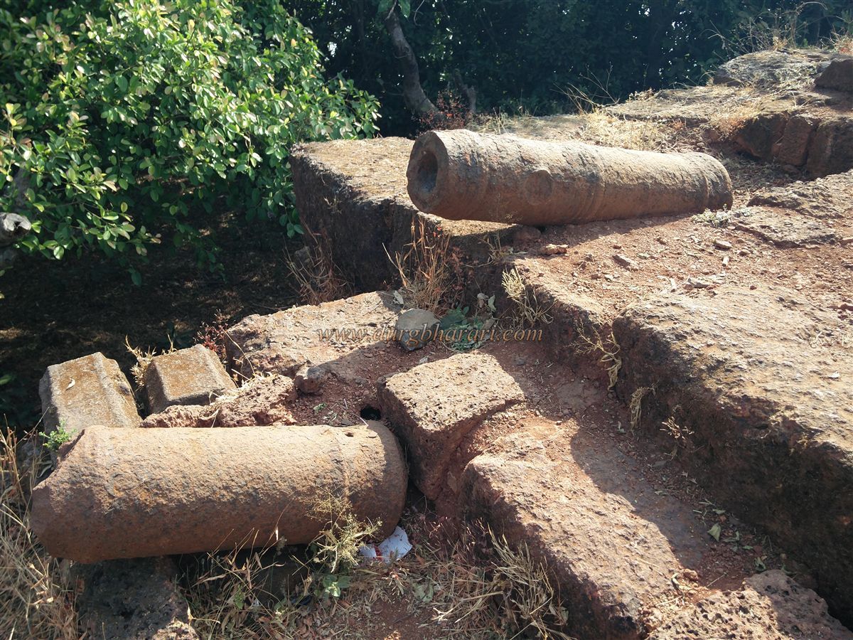
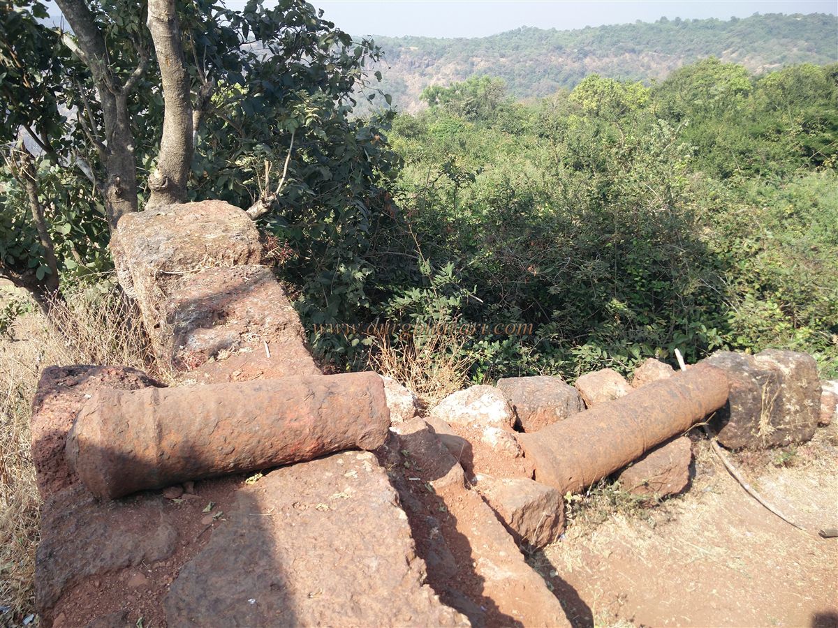
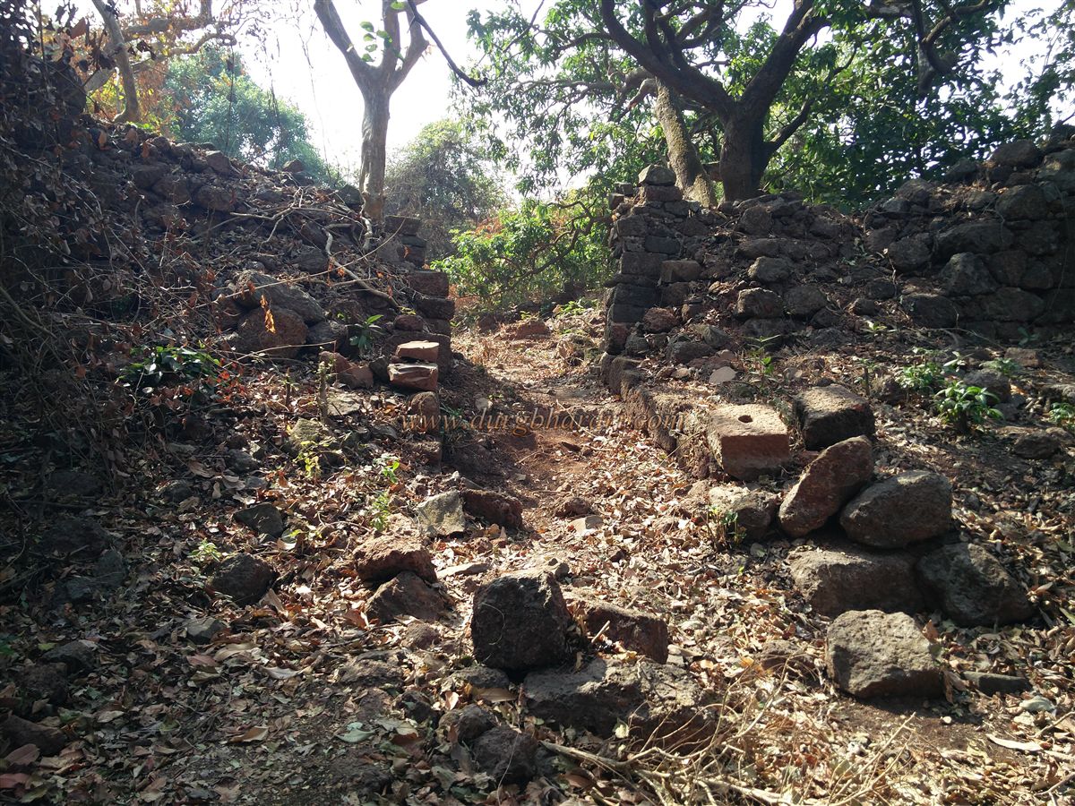
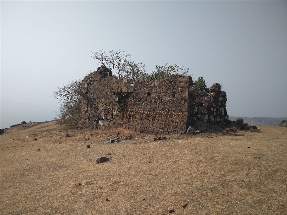
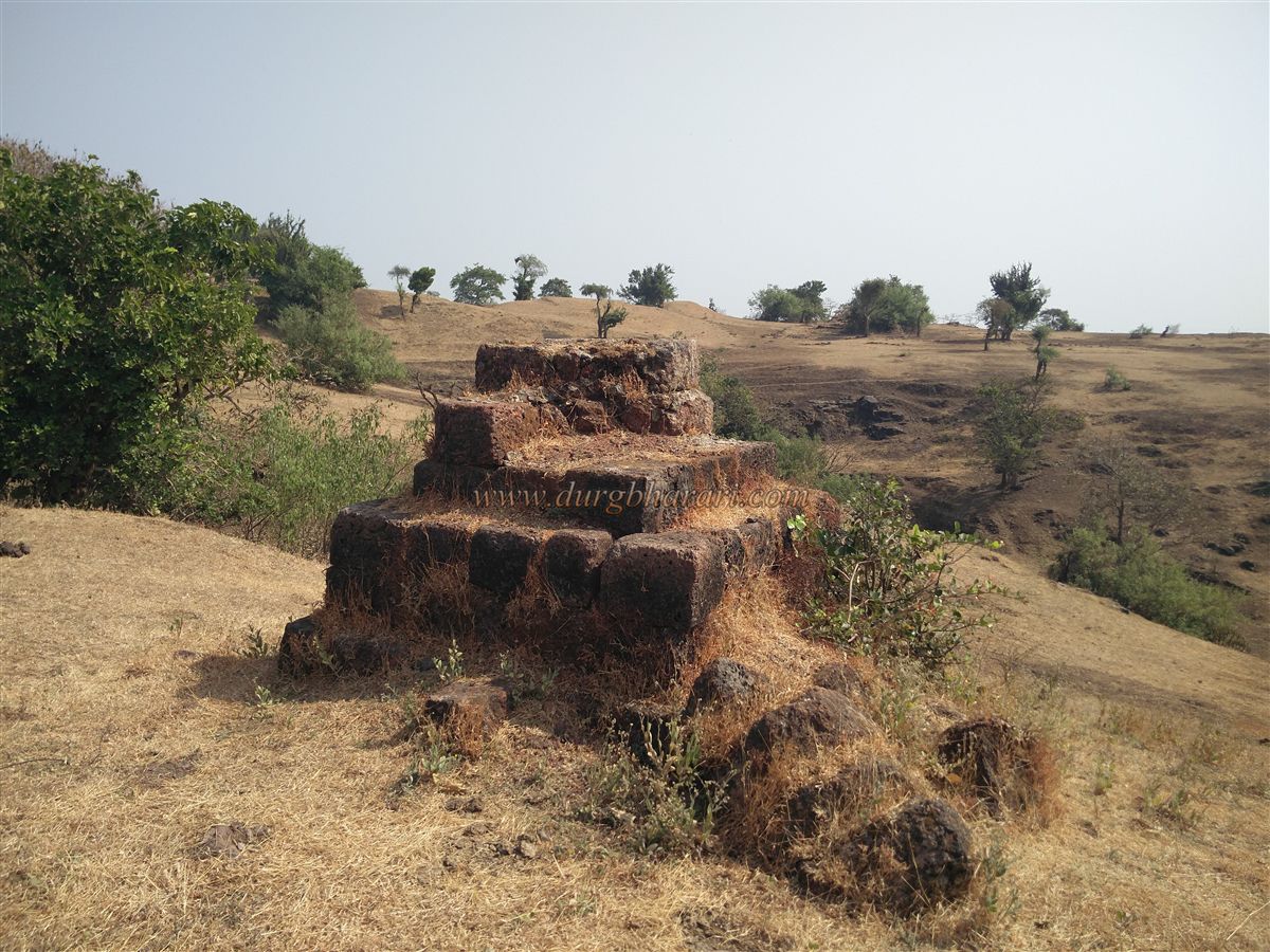
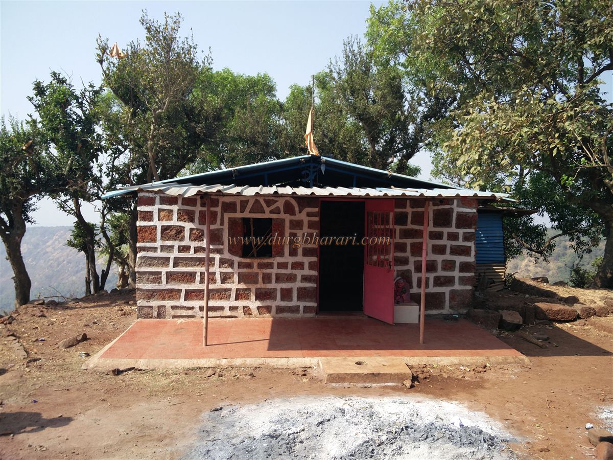
The fort is located at a distance of 10 km from the sea and Khandale is a village at the base of the fort. Alibag can be reached in an hour and a half by boat from the Gateway of India by the sea while by road Alibag is only at a distance of 92 km from Mumbai. On the way from Mumbai to Alibag, after crossing Karlekhind, Khandale village is located at a distance of 5 km from Alibag. A small but paved road leads from this village to Pavele village. There is a horizontal hill on the east side of this village and Sagargad is hidden behind this hill. An unpaved road leads from the village to the settlement on the plateau below Sagargad. But at present, the road is in a very bad condition and except for the rainy season, it is possible to reach the base of the hill by private vehicle. In the rainy season, however, the vehicle has to be parked in the village. If this road is improved, the car will directly reach the plateau below the fort and the walking distance will be reduced by one hour. Half an hour is enough to reach the base of the hill from Pavale village. Walking along this unpaved road, you can reach the plateau below the fort, when you reach the base of the hill, you can see a clear path at a turn. Since the villagers often visit the Siddheshwar temple in the gorge, the path leading to the fort is visible. After coming a little further along this path, one crosses a stream and goes to the Siddheshwar temple on the hill. Along the way, there is a beautiful view of the waterfalls in the monsoon season. We reach Siddheshwar Temple in half an hour from the base. Built-in the Konkani style, the temple has some hero stones, carved idols, and a tiled roof. The area of the temple is very beautiful and there are an ashram and a well in this area. There are water and tea facility in the Ashram. The water that flows down from this temple is the Dhodhane waterfall. On the left side of the temple, there is a path to go to the settlement on the plateau. In this way, you can settle in half an hour and from there you can reach the fort in half an hour. The path leading to the fort from Sagarwadi should be visible as well as there are directional arrows placed in some places on the path making it almost impossible to get lost. On the way to the fort, one can see a small embankment and a tombstone. When you reach the eastern end of the plateau, you first see Sagargad and the Vanderlingi pinnacle at its end. The hill of the fort and the plateau of Sagarwadi are connected by a trunk. From here, there are two ways to reach the fort. The path on the right leads to the fort through the ramparts along the valley, while the left way enters the fort through the fort gate. The north-facing main gate of the fort at the end of the trunk is built between two bastions. Today, the gate has been completely demolished, but the two adjoining bastions remain. The path in front of the door is paved with stones on both sides and the remains of the outpost can be seen on the hill in front of the door. The fort is divided into two parts, Machi and the citadel. The citadel is built with 8-10 bastions. Upon entering through the door, one can see the remains of the bastion and ramparts on the inside. The inner paved path is built of stone and is surrounded by a large number of bushes. After a short walk along this path, a small footpath appears to enter the bushes and trees on the left. After a short walk along this small path, we come to the edge of the valley in the open. At this place, you can see the ramparts towards the gate of the fort. A little further on, you can see the stone ramparts about 10 feet high and two bastions in it. Along the ramparts of the fort, you can see two more bastions and a small dry lake. Nearby is the ruined gate of the fort. There is a large number of trees growing on this bastion of the fort. After seeing this part of the fort, come back to the path and start your next fort round along the edge of the rampart on the right. The most important thing to notice in this rampart is that the lower part of 10-12 feet in height is built-in wrought stone and it has 5-6 feet high stone ramparts above it. In this rampart, you can see a 4 feet high arch like a door. In this part of the ramparts, there are two bastions and on the outside, there is a pond and an open field. Two of these bastions have barrage to fire cannons. If you do not come through the main gate, you enter the fort through this rampart. From here, on the edge of the ramparts, you can see some ruined quadrangle structures. Next, on the bank of the valley, there are three square water cisterns built of wrought stone. The water in the first two cisterns is not potable but in the third cistern, there is potable water that comes from spring through the mouth of a Nandi carved in stone. This water is available all year round. The taste of this water is very good. There is a temple of Lord Shiva on the hill on the left side of this cistern and there are idols of Shivling-Nandi as well as Ganapati and Goddess in the temple. The temple can accommodate 5-6 people and the outer gallery of the temple will accommodate 5 people. Looking at the front of the temple, one can see the vast plateau spread in two parts of the fort. Visit the temple and start your next fort round from the ramparts on the right. The ramparts of this entire plateau are still in good condition. On the plateau to the right of the fort known as Sati Mal, there is a memorial quadrangle structure, the remains of a bungalow built by the British, and a dilapidated dry cistern near it as well as the quadrangle structure of some houses. As all these remains are on a plain surface, they are easily visible. In the middle of these two plateaus, on the edge of the ramparts, one can see the quadrangle structure of a building. At the end of the plateau on the left side of the fort, known as Vanartok, you can see a pinnacle called Vanderlingi. After turning back from this end, you should start your next fort round on the other side. On the way, you can see the saffron flag fluttering on the hilltop to the right side of the temple. Going further from the plateau, one can see some quadrangle structures of houses on the edge of the ramparts and a large dry rainwater harvesting lake next to it. The ramparts at the front of the lake are very wide and have steps to climb to the curtain wall. Today, the second gate in this rampart of the fort is completely demolished. The road from Poynad to Waghode, Nagzari, and Vadavalli village come to the fort through this gate but these roads are not used much. After walking through the bushes, you can see the structure of the ammunition depot. After seeing this structure, turn around and walk towards the flag on the citadel seen earlier. In 10 minutes we enter the citadel through the collapsed ramparts. The flag is hoisted on the bastion of the citadel and a statue of Shivaji Maharaj has been erected next to it. The fort is 1348 feet above sea level and is spread over 40 acres from north to south. Four medium-sized cannons can be seen on this bastion. Inside the citadel, there is a quadrangular mansion with two doors. Inside the mansion is a partially dried well. Adjacent to the mansion, the remains of the administrative office of the fort can be seen. From the fort, one can easily see the beaches of Alibag, Dharamtar-Chaul creek, Khanderi-Underi, Karnala, Manikgad, and Prabalgad forts. Three hours is enough to complete the fort round. Apart from the temple on the fort, accommodation will also be available at the Siddheshwar Temple or the school at the Machi of Sagargad. The fort may have been built during the Bahamani or Nizamshahi period to guard the Chaul-Dharamtar creek. Until the forts of Khanderi, Colaba, and Sarjekot were built, Sagargad dominated the coast of this area. The first mention of this fort in the documents dates back to the Nizamshahi period. In 1524, when the Portuguese captain Soz asked permission to build a warehouse in the Chaul area, Fateh Khan was the official and Haider Khan was the fort keeper of Kheddurg. After the fall of Nizamshahi, Shivaji Maharaj was conquering Chaul province which was under the control of Adilshah in 1660. Kheddurg was captured by Doroji. Later, Shivaji Maharaj built small forts like Khesgad, Mandvegad, and the water fort of Khanderi to establish their control over the British and Siddi. This fort was included in the 23 forts given to the Mughals by Shivaji Maharaj under the treaty of Purandar in 1665. Between 1670 and 1672, the fort came under Swarajya again and Kheddurg was renamed Sagargad. In the battle of Khanderi on 18 October 1679, English Captain Francis Mouliweir and 25 other soldiers were taken as a prisoner to Sagargad. After the arrest of Sambhaji Raja, the fort chief of Sagargad, Mankoji Suryavanshi, took shelter at Prabalgad and Siddi took possession of Sagargad. In 1695, Kanhoji Angre conquered the fort from Siddi. At the beginning of the dispute between Chhatrapati Shahu Maharaj and Tararani over the throne, Kanhoji was on the side of Tararani, while the coastal region from Mumbai to Sawantwadi, Rajmachi fort, and Kalyan Bhiwandi Parish was under his control. Sagargad was one of the 13 forts given to Kanhoji Angre by Shahu Maharaj in 1713. After the death of Kanhoji Angre, possession of Sagargad passed to Yesaji Angre. Meanwhile, Siddisat tried to attack Sagargad from Rewas port. Siddisat was later killed by Manaji in a battle at Shrigaon on the side of Kamarle. After this, there was an internal dispute in the Angre family. In the dispute between Manaji and Yesaji Angre, the Portuguese helped Manaji, and Yesaji was defeated and Sagargad came under his control. Manaji Angre overthrew Yesaji Angre from Sagargad. In 1738, Sambhaji Angre conquered Sagargad from Manaji. Later In 1807 Jaisingh Angre, son of Yesaji Angre thrown Ramji Angre from Sagargad. The fort was bathed in blood under the auspices of the Angre clan. In 1818, the fort came under the control of the British. Bungalows were built by General Fuller and General Lestock Reed because they liked the nature and the climate of this area.
© Suresh Nimbalkar
GALLERY