SADA FORT
TYPE : HILL FORT
DISTRICT : BELGAON
HEIGHT : 2640 FEET
GRADE : EASY
On the crest of the Sahyadri range, at the border of Maharashtra and Karnataka, lies the Sada Fort. Though geographically located in Karnataka, in Belgaum district, this fort is deeply connected to Maharashtra in spirit and history. The distance from Belgaum to Sada is about 60 km, while from Dodamarg it is around 51 km. To reach the small Sada village on the Sahyadri plateau, one has to travel 10 km of rough road from Chorla Ghat in Belgaum or just about 2 km from Mhangeli village in Dodamarg taluka.
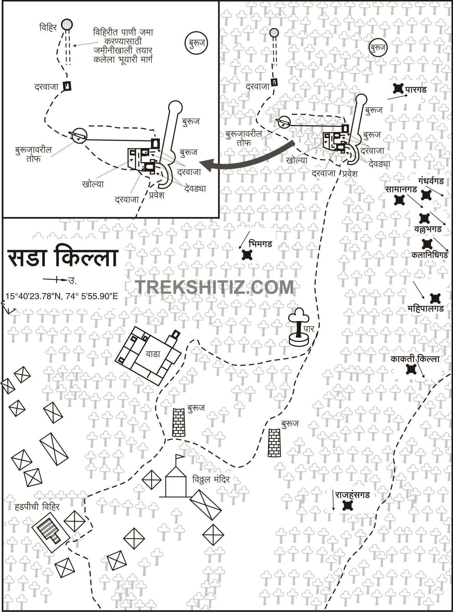
The fort was likely constructed on the hillock behind Sada village to keep watch over the Chorla Ghat region. It is said that the Desais, who were independent feudal lords in this area but acknowledged the supremacy of powerful contemporary rulers, built this fort.
...
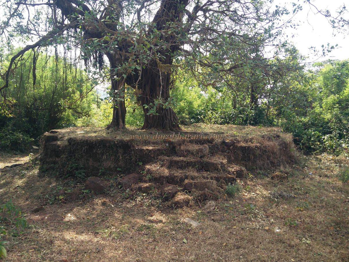
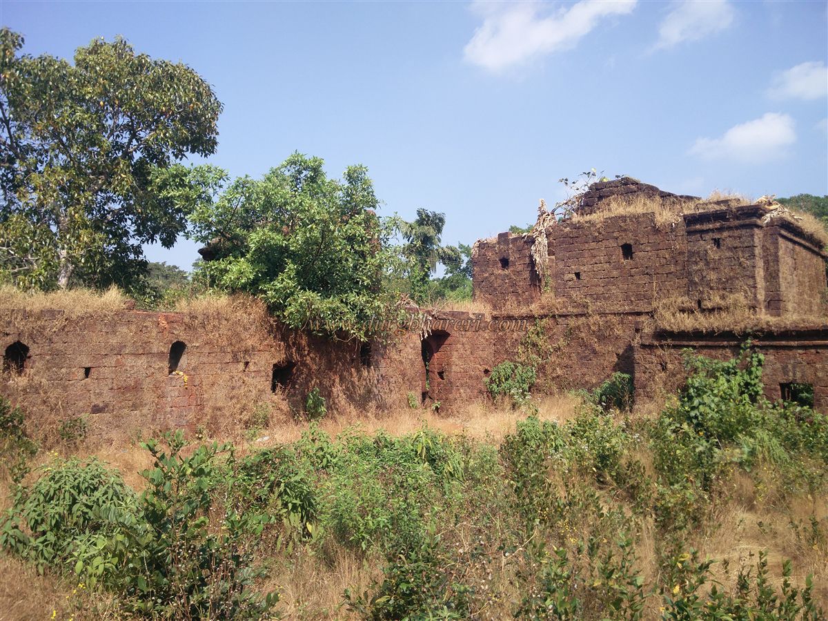
Upon reaching Sada village, one should first visit the Vitthal temple before exploring the fort. Those wishing to stay overnight can also find lodging at this temple. From behind the temple, a stepped path leads up the hill. At the top, on the left-hand side, stands a quadrangular wada (mansion) within the fort. This two-storeyed wada has lost its roof completely, but the remaining stone structures are still in good condition, reflecting its erstwhile grandeur. Around the wada are ruins of other old buildings, all built on an elevated platform.
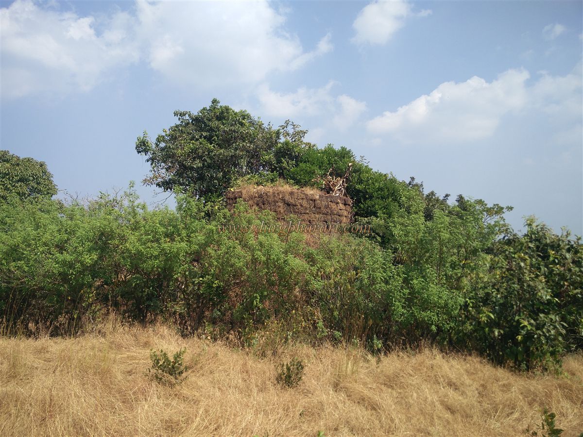
The path to the left of the wada leads to a small open plateau. As villagers light Holi bonfires here, this place is known as Holicha Maal (the ground of Holi), but originally, this was an enclosed machi (outer fortification) surrounded by defensive walls.
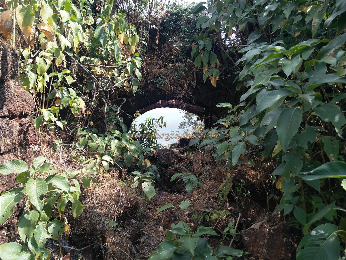
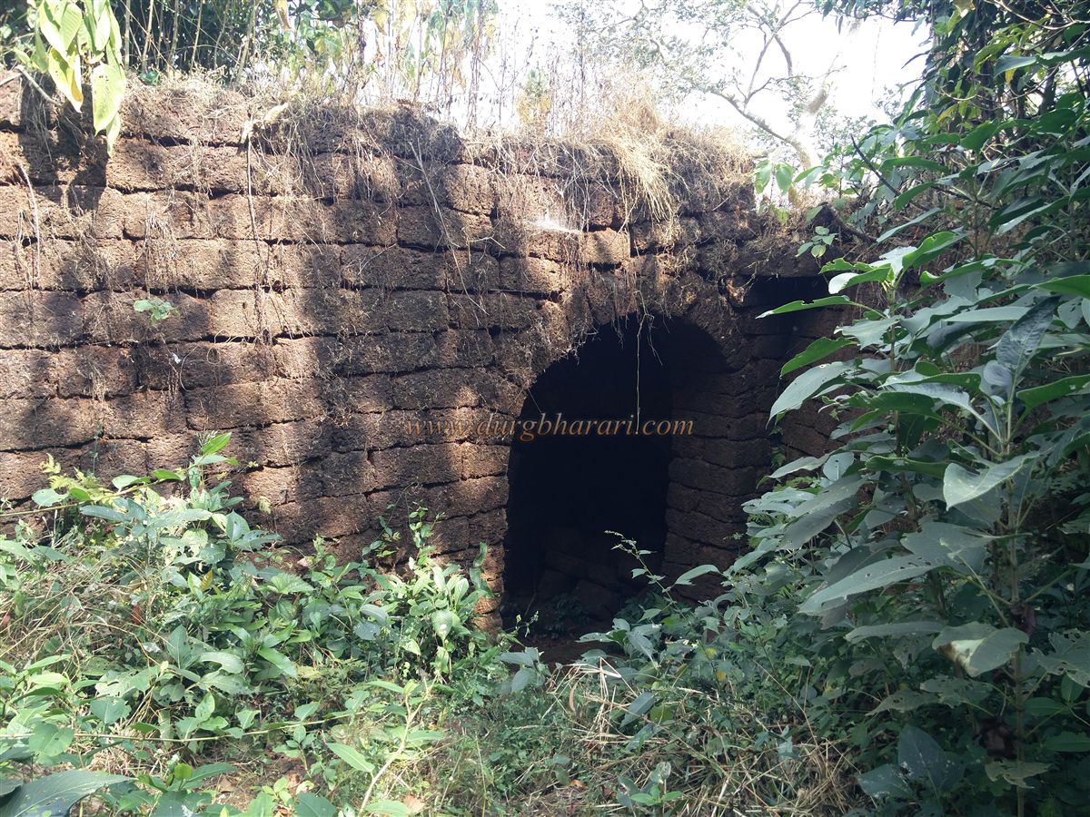
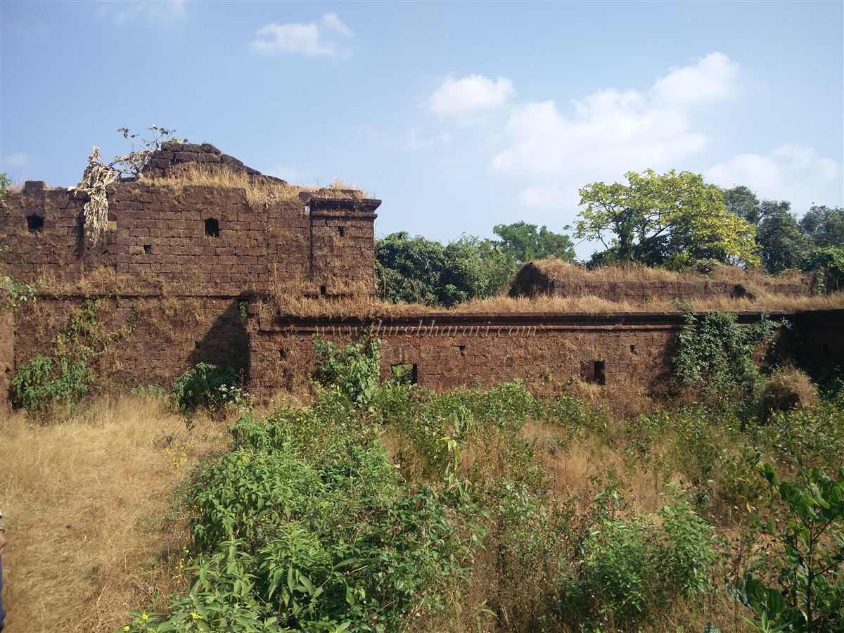
Situated at an altitude of 2,540 feet above sea level, Sada Fort spans roughly eight acres along the east–west axis. The fort comprises two main sections: the machi (outer fort) and the Balekilla (citadel). Though the walls of the machi are heavily damaged, they are still standing in parts. The machi has a north-facing arched entrance and a bastion about 15 feet tall.
After reaching the machi, descending to the right leads to the outer defensive walls, while on the right-hand slope below, the Vitthal temple where the climb began can be seen. From here, retrace your steps back to the plateau, then take the left path into the thickets to reach the ruined walls of the fort. This leads to the Balekilla (citadel), which is separated from the machi by a defensive moat.
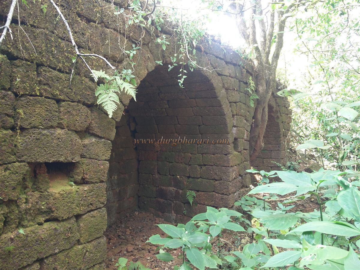
On the right side of this moat are the walls and bastions of the Balekilla, while on the left, a smaller wall provides additional layered defense. Inside the walls, a stone-paved path leads to a well located outside the fortification. After visiting the well, return and begin the climb through the collapsed stones of the upper walls.
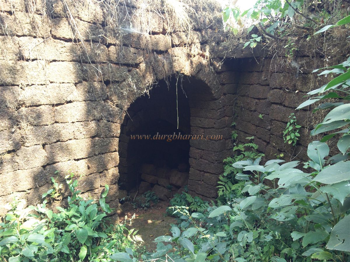
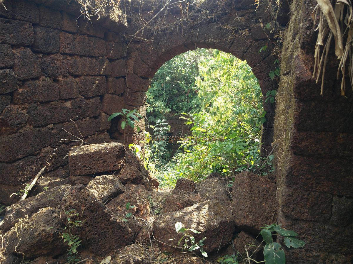
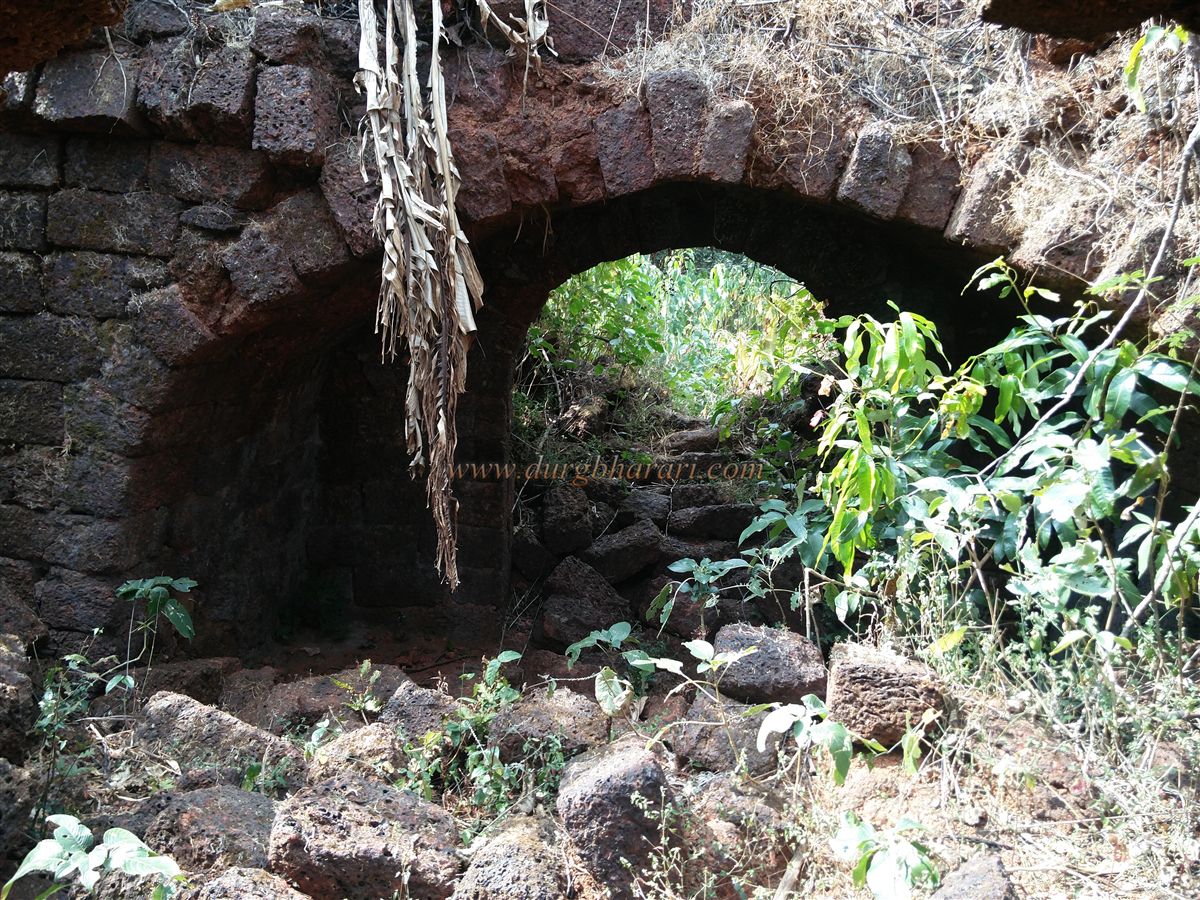
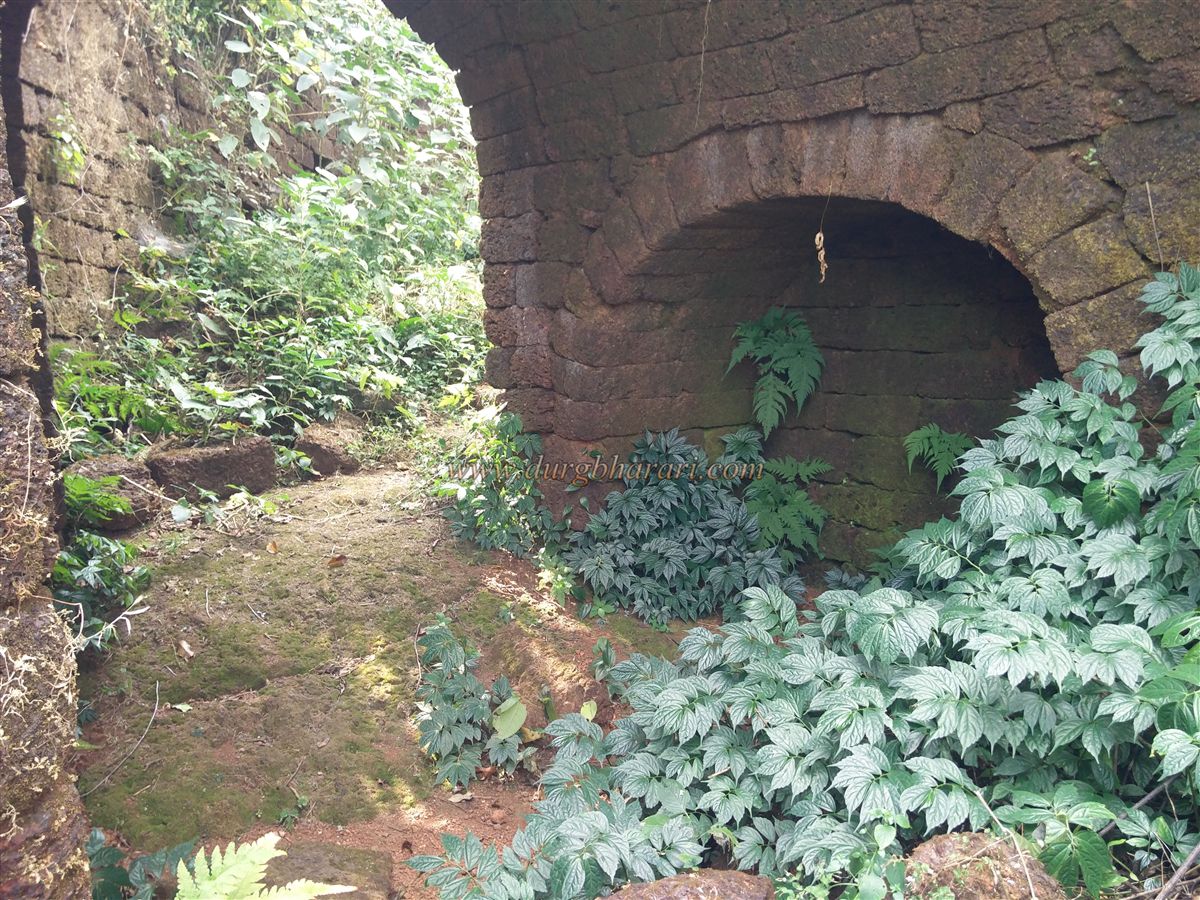
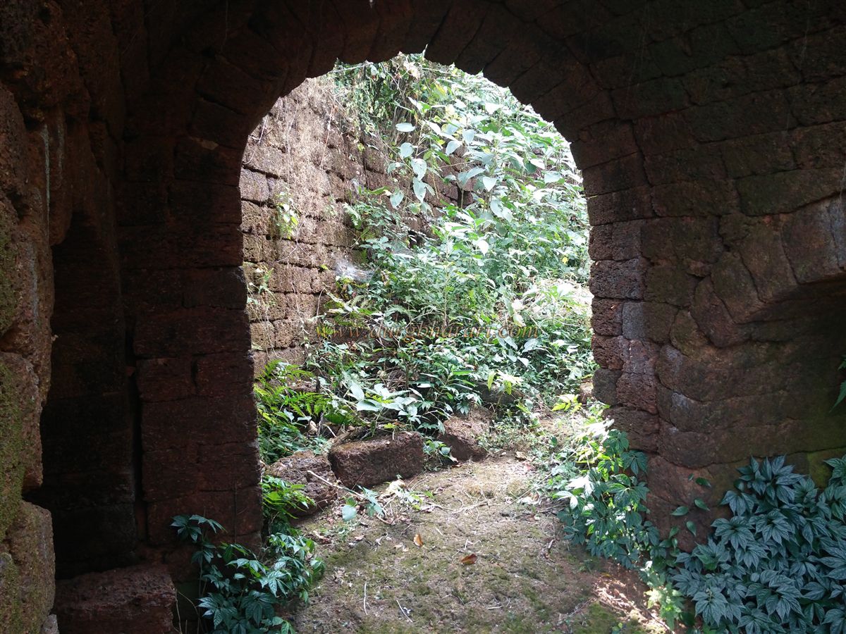
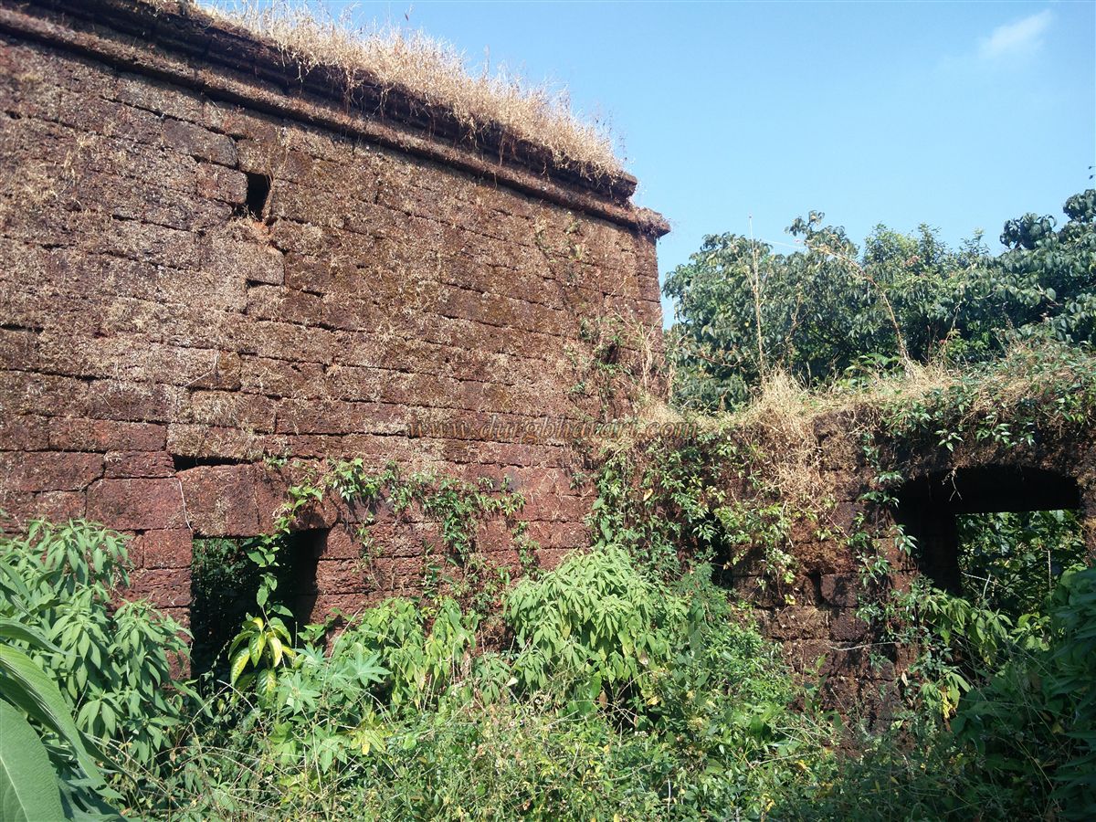
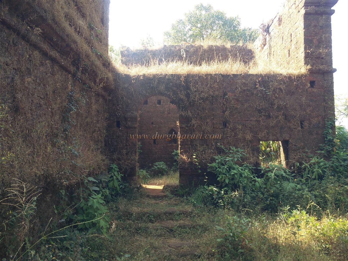
Higher up, one reaches a bastion with an arched window in the wall. This section of the inner fortifications has large quantities of fallen stones from walls and gateways. Passing through the gateway, you find guard chambers on either side or a small storeroom with a doorway in the front wall. This portion of the fort was designed in a defensive ranmandal (battle arrangement) layout — only after crossing three successive gateways does one enter the fort proper.
The main entrance of the fort lies higher up along this axis, requiring a U-shaped approach. After passing the second gate, the arched window seen earlier from below becomes visible from inside. From this vantage point, the entire approach path to the fort can be seen.
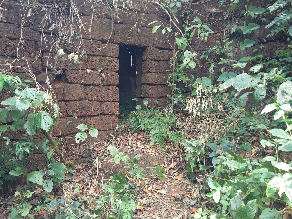
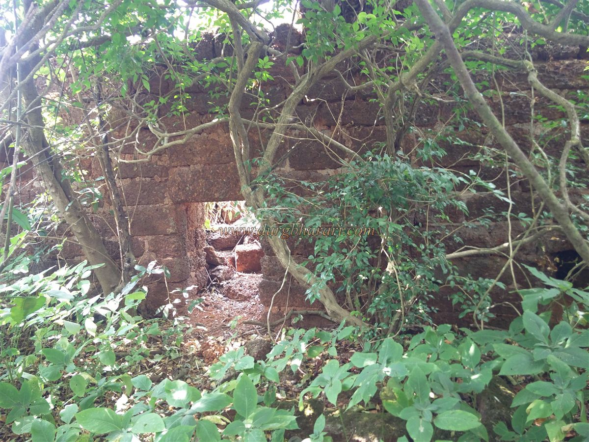
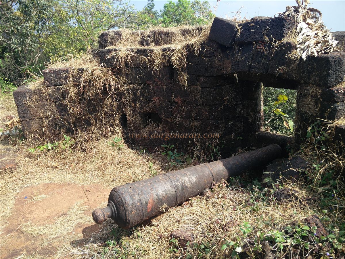
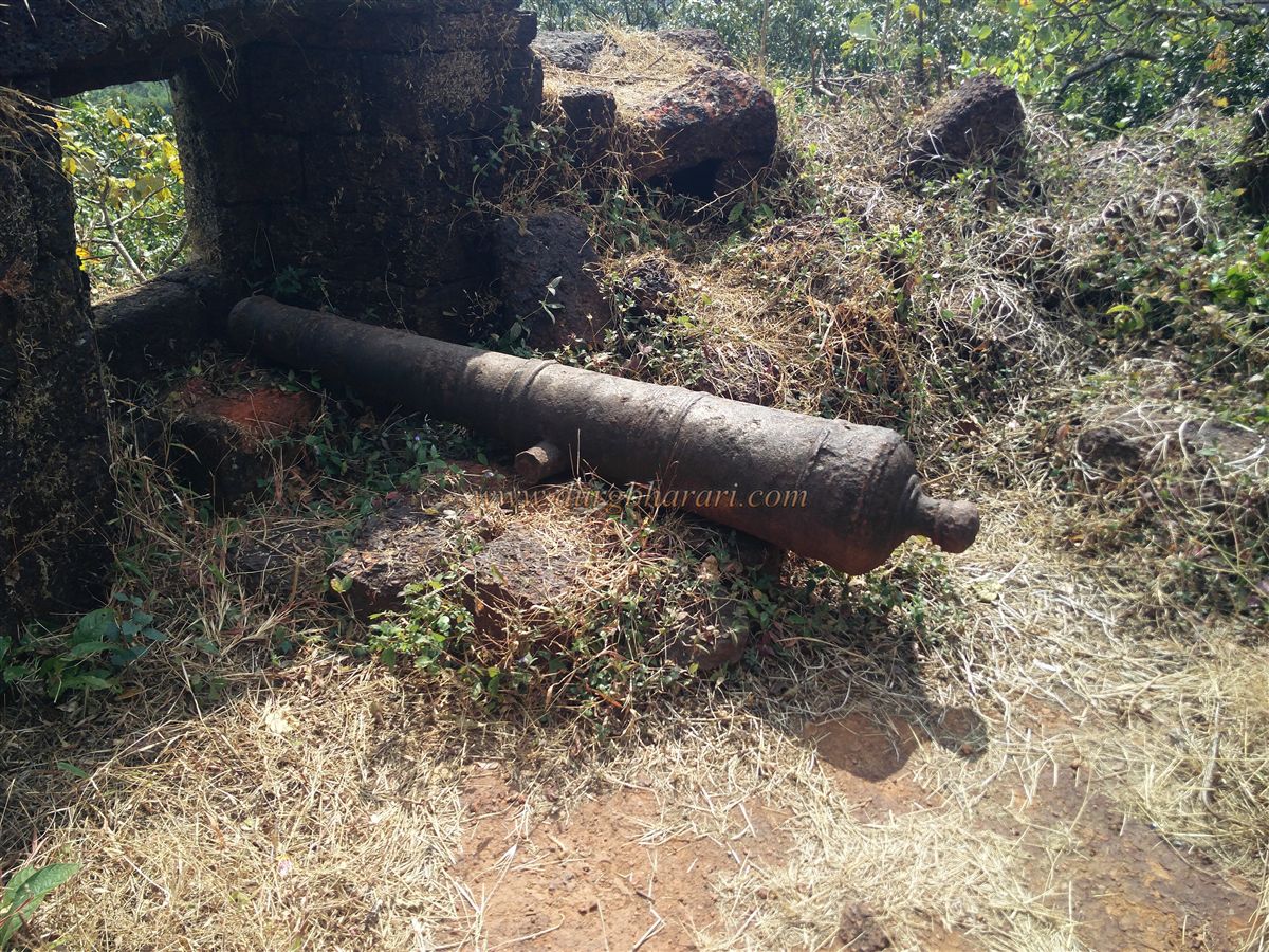
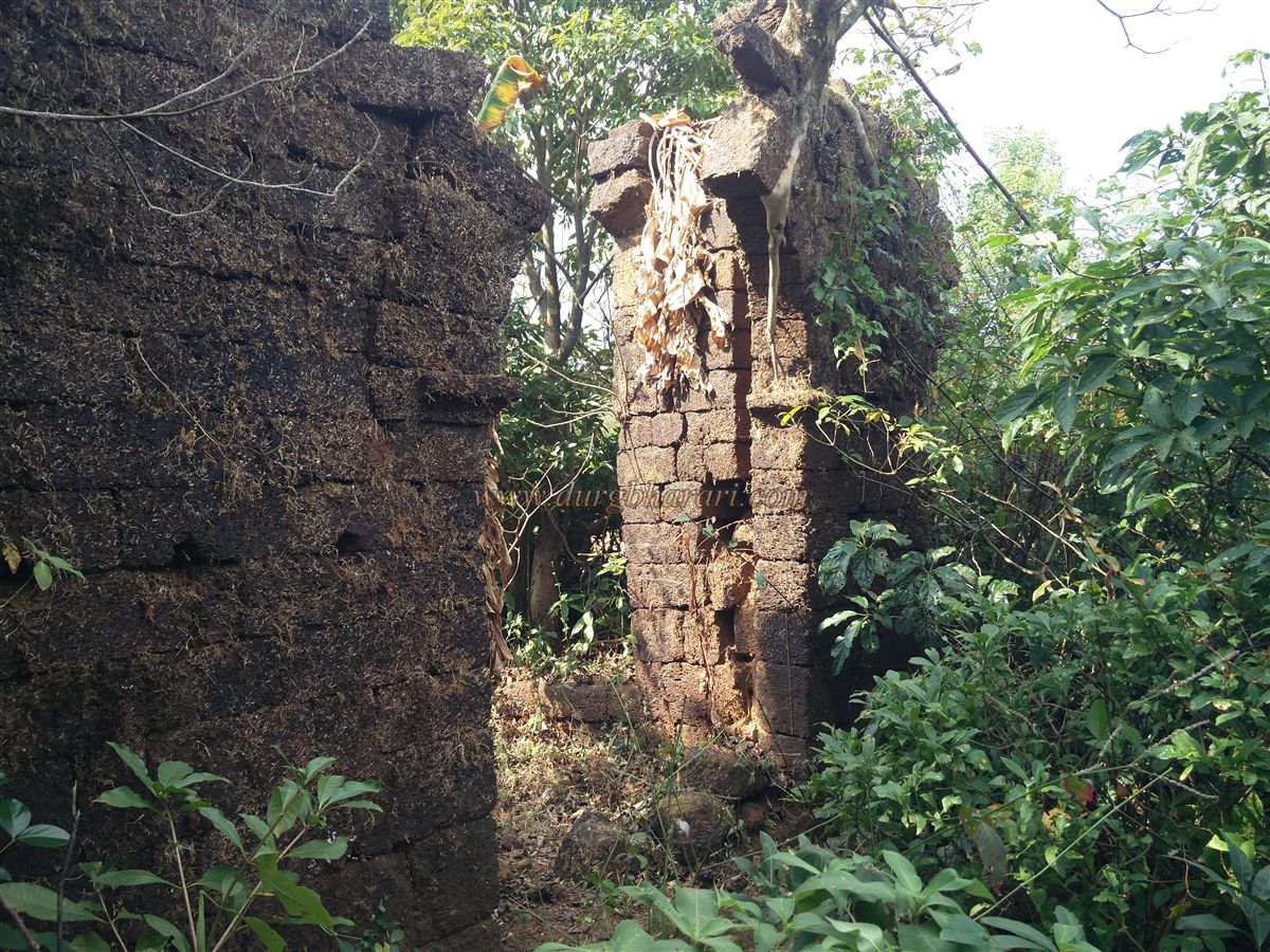
The third gateway, partly buried in soil, serves as the actual entrance to the fort. Inside, dense vegetation has overtaken the area. Two paths diverge here: one to the left and another straight ahead. The left path leads to a bastion housing a cannon. From here, one can see the wada below and the entire machi. In front of this bastion is a partially silted well. The walls also contain three or four large arched chambers, probably used as stables for horses.
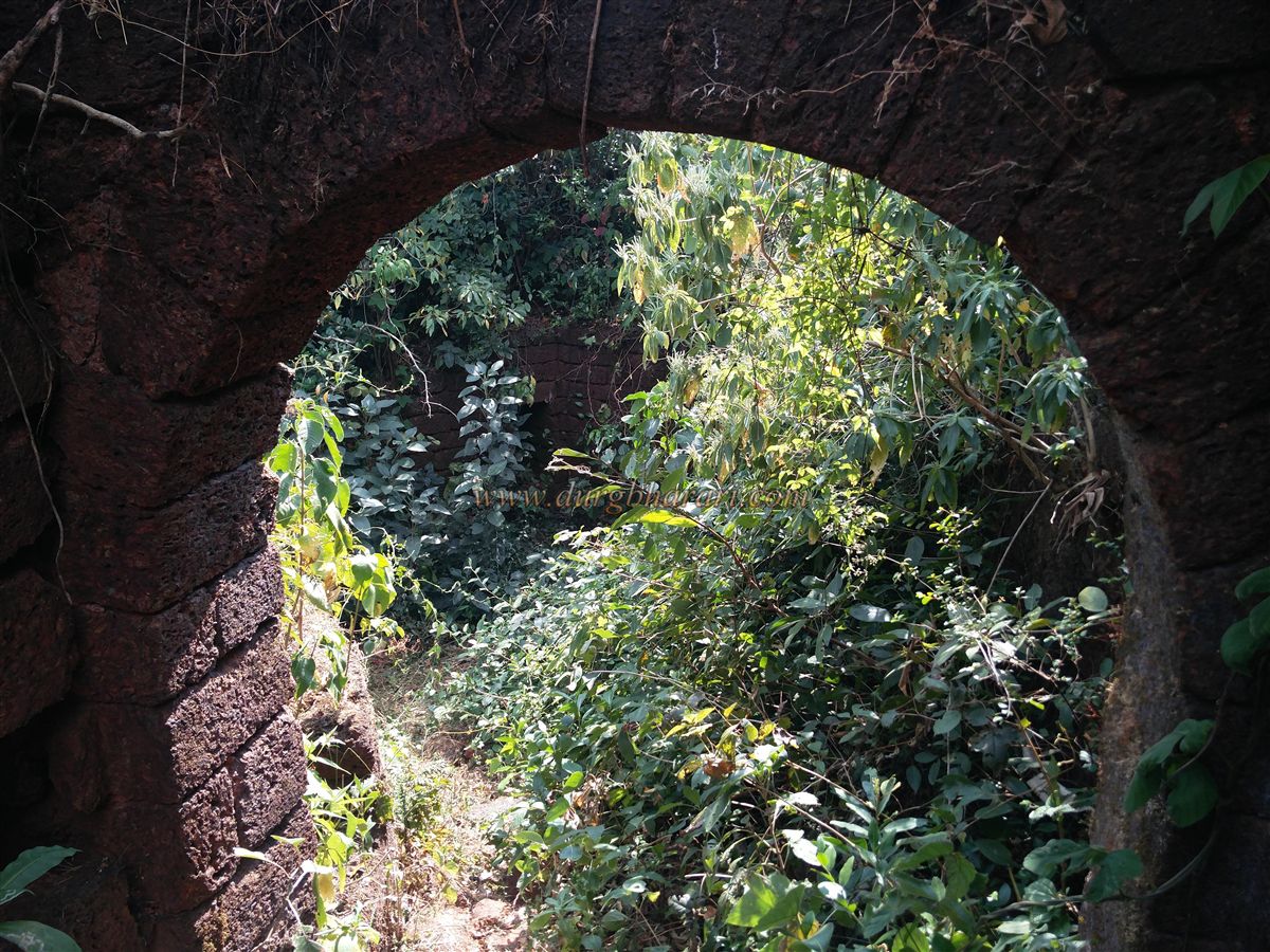
Returning to the gateway and taking the straight path brings you to the outer walls at the far end of the fort. A small doorway in this wall leads to another defensive layer, as the upper plateau of the Balekilla is protected by double fortifications.
From the fort’s ramparts, one can see Sada village, Mhangeli village, Tilari dam, Chorla forests, and the surrounding countryside. Returning to the gate completes the fort exploration, which typically takes about an hour.
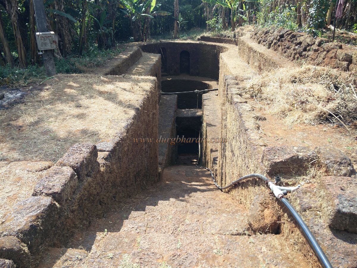
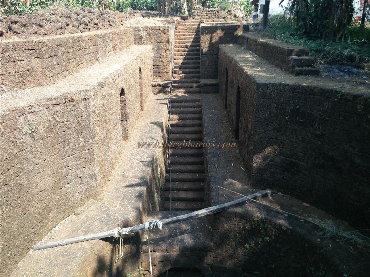
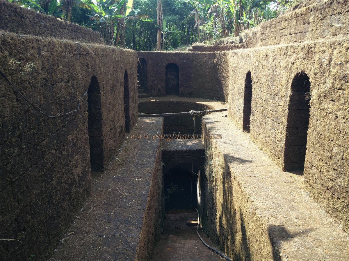
In addition to the fort, a remarkable well in Sada village is worth visiting. Located within the village settlement, this keyhole-shaped well is built in two levels. Stairs lead down to a doorway at the bottom. On the first level are arched niches, and two doorways provide access to this floor, which also allows circumambulation of the well.
© Suresh Nimbalkar
GALLERY