RIWA BURUJ
TYPE : COASTAL FORT
DISTRICT : MUMBAI
HEIGHT : 80 FEET
GRADE : EASY
After getting off at the Sion station of the Central Railway and walking on the left-hand side footpath towards the eastern side, we reach the Government Ayurvedic College. In this area, there is a garden of Ayurvedic plants on the slope of the hill. After going a little further, the gate of the herbal garden of the Ayurveda College starts and through it, we go to Riva fort. Another way to get to this watchtower is by a pond on the right side of the road from Sion to Chunabhatti, and the road to the bastion starts on the other side of the road in front of this pond. This route leads to an old gate at the foot of the hill. This door is very similar to the Portuguese doors. The wall in which this door is located looks like a rampart even though it is made of bricks. After entering through this door and going up a few steps, you see a few houses on the left side.
...
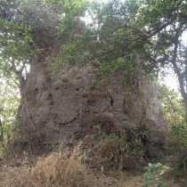
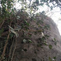
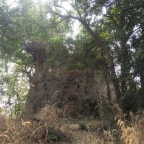
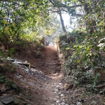
A little further on, on the right-hand side, there is a path with steps. These steps have walls on both sides. These walls are similar to the steps of other British forts in Mumbai. After climbing these steps, there is a flat area and beyond that, there is a high part of the hill. This flat area leads to the footpath described earlier. The only remnant of the Riva fort at the top of the hill in this garden is the watchtower standing on the black stone. If you look at the surrounding conditions of the bastion, it is easy to see that it was not attached to any wall or rampart, hence it is must have been a watchtower. The other architecture of the fort only has to be estimated. There is a residential and ayurvedic college building at the foot of the hill but the bushes are overgrown from the middle of the hill right to the top. There is a big tree growing near the watchtower itself. Therefore, it is not possible to inspect this bastion properly. It is a round-shaped bastion about 10 feet high and there is no arrangement to climb on top of it. In the past, you had to climb a ladder or a rope to get on top, but now you can reach the top of the bastion by rock climbing a little. This bastion is fully built of stone and should have been used as a watchtower. From this highest part of the fort, there is a panoramic view of the surrounding area up to Mahim. The Mahim Bay separated the Mumbai Islands from the mainland and Sashti lands. At that time trade was going on through Mahim Bay. Sashti Island was also occupied by the Portuguese. In 1665, the island of Mumbai came under British rule. Therefore, to keep an eye on the trade going through the Gulf of Mahim and to counter the possible attacks of the Portuguese and the Marathas from the north, British officer Gerald Aguirre built this fort in 1672. The new forts built by the British after Janjira's Siddi's attack on Mumbai in 1672 include the Riva fort on Sion hill. After the Marathas conquered Sashti in 1739, the frontier of the Marathas reached Mumbai. At that time the responsibility of protecting the border fell on Mahim, Kala fort, Riva, Sion, and Shivdi forts. There was no invasion of Mumbai in the later period but the British Empire continued to grow. In the 19th century, British rule came over the whole of India. During this period, advances in science and technology completely changed the tactics and destroyed the importance of the forts. As a result, over time, the fort collapsed and was almost destroyed. From the top of the bastion area up to Mahim is visible. After seeing this fort, one can determine the usefulness of it in terms of surveillance and protection.
© Suresh Nimbalkar


