RAWLYA
TYPE : HILL FORT
DISTRICT : NASHIK
HEIGHT : 3970 FEET
GRADE : MEDIUM
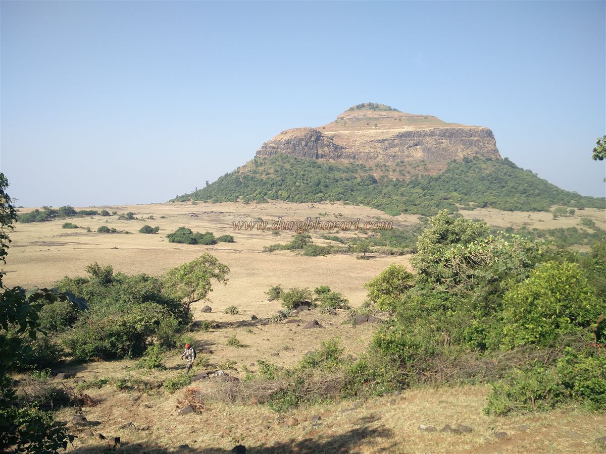
The variety of forts found in Maharashtra is unparalleled elsewhere, which is why the state is often referred to as the land of forts. In the Satmala mountain range of Kalwan taluka in Nashik district, two such forts—Ravlya and Javlya—are situated together on a vast plateau. These are two separate forts spread across a large plateau approximately 3.5 km long and 1.5 km wide. The distance between the two is about 1 km, and both can be explored in a single day after ascending the plateau.
The villages of Mulane and Babapur lie at the base of these forts, and the Mulane Bari or Babapur pass between them provides a convenient route to ascend. Alternatively, the plateau below the forts can also be reached from Mulane village. The distance from Nashik via Vani to Babapur pass is 53 km, and it is 9 km from Vani. Upon reaching the pass from Vani, the left trail leads to Markandeya fort while the right trail goes to the plateau below Ravlya and Javlya forts. The forest department has set up a tourist shelter and parking area in the pass
...
Although the trail to the plateau is well-marked and easy to follow, it is advisable to take an experienced guide from Babapur if one wishes to explore both forts thoroughly and efficiently. Starting the climb from the right ridge, it takes about half an hour to reach the second part of the plateau. The trail turns left, then right again to ascend, where remnants of a collapsed gateway can be seen. Reaching the plateau from the pass typically takes an hour.
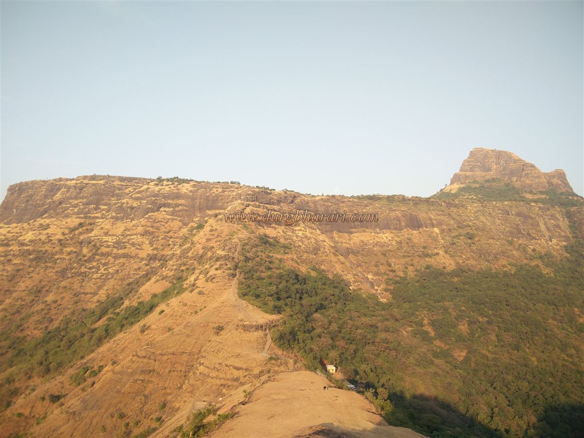
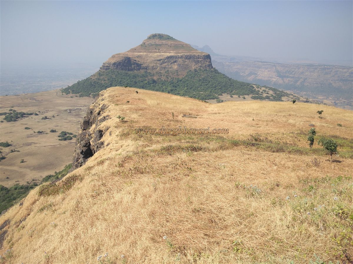
To avoid confusion, it's helpful to remember that Javlya is closer to Markandeya fort and Ravlya is nearer to Dhodap fort. Upon reaching the plateau, the triangular-shaped Javlya fort is visible ahead. Paths from both the left and right of the plateau lead to the pass between the two forts. Taking the left route while going and the right one on the return forms a complete circuit of Javlya, allowing one to view all remnants on the plateau. Along the way, ruins of buildings hidden in thickets are visible.
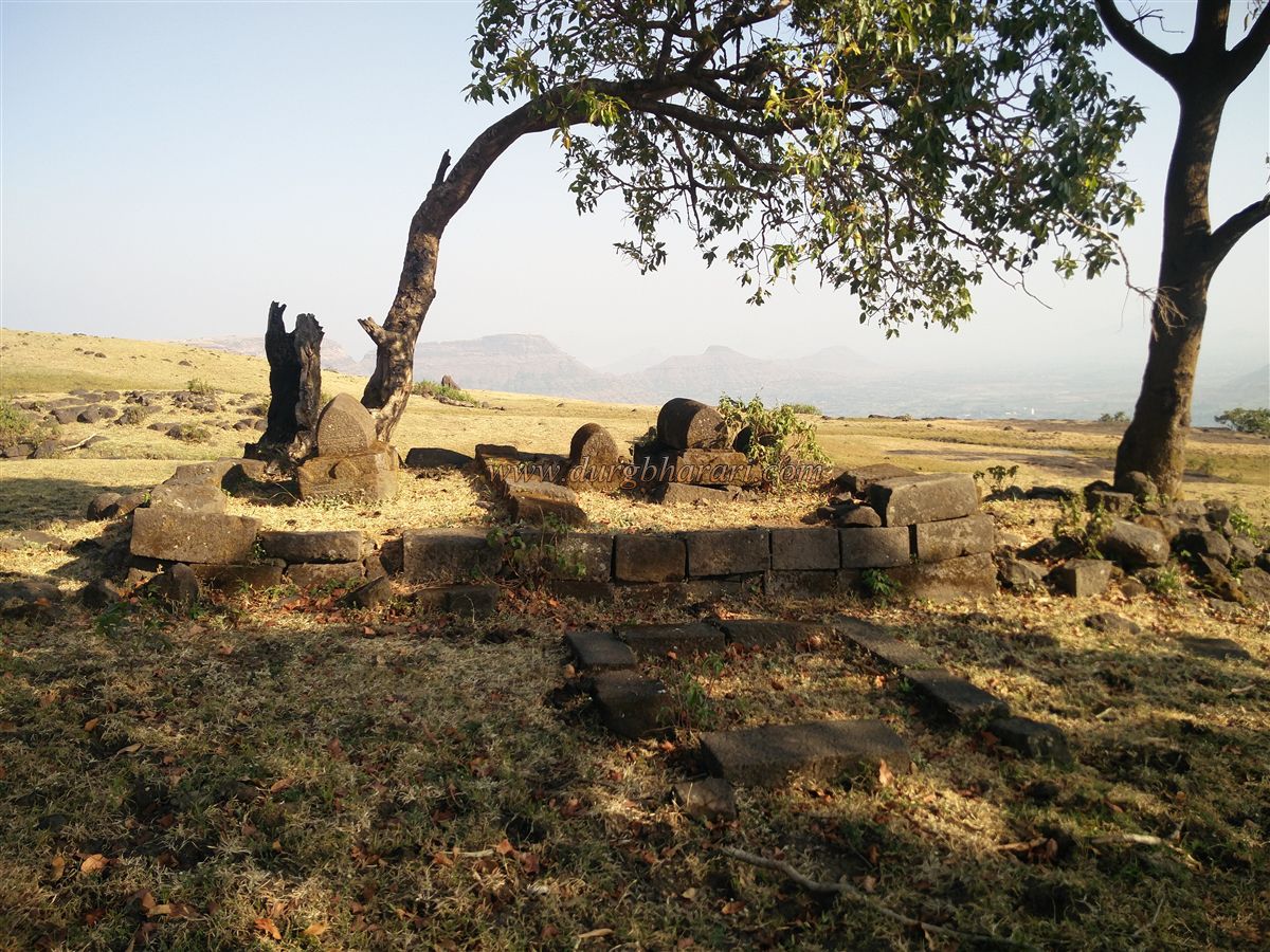
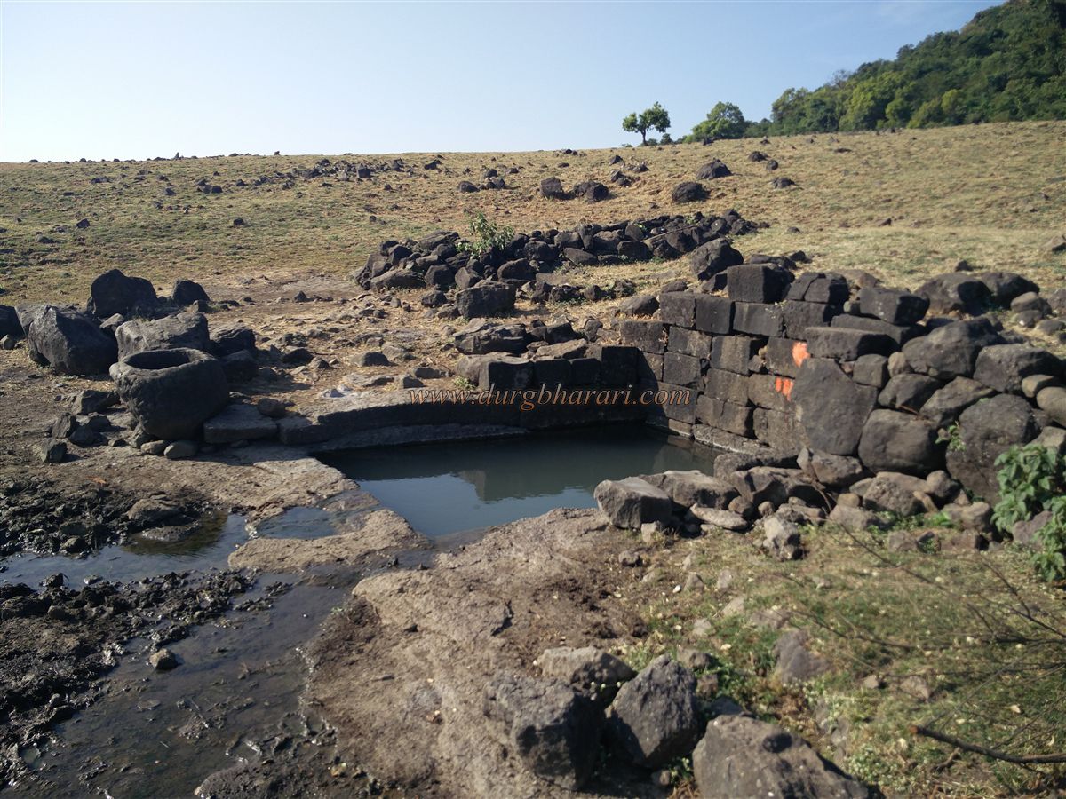
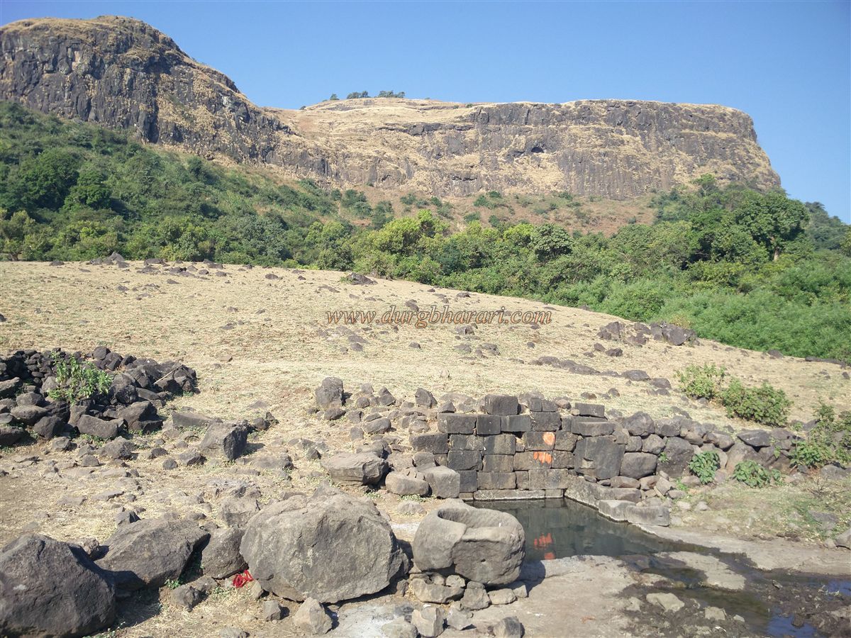
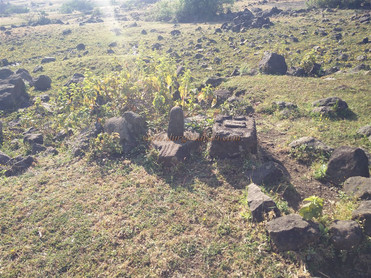
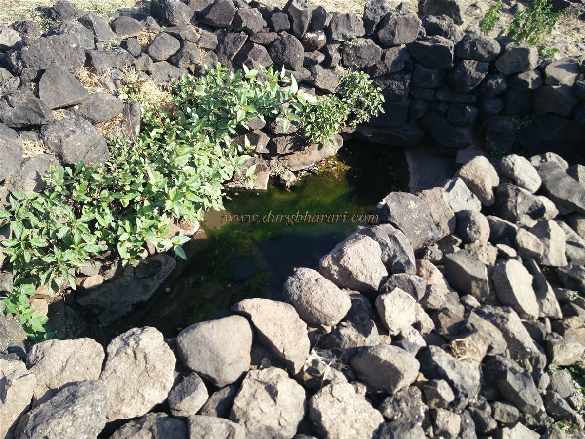
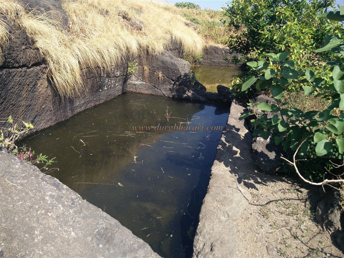
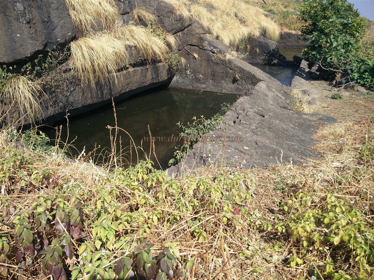
On the eastern side, one comes across 8–10 graves with carved stones featuring lamp holders. A little further lies a rock-cut water tank, the only source of potable water on the fort, supported by cut stones to prevent erosion. Stone troughs and carvings of a Nandi, a Shivling, and holy footprints can be seen nearby. Another smaller water tank lies above the main one, with water seeping down into the lower tank. In front of the tank is a small settlement known as Tiwari Vasti, consisting of 4–5 houses. The Tiwari now live in Nashik, but during monsoons, herdsmen from nearby villages stay here. The houses remain empty during other seasons, offering a good place for shelter.
From this settlement, Ravlya fort—triangular in shape—can be seen at a short distance. Two paths lead to it: one from the right ridge in front of the settlement, and another from the left ridge through the forest, which is slippery and best avoided. The well-trodden right path climbs to the base of the cliff and, hugging the cliff on the right, leads to the upper section of the left ridge. Along the way, partially carved caves can be seen, including one cave with four carved pillars that resembles an unfinished monastery. The two paths eventually meet, and at the base of the ridge are large ruins of houses and mansions.
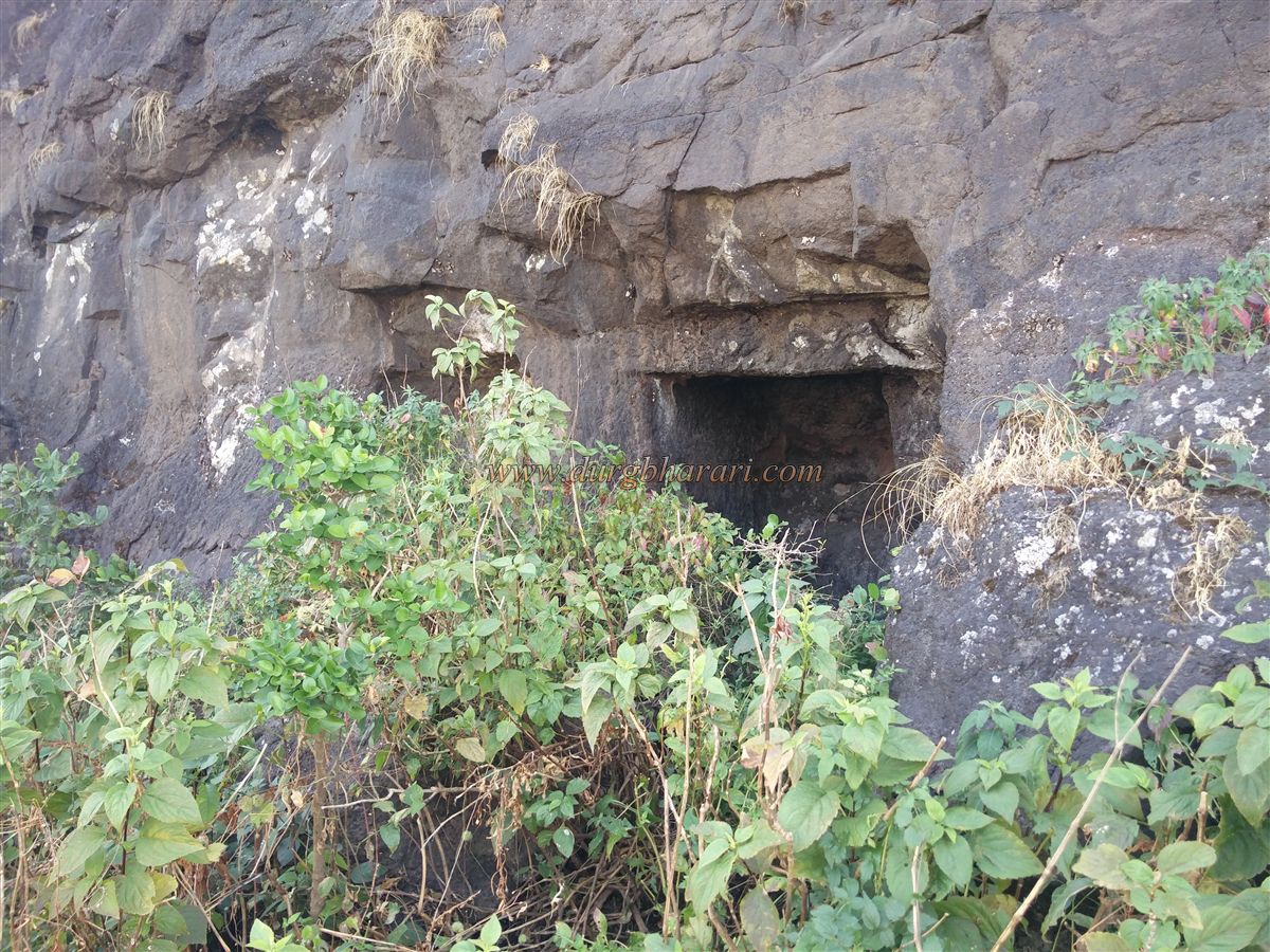
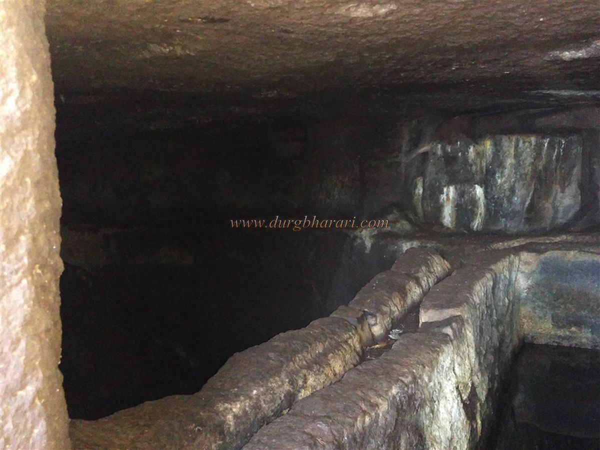
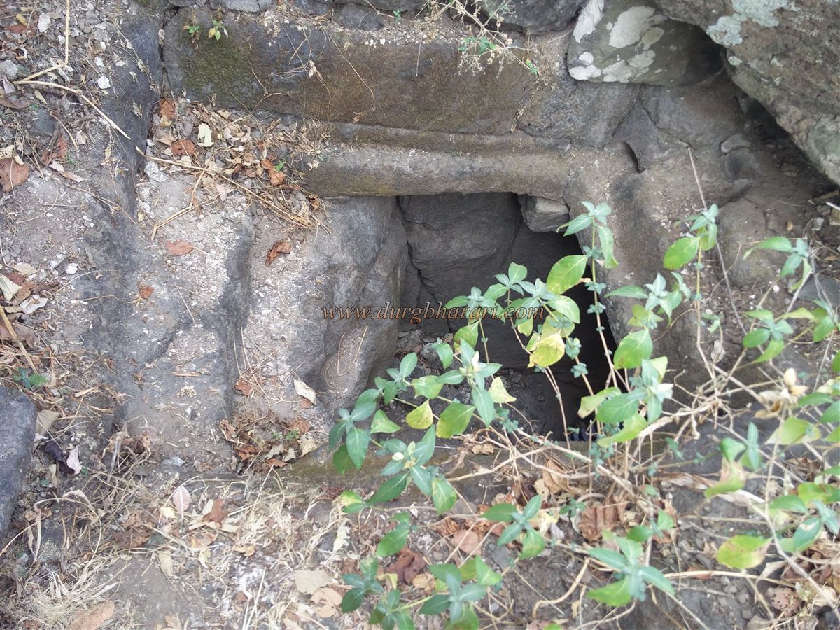
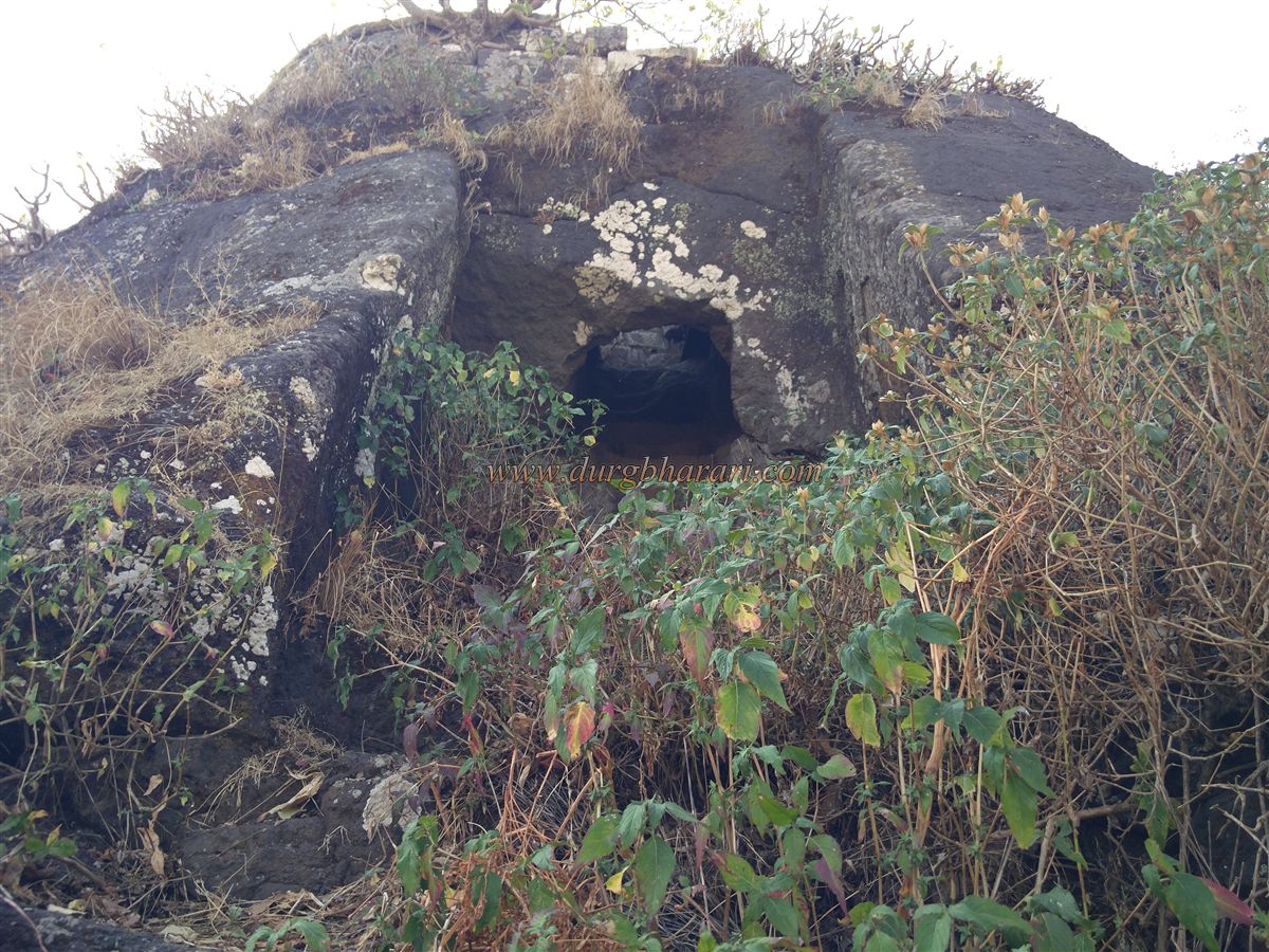
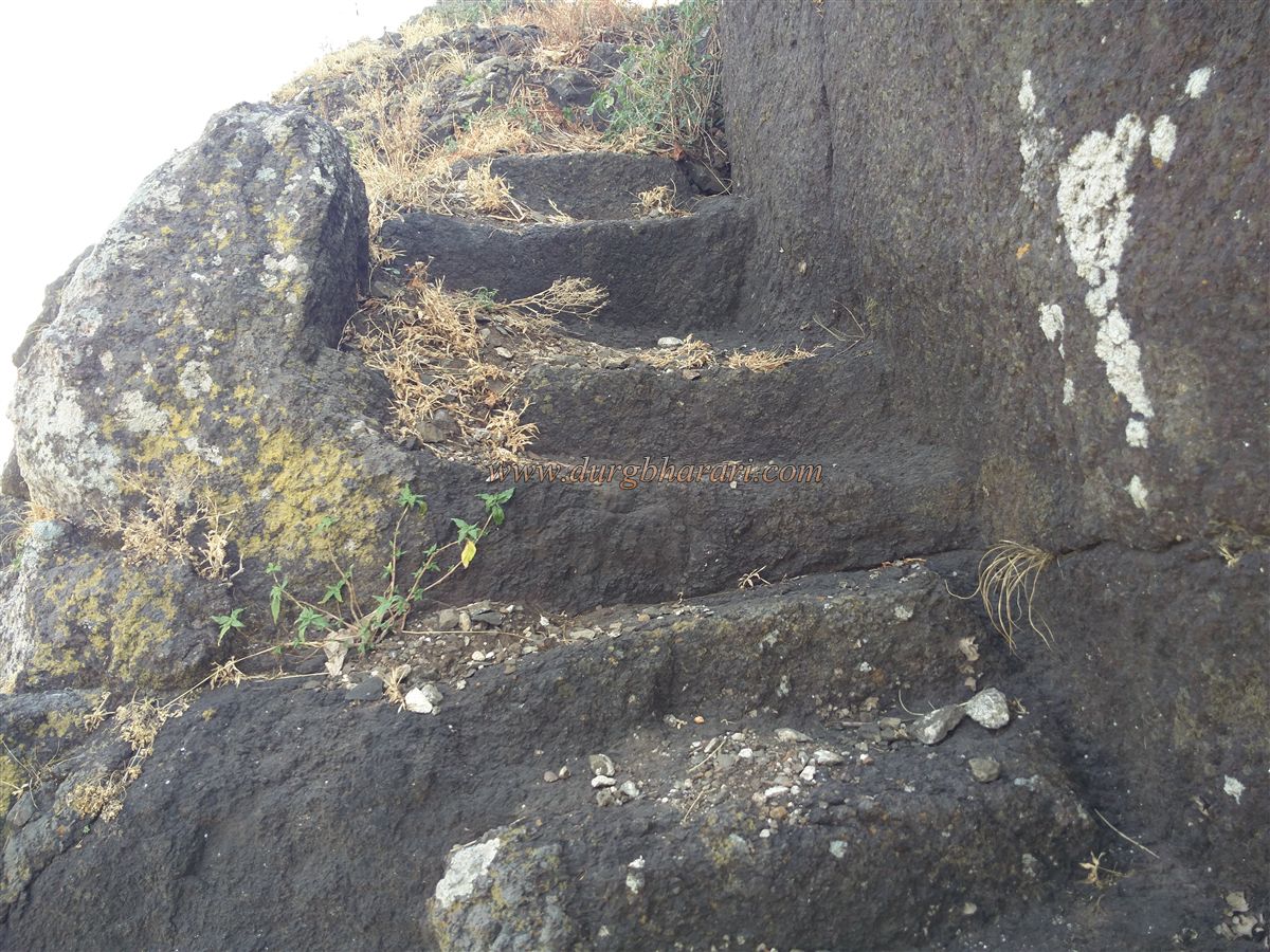
Upon reaching the ridge, one is momentarily puzzled about how to ascend further as no steps or clear path is visible. The British had destroyed the original steps, leaving only narrow foot-holds carved into the rock, requiring caution during the ascent. Before climbing, a massive cave carved into the rock face can be seen a little further along the cliff, with a window-like opening and a small door just large enough to crawl through. Some rainwater collects inside.
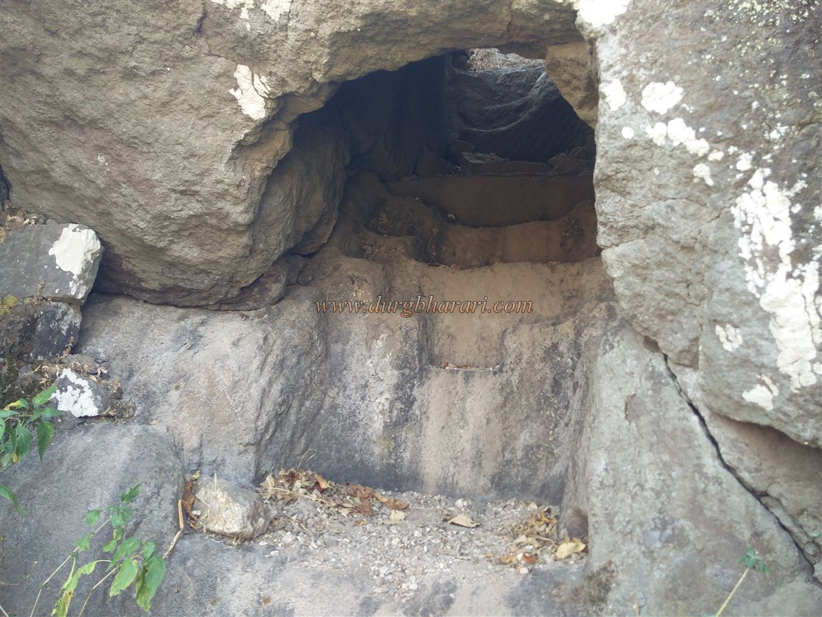
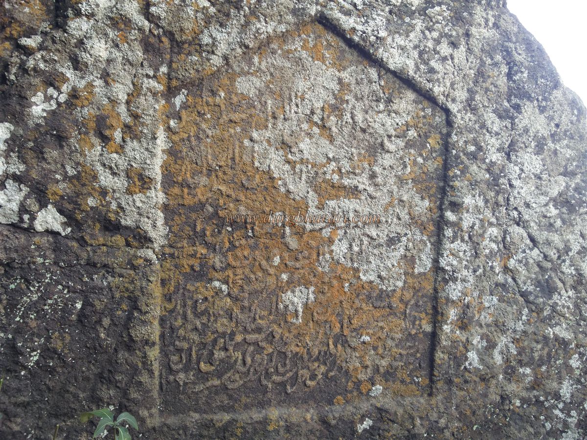
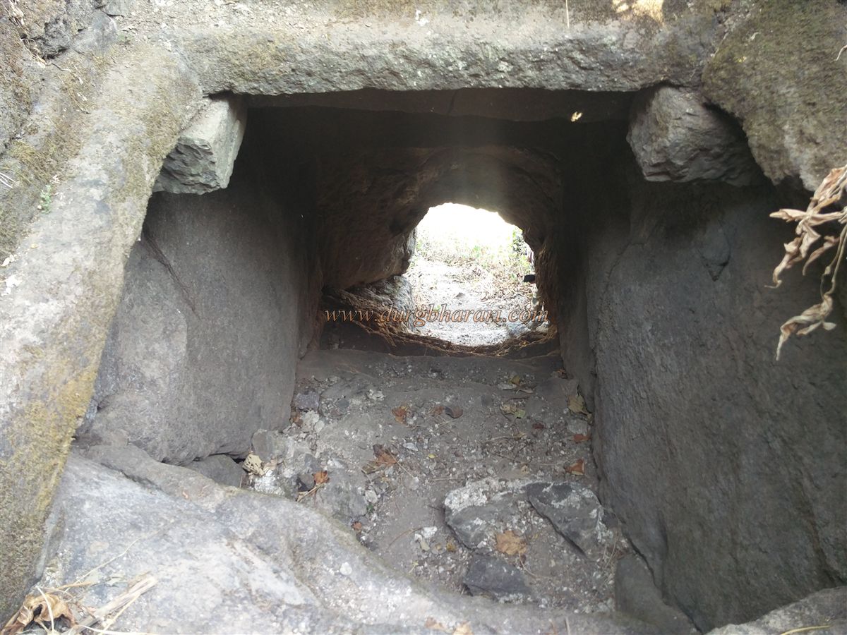
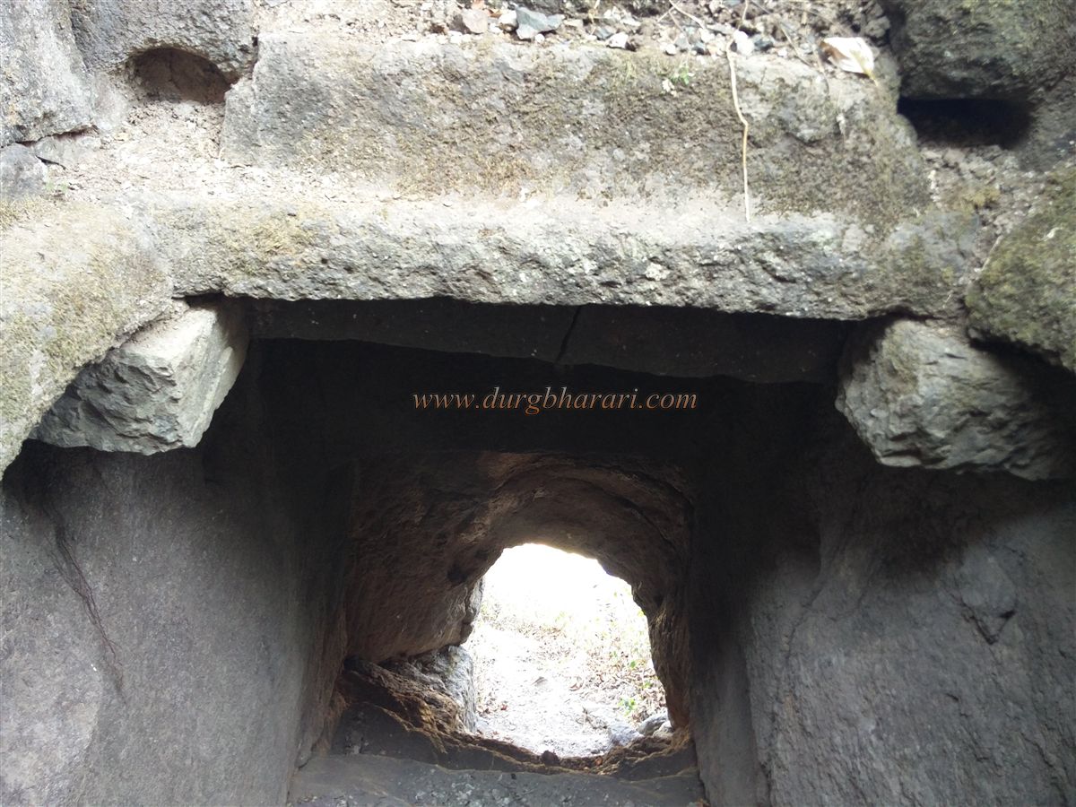
Further along the trail, there are rock-cut steps leading to a small subterranean entrance to the fort. A Persian inscription outside the doorway mentions that Allavardikhan captured the Ravlya-Javlya forts in 1636. Climbing these steps brings one to the upper part of the fort. One path continues up broken steps, while another turns left. Along this trail are two large caves, one a dry granary and the other a water tank, whose mouth is sealed with stone masonry. Over time, silt from above has nearly blocked its entrance, requiring one to crawl inside.
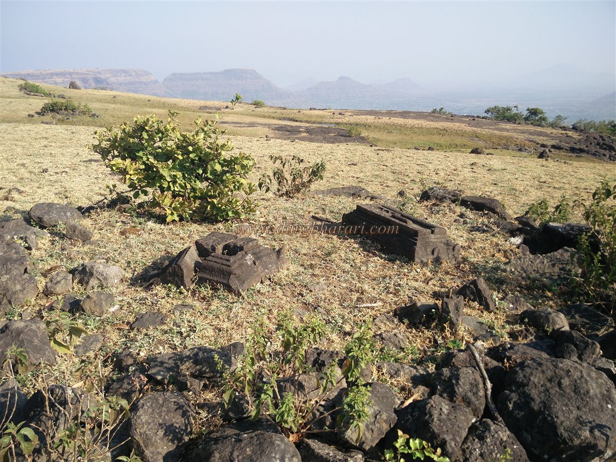
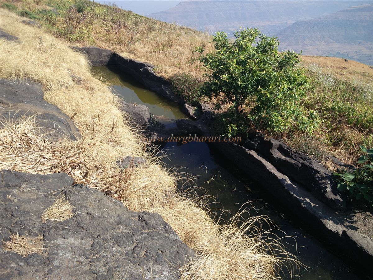
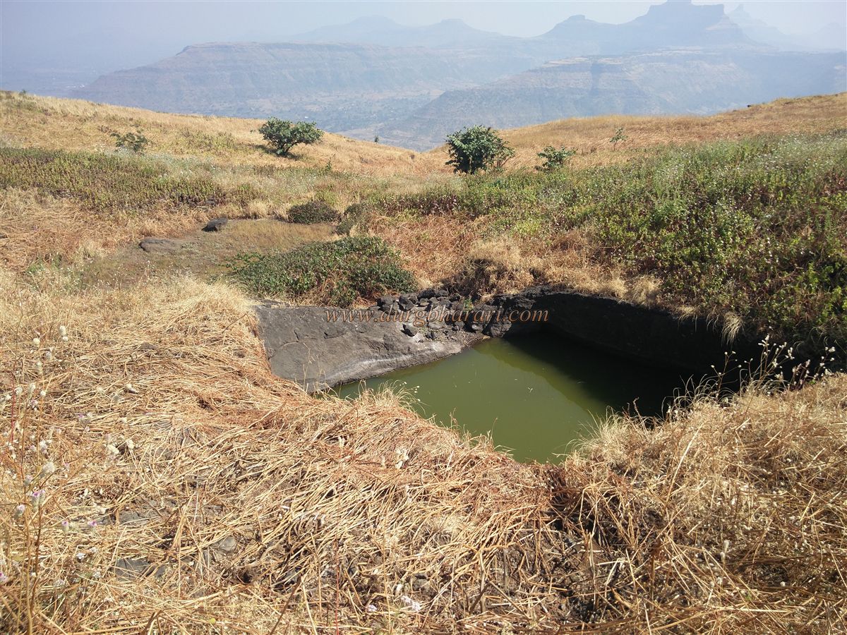
After visiting the caves and climbing the broken steps, the fort's gateway—now in ruins—is reached. A lone stone from the arch still stands. The fort, situated at an elevation of 3,970 feet, has a triangular summit spread over 16 acres. A trail from here leads toward the other end of the fort. At the start of this trail are the foundations of two buildings. Further along are three rock-cut water tanks, one of which is a pillared tank. A fourth, partially blocked pillared tank follows, along with a fifth one carved into the rock. None of these contain drinkable water.
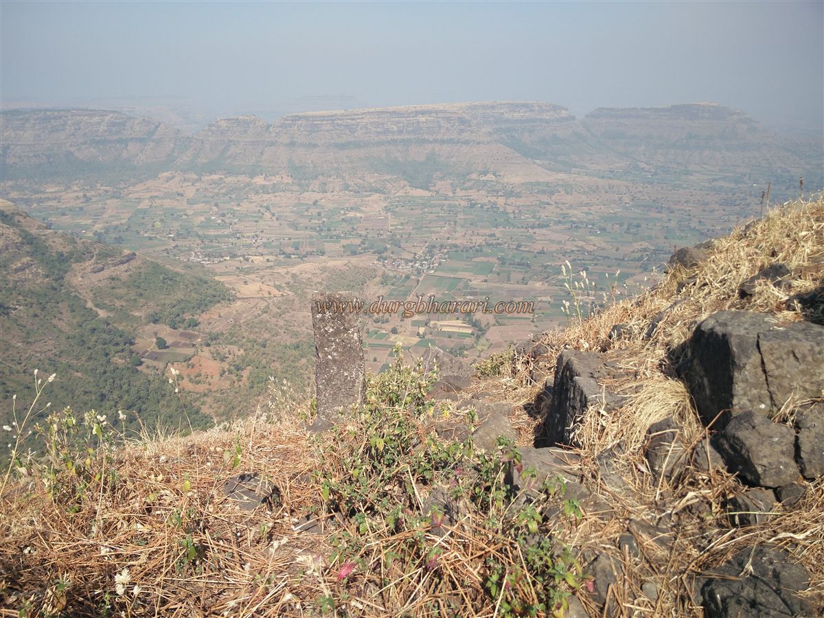
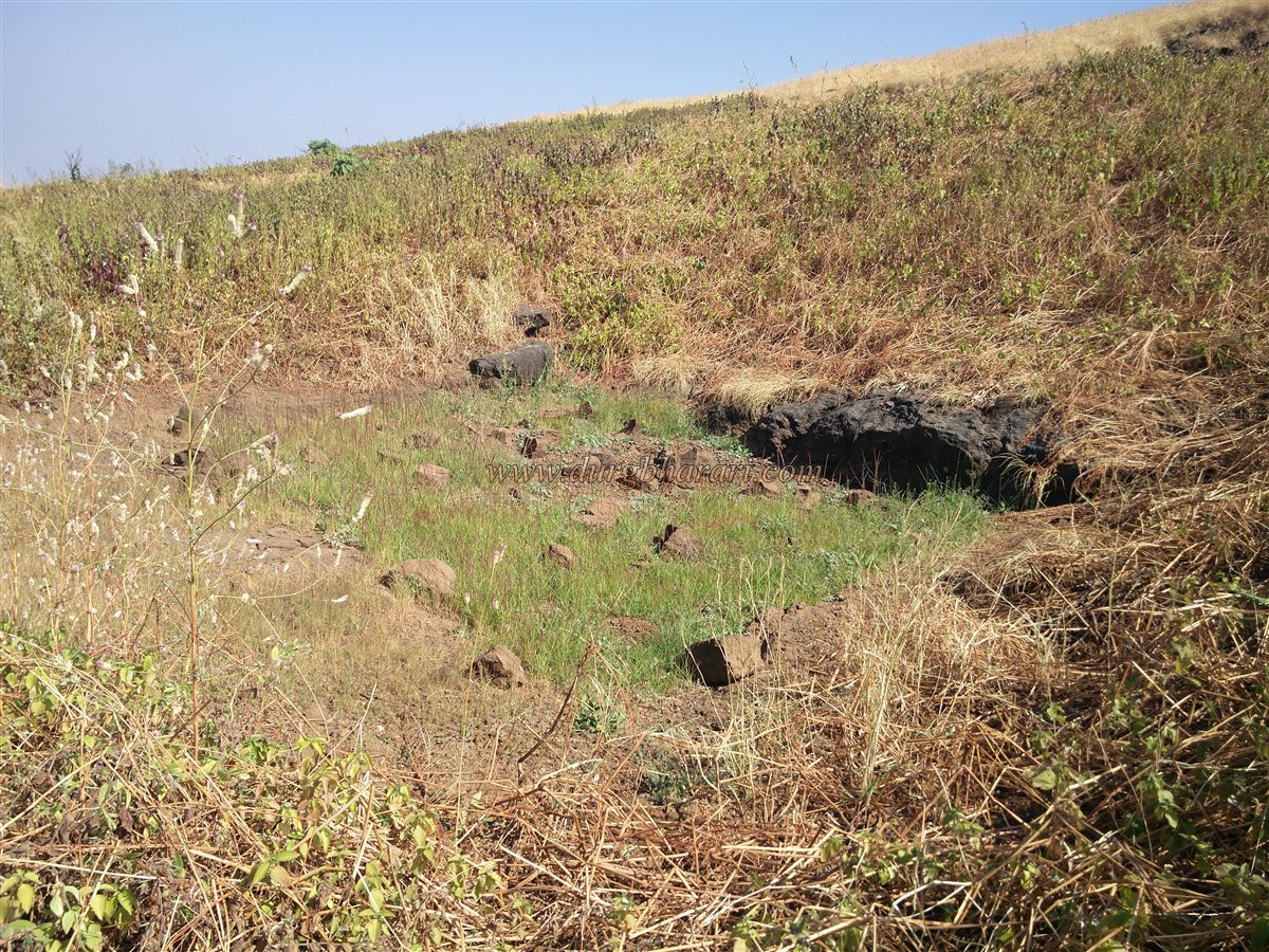
As one walks the perimeter of the fort, remnants of lookout posts and two small stagnant ponds can be seen. In the direction of Javlya, a half-buried tank is visible. From the summit, one can see eight to ten other forts including Javlya, Markandeya, Saptshringi, Kanhergad, Mohandar, Dhodap, Kanchan, Koldher, Rajdher, and Indrai.
Returning to the gateway completes the circuit. Exploring the entire fort takes about an hour, and visiting both Ravlya and Javlya, including the return descent, takes 7–8 hours.
In 1635–36, Shah Jahan sent generals Khan Dauran, Khan Zaman, and Diler Khan to dismantle the Nizamshahi regime under Shahaji Raje. Diler Khan was tasked with capturing forts in the Nashik-Trimbak region. Allavardikhan, under Diler Khan, captured Ravlya and Javlya forts in 1636. This is mentioned in the Persian inscription on Ravlya gate and in the historical text Badshahnama.
In November 1670, during Shivaji Maharaj’s second sacking of Surat, this fort came under Swaraj. According to the Sabhasad Bakhar, in 1671, when Diler Khan laid siege to the forts, Moropant’s forces repelled the attack. However, Mahabat Khan later besieged and captured the fort. It later returned to Maratha control during the Peshwa era.
In 1818, Captain Briggs took the fort on behalf of the British, and in 1819, British officer Macintosh destroyed the steps and fortifications using cannons.
© Suresh Nimbalkar
GALLERY