RASALGAD
TYPE : HILL FORT
DISTRICT : RATNGIRI
HEIGHT : 1740 FEET
GRADE : EASY
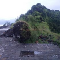
Mahipatgad, Sumargad, and Rasalgad are situated parallel to the main range of the Sahyadri which spreads from north to south. It is a trio of forts is at the southernmost end. There are many remnants of Rasalgad fort. Rasalgad comes first on the list in terms of its remains in the Ratnagiri district. Spread from south to north, the fort covers an area of about 27 acres, with a height of 1600 feet above sea level and 1200 feet at the base. Rasalgad is located at a distance of 18 km from Kheda Bharana Naka on the Mumbai-Goa highway. There is a paved road to reach the base of Rasalgad and one can drive till the steps of the fort. From here you have a path to go straight to the head. There is a plastic water tank at the beginning of the newly constructed steps. In this cistern, the water from the fort is brought down by a pipe and it is supplied to Rasalgad settlement.
...
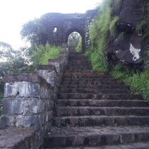
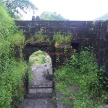
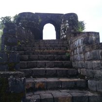
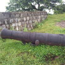
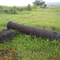
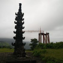
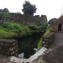
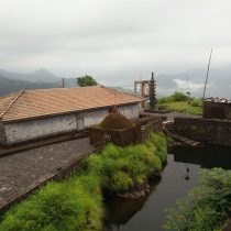
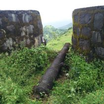
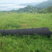
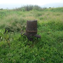
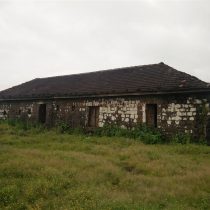
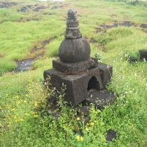
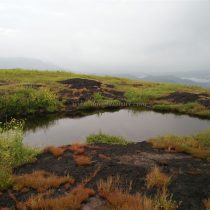
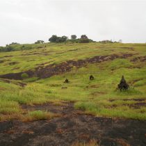
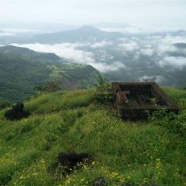
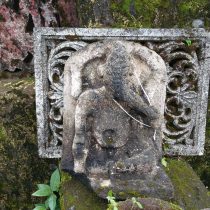
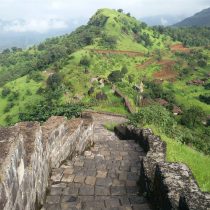
The road coming from Mahipat-Sumargad meets Rasalgad in this gorge. From here, one can see the two gates of the fort and a beautiful view of Rasalgad. To the right of the first gate of the fort is a natural bastion. From the water tank, we cross three gates of the fort and reach the top in twenty minutes on the footpath recently built by the Archaeological Department. There is a small path on the left outside the first gate of the fort. As you walk along this path, you will see an underground cistern just outside the shore and a room carved into the rock for the guard to sit on. Upon entering through the first gate of the fort, on the way to the second gate, one can see a sculpture of a Lord Hanuman with a mustache and a dagger on the waist. On the way from here, one can find a hero stone sculpture on a staircase. A little further on, you come across another door. This is the door which we see at the top from the base of the fort and there are steps to climb to the top of the door on both sides on the inside of the door. From here, there is a third gate of the fort which has been destroyed. Upon entering the fort through this gate, one can see a large cannon in the front and there are three rainwater harvesting water cisterns over here. The bastion on the right side of the door is known as Peerburuj. There is a tomb on this bastion and a ruined idol is placed next to this tomb and a cannon is lying next to it. From this bastion, a huge expanse of Rasalgad can be seen. The head of the entire fort is a plateau. While walking on the ramparts of the fort, you can see cannons lying on the plateau and bastions. The special characteristic of this fort is the 16 small and large cannons scattered on the fort. Some of these cannons are engraved with English letters and symbols. In the center of the fort is the recently renovated temple of Goddess Zolai. On the way to Zolai temple from Pirburuj, you can see the ramparts on both sides, the remains of houses, a water cistern, and some cannons. In front of the temple, you can see carved wooden pillars of the old temple. Many found idols found during the excavations on the fort are kept in one of the inner corners of the temple. The sanctum sanctorum of the temple is made up of stone constructions and has idols of Zolai, Waghjai, and Lord Bhairav. This temple is suitable for overnight stays. There is a fair of Goddess Zolai once every three years. In front of the temple is Deepmal and Tulsi Vrindavan. Two small cannons, Satishila, and some ancient idols can be seen on the temple premises. There is a dome of Ganesha at the back of the temple and the original idol of Lord Ganesha is broken and is placed at the back of the dome. There are two large ponds at the back of the temple, one of which has potable water throughout the year. Behind the temple, at the top of the water cistern, there is a citadel located on a hummock measuring 140 x 170 feet with 6 bastions. The main gate of the citadel has collapsed and you enter the citadel through the broken ramparts. There is a small gate in the north ramparts of the citadel. There are 3 cannons on one of the bastions of the citadel and inside are the remains of a mansion and an administrative office. Outside the citadel, there are four water cisterns to the north and another large pond on the back plateau. There is a cannon on this plateau and the remains of houses can be seen scattered on this plateau. At the end of the plateau is a bastion slightly separated from Machi. From here, when you go to Machi on the south side of the fort, the first thing you see is the way out of the fort carved in the rock. This should be the second way or the secret path of the fort. Beyond this is a well-maintained three-door warehouse measuring 20 x 60 feet made out of stone constructions. This should have been the granary of the fort. The stone frame of the two doors of the granary has Ganpati on the upper side and human face and some other carvings on the lower side. 50 people can easily stay in this granary. In the courtyard of this barn, a broken cannon is seen buried upside down in the ground. Remains of some structures are scattered near the cannon. A little further on, towards the right side of Machi, you can see a Shivling and Nandi as well as a worn-out Gajalaxmi sculpture. From here, the next path takes you to the end of Machi. On the way, there is a water cistern and the tombs of some heroes who became a martyr. There is a strong bastion at the southern end of Machi and a trunk descends from here. There is a cave with a pillar under this trunk although the road to get there is very difficult. This is where your fort round ends. The entire fort round takes two hours. To the west from the top of the fort, you can see Mandangad and Palgad, the mountain range of Mahabaleshwar, Sumargad, and Mahipatgad. Makrandgad is seen in the northeast direction and Vasota and Nageshwar in the southeast direction. The fort should have a large population due to the presence of three large lakes on the fort, seven medium-sized cisterns, and twelve small cisterns as well as a large number of remains of houses scattered on the fort. The Archaeological Department has done a lot of repairs on the fort. Both the lakes between the citadel and Zolaidevi temple as well as the steps leading to the fort have been constructed. The history of the fort isn’t much available. Rasalgad was built in the 13th century during the reign of the Bahamani. Later in the year 1755, Tulaji Angre took over Rasalgad. Nanasaheb Peshwa took all the forts from Tulaji Angre but Rasalgad remained under his possession. Later, when Tulaji Angre surrendered, Rasalgad came under the control of Marathas.
© Suresh Nimbalkar

