RANGANA
TYPE : HILL FORT
DISTRICT : KOLHAPUR
HEIGHT : 2180 FEET
GRADE : MEDIUM
Among the three and a half Shakti Peethas in Maharashtra, the Karveer Nivasini Mahalakshmi, also known as Ambabai of Kolhapur, is one of them. This district, famous for its spicy red and white curries and wrestling tradition, is home to thirteen forts, both large and small. Among these thirteen, Rangana Fort stands out as the most beautiful yet rugged fort surrounded by natural beauty. The name "Prasiddhagad," given by Shivaji Maharaj, did not become popular, and the fort has remained relatively unknown. The main reason for this obscurity is the dense forest surrounding it and the strenuous trek required to reach the fort.
Situated on the summit of the Sahyadri range, the fort is separated from the plateau by a small pass.
...
It was built to monitor the Hanumant Ghat, which descends into the Konkan. Though there are four to five paths leading to the fort, the routes from the villages of Chikkewadi and Narur are commonly used. Narur, located in Sindhudurg district, is 40 kilometres from Kudal. From here, it takes about two and a half hours of climbing to reach the base of the fort. The route via Chikkewadi is 105 kilometres long, passing through Kolhapur-Gargoti-Patgaon-Tambyachiwadi-Bhatwadi to Chikkewadi. State transport buses reach Tambyachiwadi, and from there, an unpaved road leads 8 kilometres to Chikkewadi. If you have a private vehicle, you can drive up to Chikkewadi, and except during monsoon, a jeep can take you to the plateau in front of the fort. Without a private vehicle, you must walk two hours through the forest from Tambyachiwadi to reach the plateau.
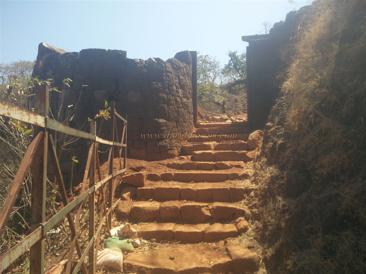
Approaching from Narur, you arrive at the pass below the northern bastion of the fort, while from Chikkewadi, you reach the plateau above this pass. Where the road ends on the plateau, there are remains of a stone threshold and a guard post wall, indicating a former sentry post. While most forts in the Sahyadri require an ascent, this route requires a descent. From the plateau, a path leads down into the valley and turns left to ascend the fort near a bastion. On the right, you can see a stone cistern carved into the rock. In the forest to the left, near the base of the plateau, are the ruins of a temple called Bandeshwar, with a well-constructed Tulsi Vrindavan or a possible Samadhi in its courtyard. The temple houses recent idols of Ganesha, Vishnu, and a goddess. As you descend into the valley, you see the ruins of a guard post.
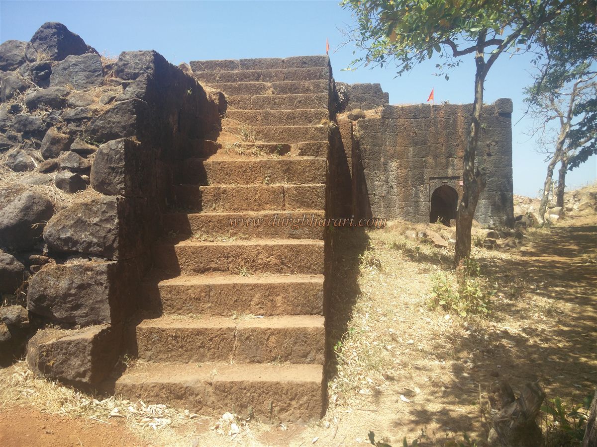
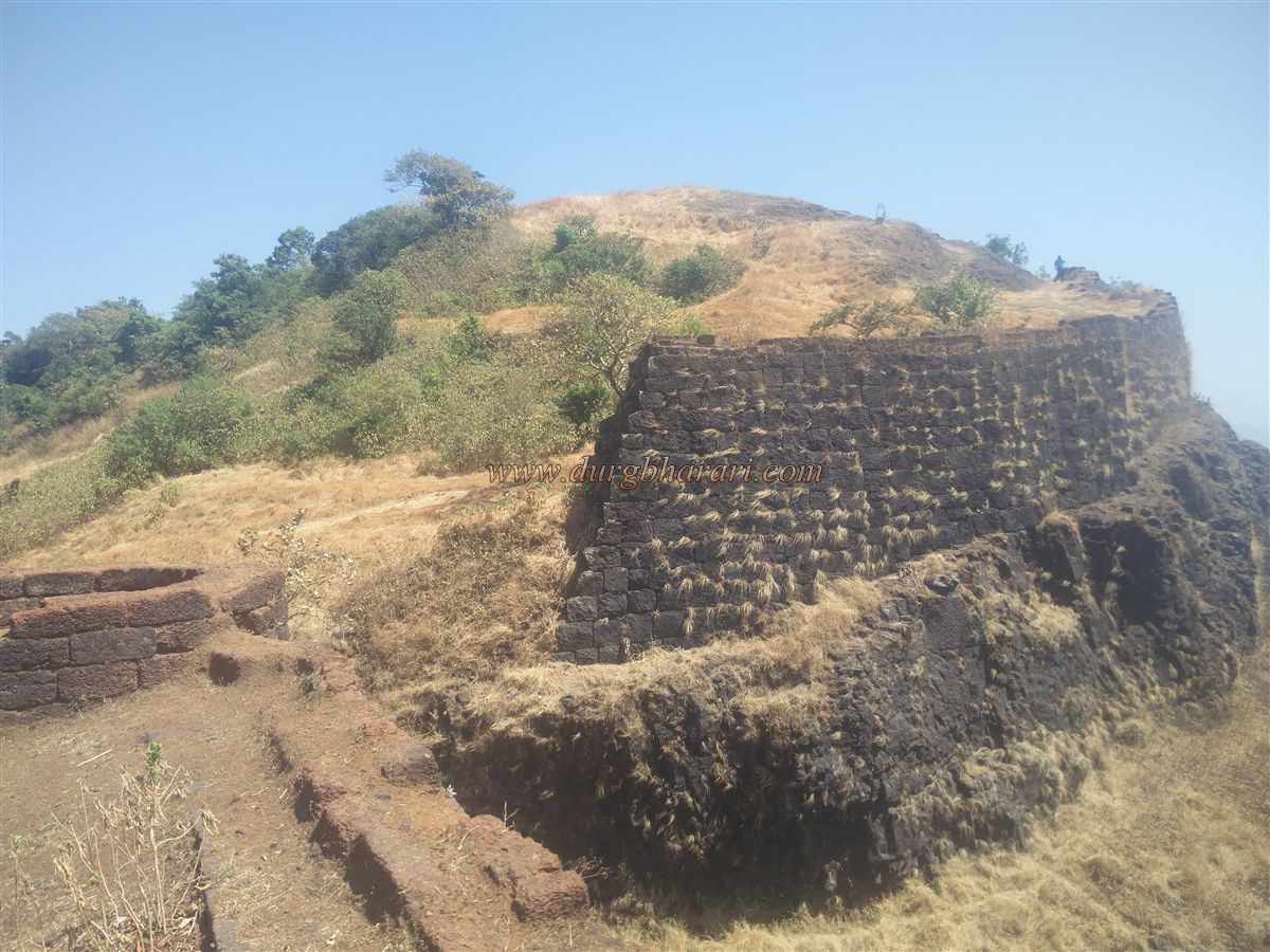
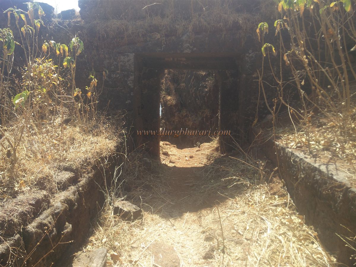
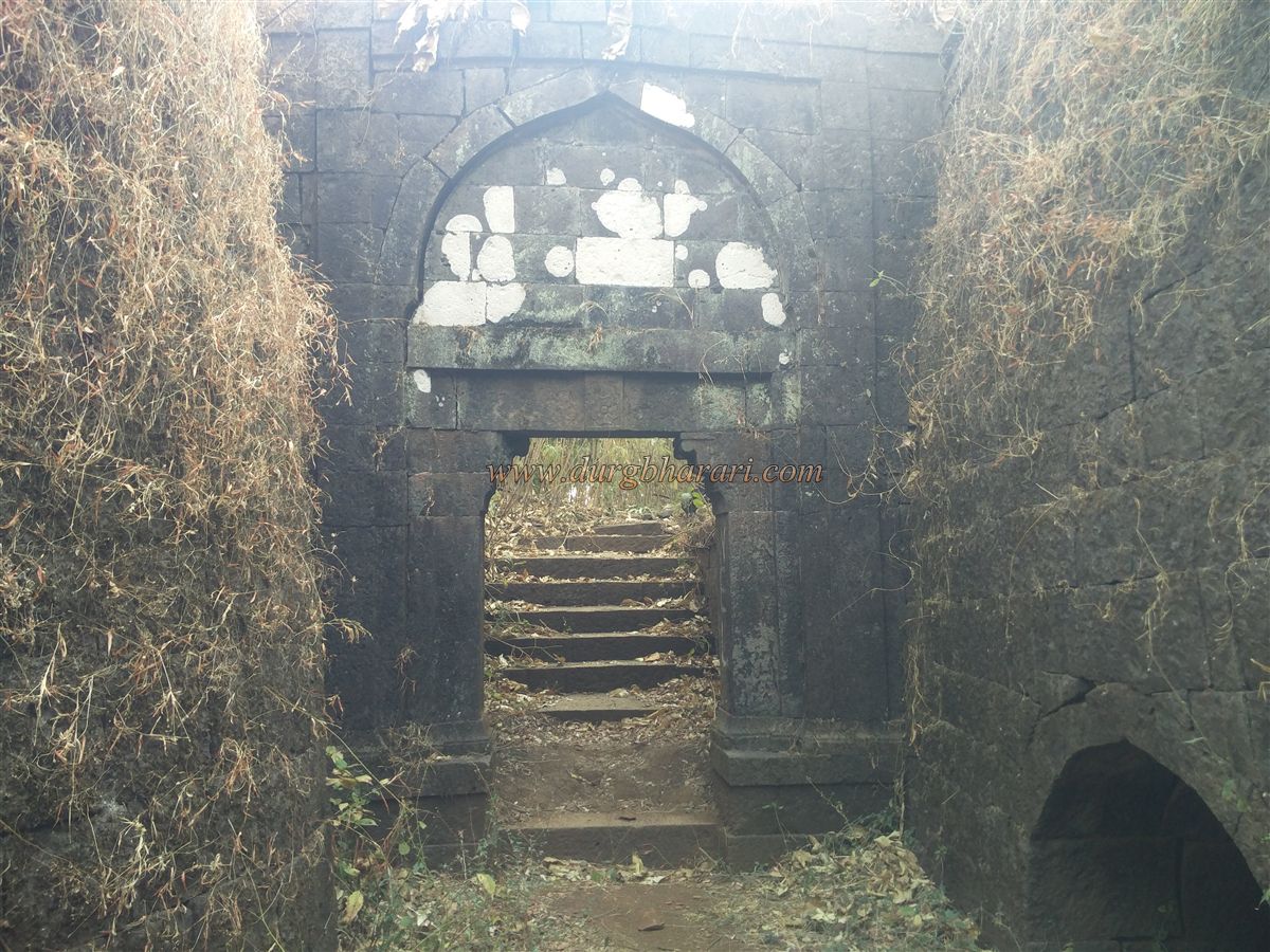
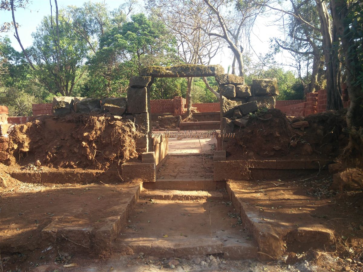
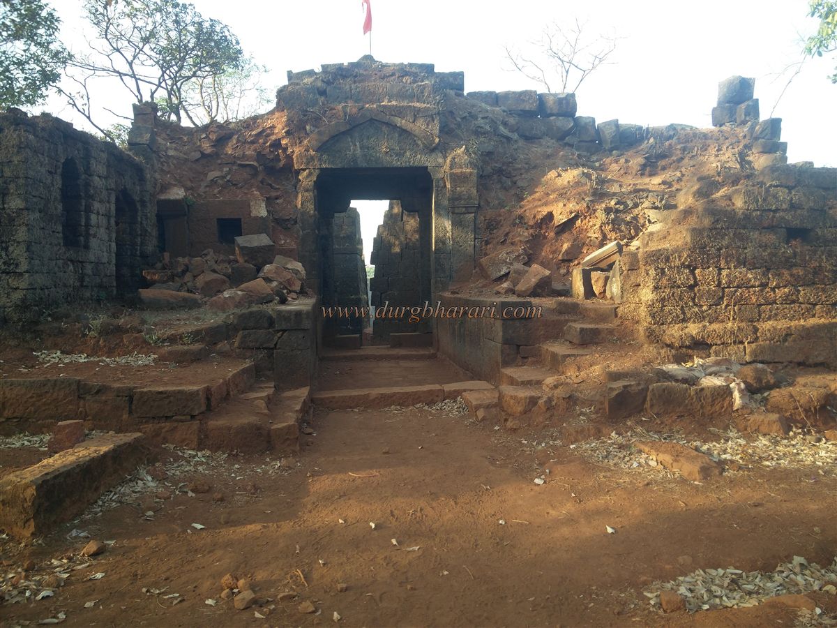
Ahead, a massive but ruined bastion within a double fortification wall reminds one of the bastion of Antur Fort in Aurangabad. If the Archaeological Department receives adequate funding, this bastion could be restored like Antur's. A path to the fort winds left along the cliff beside this bastion, protected by iron railings installed by the forest department. After climbing ten to twelve steps, you reach the first north-facing gate, the Ganesh Gate. This gate, flanked by a bastion on the left and a fort wall on the right, retains only its stone frame. Both sides have ruined guard chambers.
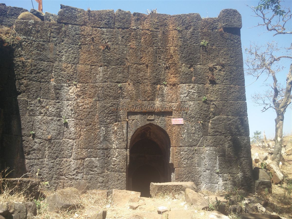
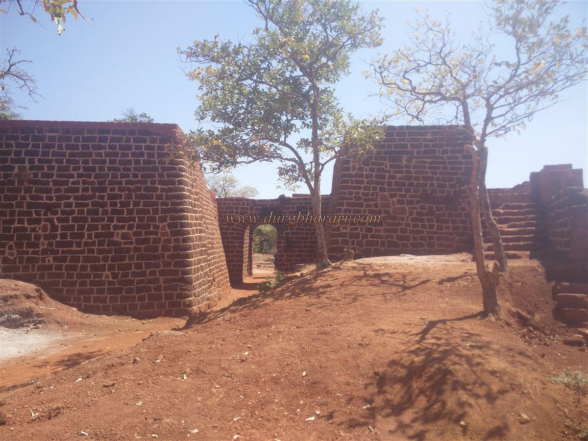
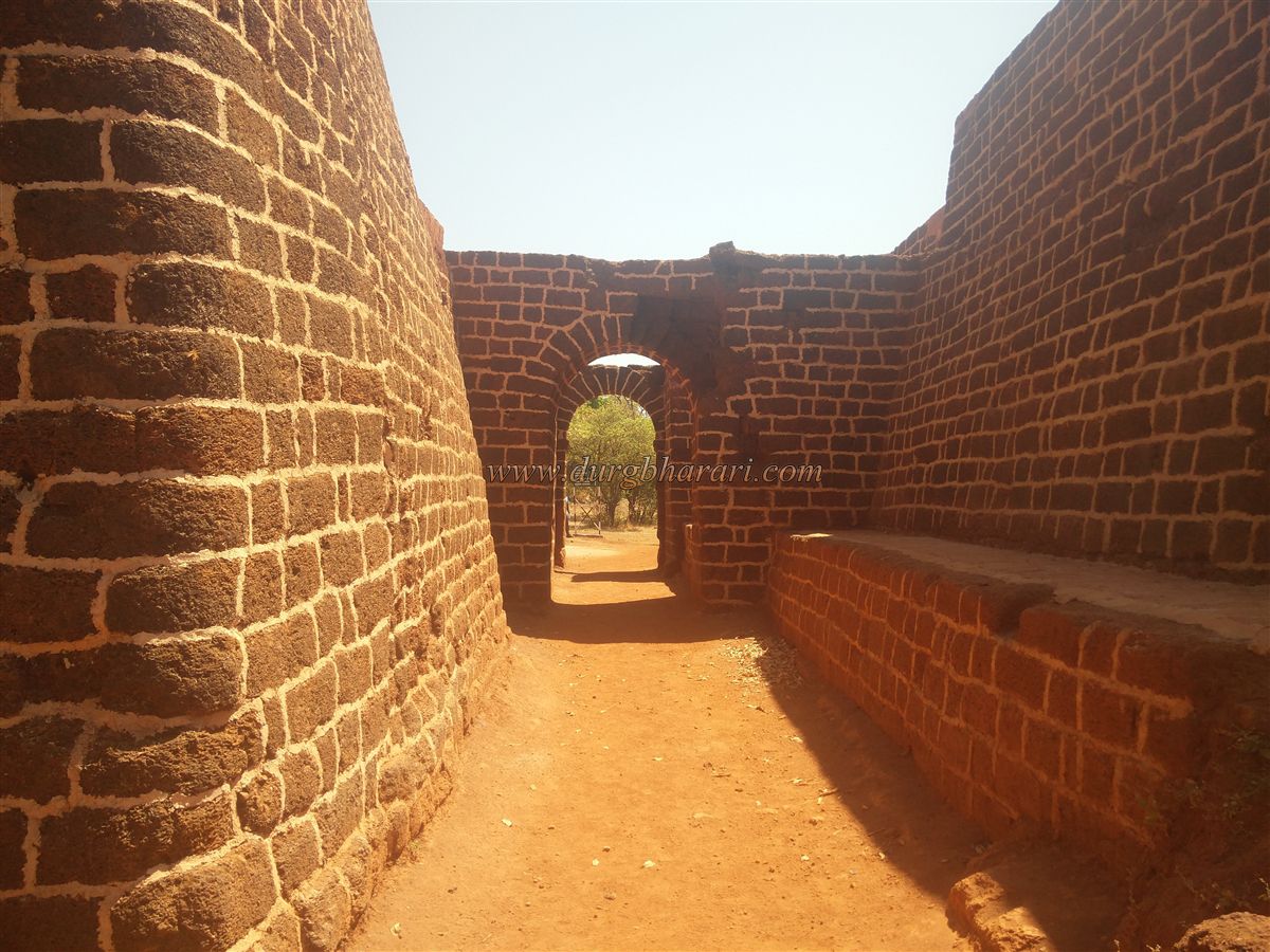
Beyond this, the path leads through a completely enclosed section to the second gate, known as Hanumant Gate, built in the Gurmukhi style and enclosed between two bastions—one square-shaped on the right and the other round on the left. Entering through this gate gives access to the fort. Inside, both guard chambers survive, though the upper structure is entirely collapsed. The walls and arched doorways of an adjoining building on the right still remain. In this area, many architectural remains survive, including platforms, walls, and doors.
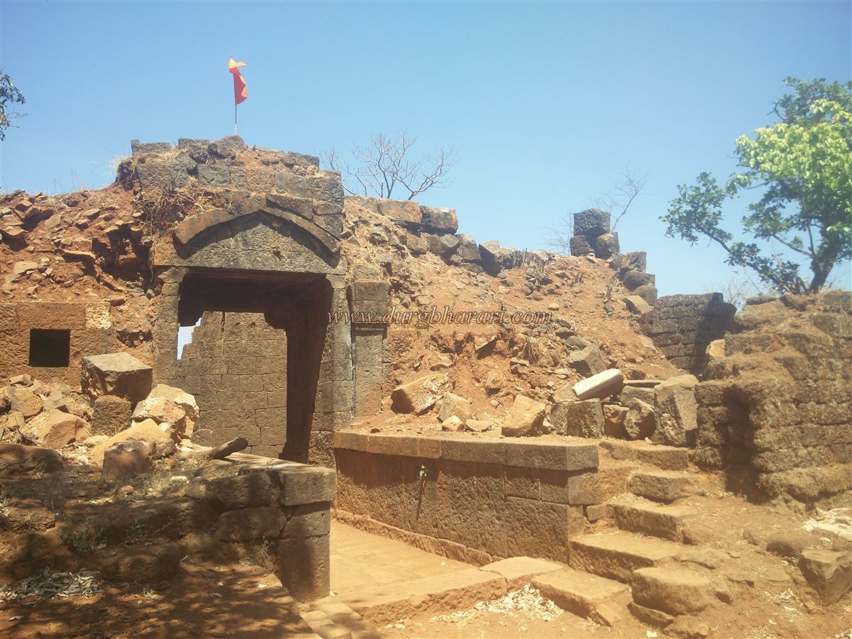
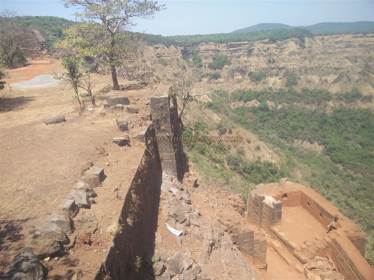
To the right, before reaching the previously mentioned bastion, there is a dried-up water tank. This bastion has stairways on both sides. On the left side of the bastion, there is a small gate in the outer wall leading downwards. A carved image of Maruti adorns this gate. Though the internal steps descend, the outer section has collapsed, blocking access. A saffron flag proudly flutters atop the bastion. The height of the fort here is 1980 feet above sea level. After visiting this bastion, return to the main gate to begin exploring the fort's interior.
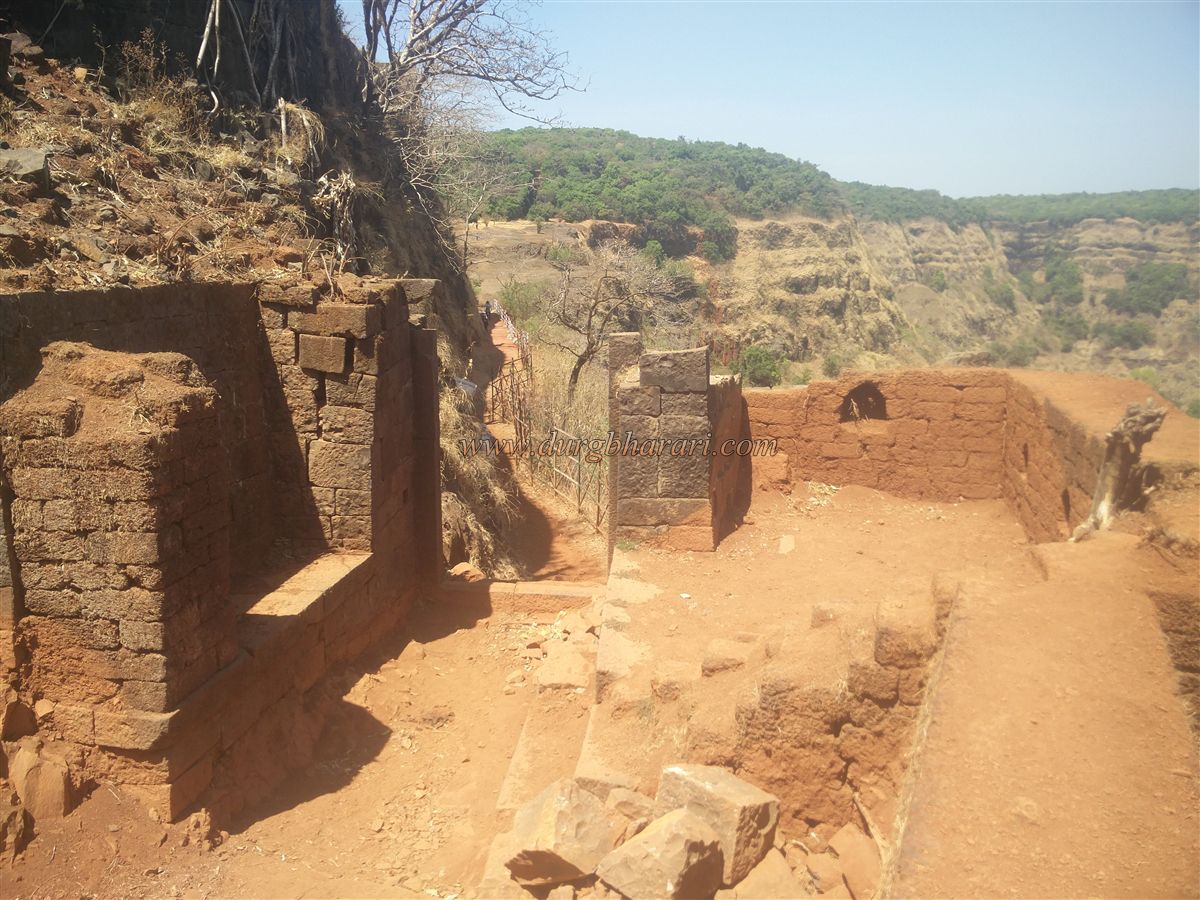
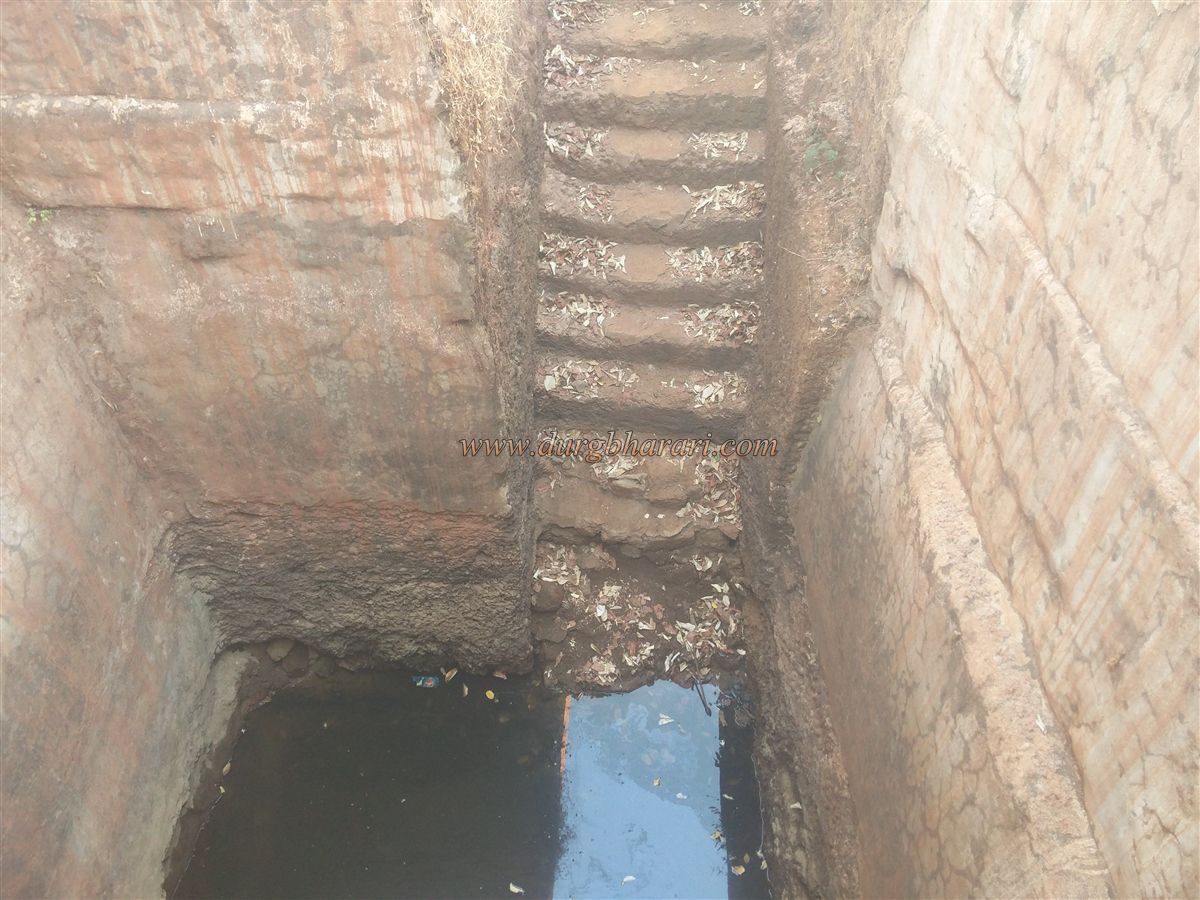
Near the gate, on the right, is the wall and entrance to a mansion known as the Nimbalkar Wada, belonging to the fort commander. Inside, along the wall, lies an eroded Persian inscription. Within the compound is a square stepwell with year-round potable water. Further ahead, you encounter transverse fortification walls with two successive gates. The northern bastion is separated from the main fort by a wall and preserved by the forest department. Steps lead up to the walls, and the section between the gates has guard chambers.
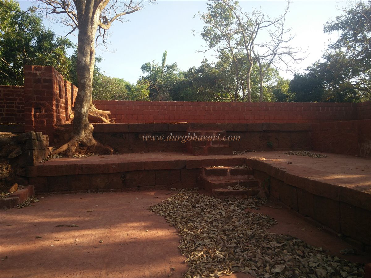
Upon entering the inner area through this gate, a paved path branches left toward the Ganesh temple and palace, while the straight path leads to the Rangana temple. The forest department has placed direction boards at this junction. Nearby, in the underbrush, are four to five Samadhi and, to the right, the Cliffside fort wall. Follow the path along the wall to explore the entire fort. To the left is a large, excavated reservoir, and to the right, a recently restored Shiva temple with a Shivlinga, Nandi, and a Ganesha idol in a niche. The courtyard also contains another Nandi and carved pillars from an older temple.
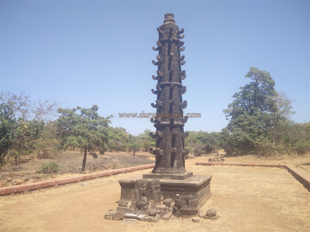
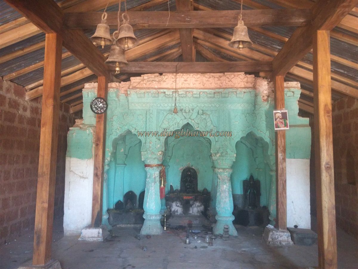
Continuing uphill toward Rangnai Devi’s temple, you pass two finely constructed Samadhi platforms, one of which houses a large Shivlinga. In five minutes from the Mahadev temple, you reach the Rangnai temple compound, where there is a square stone stepwell. In front of the temple is a 15-foot-tall stone lamp tower on a platform, along with a Tulsi Vrindavan and broken idol fragments. The temple is enclosed by a wall and has been rebuilt by the forest department. The original sanctum remains intact, adorned with floral and animal carvings in lime plaster. Inside is a four-armed idol of Rangnai Devi with weapons, flanked by Bhairav on the left and Vishnu on the right. To the left of the temple is a visitor shelter built by the forest department, and to the right, a Hanuman temple housing one Marathi and two Persian inscriptions carved in stone.
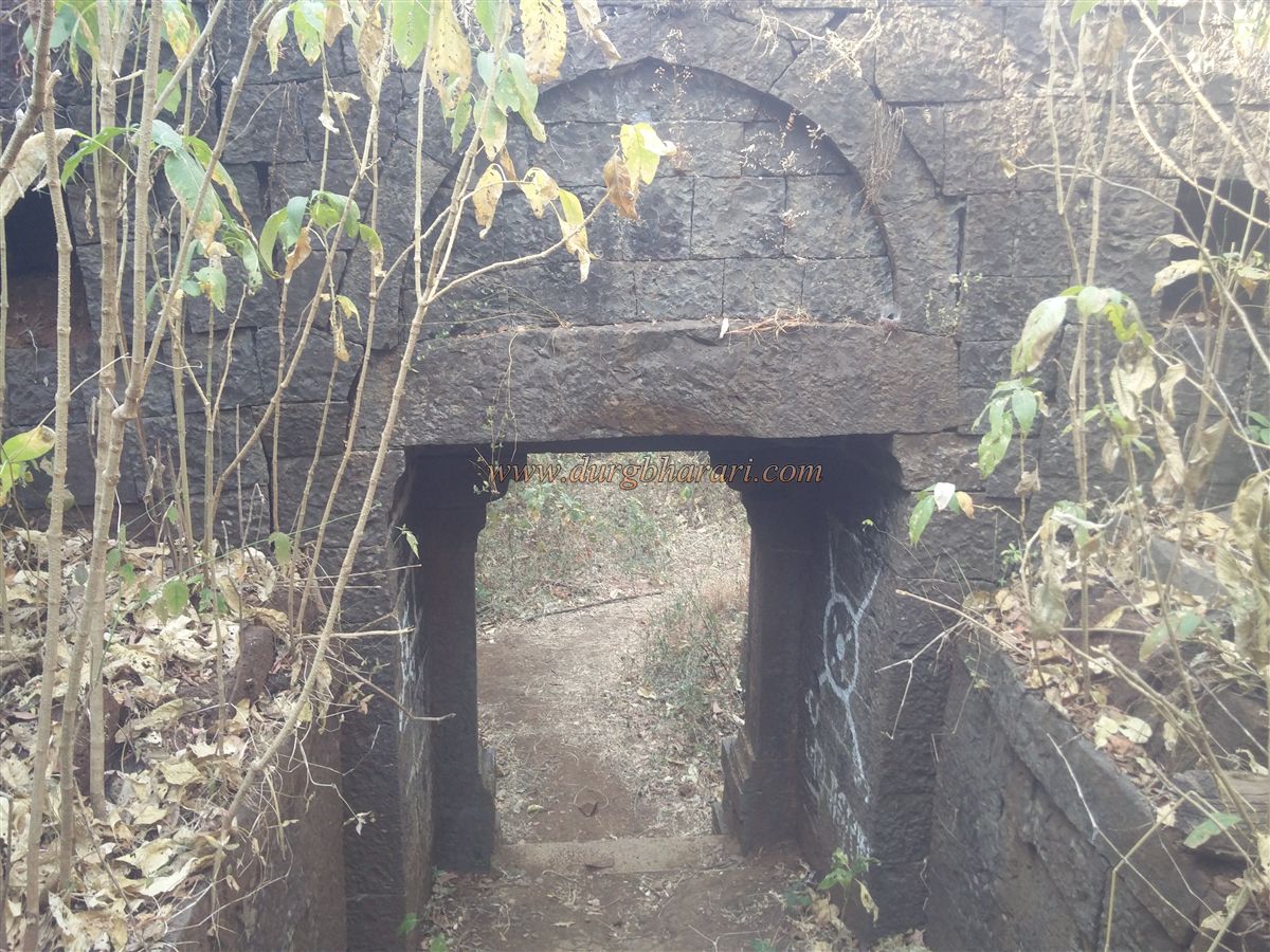
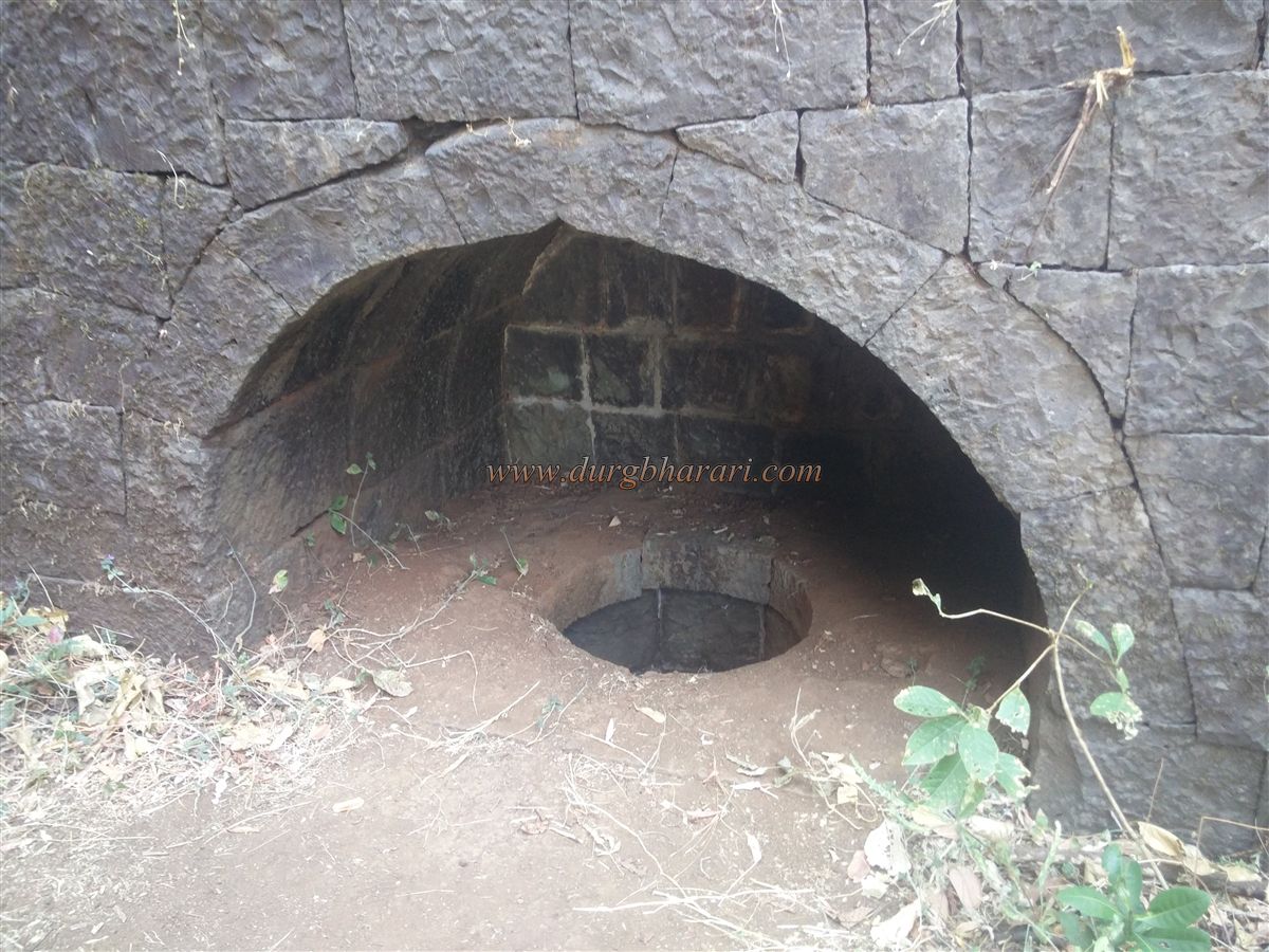
After visiting the temple complex, head to the edge of the cliff behind it, where the fort wall remains in good condition. Follow the wall northward. After about ten minutes, you descend into a small ravine. At its edge stands the Konkan Gate, from which a path leads to Narur village. A large arch built in the wall at the mouth of the ravine drains rainwater. Sculptures from old temples are embedded in the gate's construction. A bastion above protects this gate.
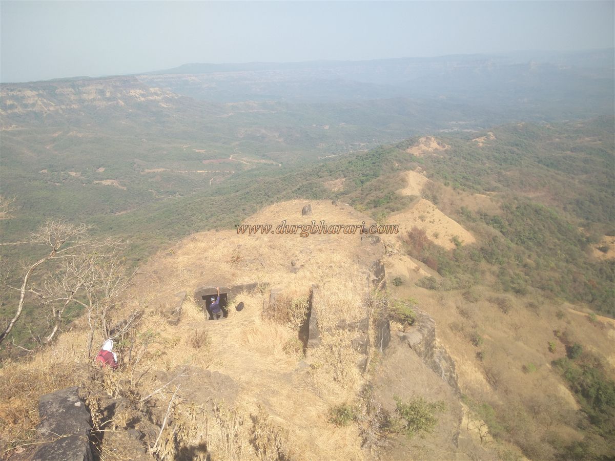
After seeing the Konkan Gate, retrace your steps and resume the fort exploration along the wall. Within half an hour, you reach the second Konkan Gate, from where a descending path leads to Kerwade village. This path is still partially in use. This north-facing Gurmukhi gate on the western wall is built within the fort and hidden behind a bastion. Proceeding from here, you reach the part of the fort known as Hattisond (Elephant Trunk), reminiscent of the Vinchukata (Scorpion’s Tail) at Lohgad. At its entrance is a beautiful but ruined arch carved from stone, and farther ahead, another arch cut into the rock. At the tip of this outcrop are two bastions with double walls. Small arched gates allow descent through the outer wall. The right bastion remains intact, but the left-side wall has partially collapsed, so caution is needed when descending.
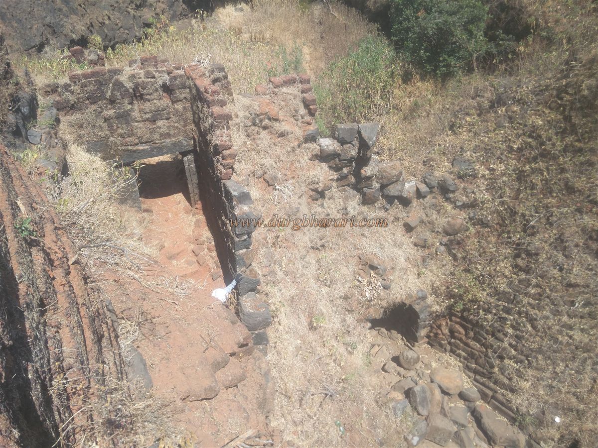
After exploring both bastions, continue along the eastern fort wall. In about 20 minutes, you arrive at the Yashwant Gate. Steps lead down from here, and a small doorway leads into the wall above. This small doorway is within a ruined guardroom behind the main gate. The north-facing gate is built between two bastions. Outside, within the wall, is a semi-circular niche with a circular opening and a small alcove, whose purpose is unclear. The descending path from this gate once led to Nerur village but is now broken and dangerous due to disuse.
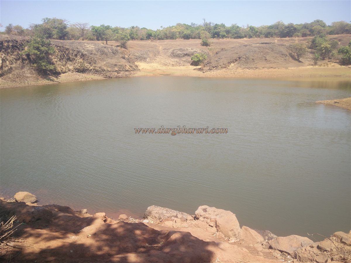
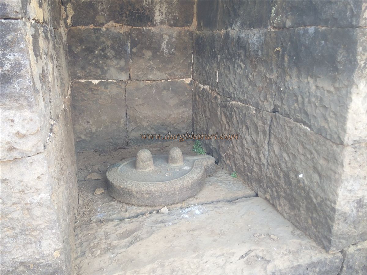
As you follow the wall, to the left is a small stagnant pond. Farther ahead lies a large stone-built reservoir, now dry due to silt accumulation. In the wall beside the reservoir is a small shrine with a sculpted Shivling made from a single stone, showing two Linga. In front is a broken Nandi. Continuing left past the reservoir, you arrive at a temple with a square Samadhi on a raised platform, carved with elephant heads on all four sides and a decorated circular stone on top. The temple houses three Shivlinga and a Nandi. The temple was restored by the Nisargvedh Parivar Sanstha led by Shri Bhagwan Chile, which has been active on the fort since 2008.
This group also discovered two cannons that had fallen into the valley below, which are in the process of being recovered. Behind the temple is a circular stone platform with a central pit of unknown purpose. Continuing left past this, you cross a large water tank and reach the ruins of the palace or royal court. The entrance arch of this four-sided structure still stands. The forest department has attempted some restoration here.
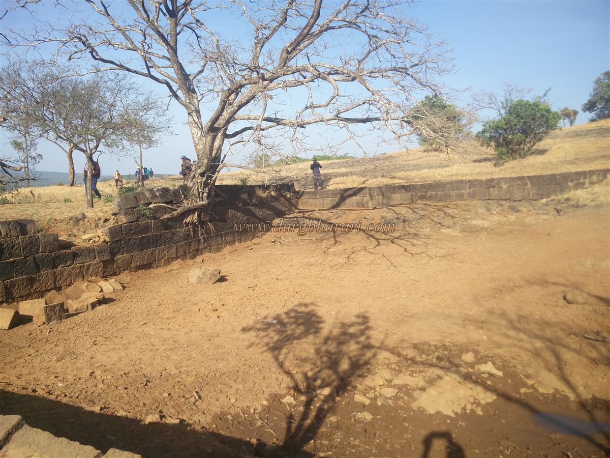
After visiting the palace, return to the Shiva temple and take the paved path turning right toward the valley. Along this path is a small domed Ganesh temple with a stone idol. Retracing your steps brings you to the double gates within the fort wall, completing the tour. The fort measures 2.5 km north to south and 1.25 km east to west, taking six hours to fully explore.
From the fort, you can see Sonagad, Manohar-Mansantoshgad, Bhairavgad, and the distant Konkan region. The fort and its surroundings are densely forested, and home to wild animals like bison, wild boars, and bears, so trekkers must exercise caution.
If visiting from Kolhapur in a private vehicle, you can also see the Mauni Maharaj Math and Bhadrakali temple at Patgaon and the Siddha caves at Tambyachiwadi. During the Chalukya reign in Maharashtra, their feudatories—Yadav in the north and Shilahar in the south and Konkan—governed. Later, both declared independence. Shilahara King Bhoja II declared himself emperor and assumed the title "Mahamandaleshwar." He made Panhala his capital (1175–1212) and built 15 forts for defense, including Rangana in 1187 CE.
In 1209, Yadav King Singhan attacked Kolhapur. His son Jaitrapal extended Yadav rule to the sea, absorbing Panhala and surrounding forts. In 1307, Malik Kafur defeated the Yadavas. By the 15th century, Rangana was under Jakhuray, king of Sangameshwar. On July 19, 1470, Bahamani minister Mahmud Gawan captured the fort, writing that he secured it by God’s grace but at the cost of valour and wealth.
After the fall of the Bahamani Empire, the fort passed to the Adilshahi. During Shivaji’s time, it was under the Sawant of Sawantwadi. A Portuguese letter dated May 5, 1658, notes that Bijapur Rustam Zaman took it from Lakhmajirao Sawant. After Afzal Khan's death and the capture of Panhala in 1659, Rangana came into Swarajya but soon fell back into Adilshahi hands. Shivaji's Konkan officer Rahuji Pandit recaptured it from Rustam Zaman on September 5, 1666. From April 14 to May 12, 1667, Bahalol Khan and Venkoji Bhosale besieged Rangana, but Shivaji himself lifted the siege. Records mention 6,000 hons spent on repairs in 1670–71.
In 1781, Shivaji wrote that Rangana's security ensured the safety of the region; if not held, all the Sawant would overrun Bardesh. Aurangzeb failed to capture the fort. As per the Warna Treaty, the fort was handed to the Karveer Chhatrapati. In March 1708, Shahu Maharaj besieged it, and Ramchandrapant Amatya and Piraji Ghorpade held it for three months until monsoon forced Shahu to retreat. Later, Jivaji Vishram of Sawantwadi betrayed and captured it, but Senasaheb Subha Yashwantrao Shinde retook it after a 2.5-month battle. Twenty-five enemy soldiers died, and the traitors were executed.
In 1781, Khem Sawant laid an eight-month siege but lifted it after pledging loyalty to the Karveer throne. During the 1844 Kolhapur rebellion, the garrison supported the revolt, and on December 9, 1844, the British bombarded the fort, causing significant structural damage. Until 1948, the fort was under Karveer Sansthan and was later integrated into independent India.
© Suresh Nimbalkar
GALLERY