RAJDEHER
TYPE : HILL FORT
DISTRICT : JALGAON
HEIGHT : 2180 FEET
GRADE : MEDIUM
Jalgaon district is generally known for its dry, drought-prone terrain and sparse vegetation. It has very few forts, most of which are ground forts and can be counted on one's fingers. Despite its lack of fame for forts, Rajdeher Fort, also known as Dheri, stands tall in the southern part of the Ajanta mountain range near the border of Nashik and Jalgaon districts. There are two forts with similar names in this region: Rajdher in the Satmala range and Rajdeher in the Ajanta range. Though they share similar names, Rajdeher is relatively lesser known and underexplored compared to the prominent Rajdher Fort.
To visit Rajdeher Fort, one must first reach Rajdeher wadi village at its base. The best travel route from Mumbai or Nashik is via Manmad and Chalisgaon. The distance from Manmad to Rajdeher wadi is about 53 km and can be covered through the Manmad–Nandgaon–Naidongri–Hingane-Dehere route.
...
While Rajdeher wadi is the main base village, the actual trail to the fort starts near the Mahadev temple adjacent to the Gangānandagiri Ashram, which is about 4 km from the village. A rough but motorable road leads up to the temple, although those without private vehicles must walk the distance. The temple has recently been renovated, and some ancient sculptures can be seen within the temple premises.
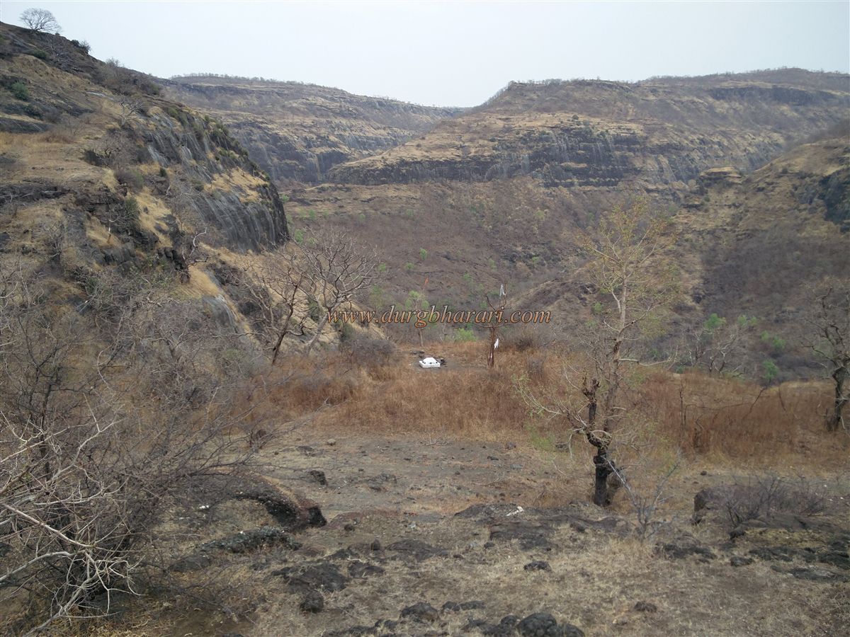
One of the ridges of the fort descends close to this temple, while the other stretches in the direction of Deherwadi. At the start of the trail from the temple, one can see the broken idols of Ganesha and Nandi lying in the open. The path then splits in two: one trail ascends through a gorge between two hills, while the other loops around the right-hand ridge to reach the rear pass and climbs to the top. Either trail can be taken to reach the fort.
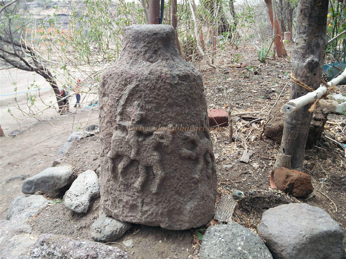
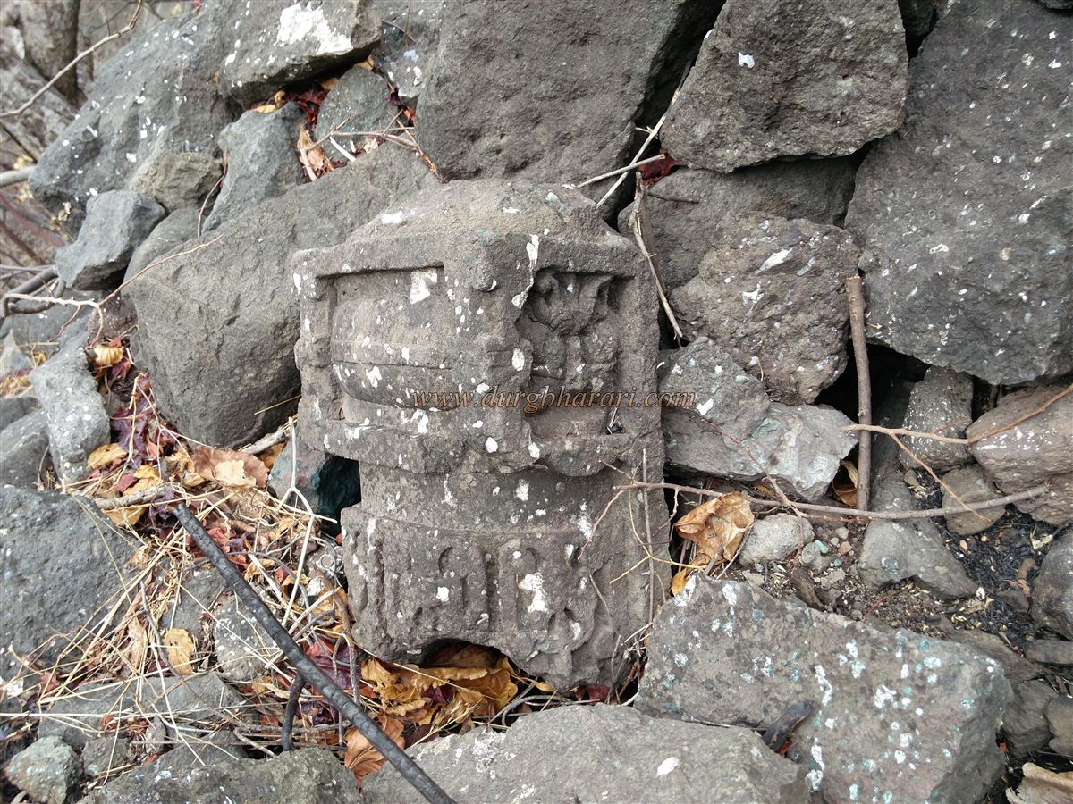
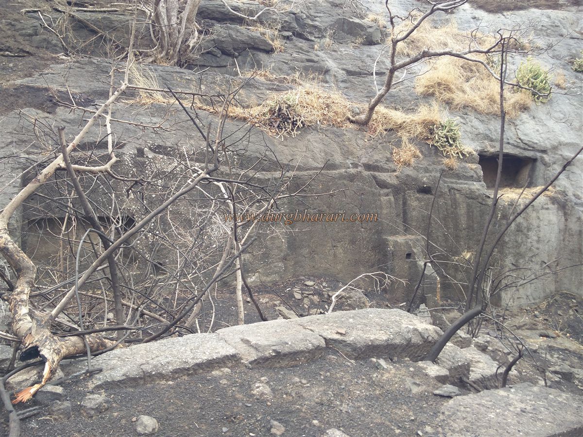
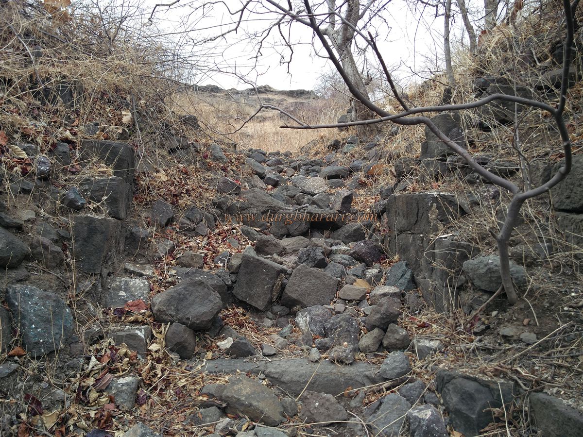
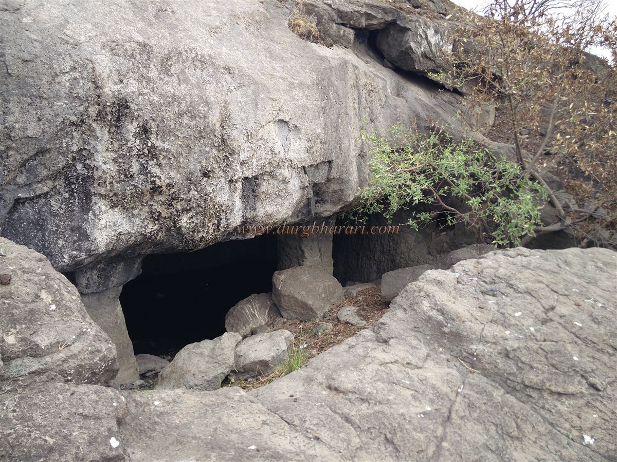
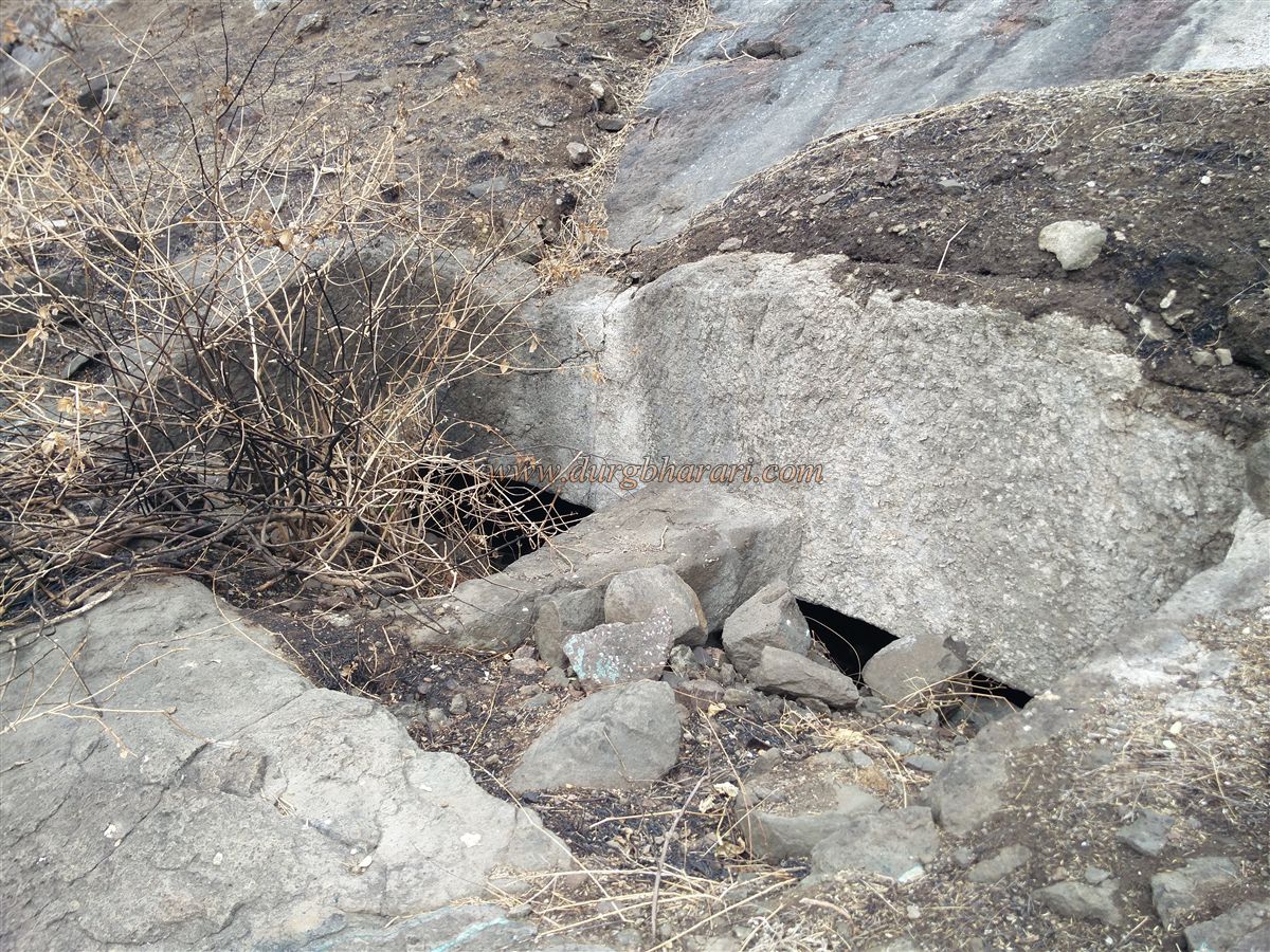
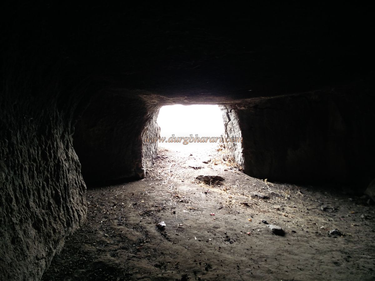
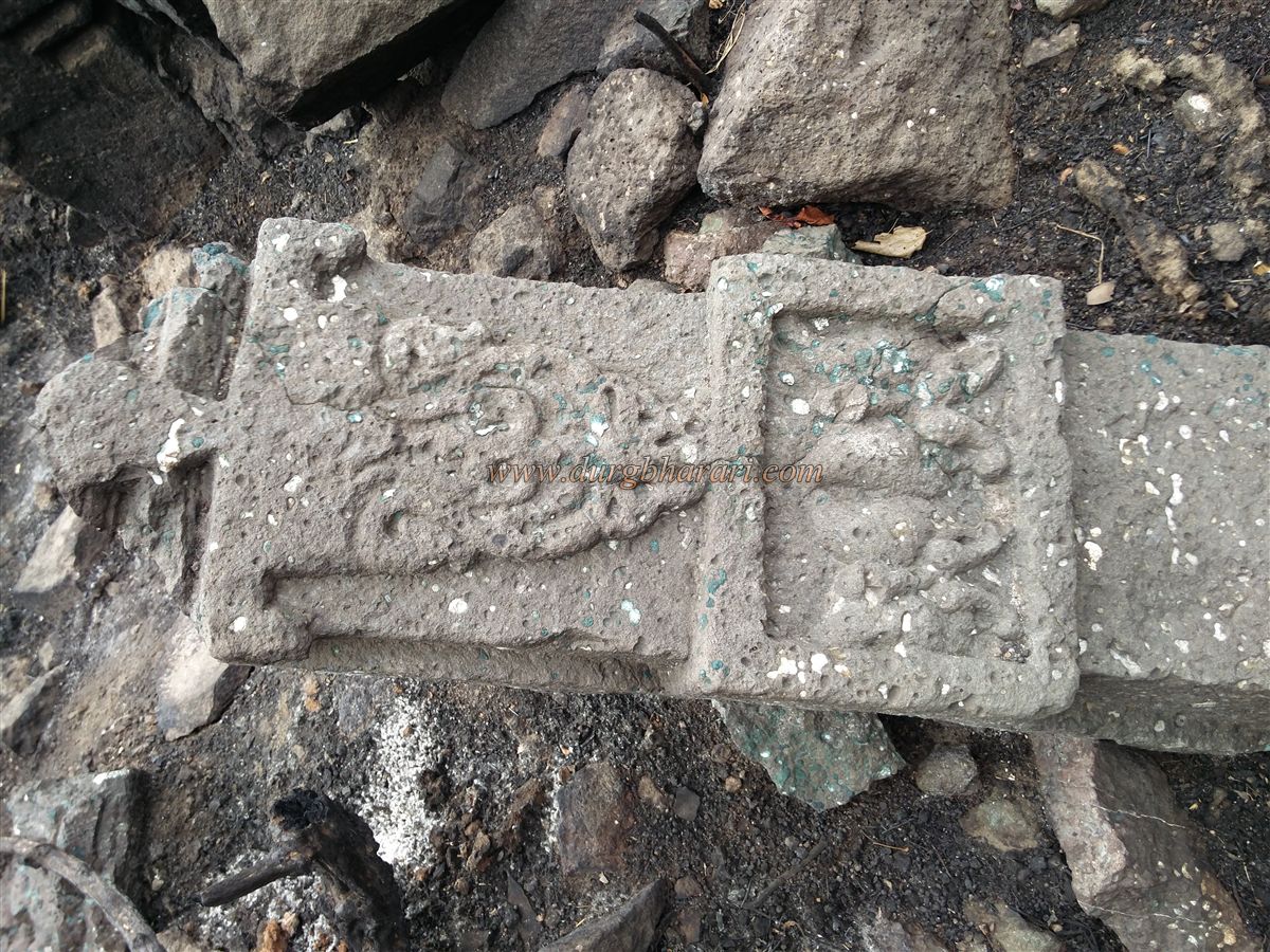
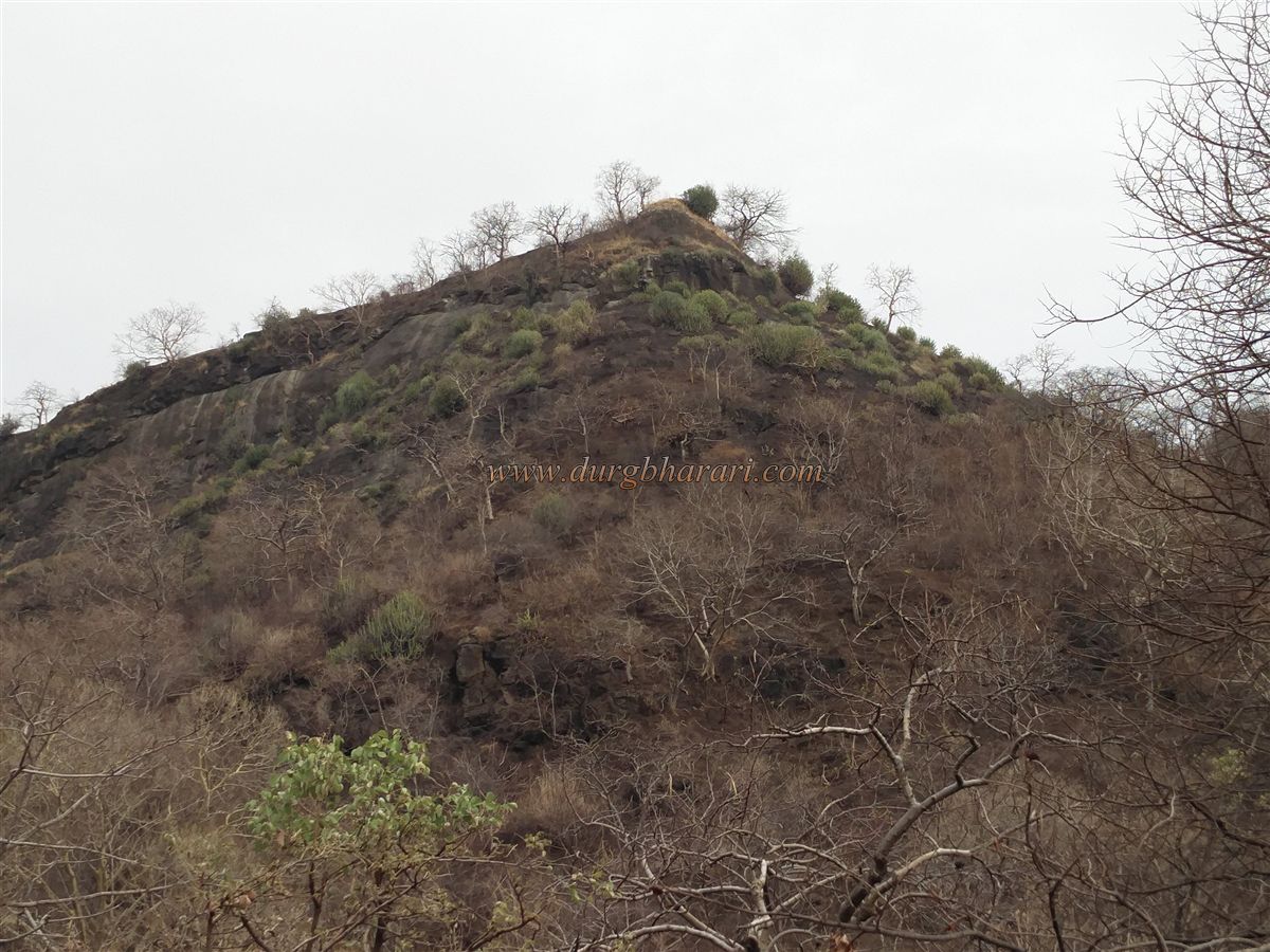
Rajdeher Fort is spread over two hillocks. A well-trodden path leads to the eastern-facing ruined gate located in the saddle between the two peaks in about an hour from the temple. While climbing through the gorge, one can spot remains of broken fortification walls and gateways. On the right side of the gorge, there are rock-cut caves and above them, a small cave and a rock-cut water cistern on the slope. At the pass, carved fragments, ruined pillars with makara (crocodile-shaped) motifs, and detailed stone relics suggest that a temple once stood here. The base rock-cut formation hints at the original ancient entrance to the fort.
Once at the saddle point, it's recommended to first explore the right-hand hill, followed by the left one. From the summit of the right hill, the entire fort can be viewed. The trails from the gorge are exposed and fall within the range of archers from either hill, indicating the fort's strategic design.
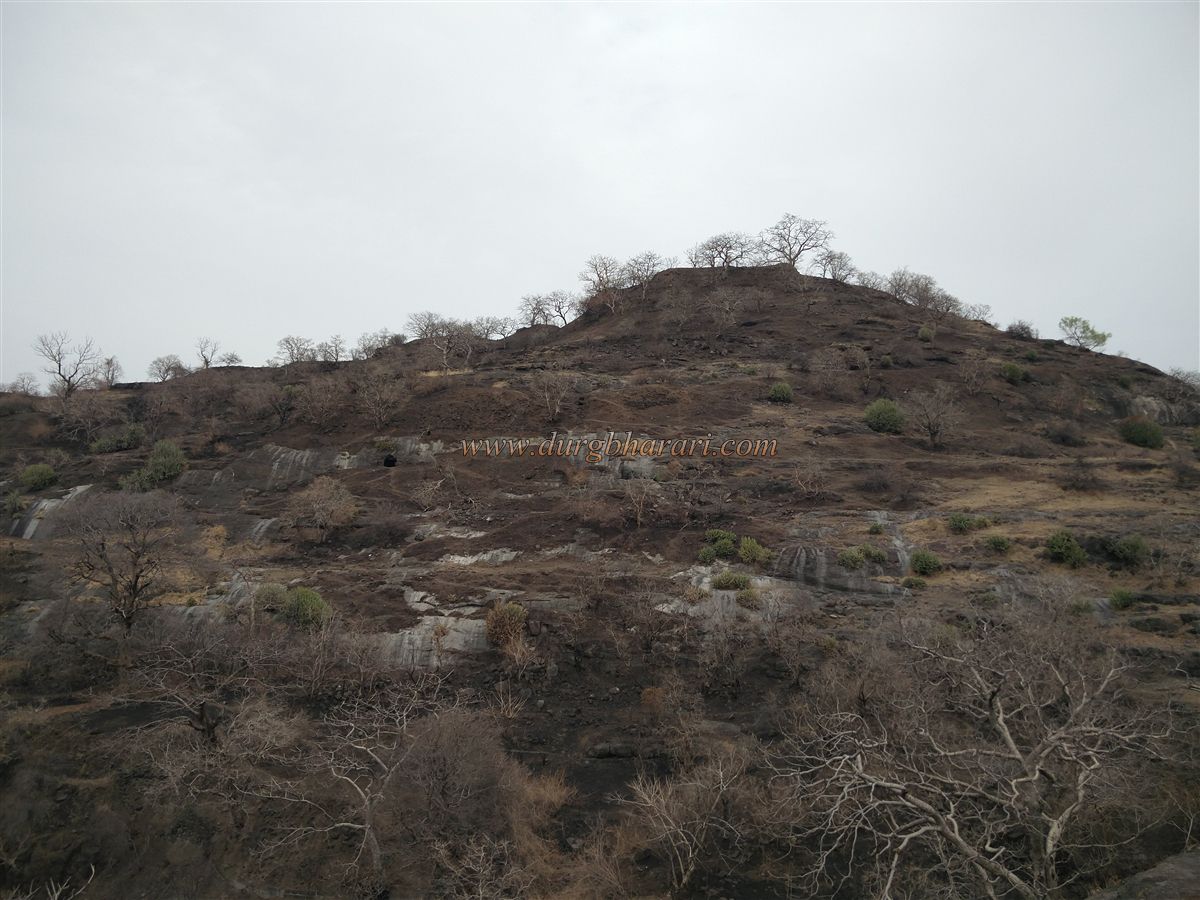
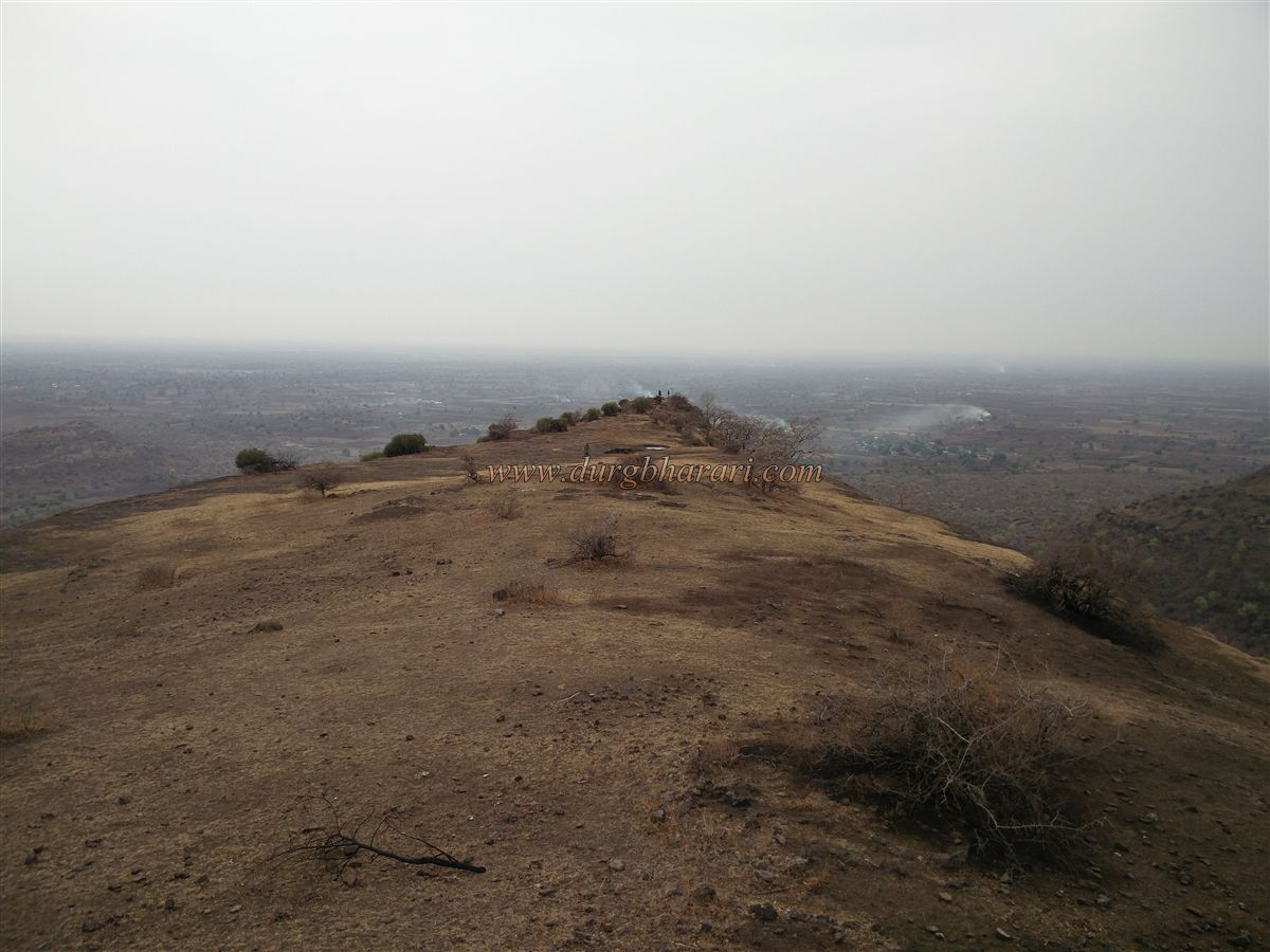
The fort, situated at 2,158 feet above sea level, has a triangular-shaped summit. The terrain is divided north-south into two sections, covering roughly 30 acres. The right hill is smaller, whereas the main fort and citadel (Balekilla) are located on the left.
On the right hill, one first encounters a ruined rock-cut cave, followed by remnants of buildings' foundations. Further ahead stands a bastion facing Rajdeher wadi. To the left of this bastion is a ruined gate through which the path from the right-hand gorge leads. On the way back through the gorge, there is a small stagnant water pond. Opposite the ascent lies another small entrance to the fort, from where a path ascends from the Pinakeshwar Mahadev temple. In all, there are three entrances to the fort. Near the bastion to the right of one gate lies a Muslim-style grave.
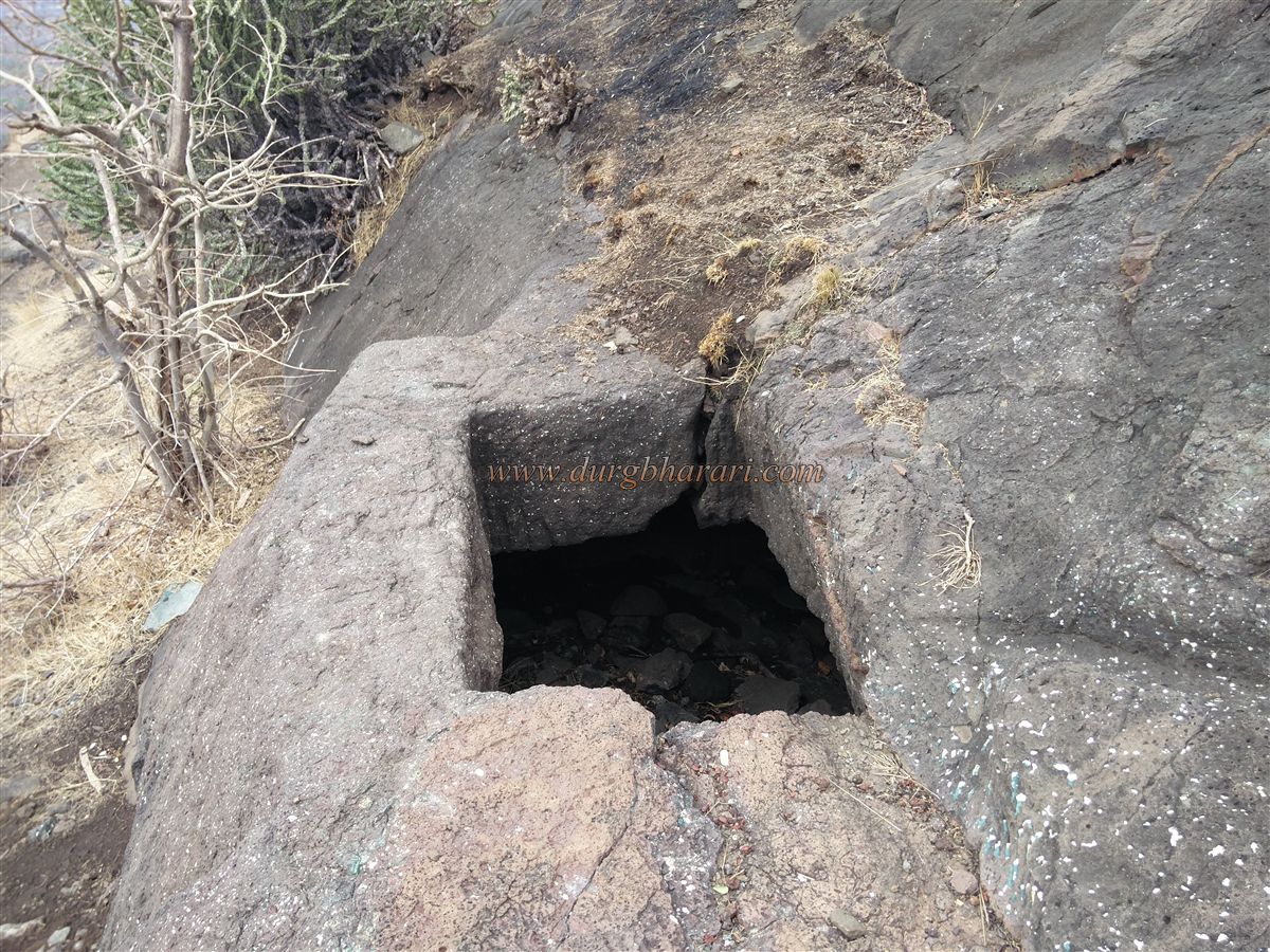
Ascending from the gorge, one can begin exploring the fort from the left side. The first feature is a rock-cut cave supported by two carved pillars. Next is a two-chambered rock-cut water cistern, followed by another cave and another cistern. Below these is a four-pillared structure resembling a cave-cistern. None of these tanks currently hold potable water. Above them are the remains of the citadel's bastion walls.
Proceeding further brings you to the machi (fort terrace), where a small pond and the broken idols of Nandi and a Shivlinga lie exposed. Nearby are rock-carved footprints and around 10–12 small depressions. At the narrow tip of the machi stands a saffron flag, from where one gets panoramic views of Rajdeher wadi and the surrounding region.
On the way to the citadel, a dry water cistern carved into rock is seen on the left. The citadel has five bastions, and portions of its fortification still survive. Entering through the ruined main gate of the citadel reveals the remnants of a wada (mansion) and other structures. Descending toward the gorge entrance, one comes across rock-cut steps and more foundation remains along the slope. The slope on this side also retains sections of the original fort wall. Returning to the gorge completes the exploration of the fort. The entire fort can be explored comfortably in about two hours.
Since there is no drinkable water on the fort, visitors should carry enough supplies. For those wishing to stay overnight, the Gangānandagiri Maharaj Ashram at the base provides accommodation.
Historically, between 1000 and 1216 CE, this region was under the control of the Nikumbh dynasty, whose capital was at Patan. Around 1216–1217 CE, the fort came under the rule of the Yadav. After their fall, it passed into the hands of Allauddin Khilji and later the Farooqui dynasty. In 1601, the fort was included in the jagir awarded to Ramjipant of Bhadgaon by the Mughals for his service during the siege of Ashirgad.
Though the fort is not mentioned during Shivaji Maharaj’s reign, it appears in the list of forts in the “109 Kalmi Bakhar.” It may have come under Maratha control around 1670. In 1752, under the treaty of Bhalki, the area was transferred from the Nizam to the Marathas. In 1762, Madhavrao Peshwa handed over Rajdeher Fort to Vitthal Shivdev Vinchurkar along with a grant of ₹10,000. The sanad (decree) specified that fort repairs were to be managed within this amount without additional funds, and the troop expenses were to be minimized.
In 1764, the Peshwa sent a letter to Narokrushna, the Subhedar of Khandesh, asking him to furnish a report on the fort’s condition and inventory through an official dispatched from Pune. Later that year, when local Jagirdar Jagjivanram and the Pawar brothers of Chalisgaon rebelled, Vitthalrao Vinchurkar, under orders from Peshwa Bajirao II, suppressed the revolt and brought Rajdeher Fort back under control.
During the Third Anglo-Maratha War of 1818, Lieutenant Colonel MacDowell reached the base of the fort via Aurangabad and captured Chandwad Fort on April 10. He then sent a message to the fort commander, Deshmukh Nikam, requesting surrender. The message was rejected by the Arab troops and the commander. On April 11, British cannons began bombarding the fort. On April 12, the Marathas proposed to hand over the fort in exchange for their pending salaries, but the British declined. They only permitted the soldiers to carry away personal belongings and gave them two hours, but this too failed to bring resolution.
Eventually, the British hauled cannon parts up a nearby hill, assembled them by nightfall, and commenced bombardment. One cannonball hit the ammunition store, setting off a massive explosion. Using the cover of darkness, the Maratha defenders retreated. On April 15, 1818, the British took possession of Rajdeher Fort.
Rajdeher is one of the must-visit forts in Jalgaon district. Though reaching it may require a long journey, fort lovers should visit it at least once.
© Suresh Nimbalkar
GALLERY