PRACHITGAD
TYPE : HILL FORT
DISTRICT : RATNAGIRI
HEIGHT : 2240 FEET
GRADE : HARD
Some forts in the Sahyadri ranges are inherently remote, and due to ongoing geographical changes, they are becoming even more inaccessible. Among these, Prachitgad, located on the border of Ratnagiri and Sangli districts in the Sahyadri mountain range, truly stands out as a crown jewel of inaccessibility.
Previously, routes from Patharpunj and Chandoli on the Sahyadri plateau provided access to the fort from the Shirala Taluka side in Sangli district. However, these areas now fall under the Koyna and Chandoli Tiger Reserve, resulting in restricted entry. Even with permission, overnight stays are prohibited, making a same-day return mandatory—something not easily feasible. Therefore, it is advisable to avoid attempting to reach the fort via these routes.
...
At present, the only viable route to the fort is from the Konkan side, starting from the village of Shringarpur, situated at the base of the fort. To reach Shringarpur, one must travel to Kasba Sangameshwar on the Mumbai-Goa Highway, which is approximately 300 km from Mumbai. From Kasba Sangameshwar, a road branches off toward Shringarpur via Kalambaste–Nayari, covering a distance of about 17 km.
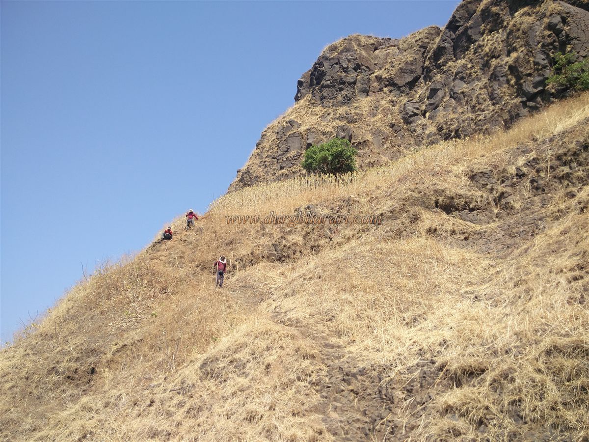
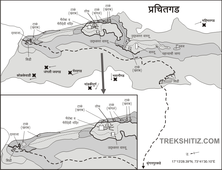
As you enter the village, the north–south spread of the Prachitgad hill behind the settlement becomes visible. To ascend to Prachitgad from Shringarpur, one must undertake a 2,500-foot climb. The ascent and descent, combined with the fort exploration time (1 hour), totals about 8 hours. It is advisable to begin the climb early in the morning to avoid heat, preferably staying overnight in the village the previous day. Meals are available in local homes, and accommodation is possible in the village school or temple.
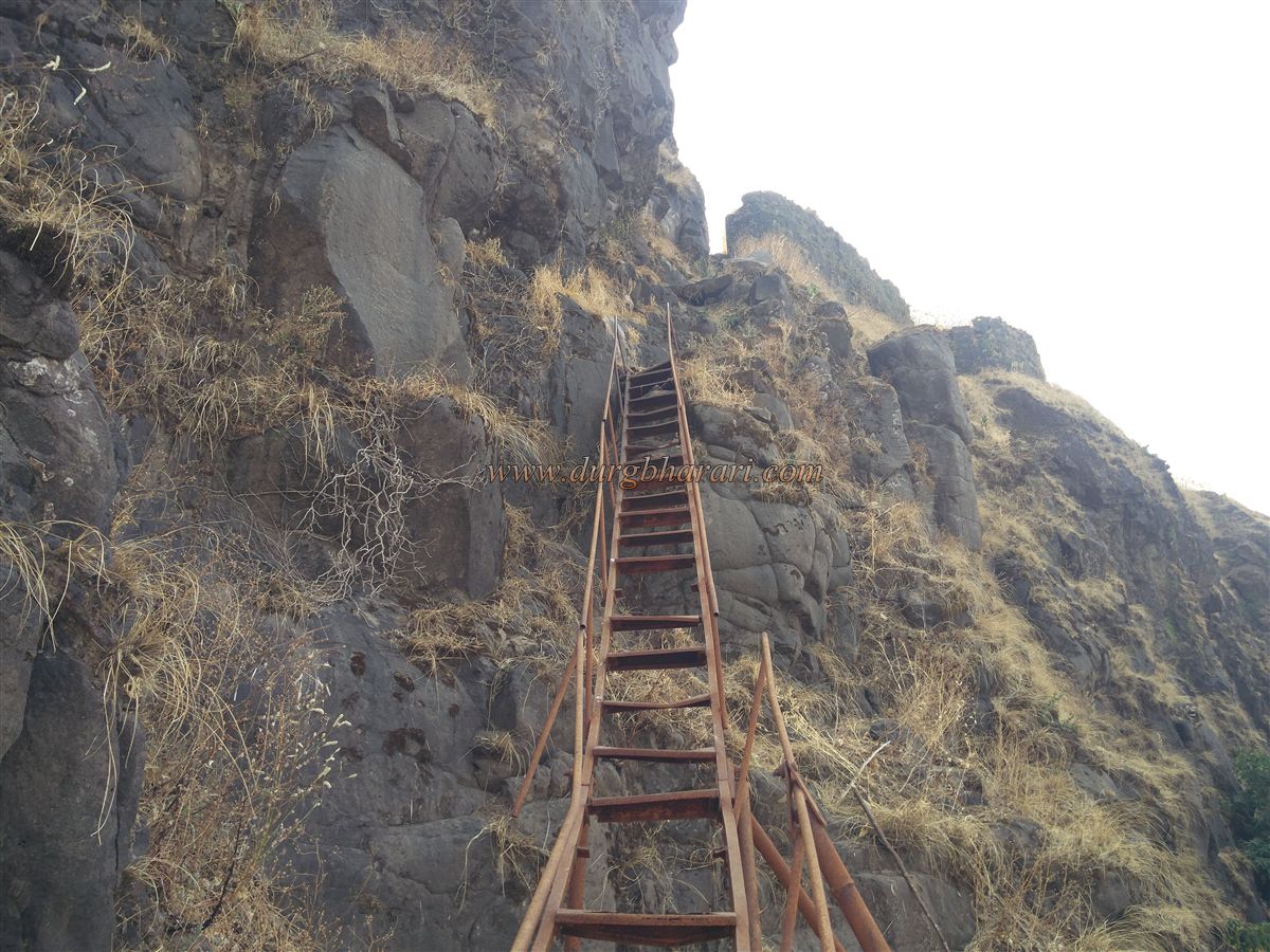
There is no water available en route, so it’s essential to carry an adequate supply from the village. However, the fort’s tanks provide drinkable water throughout the year. The trail is steep and gravelly, so carry minimal luggage. At difficult spots along the climb, six iron ladders have been installed to aid the ascent.
The cement road in the village leads to a cremation ground near a stream, from where a trail begins on the left side of the stream. After about half an hour, you cross the stream again and arrive at the base of a densely forested hill, where the real ascent begins. Up to this point, a guide is needed due to multiple cattle tracks, but beyond this point, a single marked trail leads to the fort. Trail markers guide the way through thick forest. After about an hour of trekking, you reach a plateau from where the fort’s fortifications become visible.
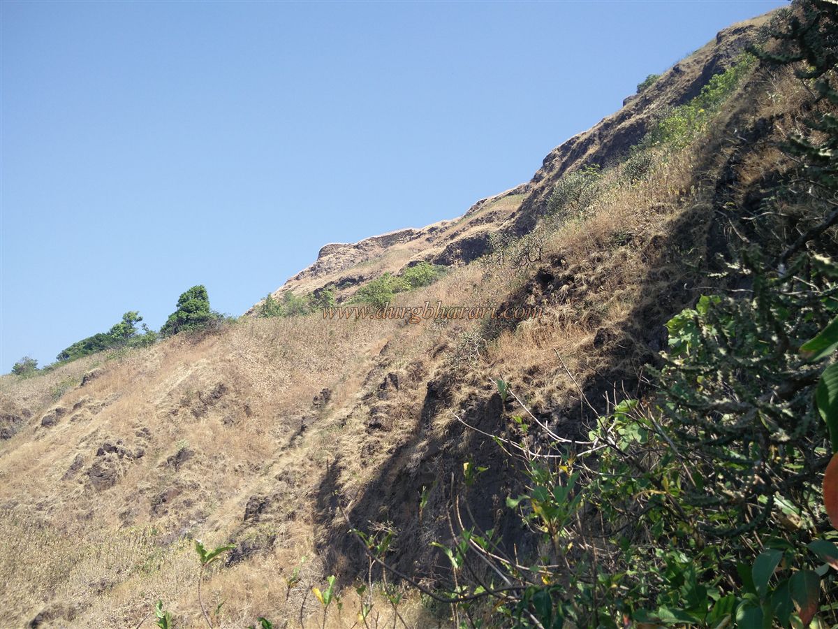
The plateau is on the southern side of the fort, while the trail to the main entrance on the northern end continues from here. A steep climb leads to the rocky slope under the hill. At this point, six iron ladders of various sizes aid the climb. With the cliff to your right and the valley to your left, the path curves northward.
A memorial stone commemorating a trekker who died in an accident en route is found near a waterfall. The path toward the northern tip of the fort is extremely steep and slippery, requiring great caution. To circle the fort and reach the entrance takes around 45 minutes. The northern tip of the fort is separated from the adjacent hill by a 200–250 ft deep ravine.
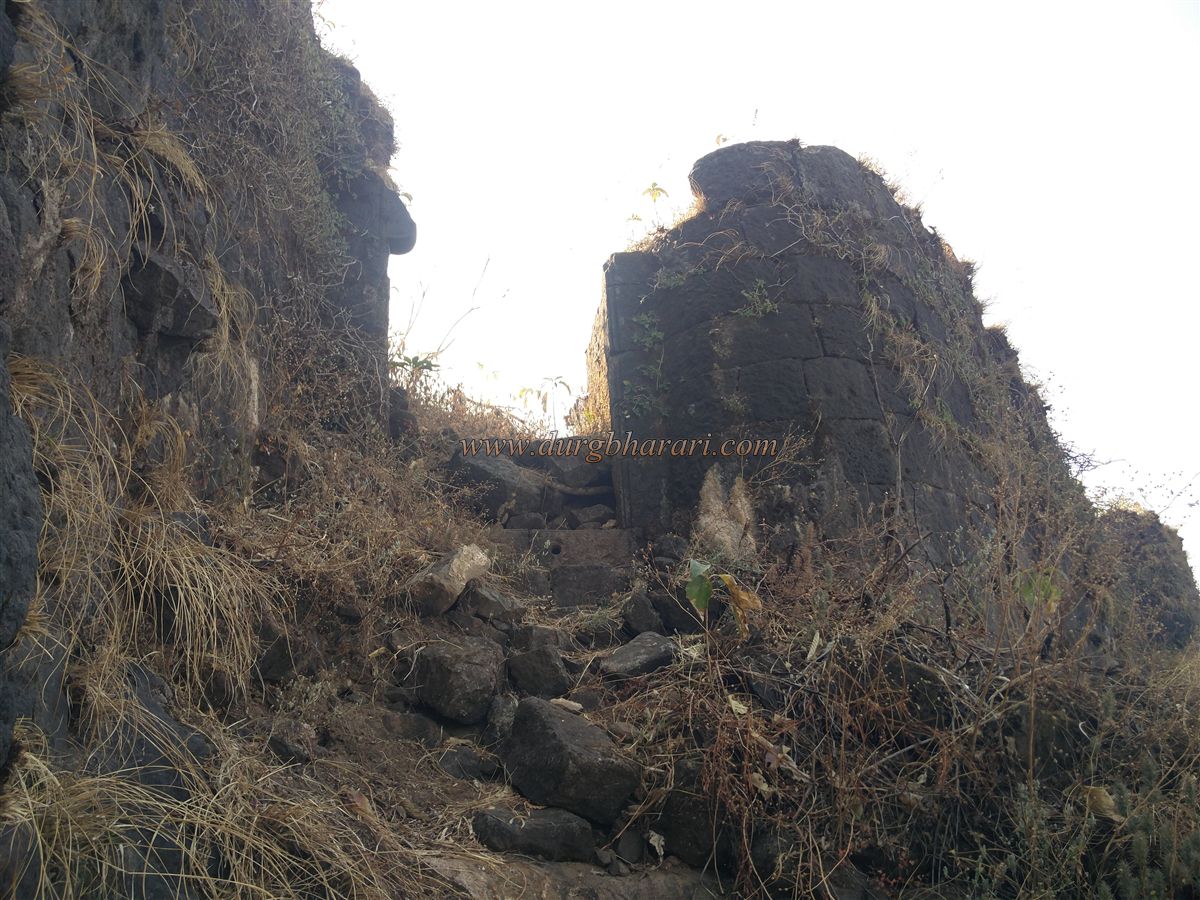
From the forest side, one must descend into this ravine and then ascend toward the fort’s gate. The steps leading up to the northern entrance are destroyed, and a 25–30 ft iron ladder is installed here. However, the ladder is in poor condition with rusted handrails and broken rungs, so one must climb carefully and distribute weight evenly.
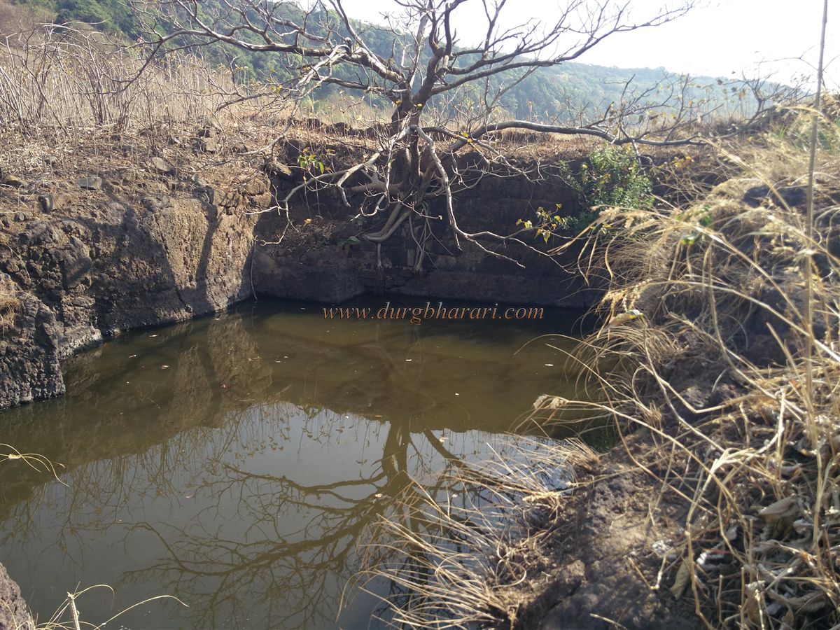
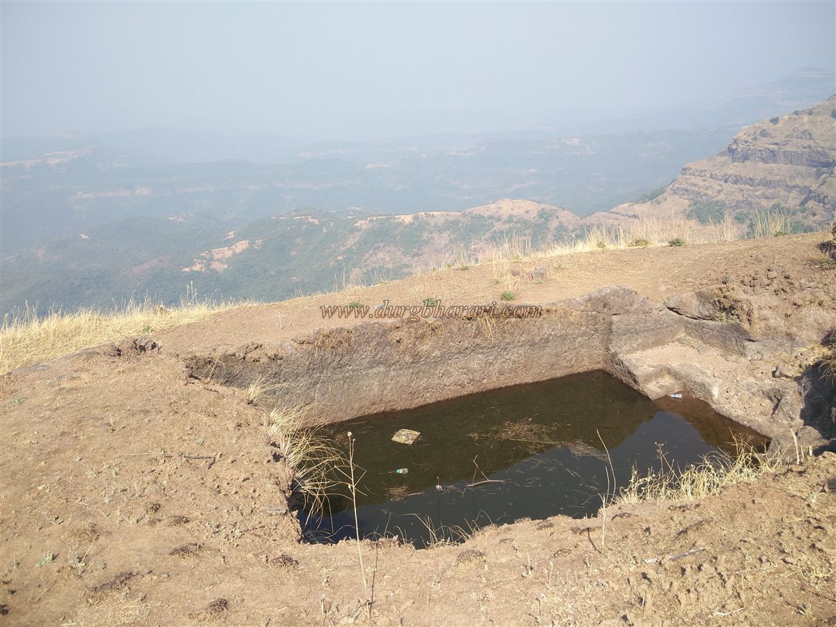
After the ladder, some rock-cut steps lead to the northern gate, built on a steep rock face. The stone frame and adjacent bastion of the gate are still intact, though the arch above has collapsed. Just inside the entrance lies a water tank filled with greenish water. The base is rock-cut, while the upper structure is built with dressed stone.
To the left of the gate stands a large bastion overseeing paths from the plateau and nearby mountain passes. It is partly covered in vegetation and earth. The bastion includes two arches and features firing slits (jangyas) for musketry.
Returning to the water tank, one path ascends uphill, while a narrow trail turns left along the fort wall through dense karvi shrubs. This trail leads to a small rock-cut tank by the ramparts. The tank is filled with water, but silt has started to block its mouth. Near the tank, the ramparts remain well-preserved.
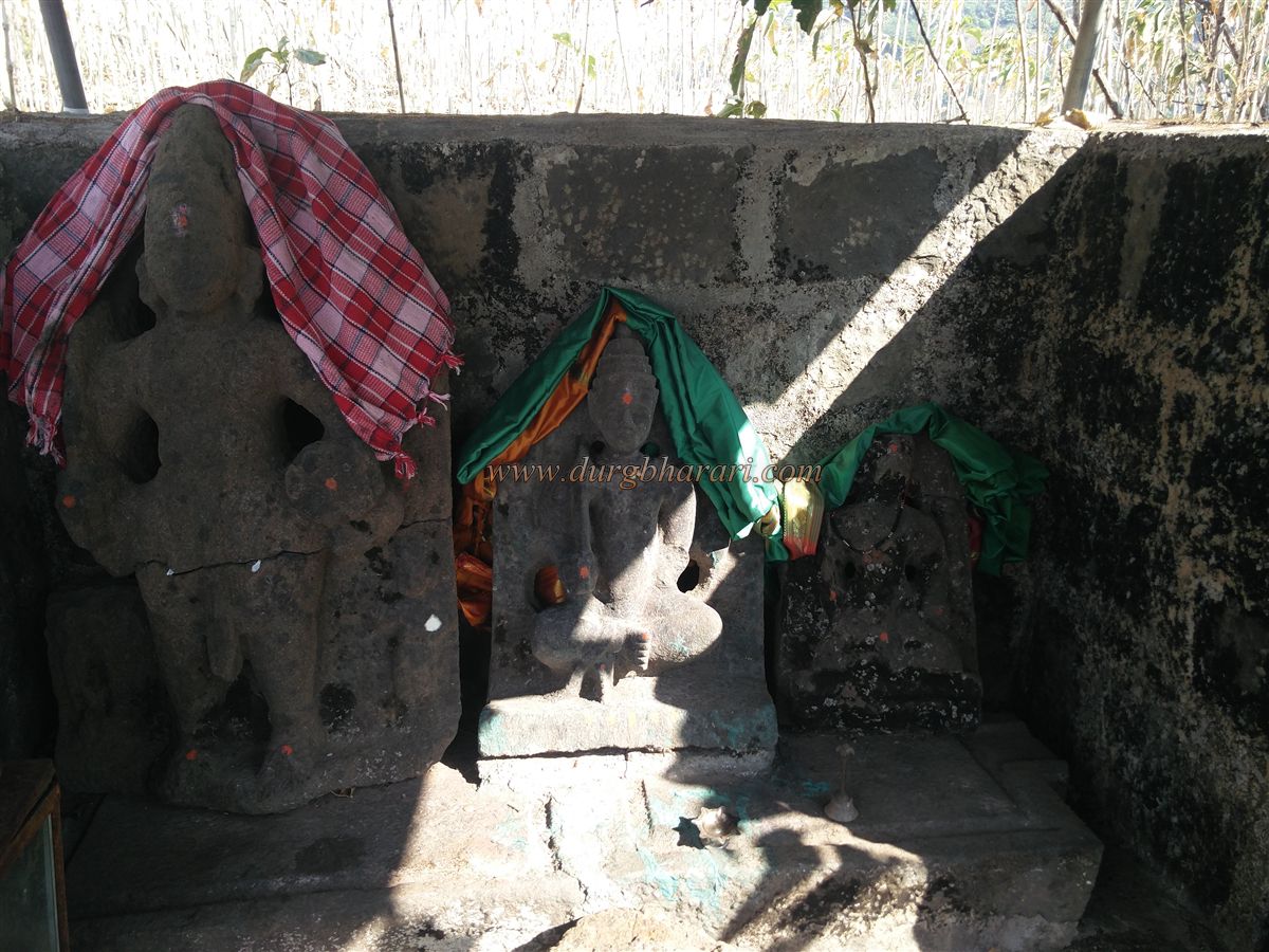
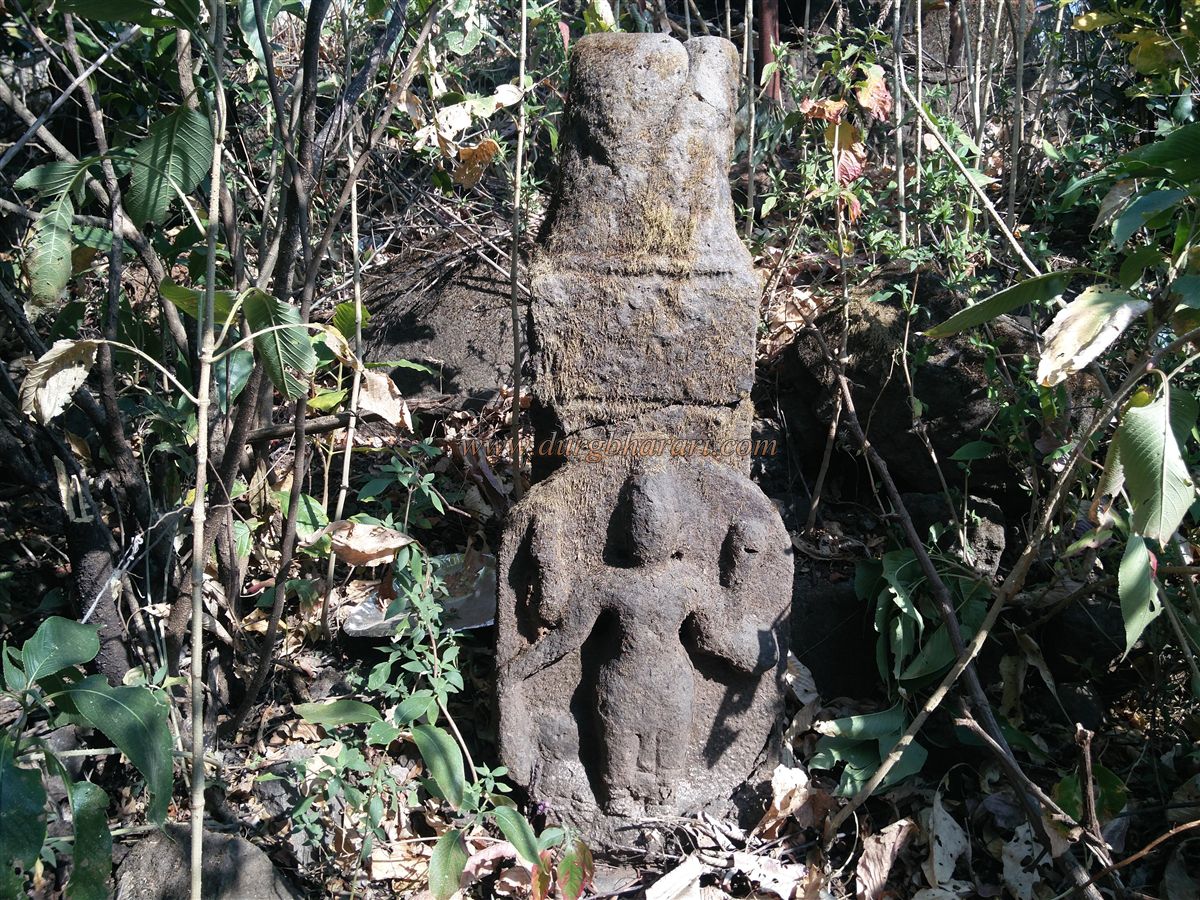
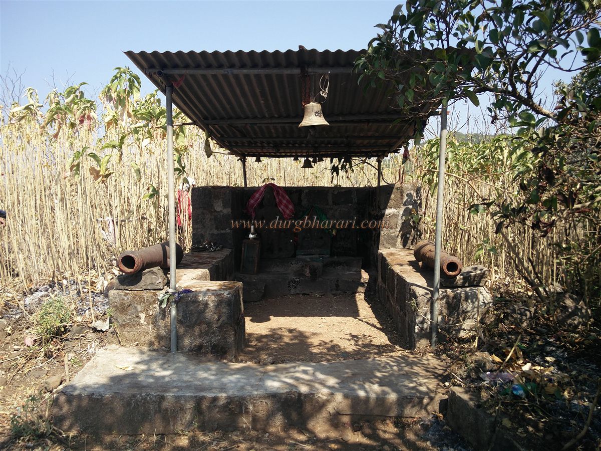
Backtracking to the main trail, a short ascent leads to the highest point of the fort, where the temple of Bhairi Bhavani is located. This temple stands at 2,575 ft. above sea level, and the fort’s summit spreads north to south. The deity’s images—one of Bhavani and two of Bhairav—are worn down. A small deepmala (lamp tower) stands in front of the shrine, along with a stone idol.
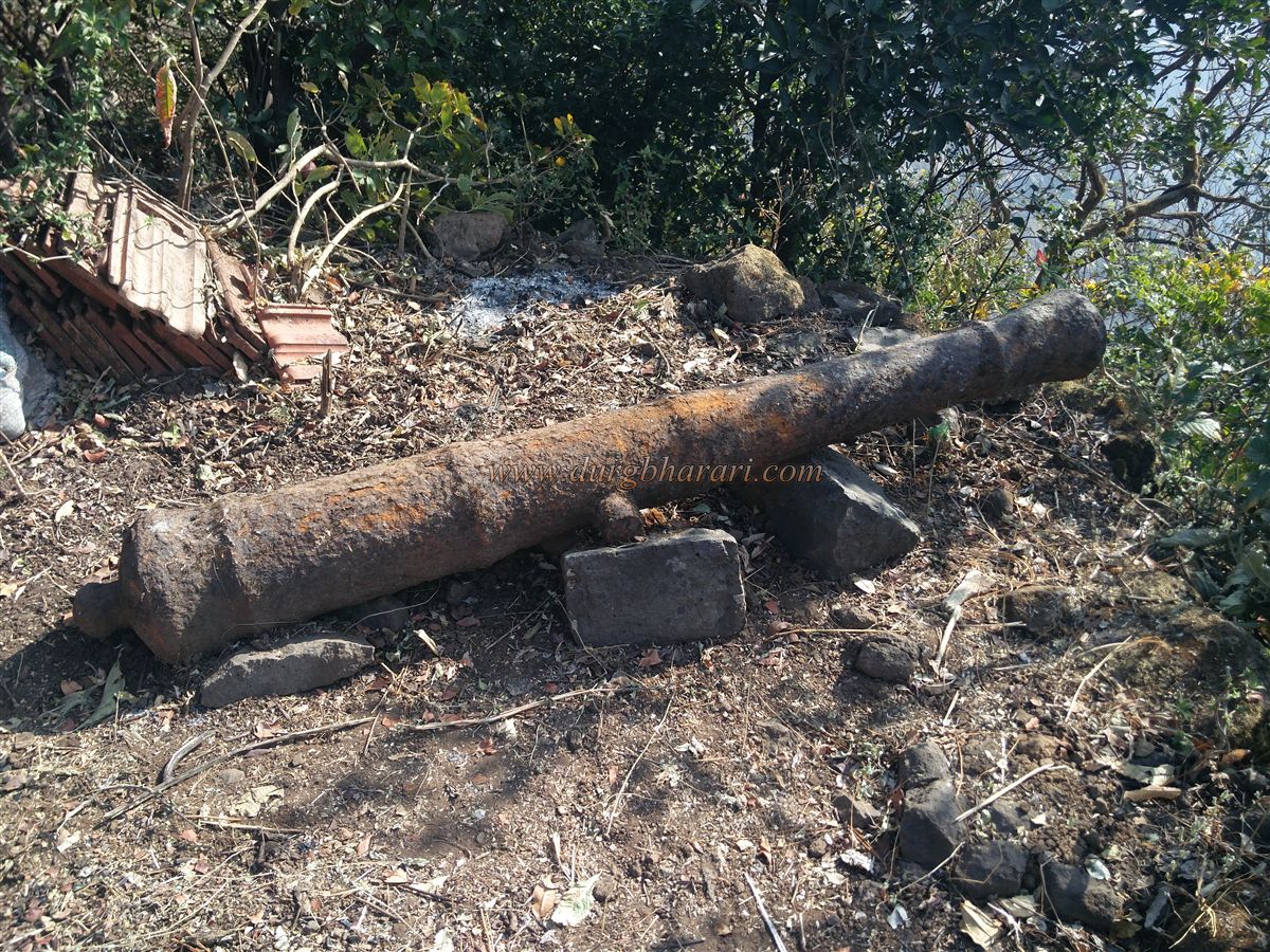
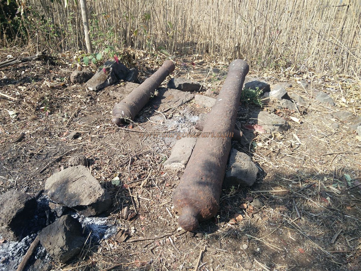
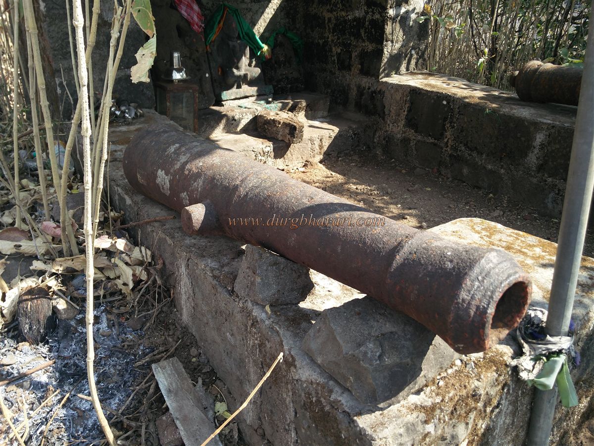
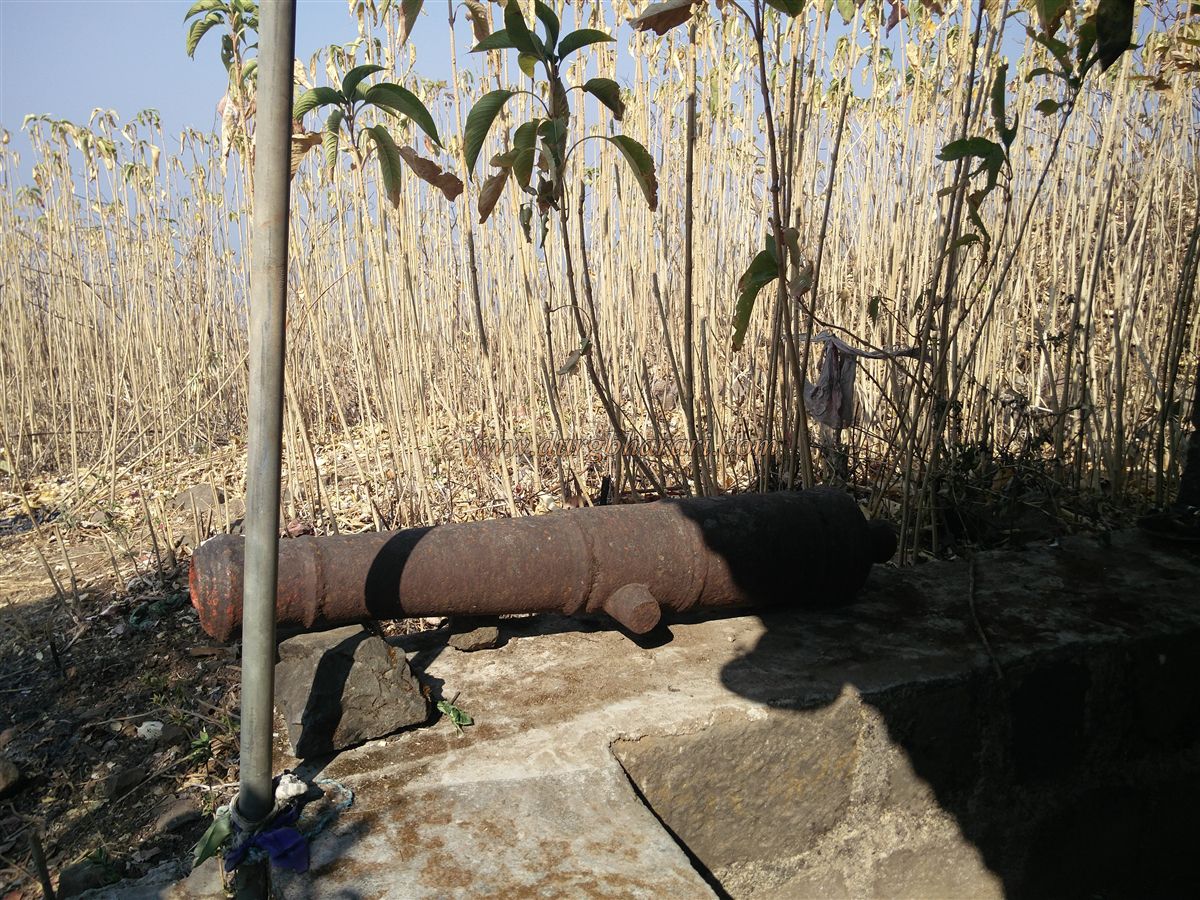
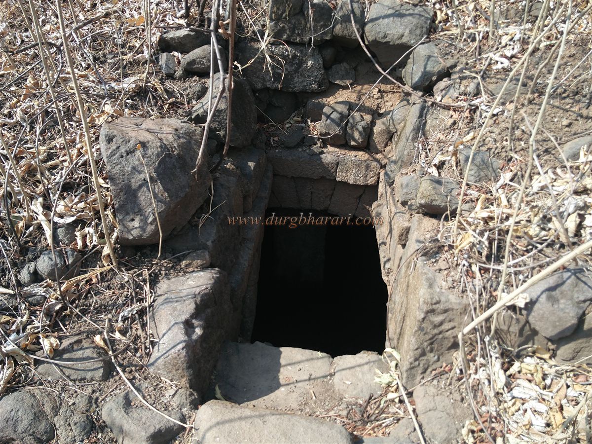
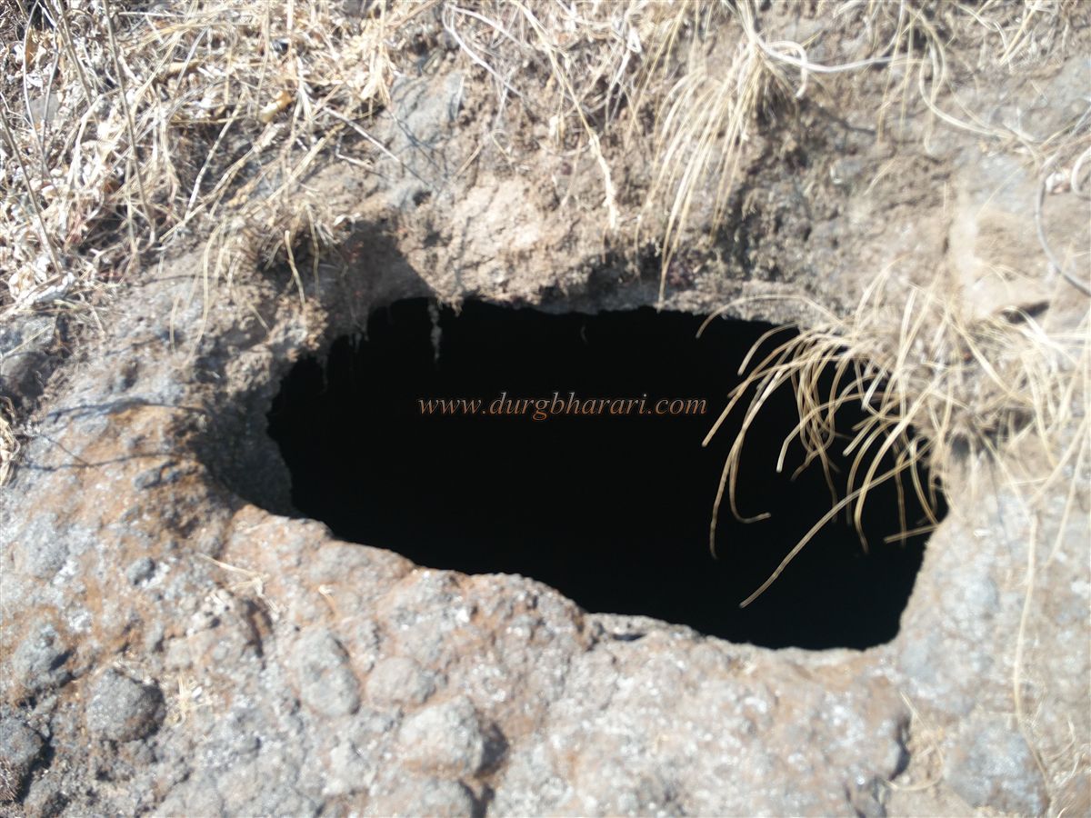
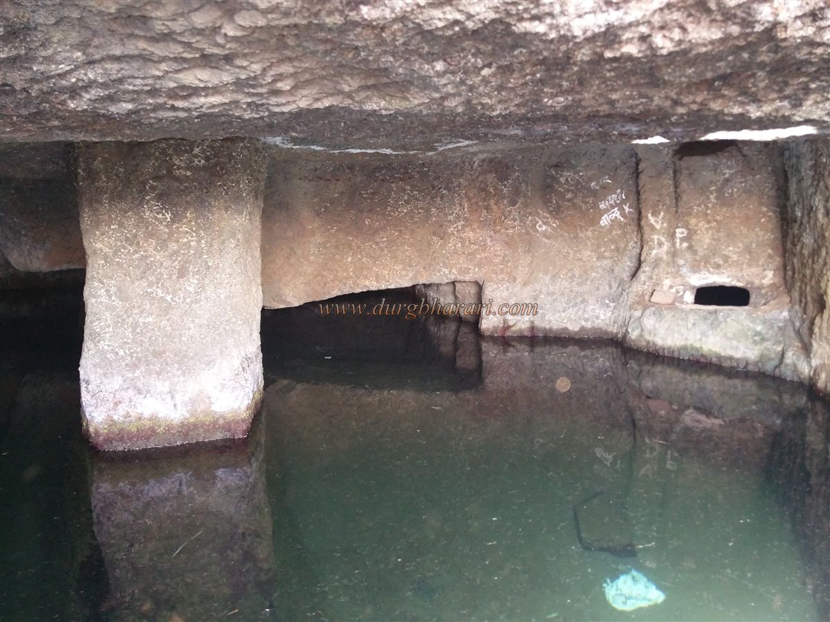
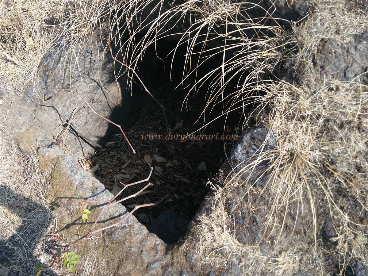
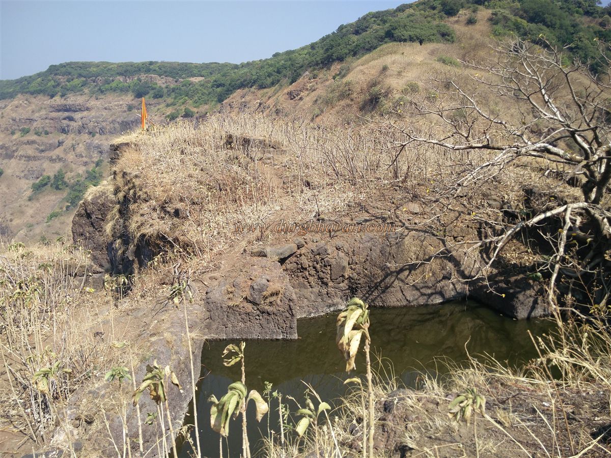
Scattered around the temple are five small cannons. Overgrown karvi bushes conceal multiple ruined foundations. A trail through these shrubs leads to a descending path with steps, where you find five underground water cisterns carved into the rock—three on the right and two on the left.
The rightmost cistern has a well-crafted entrance and carved steps inside. These three tanks are interconnected and contain potable water. Of the two on the left, one is deep, while the other is barely begun. To protect the tanks from sediment, a stone wall is built uphill.
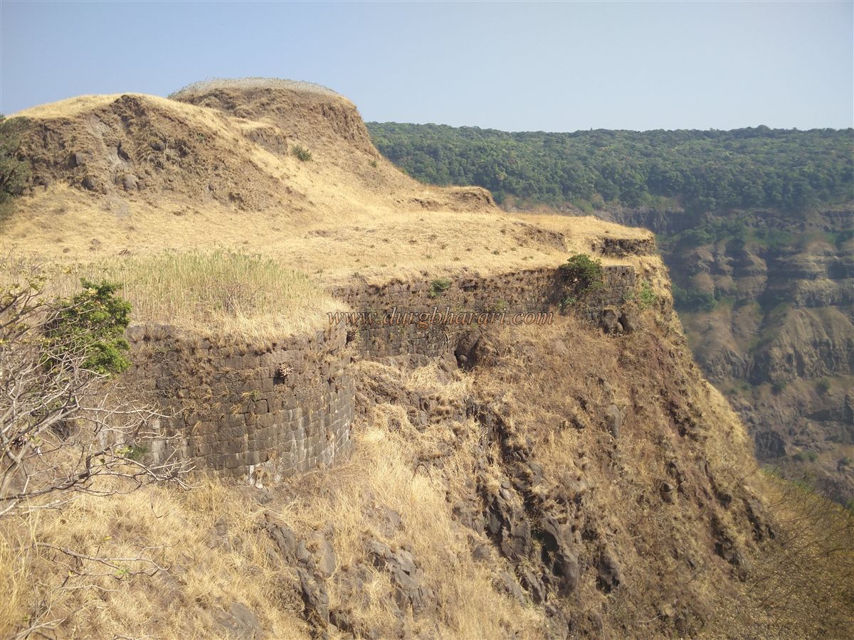
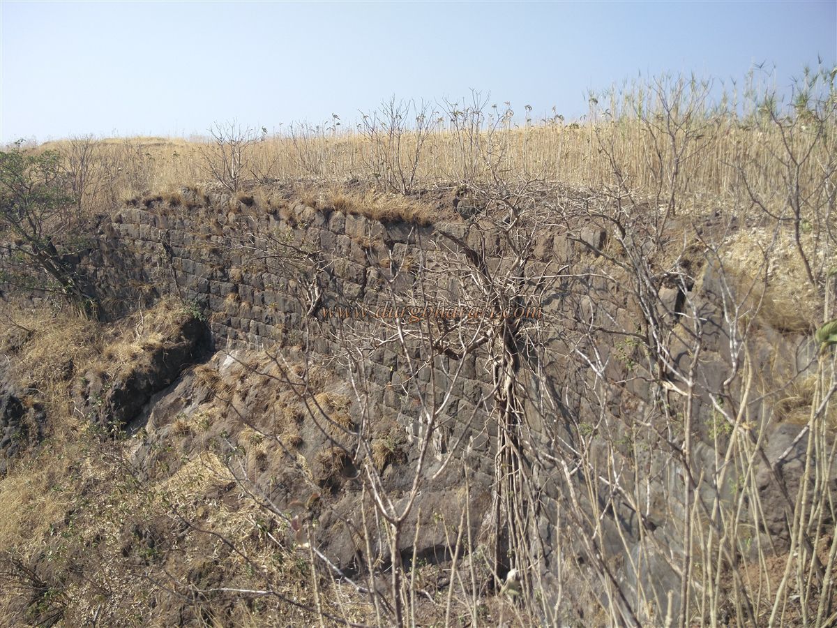
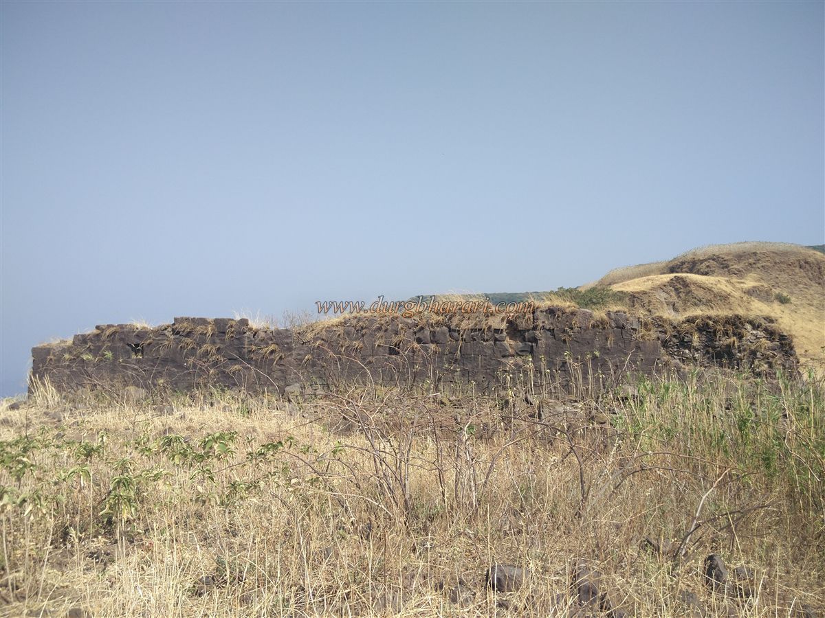
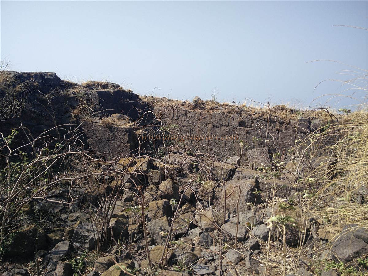
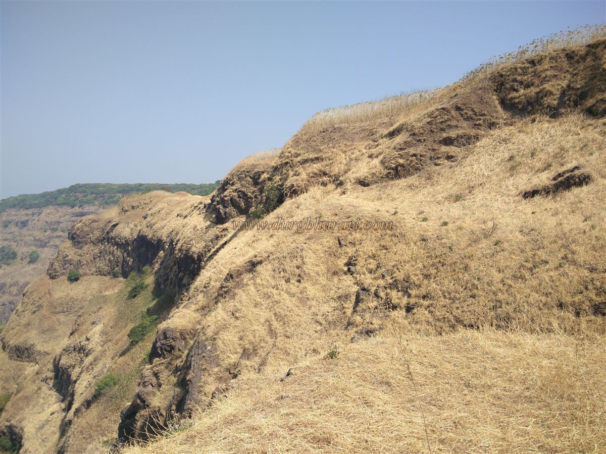
Moving further, one finds the curved ramparts and bastions along the cliff. The fort’s area is around 4–5 acres, with little flat land apart from this portion. A large umber tree offers the only shade and is ideal for a meal break.
As you proceed south, you reach a small elevated spot with a ruined foundation, possibly the remains of an important structure. Near it lies a large, mossy water tank, likely once used for construction work. Beside this is a massive ruined building, probably the fort commander’s residence. Behind it is another ruined plinth and a silted-up tank.
To the southern tip of the fort, one can see well-preserved ramparts and lookout points. Some areas are sculpted like bastions, with two small rock-cut tanks visible nearby—possibly quarries for stone, as partly-cut blocks remain in one of them.
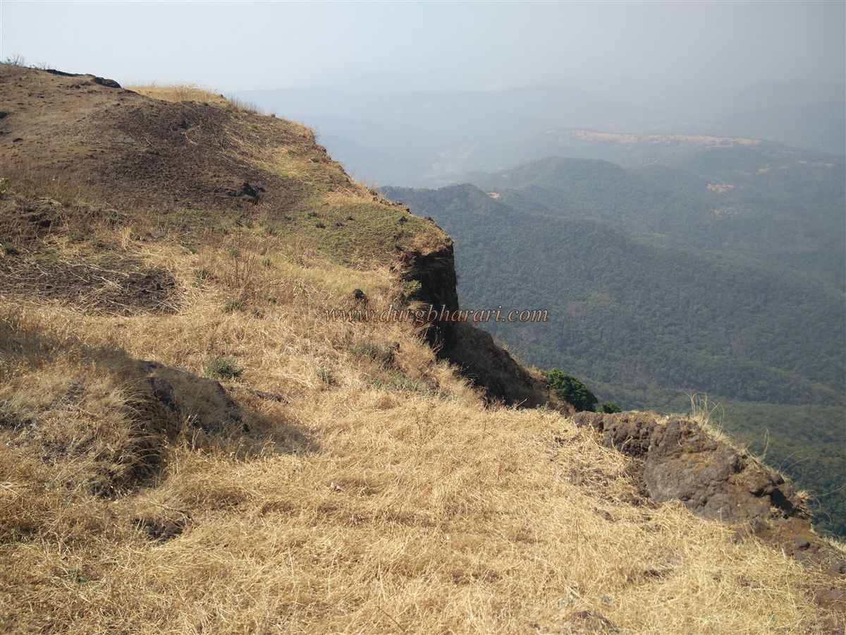
From the fort’s edge, one can view the Chandoli Wildlife Sanctuary and vast stretches of Konkan below. After this exploration, returning along the original path brings the fort tour to an end. A full circuit takes around one hour.
Historically referred to as Uchitgad or Prachitgad, the fort was built to monitor the Tivre and Rede Ghats connecting Konkan to the Deccan plateau. Though exact construction details are unknown, the rock-cut tanks and cisterns suggest a pre-Shivaji era origin.
Prachitgad history becomes prominent with the Surve family of Shringarpur. Despite the larger region being overrun by foreign powers, small independent kingdoms like the Surves survived, likely with Prachitgad as a strategic base.
When Bahamani commander Malik Uttujar invaded the area, the Surves, in alliance with the Mores, cleverly lured him near Vishalgad and destroyed his army. Later, the Surves became Adilshahi vassals.
In 1660, as Shivaji Maharaj moved through Konkan, the ruler of Palwan, Jaswantrao Dalvi, fled from Mandangad and took refuge with the Surves in Shringarpur. When persuasion failed, Shivaji attacked and captured Shringarpur on 29 April 1660. Tanaji Malusare simultaneously captured Prachitgad. Surve’s administrator Pilaji Shirke accepted Maratha rule and was given responsibility for repairing local Ghats.
Between 1664–65, Pilaji’s daughter Jiubai (aka Rajasabai or Yesubai) was married to Sambhaji Maharaj, and Shivaji’s daughter Rajkunwarbai married Pilaji’s son Ganoji Shirke.
During the southern campaigns, Shivaji appointed Sambhaji as the governor of Shringarpur, where he stayed for nearly two years. Here, Sambhaji composed the Sanskrit text "Budhbhushanam", underwent the Kalashabhishek ritual, and his daughter Bhavanibai was born.
Prachitgad was likely visited by Sambhaji during this period. Later, the fort witnessed the infamous capture of Sambhaji by Mukarrab Khan at Sangameshwar, who was then transported via the Male Ghat route. Prachitgad stood silently as a witness.
The fort is also mentioned in the 1710–12 treaty between Chhatrapati Shahu Maharaj and Ramchandrapant Amatya. In the final days of the Maratha Empire, on 10 June 1818, British officer Cunningham took the fort from Killeder Chhatursingh, destroying the gate and steps in the process.
Note: Avoid visiting Prachitgad during the monsoon or the two months that follow. Also avoid it in peak summer. Inexperienced trekkers should not attempt the climb without a guide or experienced companion.
© Suresh Nimbalkar
GALLERY