PRABALGAD
TYPE : HILL FORT
DISTRICT : RAIGAD
HEIGHT : 2460 FEET
GRADE : MEDIUM
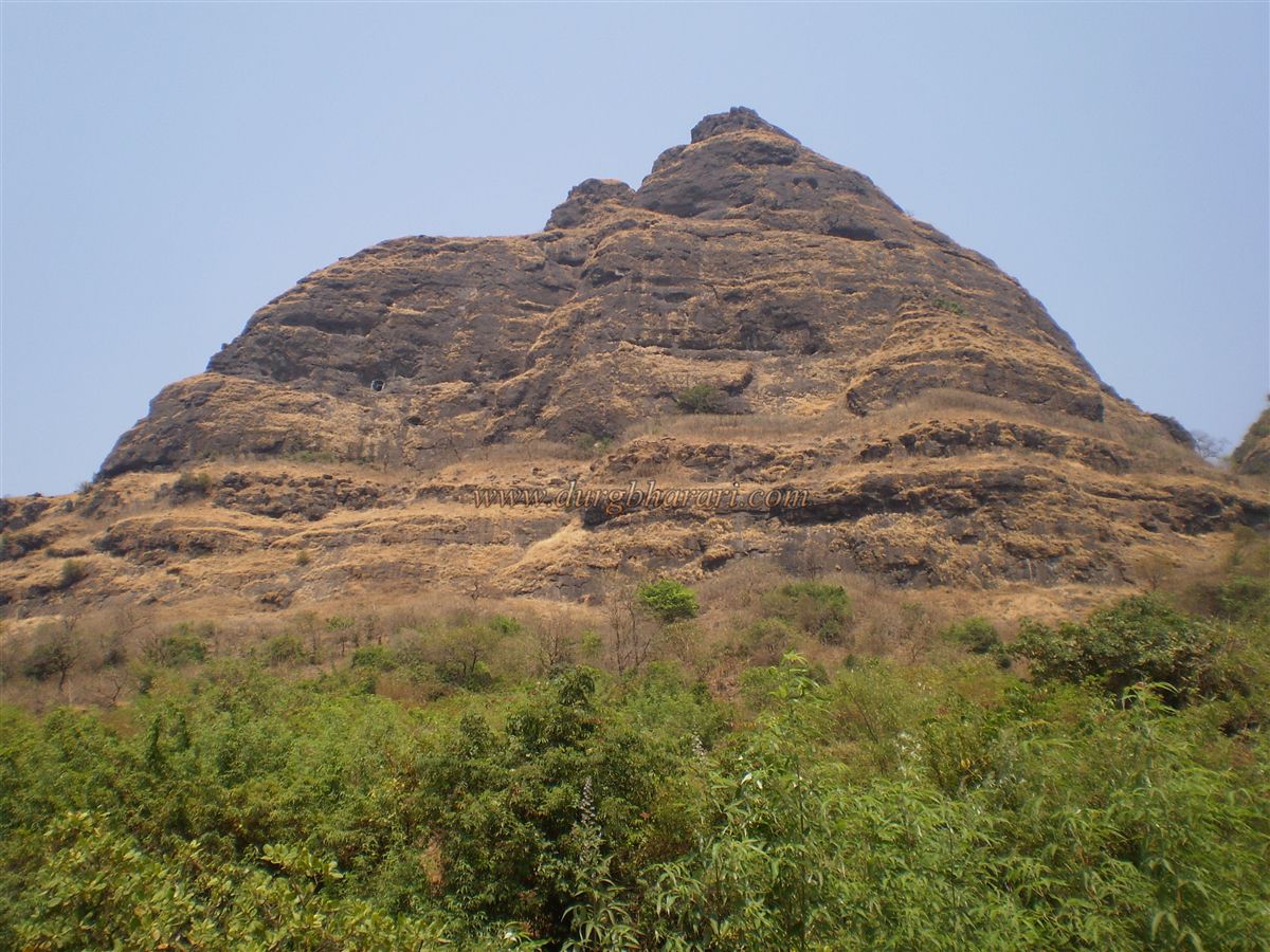
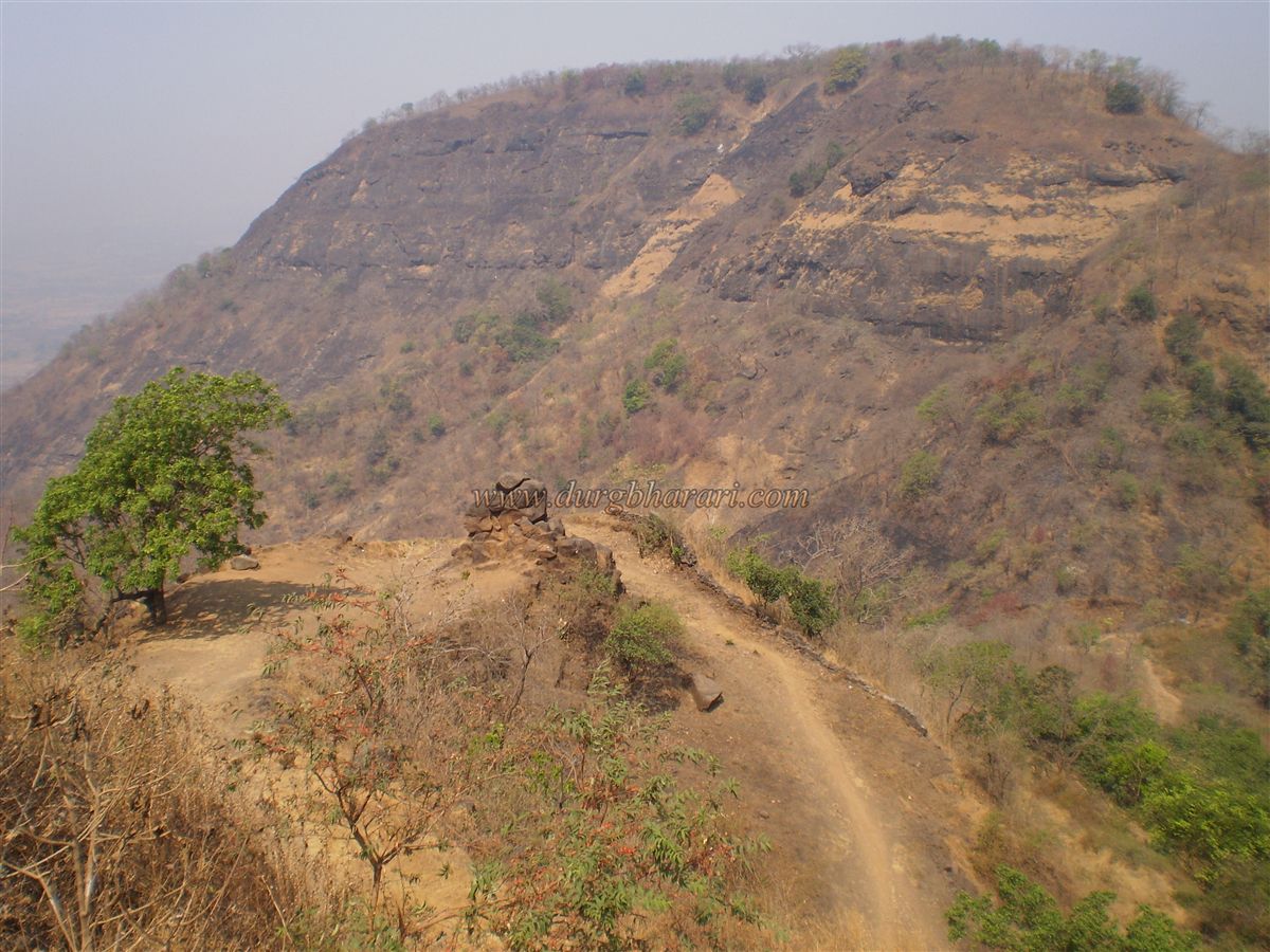
While traveling between Mumbai and Pune, a conical-shaped peak and a neighbouring mountain with a broad plateau easily catch the eye. This twin formation is none other than Kalawantin Durg and the Muranjan Fort, also known as Prabalgad. These two are separated by a col. To reach Prabalgad, one must take a turn at Shedung on the old Mumbai-Pune highway. The village of Thakarwadi, located at the base of the fort, is about 14 kilometres from Panvel. From Panvel, one can hire a six-seater rickshaw to reach Thakarwadi. Although there is a bus service between Panvel and Thakarwadi, it’s not very convenient.
As the name suggests, this robust and commanding fort was a significant location during Shivaji’s time, covering a vast area. The fort is divided into two parts: the Machi (plateau) and the Balekilla (citadel).
...
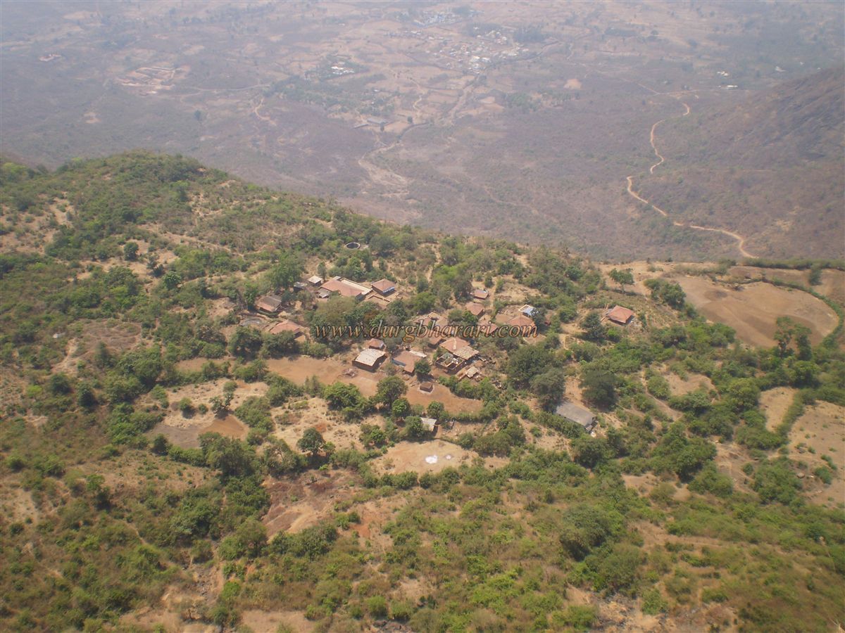
The Kalawantin pinnacle and the citadel are located on the Machi, making Kalawantin essentially a part of Prabalgad upper fort. Around 20–25 houses are found on the Machi, and a dirt road was constructed by the Forest Department to reach the hamlet. Until 2006, jeeps could reach up to Trunk, just before the hamlet, but the massive floods that year washed away much of the road. Since then, it has not been repaired and has turned into a footpath.
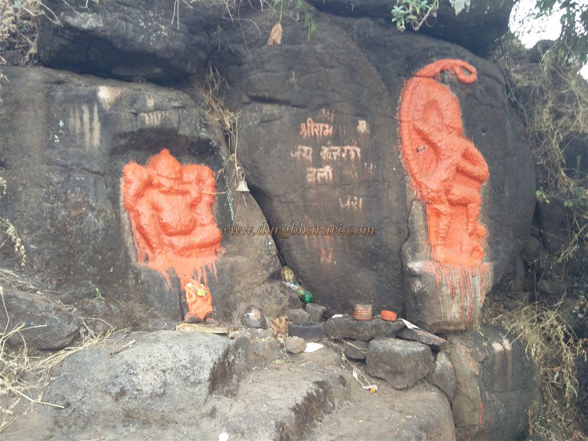
After about 45 minutes of trekking, one comes across a ruined bastion, a few steps, and a platform nearby. This spot, once distinctly visible until 2010, is now overshadowed by a built-up eatery. It’s believed that the first gate of the fort once stood here. The path from the base ends here. Nearby are rock-carved idols of Ganesh and Hanuman. After offering respects, one enters the Machi. Keeping the Kalawantin pinnacle in view, a 15-minute walk leads to Prabal Machi village. The entire climb from the base takes around one and a half hours. On the right side of the Machi lies a ruined temple of Shiva.
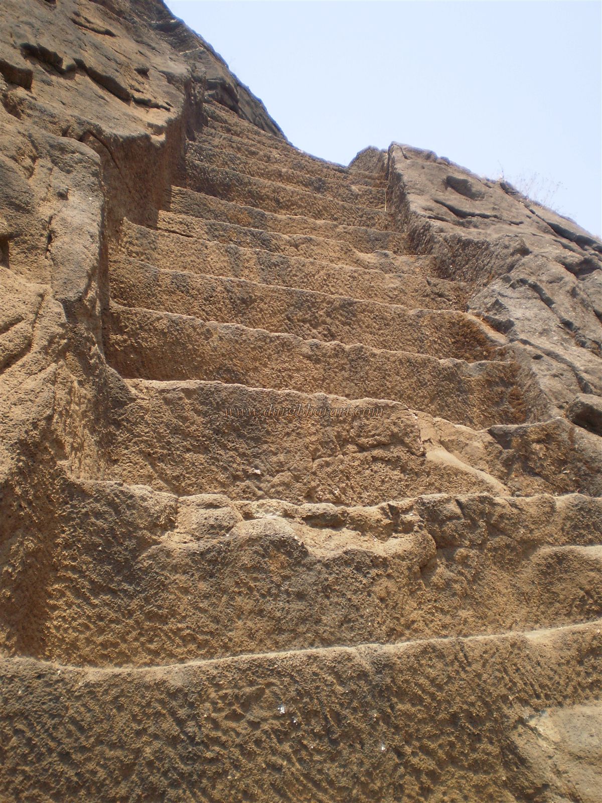
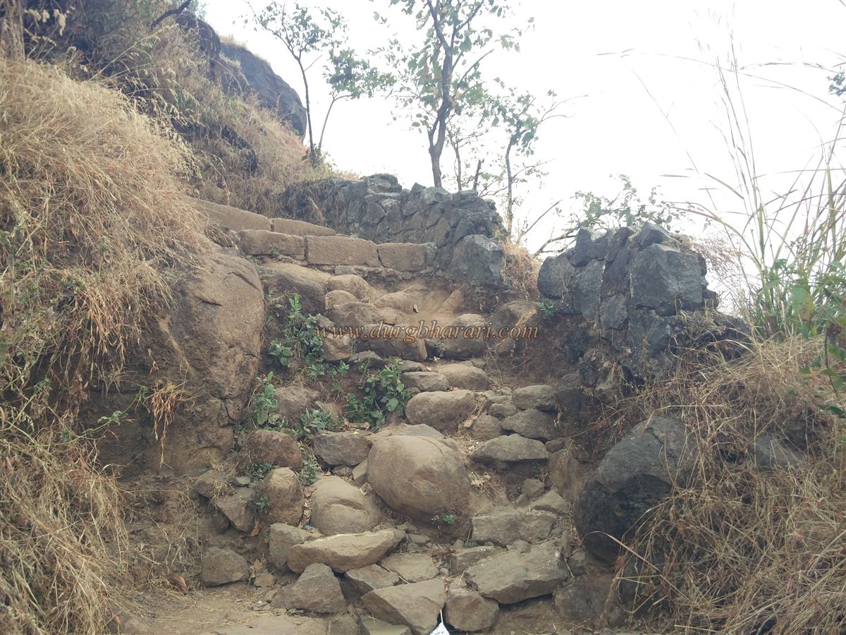
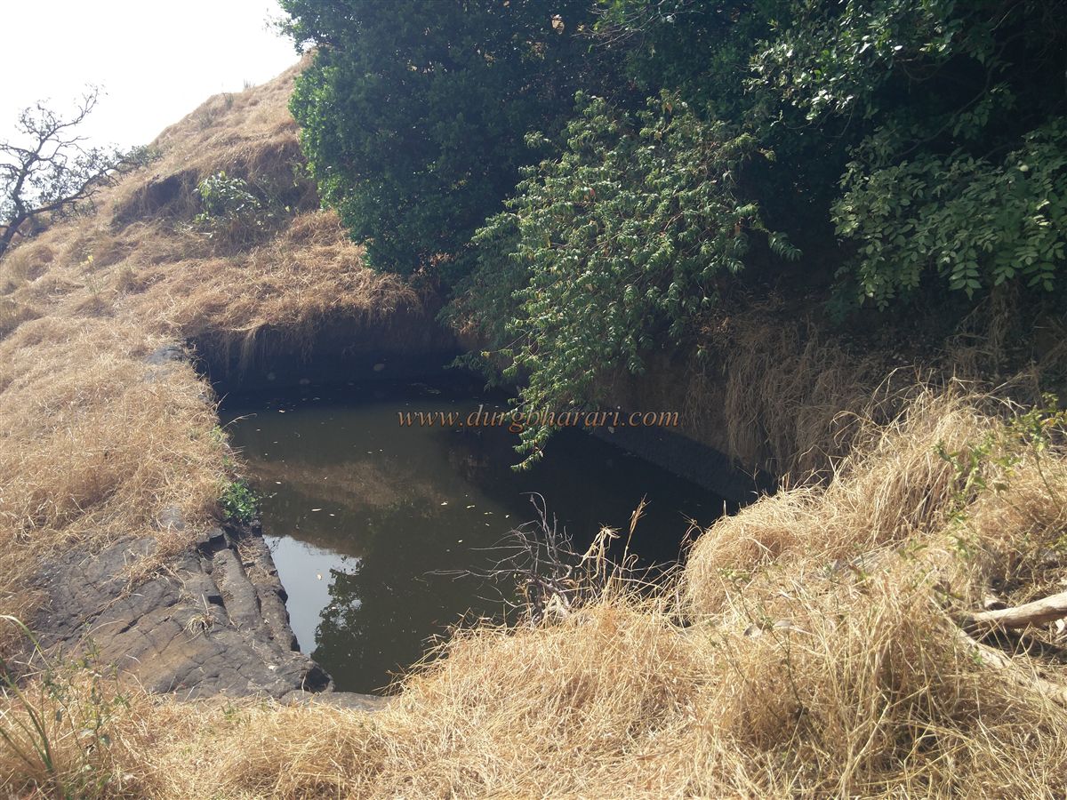
From the village, a col between the fort and the Kalawantin pinnacle leads to a beautiful, winding staircase carved into the rock. The path leading to this col is steep and tiring. It takes about half an hour to reach the pinnacle from the col. The entire path is carved into rock, and two cisterns are located on the left side. The first is filled with soil and dry, while the second, resembling a cave, has potable water, though reaching it is difficult. The final stretch of the trail involves a bit of rock climbing. Locals have tied ropes to assist climbers, but they charge a fee for it.
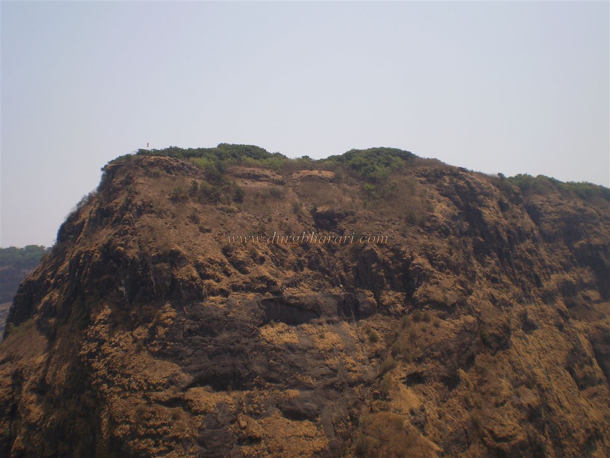
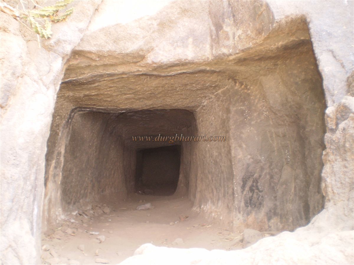
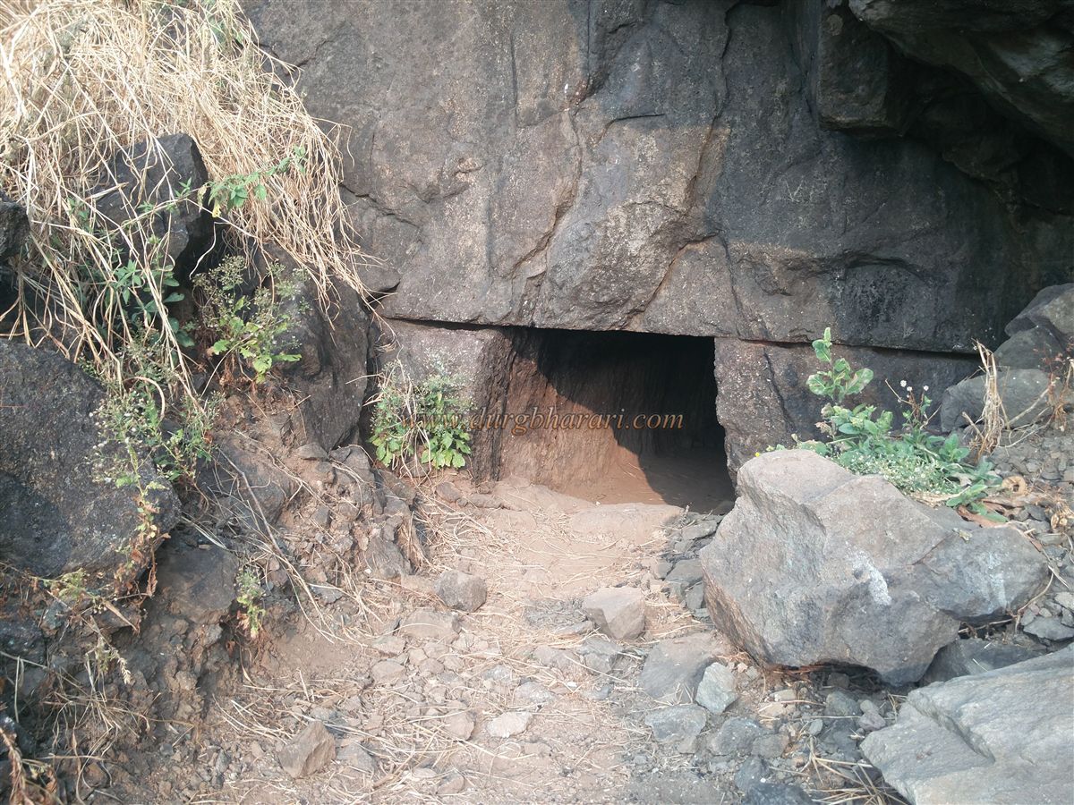
There is very little space at the top of the pinnacle, and no remnants exist, though a saffron flag waves there. From here, four bastions on Prabalgad fortification can be seen. On the day of Holi, villagers from Prabal Machi celebrate the festival atop the pinnacle. While walking beneath Prabalgad along the col between it and Kalawantin, one sees a man-made cave about 25 feet long carved into the rock. It has an L-shaped turn inside, leading to a spacious chamber measuring approximately 15 x 20 feet. Nearby is a weathered carving of Lord Hanuman. Continuing along the path leads to a gorge below the Balekilla.
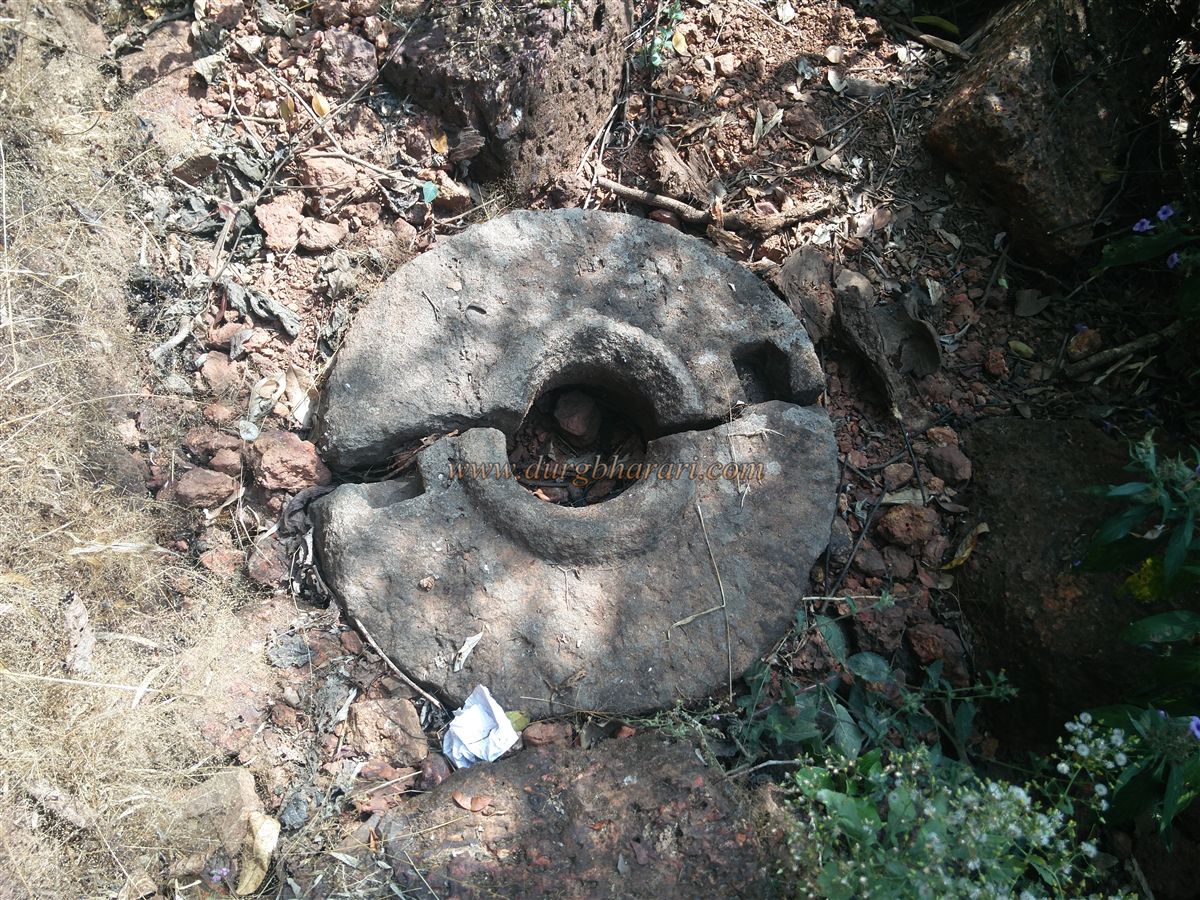
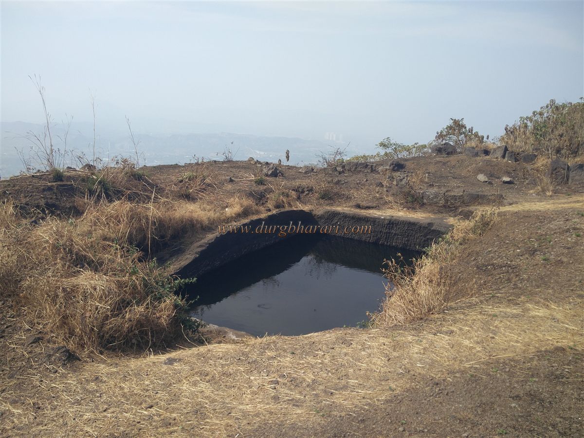
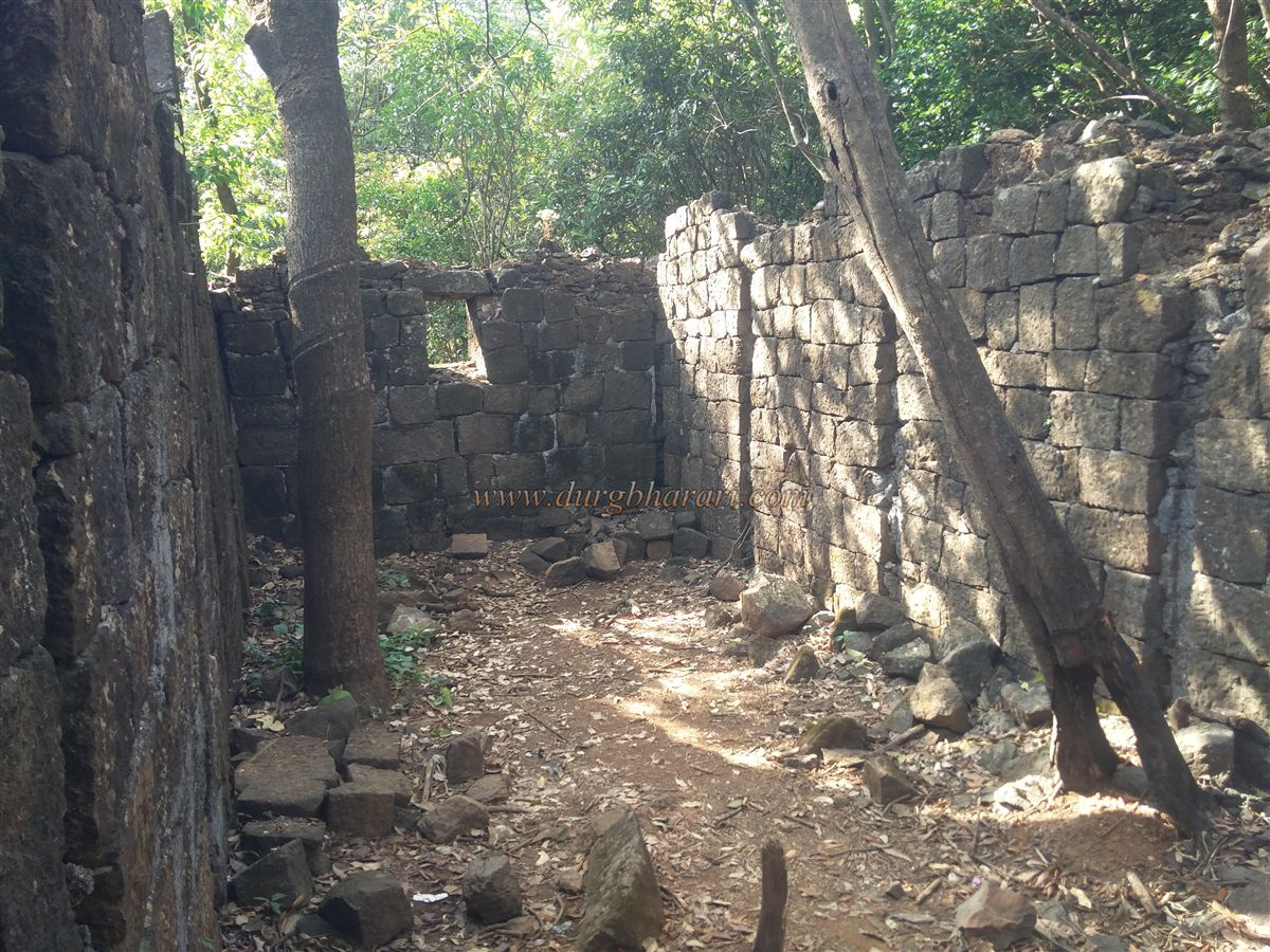
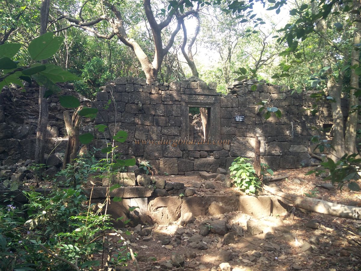
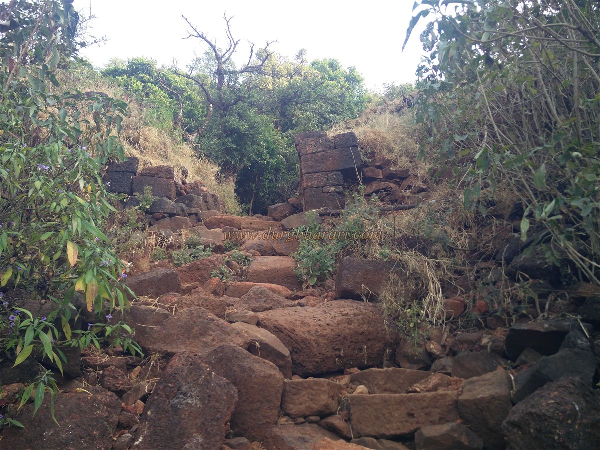
Just where the path descends from the gorge, there’s another rock-cut cave facing the Kalawantin pinnacle. It resembles the earlier cave seen from the pinnacle. From the gorge, a half-hour climb leads to the fort’s ruined main entrance. Locals refer to this route as the "Bull's Horn Path." The entrance is littered with carved stones, and its gateway frame is barely holding up. The fortification is wide but mostly buried under soil. On the right side is a small buried arch and a little further is a rock-cut cistern, currently not drinkable.
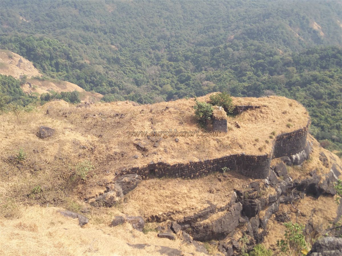
After viewing the cistern, one should return to the gateway and begin exploring the fort. Shaped like a 'Y', the Balekilla rises to 2,460 feet above sea level. Kalawantin pinnacle is at one end, Kala Buruj (Black Bastion) at another, and BoriSond (Bori Ridge) at the third. The fort’s summit is thickly forested, hiding ruins and fortifications, making exploration difficult without alertness and a spirit of discovery.
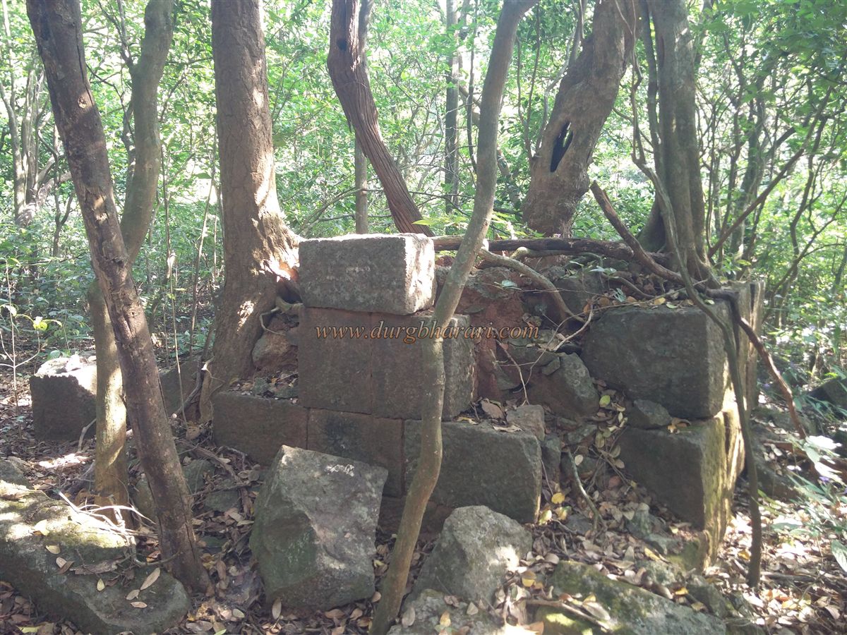
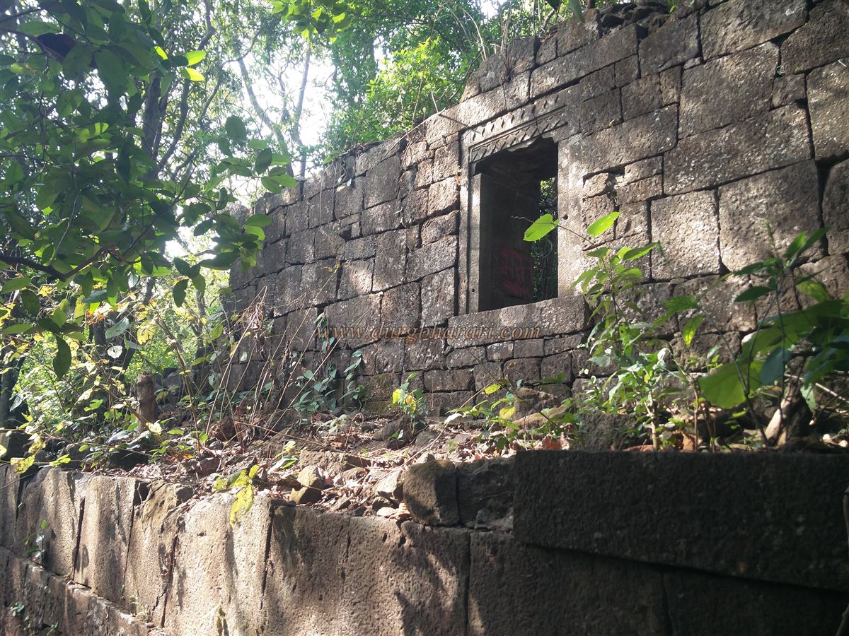
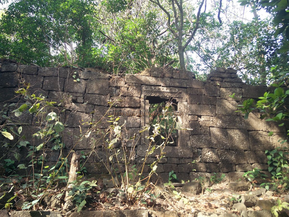
Further along the entrance path, the trail splits: the straight path leads to the bastion opposite Kalawantin, and the right path leads to Kala Buruj and BoriSond. A little further on the right path, one finds a clearing, possibly once a rainwater tank. Another fork appears, and taking the right trail again for 15 minutes reveals four intact buildings made of dressed stone on raised platforms, about six feet high. Some call these buildings a palace, but they are, in fact, granaries. Each building has a small door about four feet high with intricate carvings, and small windows for light inside. Judging by the design, they likely date to the Bahamani period.
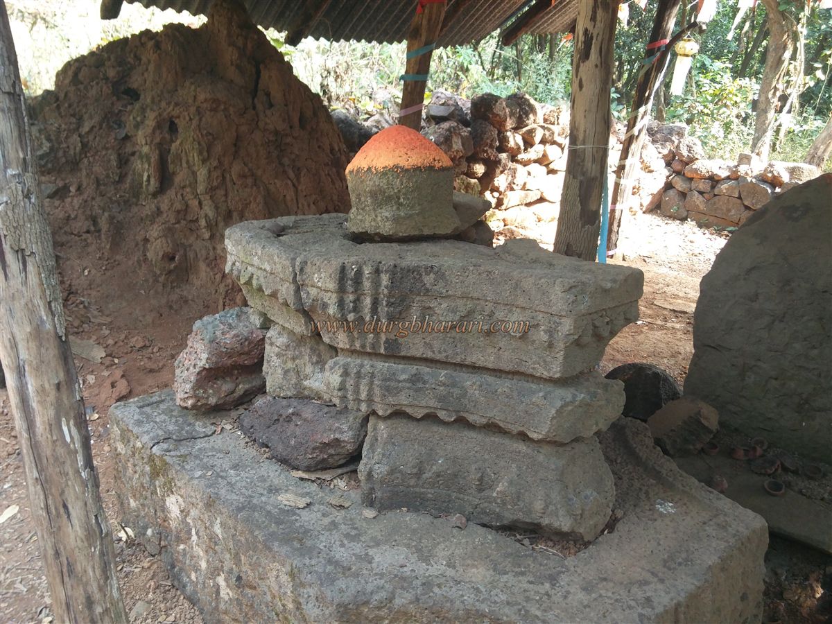
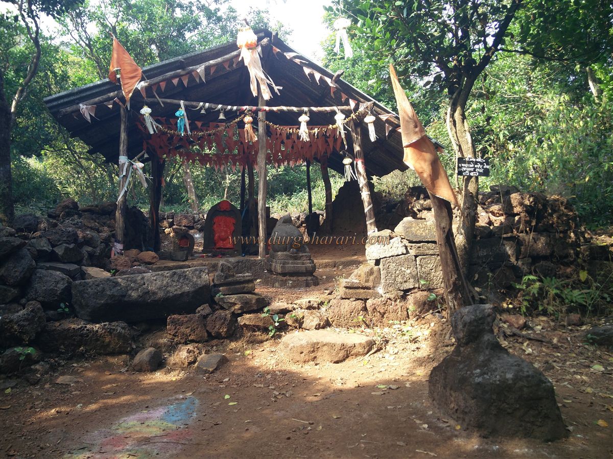
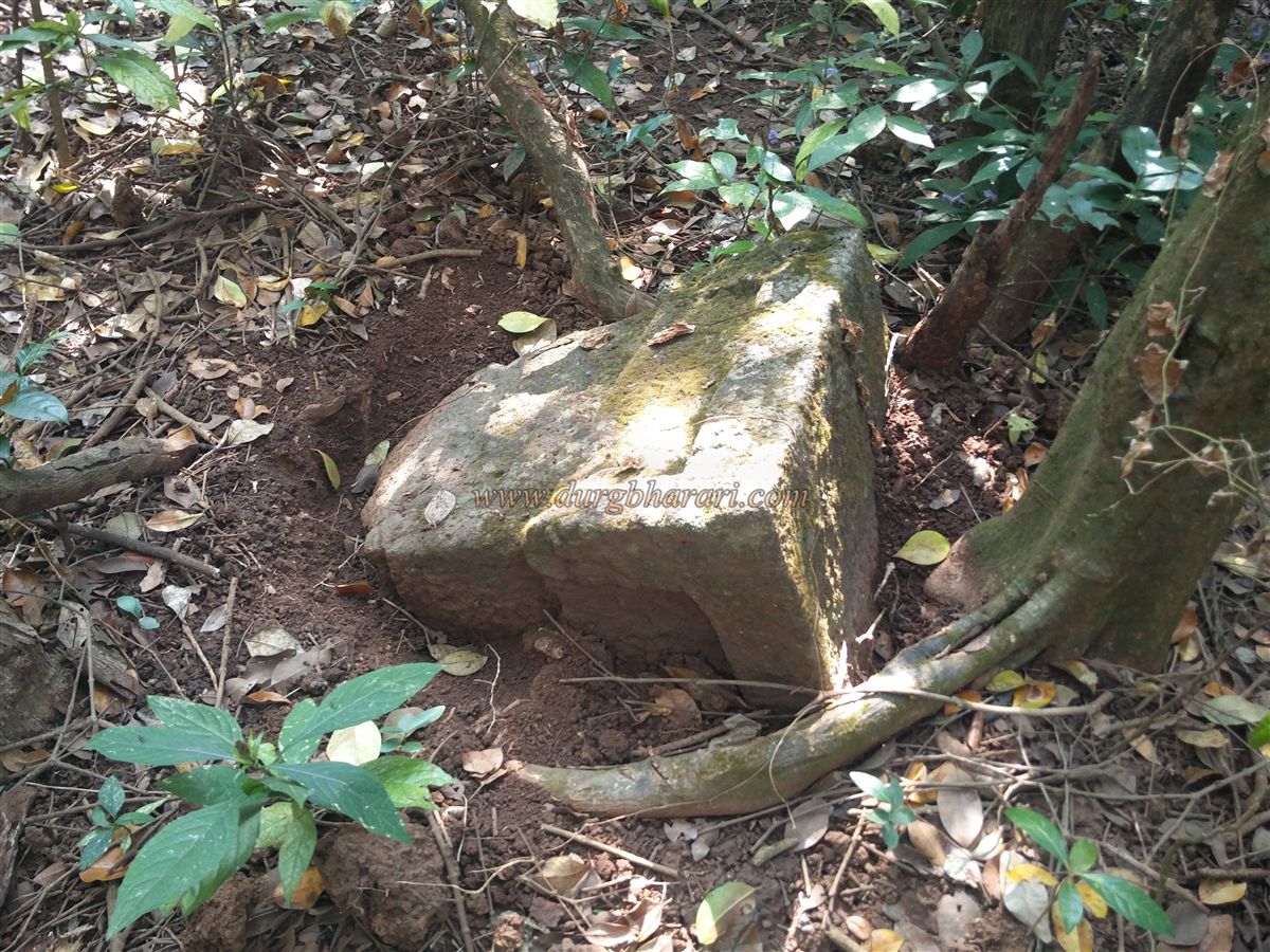
After seeing these buildings, take the descending trail next to the fourth structure, which leads to a stream that once had a stone dam. The dam is now filled with silt, leaving only one stone layer visible. Along the way are remnants of collapsed structures and a stone platform with overgrown trees, believed to be a Samadhi. A short distance away lies a large partially buried carved stone, likely once part of the Samadhi platform. Proceeding further brings one to a temple housing a Ganesh idol, hence known as Ganesh Temple. Two Nandi idols are found here—one inside, one outside. Behind the Ganesh idol is a triple-tiered Shivlinga on a sacred base, indicating the fort’s history goes back to the 11th century.
Moving ahead from the temple, a dry lake appears on the left side of the path. After a 10-minute walk, the trail again splits. The right trail leads in 20 minutes to BoriSond, named after the cluster of Bori trees growing there. Along the path to the ridge tip, a deviation on the left leads to a rock-cut cistern near the valley’s edge. The water here is not drinkable. From BoriSond, one gets splendid views of Prabal Machi, Panvel city, Karnala, and Manikgad. There are a few houses on the ridge below, and from here, one can reach the top via a difficult route.
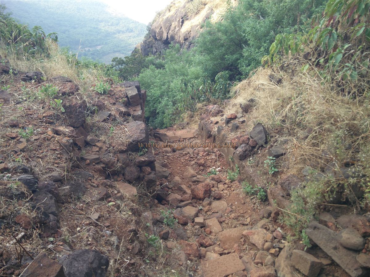
After visiting Borisond, return to the main path and head toward Kala Buruj. A 15-minute walk leads to a faint trail descending toward the valley. Following it down 200 feet brings you to another ruined gate. The arch has collapsed, and only the frame remains. This gate, known as Irshalgad Gate, leads toward Irshalgad. A large stone slab lies below the gate. After viewing it, return and follow the trail to reach Kala Buruj.
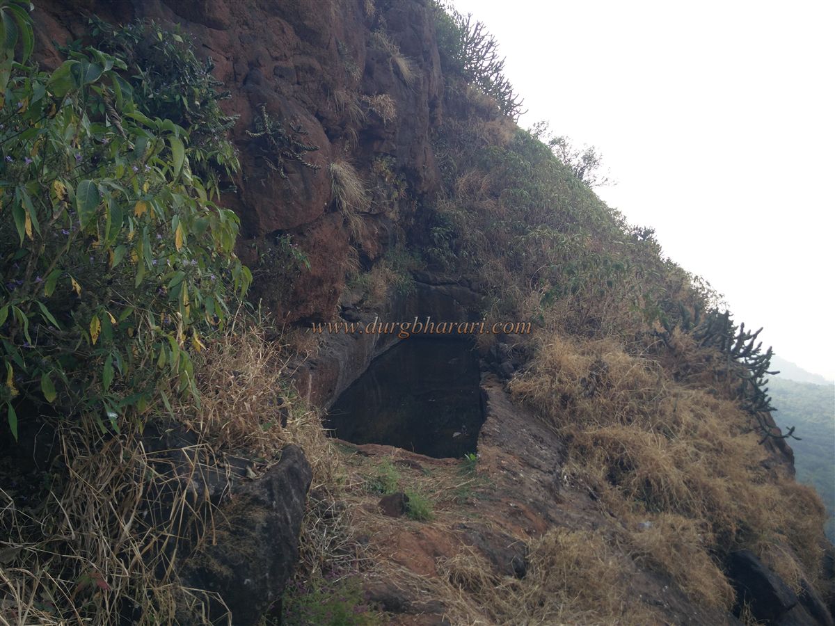
The distance between the main gate and Kala Buruj is approximately 3.5 kilometres. In this area, the forest is sparse, and many fort remnants are visible. A bastion is built on the edge of the cliff, with two nearby rock-cut cisterns—one of which contains potable water. Two large lime mounds here are remnants from British times. Before developing Matheran as a hill station, the British had considered Prabalgad, but water scarcity led them to favour Matheran. Lime and shaped stones brought for construction remain abandoned.
From Kala Buruj, one gets panoramic views of various Matheran points, Sondai Fort, Irshalgad, Morbe Dam, and more. On the left below Kala Buruj is another small Machi with a bastion at its end, known as Padghe Buruj. A small rock-cut tank lies ahead of the structure, and an exit gate has been built in its fortification.
After visiting Kala Buruj, return to Ganesh Temple. A worn path from here leads to the Samadhi of Sahadev Sawant. Beyond the Samadhi are three ridges descending from the fort, each enclosed with fortification and a bastion at its tip. Due to the dense jungle, even local guides are unfamiliar with the routes down these ridges. These ridges and their bastions are visible from the bastion near Kalawantin.
Returning from here to the temple and following the trail toward Kalawantin leads through forest ruins of dressed stone buildings. After exiting the forest into an open area, one sees the descending ridges and fortifications. A small path leads toward one of these ridges. After 5 minutes on this path is a large rock-cut cistern with potable water. From here, the bastions and walls of a nearby ridge can be observed closely.
Returning to the trail, one reaches the bastion facing Kalawantin. Nearby in the forest is another rock-cut cistern, but it’s hard to find. This bastion is known as Sondyechi Sond. From here, one can see Kalimantan’s pinnacle, Chanderi, Peb Fort, and even parts of Navi Mumbai. The fort has eleven bastions of various sizes and two ruined gates: Sondyechi Sond, Bori Sond, Kala Buruj, Padghe Buruj, three bastions on the ridges, and four visible from Kalawantin.
Parts of the fort’s walls are still visible in places. Though local guides accompany you, they often lack detailed knowledge and are reluctant to show the full site. They also avoid taking visitors to the water tanks, as they earn from selling lime juice, kokum sherbet, and bottled water. While lodging and food are available at Prabal Machi, proximity to Mumbai has led to commercialization, replacing hospitality with business-mindedness.
To experience the true peace of the fort, one must avoid weekends and holidays. The tranquillity and the sunset from Prabal Machi, once cherished, are now fading. Located in North Konkan, the fort was likely built to monitor the Borghat route. The caves suggest origins in the Satavahana period, and later served military purposes under the Shilahara and Yadav dynasties. After the Bahamani Empire’s collapse, the fort came under Nizamshahi control. In its last years, Shahaji took command and established his rule.
But Mughal emperor Shahjehan and the AdilShah allied to counter him. On June 19, 1635, Mughal commander KhanJahan descended into the Deccan, capturing Junnar and Shivneri. AdilShah general Randullah Khan also advanced. Shahaji retreated to Kondhana and Muranjan (Prabalgad) with Jijabai and young Shivaji after being refused shelter by the Siddi of Janjira and the Portuguese at Chaul. Once he learned enemy forces were close, he moved to Mahuli. In 1636, the Treaty of Mahuli handed North Konkan to the Mughals, who passed it to the Adilshahi.
In 1656, after conquering Javali, Shivaji’s commander Abaji Mahadev captured the Kalyan–Bhiwandi to Raigad region for Swaraj, including Muranjan, which was renamed Prabalgad. In the 1665 Treaty of Purandar, Prabalgad was among the 23 forts ceded to the Mughals. Rajput commander Kesarisingh Hada was appointed fort chief. When the treaty was broken, Kesarsingh died in battle against the Marathas. His mother and two sons were captured and, on Shivaji’s orders, respectfully sent to the Mughal camp at Devlali. Treasure was later discovered on the fort. During Shivaji’s reign, Abaji Mahadev governed North Konkan from this fort.
In 1828, under Umaji Naik’s leadership, the Ramoshi community rebelled against the British. A group of 300 entered the Konkan and took shelter at Prabalgad, issuing a proclamation dated December 25, 1827, urging locals not to pay taxes to the British. From this fort, they harassed the British for many days until the revolt was suppressed.
© Suresh Nimbalkar
GALLERY