PISOL
TYPE : HILL FORT
DISTRICT : NASHIK
HEIGHT : 3518 FEET
GRADE : MEDIUM
Many cities in Maharashtra have their own unique identity — Mumbai is known as the city of dreams, Pune as the cultural capital, and Nashik for its temples. But Nashik also holds another distinction — it is the land of forts. With over 65 forts, it has the highest number of forts in any district of Maharashtra. While some forts are well known, many remain obscure. One such lesser-known hill fort untouched by the legacy of the Maratha Empire is Pisol Fort.
Situated in the Galna mountain range, in the vicinity of Galna Fort, Pisol Fort lies 126 km from Nashik city and 35 km from Satana, the taluka headquarters. The base village of the fort is Wadi Pisol, from where private vehicles can reach up to a Hanuman temple at the foothills of the fort. Alternatively, a 5 km trek from Jaykheda is needed if relying on public transport.
...
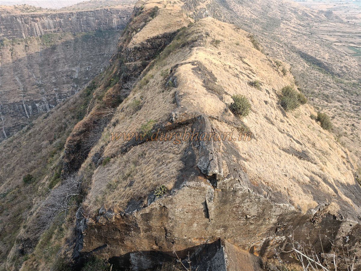
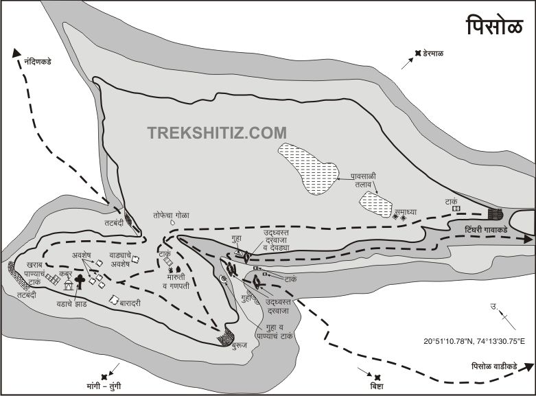
As you approach Wadi Pisol, you can see the elongated twin hilltops of the fort and a deep artificial cut made to separate the main hill from the adjoining ridge. Near the parking area at the foothill, the forest department has constructed two shelters, and a Maruti (Hanuman) idol is installed on a raised platform.
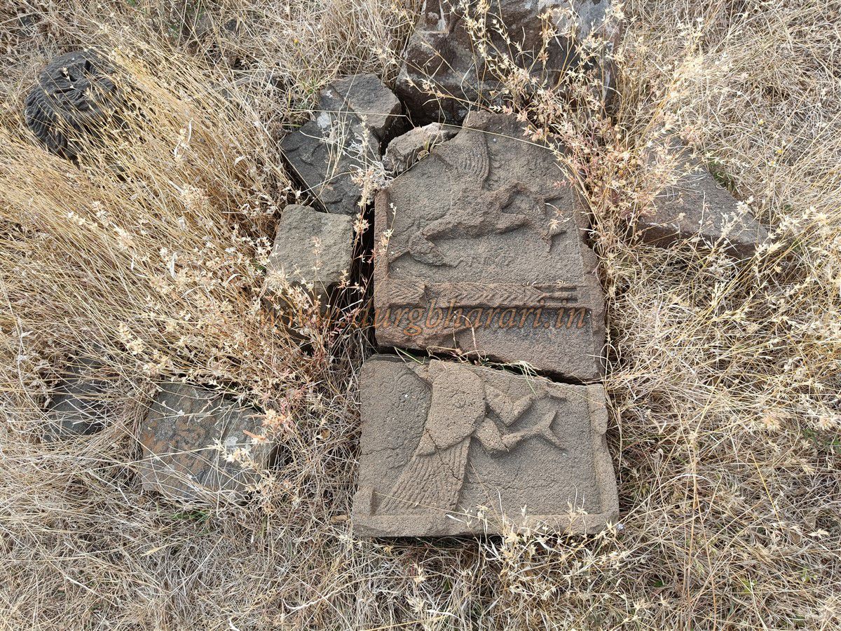
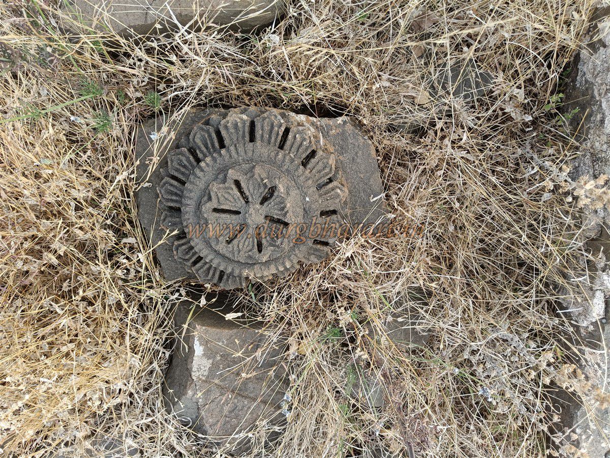
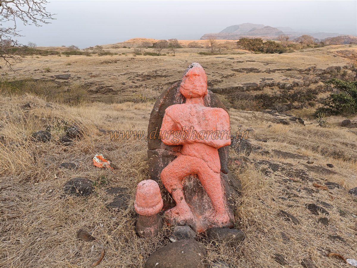
A trail through the jungle behind the Maruti idol leads to the fort. Within minutes, you come across an ancient grave, then a stone platform with a sculpted slab and a rounded stone with a niche for a lamp, likely a seat of authority in earlier times.
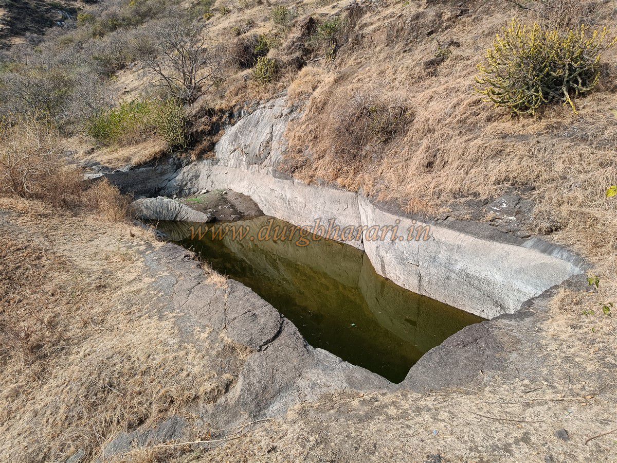
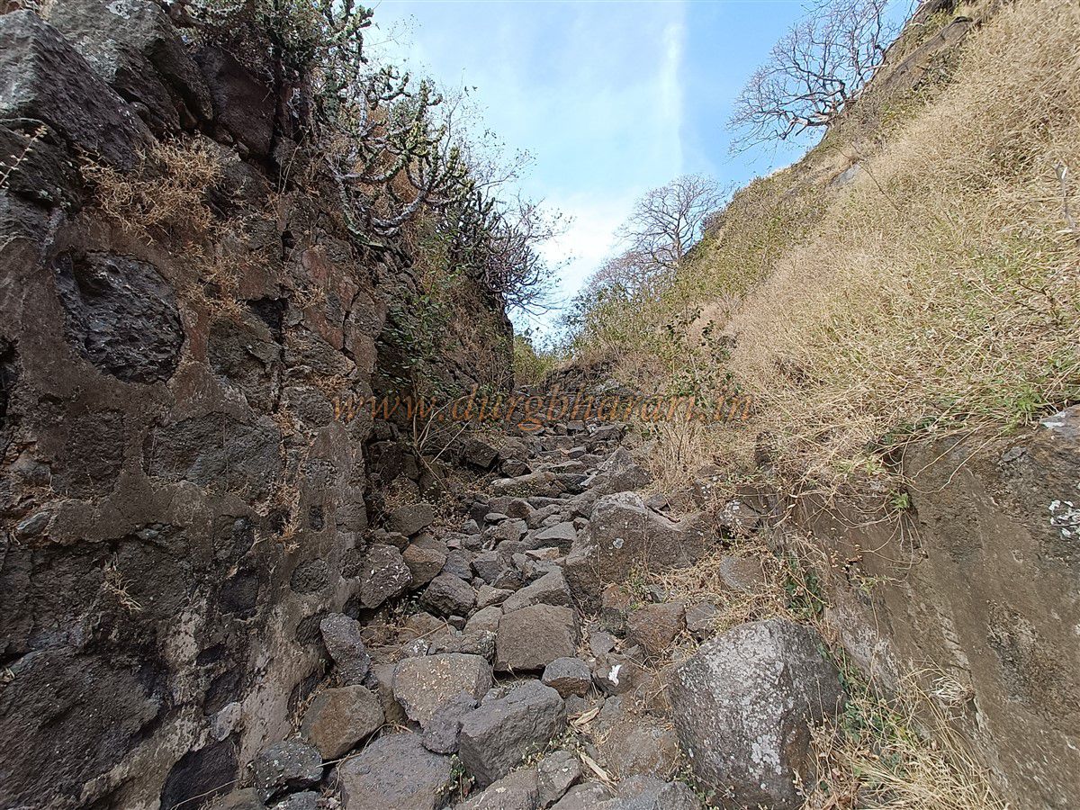
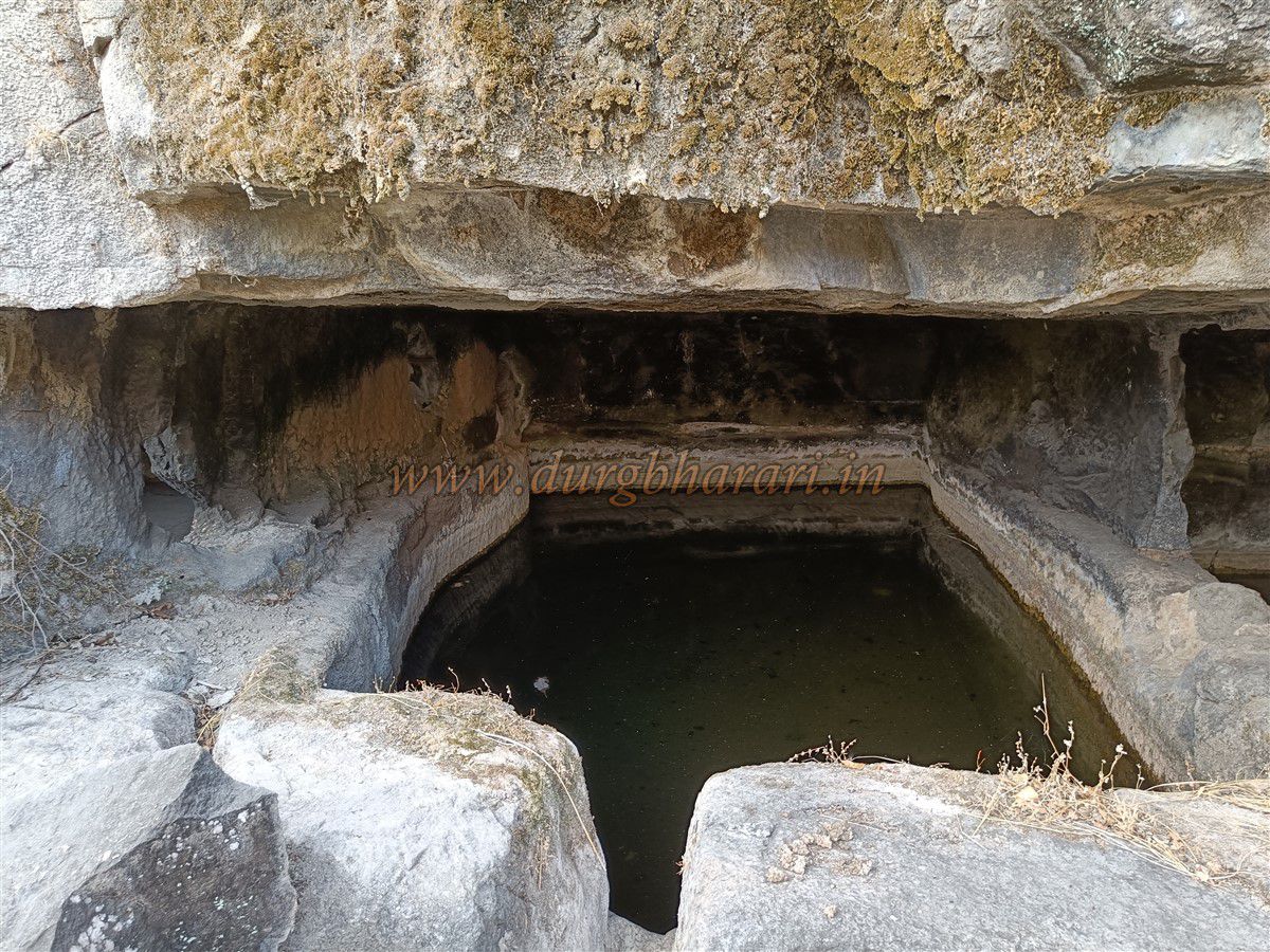
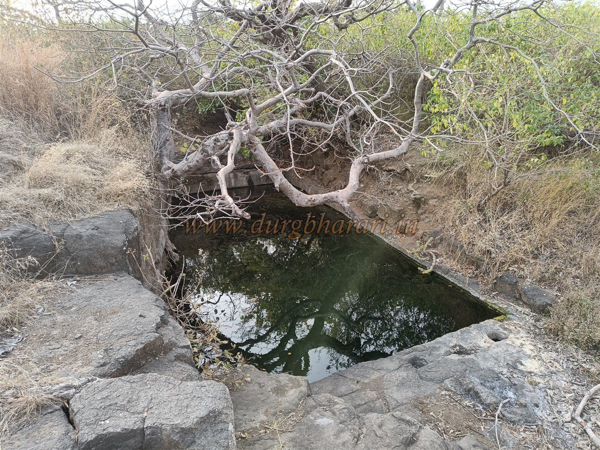
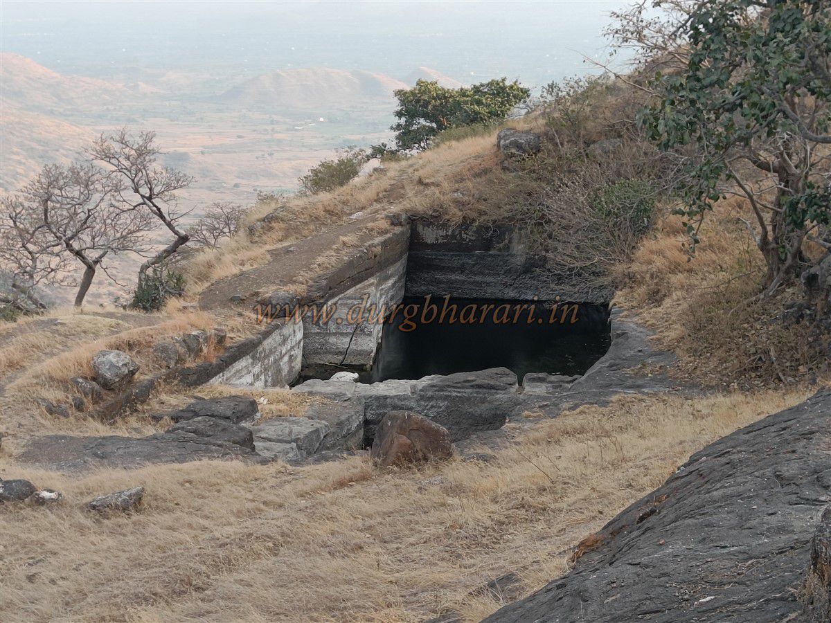
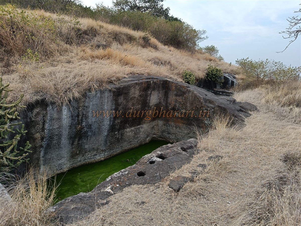
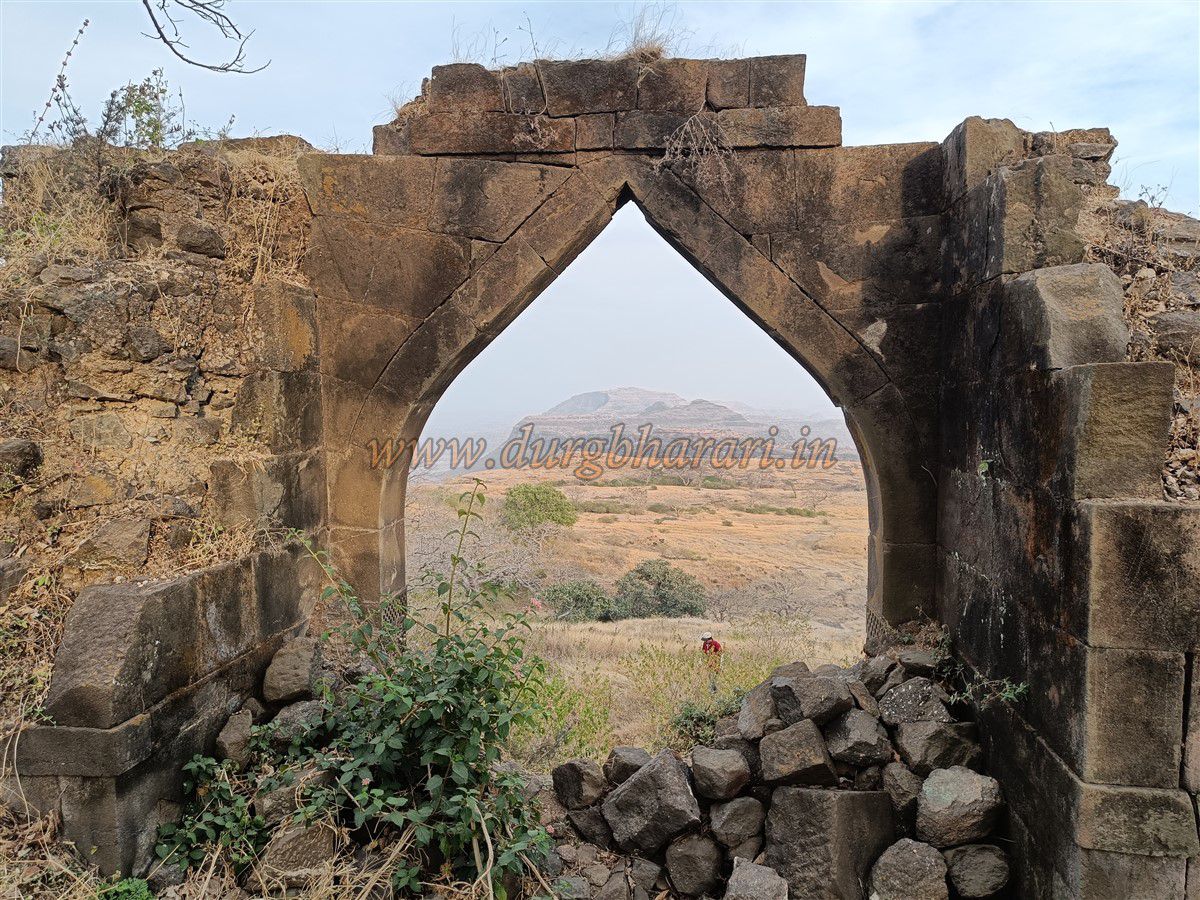
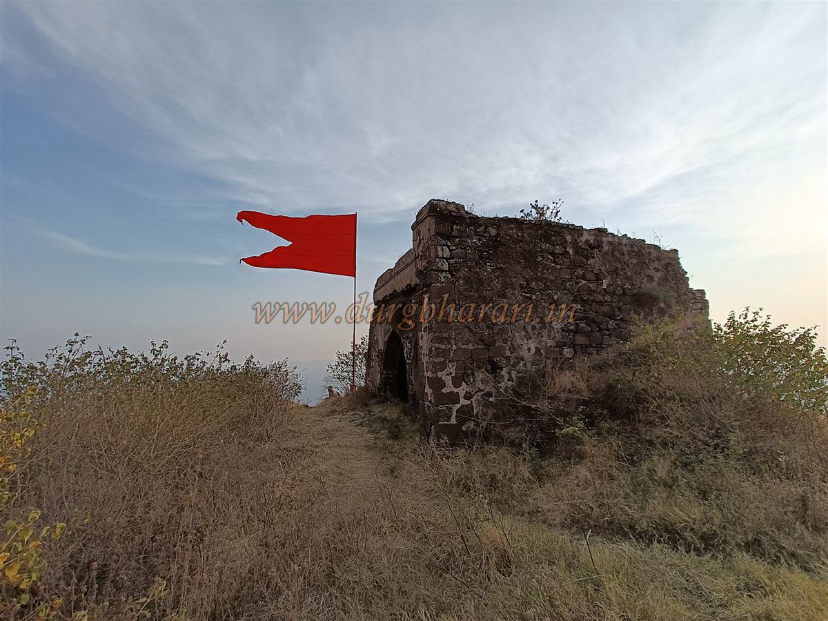
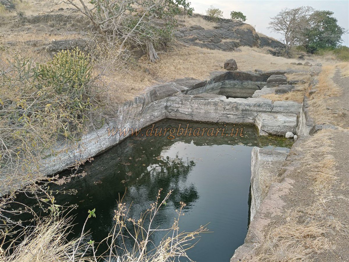
Further ahead lie two rock-cut water tanks, one of which has steps for access. Note: a straight path beyond this point leads to a cattle trail, not the fort. You must take the uphill path before the tank. After a steep but manageable climb, you reach the first ruined entrance gate, with only the foundation and one side of the arch remaining. A separate square bastion stands nearby for its protection.
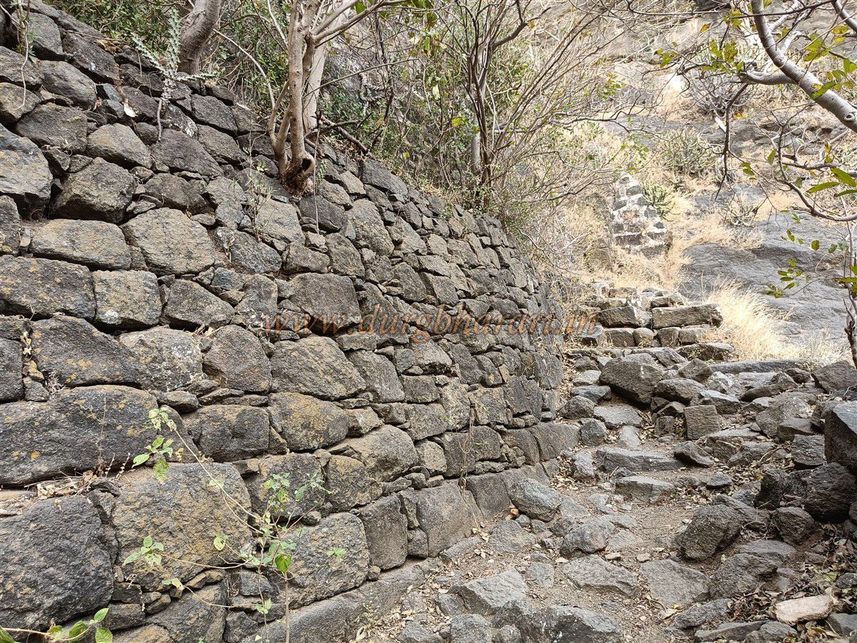
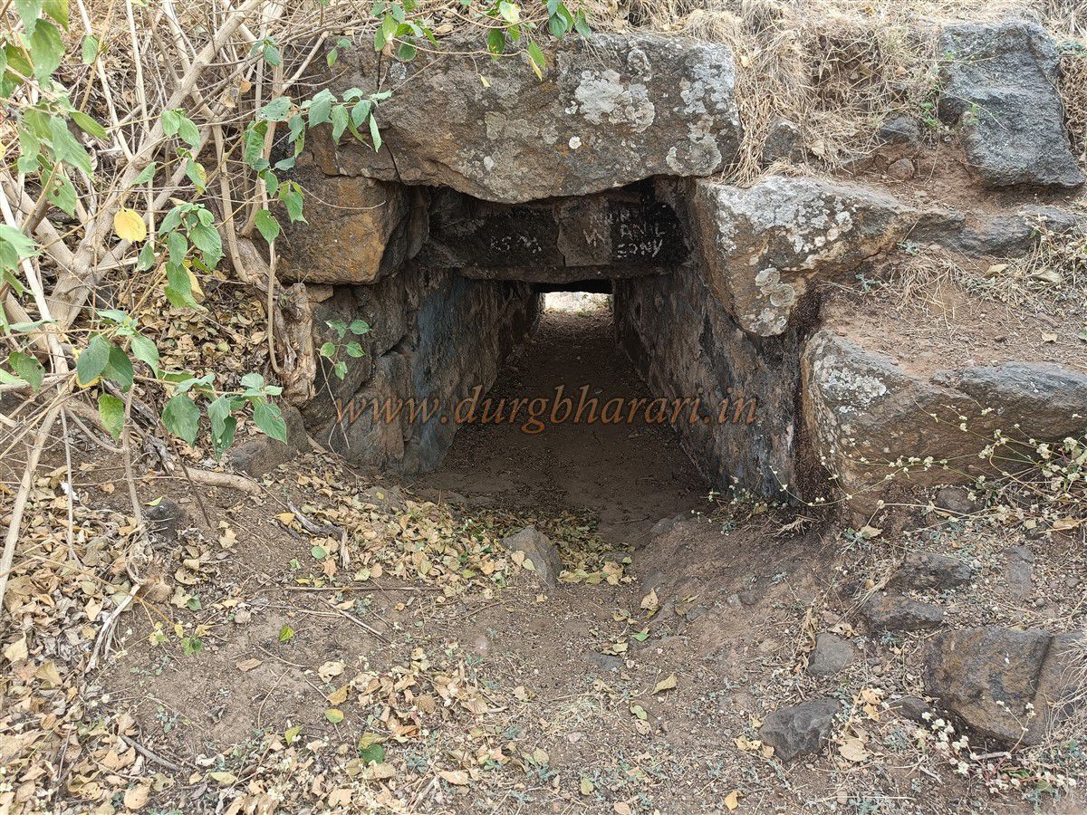
From here begins a multi-tiered fortification system, with four layered walls across the narrow gorge that leads to the fort's entrance. On entering the gorge from the right, you reach the second ruined gateway on the left side. Only traces remain, but some parts of the fort wall still survive.
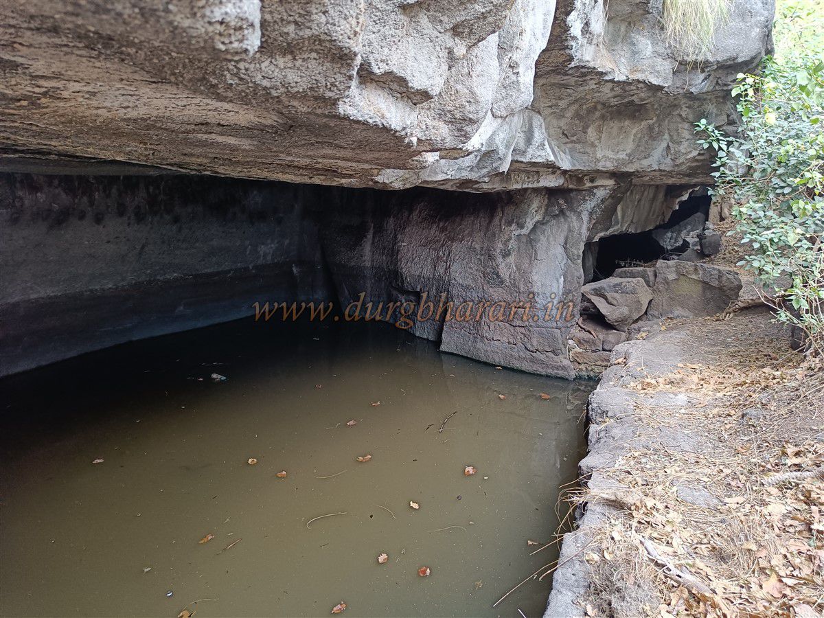
Beyond this point, there’s a difficult trail leading to two caves, one with drinkable water and the other large enough to accommodate 5–6 people. Returning, you encounter three caves on the left hill, two water-filled and one inhabited by bats.
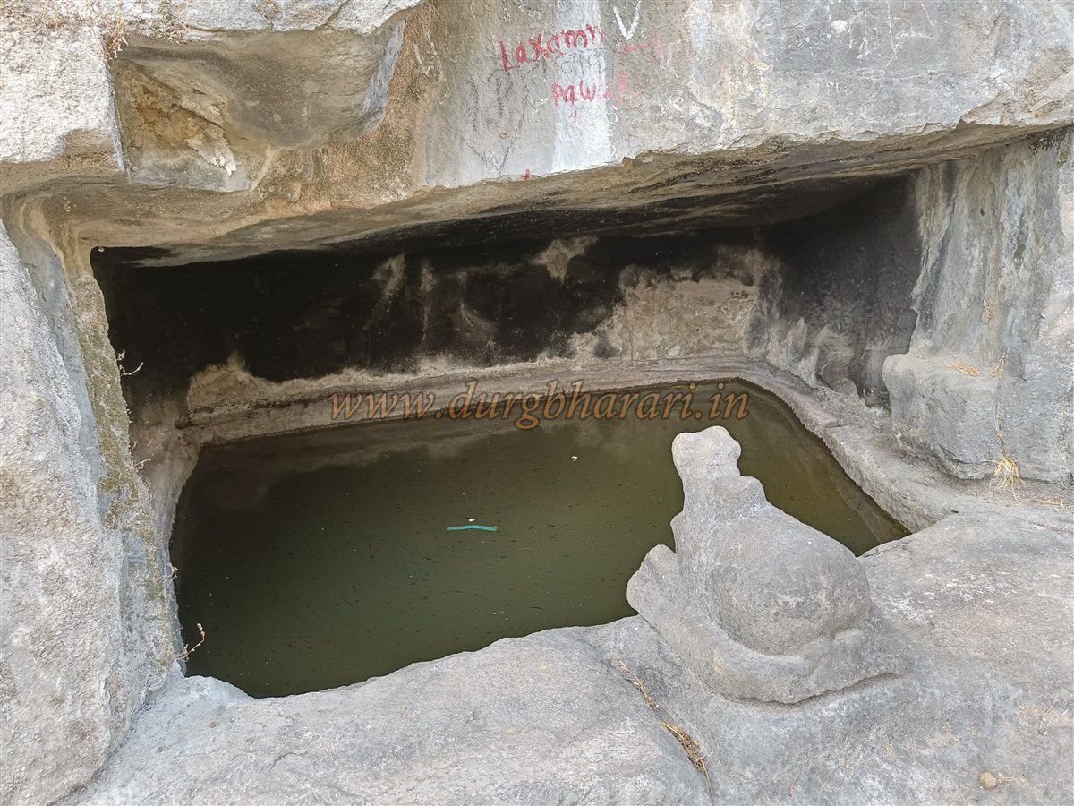
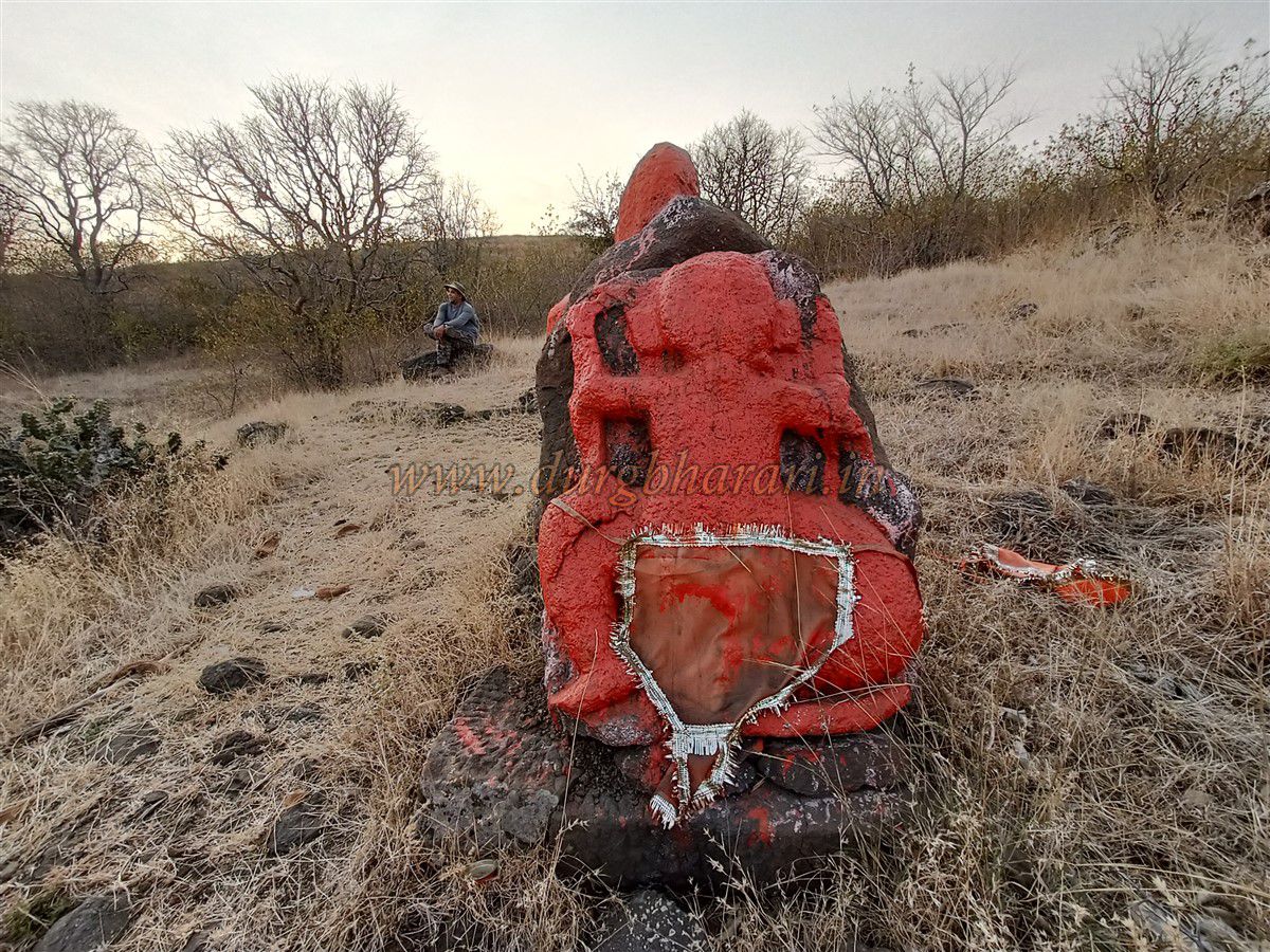
Continuing forward, you reach the fourth gate, which has lost its arch but retains its stone framework and adjacent bastion. Close by are five rock-cut caves, one of which contains a shivling submerged in a water tank. A stone Nandi (bull) outside confirms its religious nature. After passing these, you arrive at the fort plateau, about an hour from the base.
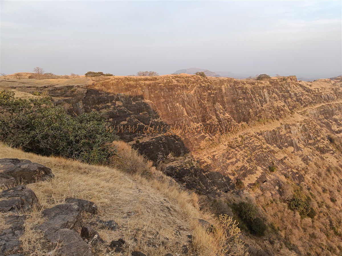
The fort is spread over approximately 50 acres, divided into a bastion peak (Balekilla) on the left and a flat plateau (Machi) on the right. The peak stands at 3518 feet above sea level. Start exploring the plateau first to relax after the climb.
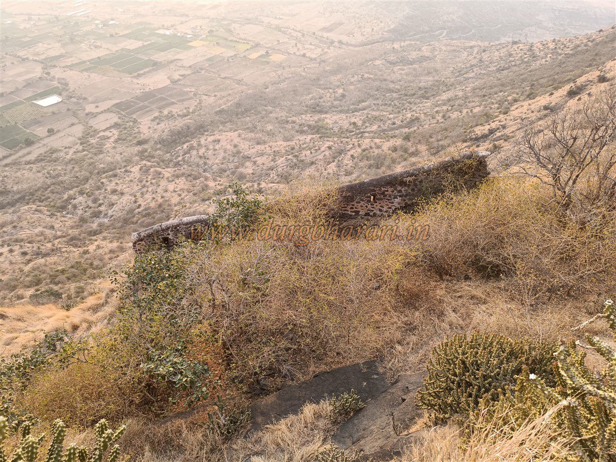
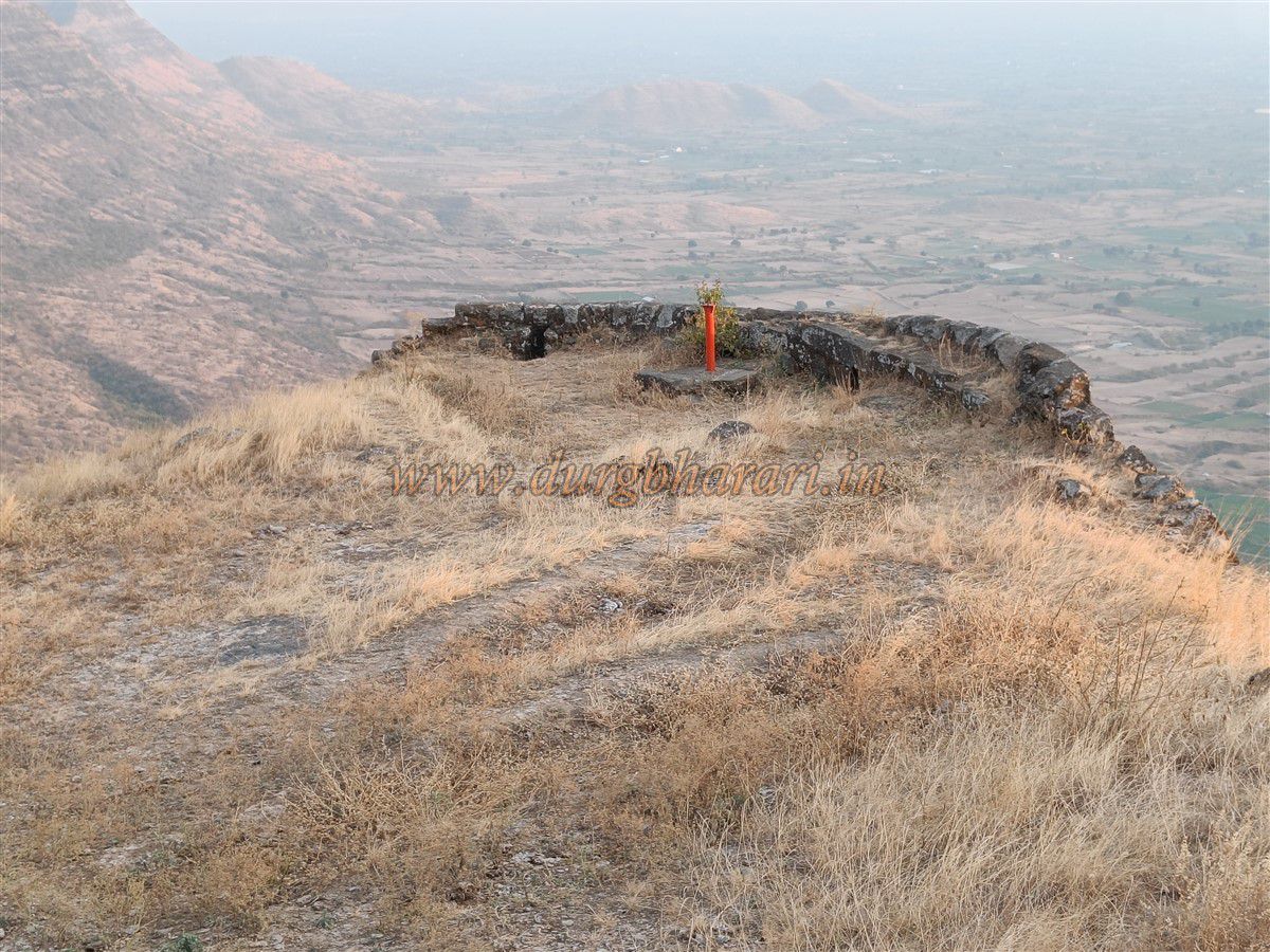
On the opposite side of the gorge is another pass with remnants of an unused gate, but the trail is broken and dangerous. The watchtower bastion here has a chamber-like window for observation or secret exits. The bastion overlooks Mangi-Tungi, Nahwa Fort, Chaulher, and Bhairav Cliff of Dermal.
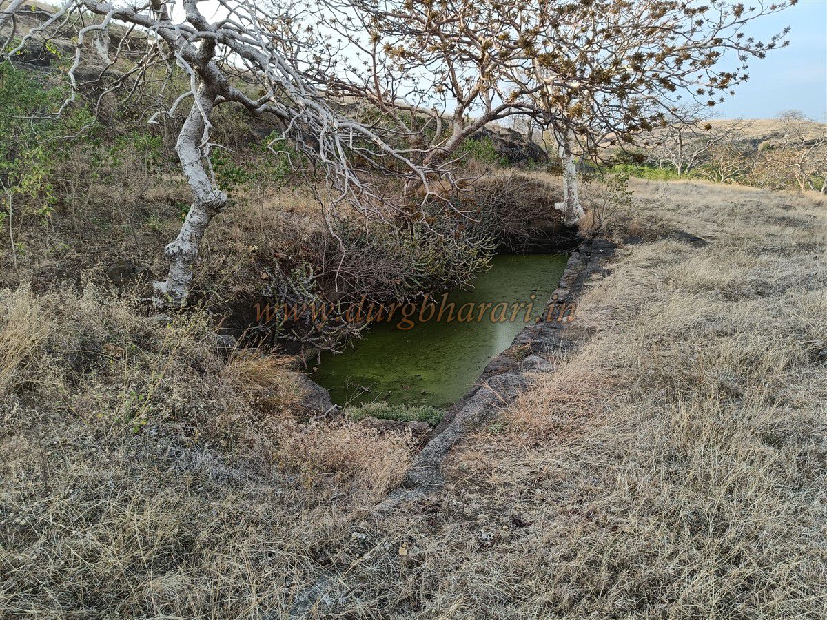
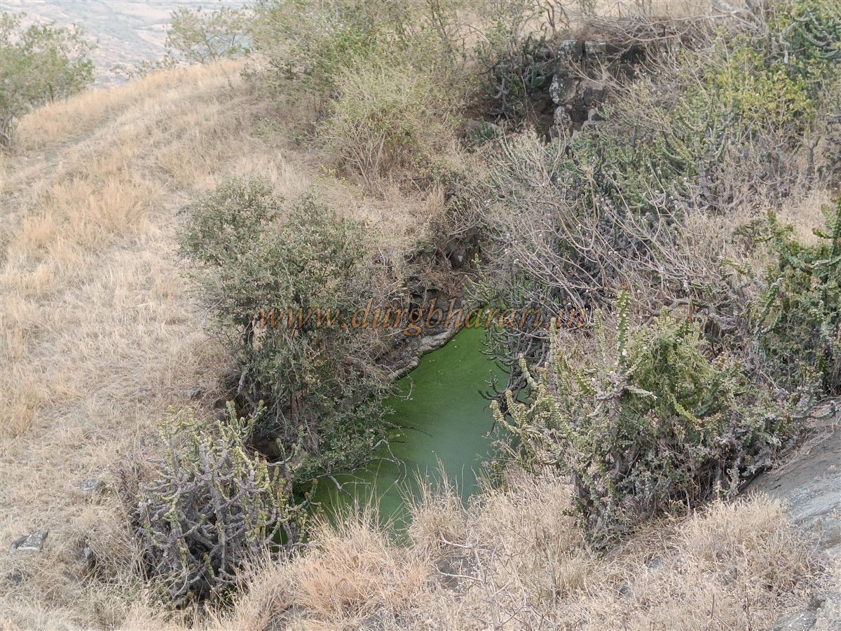
The plateau also contains two rock-cut tanks on the slope, and another one hidden in the shrubs, containing potable water. Near the centre is a destroyed stone Samadhi (memorial), once intact till 2019. Its sculpted peacocks, lotus motifs, and shivling indicate it belonged to a Hindu devotee.
Ahead lies a large rock-cut tank and a shallow stagnant water pool surrounded by greenery. Scattered foundations of buildings hint at habitation. Once this area is explored, move toward the Balekilla (citadel).
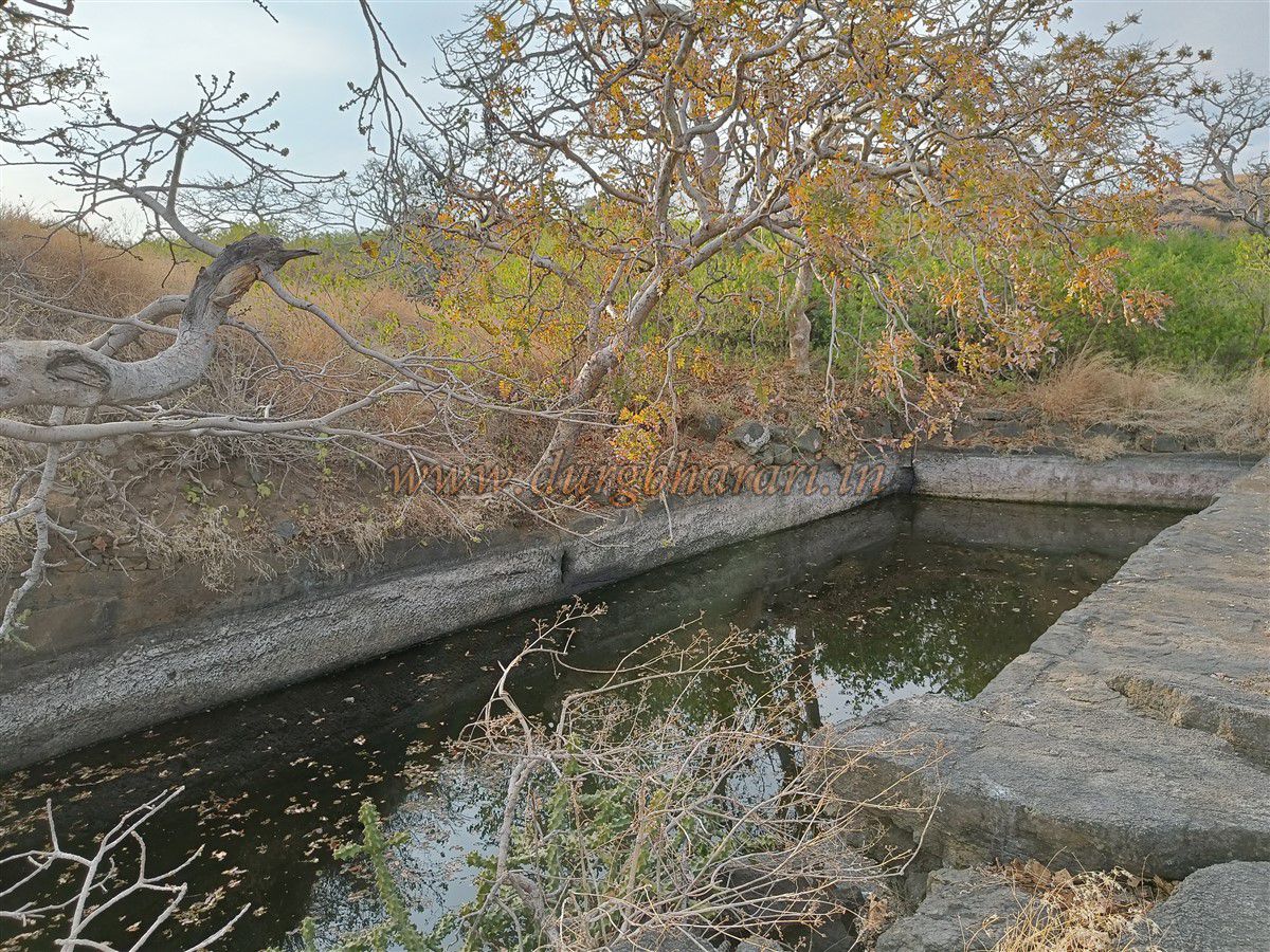
Near the base of the citadel are two dry and two filled water tanks, all carved in rock. Climbing further leads to the ruins of the fort commander’s residence, which still has a beautiful arched gateway with ornamental niches and lotus carvings.
To the left of this gate are two broken idols, believed to be Ganapati and Hanuman, and another deep rock-cut tank. From here, ascend to reach a three-arched structure, possibly used as shelter or residence, with one arch sealed off. Inside, a damaged idol is kept.
Behind this is a secondary fort wall, built for added defence of the citadel. From here, a path leads to the northern tip of the fort. Though overgrown with vegetation, two water tanks and the bases of some structures are still visible. The northern end features double fortifications, now blocked due to thorny shrubs.
Returning to the arched building, begin exploring the southern part of the fort. While there aren’t many structures here, a strong bastion marks the southern tip. From here, the two main caves near the gorge are visible. Descending along the trail brings you back to the starting point, completing the circuit.
It takes about two hours to explore the entire fort.
It is believed that in the 13th century, the fort was constructed by Gavli Raja Mahesh. In the 14th century, the Rathod king Nanadev of the Bagul dynasty defeated Gavli Raja and took control of Salher, Mulher, and Pisol forts. Thus began the rule of the Bagul Rajput, from whom the Baglan region derives its name.
In 1637, the region came under Mughal control. Although the Baglan region was under Maratha influence later, Pisol and Dermal Forts are not prominently mentioned in Maratha chronicles. In 1818, Baglan became part of British India, and by 1869, it was officially included in Nashik district.
© Suresh Nimbalkar
GALLERY