PAVNAR
TYPE : GROUND FORT
DISTRICT : WARDHA
HEIGHT : 0
GRADE : EASY
When one hears the name Pavanar, the first thing that comes to mind is Acharya Vinoba Bhave's Paramdham Ashram. While this ashram, located on the banks of the Dham River to the south of Wardha city, is well known, the Pavanar Fort situated on the same riverbank has sadly faded into oblivion.
Pavanar has an ancient legacy; in earlier times, it was the capital of the Vakataka king Pravarasena. This city, once known as Pravara Pur, gradually became known as Pavanar over the course of time. Even today, the remnants of the fort can be seen at Pavanar, silently narrating the glorious history of Pravara Pur. In today's digital age, there is barely any information available about this fort online. Hence, I have tried to document the details I gathered during my visit to the fort on the Durgbharari website.
...
A large portion of the fort has been completely destroyed, but a few remains still stand, fighting a lonely battle against time. The ignorance and indifference of locals towards the fort have significantly contributed to its decline.
To visit Pavanar Fort, one must first reach Wardha city. The distance from Wardha to Pavanar is about 10 km, and buses and auto-rickshaws are available to get there. Geographically, the fort has two distinct sections: the wall surrounding the village appears to be a town fort (Nagardurg), while the fort situated on a high hill near the river likely served as a military outpost.
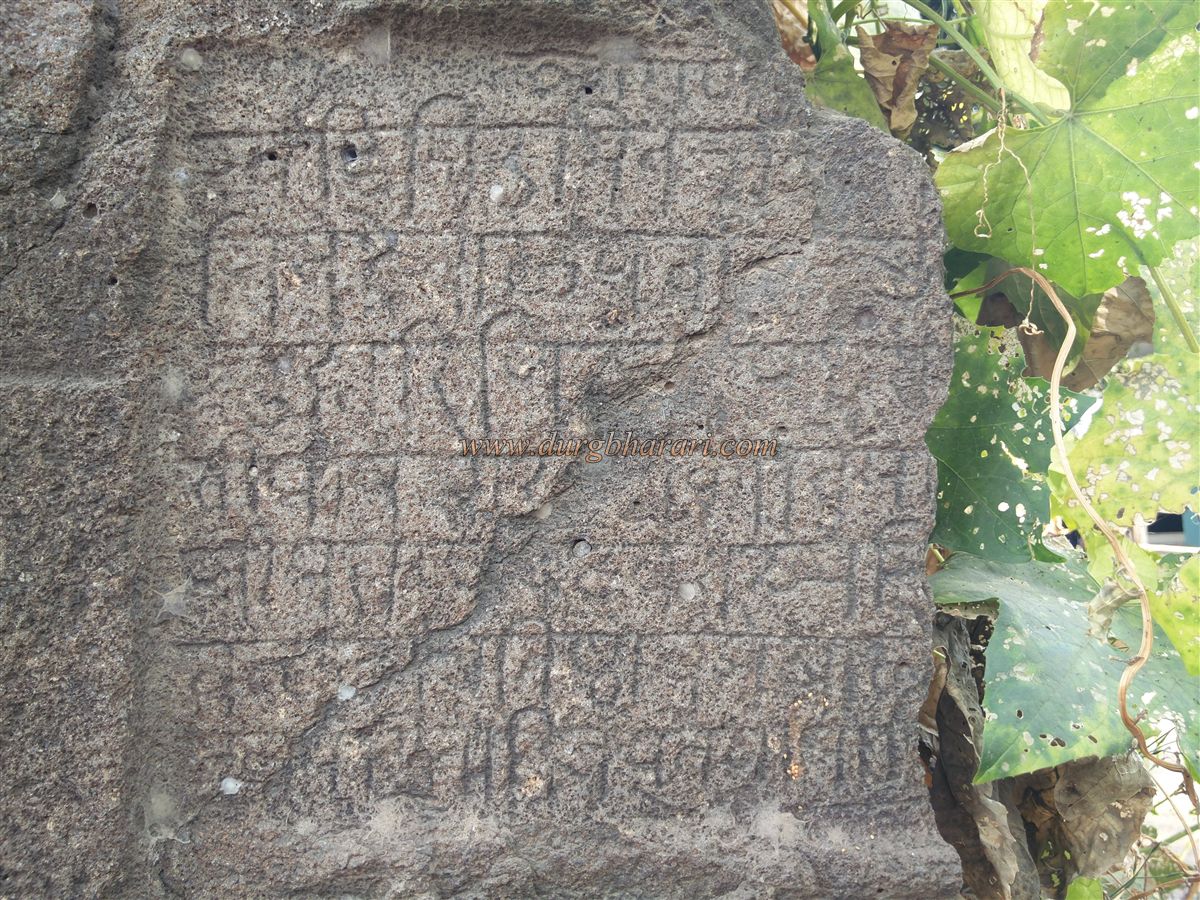
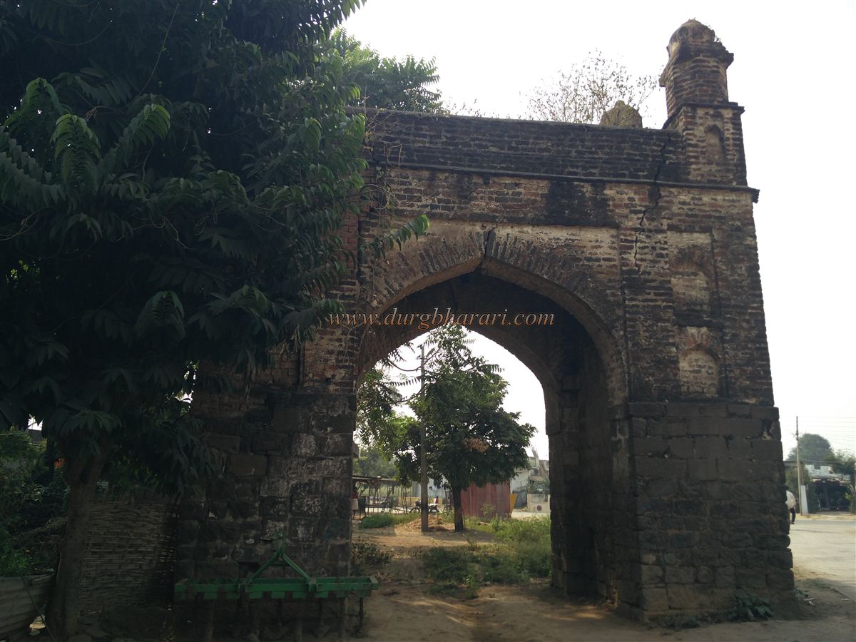
Locals say that, in earlier times, the walled town of Pavanar had four gates. Today, however, the fortifications have been completely destroyed, with only one gate still remaining. Upon arriving in Pavanar, this surviving gate, located on the Pavanar-Sewagram road, should be the first stop. Standing about 25 feet tall, the lower part of this gate is built with finely cut stones, while the upper portion is constructed using bricks. On the outer side of the gate, a partially broken Devanagari inscription is visible.
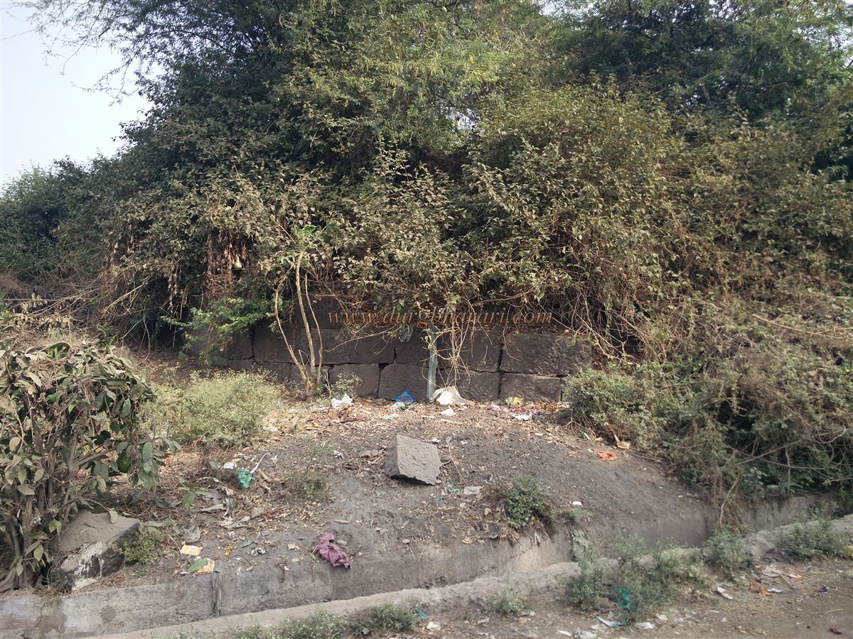
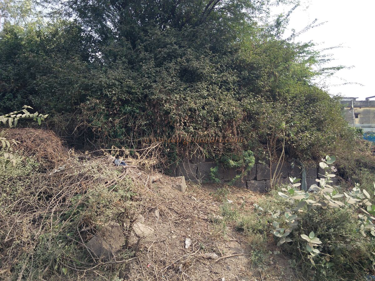
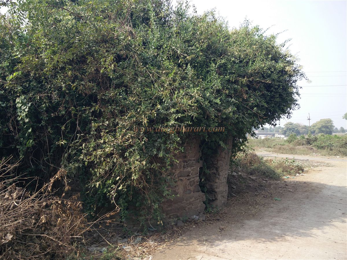
After visiting this remaining structure of the town fort, one should proceed to the hilltop fort by the Dham River. A path runs along the river directly to the fort. On the way, on the right side, you can spot some remains of the town wall and a small bastion within it. As the ascent begins, on the right side in the bushes, you can see the crumbling main wall of the fort and two bastions, which likely once formed the main entrance to the fort.
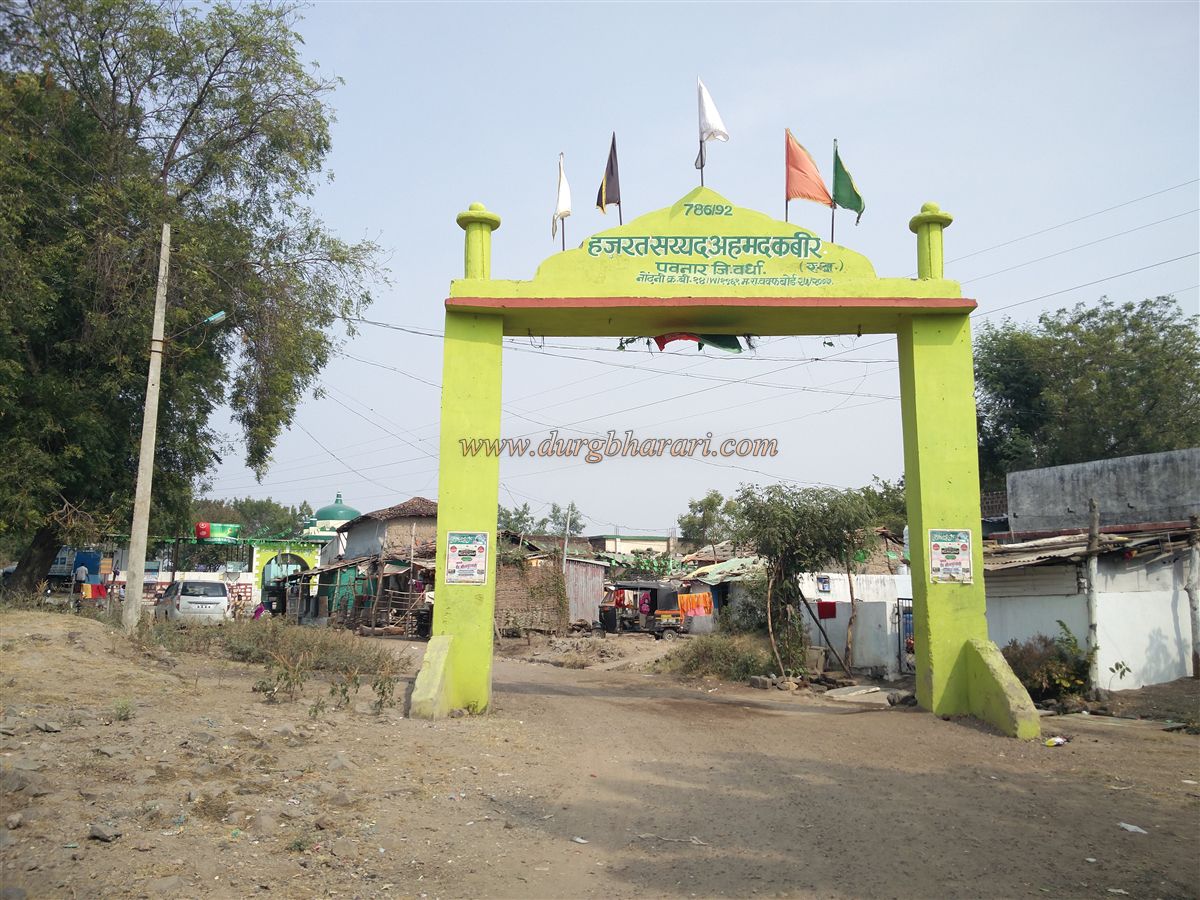
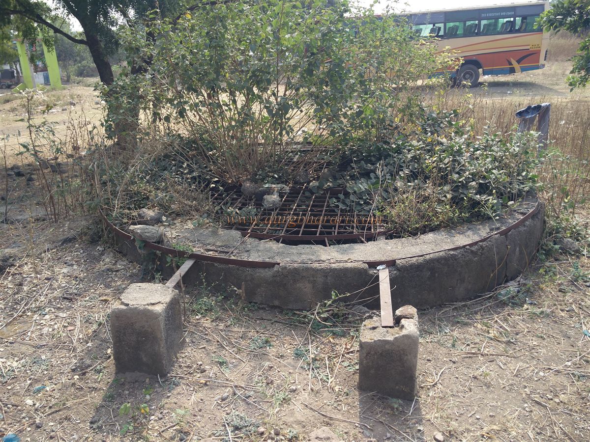
Along the path, one can spot a few signboards from the Archaeology Department, existing in name only. After crossing an arched gateway on the road, you reach a dargah (Islamic shrine) located within the fort. The area around the main dargah is filled with numerous graves, and two smaller dargah have been newly constructed. In the open ground in front of the dargah, there is a deep well secured with an iron grill.
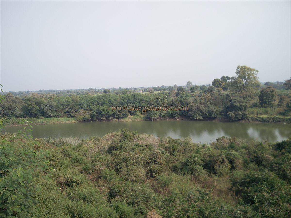
The fort, triangular in shape, spans approximately 8 acres from north to south. As you walk along the fortifications, you can see the Dham River flowing on two sides. If you circle the fort from the river side, remnants of hidden walls and bastions can be found amidst the thick foliage.
During the Mughal era, Pavanar served as an important military post in the Vidarbha region for the Mughals.
© Suresh Nimbalkar
GALLERY