PARNERA
TYPE : HILL FORT
DISTRICT : VAPI
HEIGHT : 570 FEET
GRADE : EASY
During the time of Shivaji Maharaj and the Peshwa, several forts were built along the Maharashtra-Gujarat border. One such fort, believed to have been reconstructed during Shivaji’s reign, is Parnera Fort. This fort was likely built to monitor the Par River, which flows to its south, and the surrounding region, as it stands on the only high hill in the area. Though this region was once part of the Swaraj, it became part of Gujarat during the linguistic reorganization of Indian states. Since the fort was under Shivaji’s rule, it is considered part of Maharashtra's fort heritage.
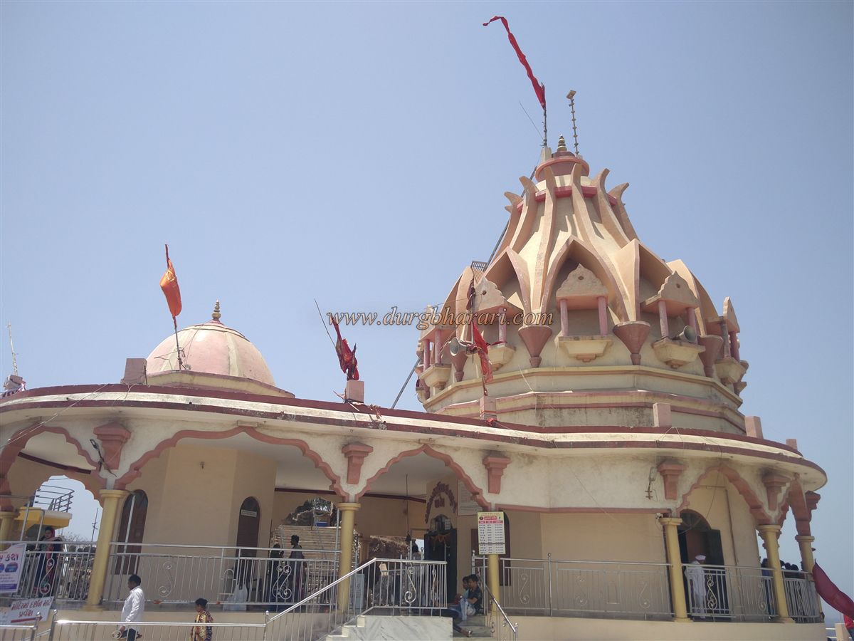
At present, due to the temples of Rameshwar Mahadev, Chandika Mata, and Kalika Mata situated atop the hill, the site is more widely known as a pilgrimage spot than a fort. Although Atul railway station, located between Vapi and Valsad, is the closest to the fort, trains halt there irregularly.
...
Therefore, it is more convenient to reach the fort via Valsad. The fort is located 2 kilometres from the Mumbai-Ahmedabad Highway, about 10 kilometres from Valsad and 24 kilometres from Vapi. Shared rickshaws are available from both towns to reach Parnera village. Because of the temples, the hill is easily recognizable from afar.
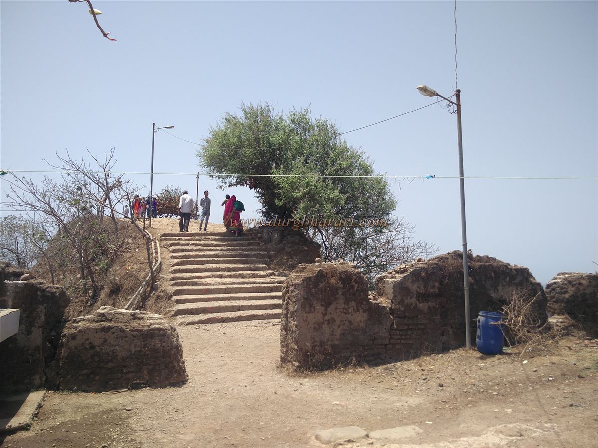
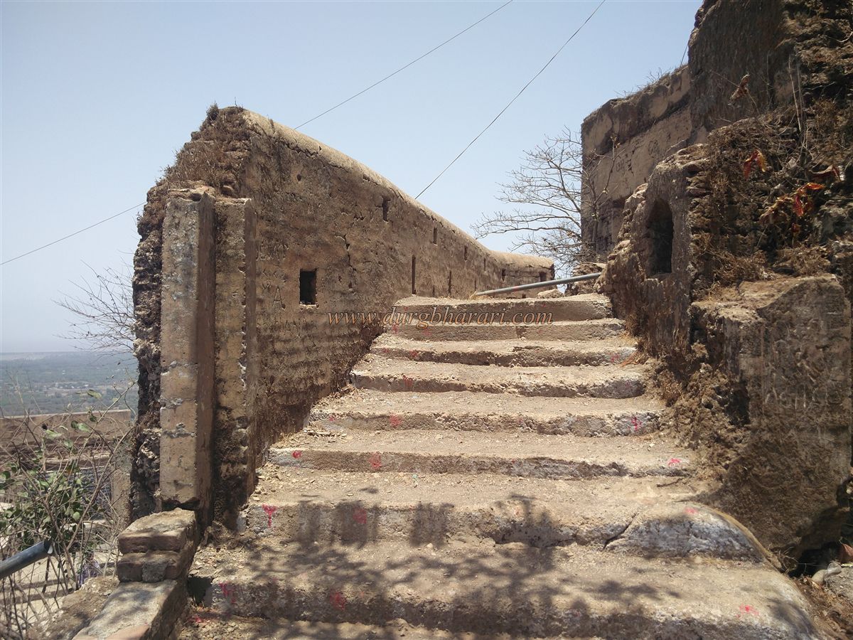
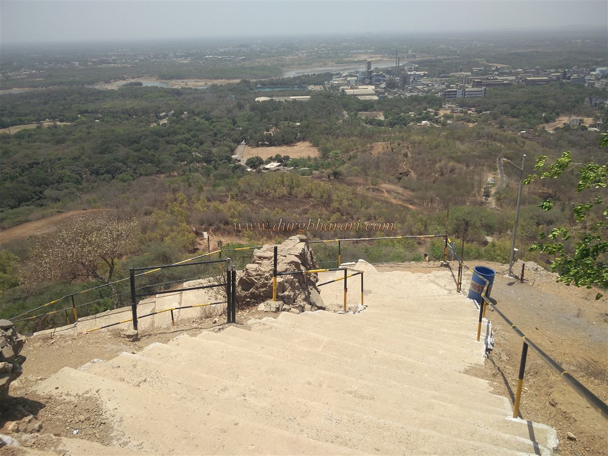
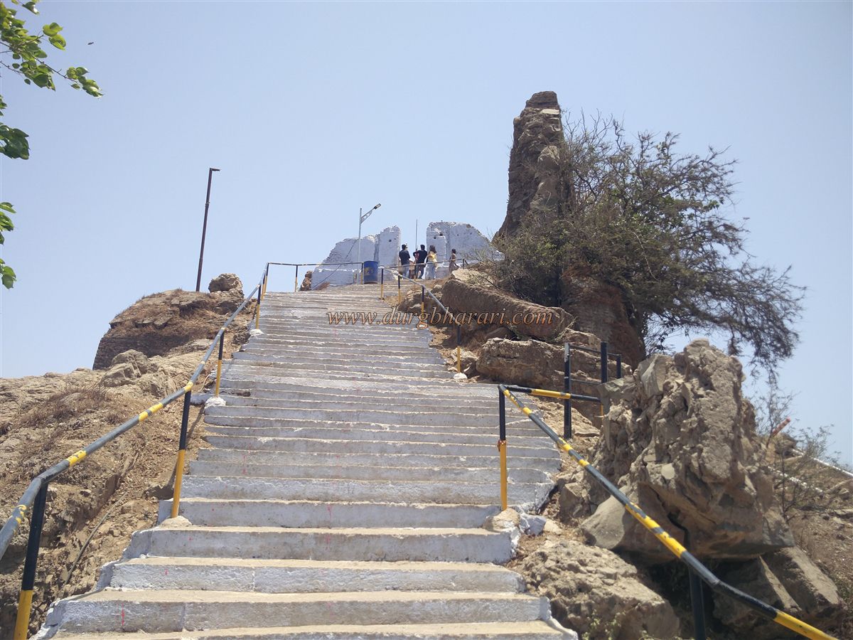
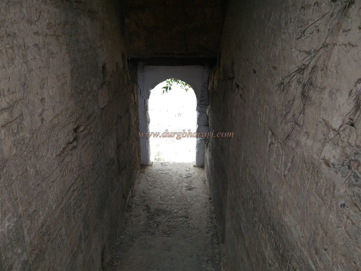
The hill extends north to south, and in recent years, steps have been built on both sides for the convenience of devotees. From Dungarwadi village, located 3 kilometres from Atul railway station, one can enter the fort from the south. Those arriving via Valsad or the Mumbai-Ahmedabad highway can access the fort from the north through Parnera village. The staircase from Parnera village is covered with a roof until the top, and the ascent to the fort walls takes about 30 minutes.
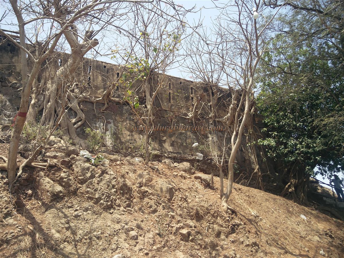
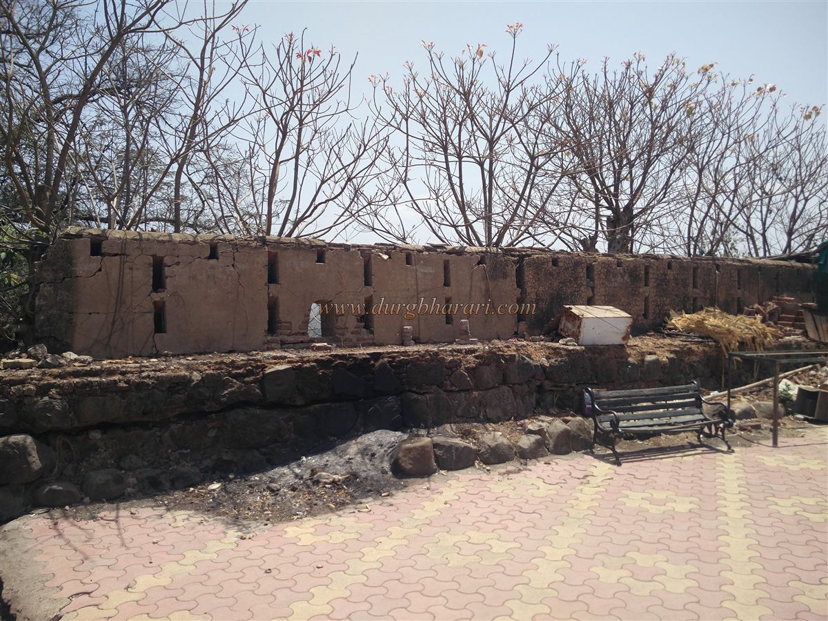
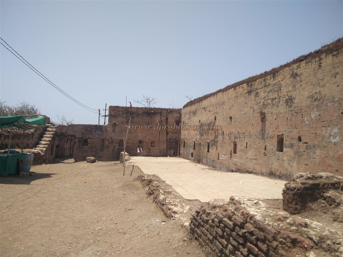
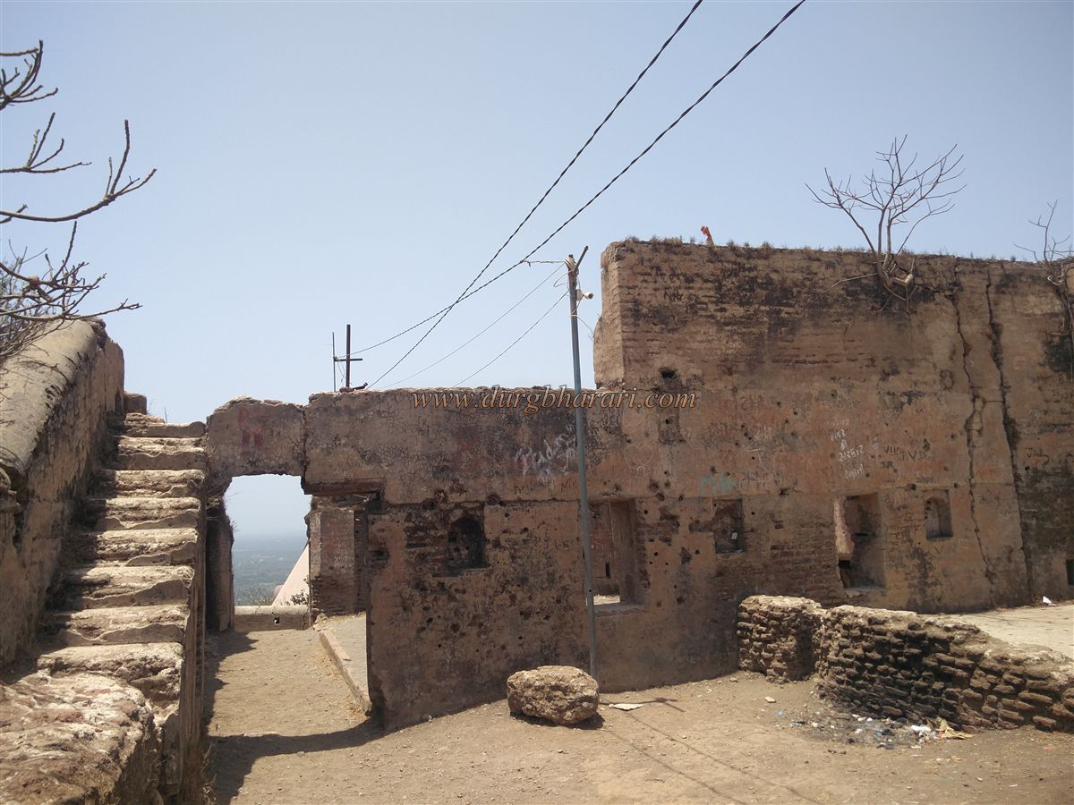
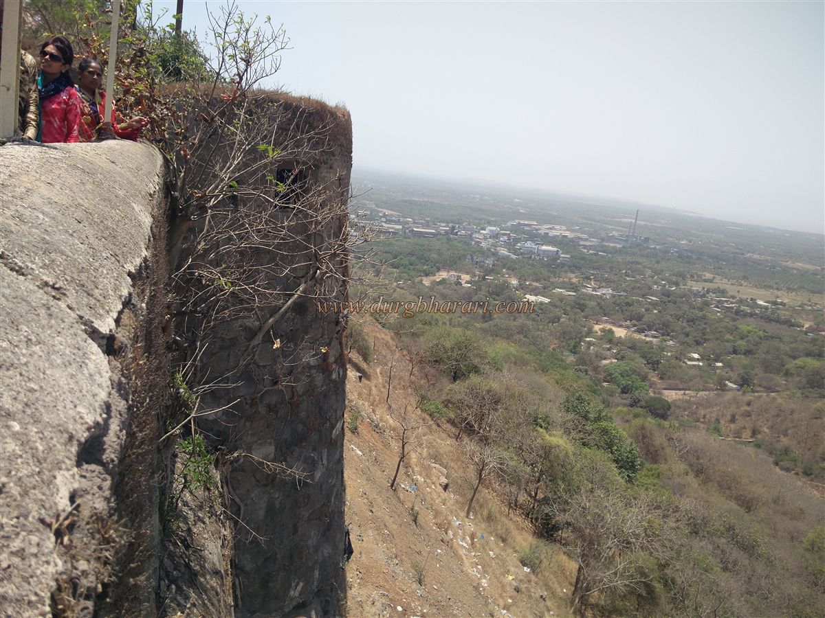
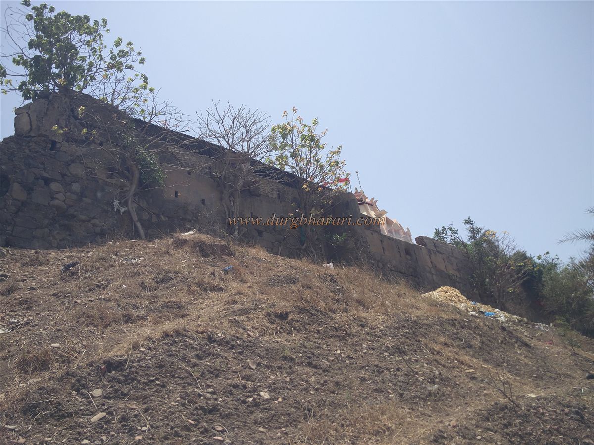
The walls have loopholes for gunfire. Outside the northern wall is the Rameshwar Mahadev temple. The fort stands 500 feet above sea level and spans about 3 acres in a narrow north-south layout. There are two main entrances—on the north and the south. Due to the number of pilgrims, additional stairways have been constructed by breaking sections of the wall. These are not meant for fort explorers. For them, a path along the wall leads to the eastern-facing arched northern gate.
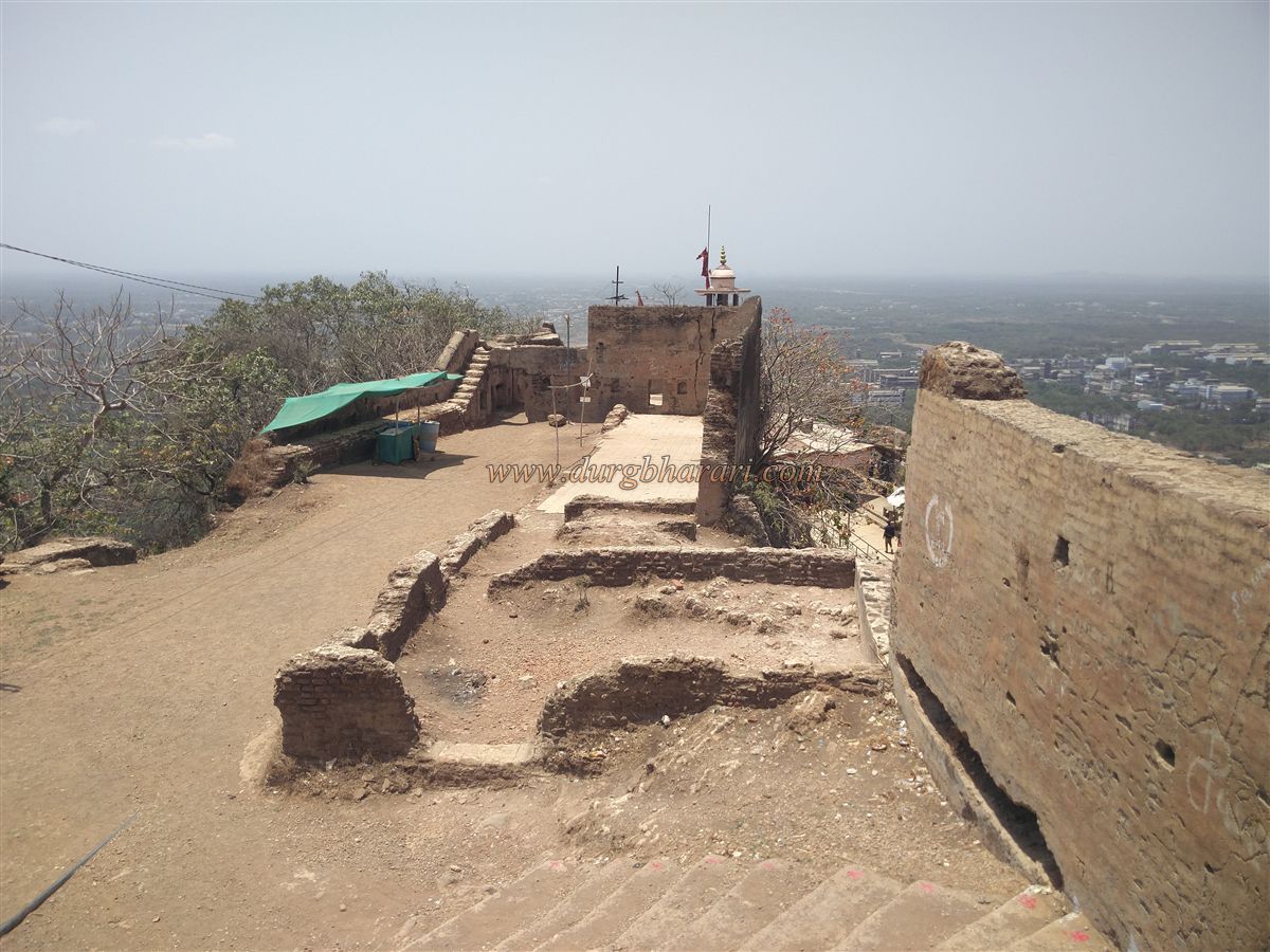
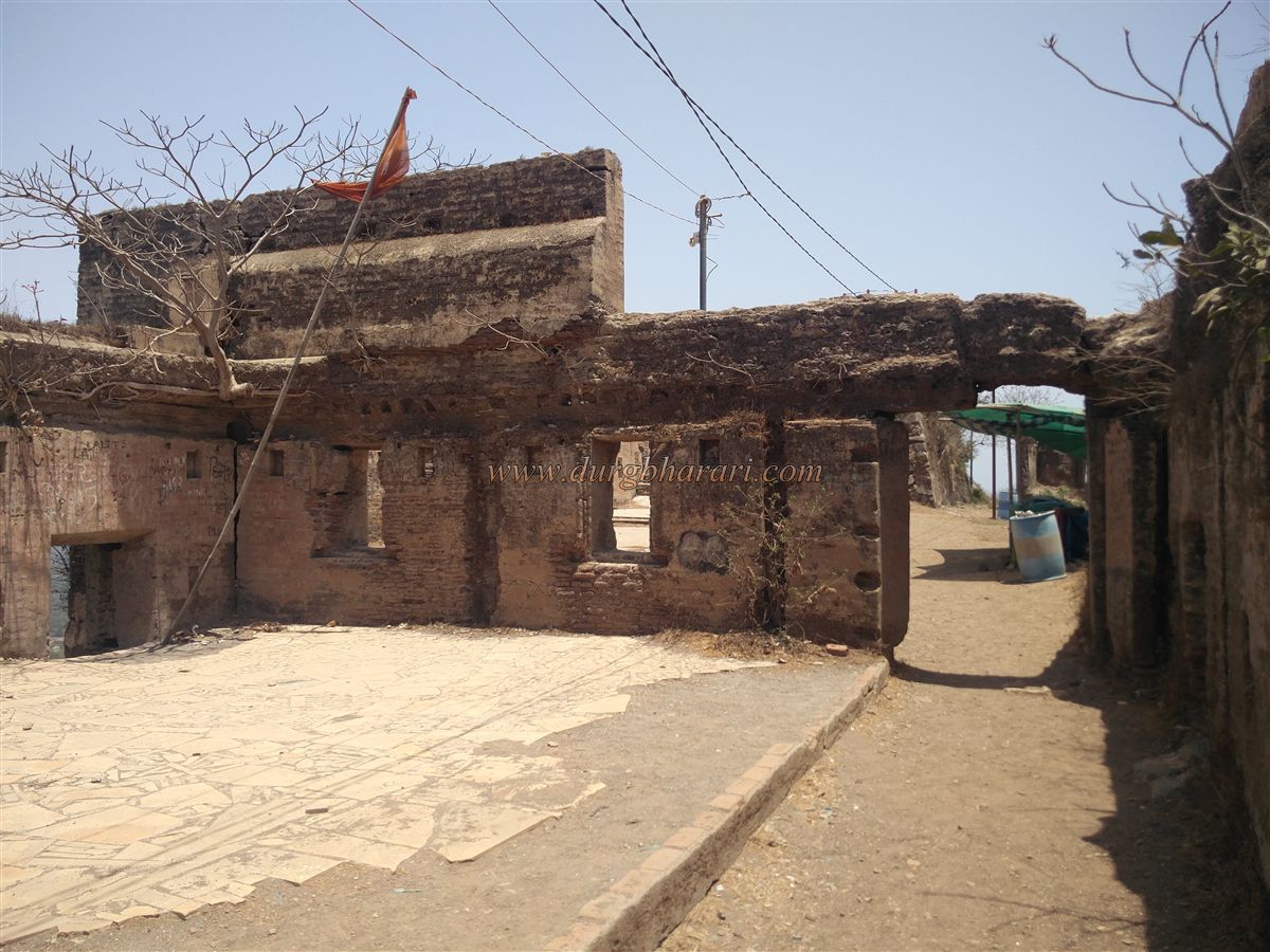
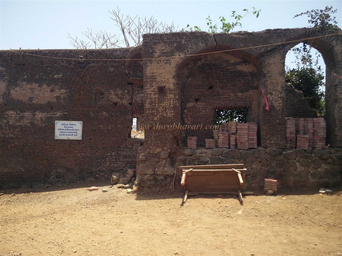
Inside this gate, in the sentry chamber, is the grave of Chand Pir Baba. Upon entry, to the left is the Chandika Mata temple, straight ahead is a Dharamshala for devotees, and to the right are three large cannons placed near the new stairway. Though the fort is small, it is divided into two sections: the outer area, known as the Machi, and the higher section, the Balekilla. The Balekilla is a raised part behind the Chandika temple, while the flat areas on either side form the Machi. The Machi is protected by fortified walls and eight bastions, whereas the Balekilla has a stone wall around it.
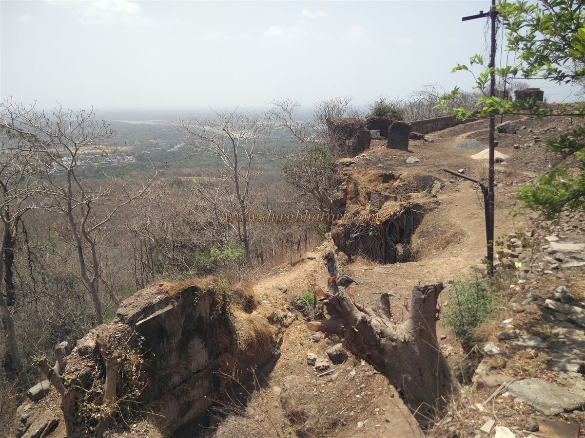
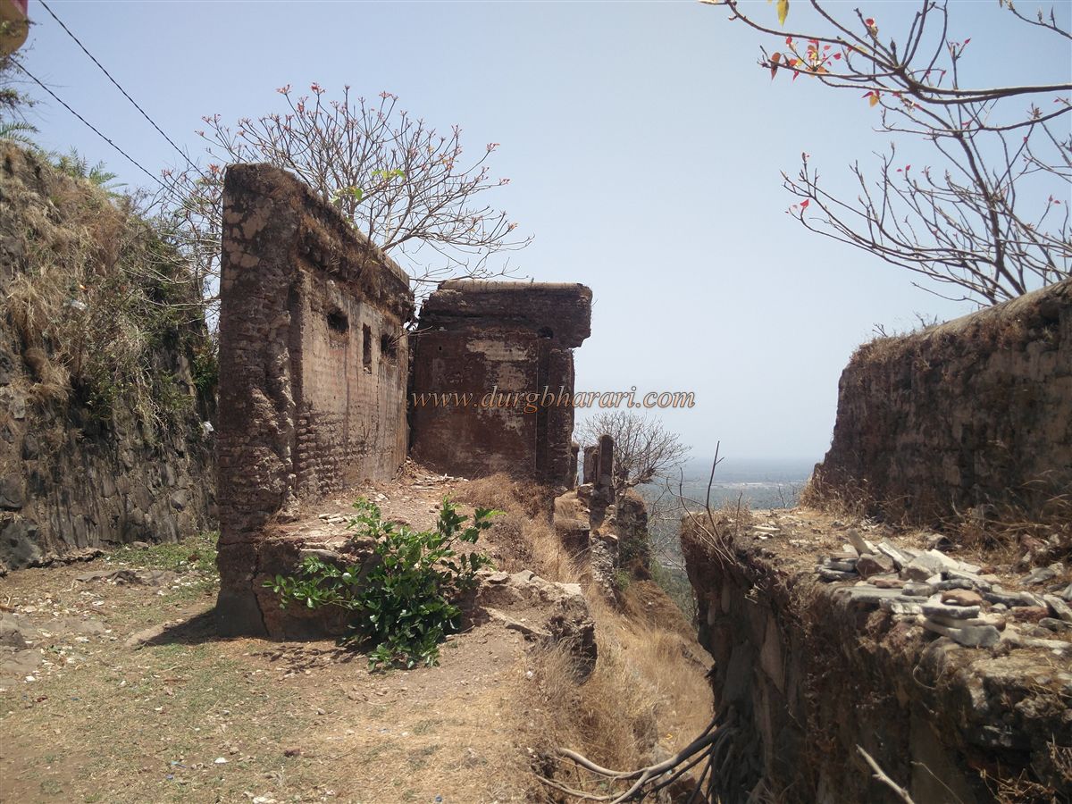
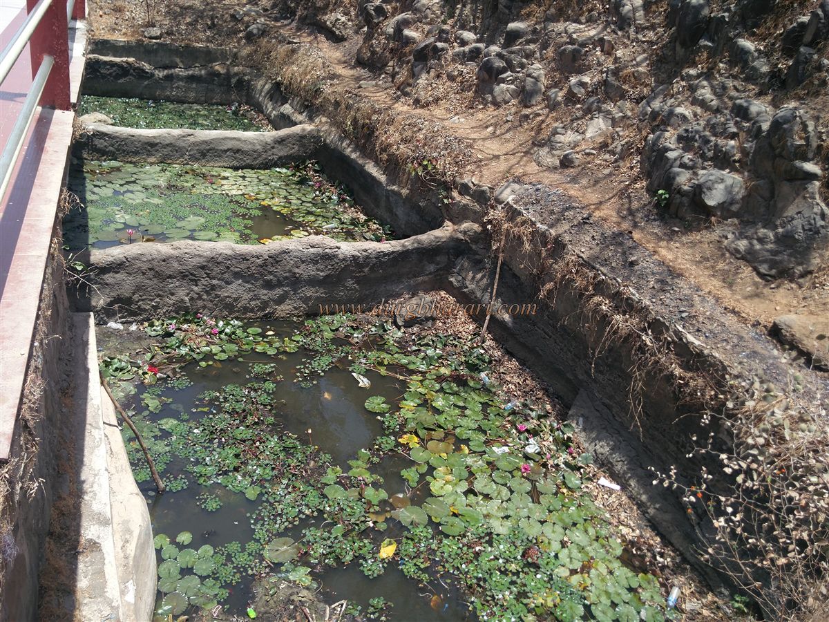
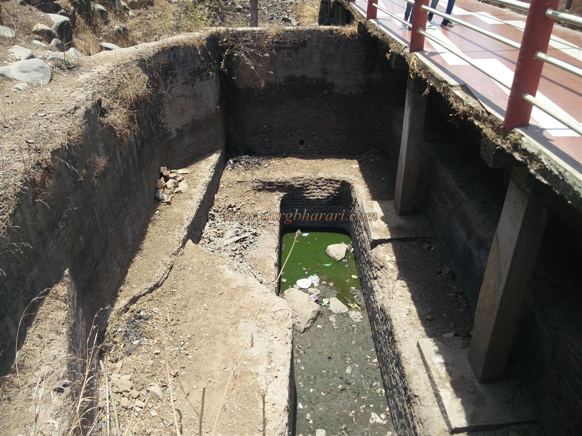
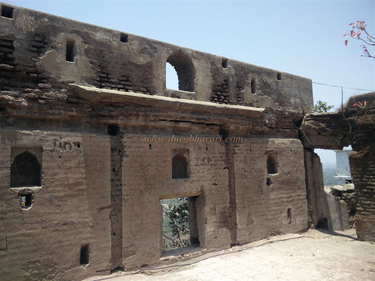
The path behind the Chandika Mata temple leads to the Balekilla. Its summit is narrow and contains many structural remains, including parts of a two-storey mansion. From the Balekilla, one can clearly see the eastern Machi, two rock-cut water cisterns lined with lime, three bastions, and the entire fortified wall. The view from the Balekilla includes the Par River and the surrounding landscape, showing the fort's strategic importance.
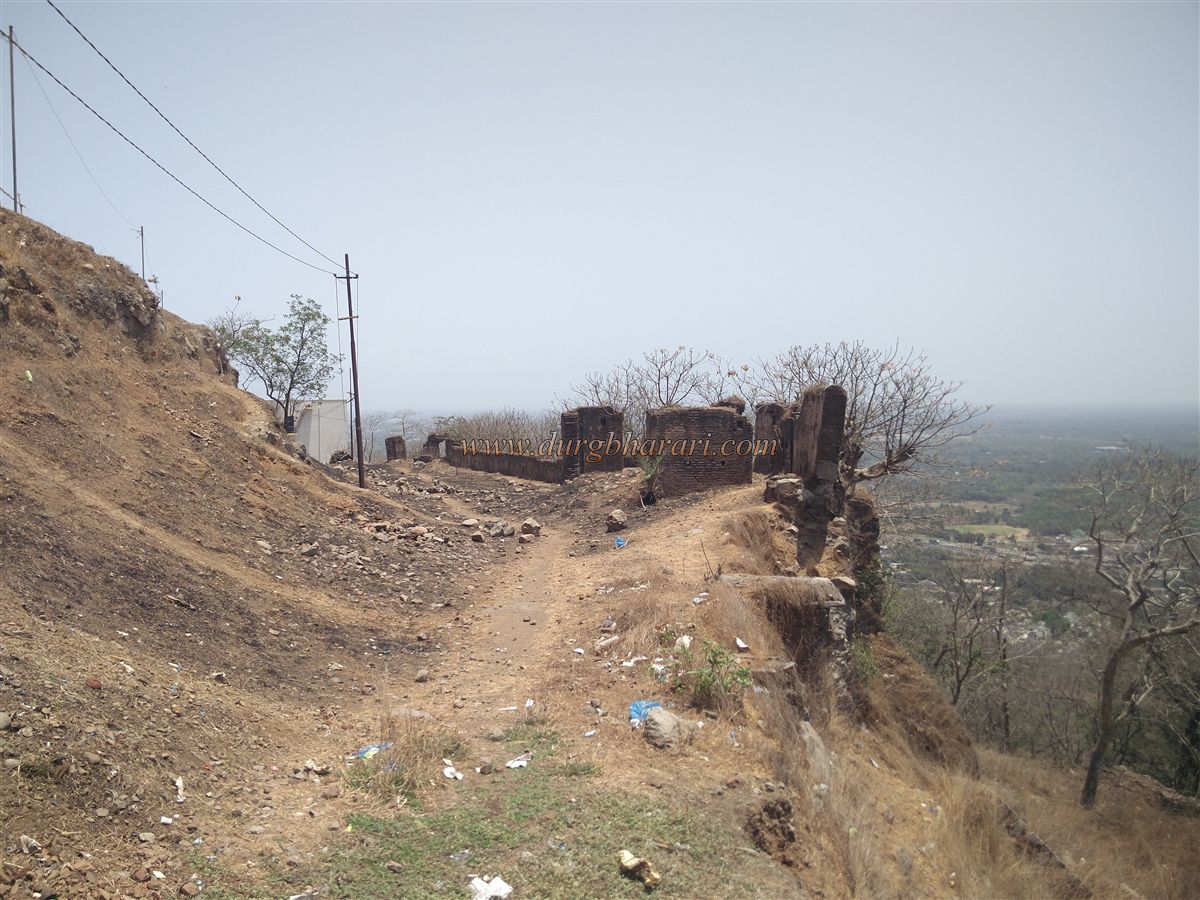
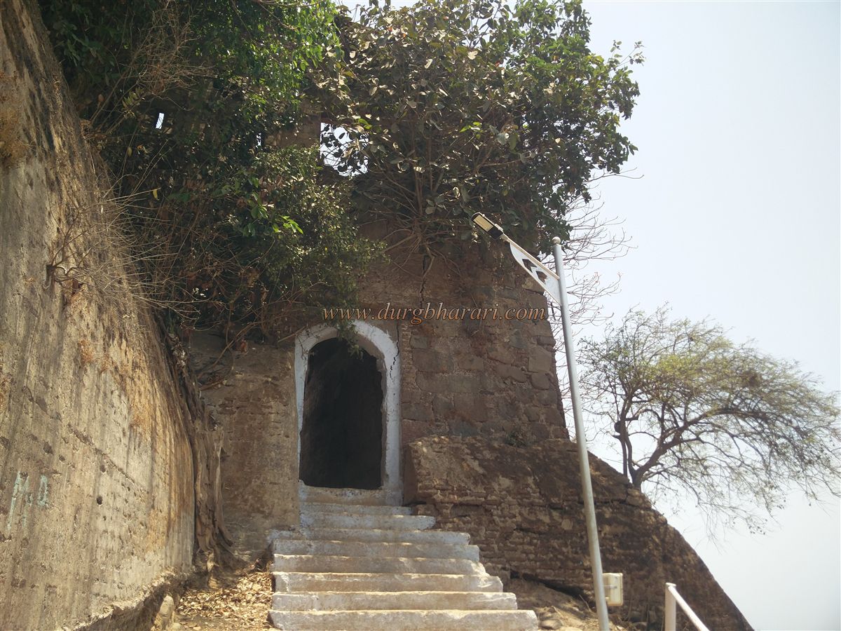
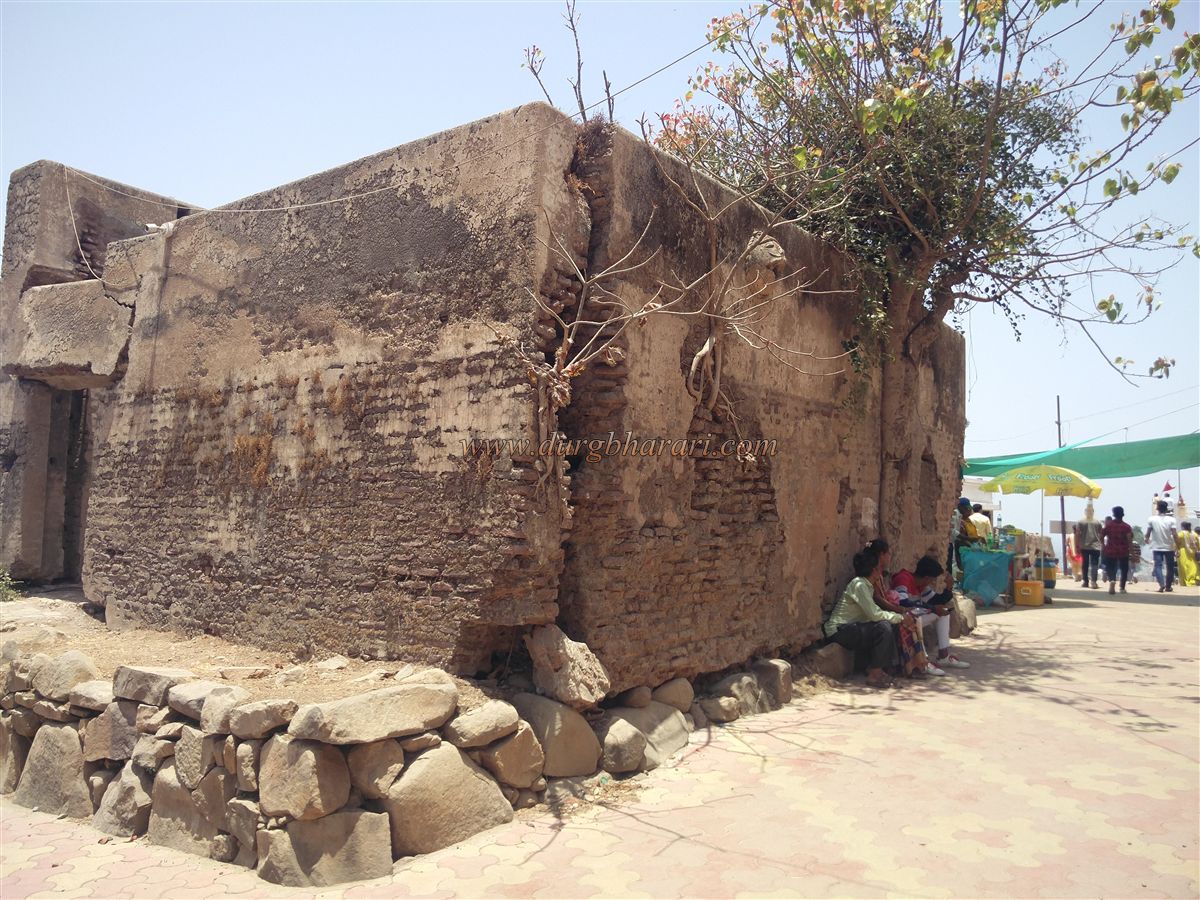
Steps at the edge of the Balekilla lead down into the Kalika Mata temple premises. Just ahead of this temple is the southern gate of the fort, next to which lie extensive ruins. This gate faces north and is about 6 feet tall. It is protected not by a bastion but by the extended line of the wall.
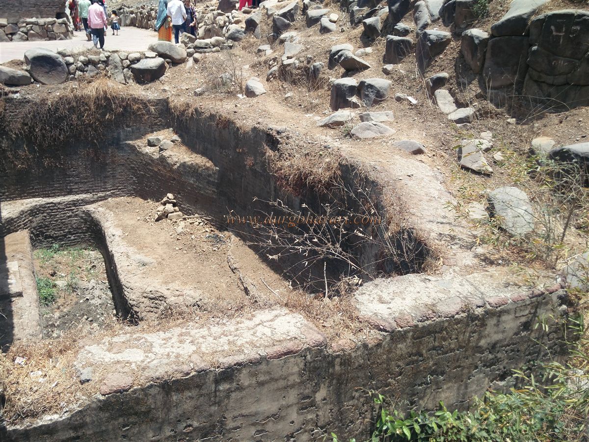
After viewing the southern gate, one must return to the Kalika temple and continue walking along the western part of the Machi. At the beginning of this section are five rock-cut water tanks, one of which is lined with lime. A small bridge has been built over one tank, leading to the next section of the Machi. Here, the remains of a mansion are visible, still standing upright though without its roof or doors. From here, walking back to the cannons seen at the beginning completes the visit. The entire fort can be explored in about an hour.
Though the original builder of Parnera Fort is unknown, the rock-cut water tanks on the hillside suggest the site is ancient. In the 15th century, it was under the control of the Koli kings of Ramnagar. By the end of that century, it was captured by the Sultan of Gujarat, Mahmud Begada. In the 16th century, it came under the control of the Pindaris. When the Portuguese captured Daman in 1551 CE, the local forces took refuge in this fort. The Portuguese then attacked Parnera Fort, causing extensive destruction and leaving it abandoned.
Later, in 1676, Chhatrapati Shivaji Maharaj rebuilt the fort. It remained under Maratha control until 1780 when it was captured by British forces under the leadership of Lieutenant Wales. After the revolt of 1857, the British deliberately destroyed large parts of the fort, rendering it nearly ruined.
© Suresh Nimbalkar
GALLERY