PARASGAD
TYPE : HILL FORT
DISTRICT : BELGAON
HEIGHT : 2740 फुट
GRADE : EASY
The place of Goddess Yellamma, famous in Maharashtra and Karnataka, is located in Saundatti Taluka of Belgaum district. A large number of devotees and tourists from Maharashtra visit the hill where the Yellamma Devi temple is situated. However, very few people know that on the same hill plateau, at some distance from the temple, lies Parasgad Fort, which was repaired by Chhatrapati Shivaji Maharaj.
Because of the nearby Yedravi village at the base of the fort, the fort is also known as Yedravi Fort. It is located only 4 km from the temple. This region, once a part of the Swaraj (self-rule), was later merged into Karnataka during the state reorganization based on language.
...
Most forts in Belgaum district are of the land fort (Bhuikot) or walled mansion (gadhi) type. Except for a few, tall hill forts are very rare here. The ones that can be called hill forts are built on small elevations or hills. Parasgad is also built on the western edge of a small hill, which has a large plateau.
Saundatti, the taluka town, is about 87 km from Belgaum. As one enters the town, the bastions and fort walls of Parasgad Fort on the hill behind the town start becoming visible. There are two routes to reach the fort from Saundatti. One route is through Yedravi village, 3 km away, from where a short climb of steps takes about 15 minutes to reach the fort’s western entrance. The second route is by private vehicle via the road that goes to Yellamma Devi temple, from which it is 5 km to reach the fort’s plateau-side western entrance.
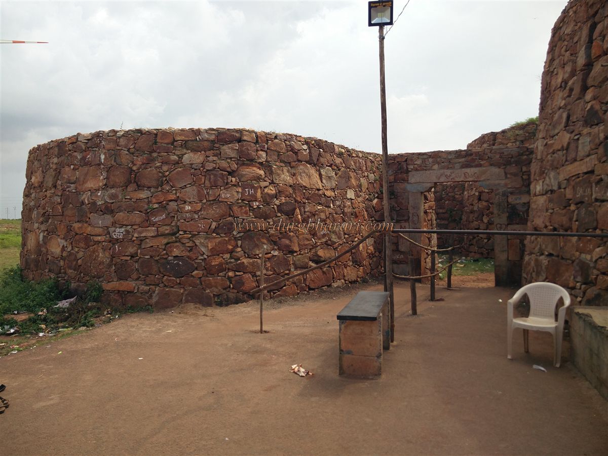
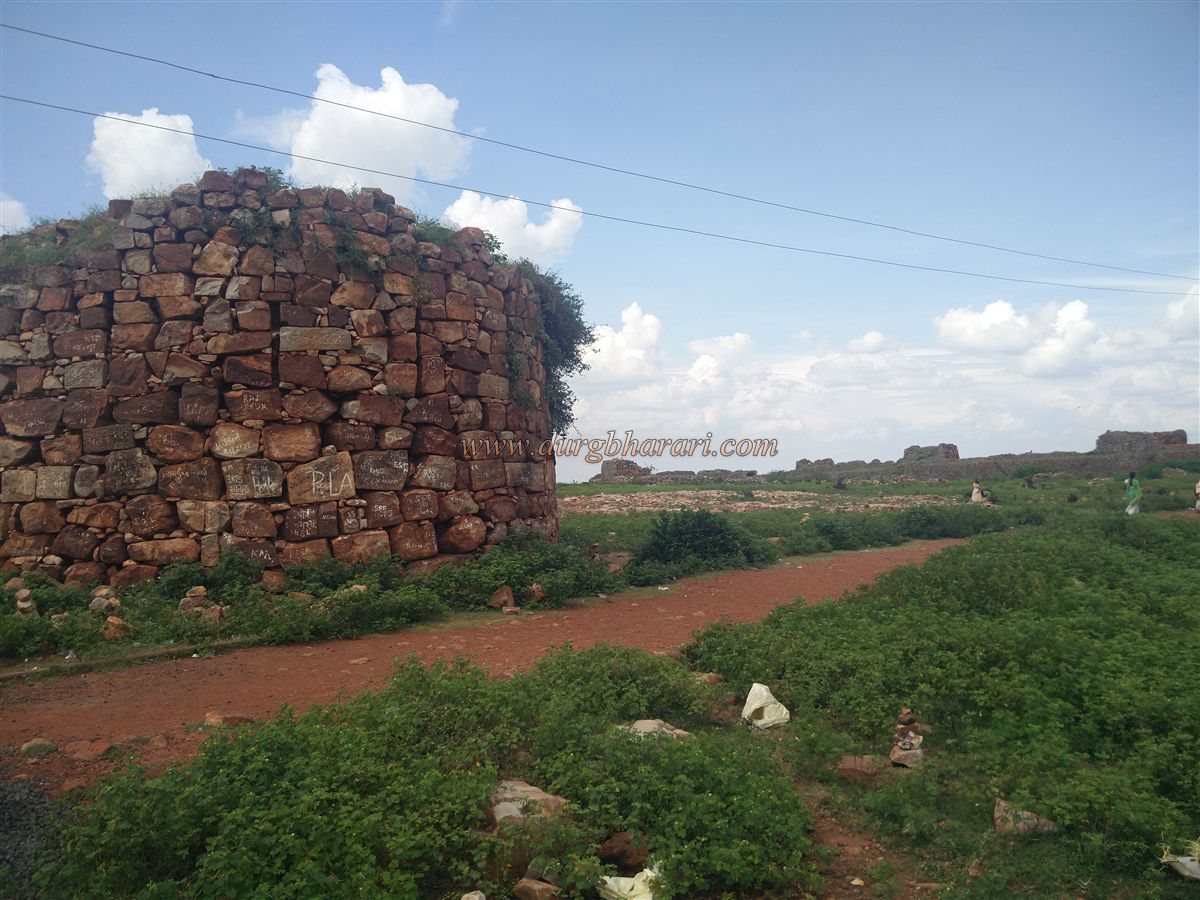
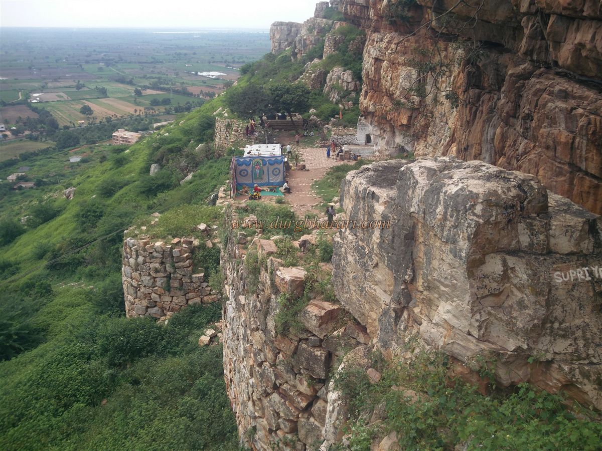
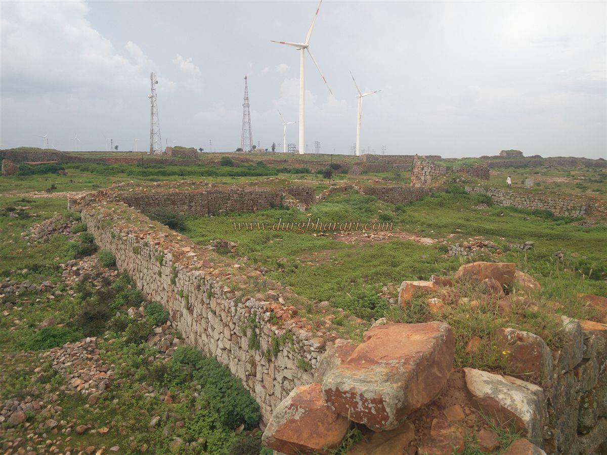
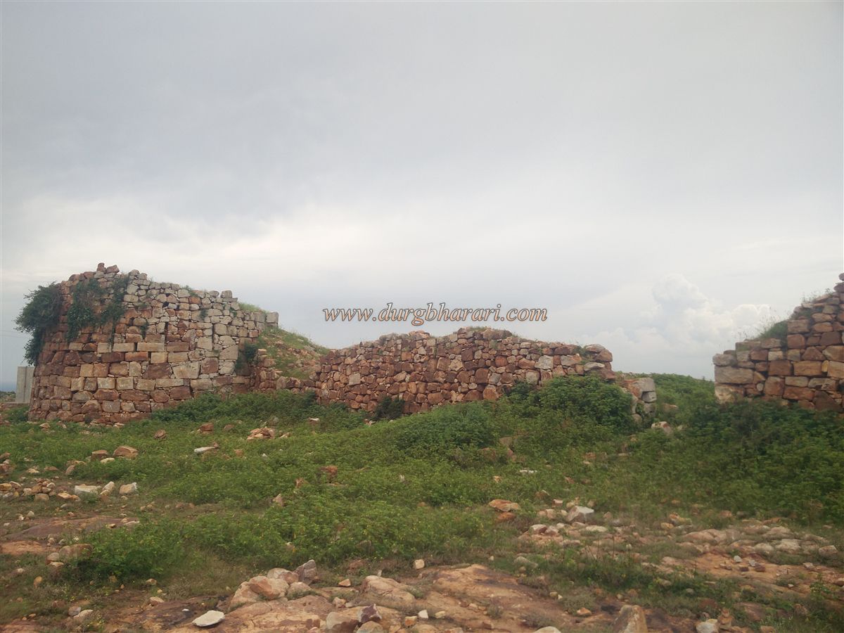
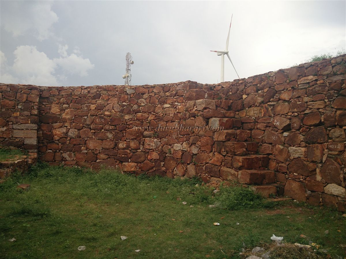
The plateau section of the fort is 1650 feet long and has 10 bastions, enclosed with fort walls. These walls, built from rough stone, are around 15 to 18 feet tall and have loopholes for gun firing. An entry fee of ₹5 per person is charged here, though there are no facilities or cleanliness, and the purpose of this fee is unclear.
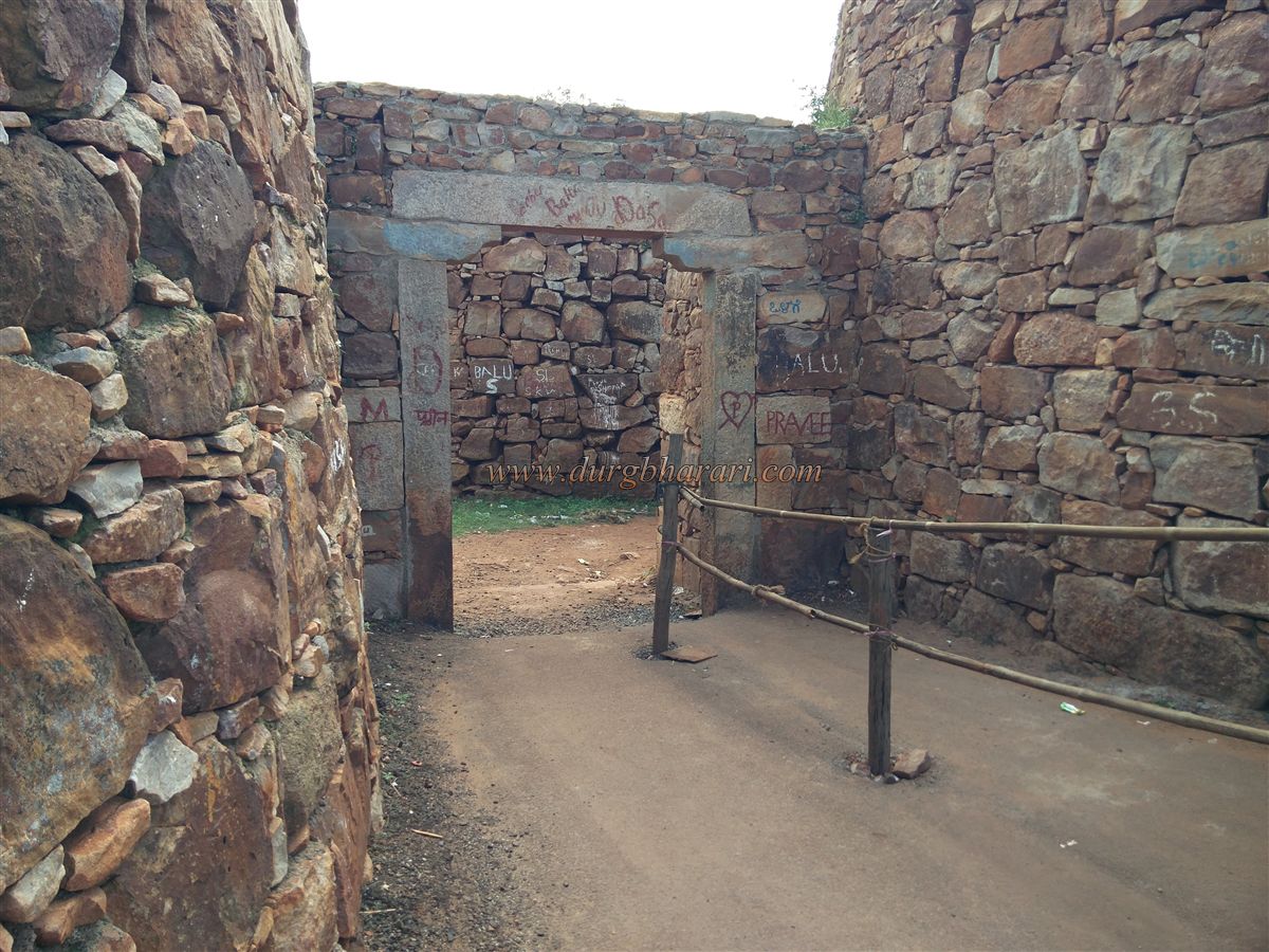
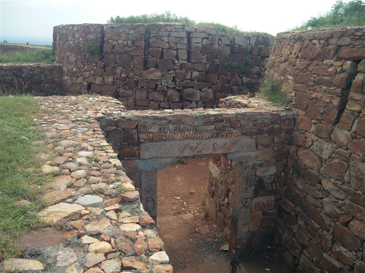
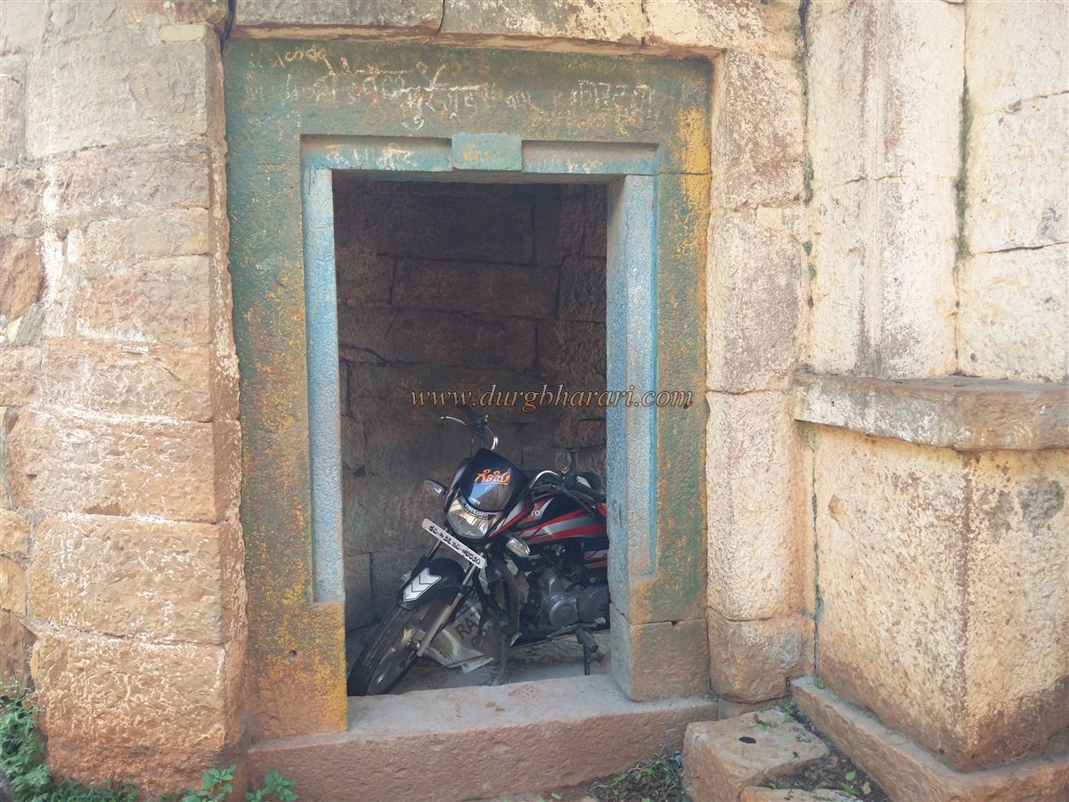
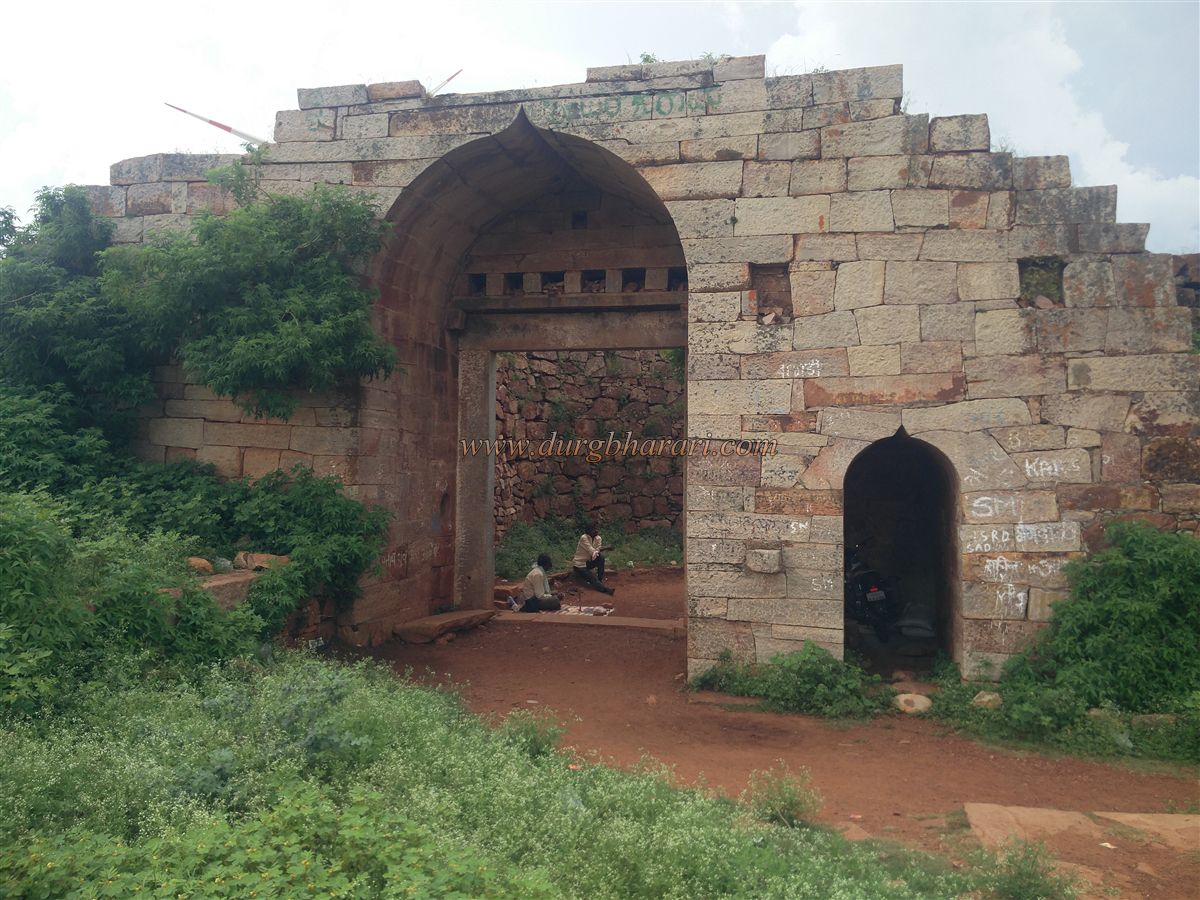
In front of the fort’s main entrance, there is another entrance in a Gurmukhi (cow-mouth) style. These two gates seem to have been built in different periods. The gomukhi gate was probably built during the Shivaji era. It is situated between two bastions, with sentry chambers inside and steps leading up to the fort walls. The path to the inner main eastern gate is very narrow and completely enclosed. Through this winding path, one reaches the main gate facing east, which is also constructed between two bastions. There is a smaller entrance inside the nearby bastion. While the entire fort is built of rough stone, this gate is made of finely cut stone. Inside, steps lead to the top of the fort walls, from where the entire fort can be viewed.
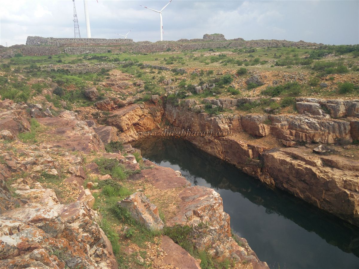
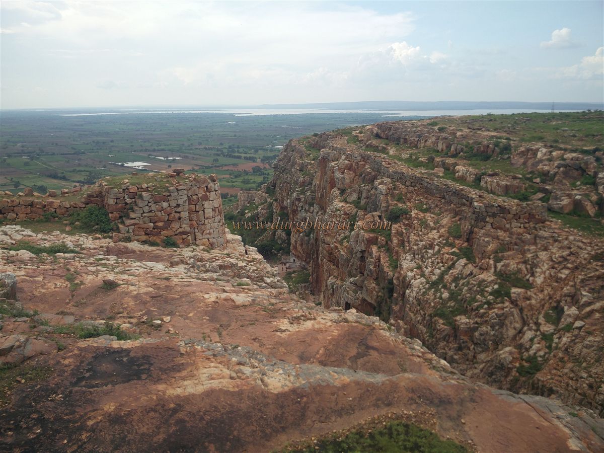
At an altitude of 2750 feet above sea level, the fort has a ruined palace between two bastions in its central part, with 2-4 damaged platforms, and no other structures are visible. The fort covers an area of about 40 acres and is divided into two parts by a ravine. Steps are visible along the ravine slope. There is a route through the ravine to reach the plateau from the hill base.
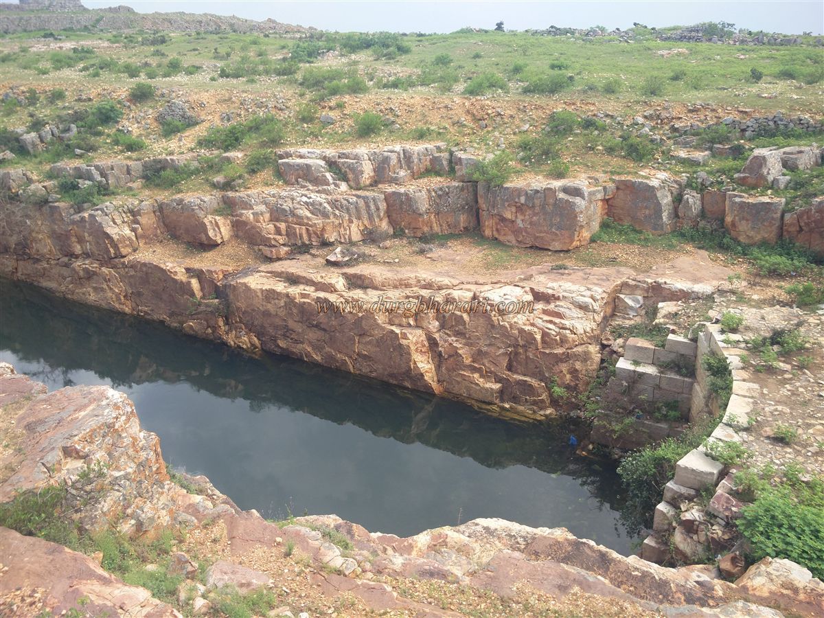
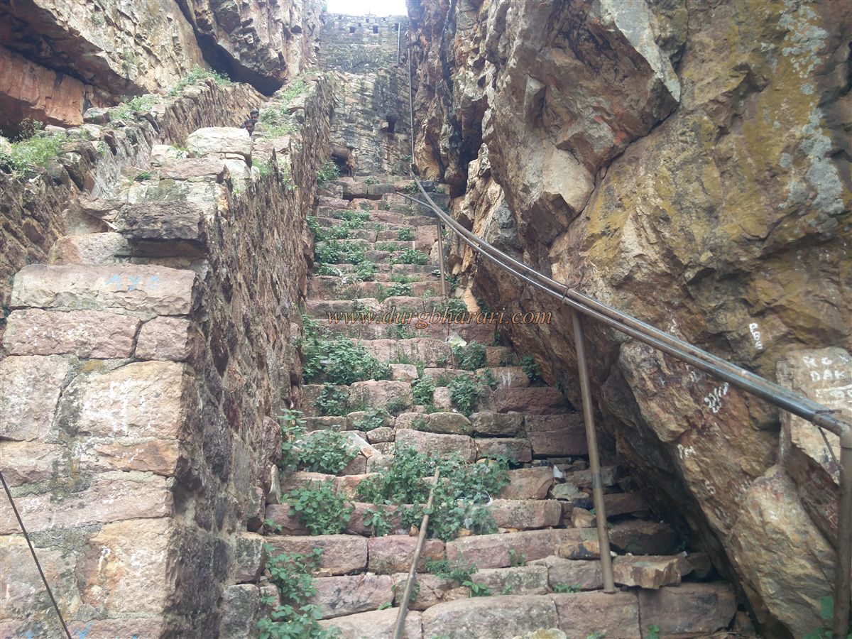
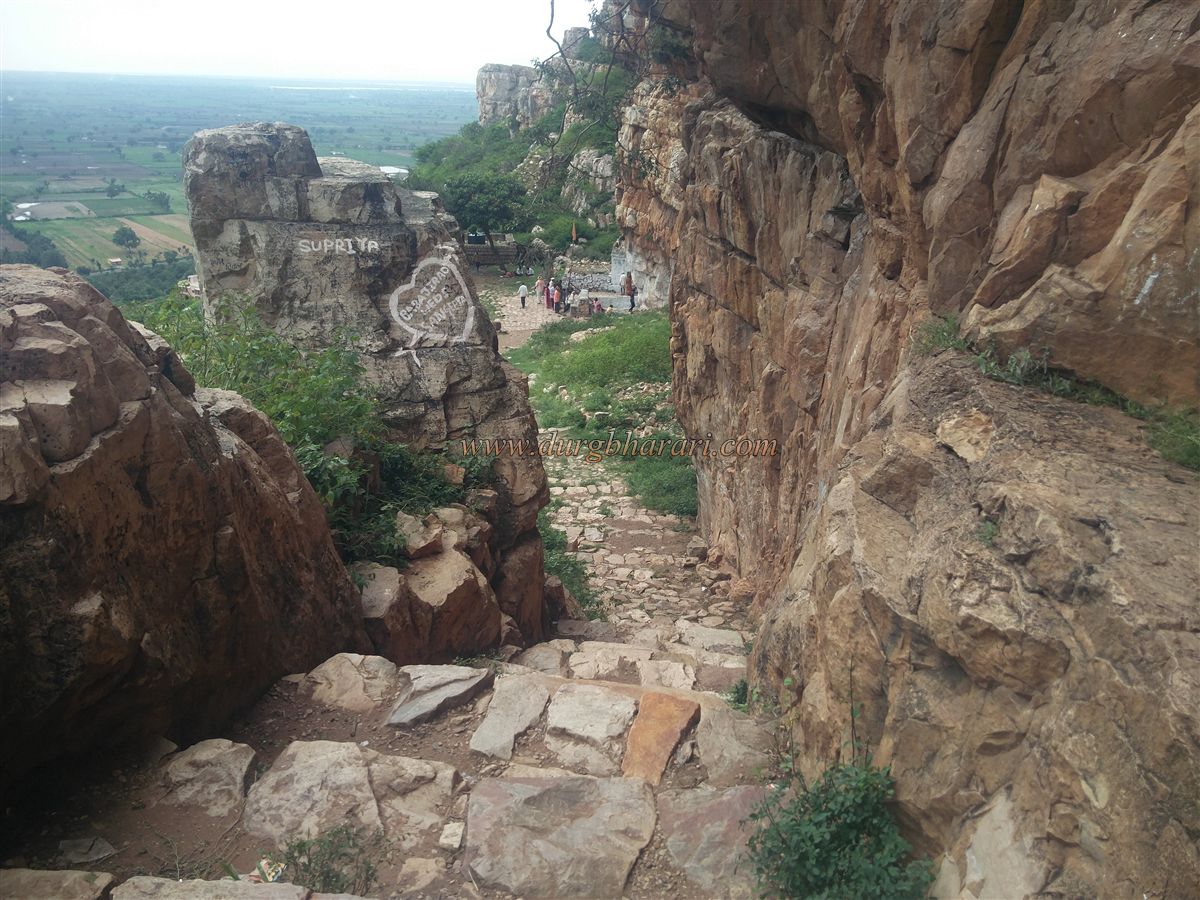
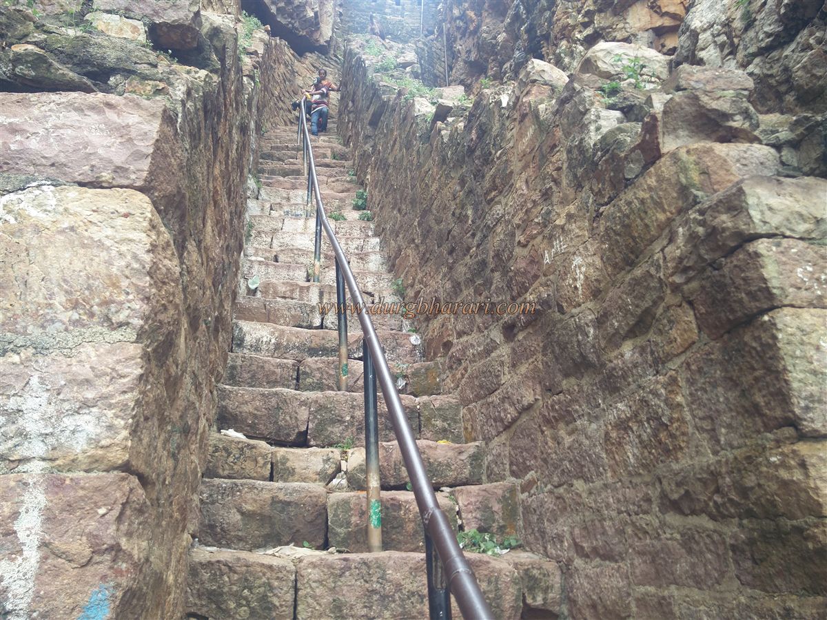
On the way to the ravine, to the right, there is a ruined Hanuman temple, and a little further behind it are two damaged platforms. The path towards the ravine is well-used and paved in some sections. After walking 5 minutes along this route, one reaches near the ruined palace. The palace is 150 x 150 feet in square shape and is mostly in ruins now. The eastern entrance of the palace is completely destroyed. A few steps from here lead to the upper part of the ravine. At the slope, a retaining wall has been built to stop the flow of water, and a large water tank has been dug in the ravine to collect water. Cement steps are built to descend into the ravine, which divides the plateau into two parts.
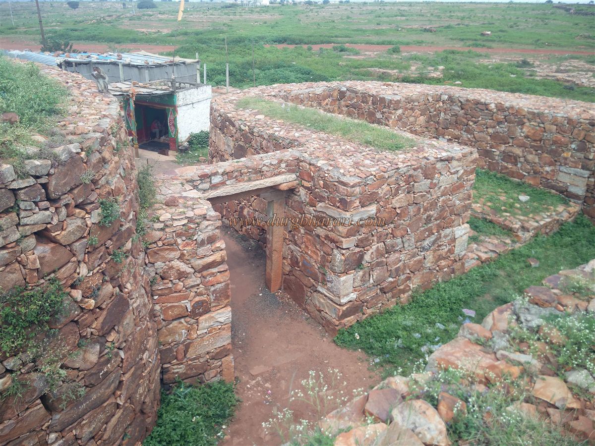
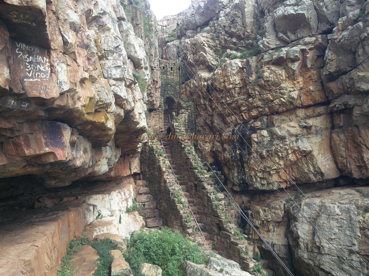
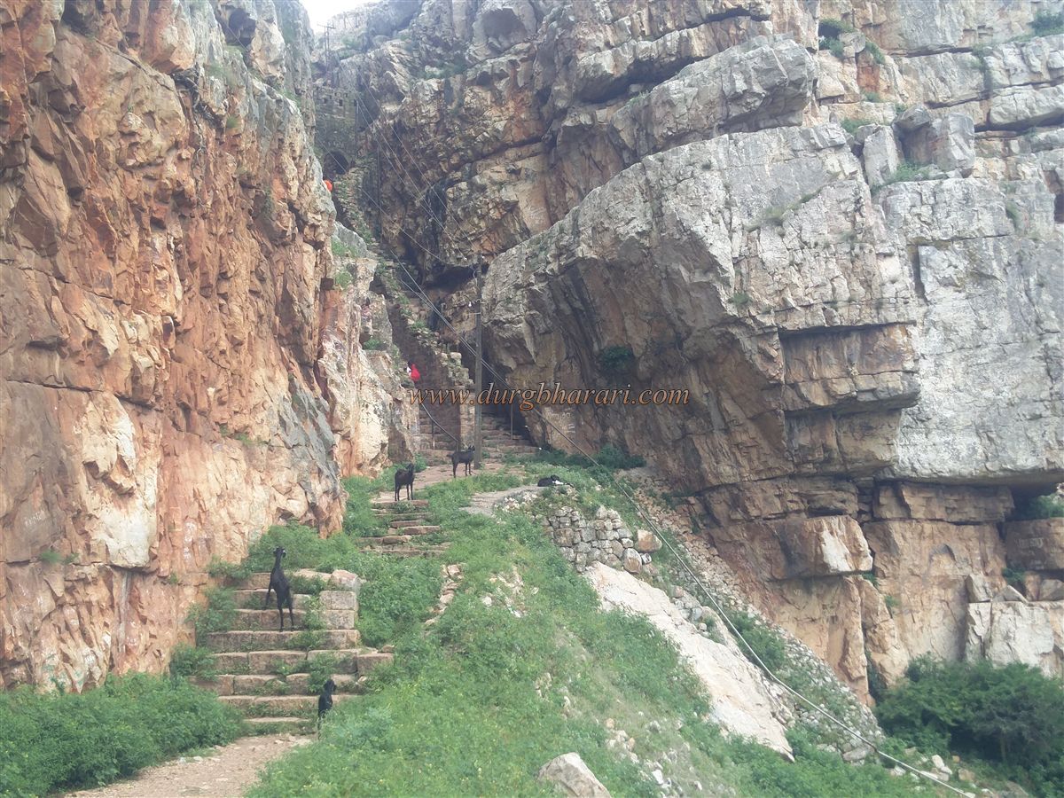
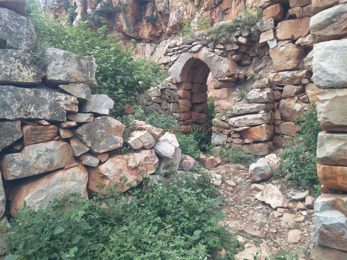
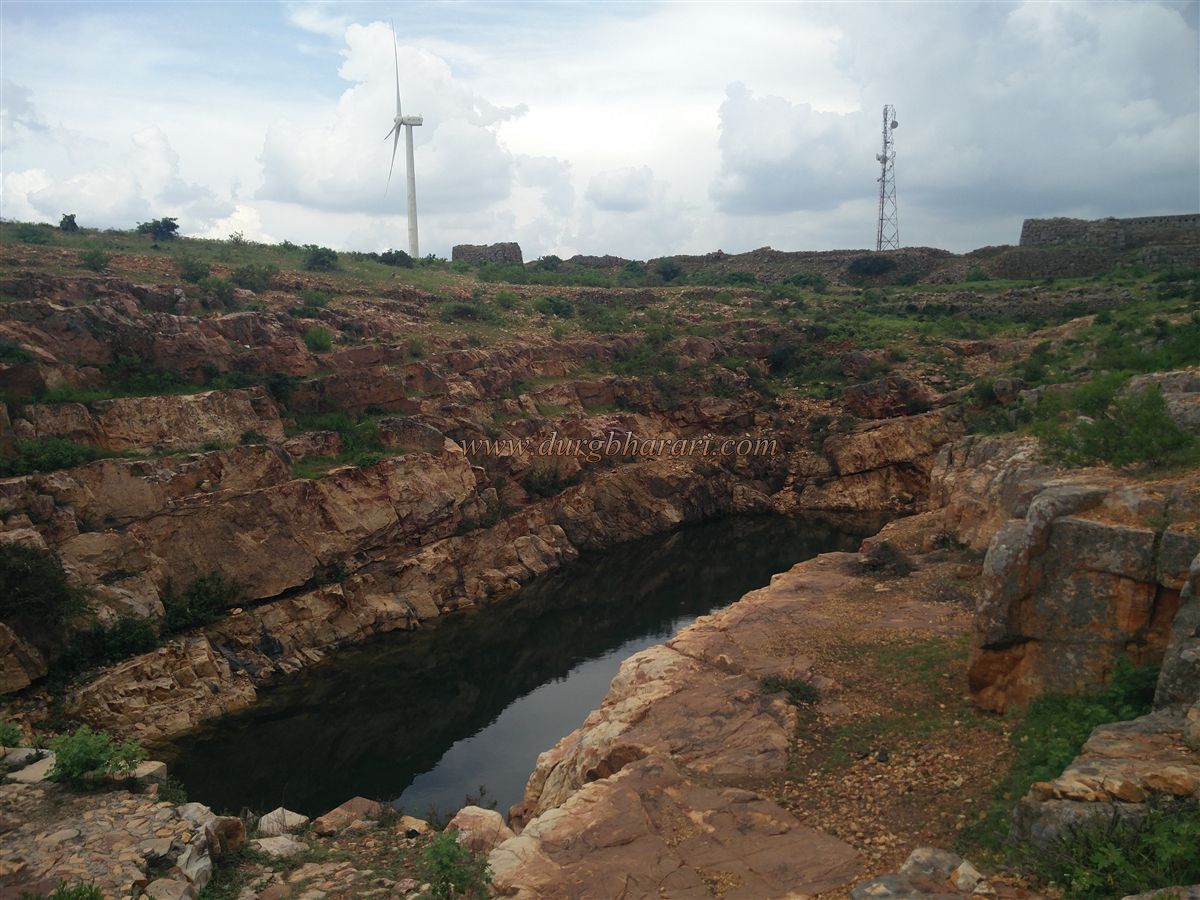
Both parts of the plateau are enclosed with walls and bastions. On the right plateau, in the northern corner, triple fortification is seen, while on the left plateau, there are remnants of past settlements. Across both sections, there are a total of 12 bastions. Descending through the ravine steps brings one to the western gate, built with an arch, which is still in good condition and has a flag post above. Gun firing loopholes are present in the wall above the gate. The descending steps are steep and enclosed with walls on both sides. There are two small arched exits in the wall, leading to watchmen's rock-cut caves.
After descending, one reaches a small flat area along the cliff, which is fully enclosed with walls and bastions. On the left side, during the descent, is the west-facing fort gate, from where the path from Yedravi village comes up. However, this path is rarely used now.
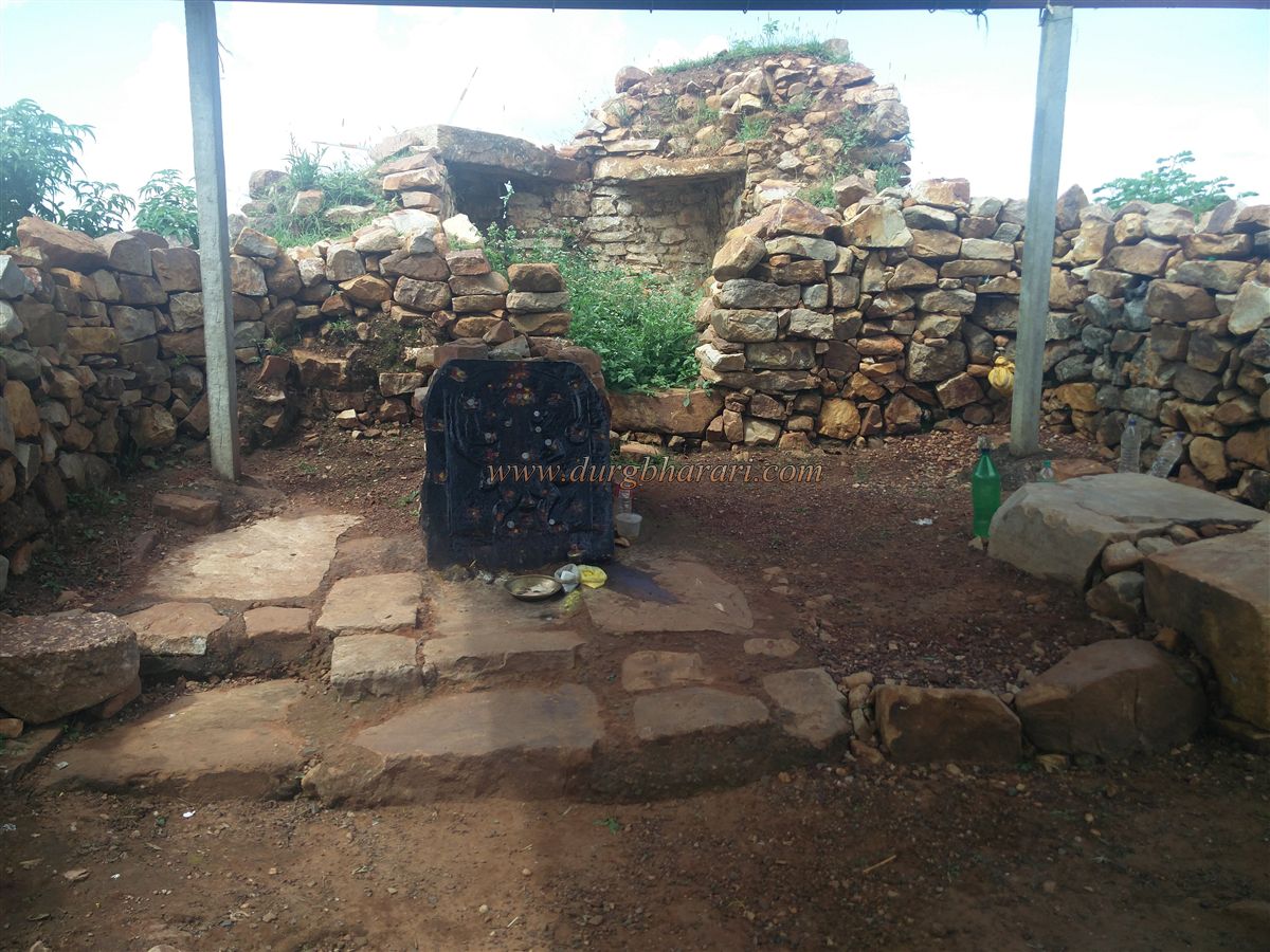
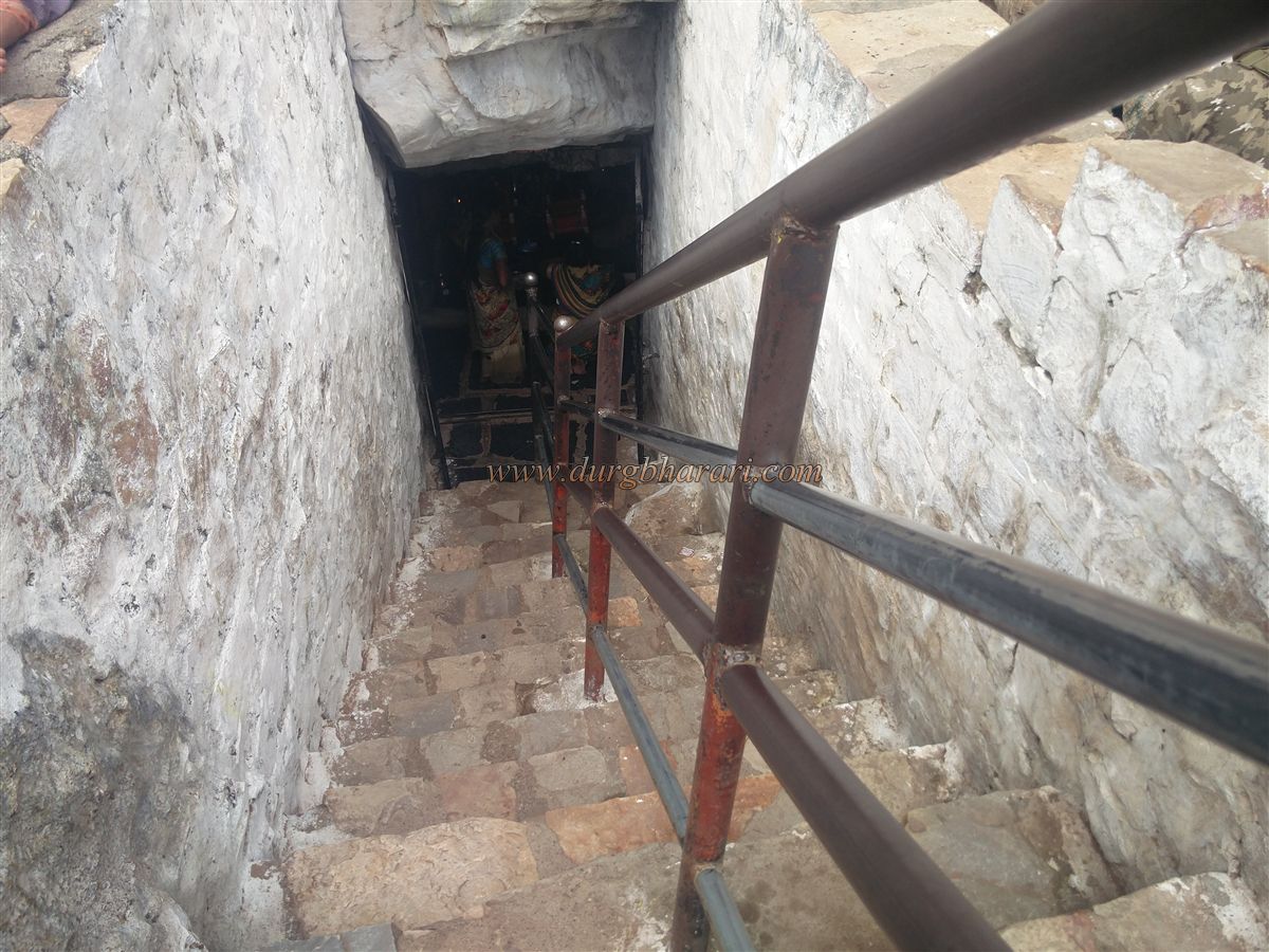
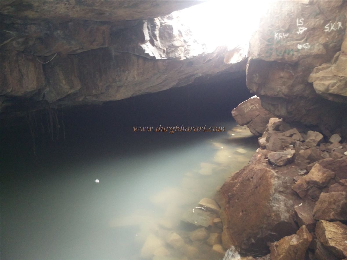
On this flat area of the fort, a rock-cut cave houses idols of Jamadagni and Parashuram, along with some other deities. Next to this cave is another large natural water-filled cave, known locally as Ramteerth, and the water here is used as holy water. It takes about two hours to explore the fort and descend to the base. From there, a 10-minute walk via steps leads to Yedravi village.
After Hooli, the second most ancient town in Belgaum district is Saundatti. The region came under the rule of several dynasties including the Rashtrakut, Rattas, Shilahara, Vijayanagar Empire, Devgiri Yadav’s, Bahamani Sultanate, Nizam, Adilshahi, Mughals, Marathas, and the British.
Six inscriptions dated between 875 CE and 1229 CE have been found in Saundatti. The town was referred to in ancient times as Sugandhavatin, Sabandhavatthi, and Savadhavatthi. It was then the capital of the region. The Rattas kings ruled from Saundatti until they shifted to Belgaum around 1210 CE. Based on inscriptions, the Rattas were Jains, and they built two Jain temples in 876 CE and 981 CE.
An inscription near Bharamappa temple in Yedravi village carved in Shaka year 901 mentions the village as Ilarame. Around 1230 CE, a Shaiva temple of Mallikarjuna was constructed here.
During Shivaji Maharaj's southern campaign in 1674, this region was under Adilshahi rule. Shivaji Maharaj captured Belgaum and repaired Parasgad Fort near Saundatti while on his way to Hubli. After Shivaji’s death, the Mughals took control of the region. In 1707, following Aurangzeb’s death, the Marathas recaptured the fort. Later, Hyder Ali of Mysore took control, and the local Desai supported him. But soon, the Peshwa recaptured the fort from Hyder Ali.
© Suresh Nimbalkar
GALLERY