PANDAVGAD
TYPE : HILL FORT
DISTRICT : SATARA
HEIGHT : 4130 FEET
GRADE : MEDIUM
The town of Wai, situated on the banks of the Krishna River, has a rich ancient history. Thanks to the river, the region is fertile and lush and holds strong appeal as a tourist destination. The proximity to Pachagani and Mahabaleshwar ensures a steady stream of visitors. However, for fort lovers like us, it is the surrounding forts that are most enticing.
In the mountain ranges around Wai, forts like Pandavgad, Vairatgad, Kamalgad, Kenjalgad, and Chandan-Vandan are located. If you have two days and a private vehicle, you can comfortably explore four to five of these forts. Among them, Pandavgad Fort, located very close to Wai, stands out.
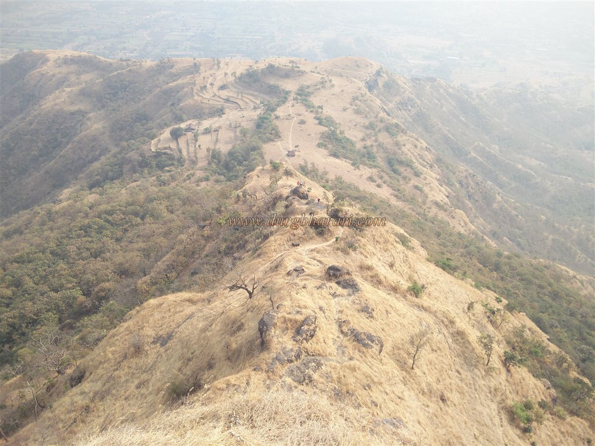
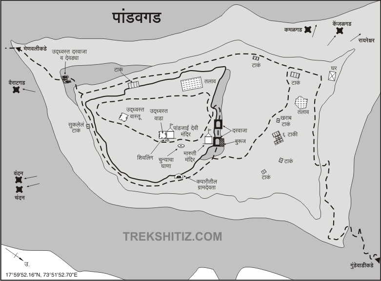
Perched on a hill shaped like a butterfly, and adorned with a crown-like rock wall, Pandavgad lies on the Wai–Mandhardevi road. To reach the fort, first, you must arrive at Wai, which is about 85 km from Pune.
...
From Wai, you can either take the Menawali route (5 km) or the Gundewadi route via Dhawadi village (9 km). Though Menawali is closer, the trek to the fort from there takes 2 hours, while from Gundewadi, it takes just about an hour.
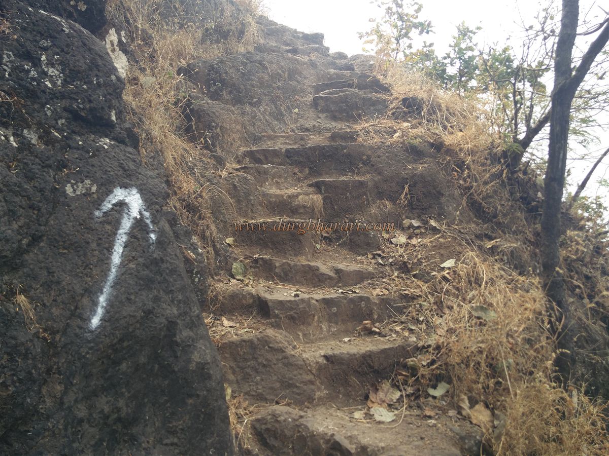
After passing 1.4 km from Dhawadi junction, there is a poultry farm on the right and 2-3 houses of the Kondke family on the left. The route to Gundewadi turns left 650 meters ahead. The trail to the fort is well-trodden due to frequent use. As part of it passes through private property, the owners have constructed steps in certain areas. A gentle one-hour trek through the forest leads you to the fort’s Machi (outer fortification).
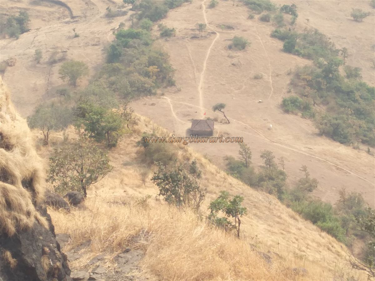
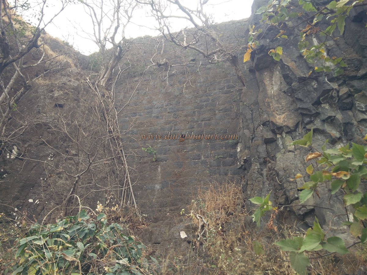
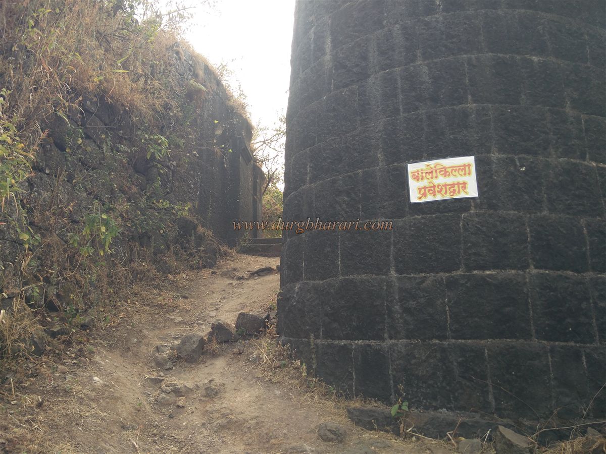
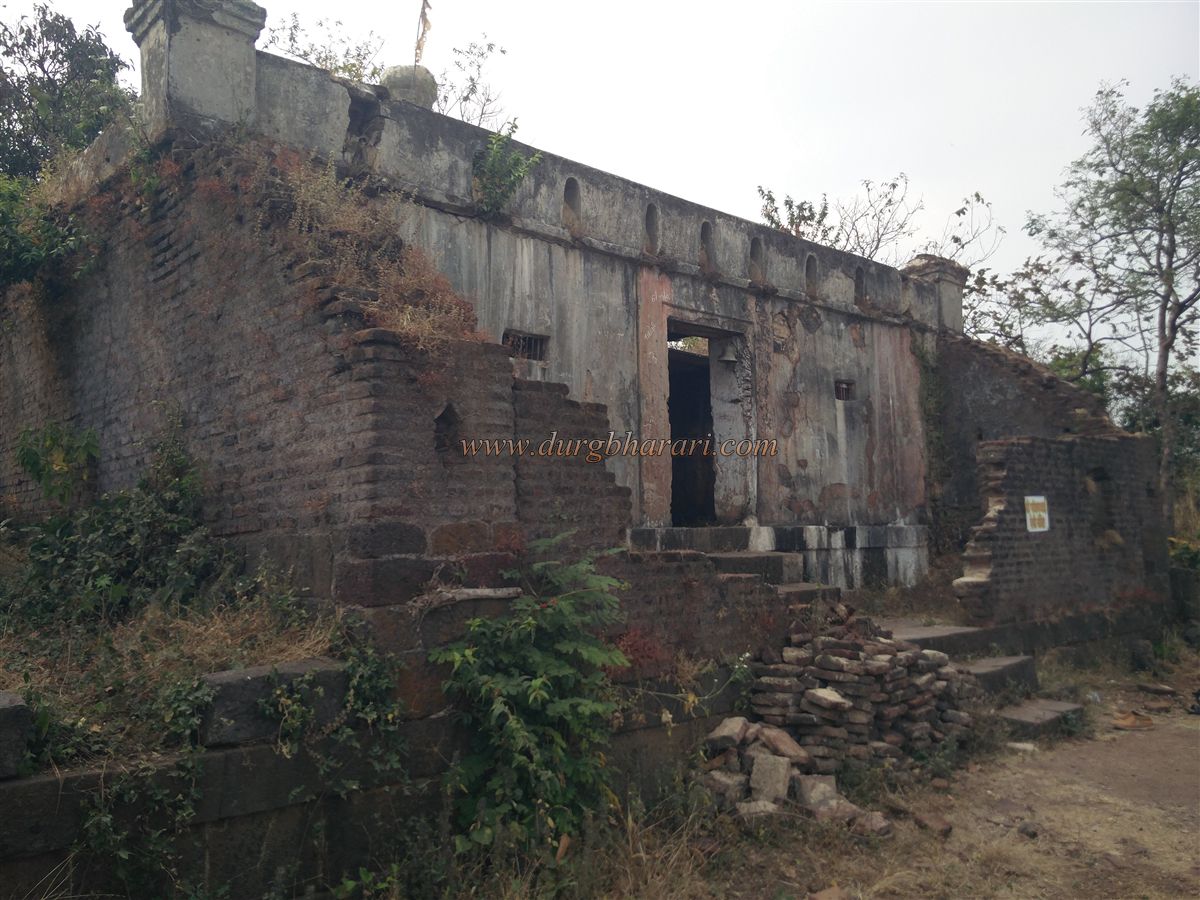
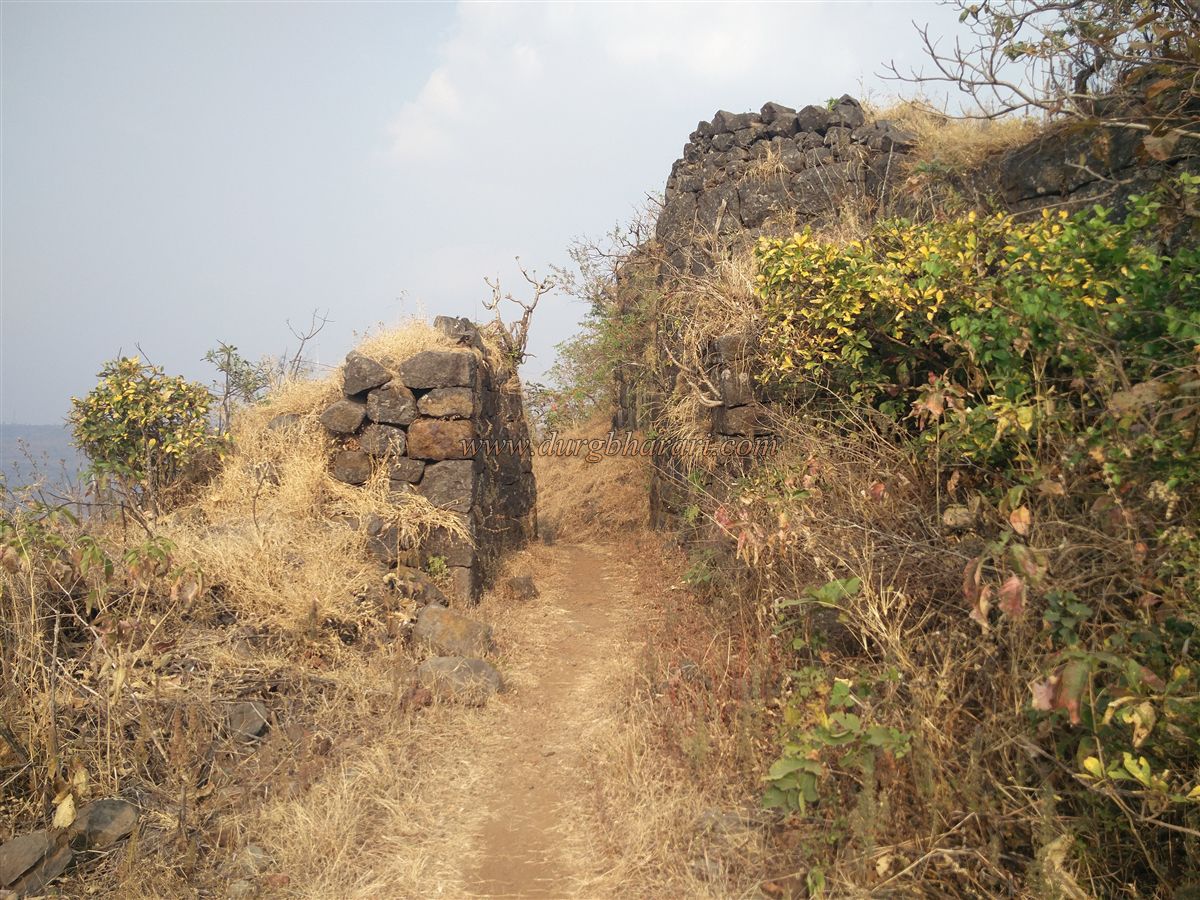
The fort is spread north to south and is divided into Machi and Balekilla (main fort). Entering from the north side, one can spot carved rock steps—indicating a former entrance gate, though only the steps remain now. Proceeding from here to the right leads you to a bungalow on the northern part of the fort.
Previously owned by a Parsi man named Wadia, most of the fort now belongs to the Mapro Company, which has posted three guards on the fort. Visitors are welcome as long as they register in the logbook.
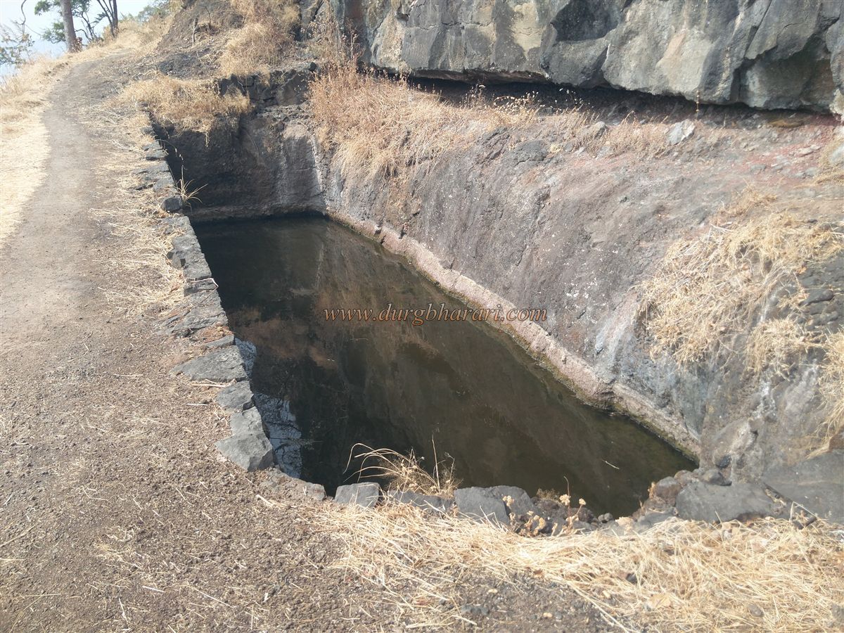
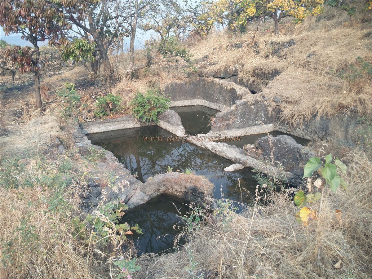
Behind the bungalow lies a trunk-shaped plateau with sparse remains of fortifications. From the bungalow, heading straight (keeping Balekilla to the left), you’ll reach a large water tank carved into rock, filled with greenish water. A bit ahead, on the cliff’s edge to the right, are two more tanks—one filled with water, the other dry.
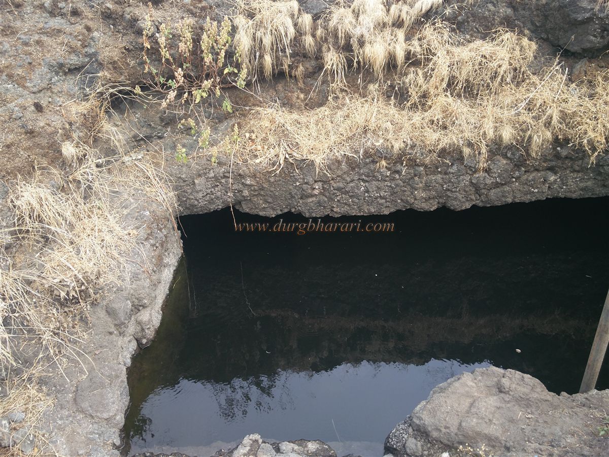
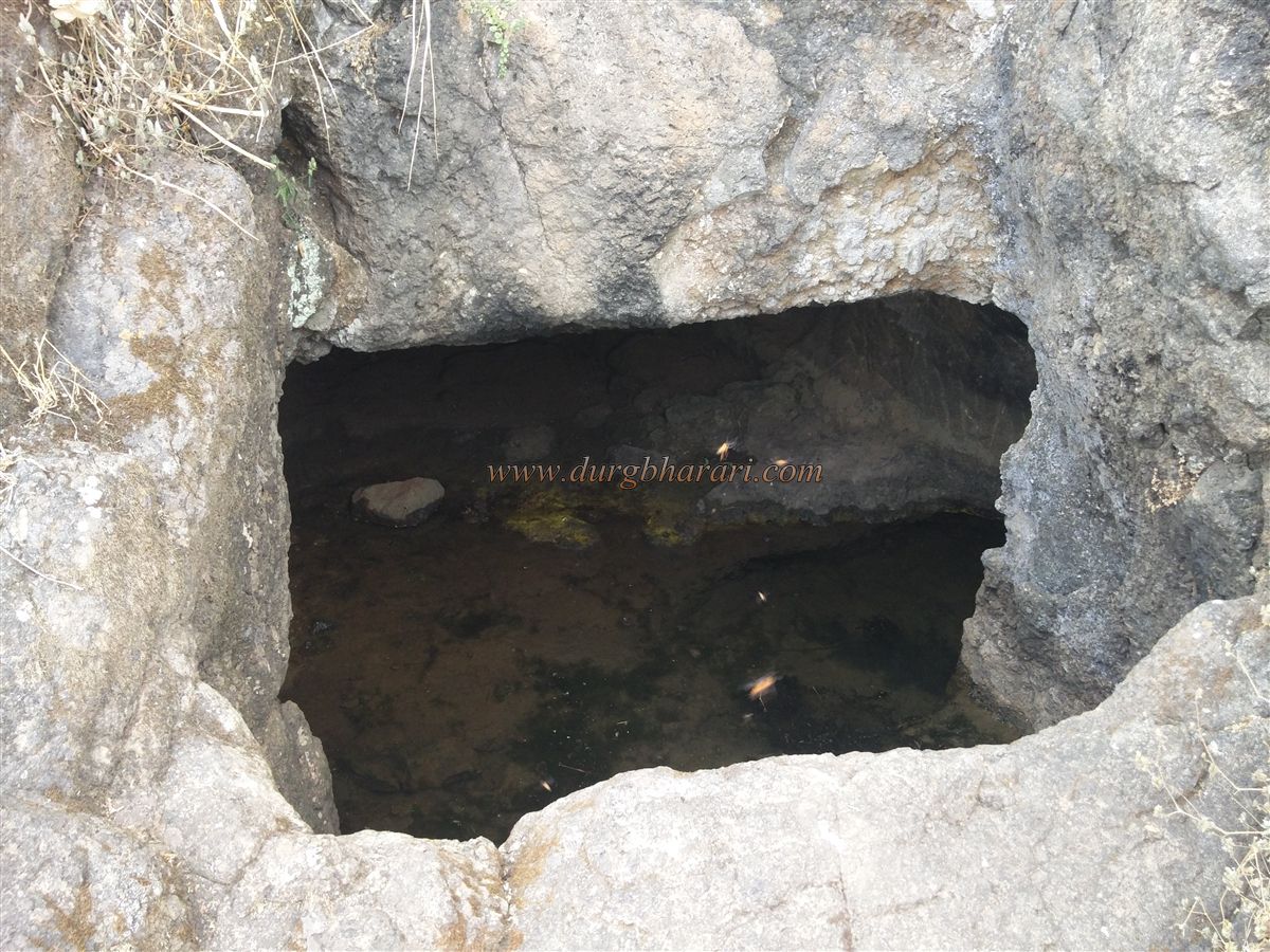
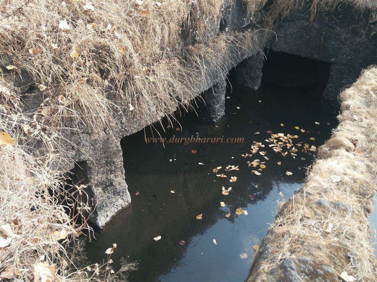
Further along the trail, to the left, there’s a cave tank enclosed with iron fencing to prevent wild animals from falling in. This is the main source of drinking water on the fort.
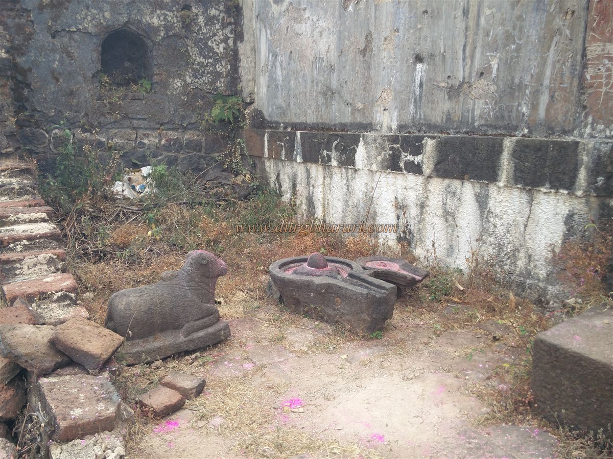
Following the Cliffside trail southward, you reach rock-cut caves and elongated tanks carved into the Cliffside. One cave has a carved lingam and Nandi, indicating its past as a Shiva temple, now in ruins and moved under the care of the Pandjai temple nearby.
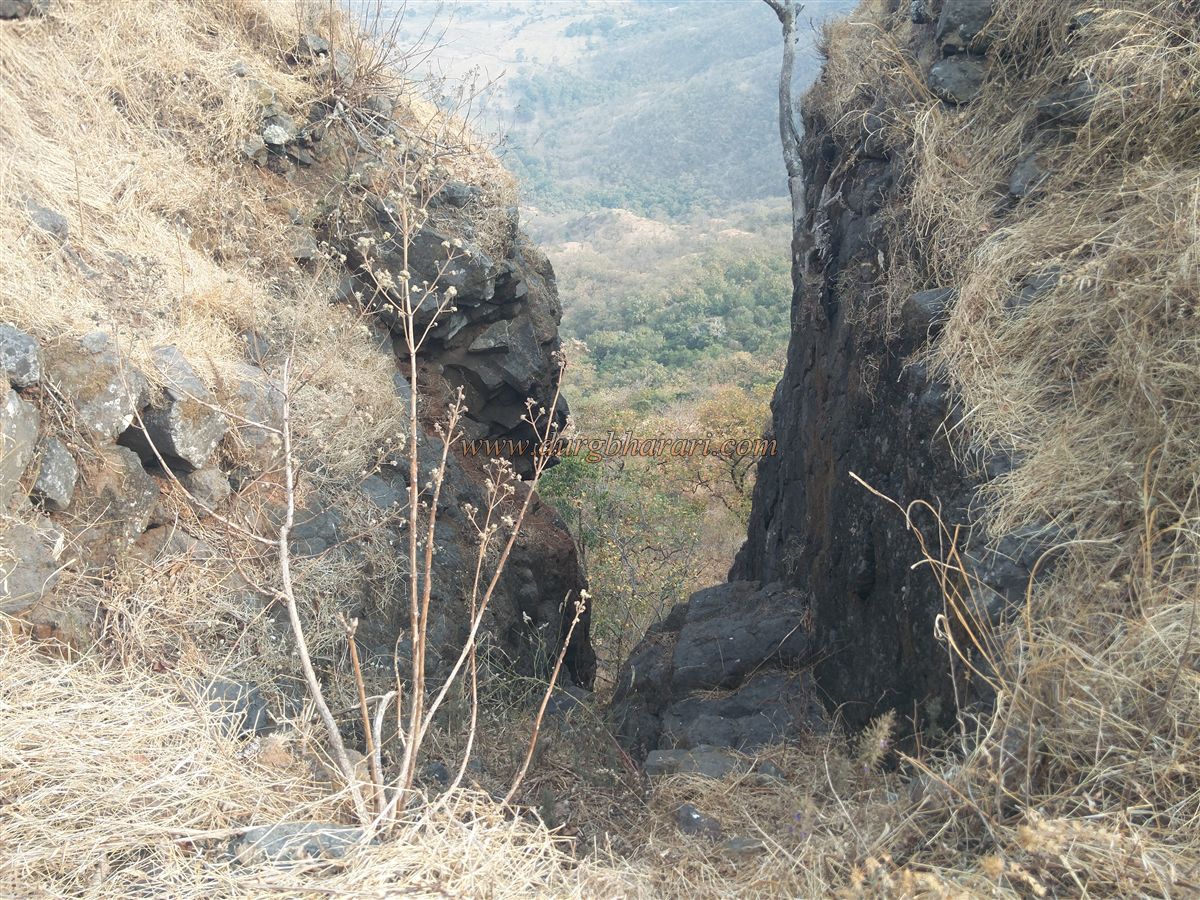
Descending from the southern tip of the fort, there’s a rock-cut path leading down to a Bhairavanath temple on a plateau. This is where the Menawali route meets the fort.
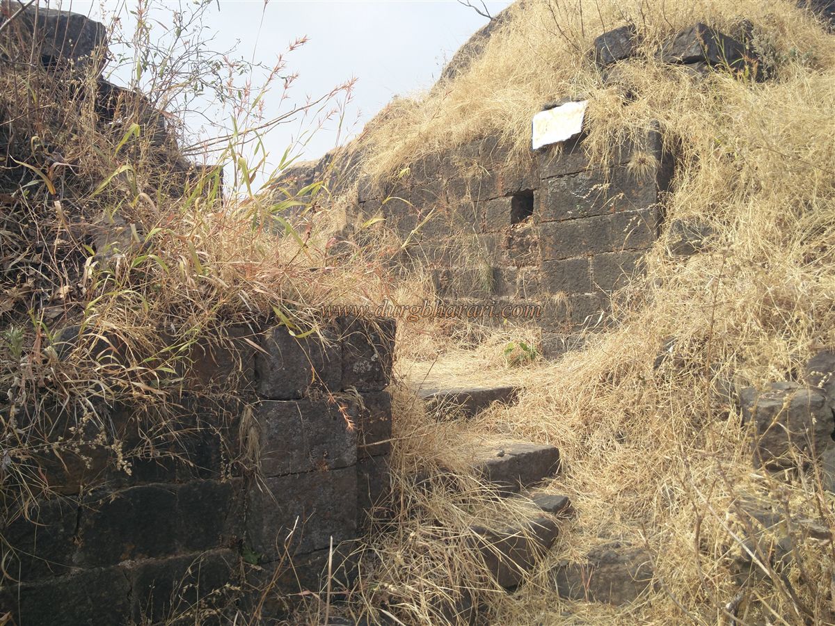
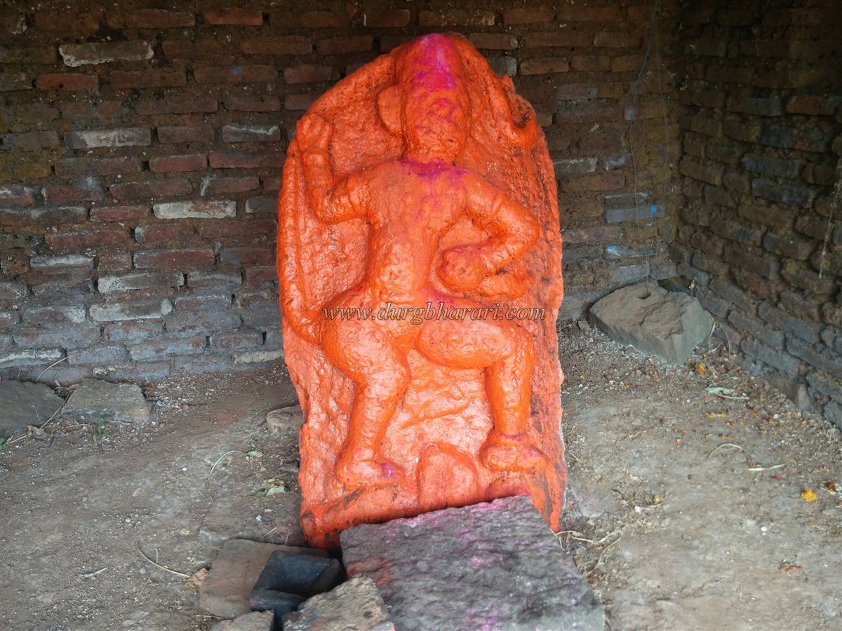
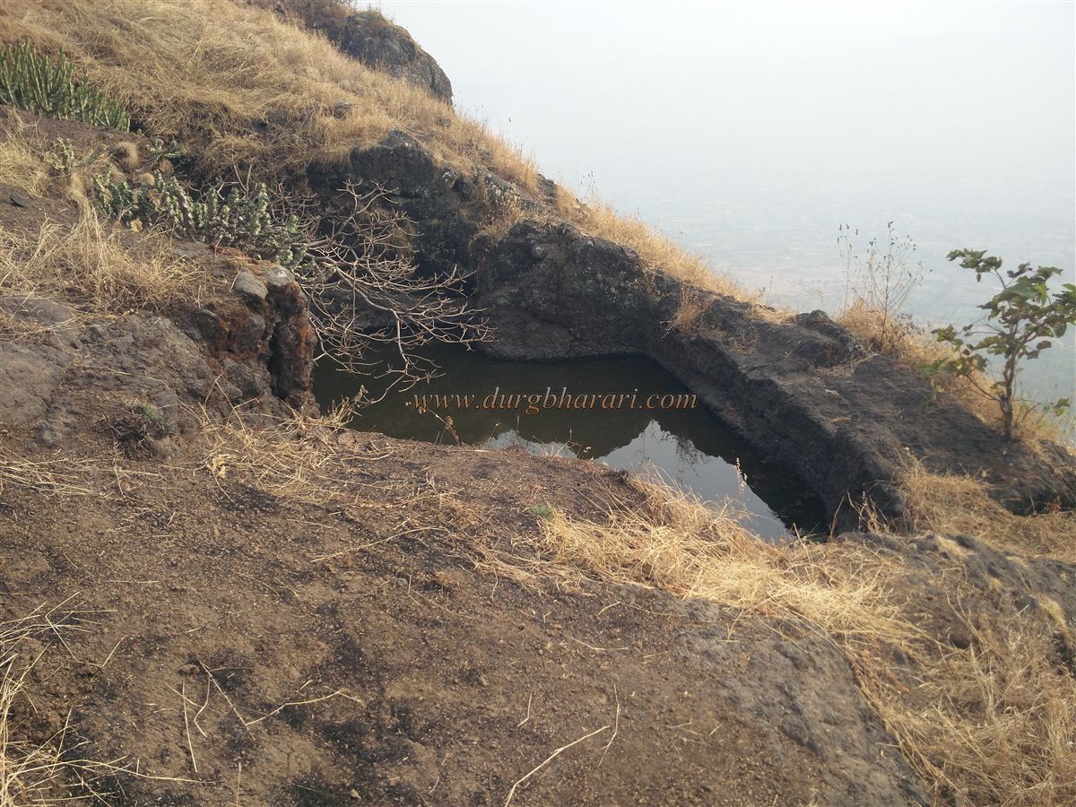
The eastern gate of the Balekilla has collapsed completely, with only its frame and guard post remaining. Re-entering the trail, after about 5 minutes, it climbs up again, leading to another water tank with an underground chamber. All the water on the fort is drinkable. One more tank lies further up the trail, leading to a rectangular cave housing a Maruti idol in striking posture. A Panuvati (evil women figure) is carved beneath the idol’s feet.
Nearby is a lime-grinding stone, with two partially broken wheels. This path eventually leads to the Pandjai temple, located on a high platform. Next to it are remnants of what could have been the Sadar (main hall) or fort commander's house. The idol's beauty is lost beneath the layers of vermilion, and the temple shows signs of partial ruin.
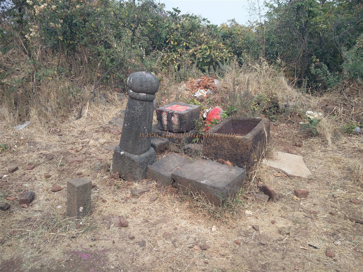
Behind the temple is a collapsed Shiva temple, with the Shivling and Nandi now placed in the Pandjai temple. Many stone pillars, Samadhi stones, carved platforms, and boundary stones lie scattered in the temple courtyard.
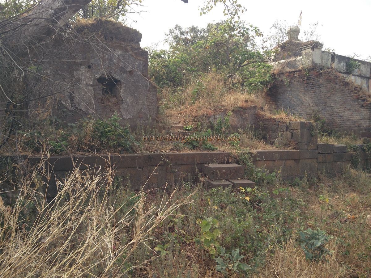
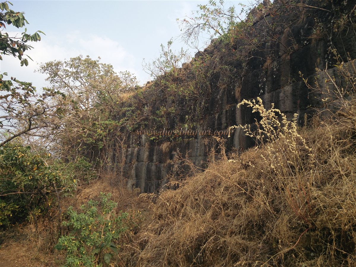
Climbing up to the continuous outer wall seen earlier, you’ll find a well-constructed drain system for rainwater management. Dense grass hides several foundations and wall remnants. The collapsed route that once descended from here is now impassable.
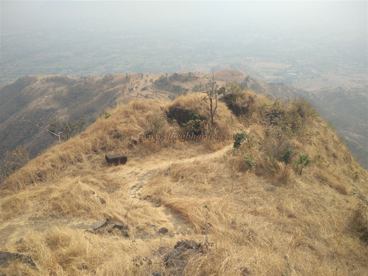
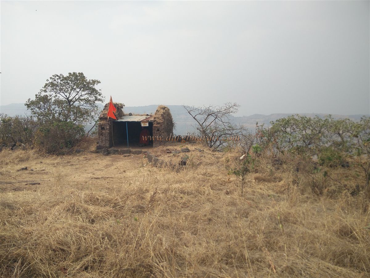
Proceeding to the southernmost bastion, you get a panoramic view of Menawali village and the entire trail to the fort. A large rock-cut reservoir, now dry, lies ahead, with saffron-smeared stones and a flag nearby.
Completing the circuit, you return to the main gate of the Balekilla. Along the way, there are eight water tanks, including a four-pillar tank (Kham take). A little ahead, two more tanks and a large stone reservoir can be seen. A few architectural remains lie scattered nearby.
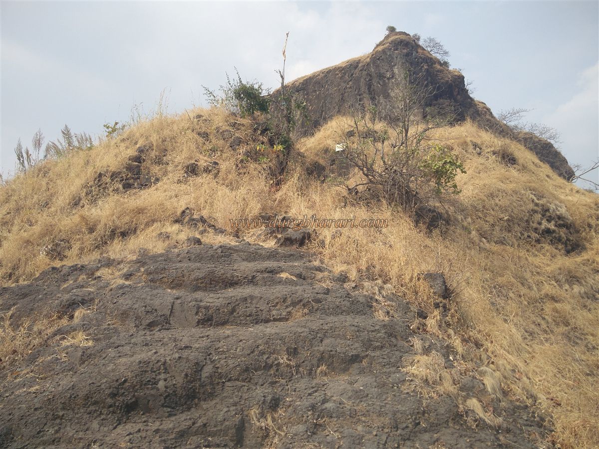
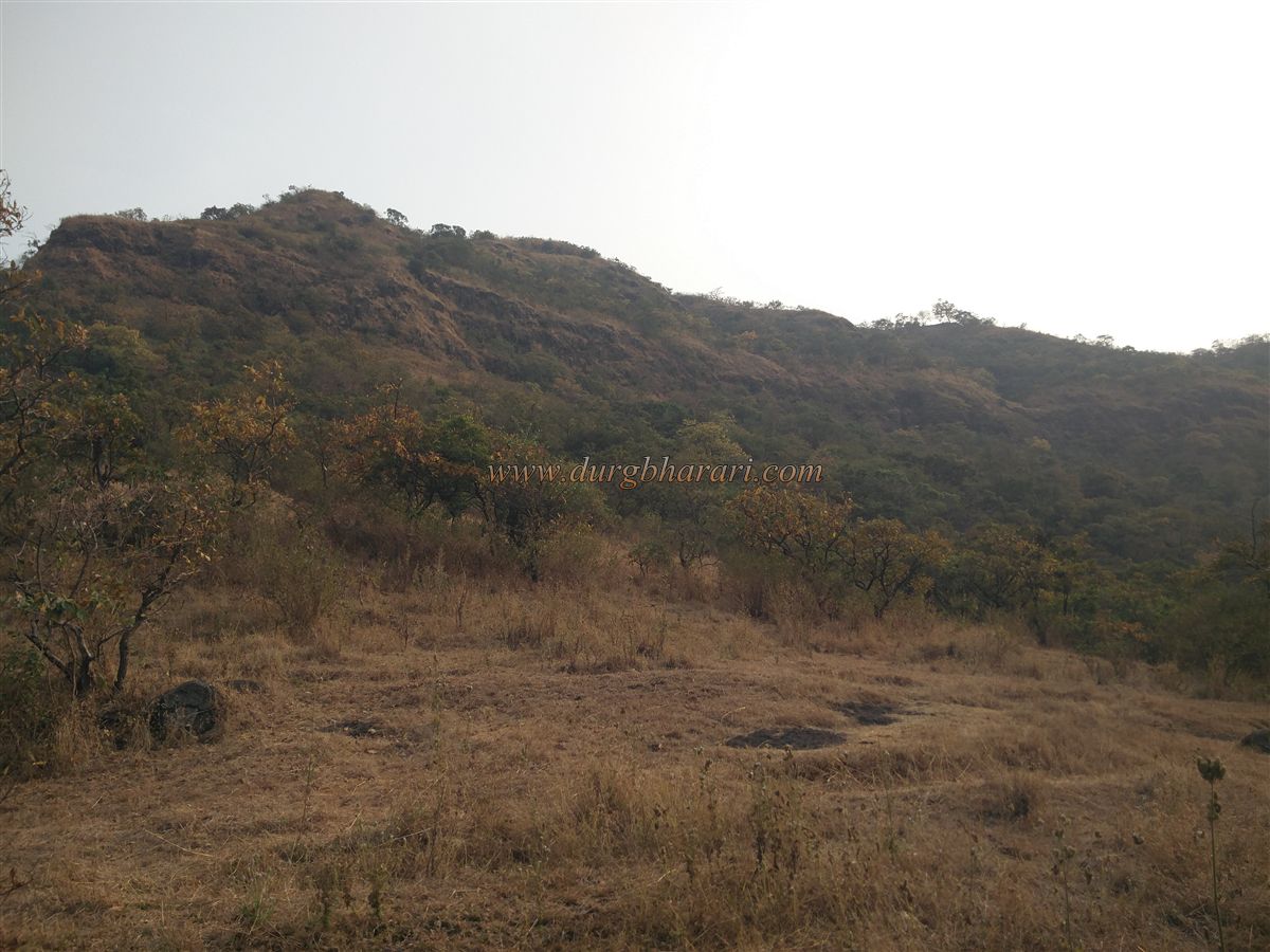
The fort is naturally protected by steep cliffs on all sides, so fort walls were constructed only where necessary. Just before descending, to the right of the steps, lies a 30x30 platform, perhaps used for military or public gatherings.
The fort has ample water supply and structural remnants, indicating it once supported a large population. From the top, one can see Chandan-Vandan, Vairatgad, Kamalgad, Kenjalgad, Panchgani, Mahabaleshwar, Mandhardevi, and the Dhom Dam reservoir.
A full exploration takes about two hours. If you wish to stay, you can camp near the bungalow with the guard’s permission—though this is not feasible in the monsoon.
• After the fall of the Chalukya, the Shilahara ruled the Panhala–Kolhapur region.
• As per a copperplate inscription found in 1991–92, Shilahara King Bhoj II built Pandavgad between 1178–1193 AD.
• After the Yadav’s’ defeat, the fort passed through Bahamani and Adilshahi control.
• In October 1673, the fort was annexed into Shivaji Maharaj’s Swarajya’s.
• During the Mughal onslaught post-Shivaji’s death, the fort fell to the Mughals in 1701.
• Shahu Maharaj later reclaimed it.
• In 1711, Balaji Vishwanath Bhat, the first Peshwa, was besieged by ChandraSen Jadhav at Pandavgad. Shahu Maharaj sent Sarlashkar Haibatrao Nimbalkar from Ahmednagar to assist, and Chandrasen was defeated at Adarki.
• In 1817, Trimbakji Dengle resisted the British using Pandavgad as a base.
• Finally, in 1818, Major Thatcher captured Pandavgad for the British.
© Suresh Nimbalkar
GALLERY