PABARGAD
TYPE : HILL FORT
DISTRICT : NAGAR
HEIGHT : 4115 FEET
GRADE : MEDIUM
The Bhandardara region in Nashik district is a trekker’s paradise, furnished by the Sahyadri cliff edged terrain and crowned with forts like Ratangad, Alang, Madan, and Kulang. Among these challenging climbs, Pabargad Fort is a gem that truly tests a fort lover’s mettle. Its name—‘Pabargad’—deceives you into thinking its easy, but the reality is a strenuous three hour, rock steep ascent.
There are two village basecamps—Mudkhel and Guhire. Though Mudkhel offers a route to the summit, the loose scree and steep pitch make it less advisable. The preferred path is via Guhire village, located on the Ghoti–Sangamner route. You can reach it by bus from Igatpuri or Ghoti toward Sangamner, Akole, or Pune. It lies 37 km from the Ghoti junction on the Mumbai–Nashik highway.
...
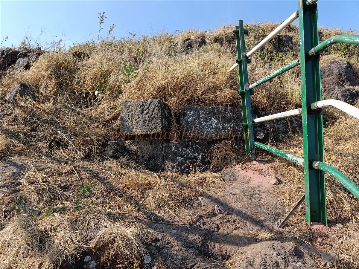
Upon nearing Guhire, Pabargad is briefly visible between two hills, but the nearer hill blocks a full view inside the village. A ridge flows down that hill—the starting point for the ascent. Accommodation is possible at the village Hanuman temple, with tea and meals available from a house nearby. Temple premises hold a few ghadiv thadis (boundary stones).
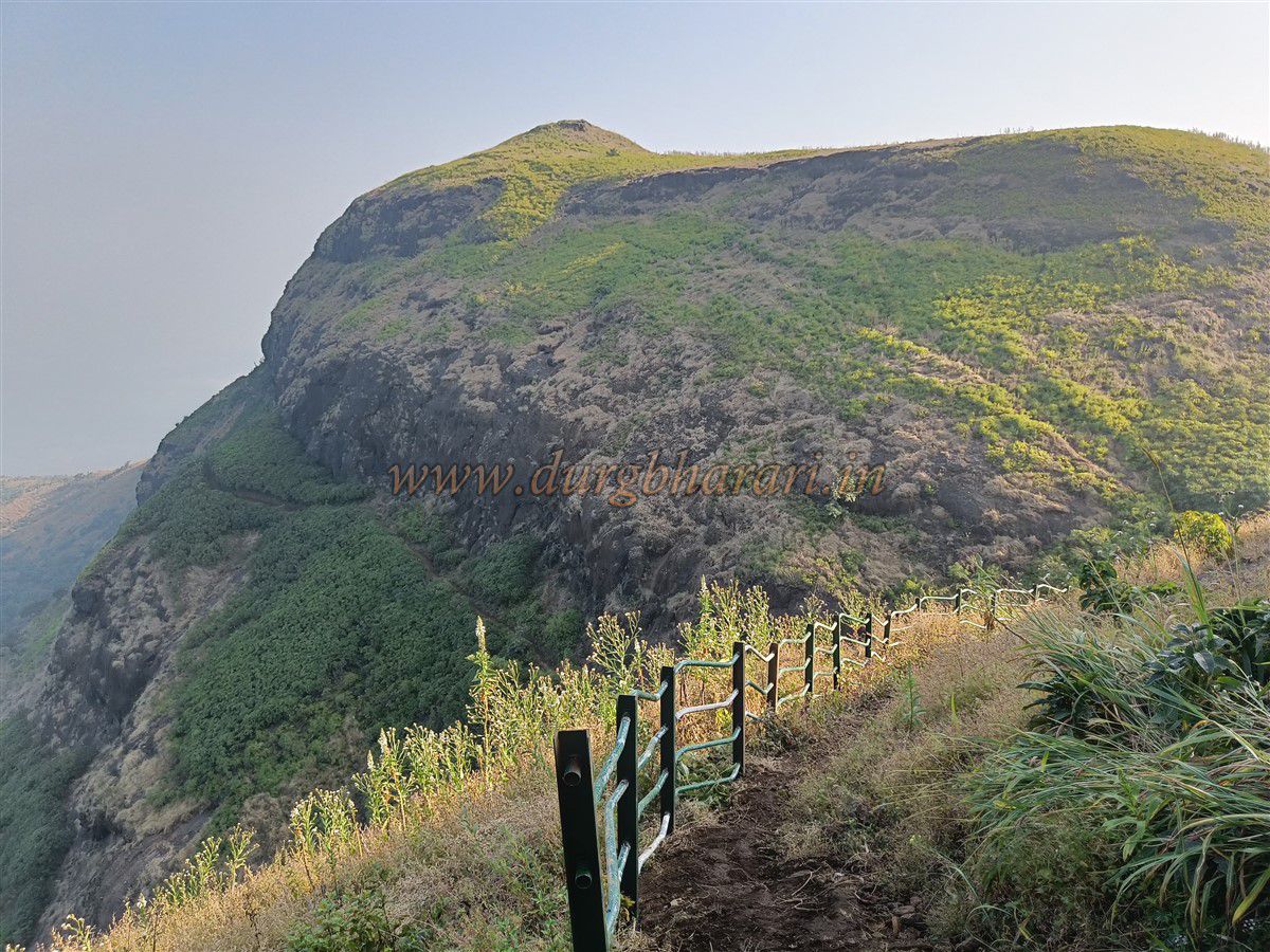
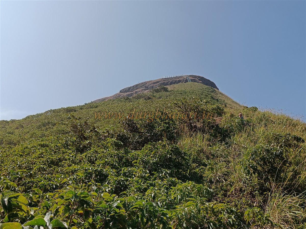
The climb begins up the ridge from the right of the temple, through well trod livestock trails. After ascending, Pabargad and the adjacent hill become visible.
You then choose between two routes:
1. Ridge crest path – ascend to the base of the upper hill, ascend past the cliff on the left while descending the ravine on the right into the gorge between the two hills.
2. Gorge skirting route – bypass the high ridge by traversing its base to the gorge, then climb steeply to reach the upper gorge near the fort.
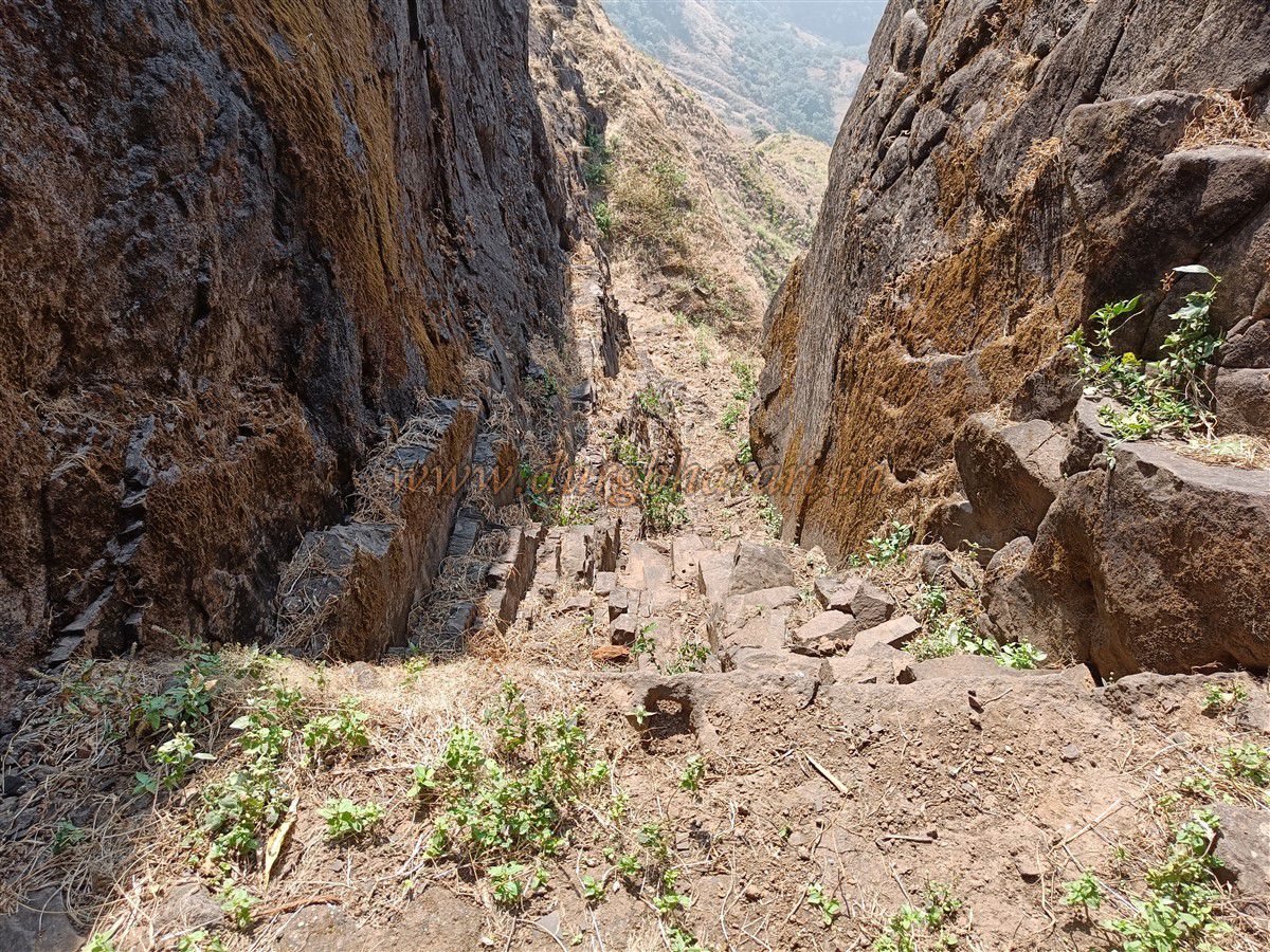
The second route is somewhat easier until the final steep stretch. It takes approximately 1.5 hours from the base to enter this gorge, which meets the cliff face edged with sheer drops onto the ramparts.
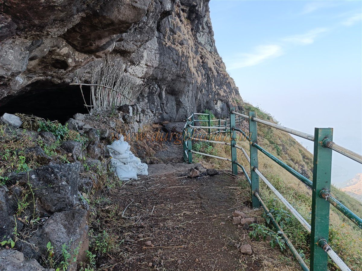
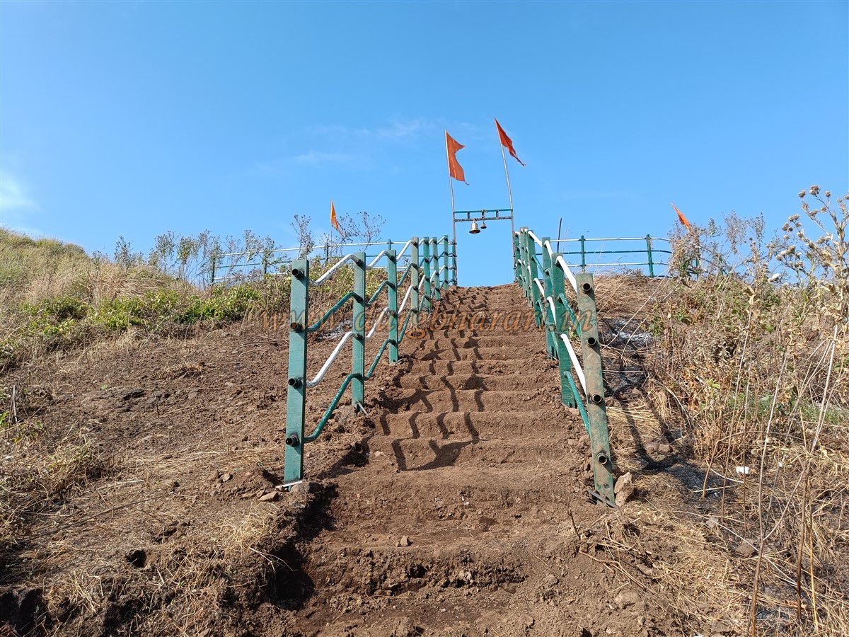
In 2021, the Forest Department eased a particularly difficult section by installing a 30 foot ladder and two protective ladders along the steepest part. Shortly after, you encounter the first ladder embedded into the cliff, above which carved steps are visible—then the trail dives into dense karvi (briar) brush to a Bhairav shrine commonly used by villagers, making the path well worn.
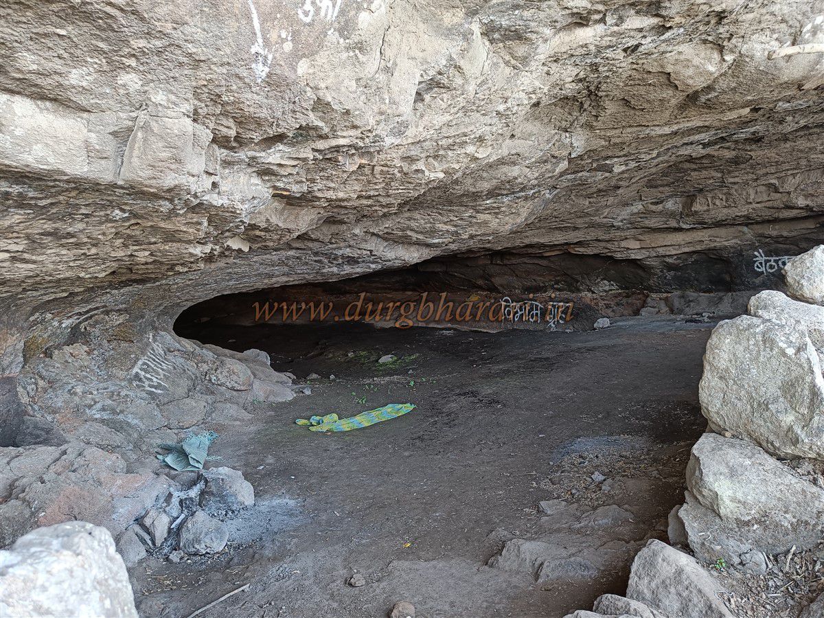
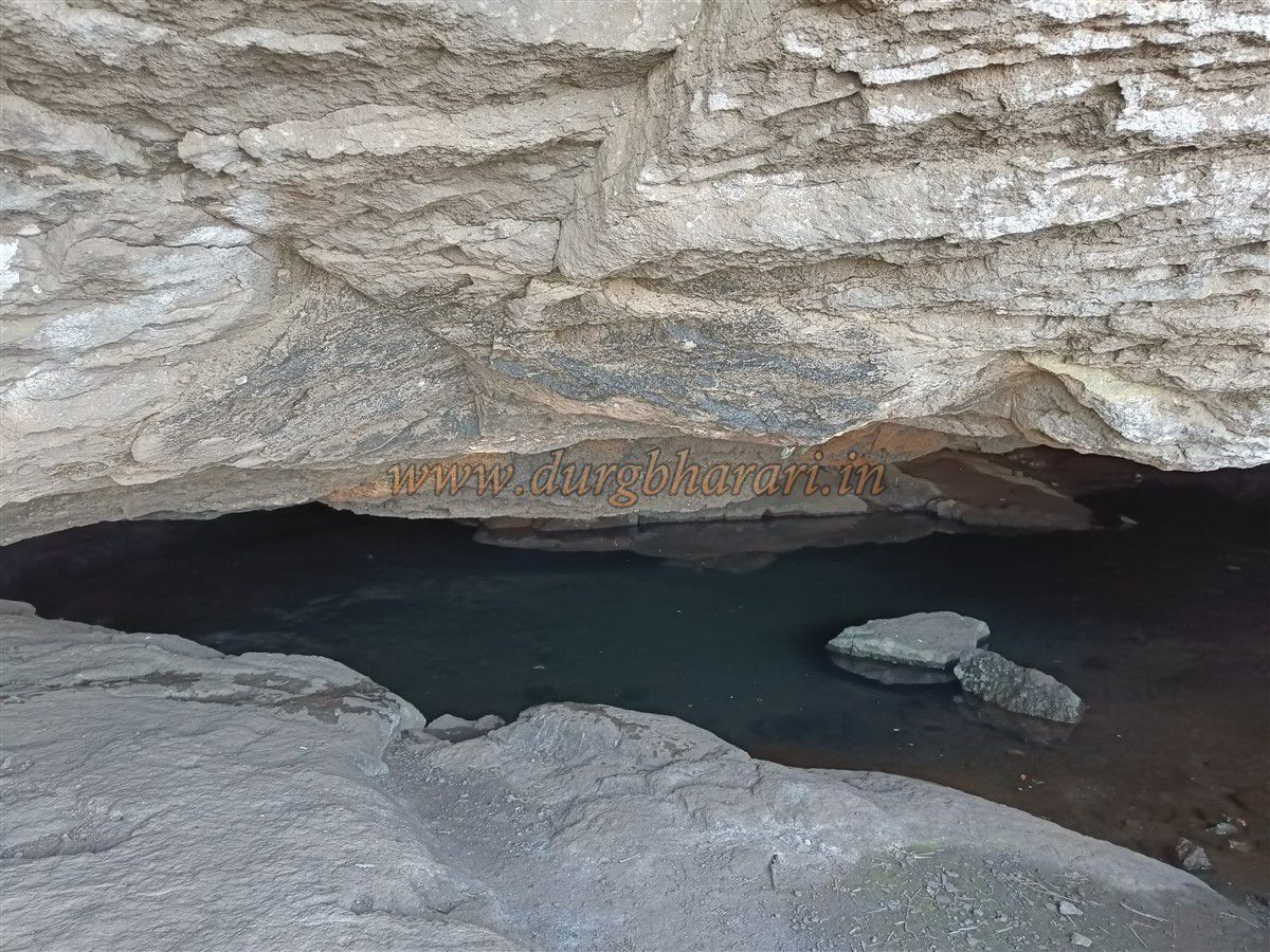
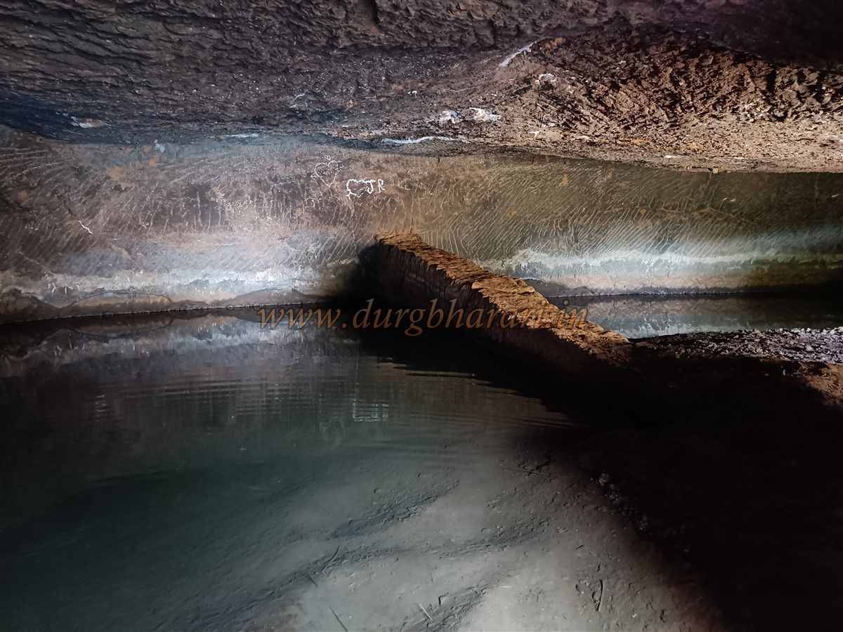
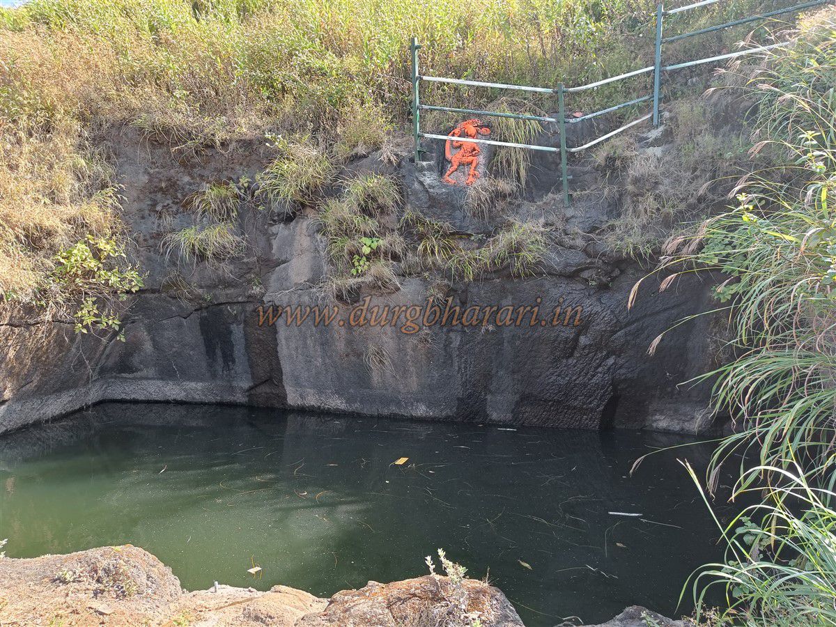
After 20 minutes more, you reach the cliff bed and find a second ladder to climb to the fortress top. Before climbing, a goat path leads along the cliff edge to a natural cave. Inside, a rectangular carved water cistern is hewn from the rock. This cave can shelter 10–12 people overnight. Beyond lies another natural cave with year round drinking water—and a carved Shiva-ling and Nandi face the cliff.
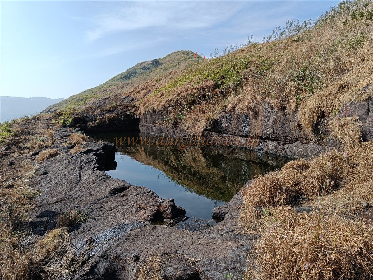
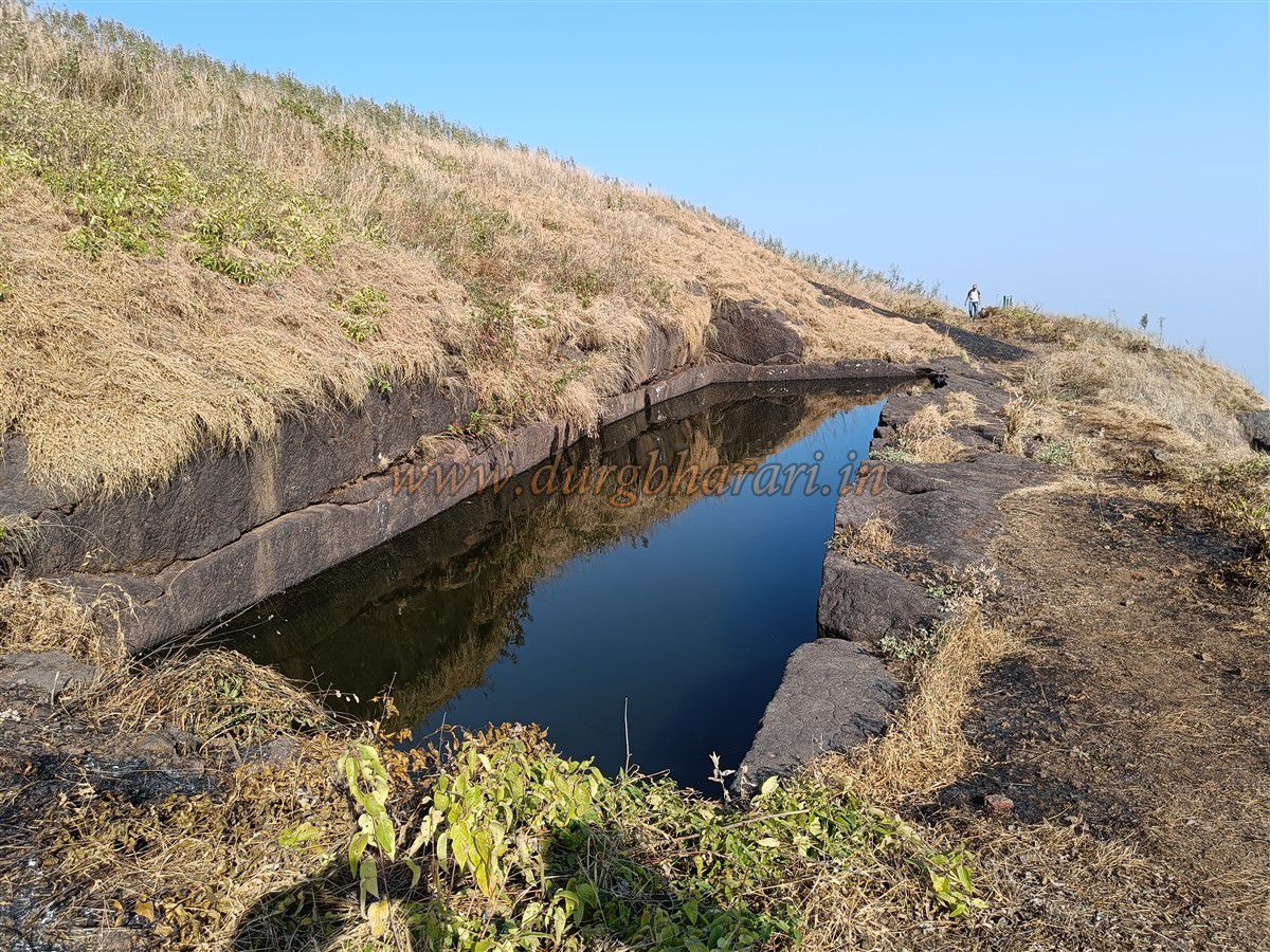
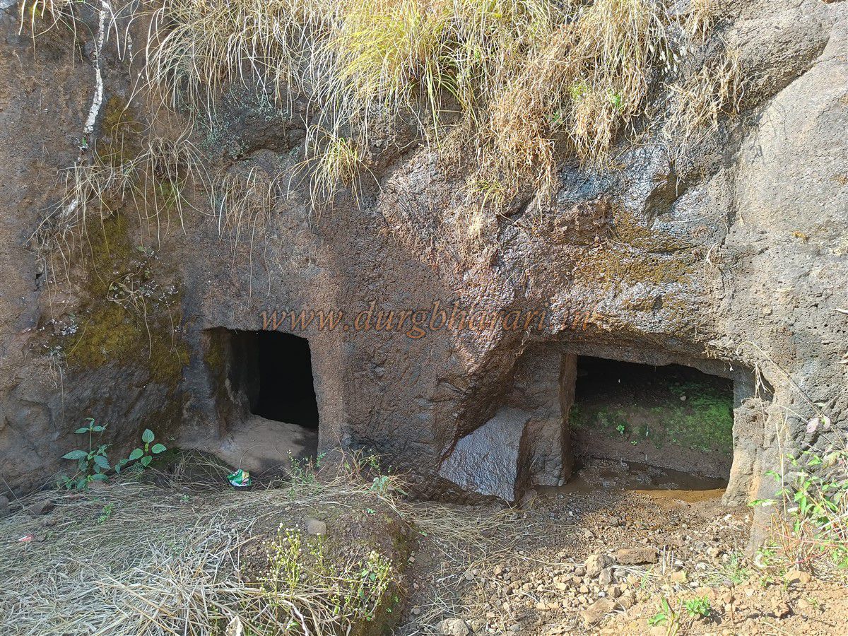
After exploring the cave, climbing the ladder gains entry to the fort. At the point of entry are cliff carved steps and a fragmentary bastion built of precisely jointed masonry. Continuing toward the summit, you encounter two more rectangular rock cut cisterns—neither safe to drink from. A path rises from the second cistern toward the main plateau, which you can skip in favour of scaling the cliff edge. After about 50 steps, you arrive at the north-facing gate, its semi-arches fallen and 10–12 carved cliff steps leading upward. This was the original main entrance, now bypassed through collapsed ramparts.
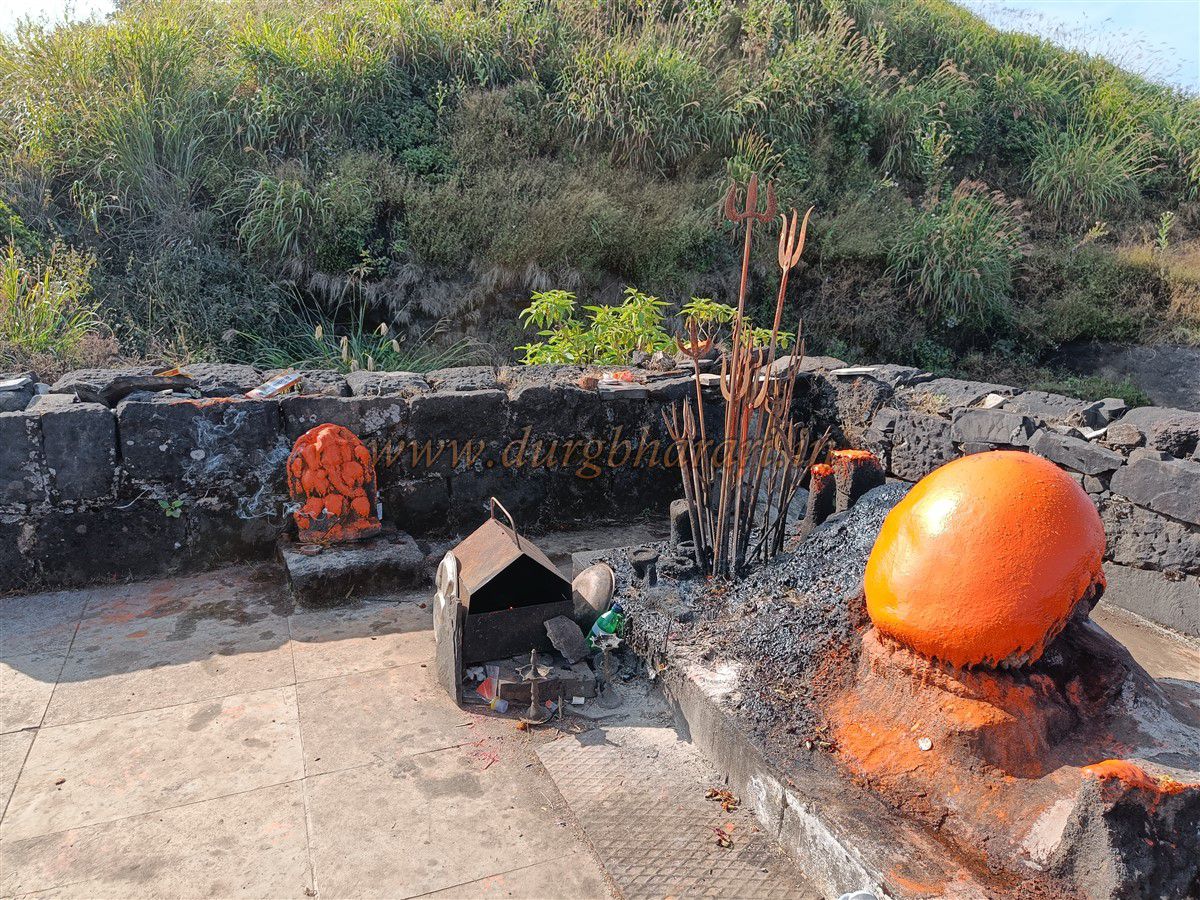
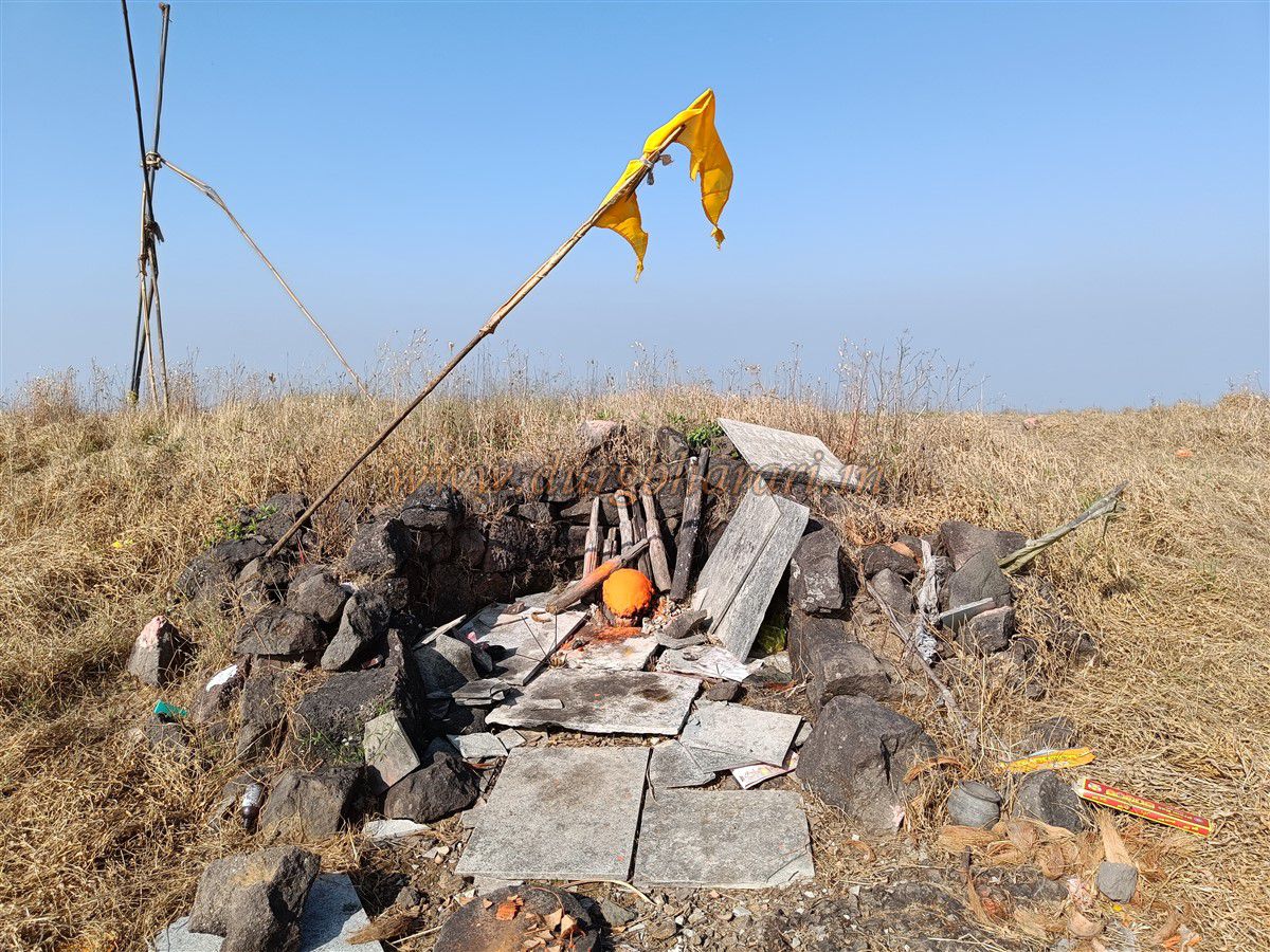
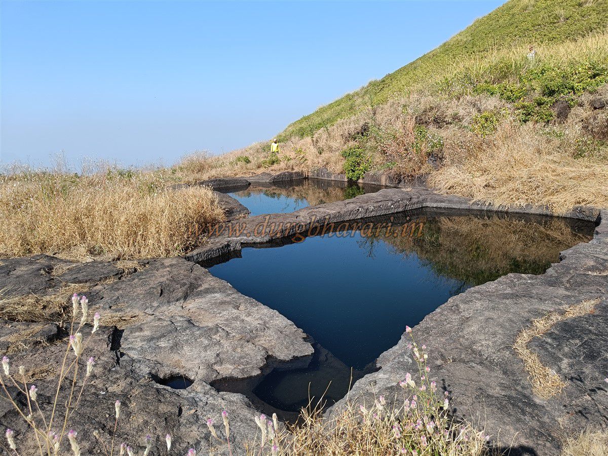
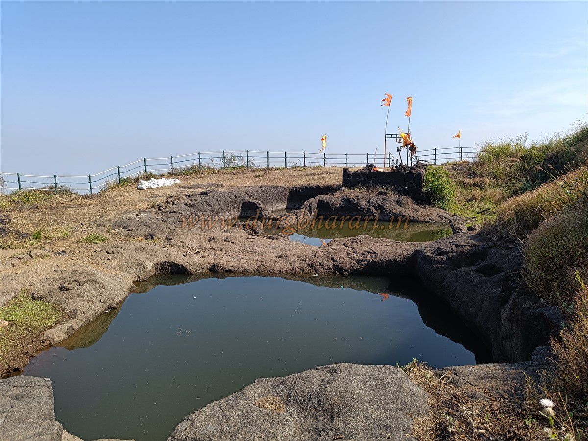
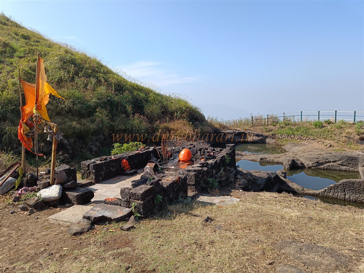
Return to the primary path to reach the plateau, where four cliff cut cisterns surround the collapsed Bhairav temple. Inside, two earthen-and-saffron vermilion offerings lie atop the Bhairav idol along with a Ganapati idol. Beyond the tank, near the ravine edge, lies another cistern. From there, a steep hill leads to the fort’s highest point, where another ruined Vetal temple stands—aside from vermilion remains, nothing else survives.
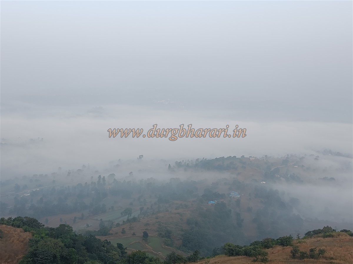
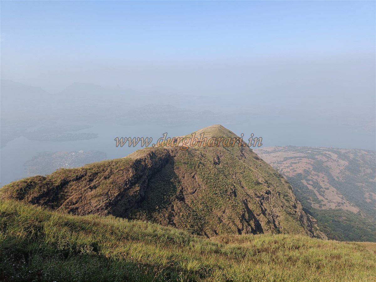
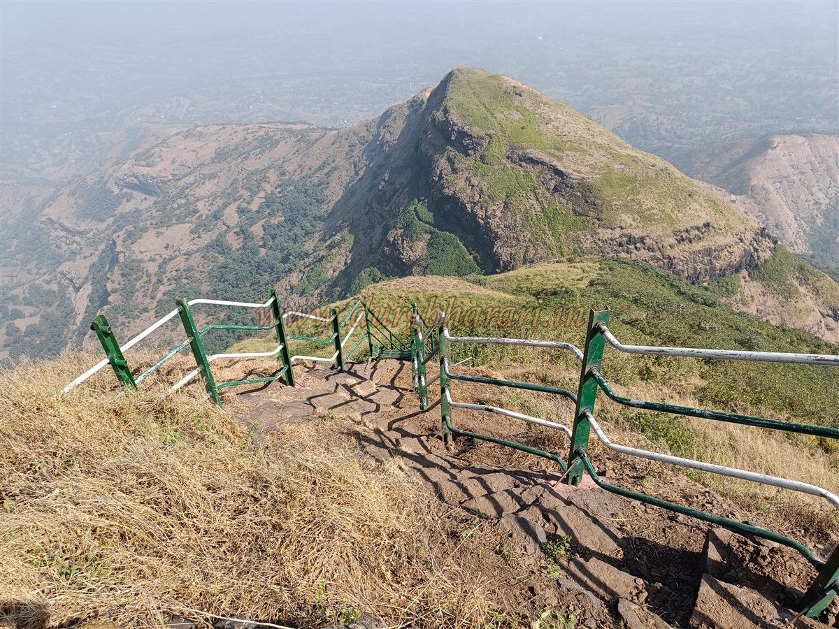
The summit sits 4,115 feet above sea level and spans two connected hills. Most ruins lie along the east–west plateau; the north east summit hill holds only a single cistern. The total area is approximately 15 acres. From here, you can see the forts of Alang, Madan, Kulang, Ratangad, Pattan, and the peaks of Kalsubai, Ghanchakkar, and Mud Parvat. The vast reservoir of Bhandardara fans out below.
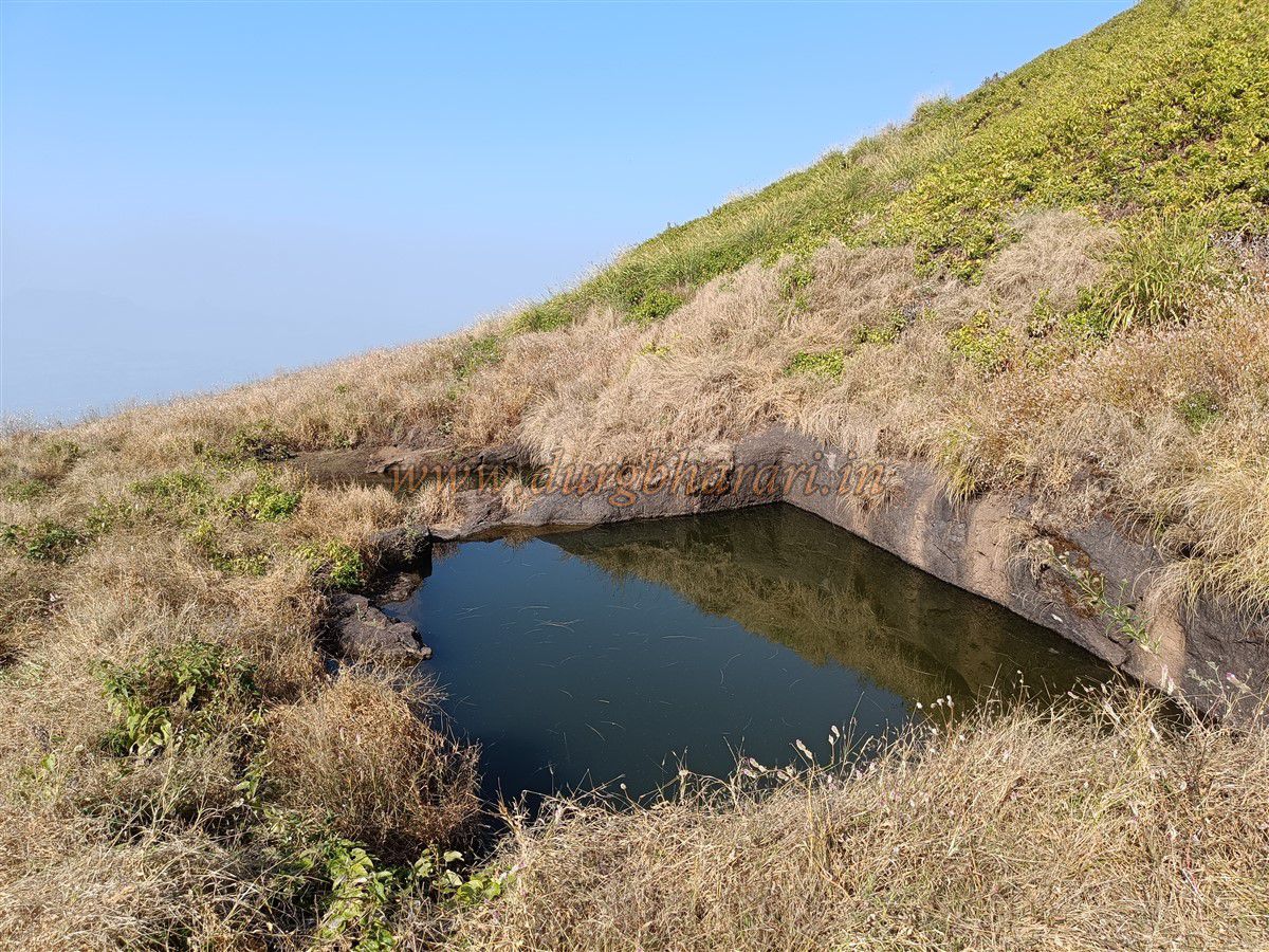
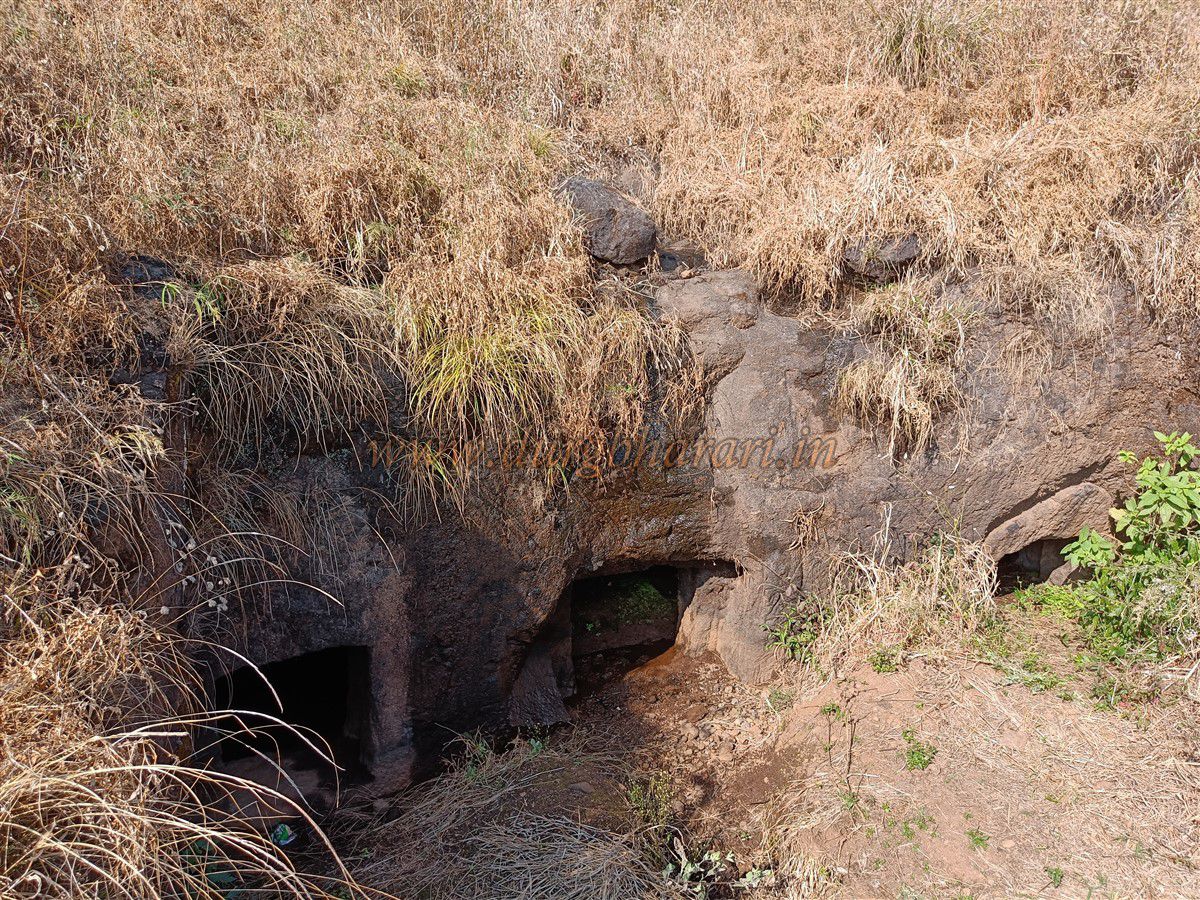
Instead of retracing your climb, descend the opposite ridge below the summit plateau. On this descent, you pass four more cliff cisterns—three are filled with green water, one is broken. Near the plateau’s tip is the ruin of a large building. Continuing the descent, you encounter three subterranean gates carved into the lower hill—believed to be storerooms (kothars). Originally, this was a single cistern with columns, creating the illusion of three gateways. The cistern’s west wall has partially collapsed, allowing soil to fill the upper mouth.
After exploring these cisterns and tunnels, return to the main path to continue your descent. On the right, near the cliff, stands another carved water cistern with a Hanuman sculpture. A short walk from here brings you back to the Bhairav temple and the trek’s end. The full circuit takes about one hour.
Though absent from historical records, the Maratha presence in this area suggests that Pabargad was under Swarajya’s during Shivaji’s time—a hidden sentinel amid the Konkan Ghats.
© Suresh Nimbalkar
GALLERY