NHAVIGAD
TYPE : HILL FORT
DISTRICT : NASHIK
HEIGHT : 3650 FEET
GRADE : HARD
The Baglan region in Nashik is a treasure trove of forts, with one grander than the other dotting the Selbari-Dolbari mountain ranges. Among these, the fort referred to by Chhatrapati Shivaji Maharaj himself in a letter to his brother Venkoji Raje in 1680 is Nahavagad, also known as Ratangad. In this letter, Shivaji Maharaj writes: “Another fort, Nahavagad, situated between Baglan and the frontier, was difficult, but we took it. These two forts (Ahivant and Nahava) were ancient, significant places which we have now secured. Considerable wealth was found on that fort as well, and the rest was sent into the territory for order and control.”
This fort is located in Satana taluka of the Baglan region, approximately 128 km from Nashik via Taharabad, and about 38 km from Satana.
...
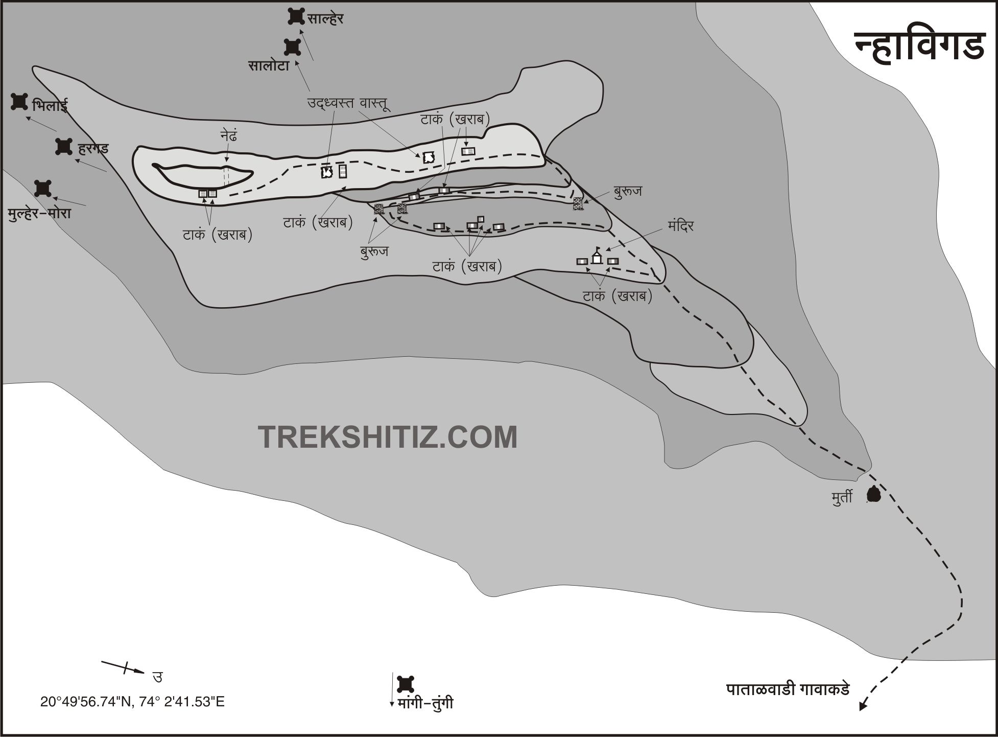
The village closest to the fort is Bhilwadi, which is well-known due to the nearby Mangi-Tungi Jain pilgrimage site and is well-connected by road. From here, the small hamlet of Patalwadi at the base of Nahavagad is about 5 km away and can be reached directly by private vehicle. Though the fort is visible from Bhilwadi, once you reach Patalwadi, its shape is reminiscent of Harihargad, with a long ridge stretching north-south behind the village.
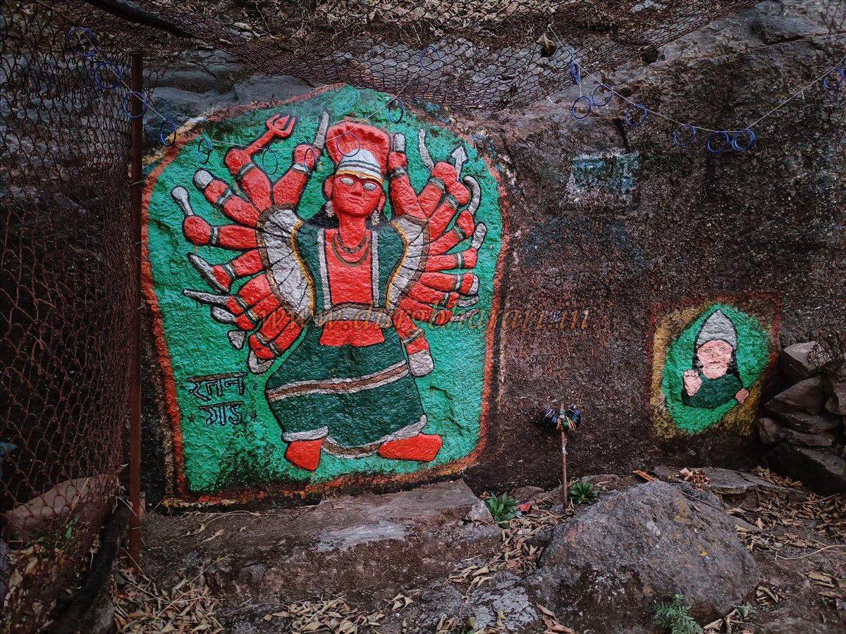
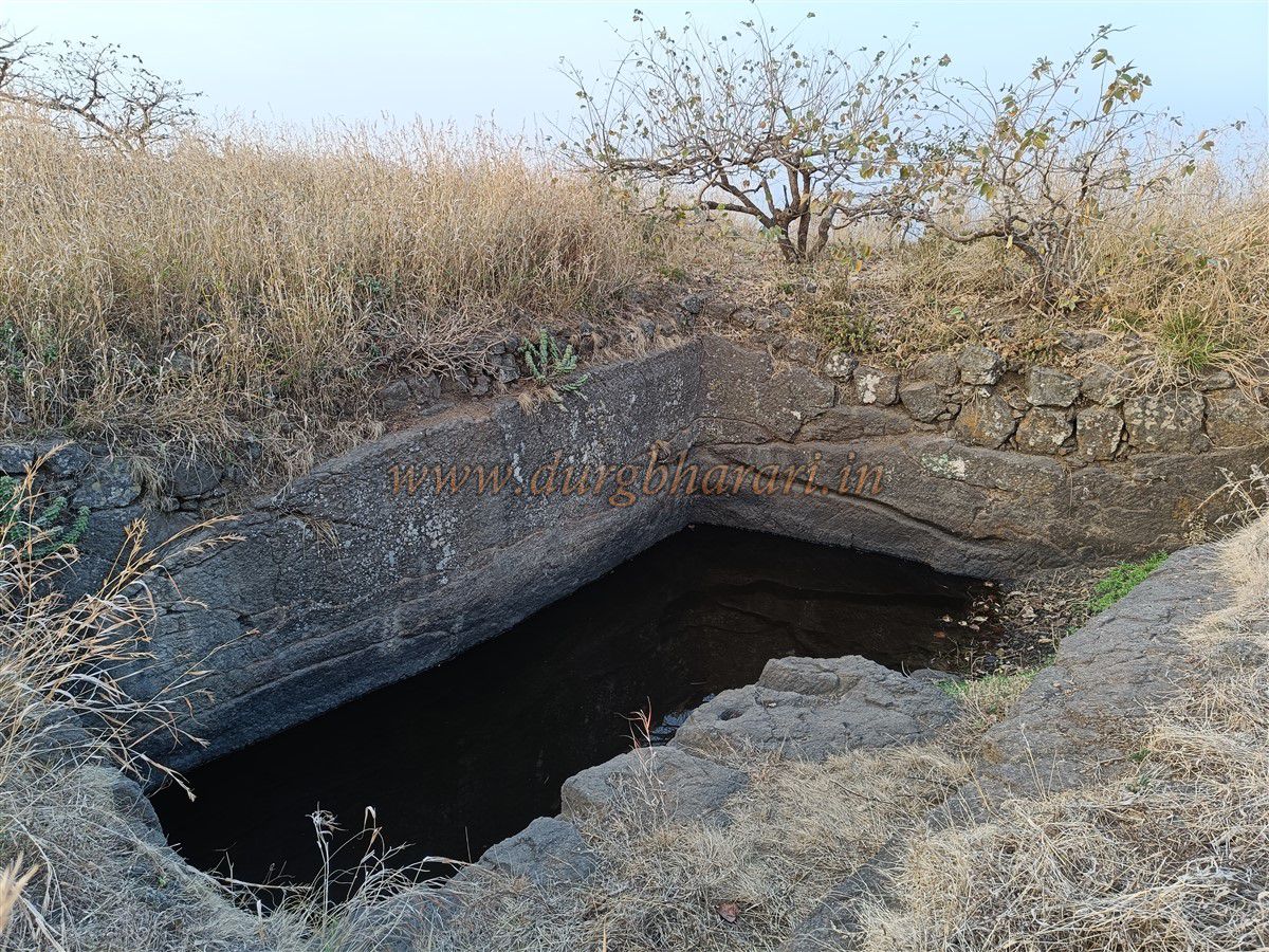
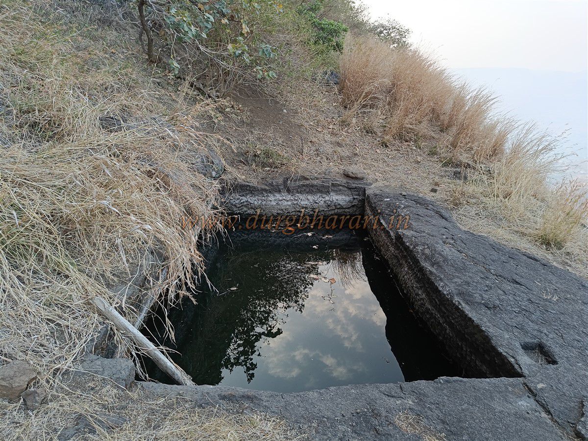
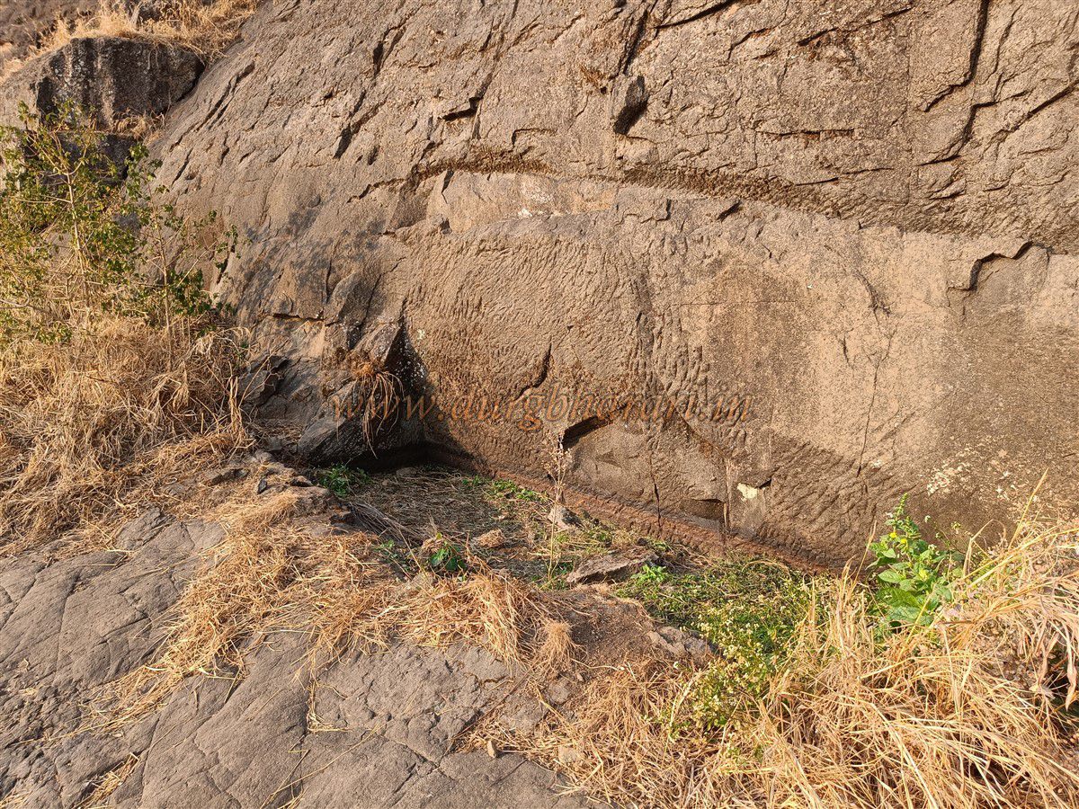
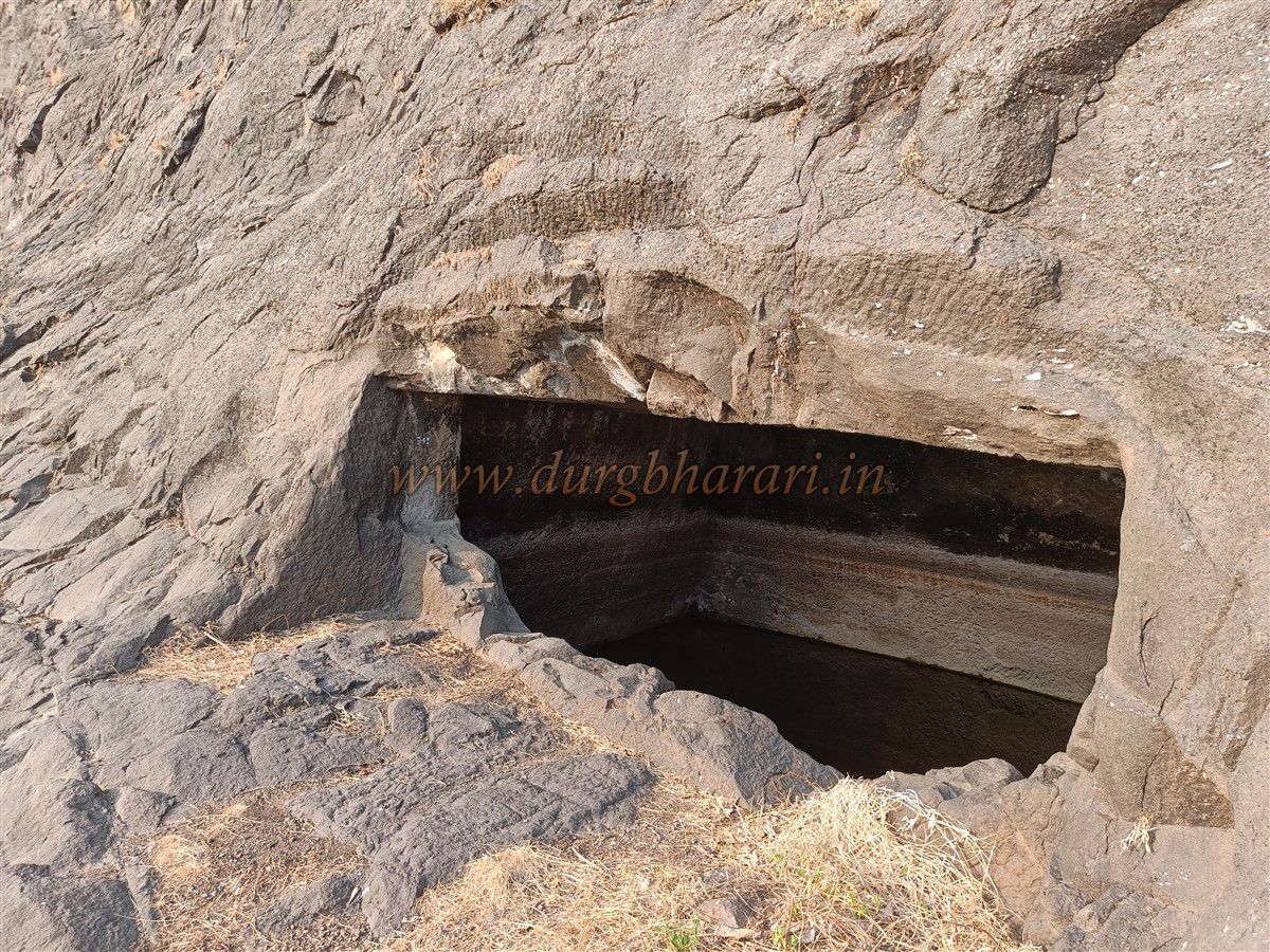
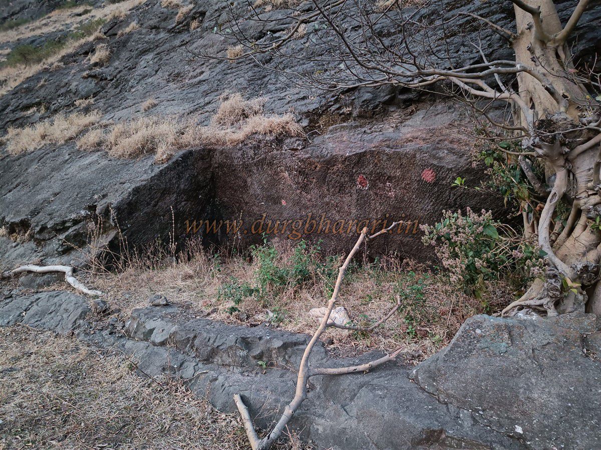
A marked trail leads from the settlement to a plateau at the base of the fort. From this plateau, a prominent ridge leads up to the fort. At the base of this ridge is the shrine of Vaghdev, with carvings of the sun, moon, and a tiger on a wooden beam. The remains and platform here suggest this was once a resting place or checkpoint. This point marks the boundary between the Khandesh and Baglan regions—today, on one side is Nashik district and on the other, Dhule district. It takes about half an hour to reach the plateau from Patalwadi. As one ascends the ridge, a small trail on the left leads to a tree marked with a flag. Following this path brings you to a large, broken cistern carved into the rock, beside which is a colourful rock-carved image of Goddess Saptshringi with eighteen arms. A little further along is another tank containing potable water—currently the only drinking water source on the fort. After visiting these tanks, one should return to the main route and continue upward.
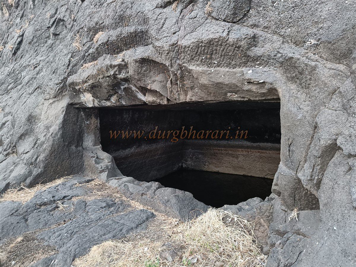
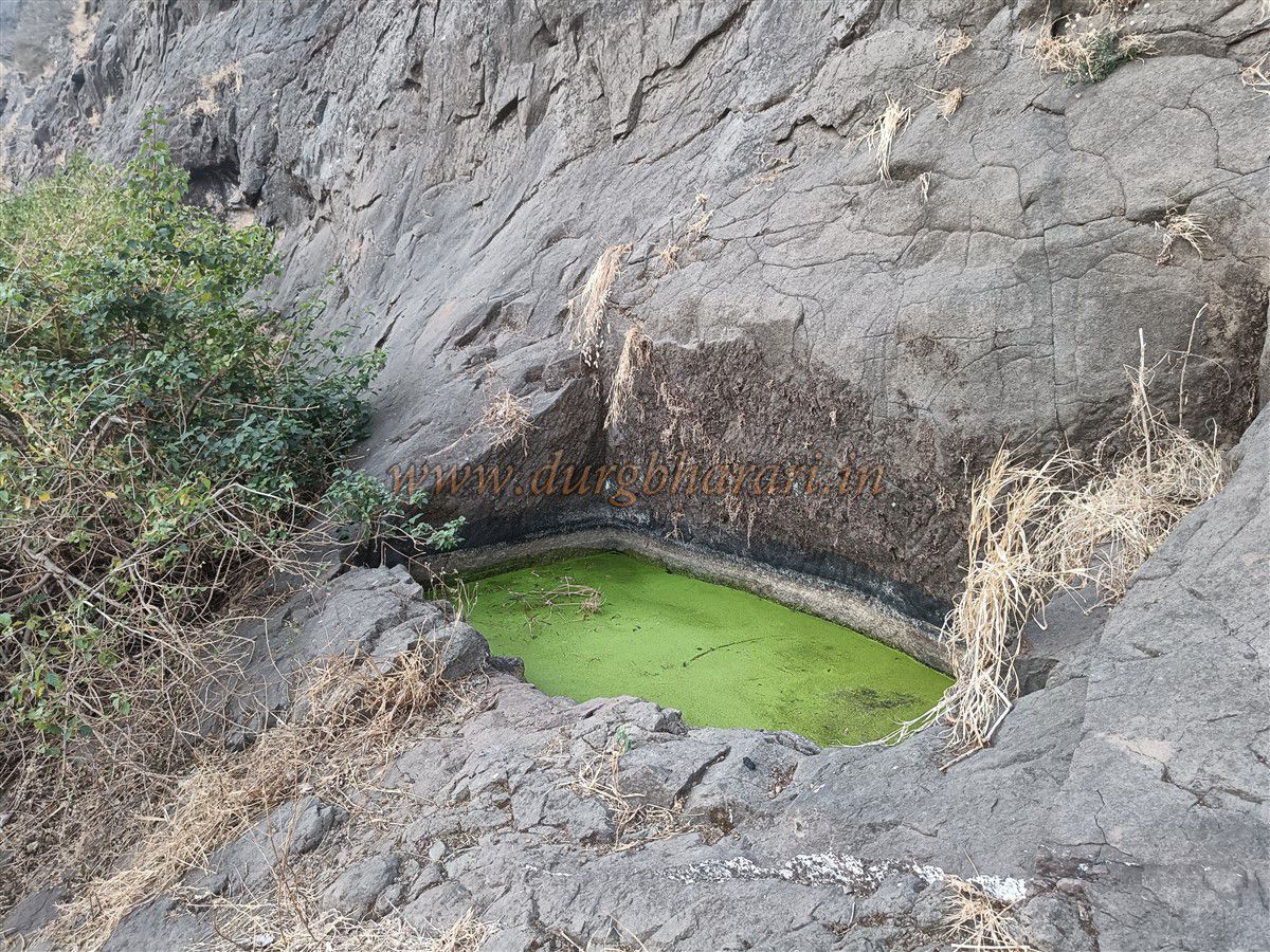
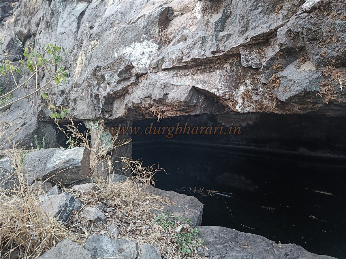
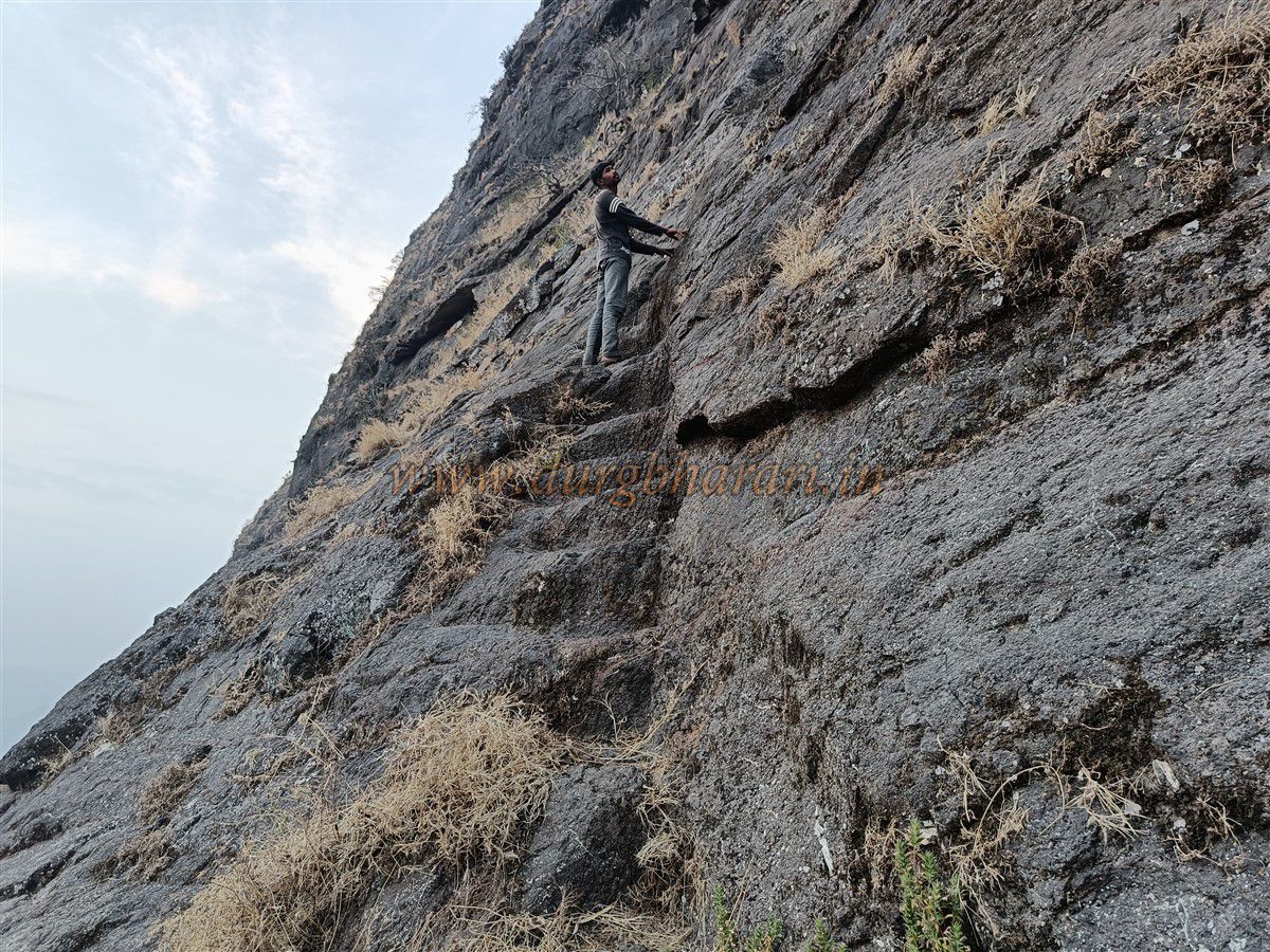
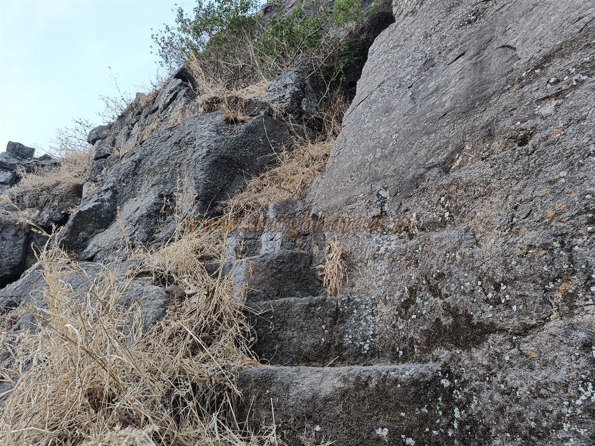
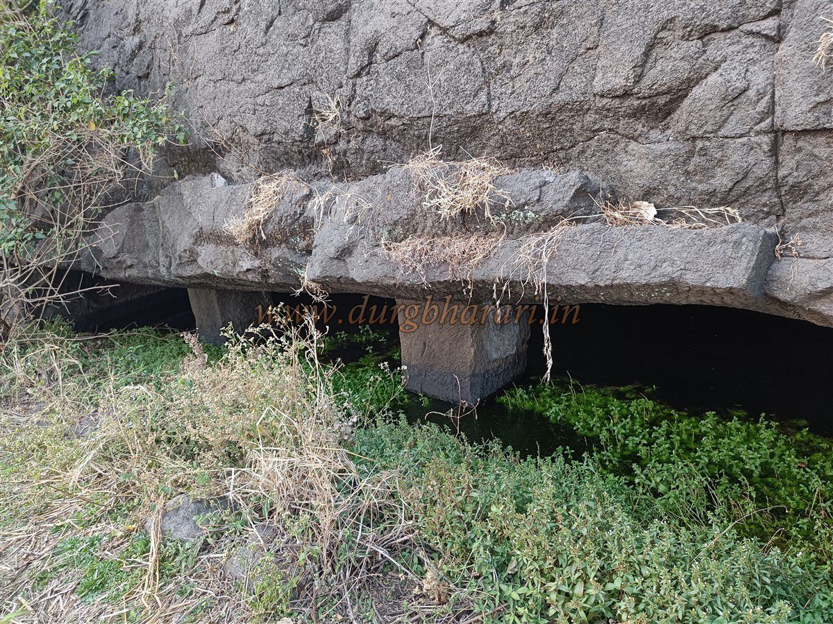
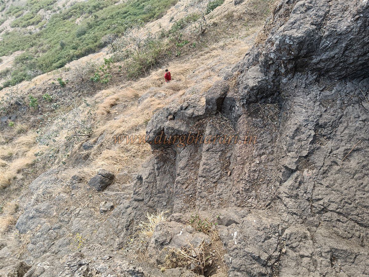
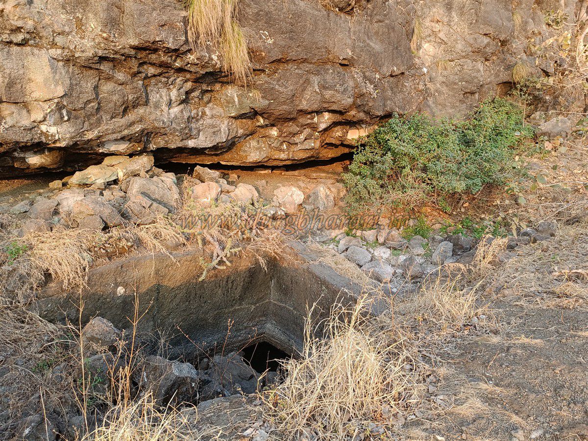
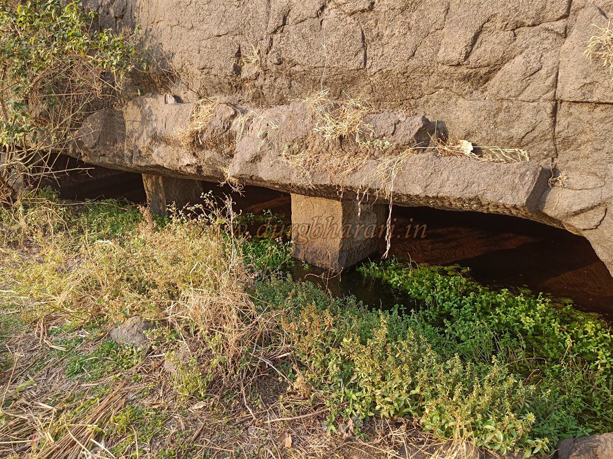
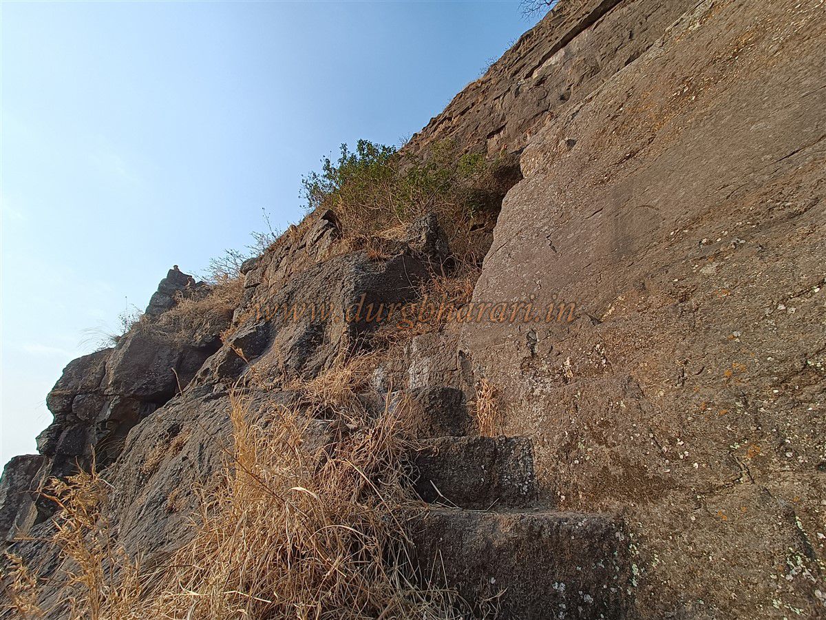
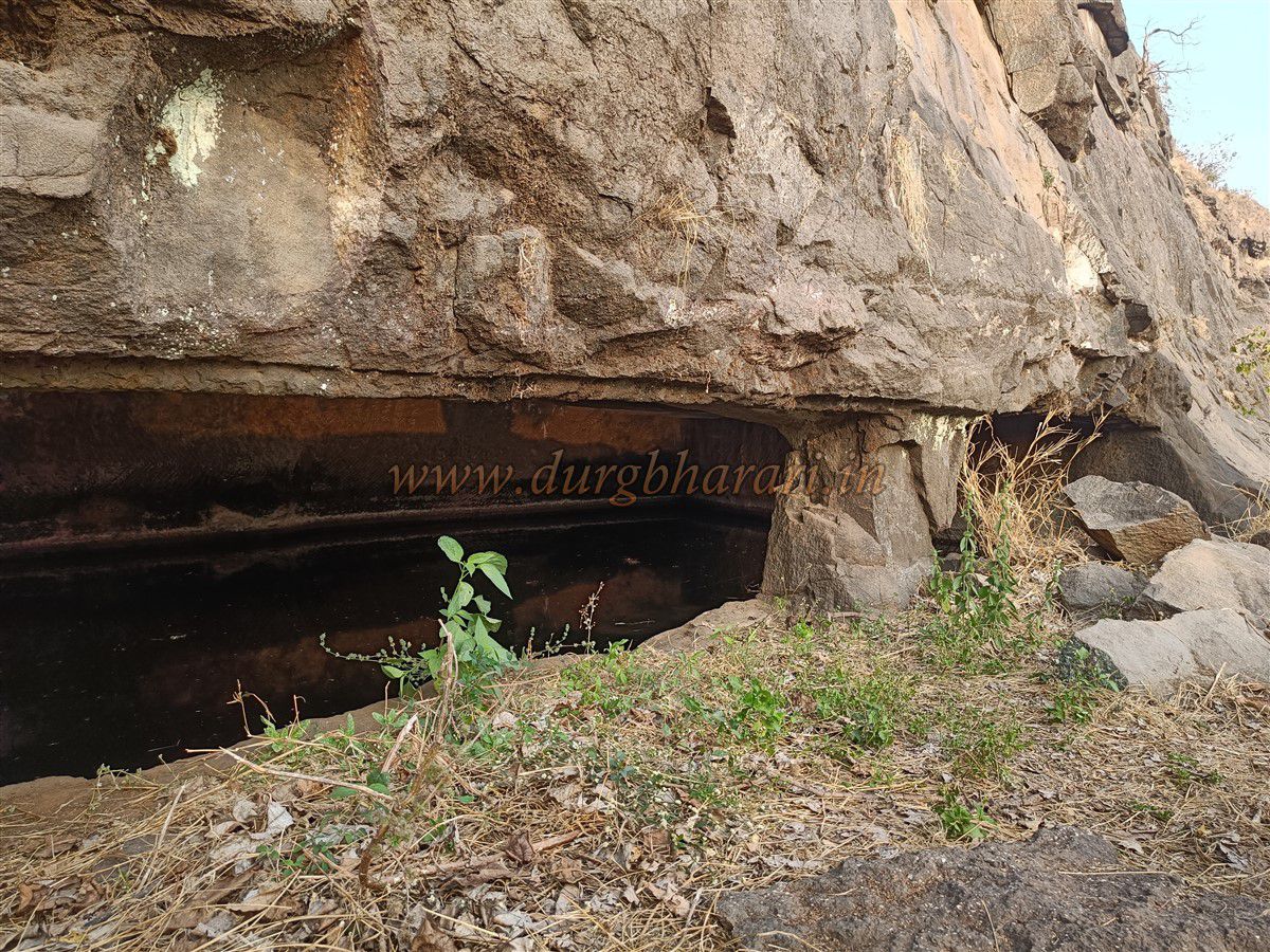
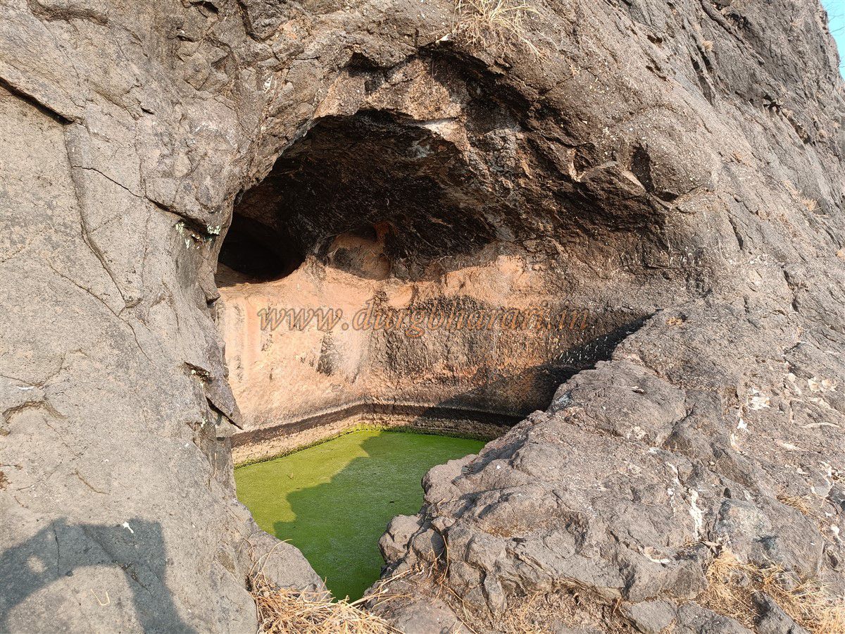
Soon, you reach the base of a bastion where two routes to the fort emerge. The first is a direct climb up rock-cut steps that lead straight to the bastion, though some steps are broken and require rock climbing, making it risky. The second, safer path veers left, circling the hill with the fort to the right and the valley to the left. This path leads to a cave-like tank carved into the mountainside. Further along, there are two open cisterns filled with algae-green water, and another cave-tank supported by pillars, though its water is unfit for drinking. Continuing onward, the rock-cut stairway resumes and leads through a simple gate without an arch into the lower part of the fort. A bastion stands beside this gate, and remains of a fort wall are visible along the cliff. From here, the trail curves right toward the bastion on the ridge seen earlier. At the beginning of this path is a two-pillared rock-cut cave and a ruined cistern. Within five minutes, you reach the top of the bastion previously seen from below. Looking down from here reveals the steep and dangerous path taken by those who ascend directly.
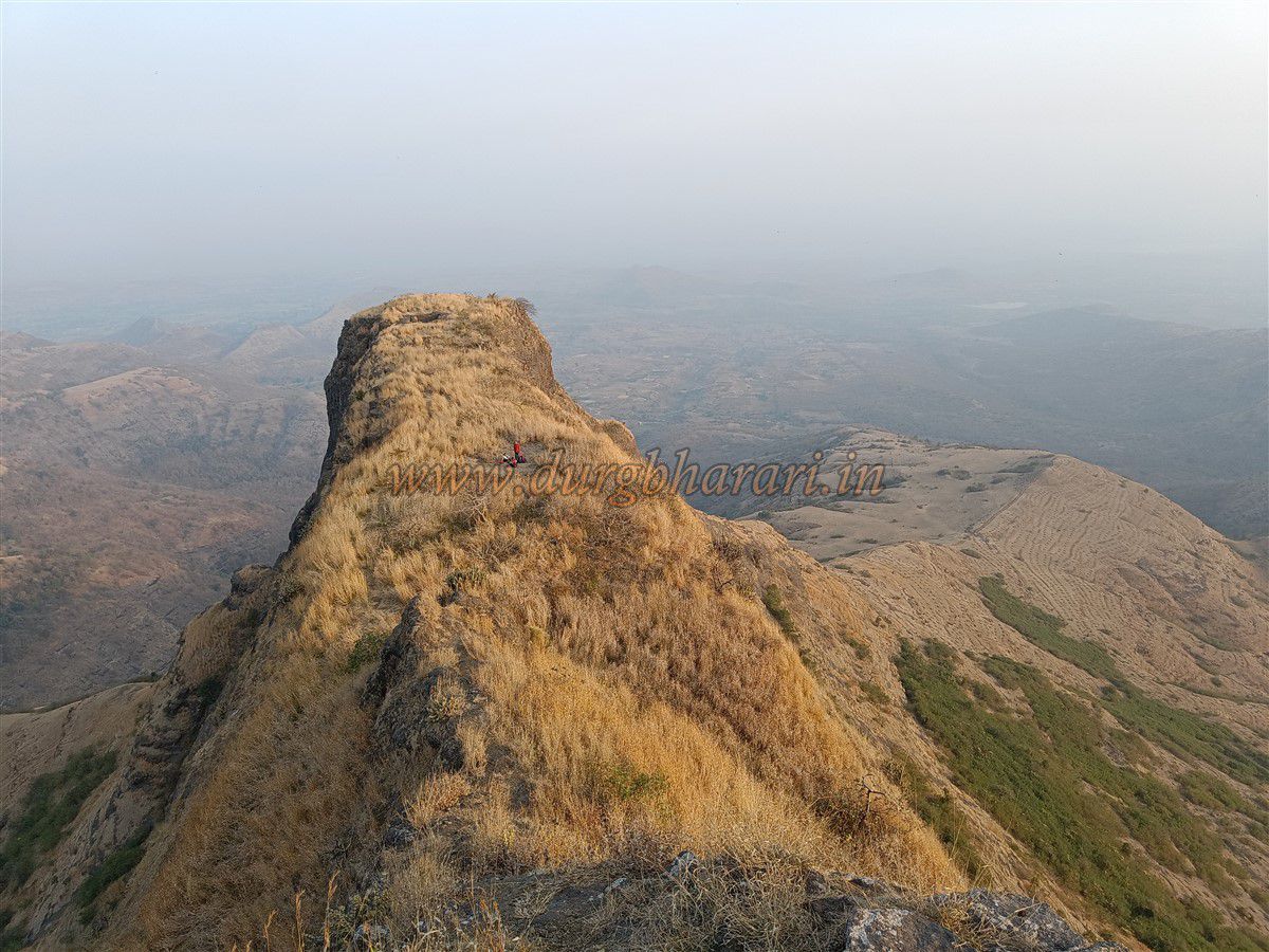
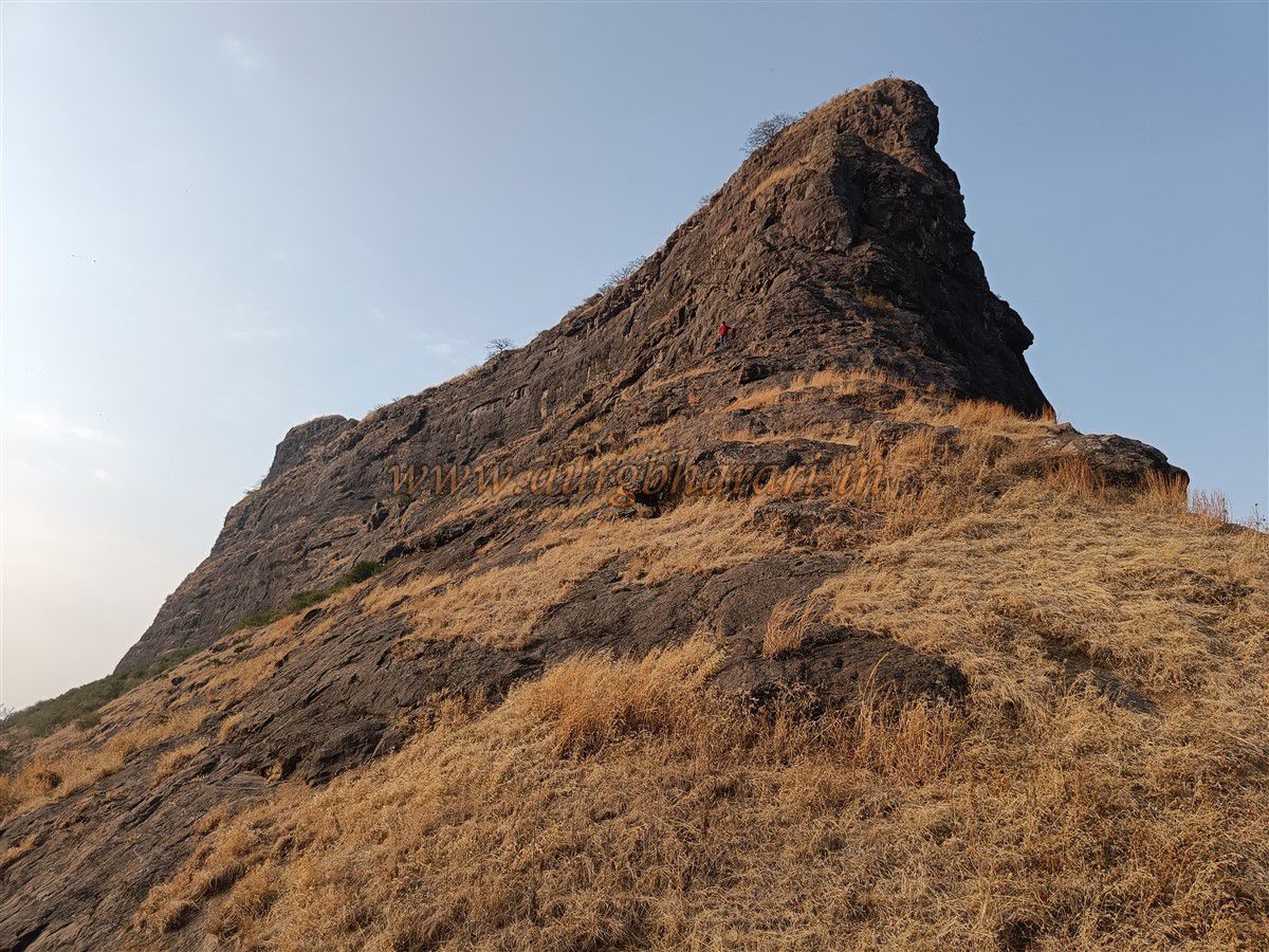
From this bastion, a rock-carved path leads to the summit of the fort. Due to soil accumulated over time, these steps must be tread with caution. After ten minutes, you reach the top of the fort. The original entrance gate is now completely destroyed, leaving only its threshold. It takes about one and a half hours to reach the summit from Patalwadi. The tapering summit sits at an elevation of 3,650 feet above sea level and spans approximately 2.5 acres from south to north.
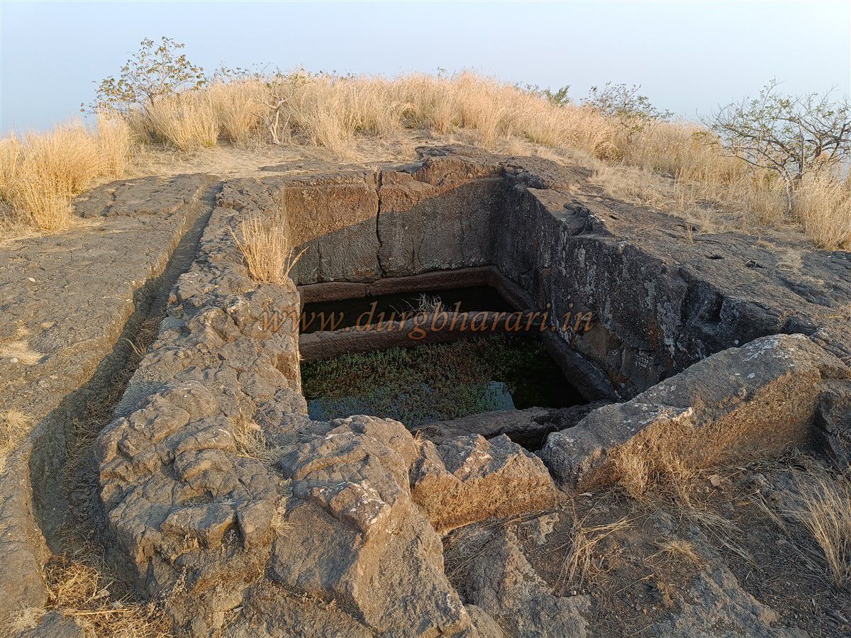
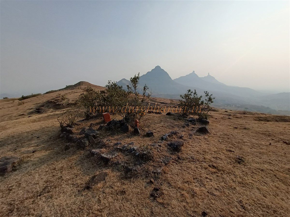
At the summit, a large rock-cut tank appears first, containing three smaller tanks within. Channels have been carved around the edges to collect rainwater. A little ahead lie the ruins of an old mansion, with surviving platforms and walls. Behind the mansion is another water tank, and further along the ridge, more platforms suggest the foundations of old structures. To the south lies a rock pinnacle, and while walking around it, one sees two water tanks—one dry and one filled. To the left of the pinnacle are two more tanks filled with soil and rubble. Within this pinnacle is a natural cave, accessible with basic rock climbing. Though there are no structures atop the pinnacle, the panoramic view is breath taking.
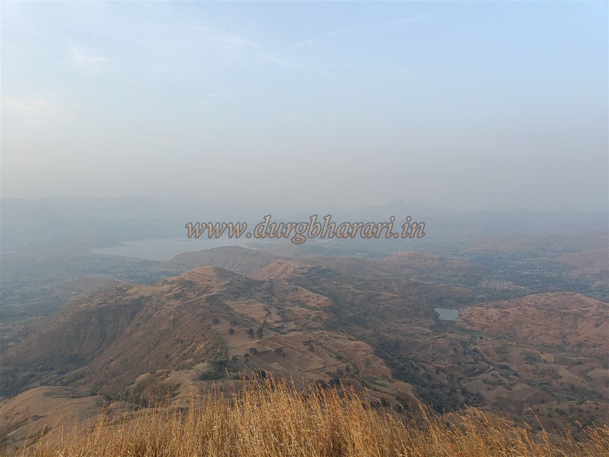
From the summit, to the east, you can see Tambolya and Mangi-Tungi peaks, and to the south, the forts of Mulher, Moragad, Hargad, Salher, and Salota are visible. Exploring the entire summit takes about 45 minutes. Given the rock-cut stairways, cave tanks, and structures, it is evident that the fort was inhabited since ancient times. In pre-Shivaji era history, Nahavagad is mentioned as Tumbola. According to the Persian chronicle Tawarikh-e-Alfi, in 1431 CE (Hijri 835), Prince Muhammad Khan of Gujarat was on a campaign to Nandurbar when Ahmad Shah Bahamani attacked him. However, Gujarat’s forces arrived in time, and Ahmad Shah was forced to retreat. On his way back, Ahmad Shah’s troops laid siege to Tumbola Fort. A fierce battle ensued at the base of the fort between the Bahamani and Gujarat armies, resulting in heavy casualties on both sides. With no decisive result, both forces withdrew under cover of darkness.
In 1670, after the battle of Kanchanbari, Moropant Pingle brought this fort and the surrounding region under Maratha control, though it likely fell back to the Mughals later. During Shivaji’s time, the fort was known as Nahavagad. Over time, the name simplified to Nahavagad, and British records refer to it as Barbers Fort. If traveling by private vehicle, both Nahavagad and the Mangi-Tungi pinnacles can be visited in a single day.
© Suresh Nimbalkar
GALLERY