NANI DAMAN
TYPEर : COASTAL FORT
DISTRICT : DAMAN
HEIGHT : 0
GRADE : EASY
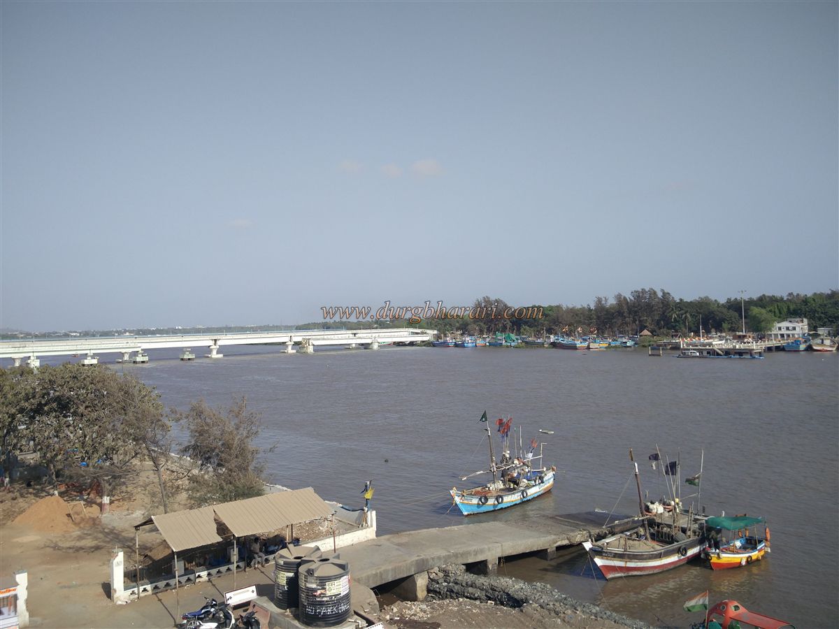
The city of Diu Daman is located at a distance of 180 k.m. from Mumbai. The Portuguese who traveled thousands of miles to reach India in the 16th century had ruled the city for 400 years and after India gained independence, in December 1961 this region was included in India. Due to the river Damanganga flowing through the city of Daman, the city is divided into Moti Daman and Nani Daman which means big Daman and small Daman. The smaller Daman is larger and the larger Daman is smaller in size. As the original Portuguese settlement was in Moti Daman fort, Moti Daman fort is big and Nani Daman fort is small in size. As the Portuguese were a seafaring tribe, they built two forts on the mouth of the Damanganga creek to maintain direct contact with Portugal and to protect the city of Daman.
...
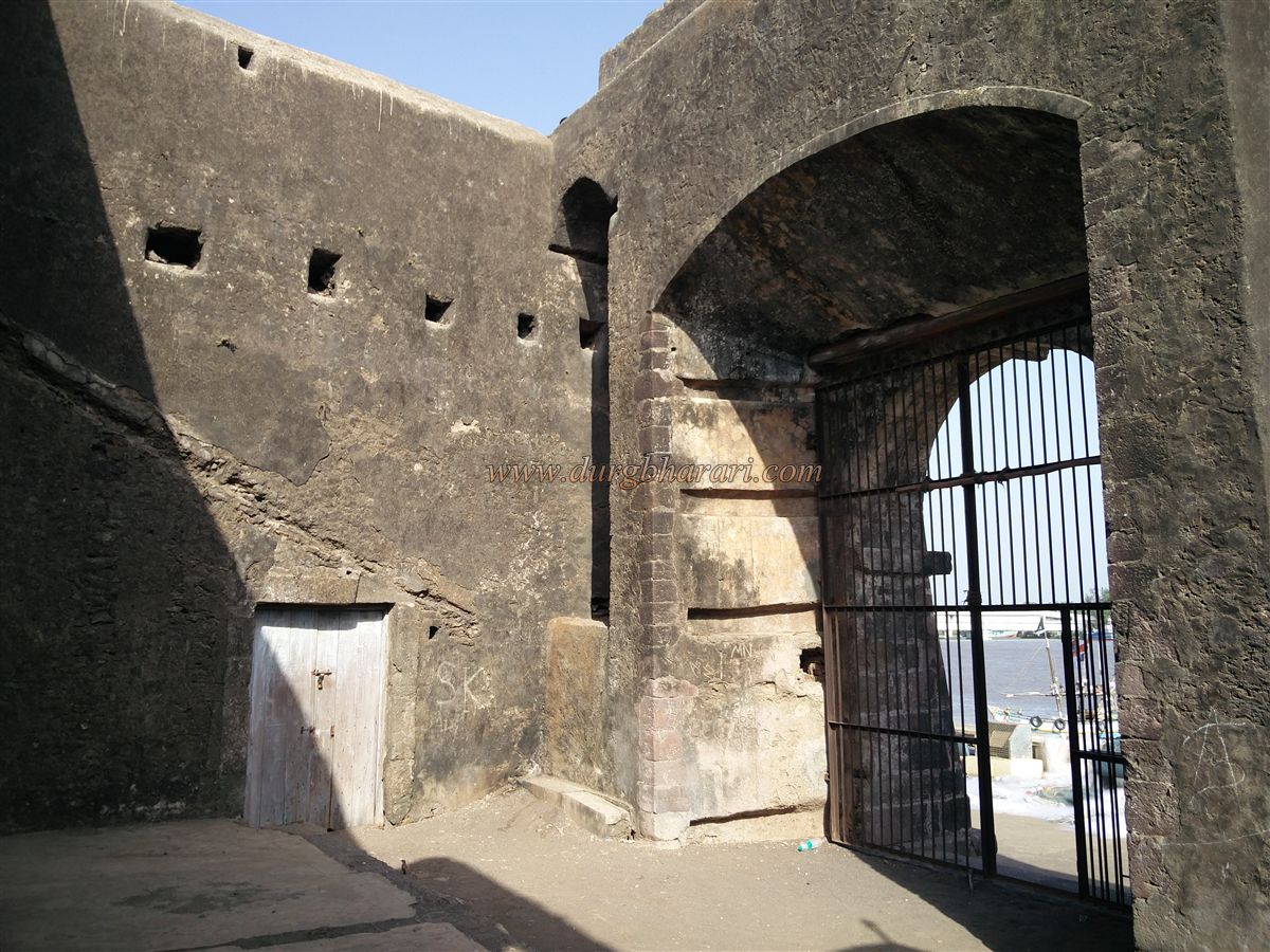
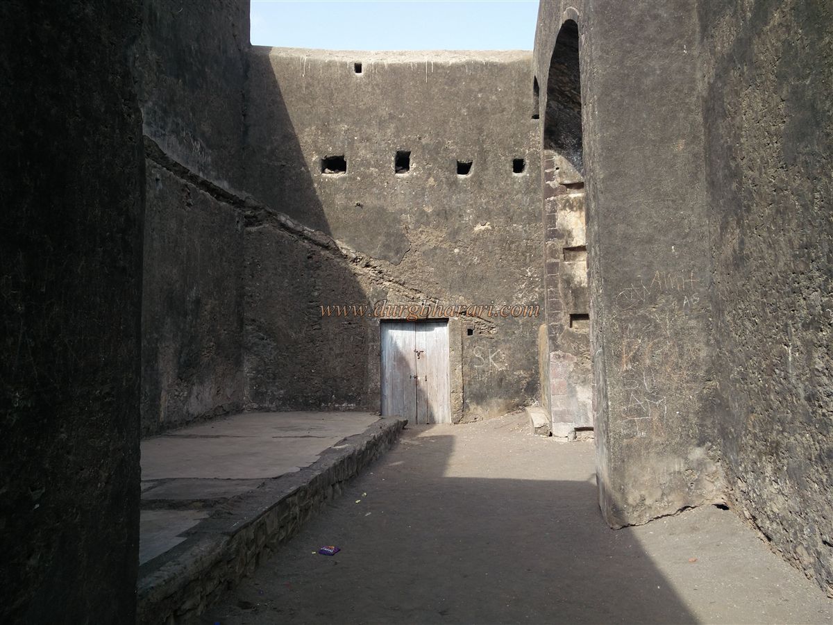
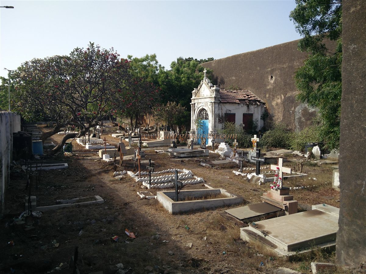
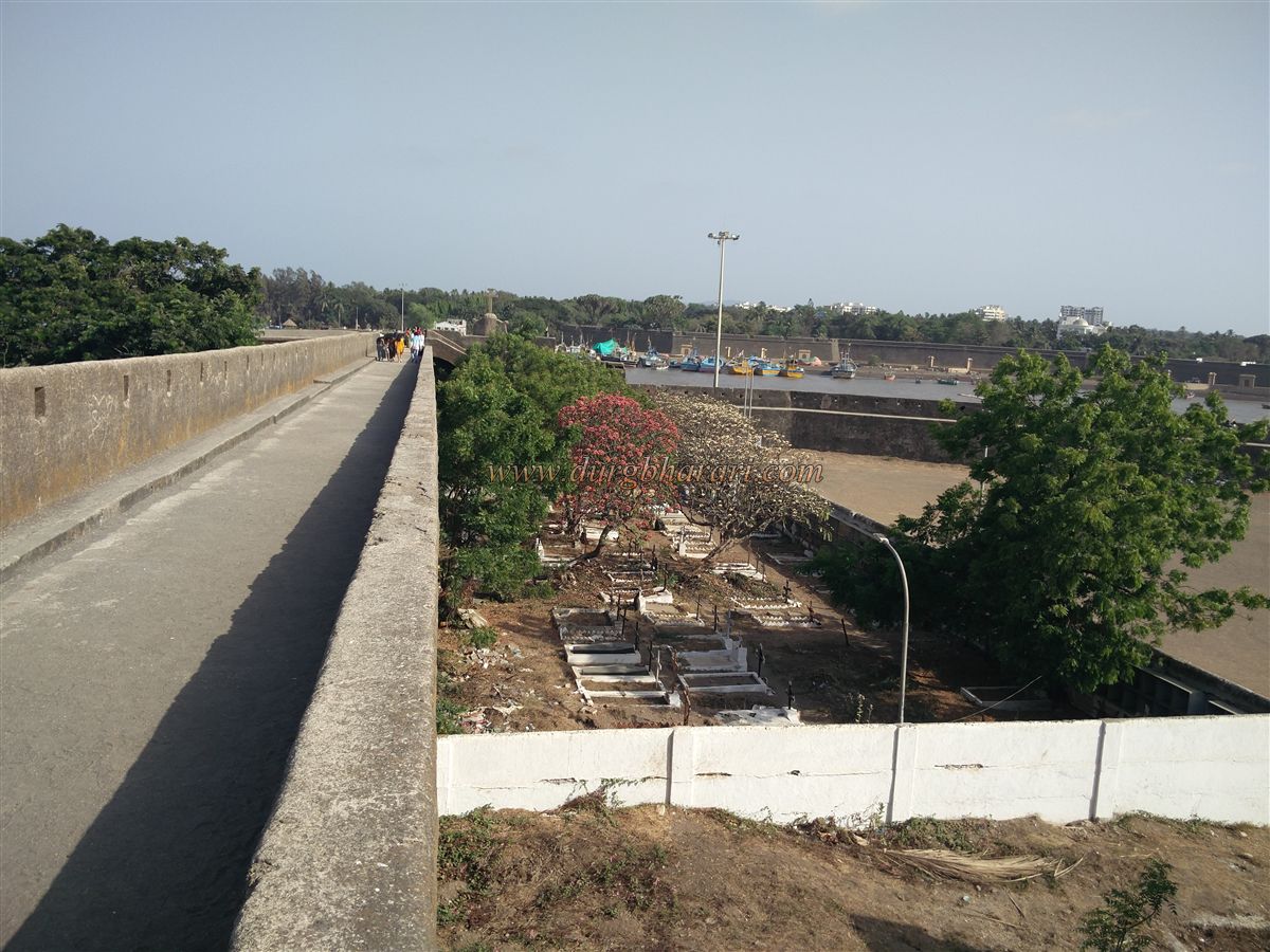
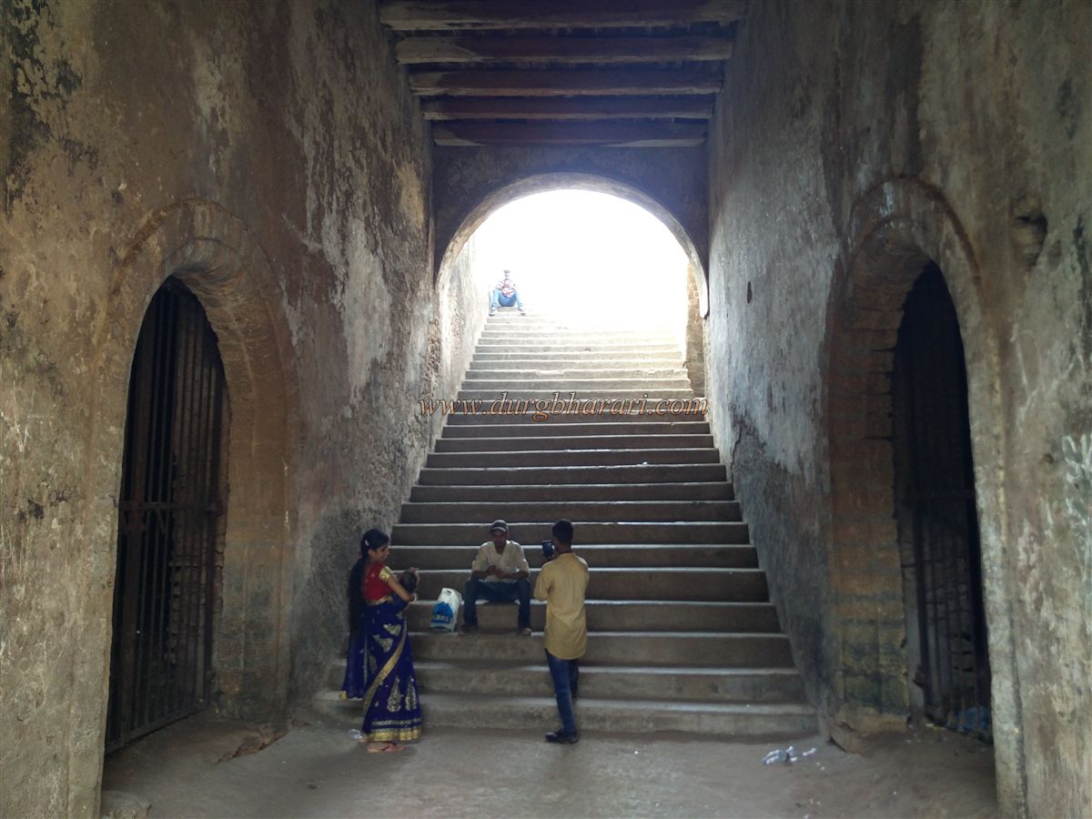
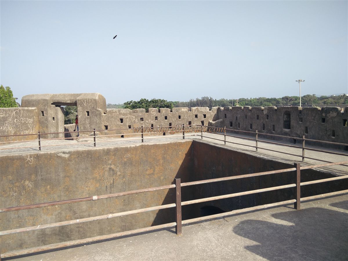
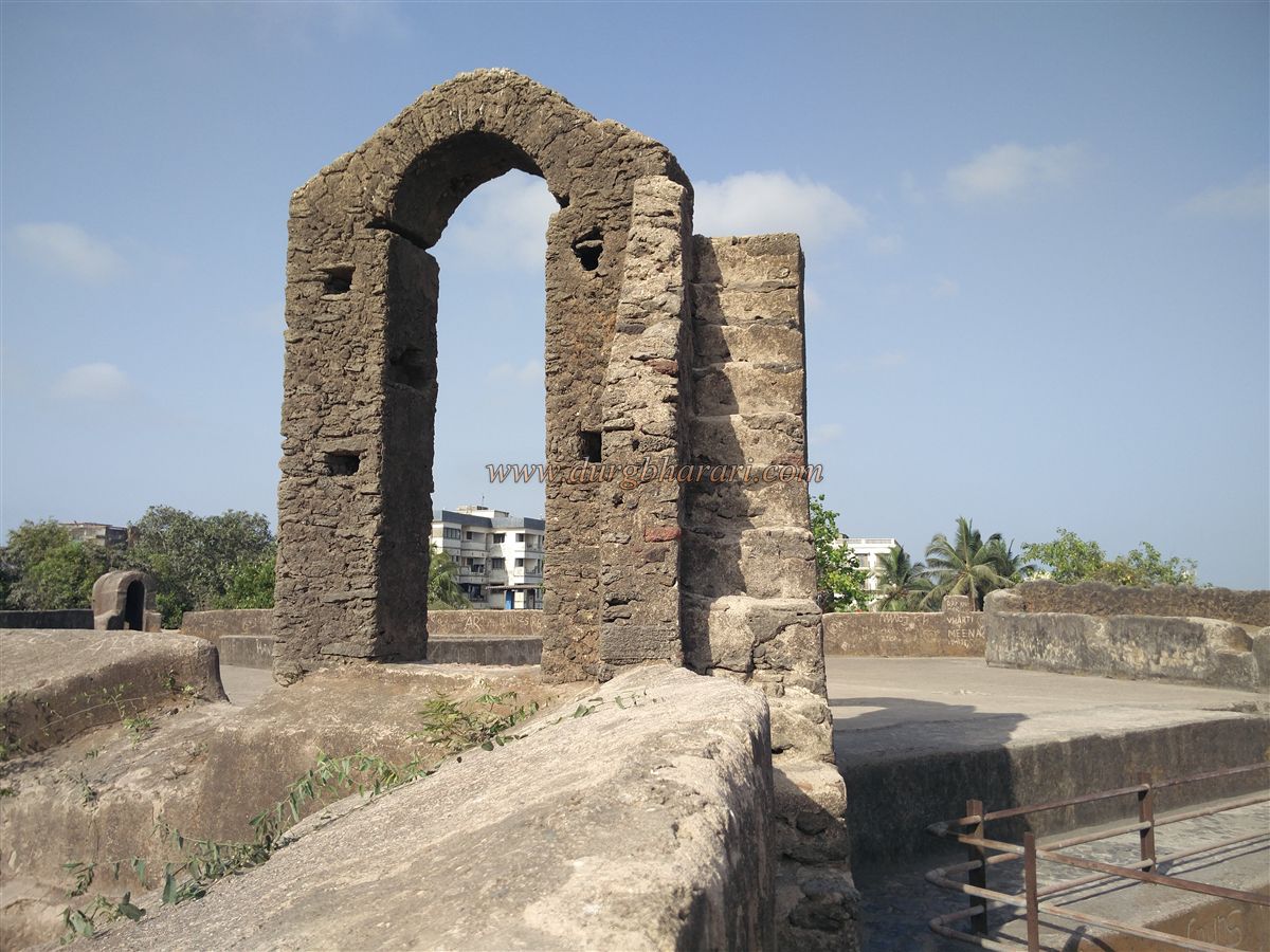
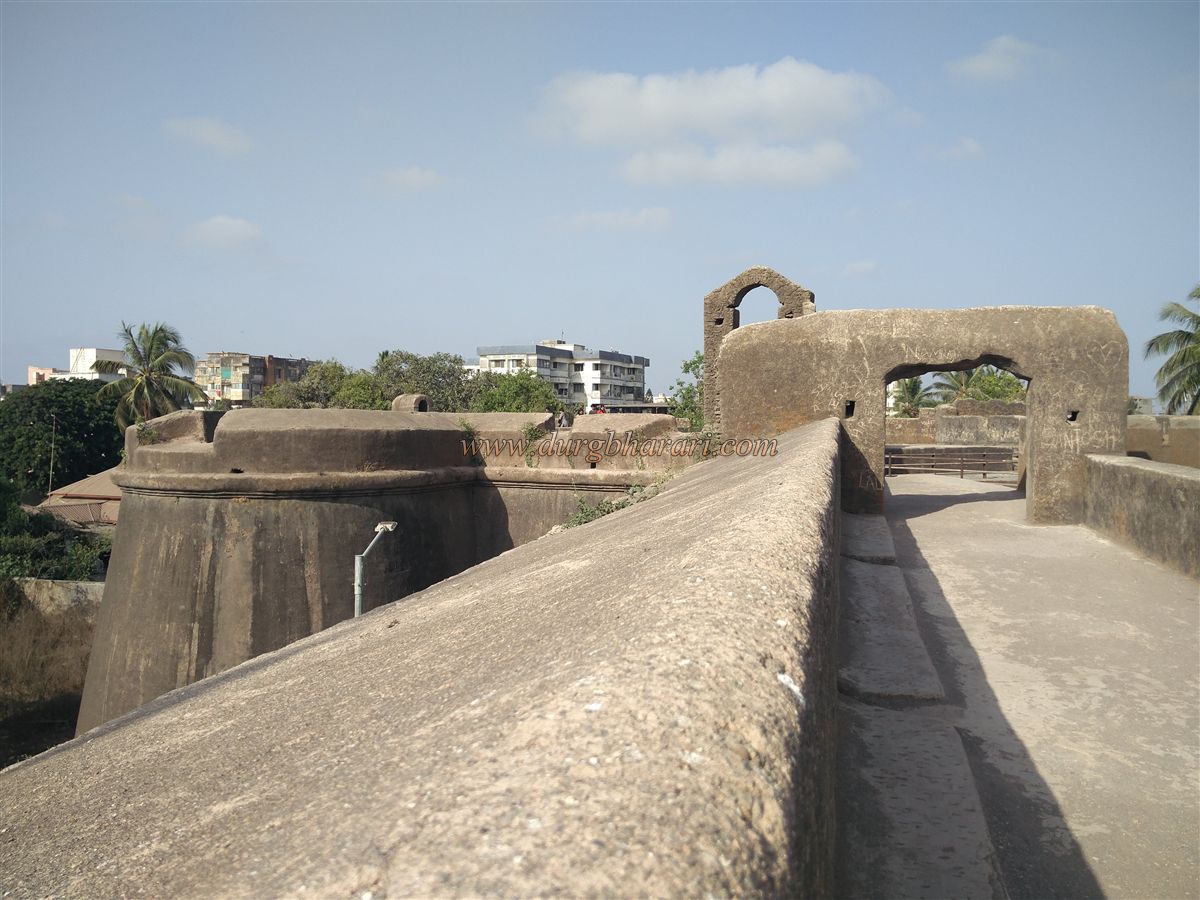
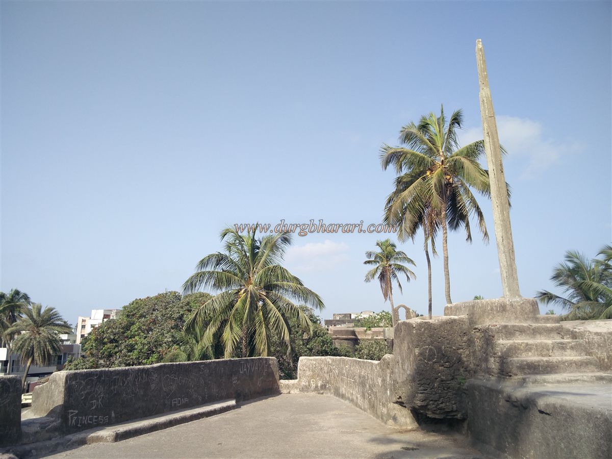
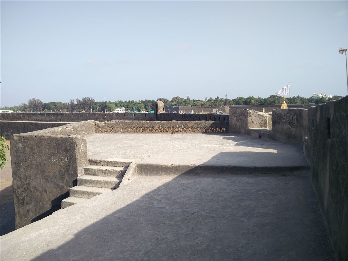
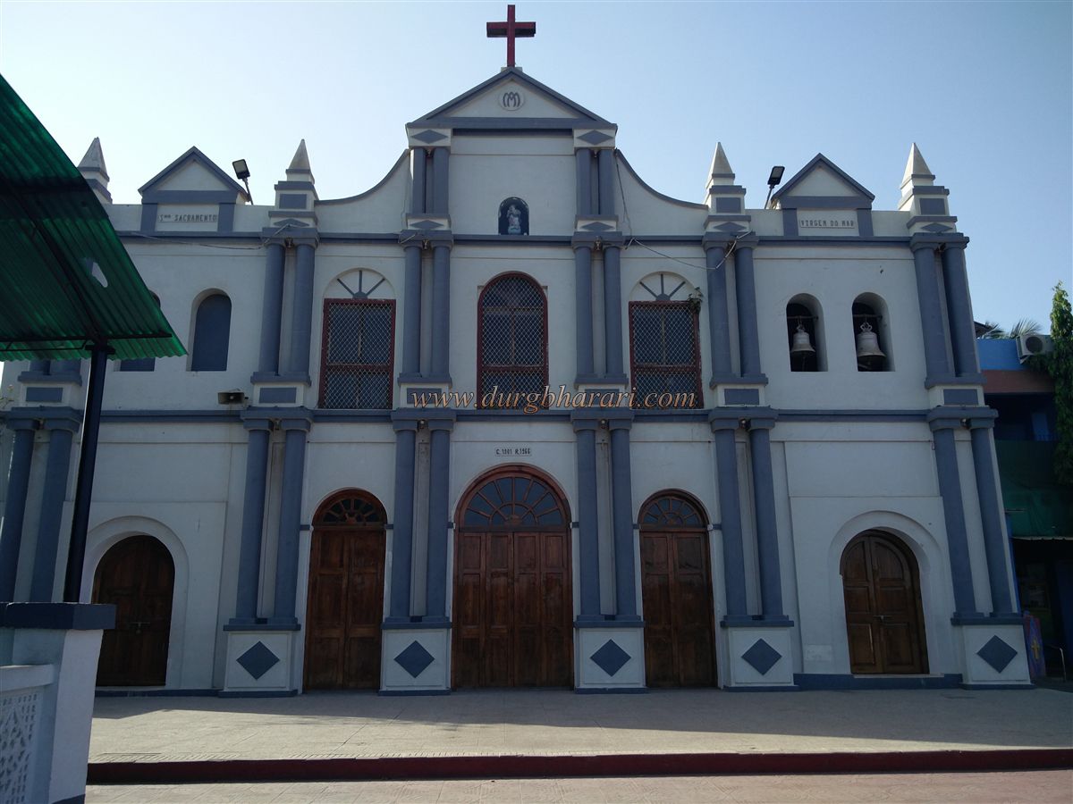
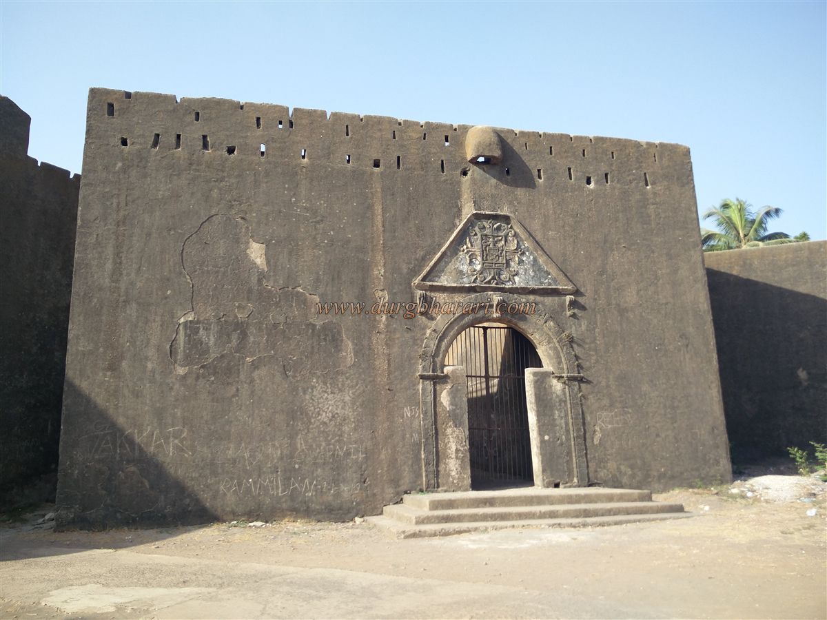
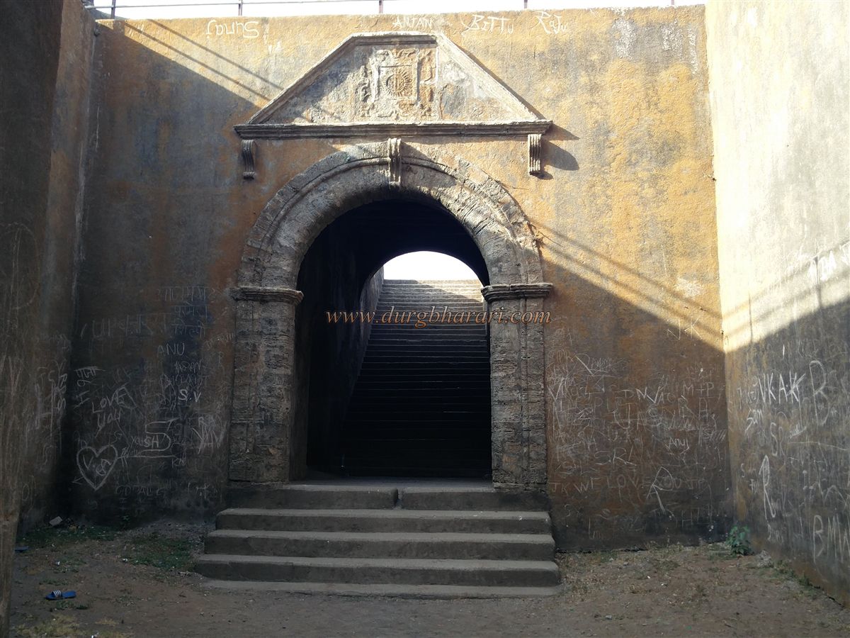
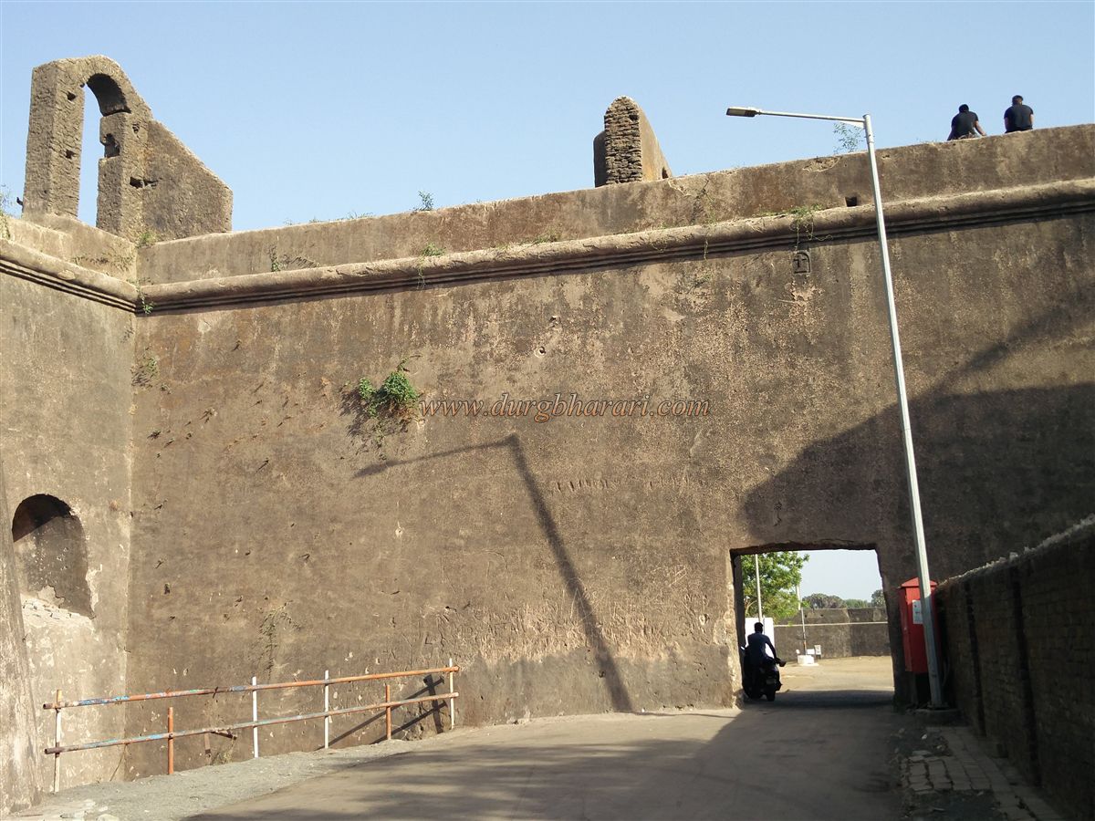
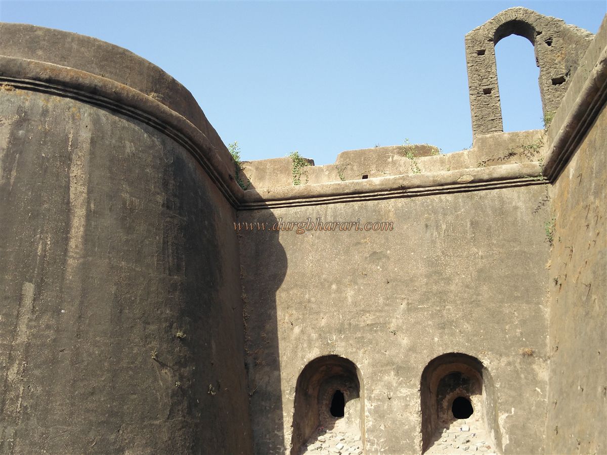
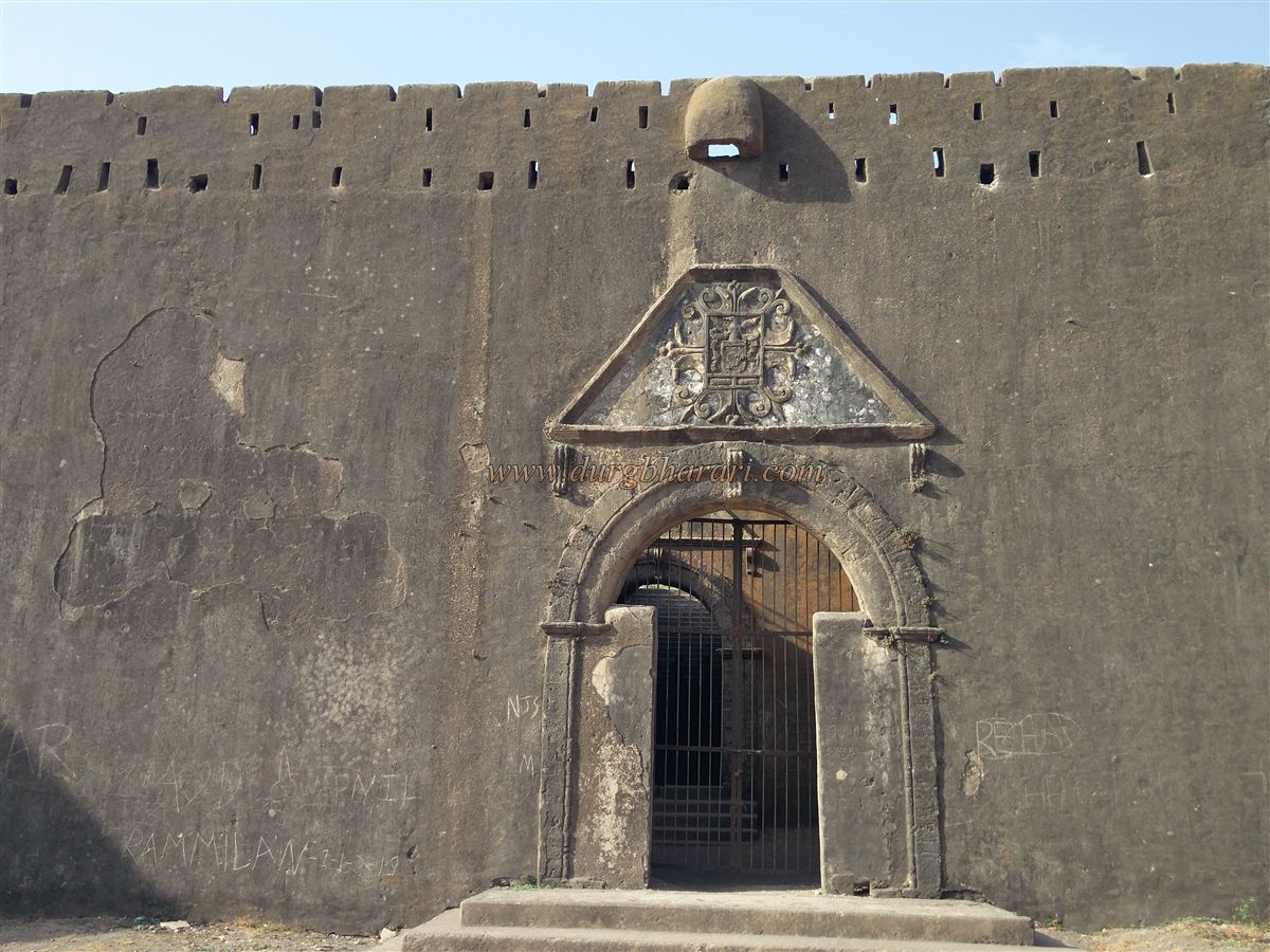
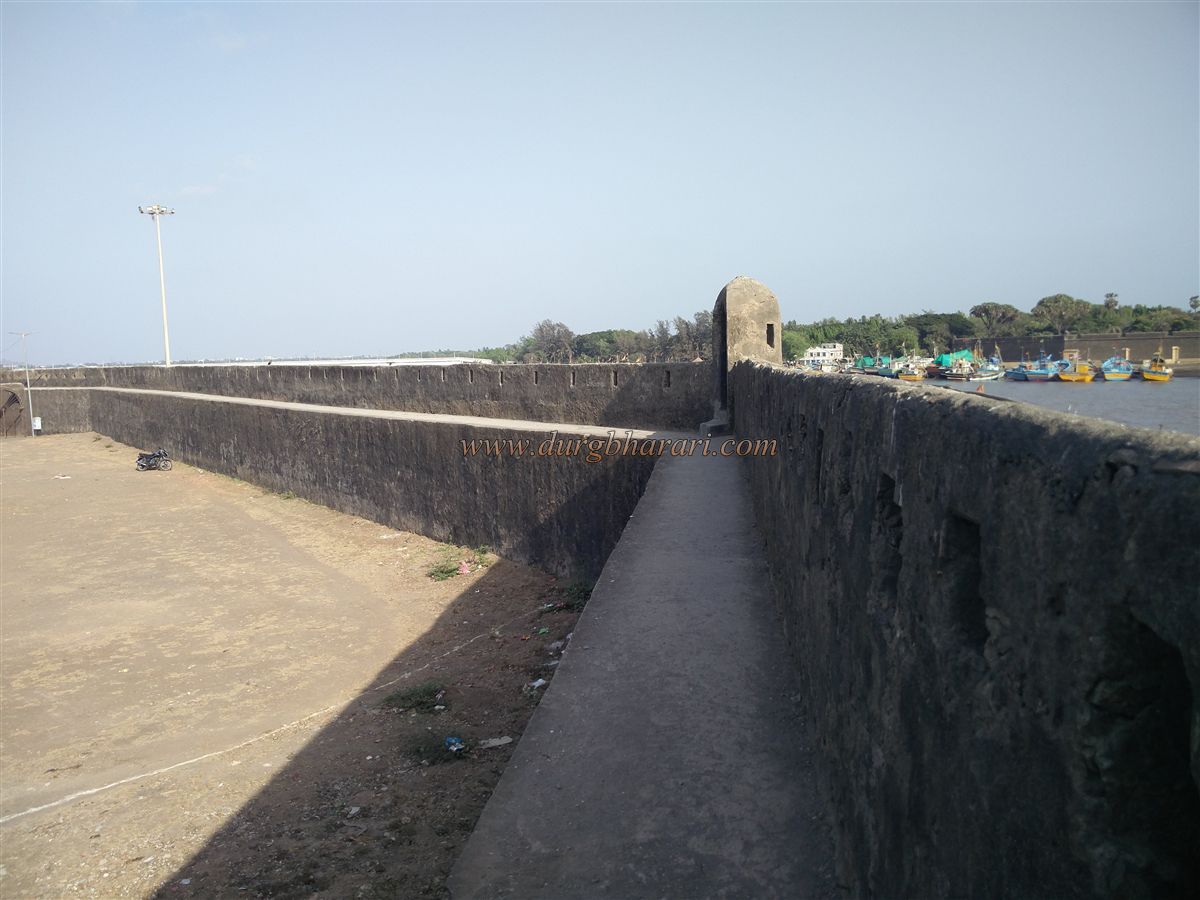
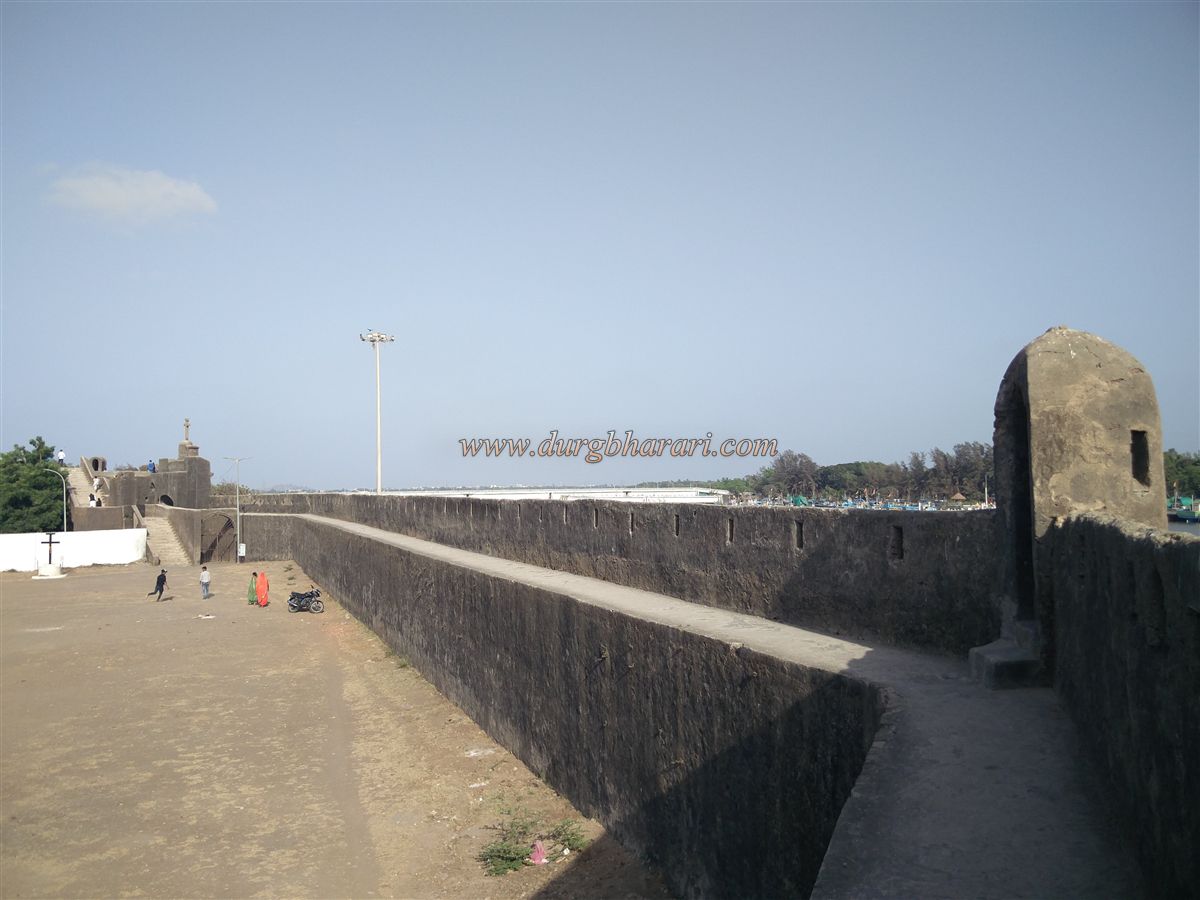
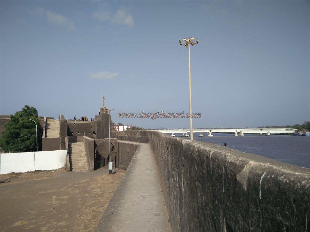
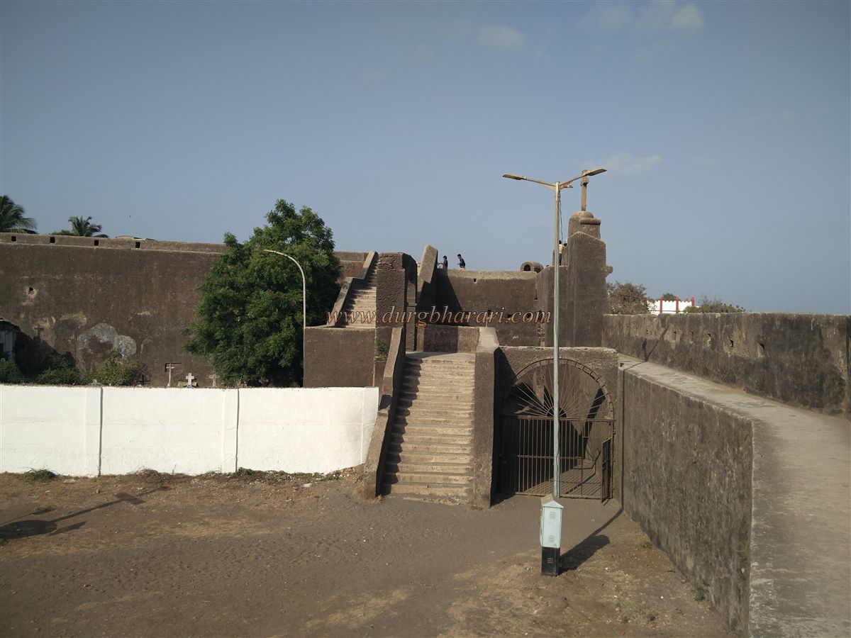
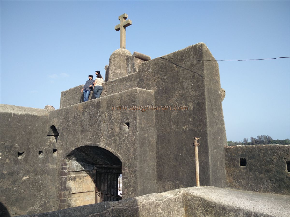
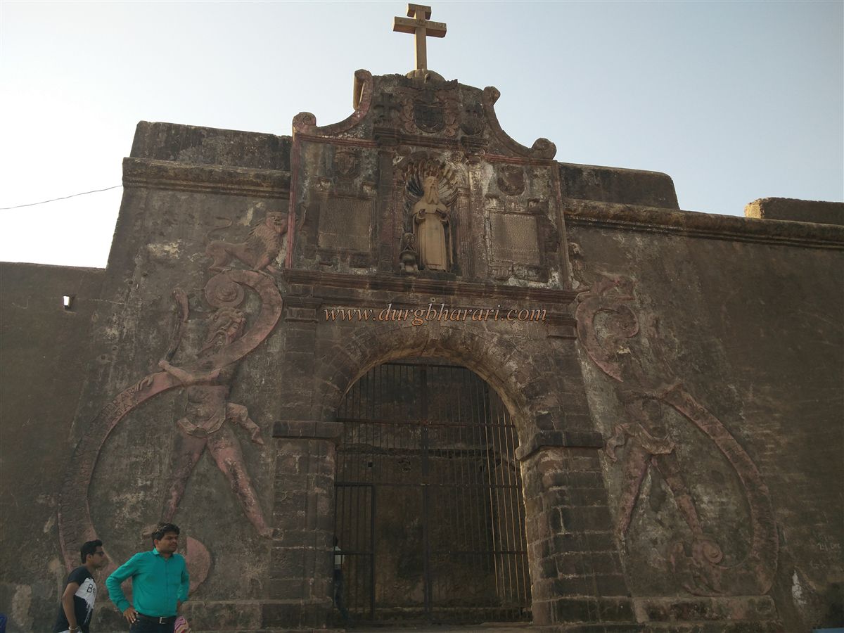
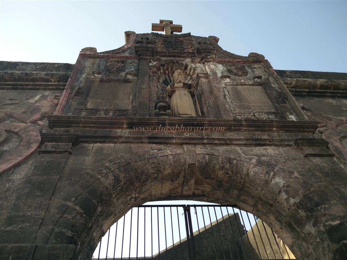
The two forts are opposite each other and Nani Daman Fort i.e. St. Jerome Fort is located on the north bank of the river Damanganga. The connection of the Marathas with this fort is that during the Vasai campaign of Chimajiappan in 1739, the fort was cordoned off by the Maratha forces so that the Portuguese could not get help for the Vasai fort. After the conquest of the province by the Sultan of Gujarat, the Portuguese started building a fort here. The construction of this fort lasted from 1614 to 1672, so it took about 50 years to build the fort. The construction of the fort is a masterpiece of Portuguese architecture. This square-shaped fort is spread over about 3 acres and there are three arrow-shaped bastions in the ramparts of the fort. The fort's 20 feet high ramparts have the main gate facing the river Damanganga in the south and another small gate in the north. On the main gate of the fort, there are two inscriptions carved with Portuguese insignia and a statue of St. Jerome, among other decorative works. The entire door is decorated in Portuguese style. There is a horizontal wall on the inside of the gate and this wall does not allow you to enter the fort directly. A room is built in the wall at this place. Inside the fort, there is ‘Our Lady of the Sea Church’ and a Christian cemetery, two old buildings, and a newly built school. The rest of the fort has been converted into a large plain ground. Upon entering the fort, there are steps on the right side to reach the rampart along the bank. As the ramparts of the fort are intact, the entire fort can be reached from here. The ramparts are about 10 feet wide enough for a bullock cart to pass through. We climb the bastion near the gate and walk to the second bastion on the fort. There is an arch to hang the bell on this bastion. Looking at the moat under the bastion, a moat must have been built around the entire fort But it must have been extinguished over time. There is a staircase to descend from this bastion to the fort and a door to reach the fork below the staircase. At the bottom of this fork, two large barns are built. Adjacent to this bastion is another small gate to exit the fort, which is the northern gate. After this, we come to the third bastion on the west side of the fort i.e. towards the sea. There is a tall quadrangle structure built on this bastion and a big wooden pole is erected on it to hoist the flag. From here onwards, walking along the bank and reaching the main gate of the fort, your fort round is completed. Half an hour is enough to cover the exploration of the entire fort. The distance from Vapi to Daman is 12 km. Vapi railway station can be reached by bus, rickshaw, and private vehicle. The fort is just a ten-minute walk from the Nani Daman bus stand.
© Suresh Nimbalkar
GALLERY