NAGAR FORT
TYPE : GROUND FORT
DISTRICT : NAGAR
HEIGHT : 0
GRADE : EASY
In the Sahyadri mountain range, there are relatively few ground forts (Bhuikot). These ground forts were built solely to establish dominance over flat terrain. One such impregnable ground fort is the Bhuikot Fort of Ahmednagar. Seeing the fort’s still-solid condition today, it’s hard to believe it was built over five hundred years ago—such is its excellent preservation. On the Manmad–Daund railway line, Ahmednagar is a central railway station. The fort, located in Bhingar (also called the Nagar Fort), is about 5 km from Ahmednagar railway station. Auto-rickshaws and buses are available to reach there, so one can arrive at the fort’s entrance within ten minutes. When the fort was built, it stood about a kilometer away from the village; now, however, the city has spread all around it.
...
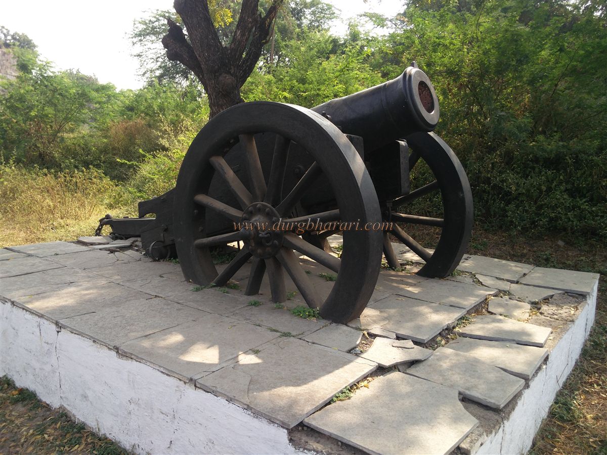
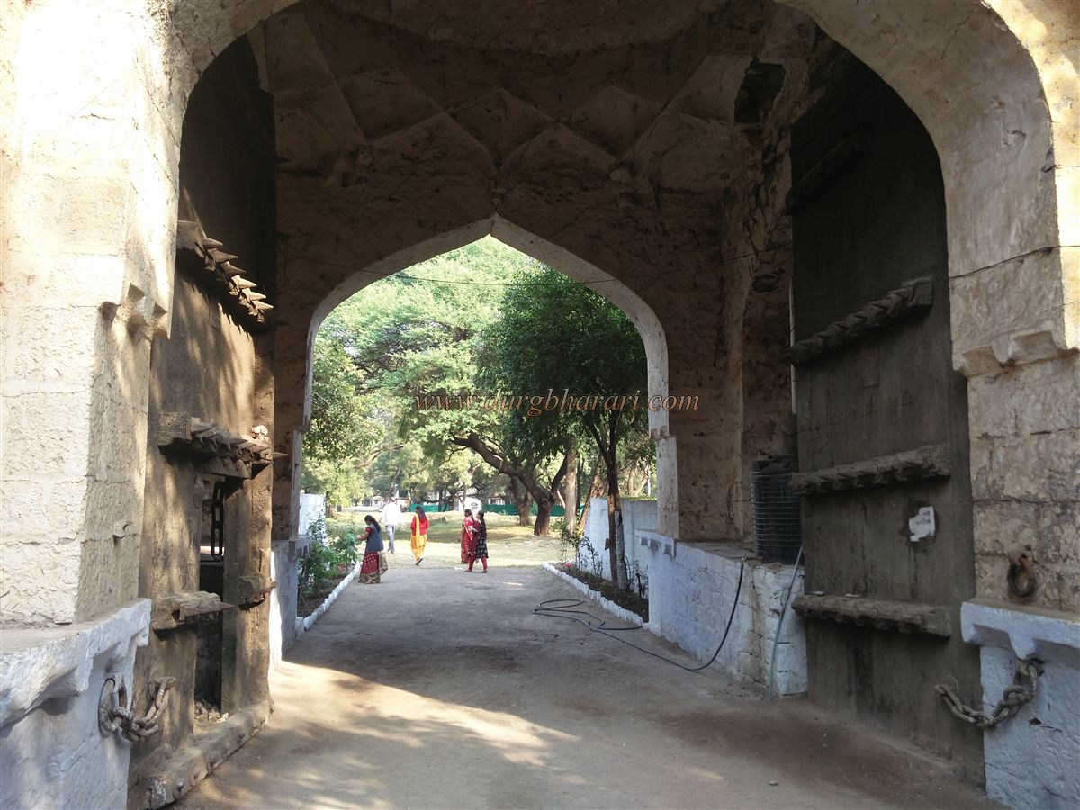
At present, the fort is under the control of the Indian Army, so for security reasons, it can only be visited between 9 a.m. and 5 p.m. A government-issued identity card is required for entry. Today, the entrance used to enter the fort via the bridge over the moat is not the original gate; the real entrance lies to the right of it. The gate was changed for better transport access. On the left of the present gate, the Indian tricolour flag can be seen flying. In front of the gate, two cannons mounted on their carriages stand on two platforms.
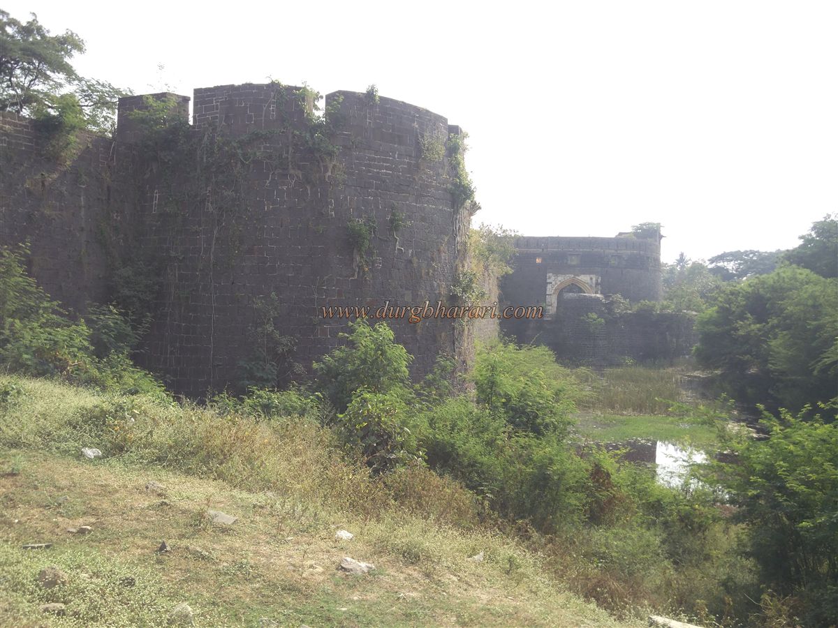
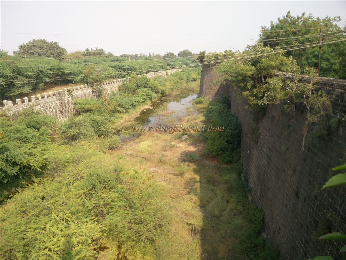
The fort is surrounded by a 150-foot-wide moat. On one side of the moat is the stone fort wall, and the opposite side is also lined with stone masonry. A cement wall with fencing has been added outside the moat. In earlier times, the moat was filled with water and crocodiles or alligators were released into it for defense. The fort is somewhat circular, covering about 60 acres inside, while the total area including the moat exceeds 80 acres.
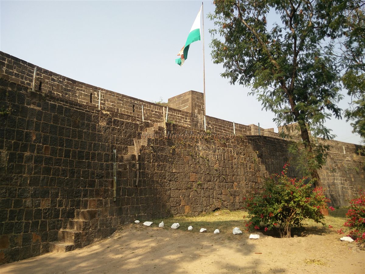
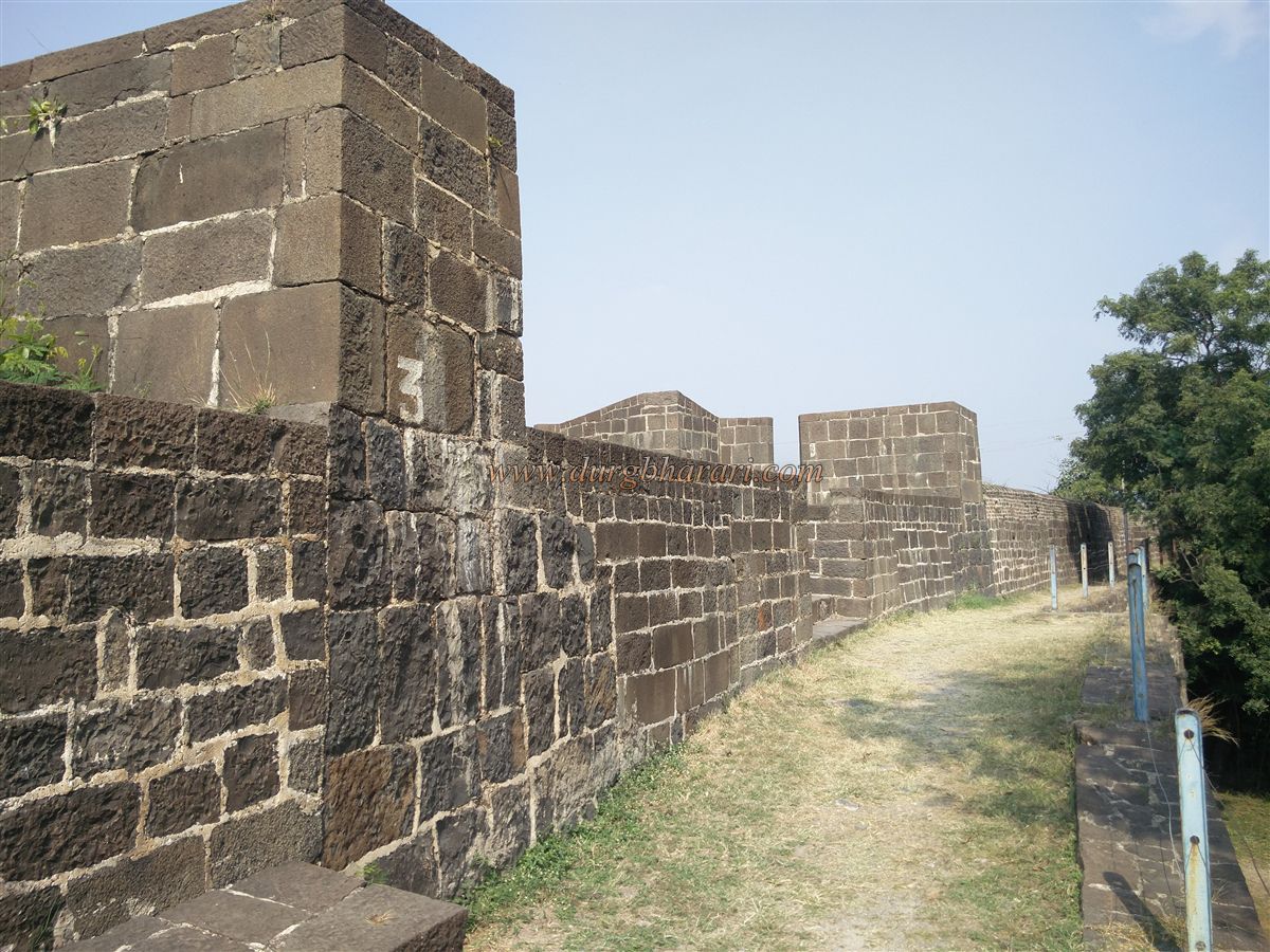
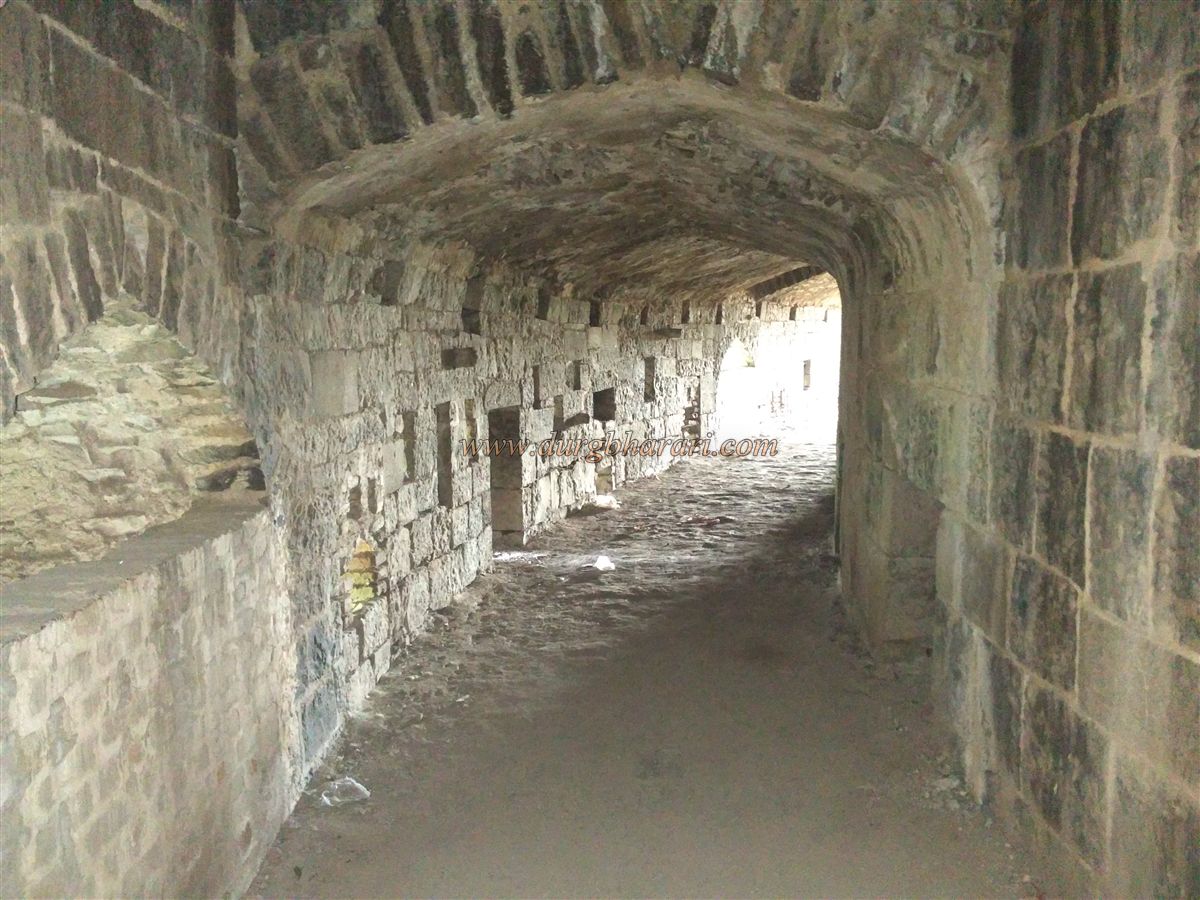
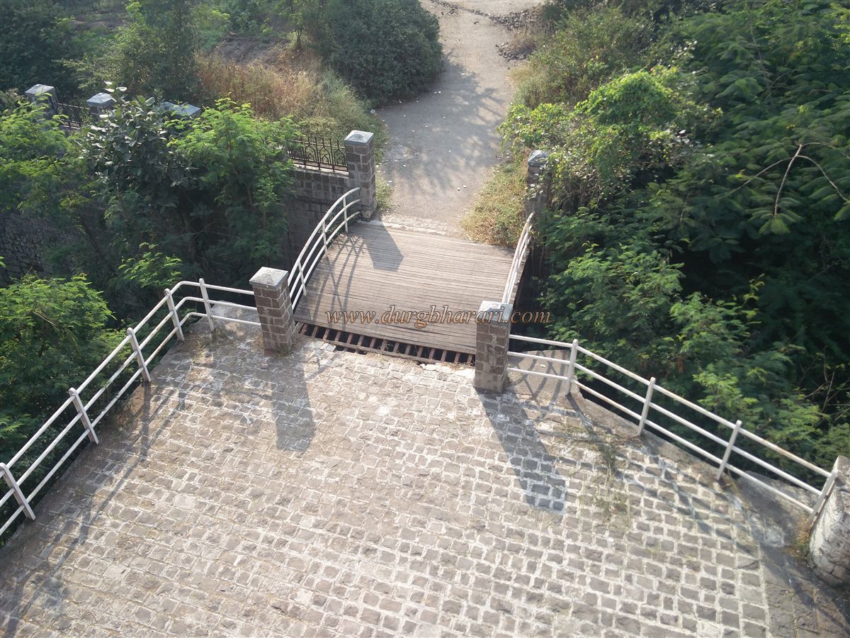
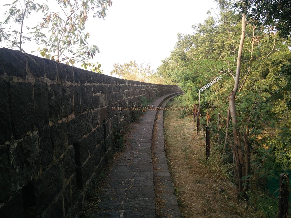
Tall stone walls surround the fort, with a total of 22 bastions. The original construction is of stone blocks, while later repairs used bricks. Thanks to the army’s upkeep, the fort remains in excellent condition. The main entrance faces west toward the city, while another gate exists on the eastern bastion. Wooden bridges have been built over the moat in modern times, whereas earlier, the bridges could be removed in times of attack.
Upon entering, there is a registration office to the right and a vehicle parking area to the left. Stairs on either side of the entrance lead up to the ramparts. The fort can only be viewed from these ramparts, as the interior pathways and stairs leading down have been closed with fencing. Visitors usually start their exploration by climbing the bastions to the right after entering.
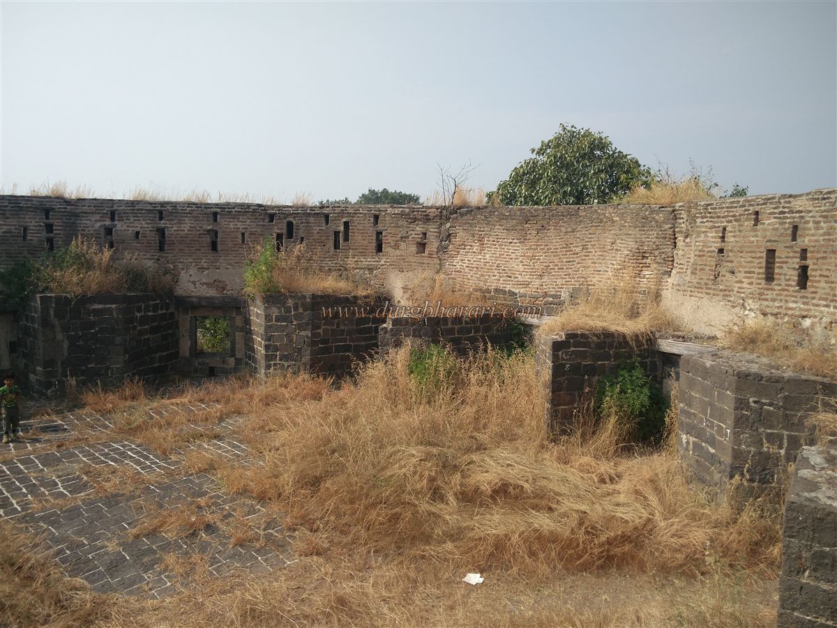
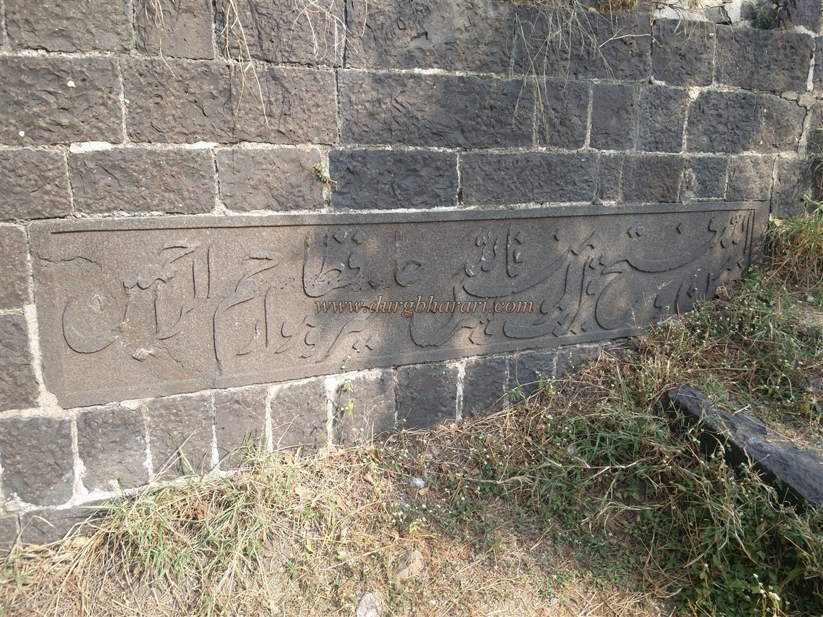
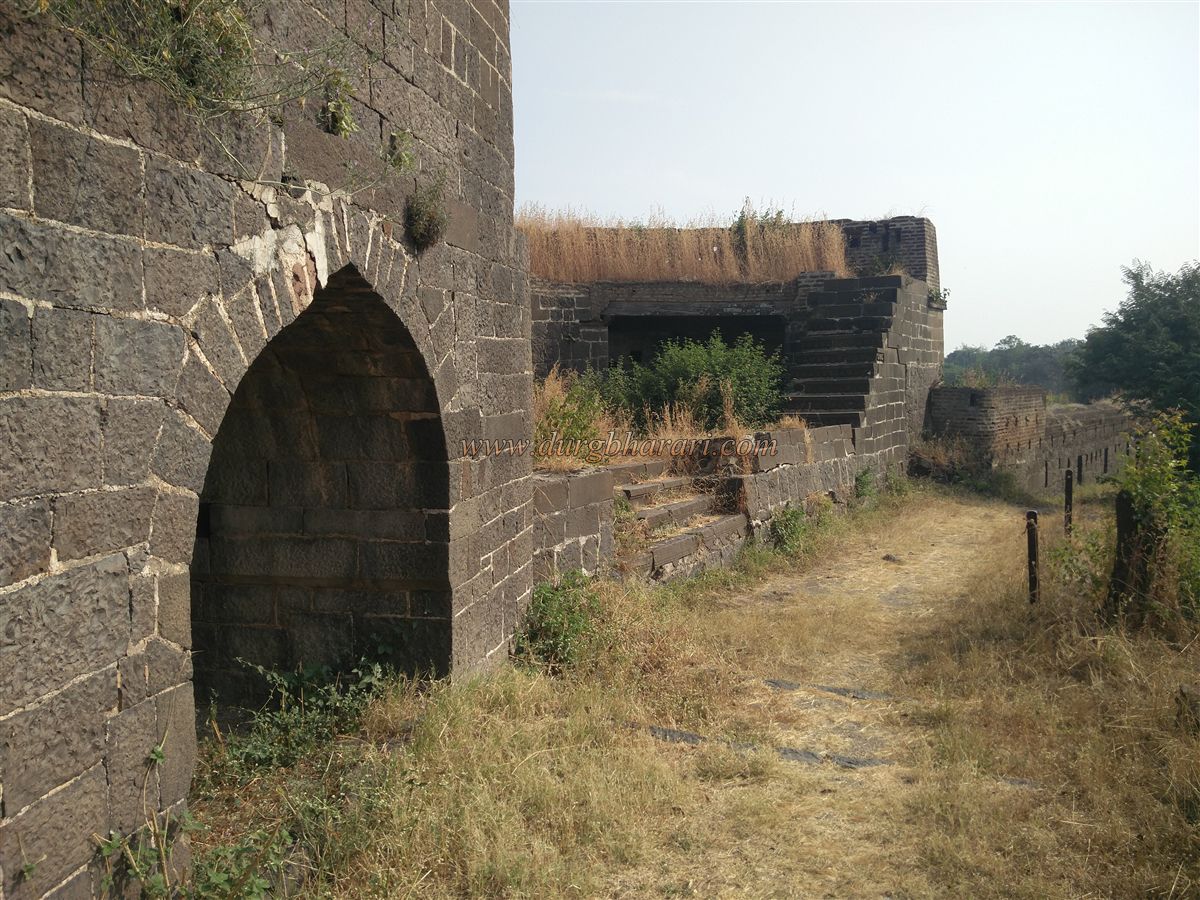
On the first bastion stands a flagpole, and nearby are the old prison cells from historical times. The rampart, about 1.75 km long, connects all 22 bastions. The bastions are often two or three stories high, with many intricately carved stones visible in their construction. During repairs under different regimes, stones from older fort structures were reused. Sultan Ahmad Shah named the bastions after his brave and capable commanders, and several have Persian inscriptions carved into stone.
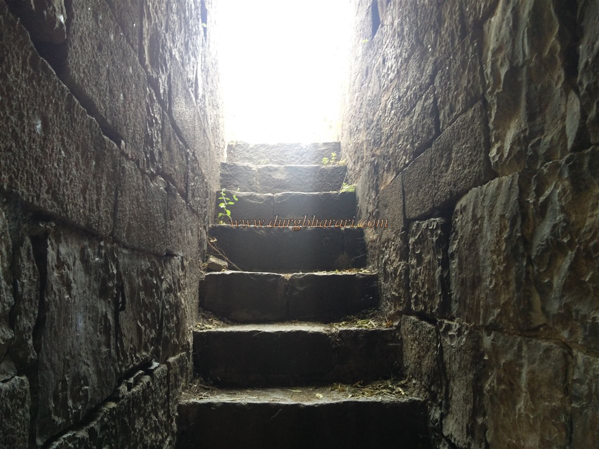
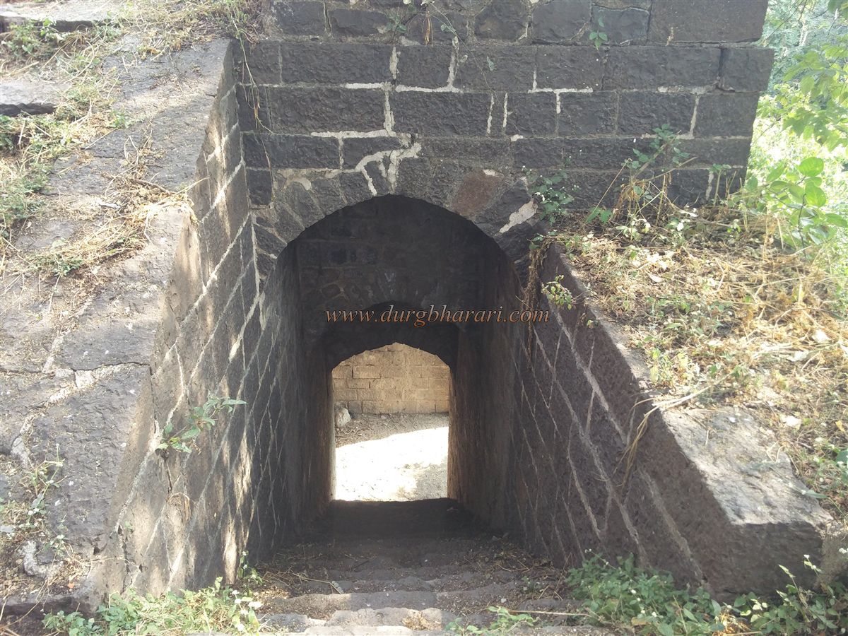
During British rule, brick barracks were built atop many bastions. Between bastions 7 and 8 lies a grand bastion with double fort walls. On bastion 7’s wall is a Persian inscription. From this bastion, a staircase leads down into the fort, and there’s a small gate leading to the outer wall. This gate opens into an underground passage that exits at another bastion. A tall wooden pole stands there, likely once used as a signal post, with an oil lamp lit at night to signal afar.
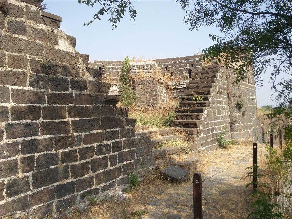
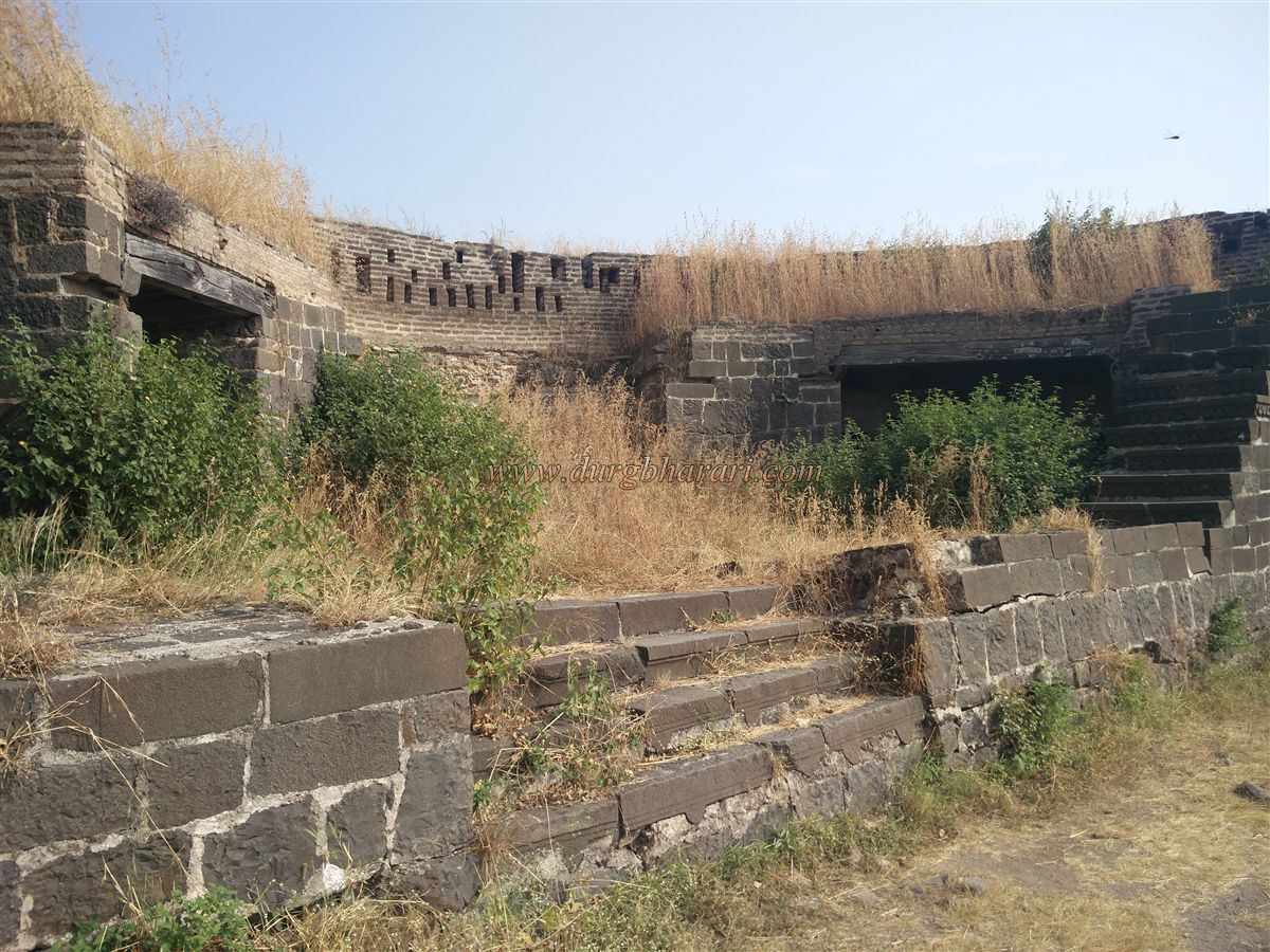
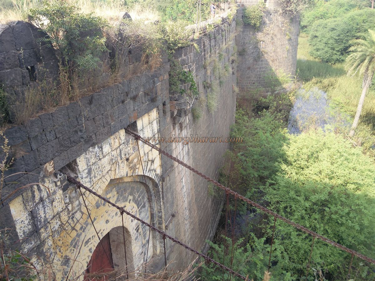
Between bastions 9 and 10, rooms have been built under the ramparts. From bastion 10, a stone-paved slope leads down, once used to haul heavy cannons up to the wall. Bastion 11 has a secondary gate with thick iron chains hanging from its roof, and an iron-chain suspension bridge built by the British for emergency exits. Marks of an earlier removable bridge are still visible on the moat’s edge here.
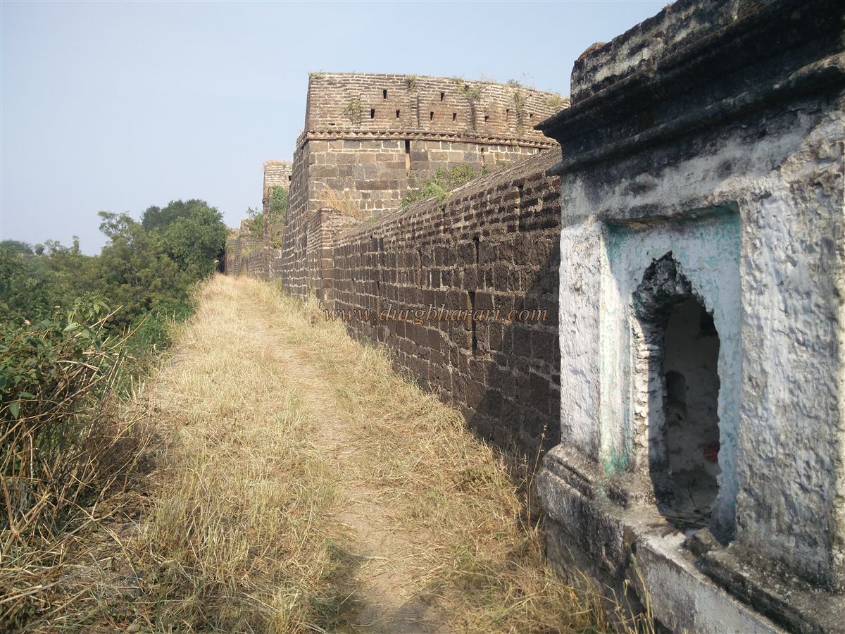
Near bastion 12, there’s a shrine to a Pir (Sufi saint). Bastion 13 has decorative niches carved into its wall. Bastion 14 has an underground staircase leading toward the moat, but its lower section has collapsed, making direct access impossible. Bastion 15 has a massive round ring for mounting a cannon. Bastion 16 bears another Persian inscription. After bastion 17, the ramparts have three stepped levels for added strength.
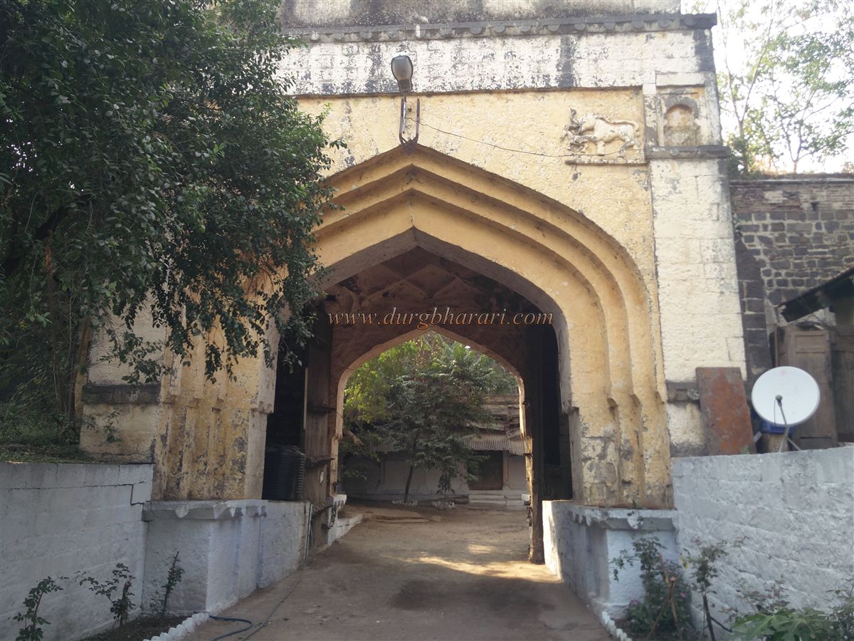
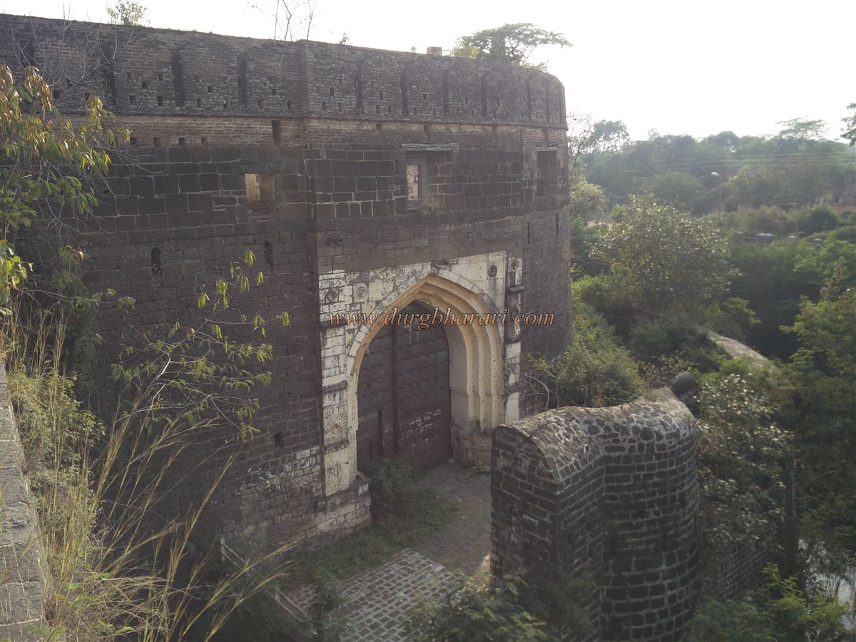
At the massive bastion 21, the fort’s main entrance is found. It has a double-gated design with a forecourt in between, and a protective wall and bastion stand in front of the gate to prevent direct attacks. Visitors must take a circular approach with the bastion wall on the right to reach the door. This layout allowed defenders to attack enemies more easily.
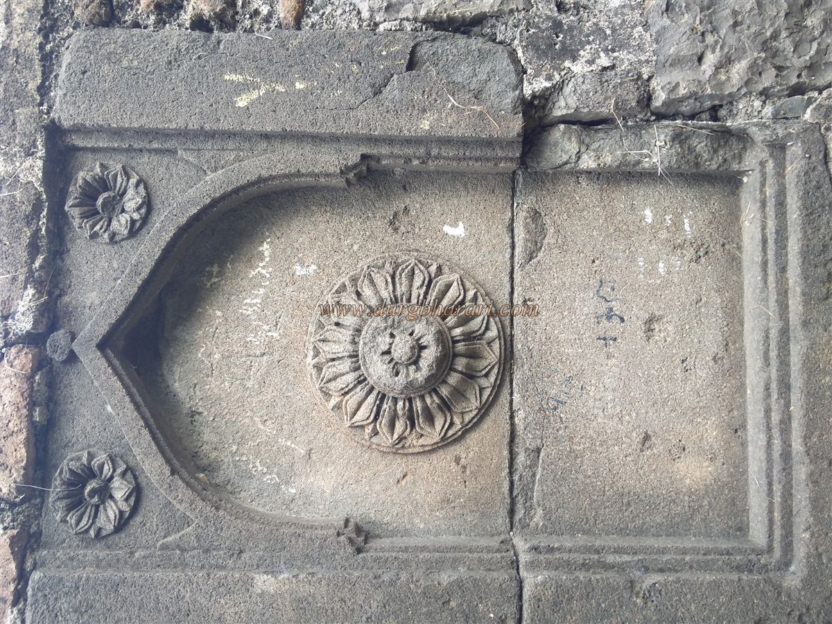
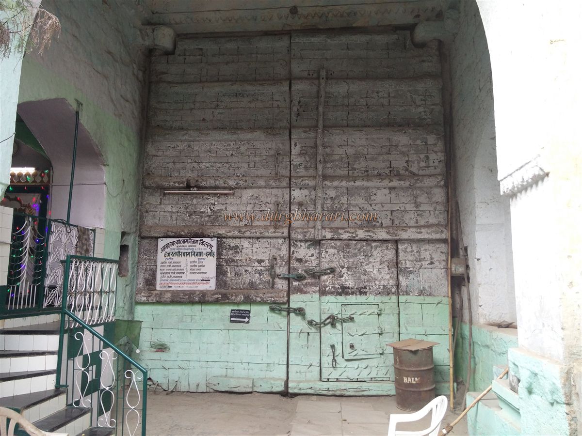
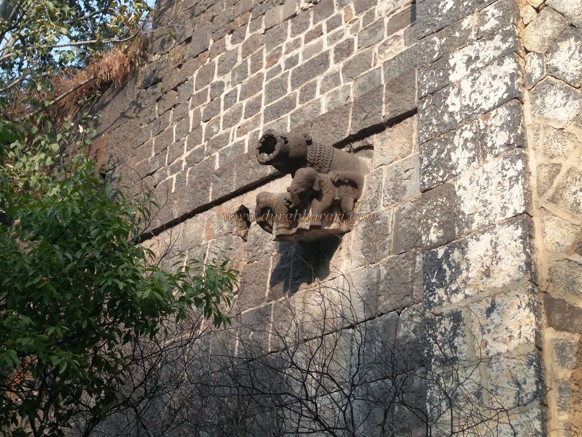
Both original wooden gates still survive, each with smaller pedestrian doors built into them. The main gate is studded with iron spikes to protect against elephant charges; these spikes are 2.5 inches thick, 1 foot long, and start 6 feet above the ground, arranged in eight rows. Floral carvings adorn the top corners of the gate. Between the two gates lies an enclosed courtyard. The second, west-facing gate also has some iron spikes, and on either side are carvings of a mythical creature (Sharabh) holding two elephants in its forelegs. Above the gates, rooms have been built atop the bastion.
In comparison, the eastern gate is much simpler, and it cannot be viewed from below without descending into that area.
After passing through the main entrance of the fort and moving ahead, you arrive back at the spot where you had re-entered the fort, completing the circuit of the fort’s ramparts. During the Nizamshahi period, within the central part of the fort and inside the fortifications, there were a total of six royal palaces — Son Mahal, Mulk Mahal, Abad Mahal, Gagan Mahal, Meena Mahal, and Baghdad Mahal. In the middle of these structures, a madrasa was built for the education of the royal children. Other buildings, such as Dilkashad and Habshi Khana, were constructed as needed.
To ensure a water supply for all these facilities, four large wells were dug inside the fort. They were named Ganga, Yamuna, Machlibai, and Shakkarbai. Today, neither the wells nor the palaces survive, and only one well can be seen while walking along the ramparts. During British rule, many of the fort’s original buildings were demolished to make way for new constructions.
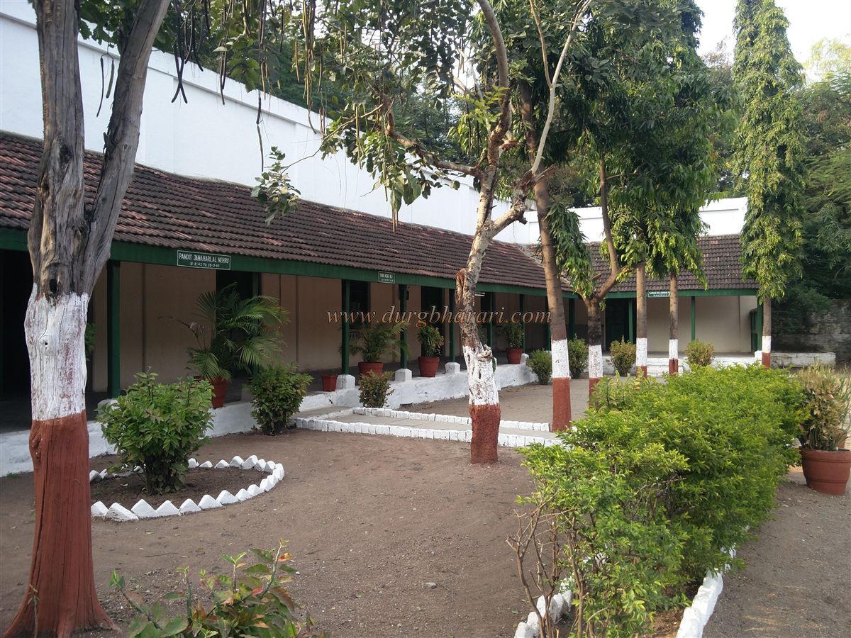
At the central point of the fort is a place called Netakaksh (Leader’s Chamber), where the British confined Indian leaders. Some of Pandit Nehru’s personal belongings can be seen here, along with letters handwritten by several leaders. It takes about two hours to comfortably tour the fort.
Apart from the fort, Ahmednagar city has many other historical sites to visit, such as the Rangada Museum, Chand Bibi Mahal, Faria Bagh, and Bagh Roja Dome.
In the late 15th century, in 1486 CE, the Bahmani kingdom split into five parts, one of which was ruled by Malik Ahmad Shah Bahiri, who founded the Nizamshahi dynasty. In 1490 CE, Ahmad Shah defeated Jahangir Khan, the commander of Bidar, near the village of Bhingar on the banks of the Sina River. There, he built a palace called Kotbagh Nizam and began establishing a city, which came to be named Ahmednagar after him. By 1494, the city layout was complete, and Ahmednagar Fort became the capital of the Nizamshahi kingdom. At that time, the city was compared to prosperous cities like Cairo and Baghdad.
The fort’s walls were originally made of mud. The present stone fortifications were built around 1562 CE by Hussain Nizam Shah with Portuguese assistance. During the Nizamshahi period, the fort was of great importance. In 1596 CE, the Mughals attempted to capture it, but Chand Bibi valiantly resisted them. However, political intrigues within the fort led to its fall, and in July 1600, four years after the siege, the Mughals took control following Chand Bibi’s death.
The Nizamshahi dynasty, ruled by kings like Ahmad Shah, Burhan Shah, and Queen Chand Bibi, lasted here until 1636. In that year, Mughal Emperor Shah Jahan captured Ahmednagar. The region’s wealth is evident from the fact that Chhatrapati Shivaji Maharaj’s forces plundered it three times. At that time, Mughal commander Muflat Khan was in charge of Ahmednagar. Since he had brought all the riches inside the fort, the Maratha forces could seize little.
In 1759, the Peshwas brought the fort under Maratha control through diplomacy, granting personal estates to the Mughal commander Kavi Jung. In 1797, the fort was handed over to the Scindia dynasty. On 12 August 1817, General Wellesley captured the fort, securing British control over Ahmednagar.
Ahmednagar Fort was used to house many political prisoners over time — from the Mughal and Peshwa eras to British rule. In 1767, the impostor Sadashiv Bhau was imprisoned here; in 1776, Peshwa loyalists such as Sakharam Hari Gupte, Nana Fadnavis, Moroba Dada, and Baloba Tatya were also confined here. During World War II, the British used the fort to detain many German prisoners. The mysterious death of the fourth Chhatrapati Shivaji Maharaj also occurred here.
Under British rule, several changes were made. In 1932, a suspension bridge was built on the east side of the fort, and a cartridge manufacturing plant was established within the fort. During the Quit India Movement of 1942, national leaders such as Pandit Jawaharlal Nehru and Sardar Vallabhbhai Patel were confined in Ahmednagar’s land fort from 10 August 1942 to 28 April 1945. During his imprisonment here, Pandit Nehru wrote his famous book The Discovery of India. Dr. Prafulla Chandra Ghosh also composed his work History of Ancient Indian Civilization in the fort. In Ahmednagar city, Dr. Babasaheb Ambedkar wrote Thoughts on Pakistan, and Maulana Azad penned Ghubar-e-Khatir.
In 1947, the fort was handed over to the Indian Army.
© Suresh Nimbalkar
GALLERY