MULHER
TYPE : HILL FORT
DISTRICT : NASHIK
HEIGHT : 4120 FEET
GRADE : MEDIUM
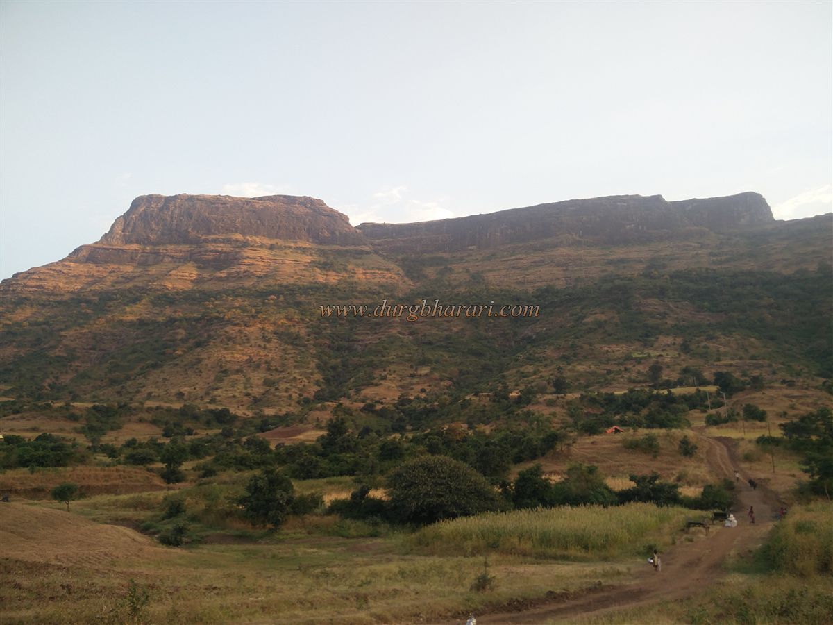
Despite being located in the Dolbari hill range of Nashik district, the fort trio of Mulher, Mora, and Hargad receives very few visitors, unlike the Alang-Madan-Kulang forts in the Kalsubai range of Ahmednagar district which are frequently visited by trekkers. If one has two to three days, an excellent trekking itinerary covering Salota, Salher, Mulher, Moragad, and Hargad can be planned. Due to its proximity to Mumbai and Pune, Rajmachi Fort has become quite popular, particularly because of its two citadels—Manranjan and Shrivardhan—but Mulher in the Dolbari range, despite having three prominent citadels—Mora, Mulher, and Hargad—remains relatively unknown. Situated near the border of the densely forested Dang region and Baglan, Mulher was once the capital fort of the Bagul rulers. To reach Mulher Fort in Satana taluka, one must travel via the Nashik-Satana-Taharabad route.
...
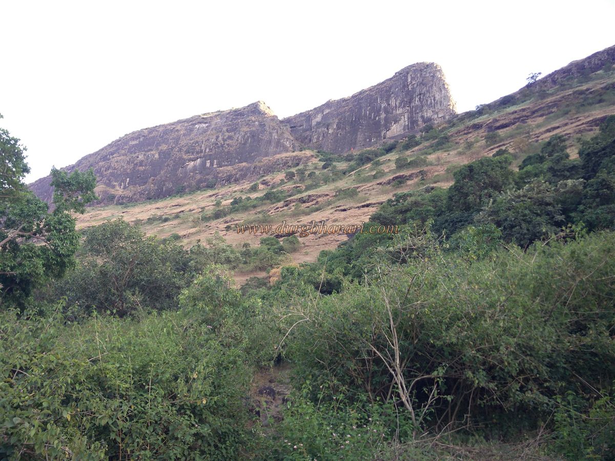
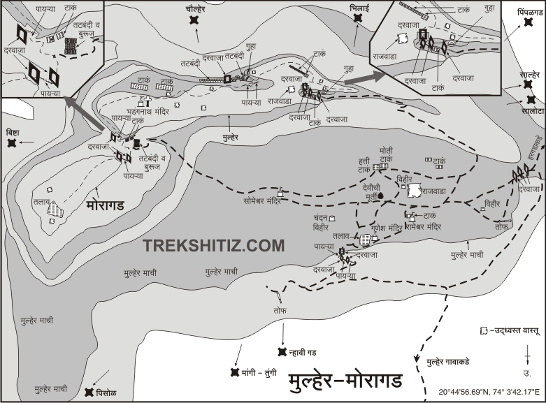
Nashik to Satana is 90 km, and from Satana, Mulher is a further 35 km. Upon reaching Mulher village, the Mulher plateau and the three citadels—Moragad on the left, Mulher in the centre, and Hargad on the right—are visible. The base of the fort is about 3 km from the village and can be reached directly by private vehicle. Walking through the village toward the fort, one can spot some old mansions. As one exits the village, a temple appears on the left hillock, while on the right, a semi-circular domed structure stands—likely a tomb of a Muslim noble based on its architecture.
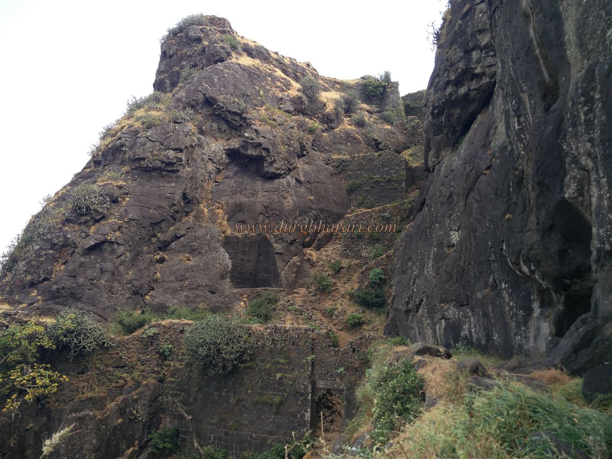
The fort consists of a plateau and a citadel, with paths leading from the plateau to all three citadels—Mora, Mulher, and Hargad. Mora and Hargad have separate entrances apart from the Mulher plateau and are sometimes considered independent forts. This article focuses only on the Mulher plateau and citadel, as separate descriptions are provided for Mora and Hargad elsewhere. From the base, a rough trail ascends to the plateau. One path goes straight to the plateau, while another goes to Hargad and loops around to the plateau. Historically, both these routes were used and had a series of three defensive gateways each. If only Hargad is to be visited, the second route is preferable; otherwise, the direct path to the plateau is more suitable. The second path adds about 30 minutes to the trek.
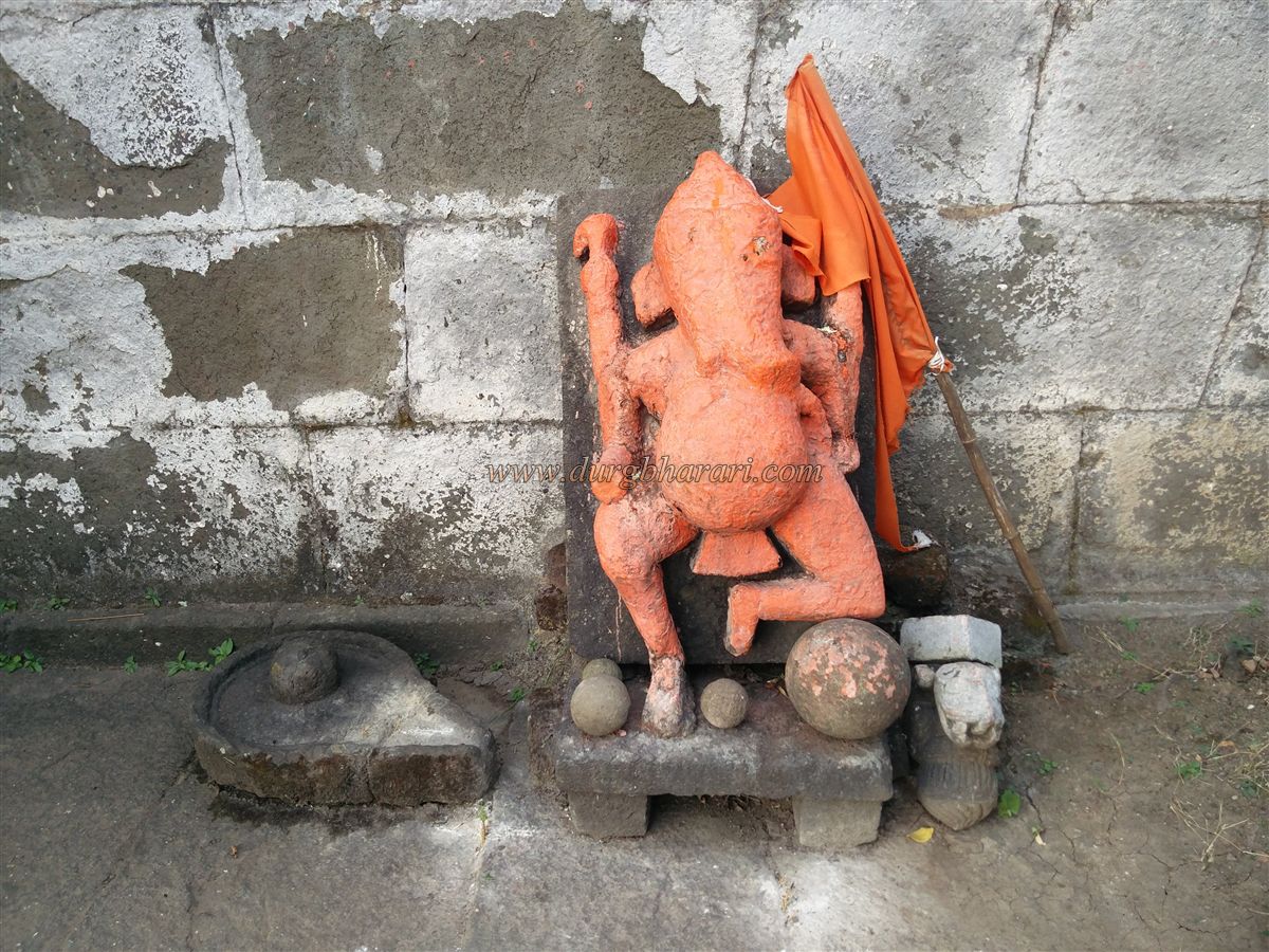
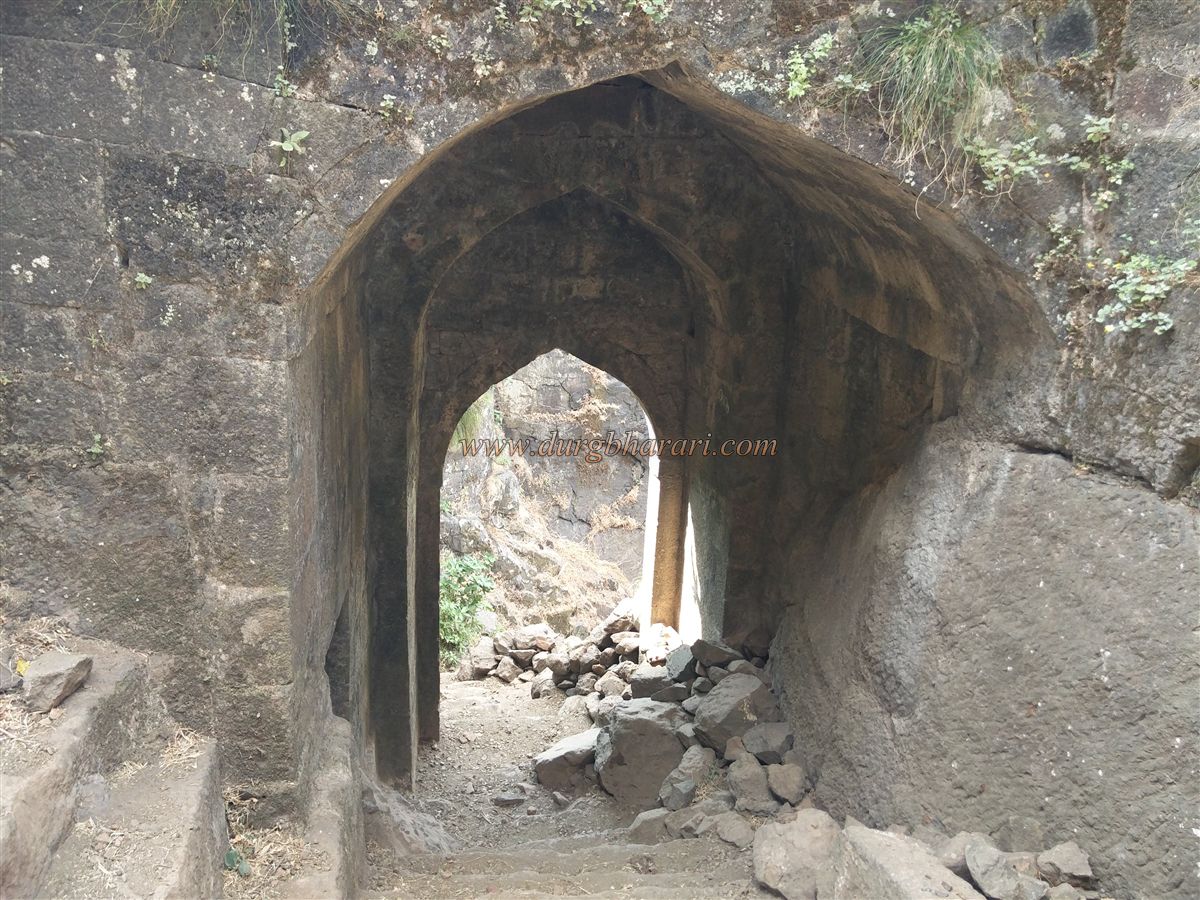
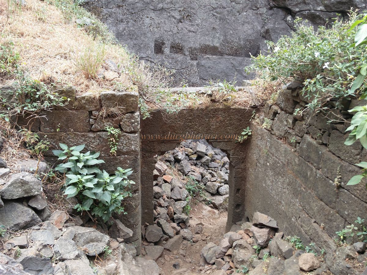
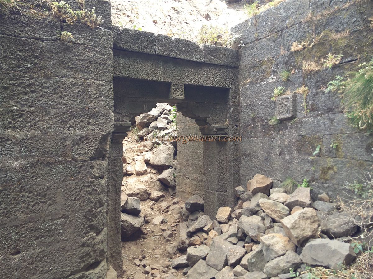
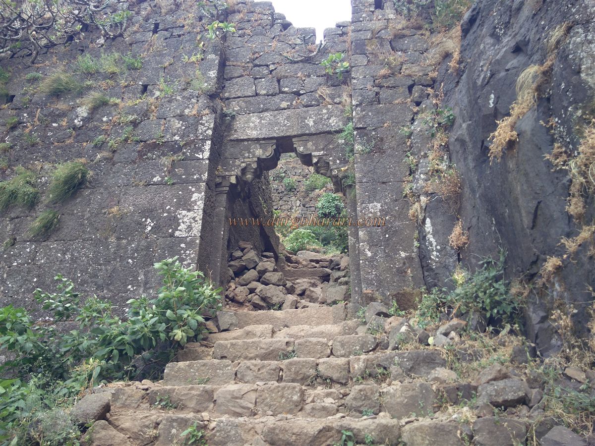
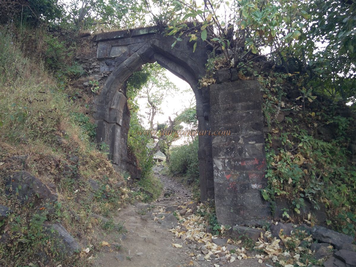
From the village, one reaches the fort base in about 30 minutes and then another 20 minutes up a dirt trail to reach the first west-facing gateway. This gate is now destroyed, leaving only signs of its existence. Hanuman and Ganapati carvings are visible on the outer rock near the entrance. After entering, one encounters the second gateway, also facing west, in a similar ruined condition. After entering this second gate, the main path turns right, but if one proceeds straight along the fort wall through the shrubbery for 10–12 minutes, an 8-foot-long cannon can be found, though it's not easily visible due to dense vegetation. After seeing the cannon, one should return and proceed to the third east-facing gate, which still has its arched structure and a sentry post inside. The wall near the gate encircles the plateau.
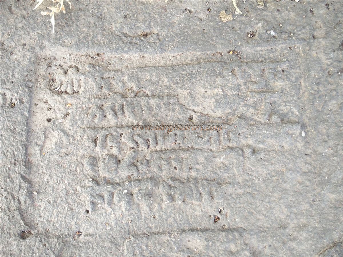
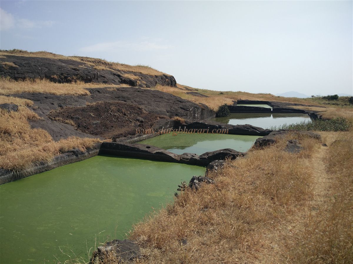
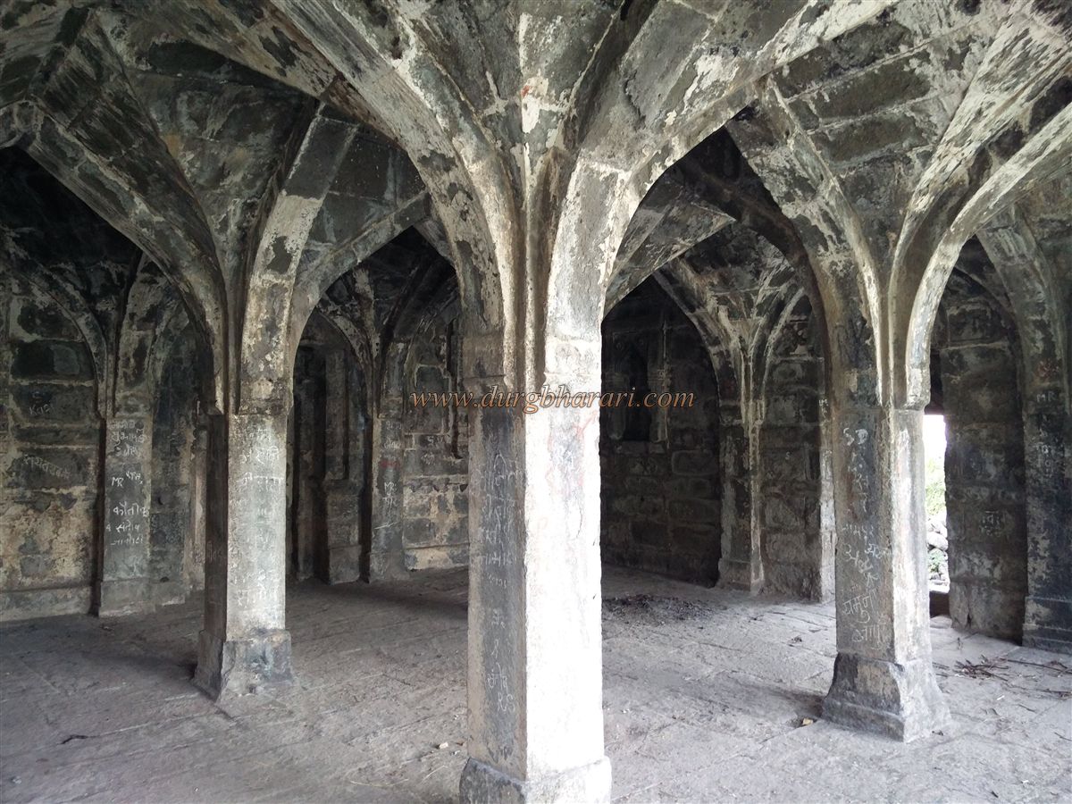
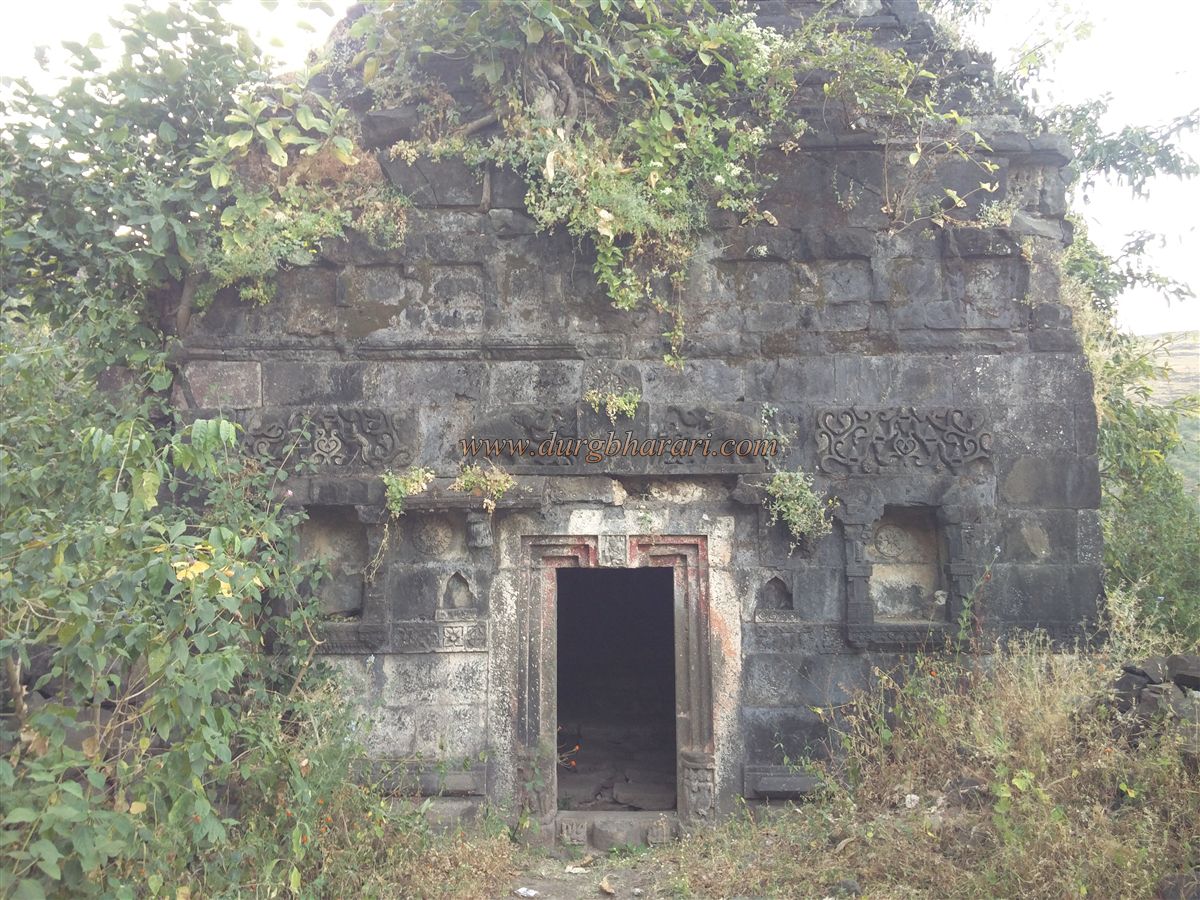
After passing through the gate, a neatly constructed Ganesh pond is visible ahead, with a Ganesh temple on its western bank. On the eastern bank lie the ruins of a structure with a central stone pillar. The temple, made entirely of dressed stone, consists of a Sabhamandap and a sanctum, with the Sabhamandap resting on six columns and three arches. The temple is richly carved, and an inscription on one pillar states: "In the Shaka year 1534, in the year named Paridhavi, on a Wednesday, under the reign of Hazrat Pratapshah at Salher and Morer (Mulher), the Mandap of Moreshwar was constructed." This indicates that the temple was built around 1612 CE by King Pratapshah. Entry to the temple is via small doors on the north and south walls of the Sabhamandap. In the sanctum niche is a Ganesh idol, and a Shivling is carved on the floor in front of it. Steps descend into the pond next to the temple.
Behind the temple, a path through dense vegetation leads to the Rameshwar Temple, which consists of a sanctum with a spire and intricately carved entrance. The threshold features a Kirtimukh, flanked by gatekeepers and a Ganesh carving above. Niches and elephant carvings decorate the entrance. Though named Rameshwar, a newly installed idol of a goddess resides in the sanctum. Nearby is a large black stone cistern with potable water. Returning to the main path near Ganesh pond, one reaches a trail junction. The left path goes to Someshwar Temple, the right to the Mulher-Hargad saddle, and the straight path to the citadel.
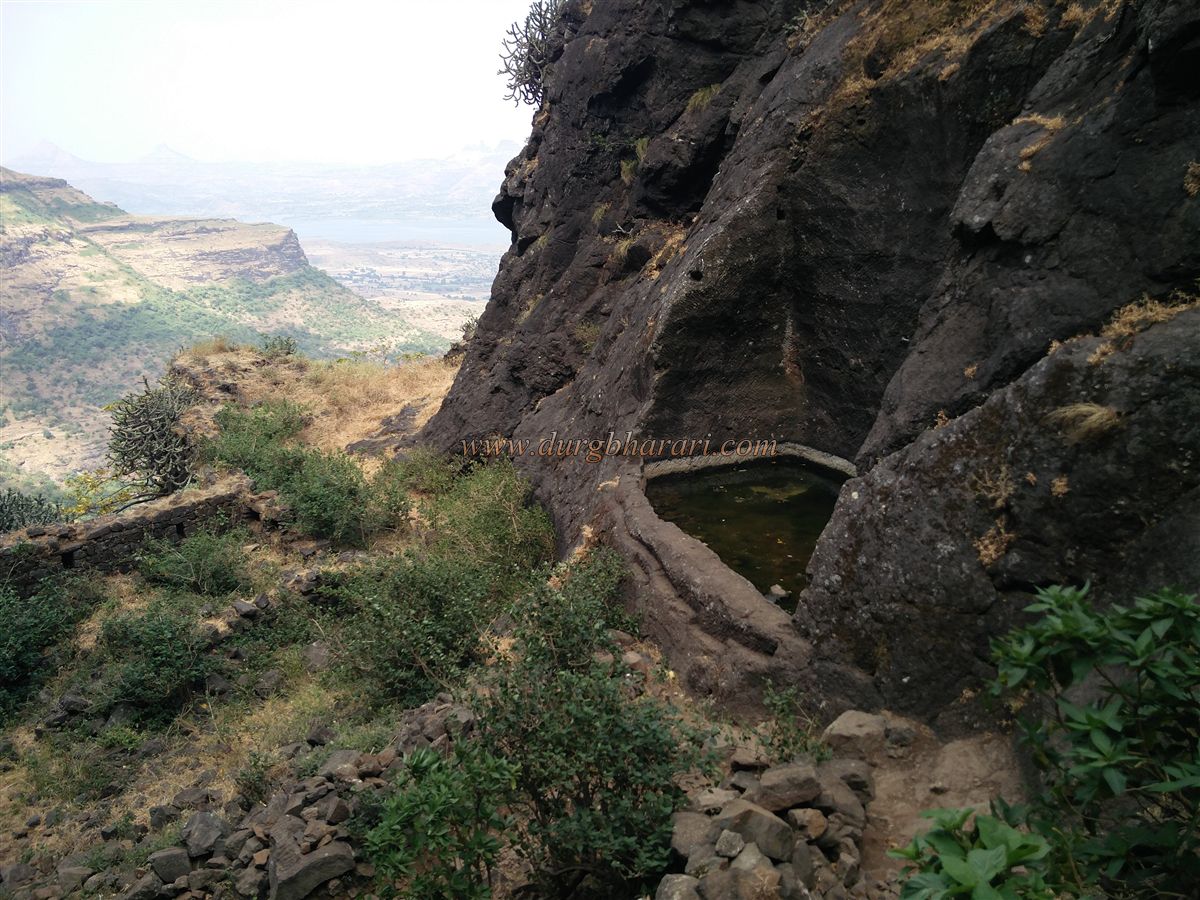
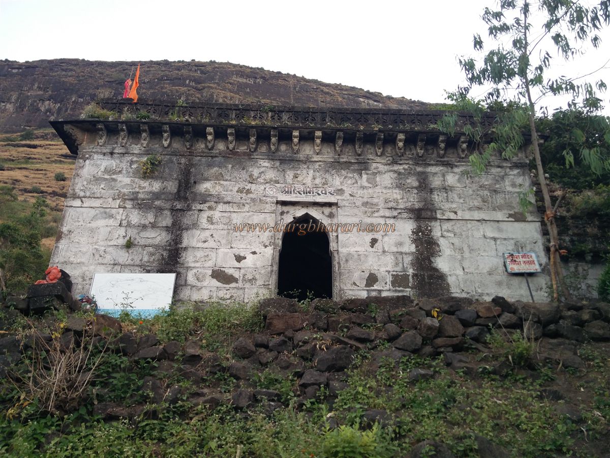
Taking the left path, one finds a stone platform structure with a sheet roof housing a goddess idol, believed to be the Ranimahal (Queen’s Palace). A little further on, a side path to the left leads into the woods to Chandan Bav—a large hexagonal stepped well built in stone with arched recesses and stairs, though it is currently filled with foliage and unsafe to descend. The dense forest here hides several structures, making it a small exploration in itself. Continuing, one reaches the base of the Someshwar Temple. The layout resembles that of the Ganesh Temple and reflects Mughal-Rajput architecture. Built in 1480 CE by Mahadevshah Bagul to fulfill a vow for a son, the temple once had a front water tank, now buried. A plaque installed by the Baglan Pratishthan lists rulers and custodians from 1330 to 1692 CE. The sanctum lies underground, visible through a small window in the Sabhamandap. Stairs to the left descend into the dark, narrow sanctum. Behind the temple is a platform with a Shivling and idols of Ganesh, Hanuman, and a goddess. Four cannonballs lie near the Ganesh idol. A rear water tank supplied by the main cistern ensures good water availability. Above the temple lies the Gulab Tank, carved into the rock with steps, though the water is not potable.
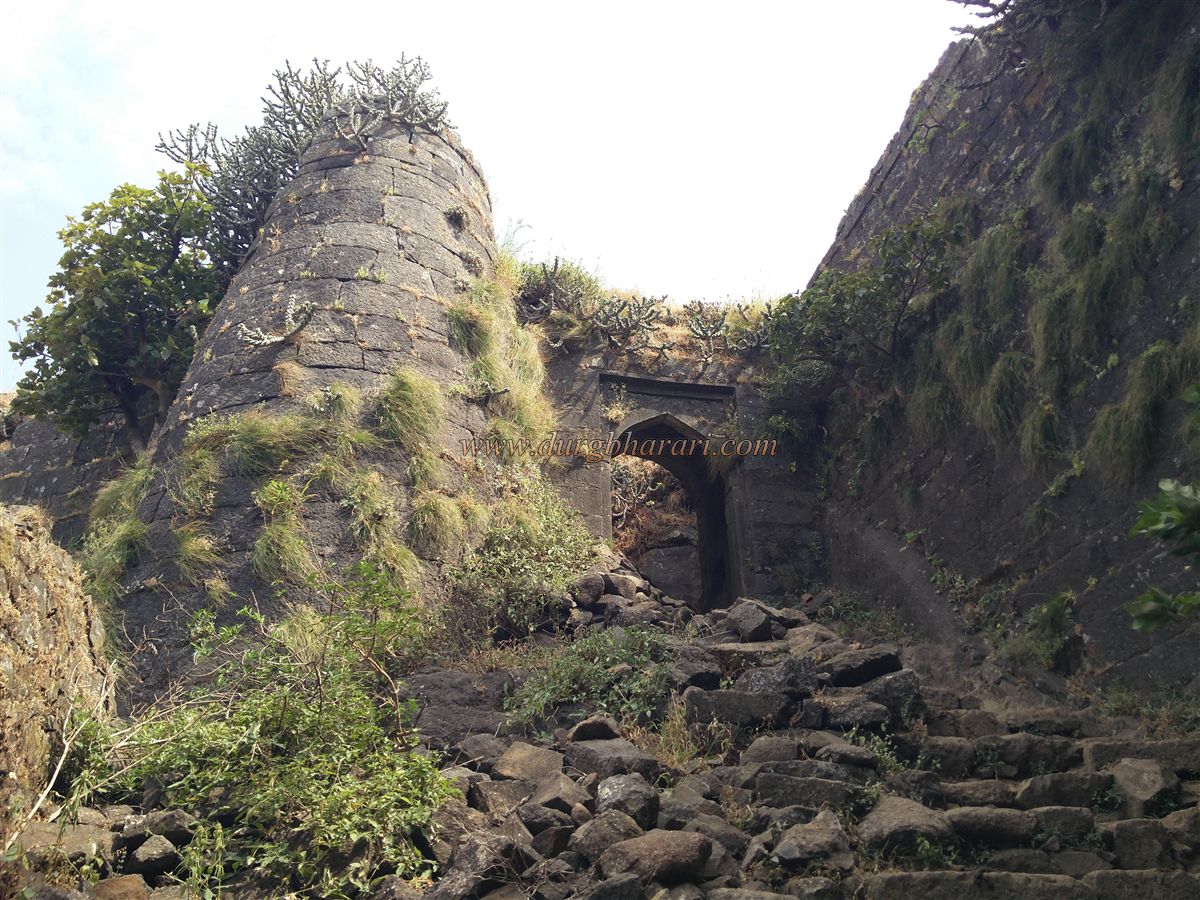
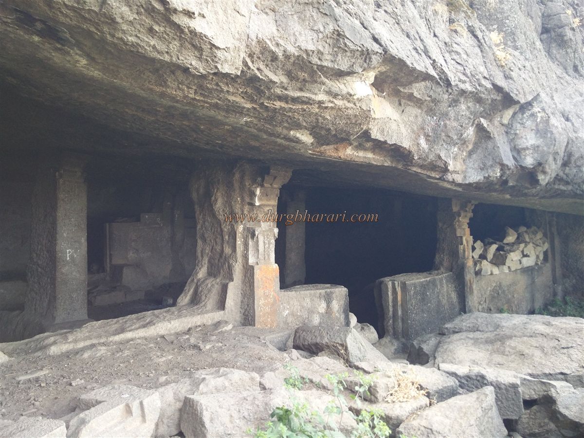
Three routes lead to the Mulher citadel: two from the plateau and one from the opposite side, now defunct. The path described ascends from Someshwar Temple and descends via the saddle between Mulher and Moragad. From the temple, the connecting saddle and its descending ridge are visible. The path to the saddle starts near a ruined temple, climbs steeply for 45 minutes, and reaches a 30-foot-high fortified section with three bastions, linking the Mulher and Mora citadels. The walls have three entrances—two collapsed and one intact but buried. Stones must be climbed over to access the walls. On the right, a cistern holds stagnant water. To the left are steps leading to Moragad, and to the right, a small gateway to the Mulher citadel. This gate, partially blocked by stones, leads to a carved cave with internal stairs. The cave, likely once covered by a roof, contains a bastion above.
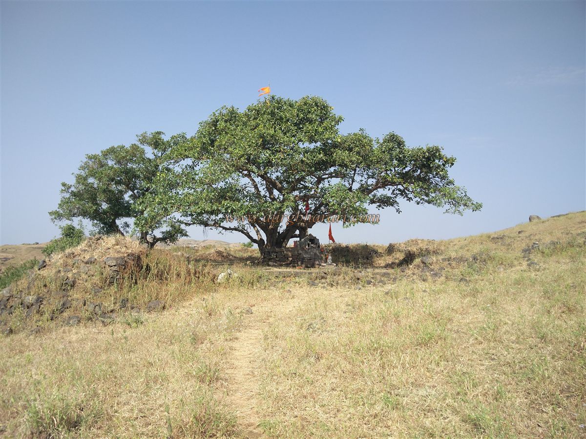
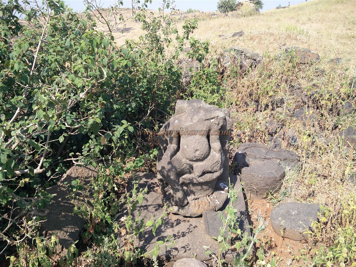
On entering the summit, one finds a large stone platform with an Audumbar tree and a shrine to Bhadangnath, a Nathpanthi saint. A weathered Marathi inscription lies near the platform. The summit holds ruins, including a dry rectangular tank with stone sides and a central pillar. Another dry tank lies further ahead, with a carved Shiva idol and a decapitated 3-foot sculpture nearby. On the way to a distant arched gateway, one encounters rock-cut water tanks. Two round, turret-like structures without doors appear along the route, their purpose unclear.
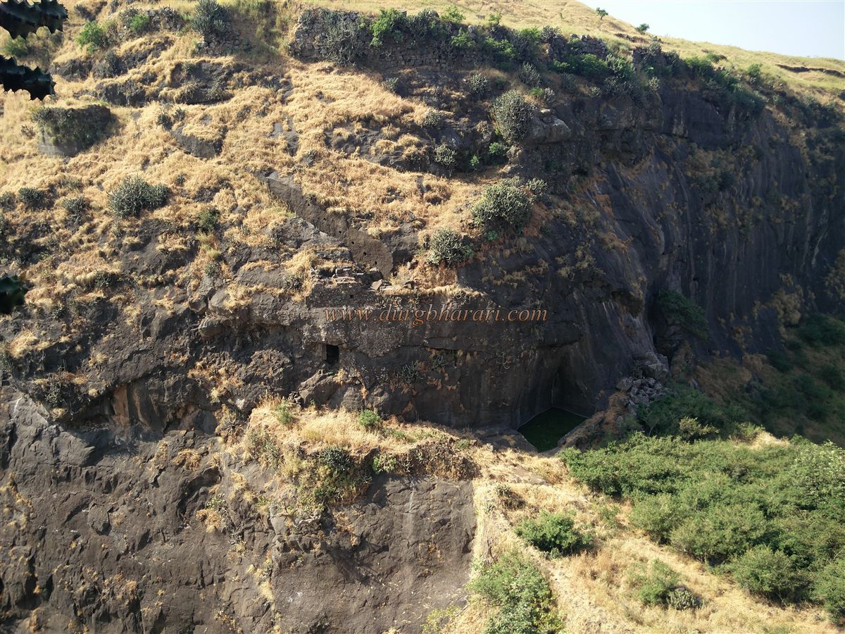
Mulher citadel is formed by two narrow hillocks joined together, creating eastern and western valleys. The eastern valley has a small dam and rock-cut cistern. Walls on both sides and a gate guard this valley, though the route from here to the plateau has disappeared. The cliffs here are accessed via steps from both sides. Behind a ridge lies a large rock-cut cave, partially enclosed with a bastion. The cave's purpose—whether a storehouse, prison, or cistern—is unknown.
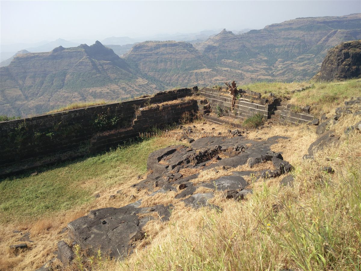
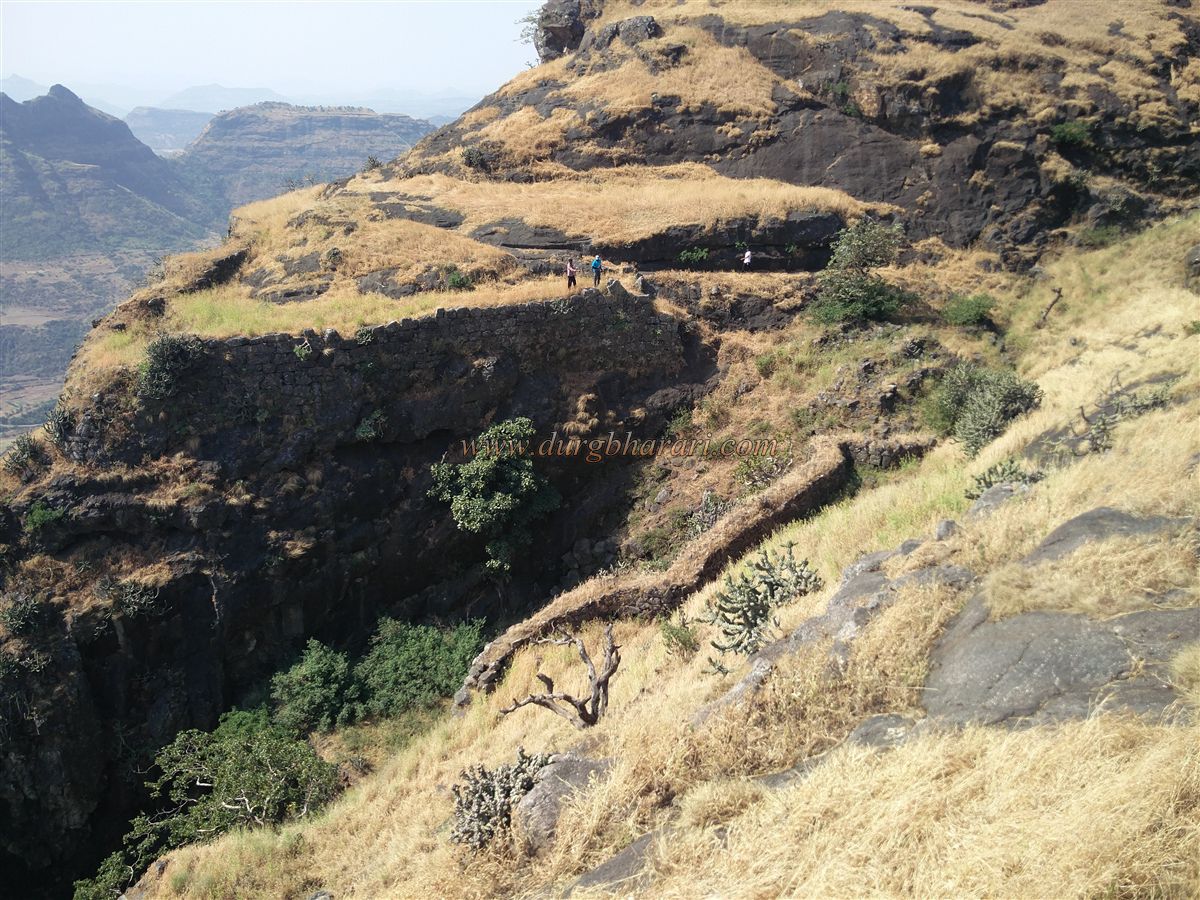
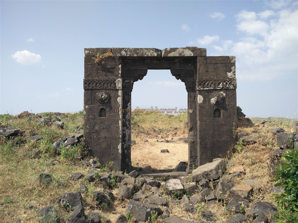
Returning to the arched gateway, one passes a square cistern, then reaches the remnants of a palace gateway. To the right of the palace lie nine cisterns carved in a row, one of which holds potable water. This section stretches toward Hargad and includes ruined platforms. Higher up lies another palace ruin. This is the fort’s highest point at 4265 feet above sea level, offering views of Mulher plateau, Moragad, Hargad, Nhavigad, Mangi-Tungi, and Salher-Salota forts. Ahead lies the western valley with the second path to the citadel. Four defensive gateways in series protect this path, with zigzagging walls and a guard post between the first two well-preserved gates. A narrow stairway leads to the third gate with lotus carvings and a Ganesh sculpture. To the left is a cave; below it lies the fourth west-facing gate, still intact and adorned. Left of this gate is a trail leading to a rock-cut cistern and bastion. Two large caves lie ahead—one holding water and another with chambers. The second cave has no nearby water, though it is otherwise habitable.
Exiting the fourth gate reveals robust walls, suggesting a possible fifth gateway or watch post. Descending further reveals a 5-foot Hanuman carving, painted in vermilion, clearly visible and marking the path. Two diverging paths appear—one skirting the hill toward Hargad and the other descending to the plateau. Since Hargad base is part of the same massif, it must be visited to complete the fort tour. A stone-cut cistern with green water lies en route. This path leads through dense vegetation to the Mulher-Hargad saddle called Dakinidara. A fortified wall spans this saddle, with gates on both ends, now mostly collapsed except for two bastions. One ridge of Hargad descends into this saddle. The descent from the citadel to this point takes about an hour.
The return journey should take the alternate path descending from this saddle, which passes through the now-ruined gateway from the plateau to Hargad. After 5 minutes on this path, a leftward trail joins the second approach path from the village. This path to the plateau has three west-facing gates, all retaining their arches. However, dense overgrowth conceals many features. The trail runs along rock-cut cisterns. Reaching the plateau's northwest corner reveals an 8-foot-long cannon. Due to the secluded nature of this area, assistance from locals or shepherds is advised.
After seeing the cannon, return to the third main gate and proceed to the Ganesh Temple path junction. On this route are several dry cisterns. Turning right, the largest structure on the plateau—the palace—comes into view. Due to heavy vegetation, exploration is limited. Inside the palace compound is a well and the ruins of a subterranean chamber. Further along are two tanks—Hathi Tank and Moti Tank. Hathi Tank is dry, while Moti Tank holds potable water and is the primary drinking water source. From here, the left path goes to Someshwar Temple and the right to the citadel. On the citadel route are two more large rock-cut cisterns. After viewing these, return to the Ganesh pond to conclude the tour. Exploring Mulher plateau, Moragad, and the Mulher citadel properly requires at least one and a half days.
Mulher Fort’s history is linked to the Mahabharata era. Once called Ratnapur, it was ruled by a king named Mayurdhwaj. The fort was named Mayurgad and the town Mayurpur. In the 9th century, the Yadav king Dridprihar ruled here. Over time, the name evolved to Mulher. Documented history begins in the early 14th century. Persian texts like Tarikh-i-Firozshahi, Ain-i-Akbari, and Tarikh-i-Dilkhush mention the fort. Around 1340 CE, under the Abhir dynasty's King Jagatchhaya, the Rathod clan from Kanauj, led by Nanadev Bagul, seized power and built the fort. From 1308 to 1638, the Bagul dynasty ruled Mulher for over 350 years, making it the capital of Baglan. The region's name derived from Bagulgad, later becoming Baglan. During their rule, the local sword hilt design called "Mulheri Muth" gained fame across India. The Bagul had 11 rulers, each titled Bahirji.
A 1340 mention in Tarikh-i-Firozshahi states that Nanadev ruled Salher-Mulher. Despite repeated attempts, the Farooqui dynasty of Khandesh couldn’t conquer Baglan. Around 1595, during Akbar’s conquest of Khandesh, local ruler Narayan shah and his son Pratapshah allied with the Mughals. In 1610, English traveller Finch noted a mint at Mulher producing Mahmudis—coins of Sultan Mahmud of Gujarat—which were used locally. During Shahjehan reign, Mulher remained with the Bagul. When Aurangzeb became Deccan Subhedar in 1636, he attacked Baglan in 1638. King Bahiramshah fiercely defended the fort but eventually surrendered and accepted a Mughal mansabdari. Thus, Baglan’s Hindu kingdom ended on 15 February 1638, and the fort was renamed Auranggad. Aurangzeb appointed Muhammad Tahir as fort commander, who established a village named Tahir, now known as Taharabad. In 1660, Khwaja Beg was fort commander, followed by Kulibeg in 1662, during whose time a soldiers' mutiny occurred.
After Shivaji Maharaj’s second raid on Surat in October 1670, he launched a Baglan campaign. In 1671, the Marathas attacked Mulher, but its commander Neknam Khan repelled them. After the Salher battle, Moropant led a successful campaign on 18 February 1672 to capture Mulher. However, by 1680 it was likely back under Mughal control. In 1681, Devising was the fort commander; in 1690, Manohardas Goud, a Rajput, held the post; and in 1692, Bahroz Khan was in charge. According to the 1752 Treaty of Bhalki, Mulher and surrounding Khan Desh territories came under Maratha control, and Trimbak Govind became the commander. In 1765, records in the Peshwa archives mention hidden treasure in the fort.
During the final Anglo-Maratha War of 1818, commander Ramchandra Janardan Phadnis surrendered the fort without resistance on 12 July. At the time, the citadel housed four 8-foot cannons—Fattalashkar, Ramprasad, Shivprasad, and Markandeya. The British melted the Markandeya cannon; two remain, but one is unaccounted for. In 1825, 800 tribal rebels under Shivram attacked Antapur and captured Mulher. British officer Outram crushed the rebellion and imprisoned Shivram and hundreds of others. The British later reorganized the region and made Satana the administrative centre.
(Note: Due to the dense vegetation on the plateau, caution is advised while exploring.)
© Suresh Nimbalkar
GALLERY