MUDKAVI
TYPE : GROUND FORT
DISTRICT : BELGAON
HEIGHT : 0
GRADE : EASY
During the reorganization of states on linguistic basis, Belgaum — a Marathi-speaking and multilingual region once part of Swaraj — was incorporated into the state of Karnataka. I consider such forts, which were once under Swaraj, to be forts of Maharashtra and refer to them as such. One such beautiful fort in Belgaum district is the Mudkavi Fort. The village of Mudkavi is located within the fort premises, about 107 km from Belgaum and just 10 km from Ramdurg, the taluka headquarters.
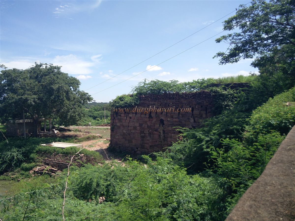
While traveling from Ramdurg towards Mudkavi, one crosses a small Ghat, and from a distance, the entire fort of Mudkavi becomes visible. Rarely do we get to witness a complete view of an entire fortified structure with its citadel from a single spot, which makes it impossible to resist capturing a photograph.
...
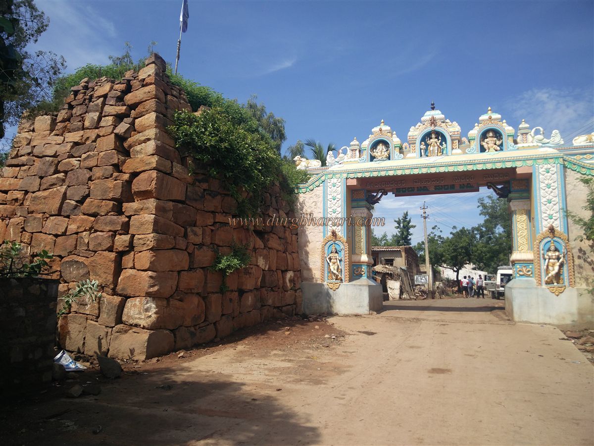
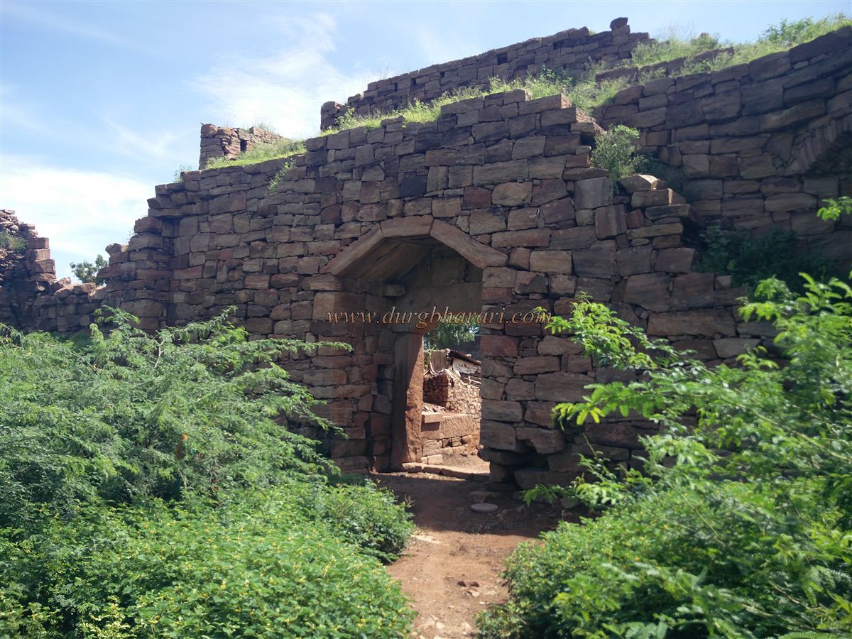
Turning left from the main road into the village, one can see a newly built temple arch between two bastions of the fort’s wall on the left. Villagers demolished the original gate here to erect a new, beautifully decorated arch with idols. However, the regret remains that the original gate had to be sacrificed for this.
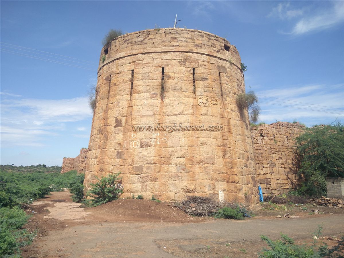
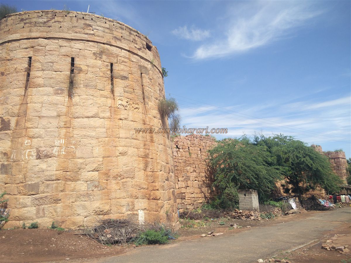
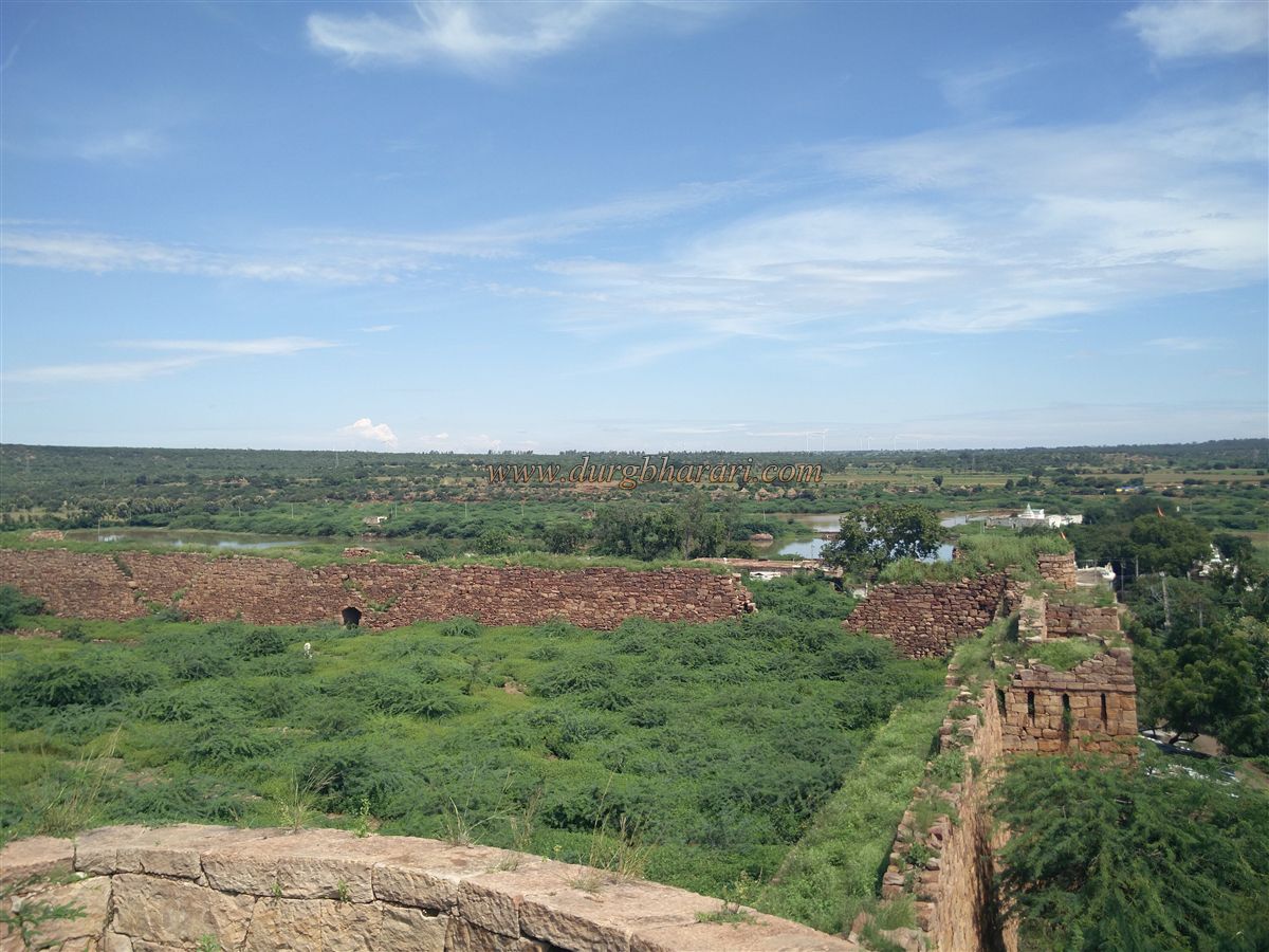
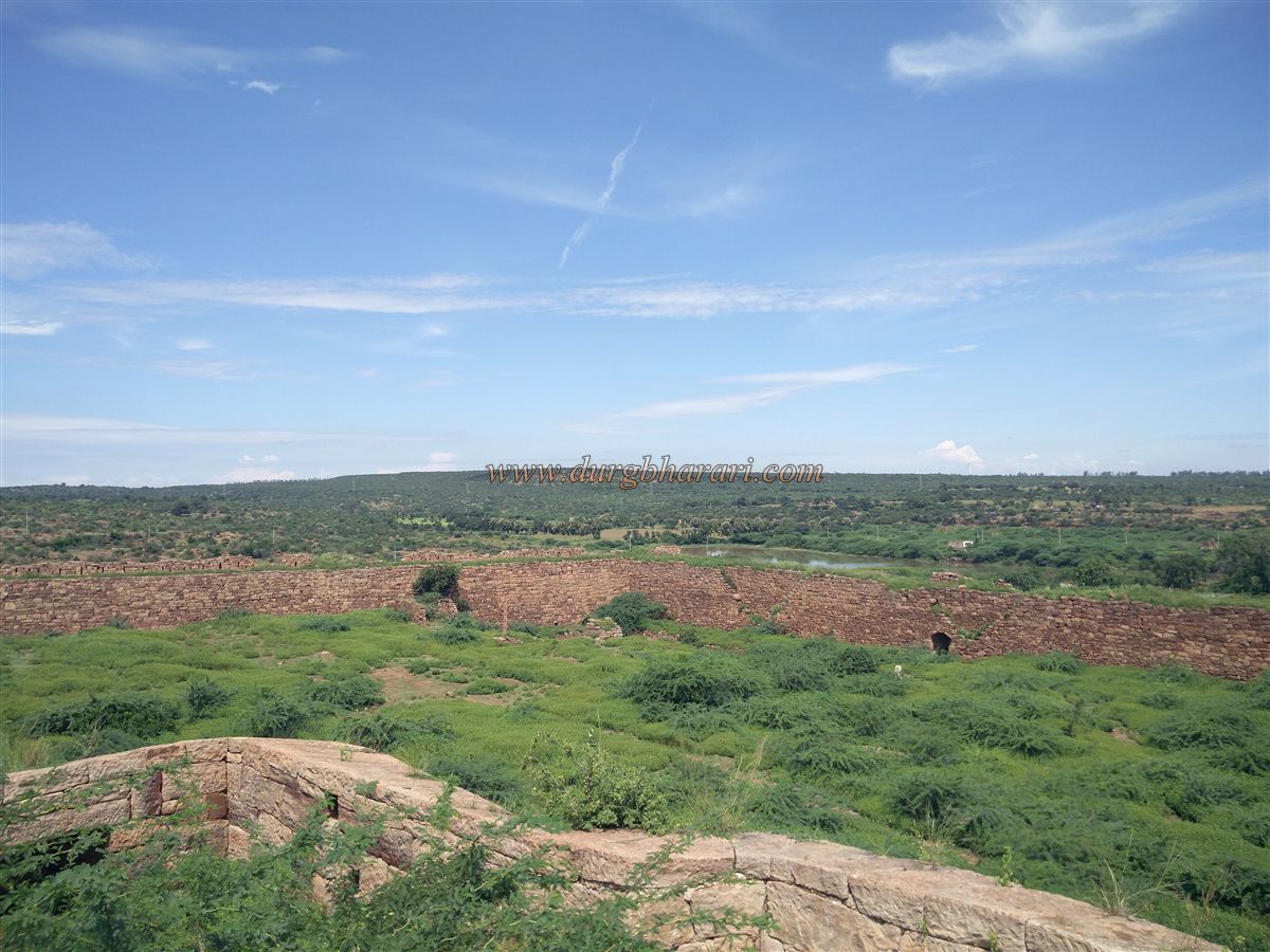
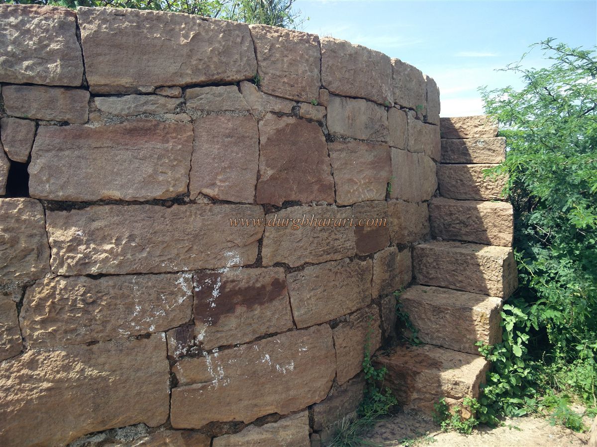
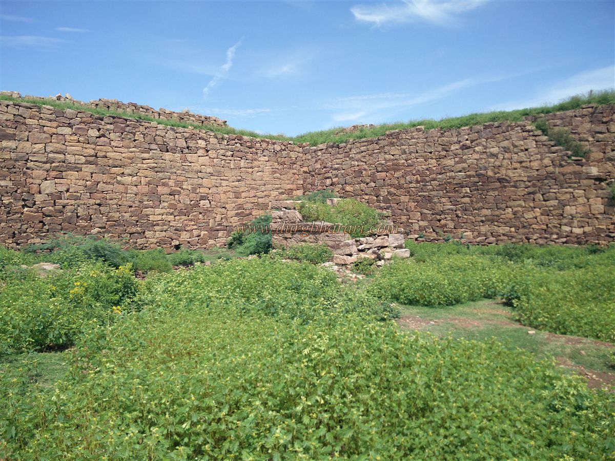
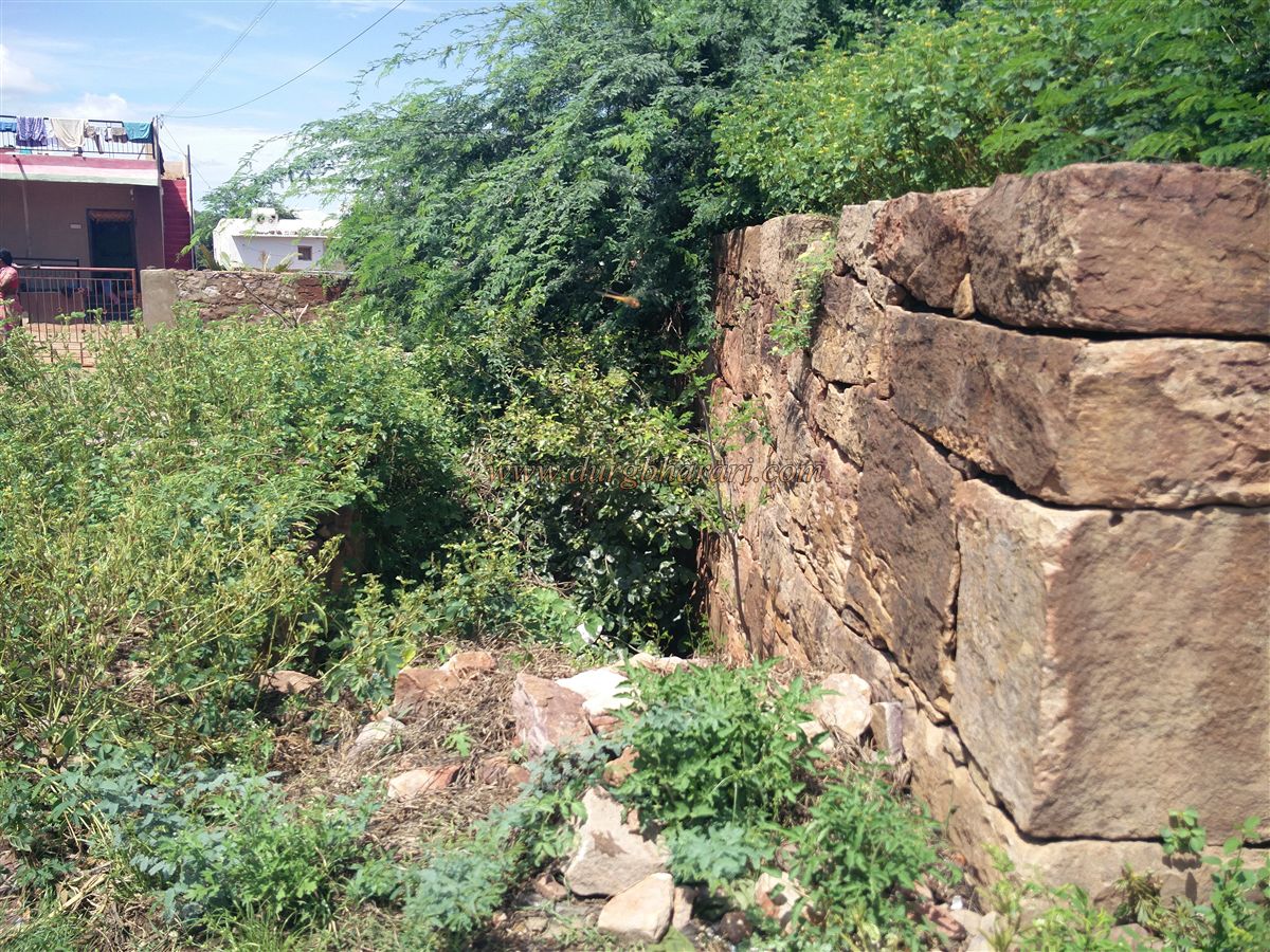
The fort is built in two parts — the outer fort and the inner citadel — and spans an area of about 38 acres. The outer wall of the fort has 20 bastions, some of which are round and others square in shape. The round bastions have embrasures and loopholes for cannons and muskets, while the square ones have only musket loopholes. The wall includes two small and two large gates, with no gates on the southern side. The fort's overall size is massive; exploring it completely takes about 5 to 6 hours. However, since there is not much to be seen beyond the walls and bastions, it is best to focus on certain key areas of the fort.
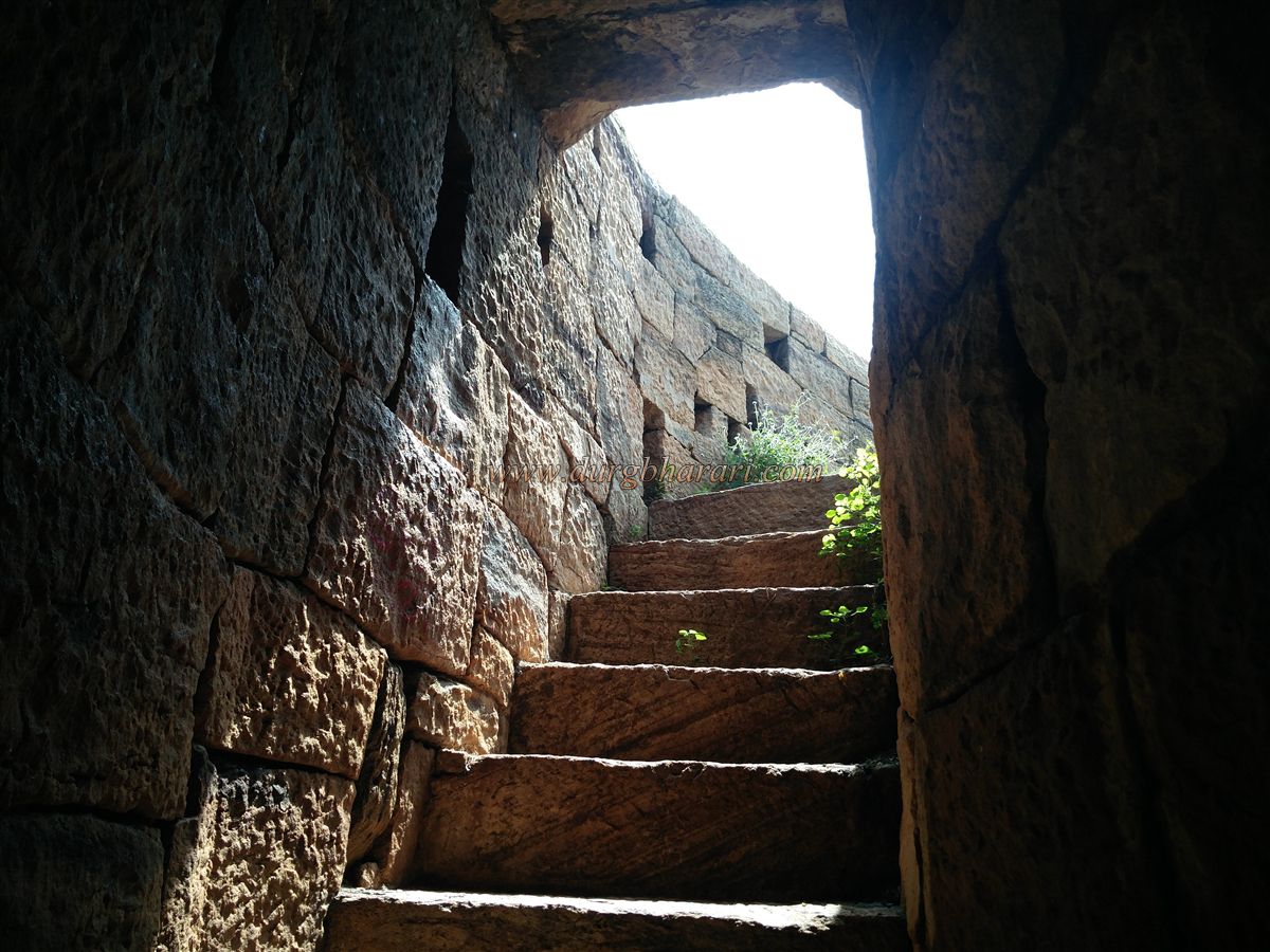
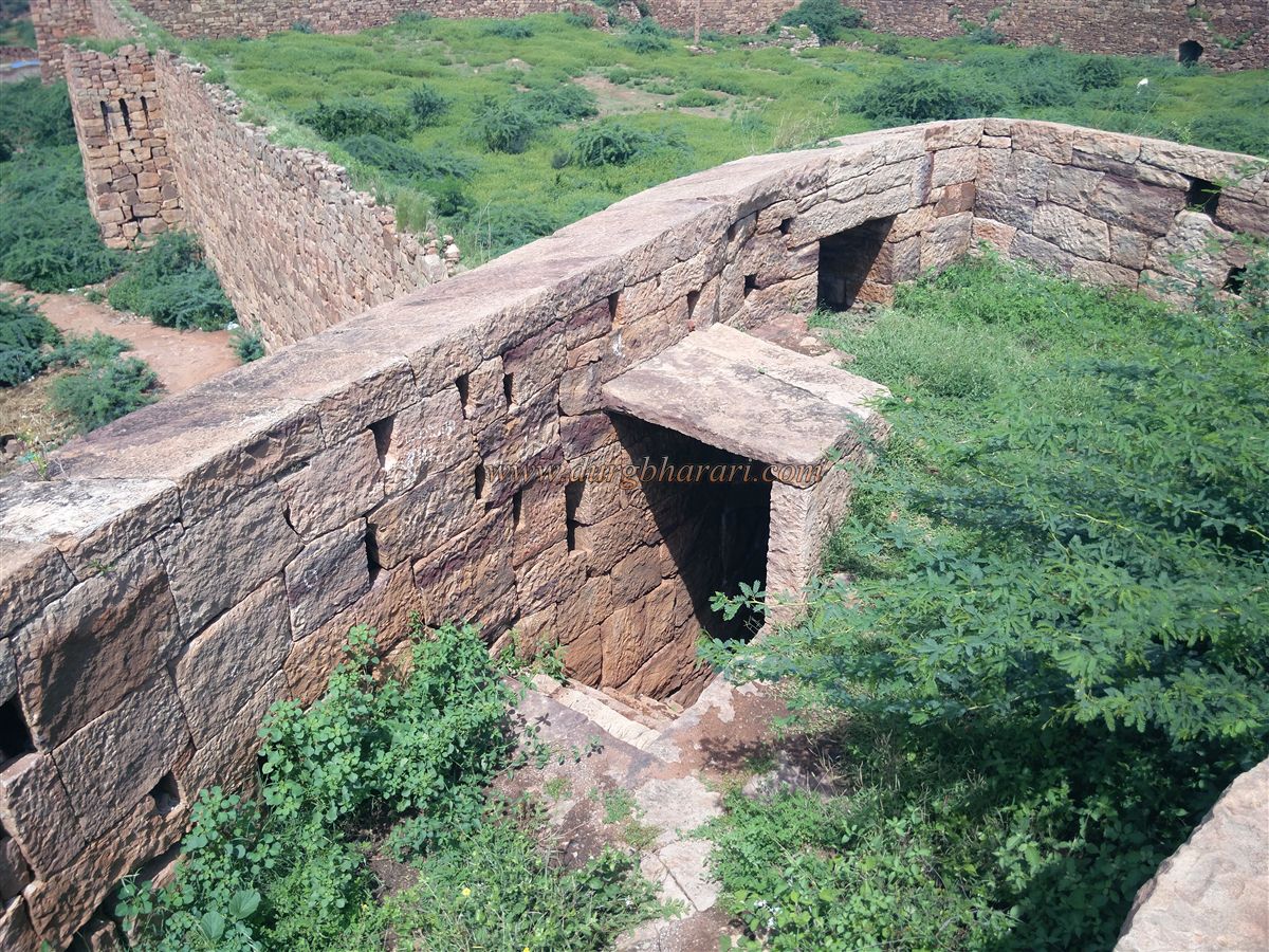
The original eastern gate of the fort, where the new arch now stands, is adjacent to square bastions that still remain intact. Instead of entering through the arch, if one proceeds further along the path, a ruined smaller gate used for entry into the fort can be seen. A short distance from this gate, on the north-eastern corner of the fort, there is a large round bastion. This bastion has stairs leading up from the base rather than from the wall. At the top, there is a platform for cannon placement, along with loopholes and musket jharokhas. The same construction style is seen on all six of the round bastions — one on each corner of the fort and two in the centre.
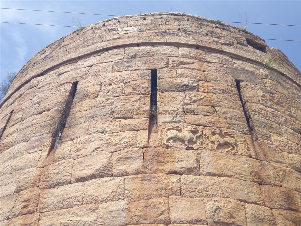
After seeing this bastion, it is better to return to the archway and formally enter the fort. Proceeding straight inside leads to the south-eastern bastion of the citadel — the most prominent and well-preserved structure on the fort. This is also the tallest bastion of the fort and has two large carvings of mythical Sharabh on it. The height of the wall is about 25 feet, and there are loopholes for muskets throughout. Continuing along the path leads to the eastern-facing main gate of the citadel, built between two square bastions. There are stone platforms outside the gate, but no ornamental carvings can be seen.
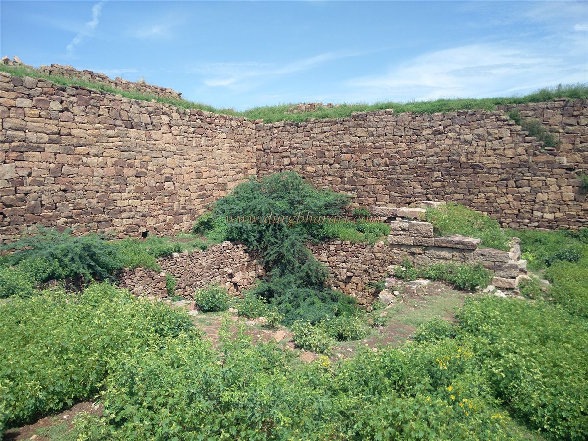
Inside the fort, an overgrowth of babul (thorny acacia) trees dominates, making the condition of such a beautiful fort look pitiable. One must literally carve a path through this dense thicket. We always carry a large sickle when exploring such forts, making it easier to clear a way through the thorny bushes. The citadel’s bastion can be reached using a staircase along the wall, leading to a small enclosed entrance. From here, one reaches the top of the bastion, which has a circular platform for cannons and a flag-post mount. This is the highest point of the fort, and from here, one can view the entire citadel, the surrounding fortifications, and other remnants. Therefore, this bastion is a must-visit on any fort trek.
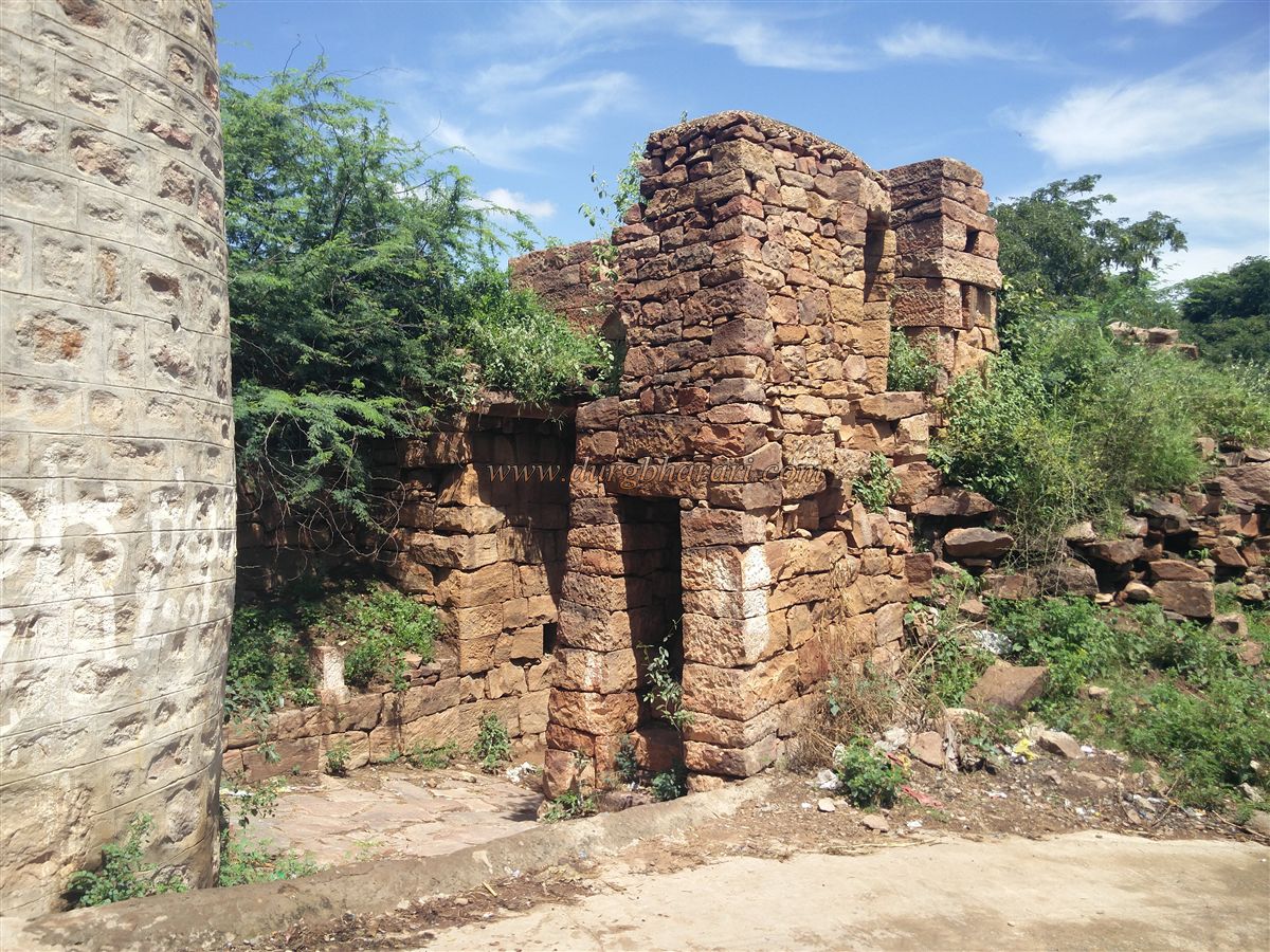
To the east of the citadel lies the village of Mudkavi within the outer walls, and to the south near the wall is a school. The citadel is centrally located within the larger fort and covers around 2.5 acres. It has nine bastions: two round ones on the eastern edge and seven square ones. There is a small gate on the northern wall of the citadel, and three access points with steps are built into the wall. The entire citadel wall has a parapet walk, though due to two sections being broken, one cannot make a full round walk on top.
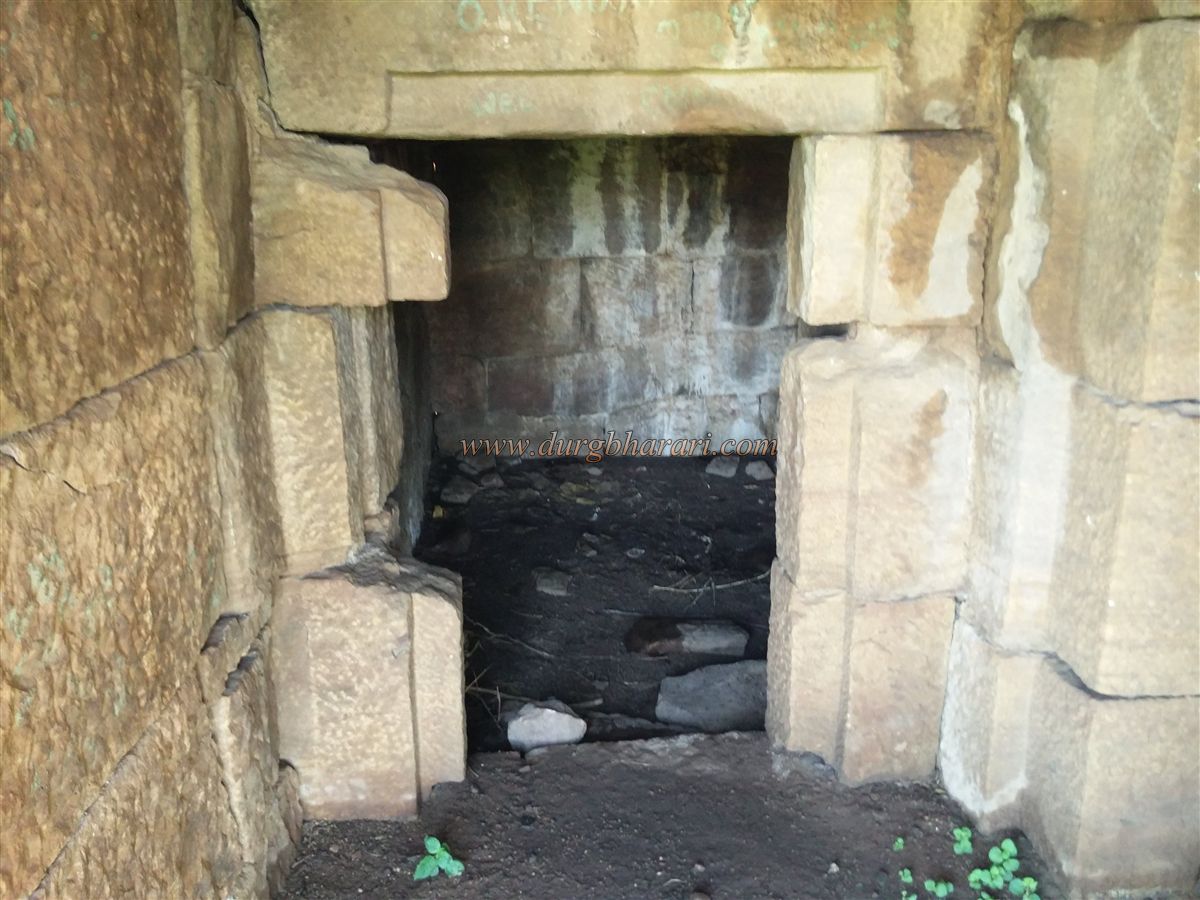
To descend from the opposite side of the bastion, there is an enclosed staircase, which leads to a storage chamber inside the bastion. After viewing this, one should return to the gate and take the narrow path through the brush to reach the western wall of the citadel. The path here becomes rocky, and vegetation is less dense. In the northwest part of the citadel is a large rock-cut stepwell that still contains water, though it is not potable due to disuse. A high platform built at the edge of the well was used to draw water using a pulley system, possibly to supply the fort from this elevated structure.
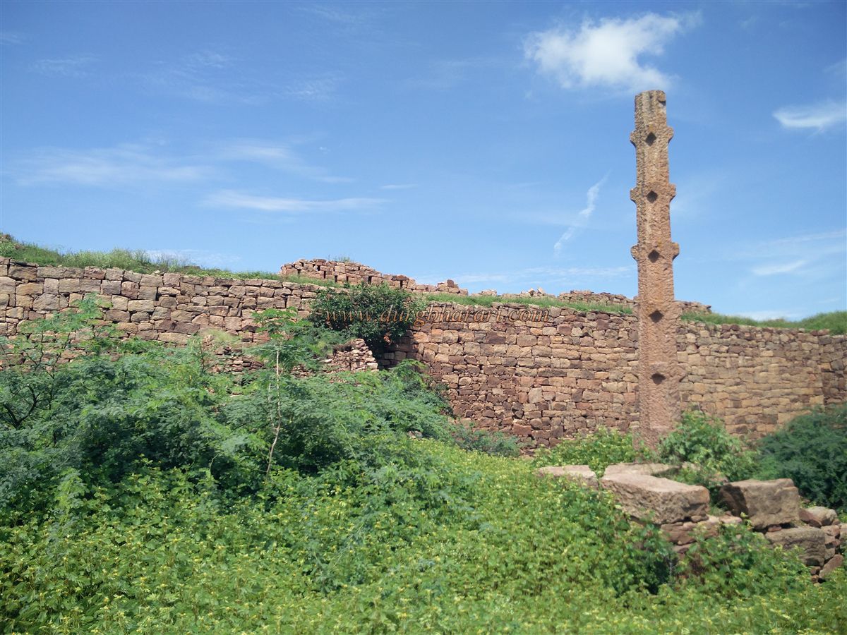
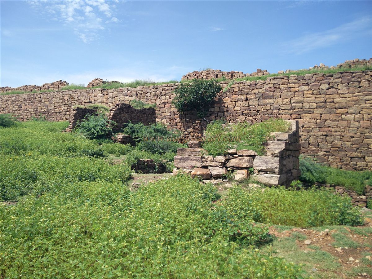
Near the well is a ruined temple and a 15-foot-tall monolithic stone lamp tower (deepmala). A newly built temple can be seen near the southern wall, constructed by the villagers. One wonders why a new temple was built instead of repairing the existing one. Also, no proper path leads to it, and thick thorny bushes have overrun the area. There may be other remains within the fort, but they are not visible due to the vegetation. After exiting this temple area, one completes the citadel visit. Proceeding further brings one to the northern wall of the fort.
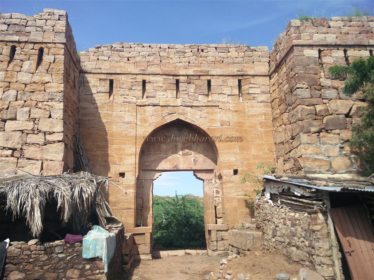
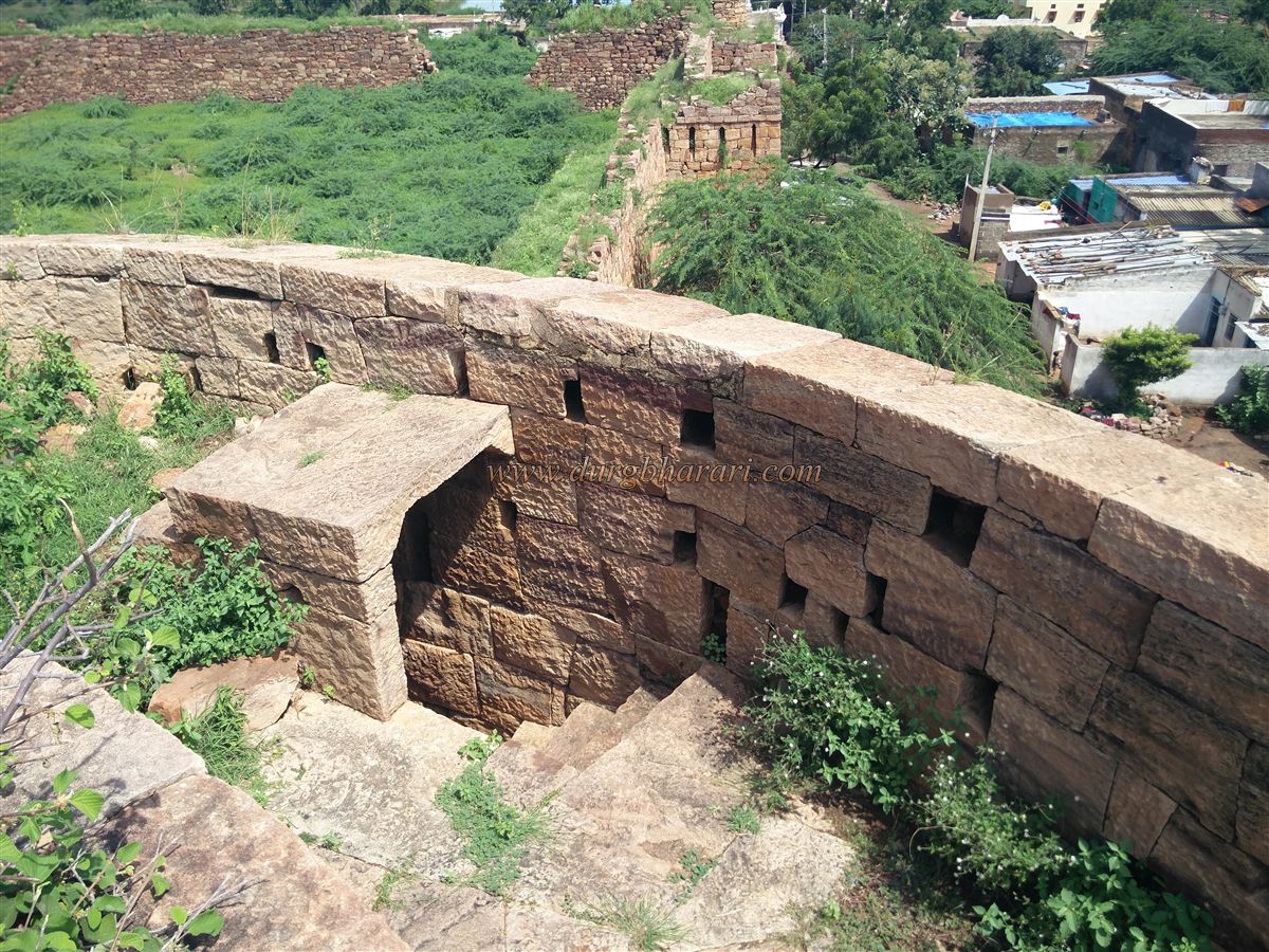
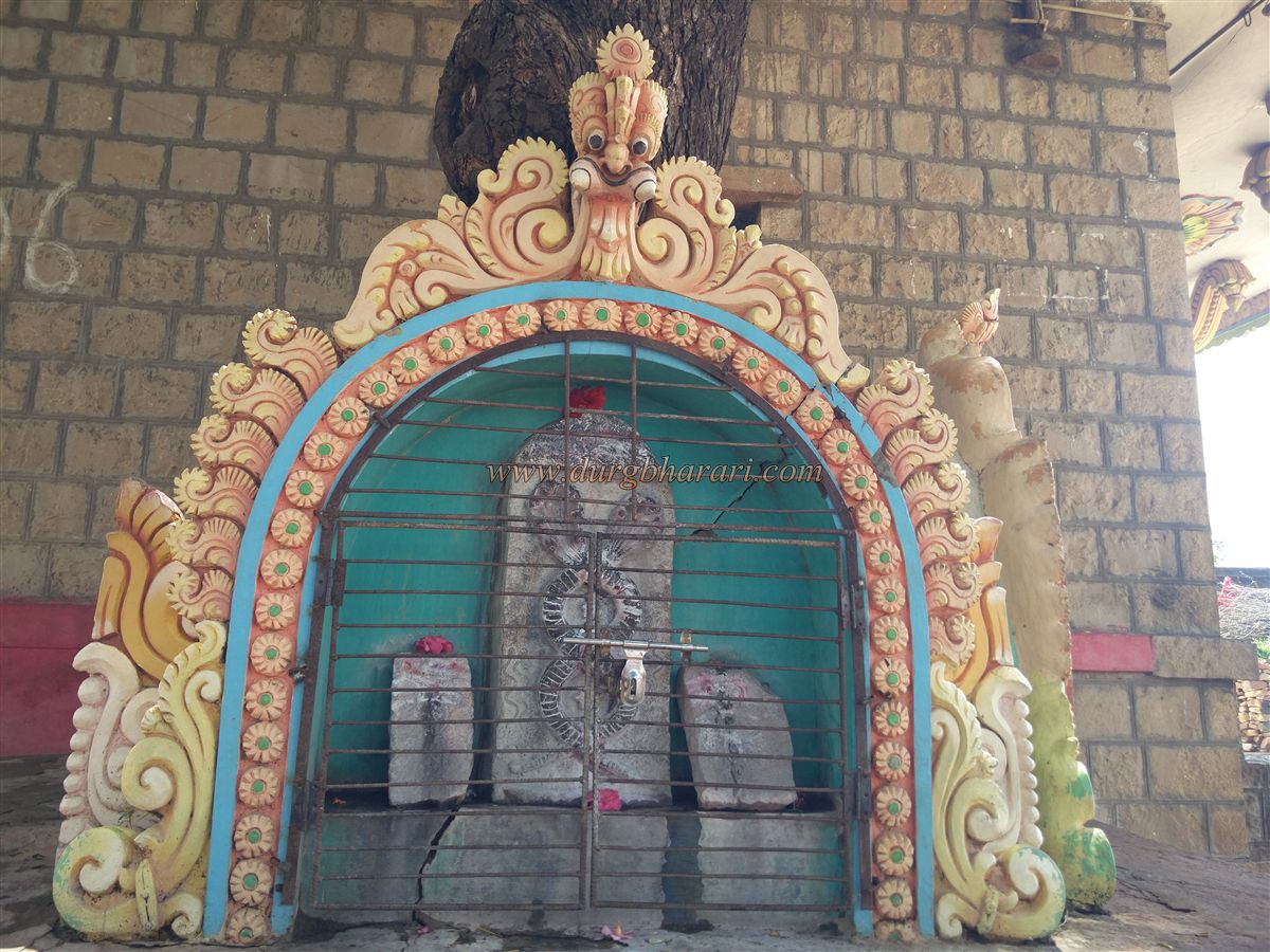
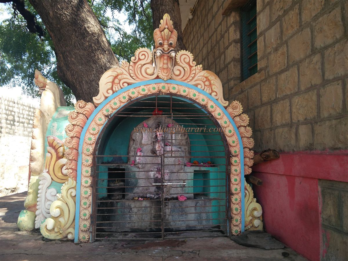
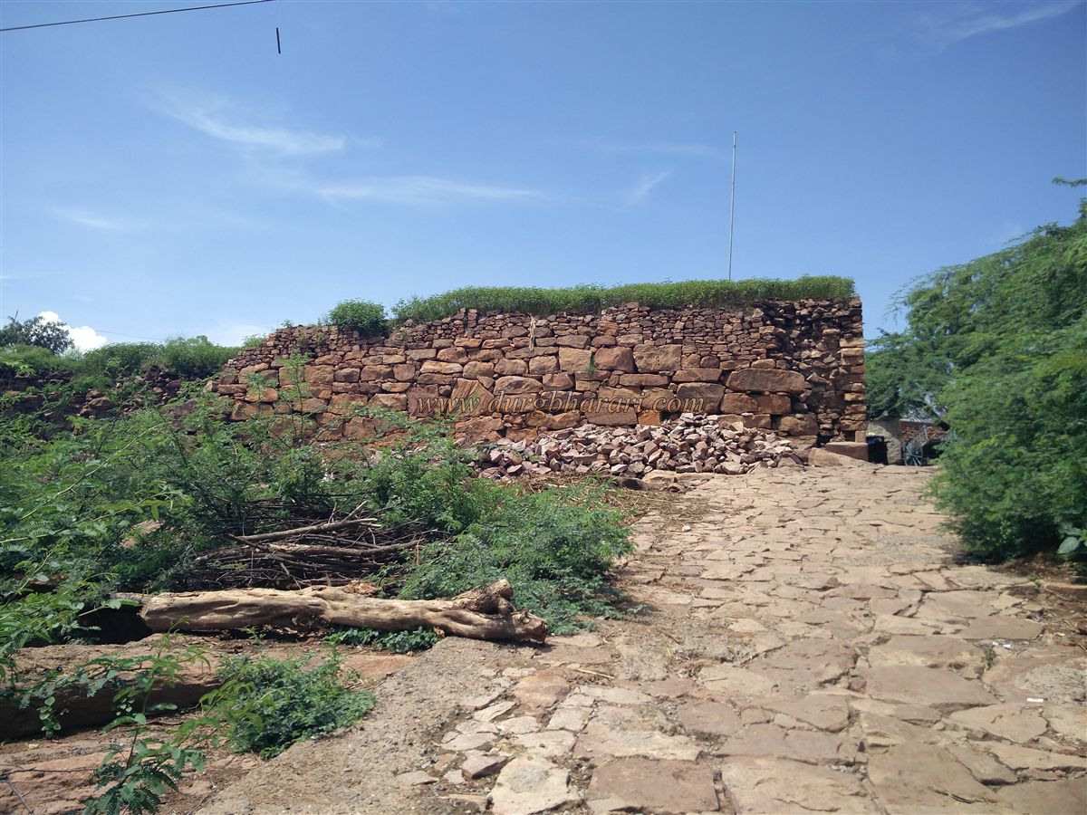
Next to the wall are two temples — one dedicated to Shiva and the other to Vishnu — both restored in modern style using cement by the villagers. In the Shiva temple courtyard, two small domes house ancient serpent sculptures and a Ganesha idol. Further along the wall, the north-facing gate of the fort is situated between two bastions. A staircase has been built into the wall of one of the bastions, allowing access to its upper level. These two bastions and the gate are built slightly beyond the main wall, and there are sentry alcoves on the inner side. The wall next to the gate has been broken to allow vehicular access inside the fort.
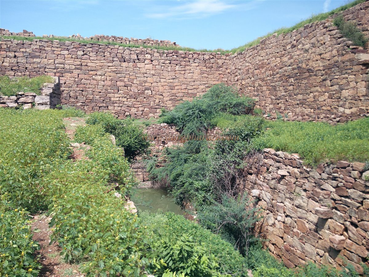
Outside this gate, next to the wall, is a massive built-up reservoir. Stone steps (Ghats) line the tank, and a wall dam has been constructed to retain the water. A square portion of the wall extends into the tank. After seeing the gate, proceed rightward along the wall in the direction of the reservoir. At the point where the wall enters the tank, there is an arched gateway and a stairway descending into the tank. Continuing along the outer wall leads to the north-western bastion, which resembles the one seen earlier. A little ahead along the wall, a partially ruined section and a gate can be seen.
Some portions of the outer fort wall are in disrepair, but walkways (parapets) can still be seen on top. Returning from here to the Sharabha-carved bastion completes the fort circuit. This exploration takes about one and a half hours. Though today the fort is known by the name of Mudkavi village, it must have had a different name in historical times. No specific historical references to a "Mudkavi Fort" are found. It remained largely under Maratha control during and after Shivaji Maharaj's era. As usual, villagers attribute it to Shivaji Maharaj, but no further details are known. Given its proximity to the Ramdurg Fort, the history of Mudkavi Fort is likely connected with the Ramdurg princely state.
© Suresh Nimbalkar
GALLERY