MRUGGAD
TYPE : HILL FORT
DISTRICT : RAIGAD
HEIGHT : 940 FEET
GRADE : MEDIUM
The main Sahyadri range runs north to south, and for over two thousand years, many mountain passes leading from the Konkan to the plateau have existed within its rugged cliffs and valleys. While some of these passes are still in use today, many have fallen into obscurity due to disuse over time. Along with these ancient passes, the forts built to protect them have also faded from collective memory. One such pass from the Konkan to the Maval region is the Savghat Pass. Guarding this pass were Mruggad on the Konkan side and the forts of Tung and Morgiri in the Pavana river valley above. The route descending from the Maval into this pass is still known today as Nisani’s path. With the construction of Borghat during the British era, the use of this ancient pass ceased entirely, and Mruggad, once its vigilant guardian, too fell into oblivion. Due to its proximity to the village of Bheliv at its base, the fort also came to be known as Bheliv Fort.
...
This fort, which can be easily visited in a single day from either Pune or Mumbai, is located in Sudhagad taluka of Raigad district. The village of Bheliv, at the base of Mruggad, is situated 92 km from Mumbai and 115 km from Pune. After passing Parli village on the Khopoli–Pali road and crossing the bridge over the Amba River, a left turn through an archway leads to Jambulapada village. From there, a left road near the “Rest in Forest” hotel leads 12 km to Bheliv at the eastern foothills of the Sahyadri, while the right road leads to Kalamb, the base village of Anghai Fort.
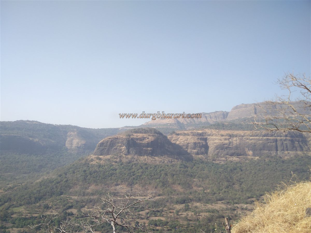
After crossing the bridge over the Amba River just before Bheliv, one can see the Sahyadri range stretching eastward and five prominent spires rising from it. The farthest and tallest among these is the Moradi pinnacle. Mruggad is located on the last three spires behind the village, excluding the first two. Due to the efforts of the Durgveer Pratishthan, which has undertaken conservation work on the fort, the trail to the top is now clearly marked with directional signs.
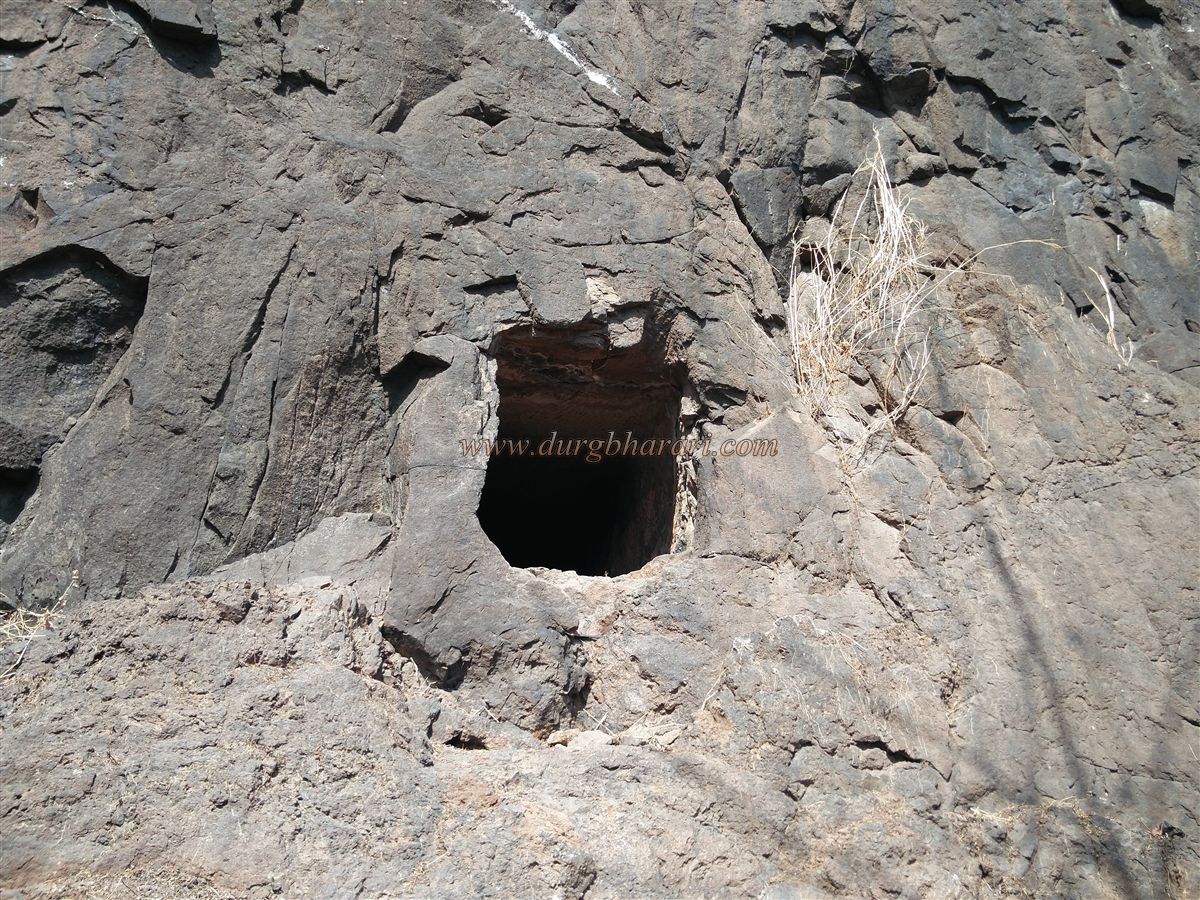
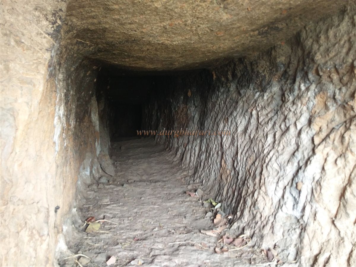
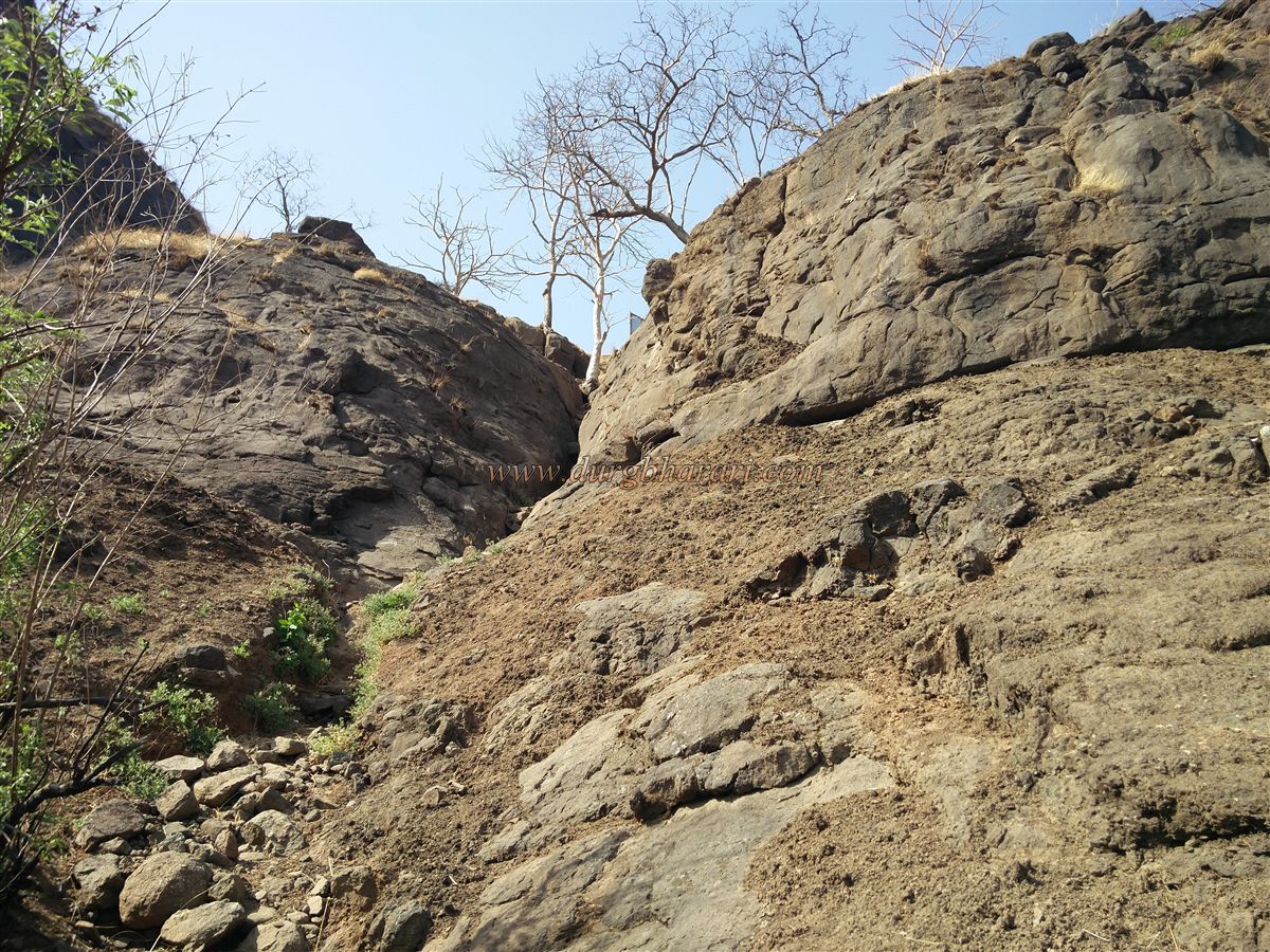
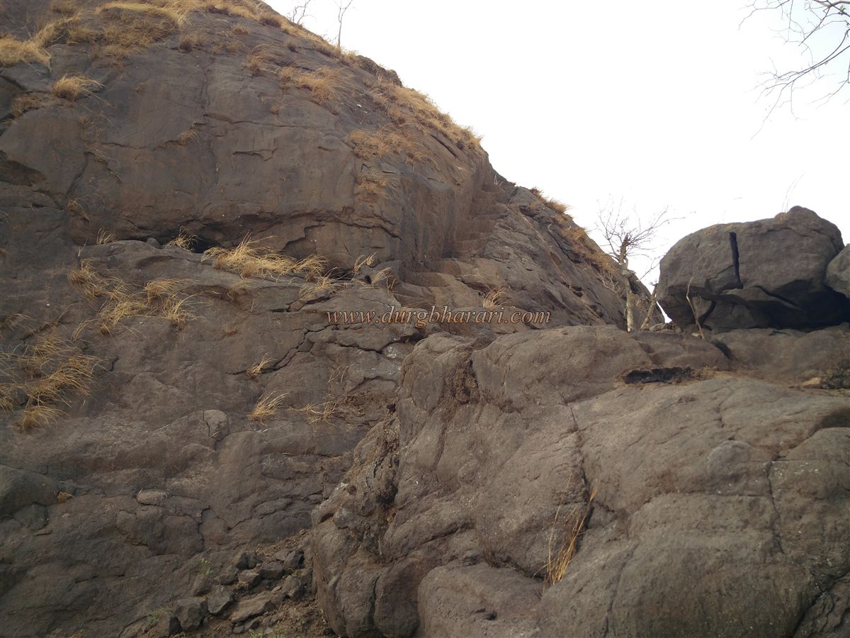
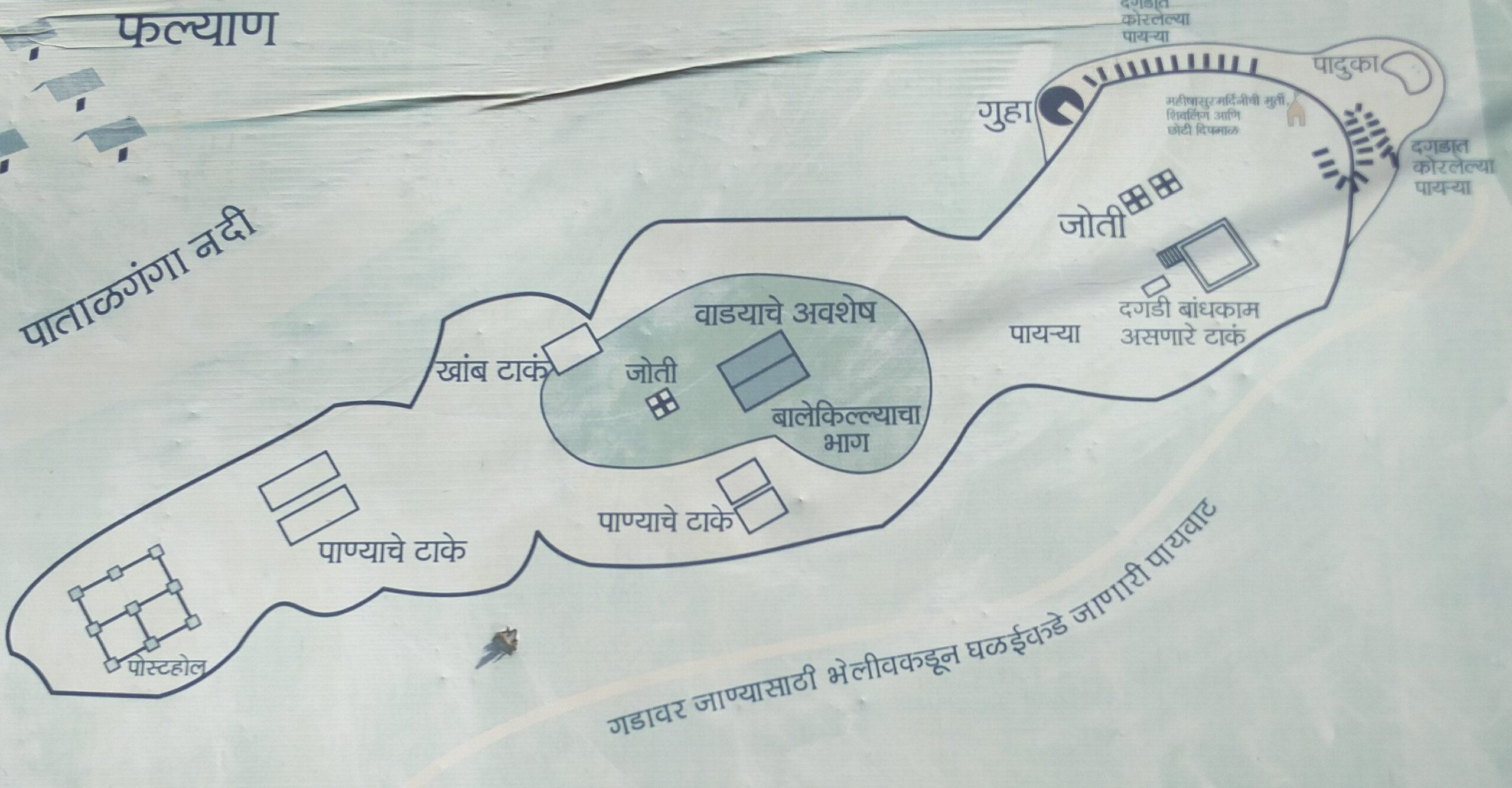
In front of the village school is a temple, and the trail to the fort begins just above this temple. Since there is no water available on the fort, one must carry sufficient water from the village. Apart from the initial and final sections, the trail passes through dense forest, making the ascent less exhausting. The route to the top goes through a narrow gorge located between the last two pinnacles to the east. About half an hour after starting the trek, one reaches this gorge. On the right-hand side of the gorge, there is a small square cave entrance about 3 x 3 feet in size. This cave extends about 30 feet inside with two bends and ends in a larger 10 x 12-foot chamber.
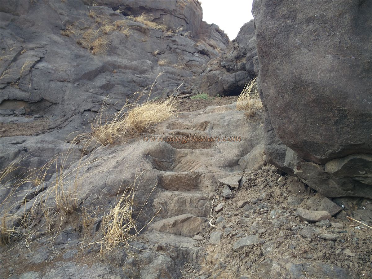
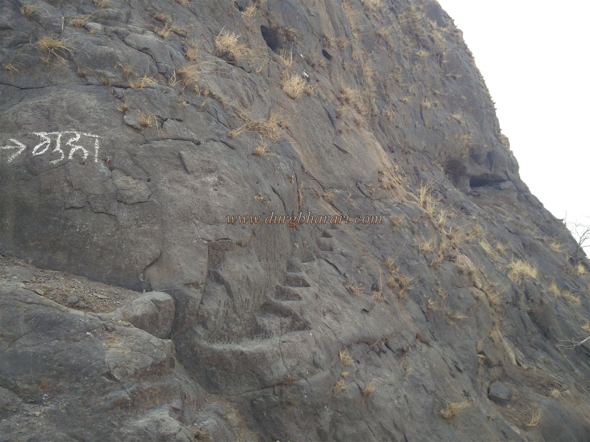
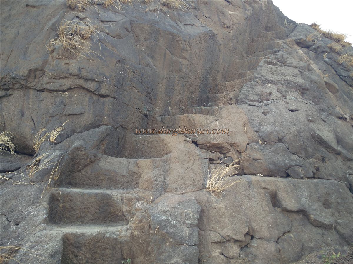
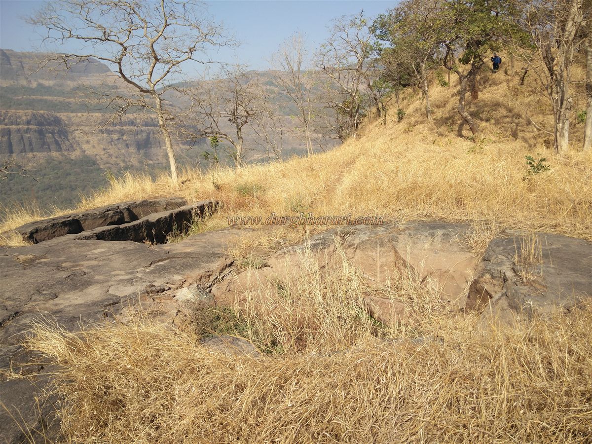
After visiting the cave, continue up through the gorge. As the original trail here has been lost, a short rock-climb is necessary, after which one reaches rock-cut steps on the left that lead to a small plateau just below the summit. On the right side of the plateau is a small elevation where remnants of a guard post can be seen. A map of the fort, installed here by Durgveer Pratishthan, helps visitors navigate the site.
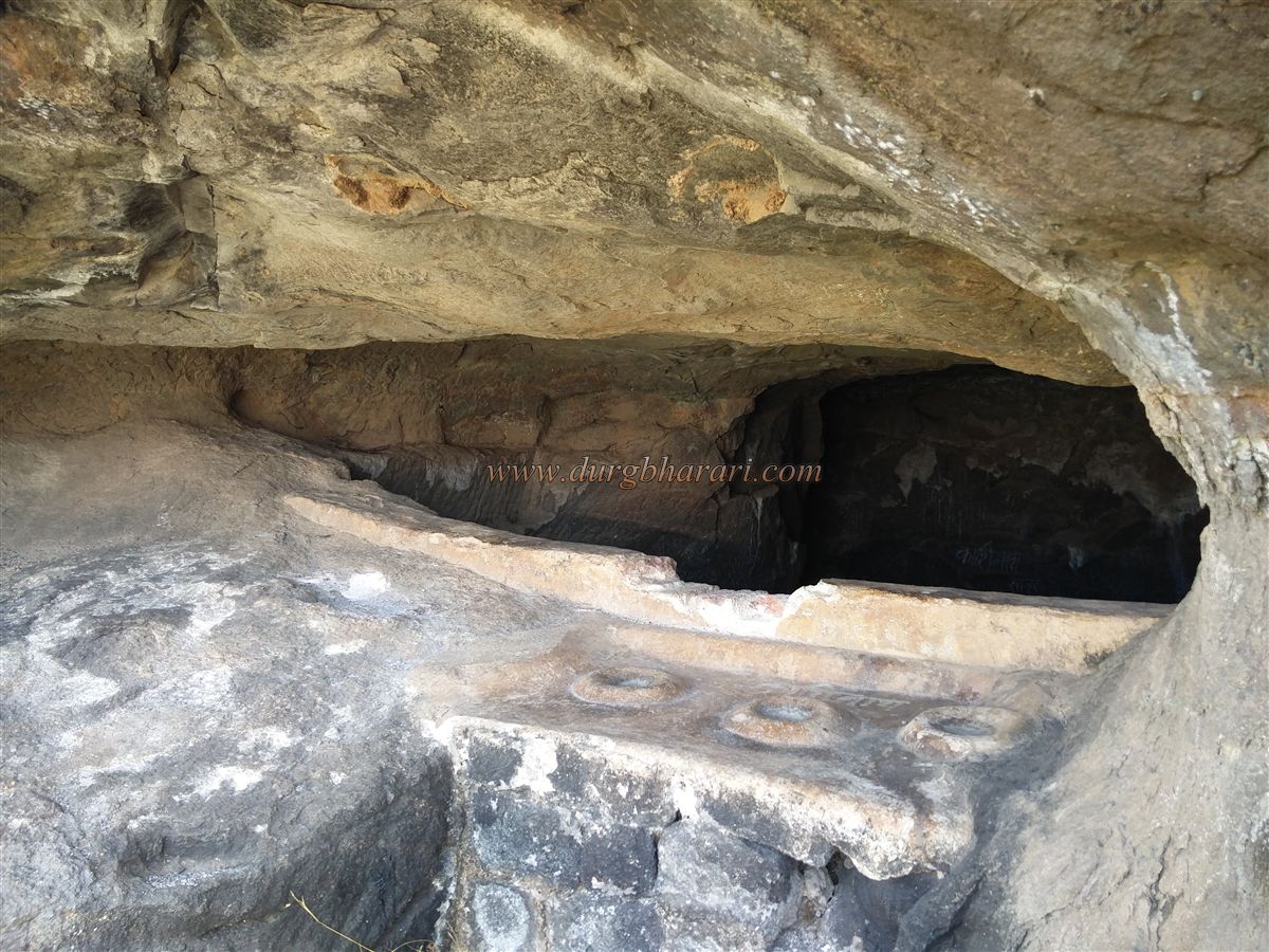
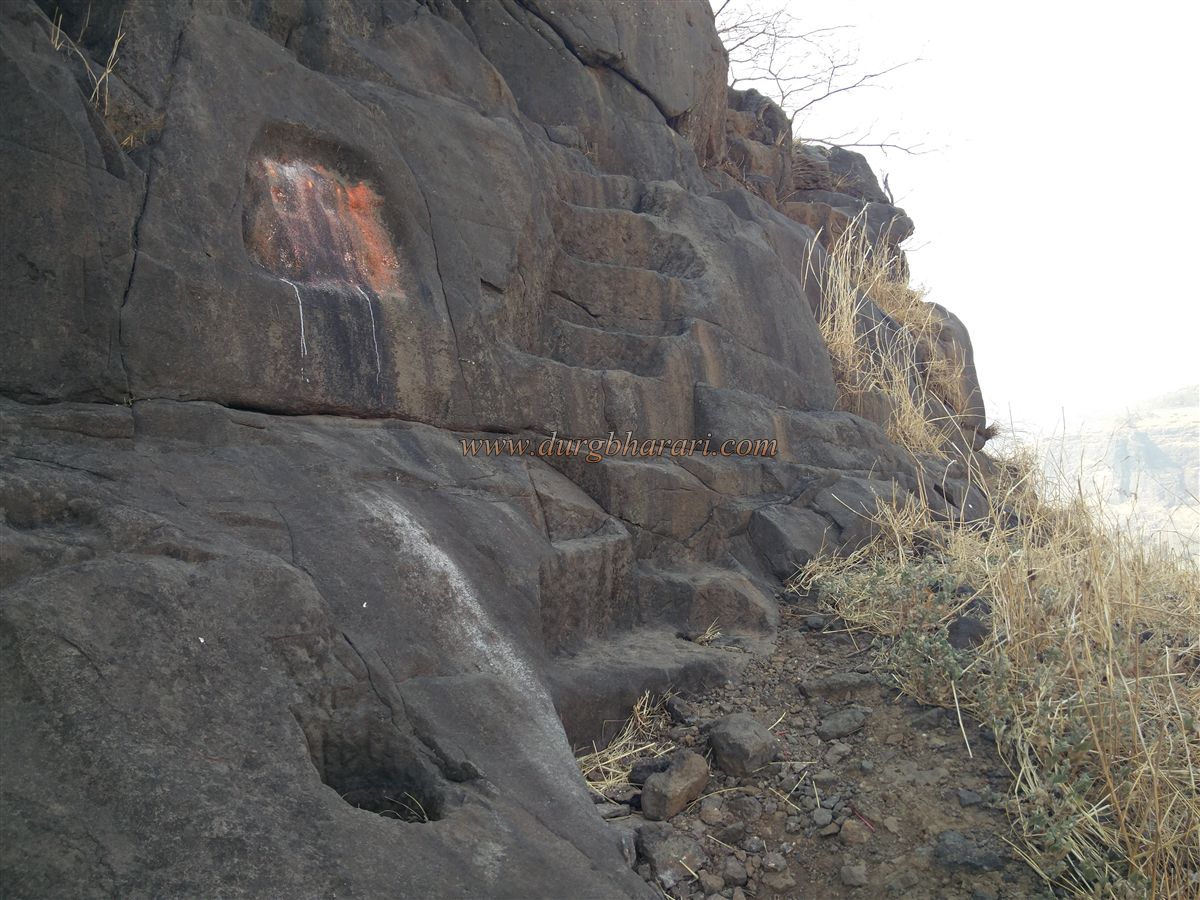
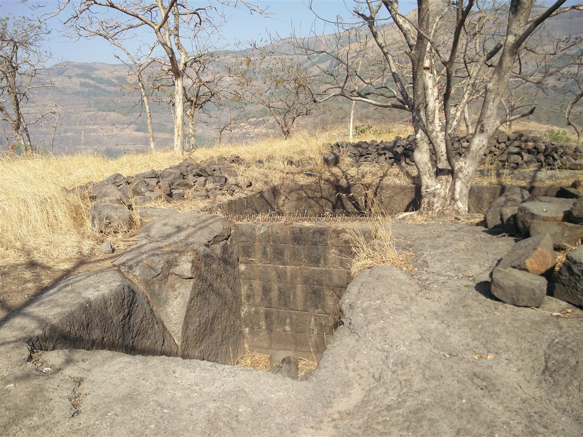
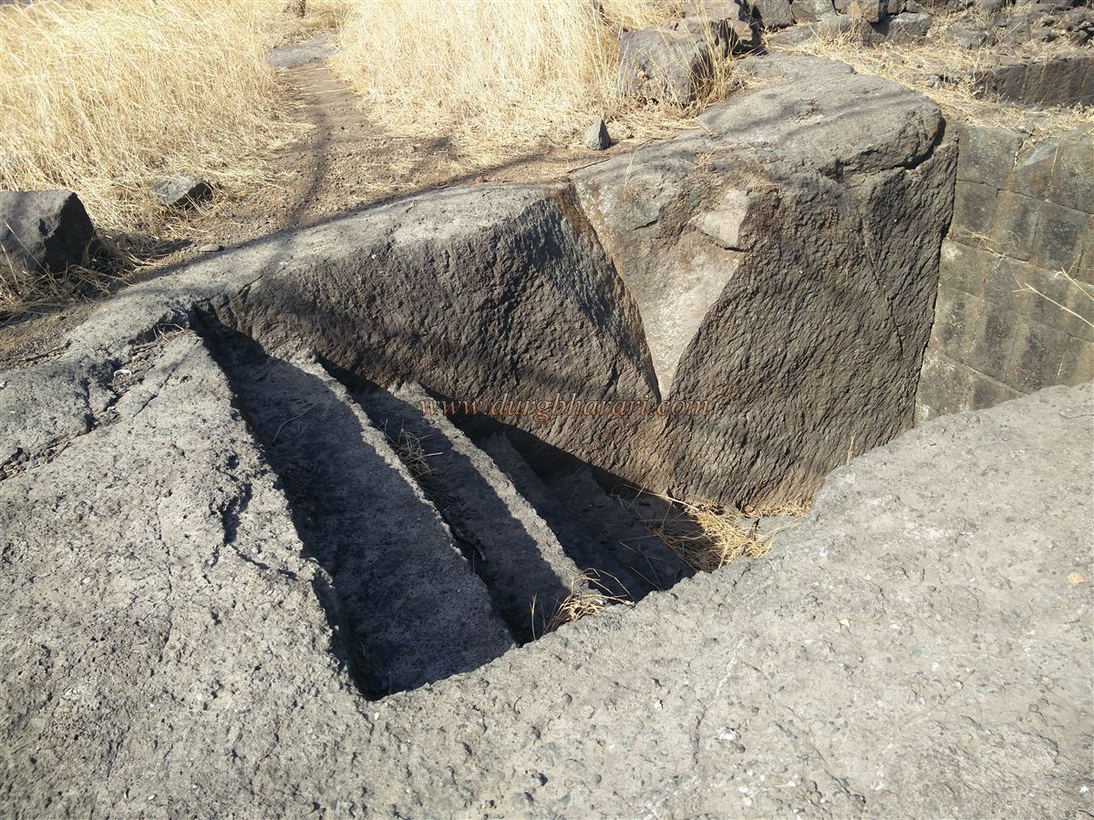
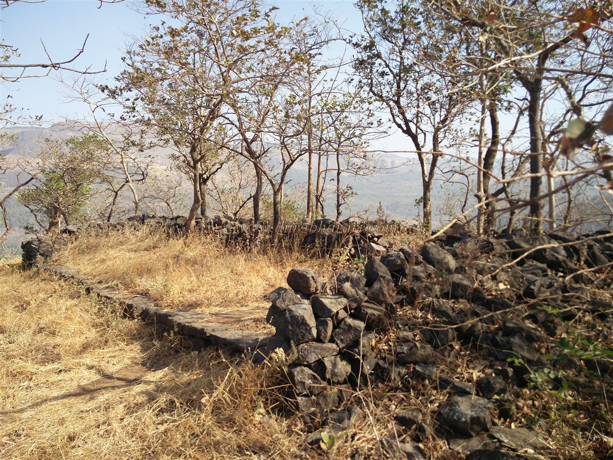
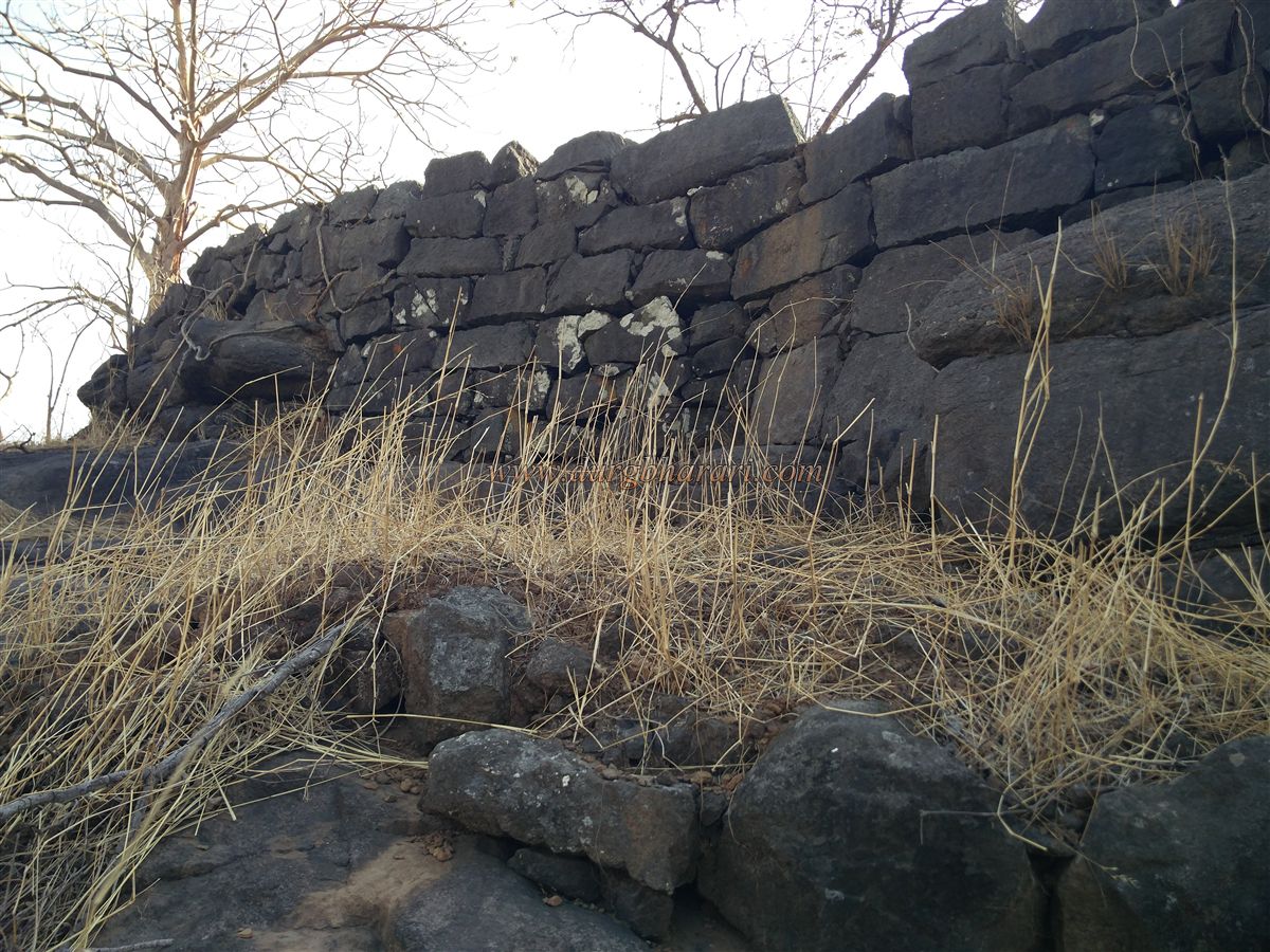
On the left side of the plateau, steps carved into the rock lead toward the fort summit, while to the right, smaller rock-cut steps descend toward a cave and a now-dry water cistern. Outside this cave are circular lime-plastered platforms meant for storing large water jars. Due to the narrowness of this trail, it is not advisable to attempt it during the monsoon. After visiting the cistern, one returns to the carved steps, from which the fort is entered within ten minutes. To the right of these steps is a carved image of Lord Ganesh. Here, signs of a now-ruined east-facing entrance gate and remnants of stone fortifications can be seen along the cliff edge.
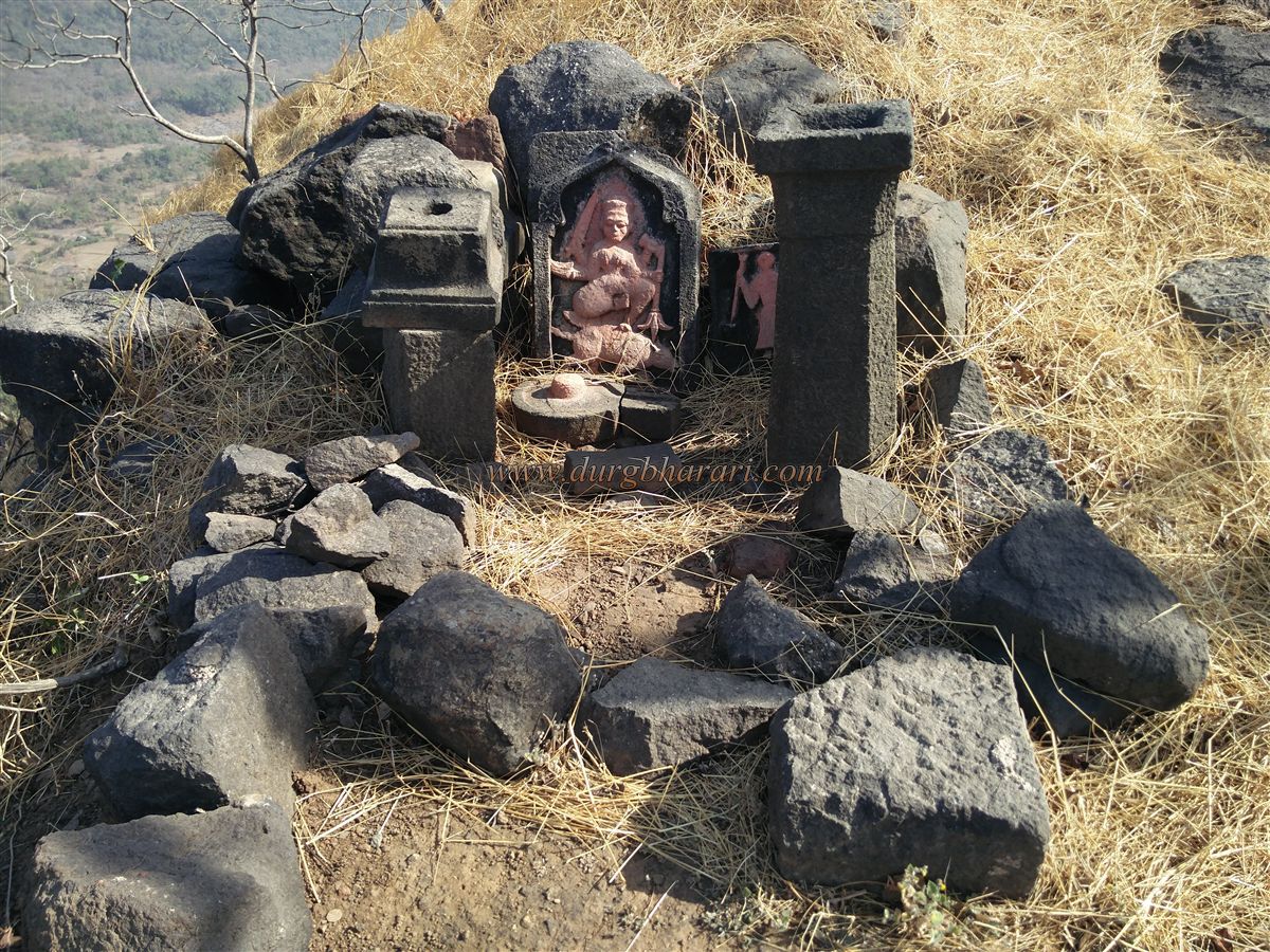
After entering the fort, one sees a neatly placed idol of Mahishasurmardini, a broken Shiva lingam, and a large stone oil lamp to the right. In front of the idol are the remains of a structure’s foundation. To the left of the summit are three dry cisterns, one of which is divided into two sections by a stone wall. Another cistern has steps carved into it for access. After viewing these, the trail continues to the next summit, where the remains of a mansion’s foundation can be seen on the left. This summit has some vegetation and additional ruined structures whose purpose is unclear.
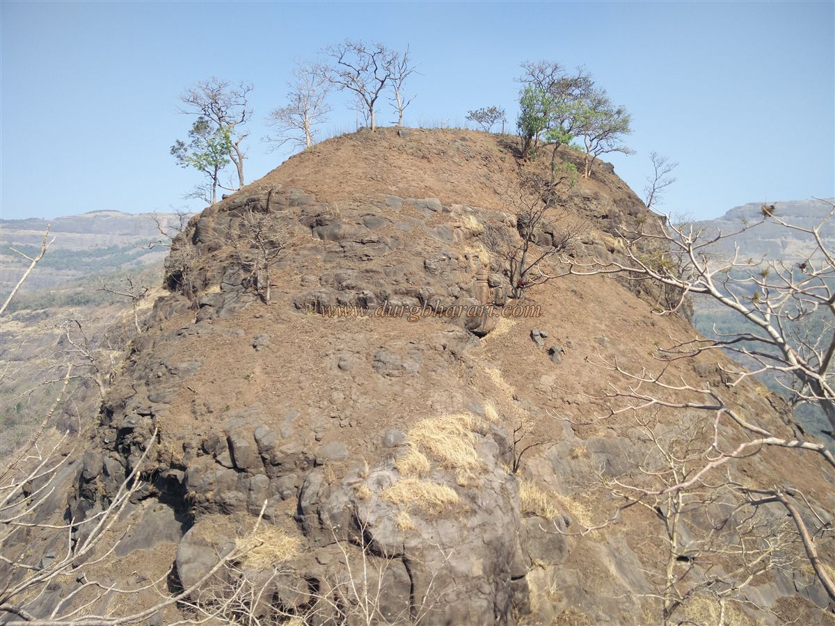
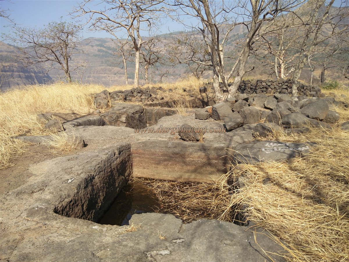
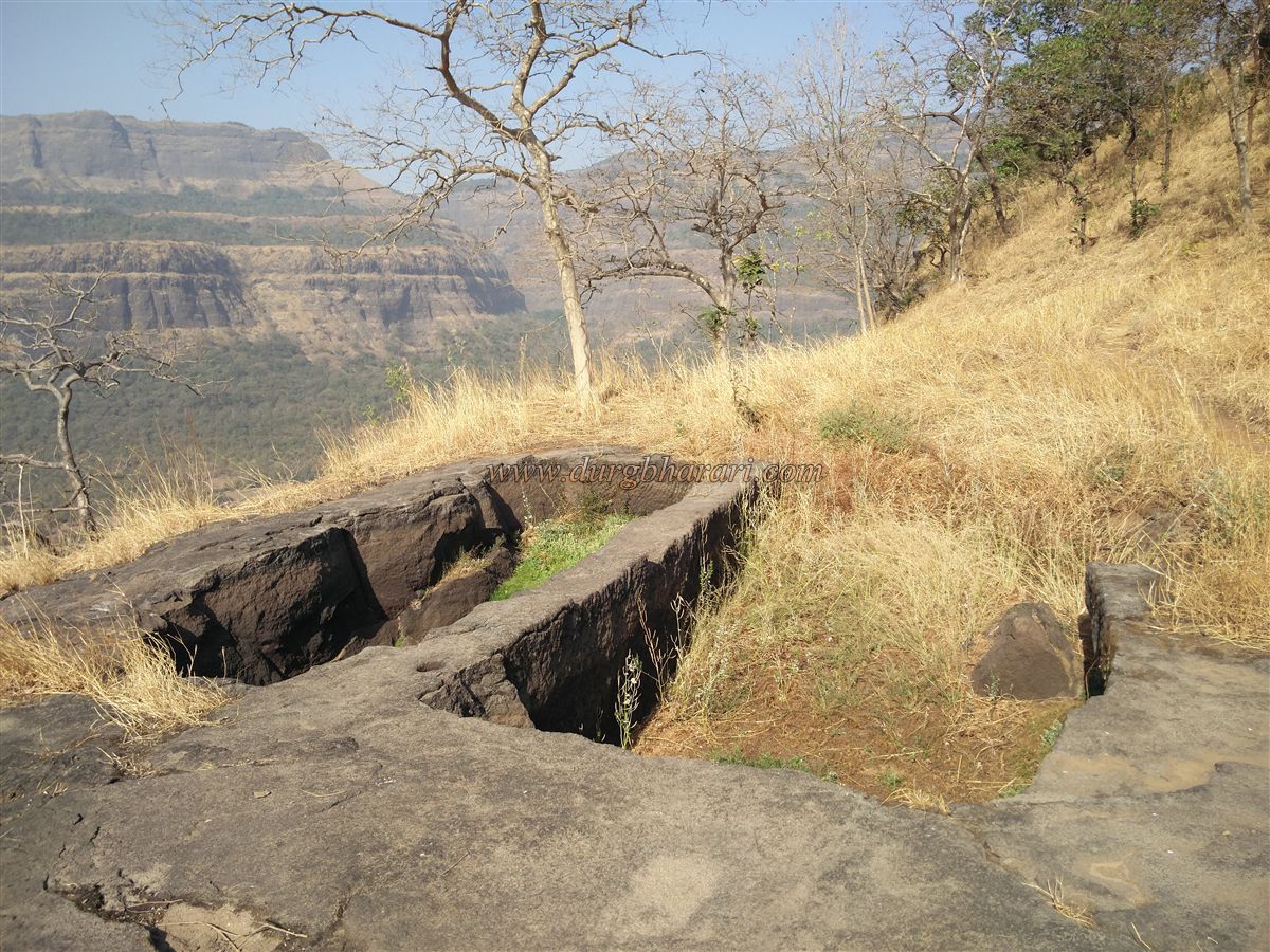
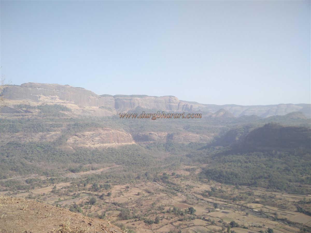
Descending from the right of this foundation, one reaches a rock-cut but dry cistern known as Khambtake. From here, crossing a small descent brings one to the westernmost summit of the fort. This summit contains two large, rectangular dry cisterns and several large cuttings in the rock—evidence of past stone extraction activities. A flagpole stands in this area, and the surface here is relatively flat. From this spot, one gets a clear view of the Kurvanda Pass, Umberkhind region, and to the east, Sarasgad Fort.
Given its location, shape, and surviving features, Mruggad Fort likely served as a lookout post. The summit is compact, and one hour is sufficient to explore the entire top. Starting from Bheliv village, it takes about three hours to climb the fort, explore its remains, and return. Although the Umberkhind battle between Shivaji Maharaj and Kartalab Khan, which took place in this area, is well-known in history, Mruggad Fort itself is not mentioned in accounts of the battle.
© Suresh Nimbalkar
GALLERY