MORAGAD
TYPE : HILL FORT
DISTRICT : NASHIK
HEIGHT : 4135 FEET
GRADE : MEDIUM
In Maharashtra, forts with two citadels (Balekilla) on a single plateau are quite rare. The Rajmachi Fort, located near Mumbai and Pune, is well known among fort lovers for its two citadels, Manranjan and Shrivardhan. However, Mulher Fort in the Dolbari mountain range of Nashik district, which boasts not just two but three citadels—Mulher, Mora, and Hargad—remains largely unknown and far from fame. The hill, which is taller than the main Mulher citadel, is known as the second citadel of Mulher. Though it is commonly referred to as part of Mulher Fort due to its proximity and the fact that the two accessible paths to it begin from Mulher, some historical documents mention it as a separate fort. This may be true to some extent, as there is a third independent path to the fort, now completely lost, with only faint traces visible, but it is too dangerous to use today. Regardless, Mora Fort cannot be mentioned without referencing Mulher.
...
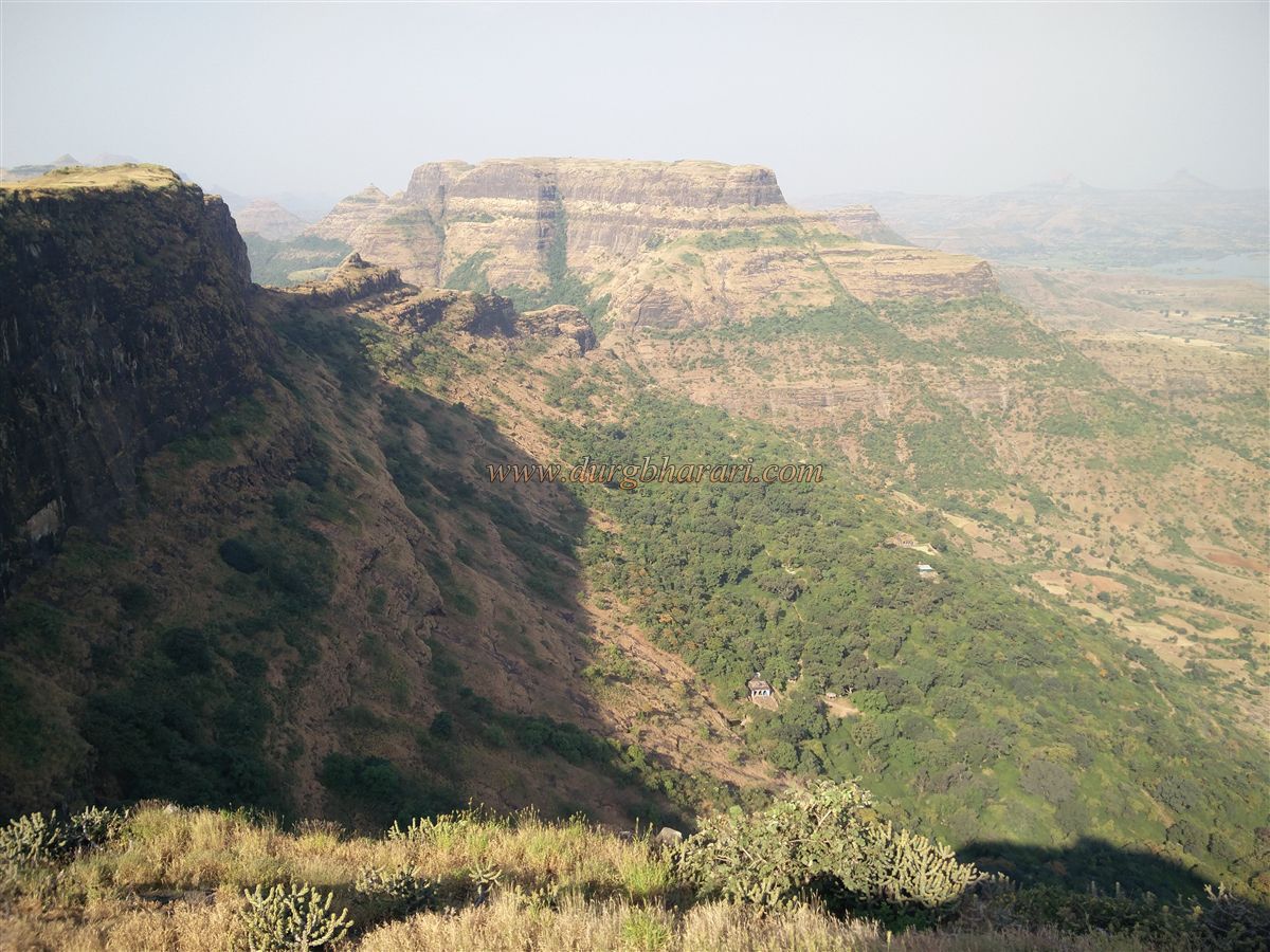
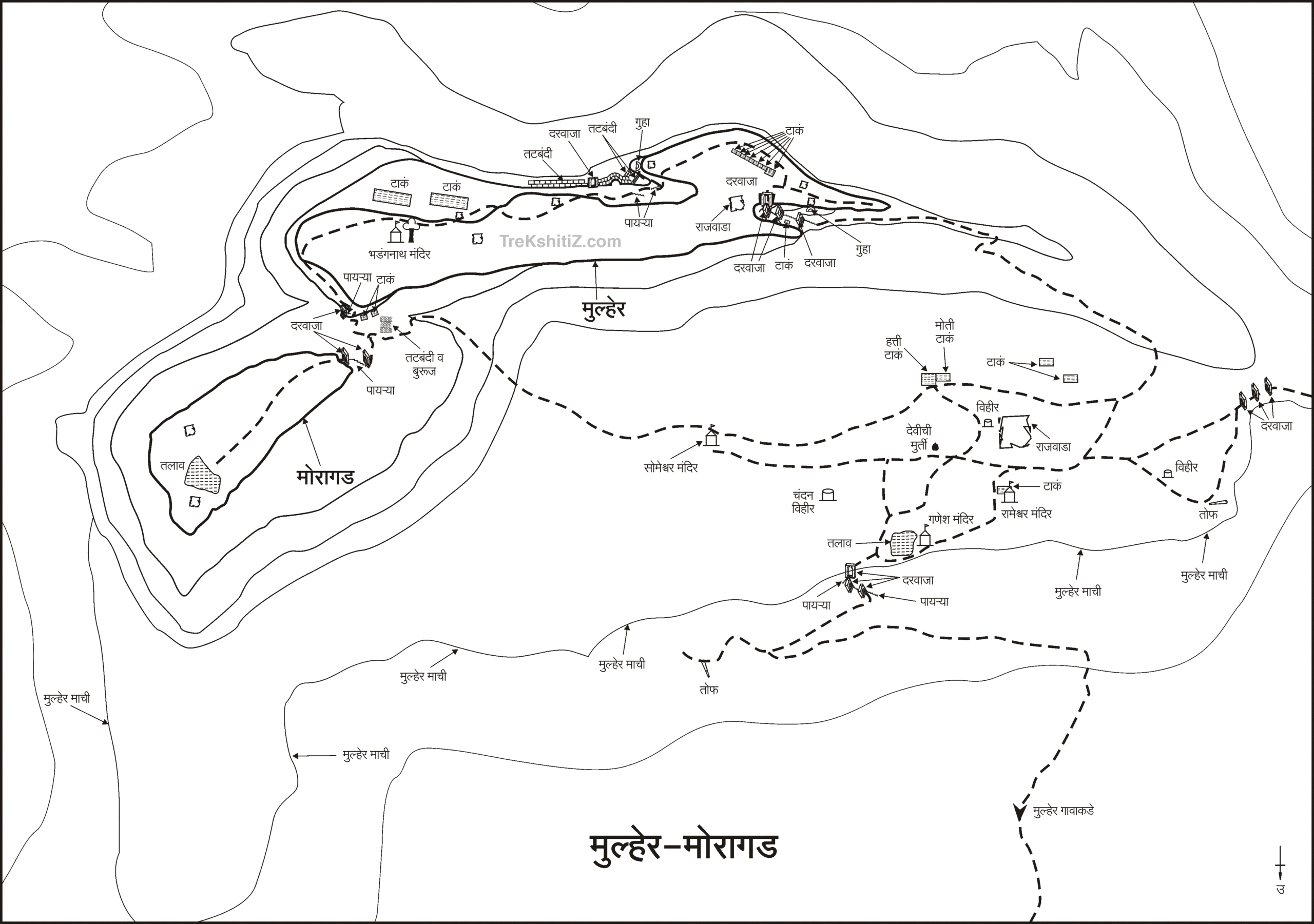
Mulher and Mora Forts are located on the boundary between the dense forests of Dang in the west and Baglan region. To reach Mora Fort in Satana taluka, one must travel via Nashik–Satana–Taharabad to the village of Mulher. The distance from Nashik to Satana is 90 km, and from Satana to Mulher via Taharabad is 35 km. Once in Mulher, one can clearly see the Mulher plateau with Mora Fort to the left, Mulher in the center, and Hargad to the right—forming a trio of citadels. As you proceed from Mulher village toward the forts, you come across beautifully carved old mansions. On the way out of the village, to the left on a small hill stands a temple, and to the right is an ancient Mughal-style domed structure.
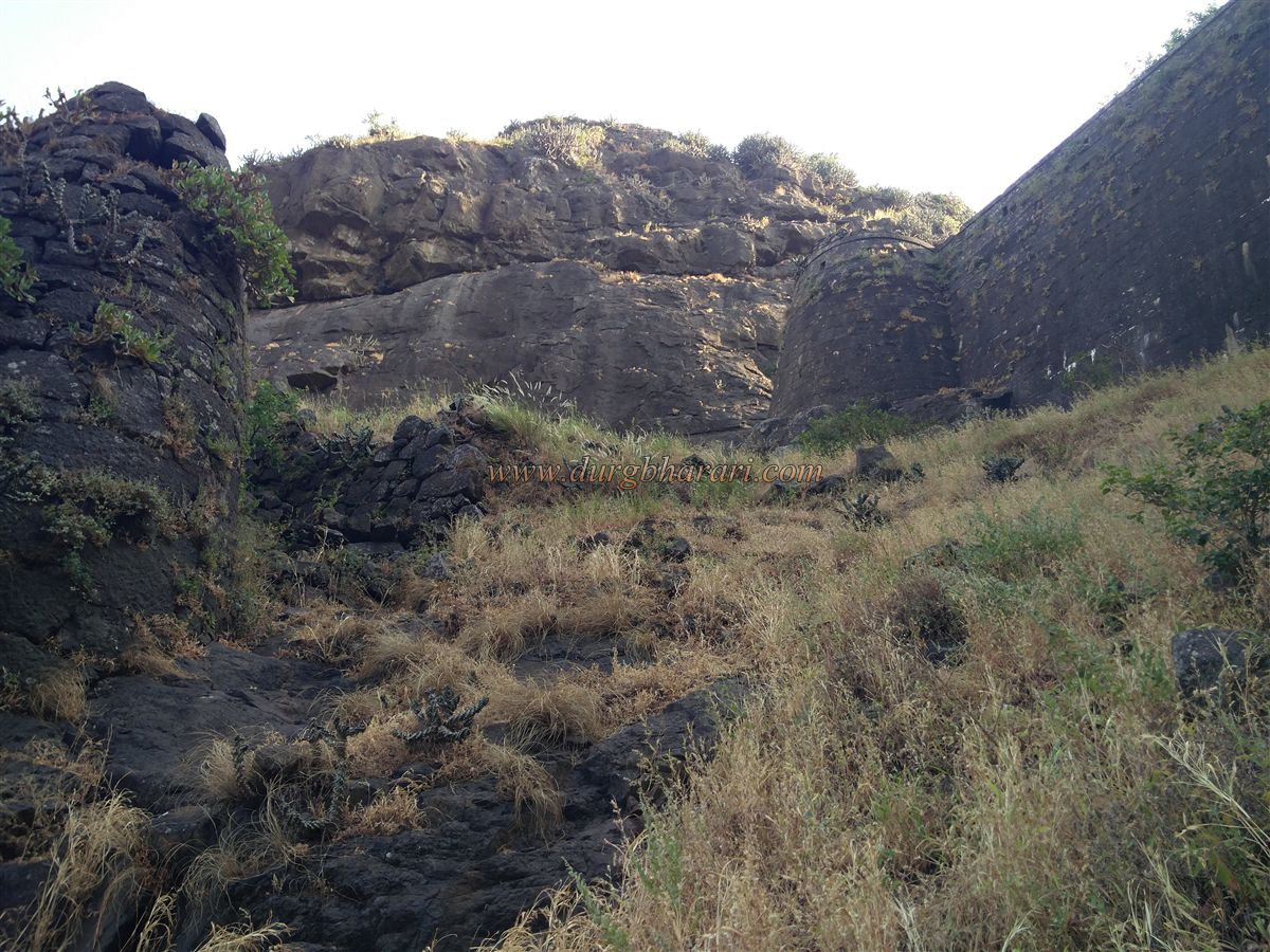
Both routes to Mora Fort begin from the Mulher plateau—one from the Someshwar temple and the other from the Mulher citadel. Describing the path from Someshwar temple: a paved road takes you to the base of Mulher Fort, from where a dirt path goes through three gates to reach the Ganesh temple on the plateau. From here, a worn trail veers left towards Someshwar temple, situated below the saddle between Mulher and Mora Forts. A steep climb past the temple leads to the saddle, where a stone wall fortification, still in good condition, seals off the gap between the two hills with three bastions. This wall joins the two forts.
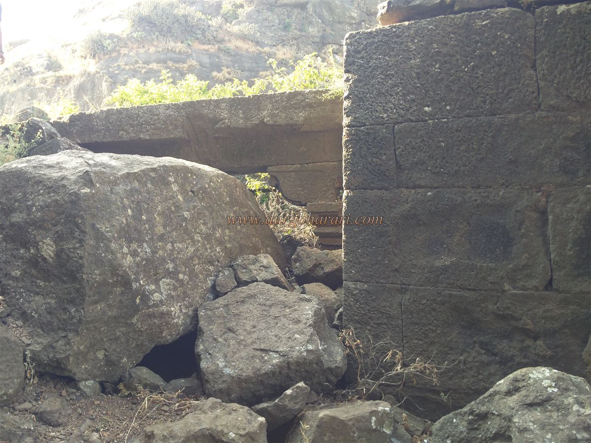
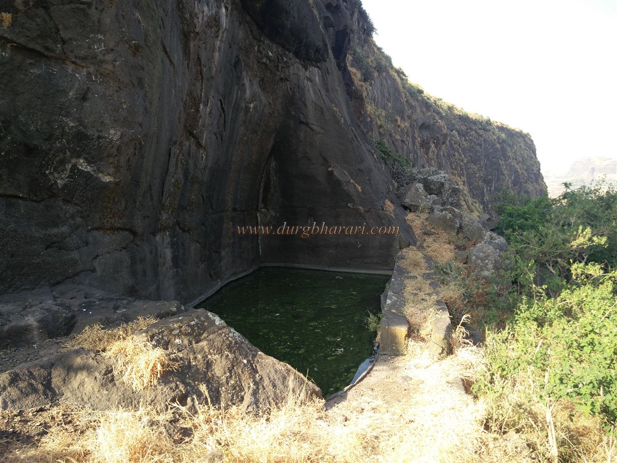
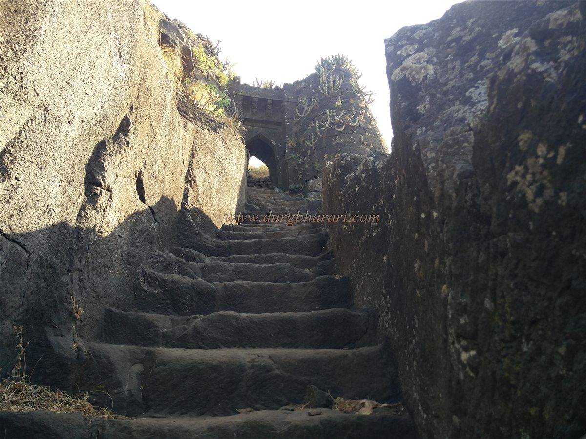
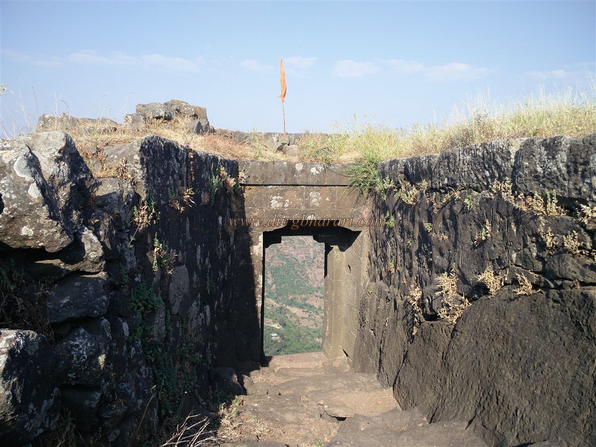
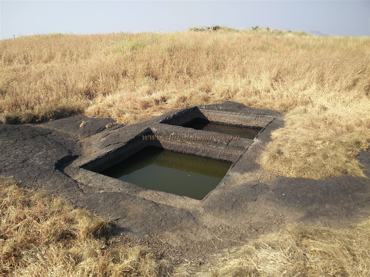
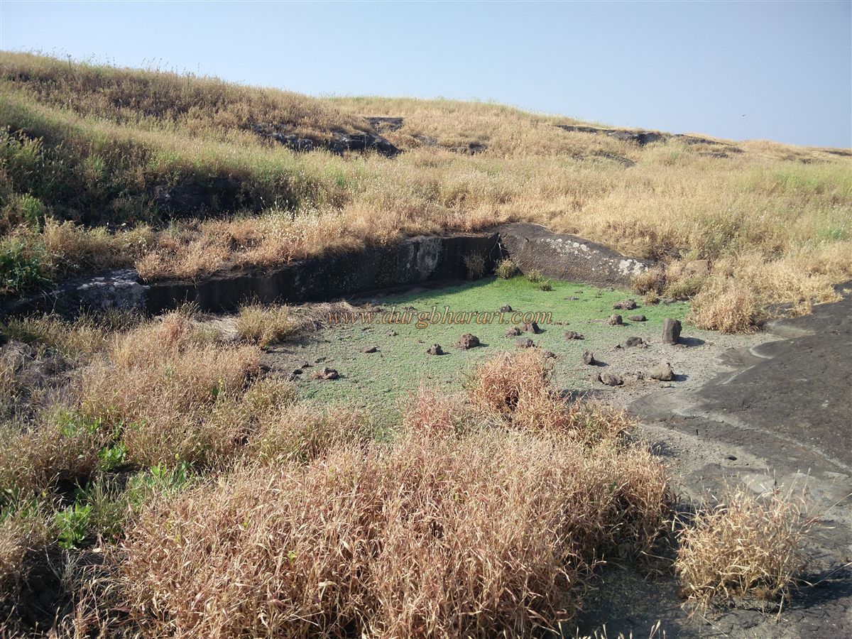
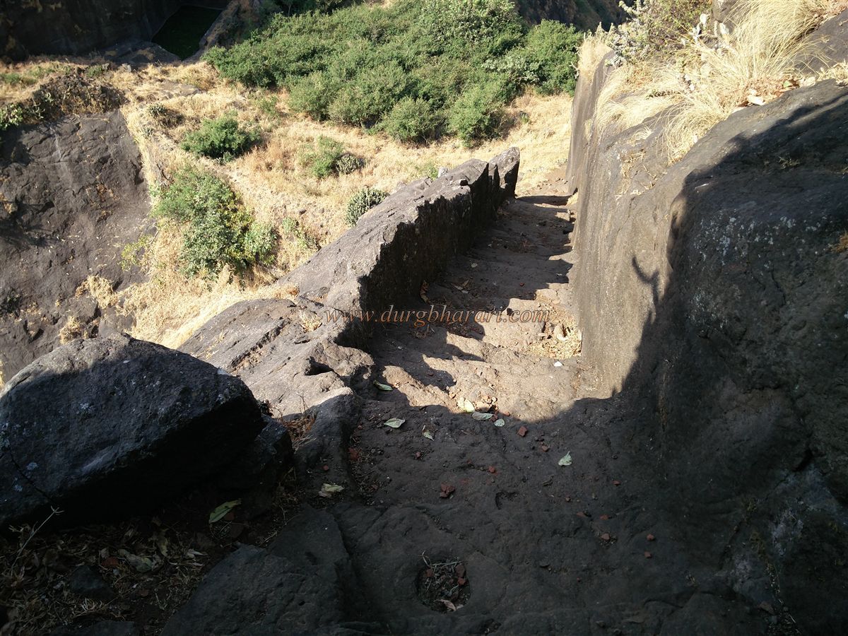
There are three gates to approach the wall from below, but two have completely collapsed, while the third remains intact with its arch buried under debris—climbers must scale the stones to enter. A small trail from the Mulher citadel also descends here. It takes two hours to reach this point from the base of the fort. On this fortified saddle, there are rock-cut water tanks inside the hill, though they contain mossy water.
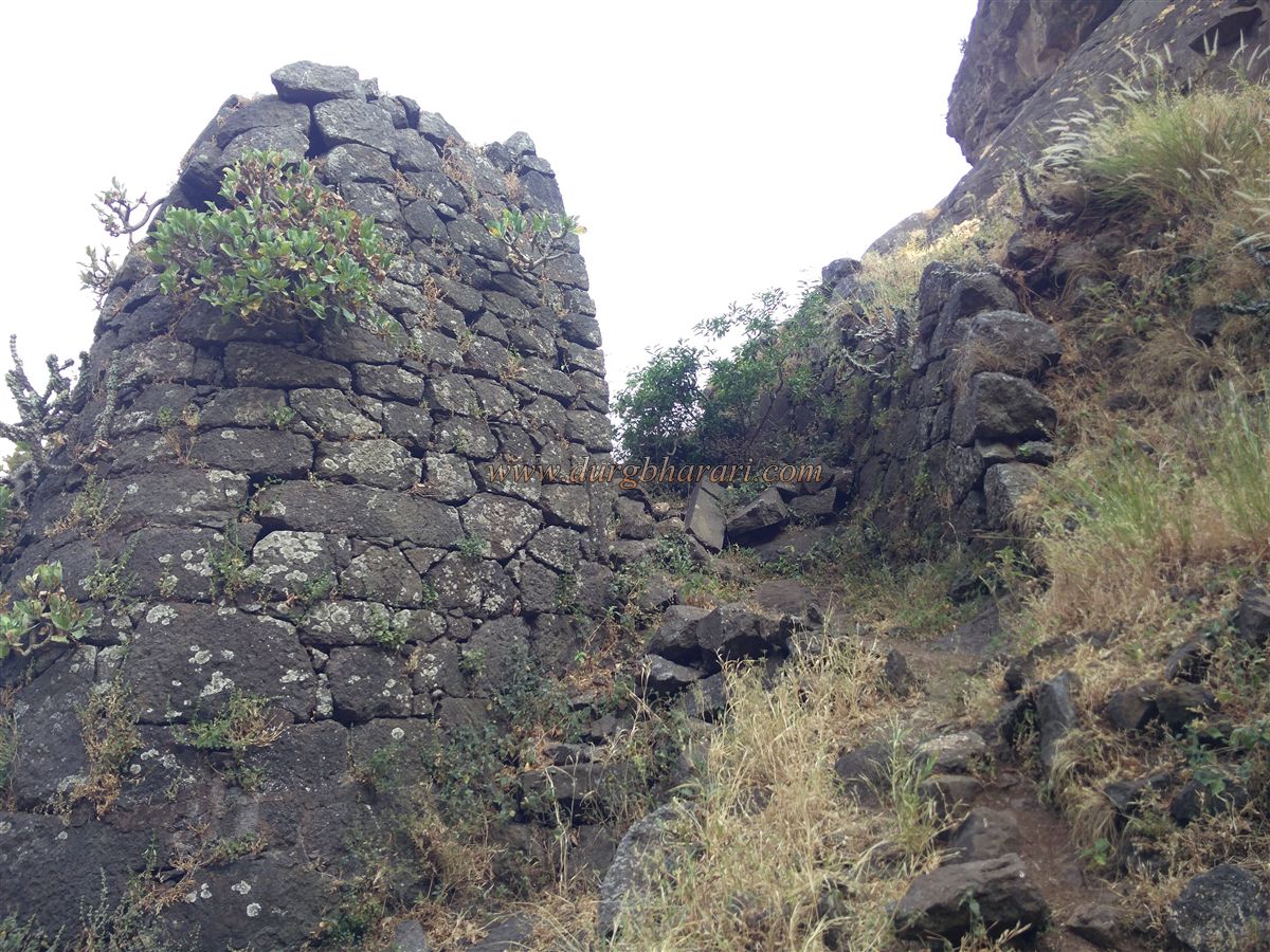
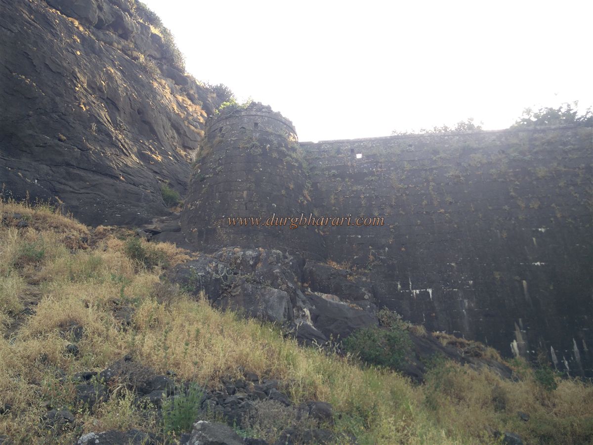
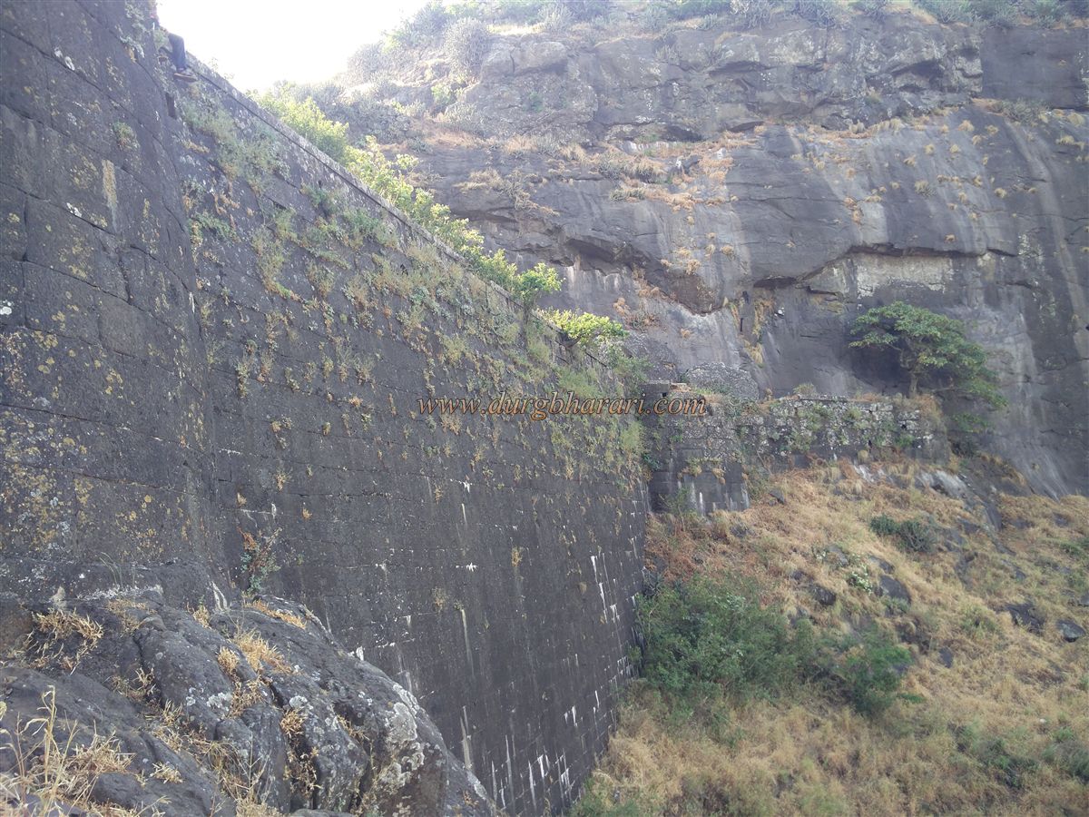
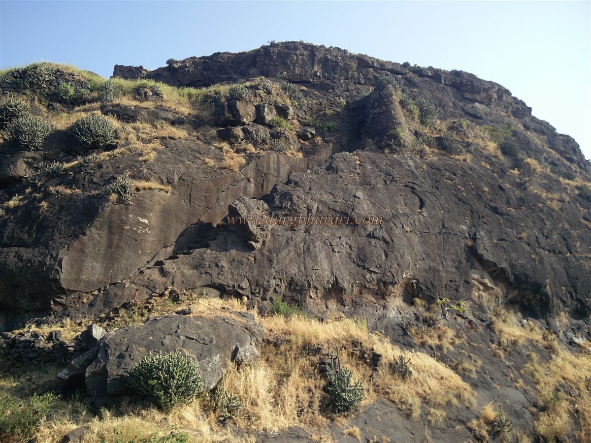
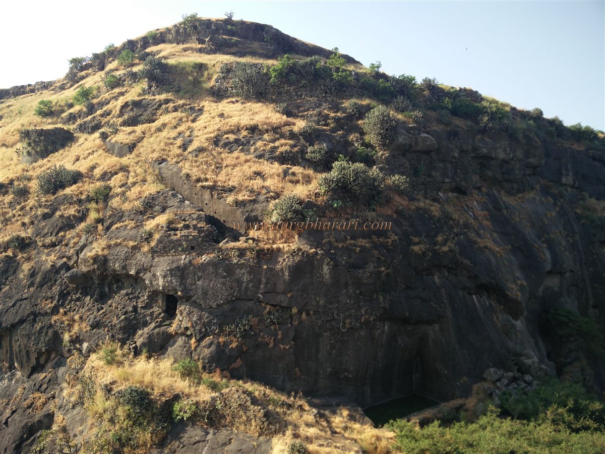
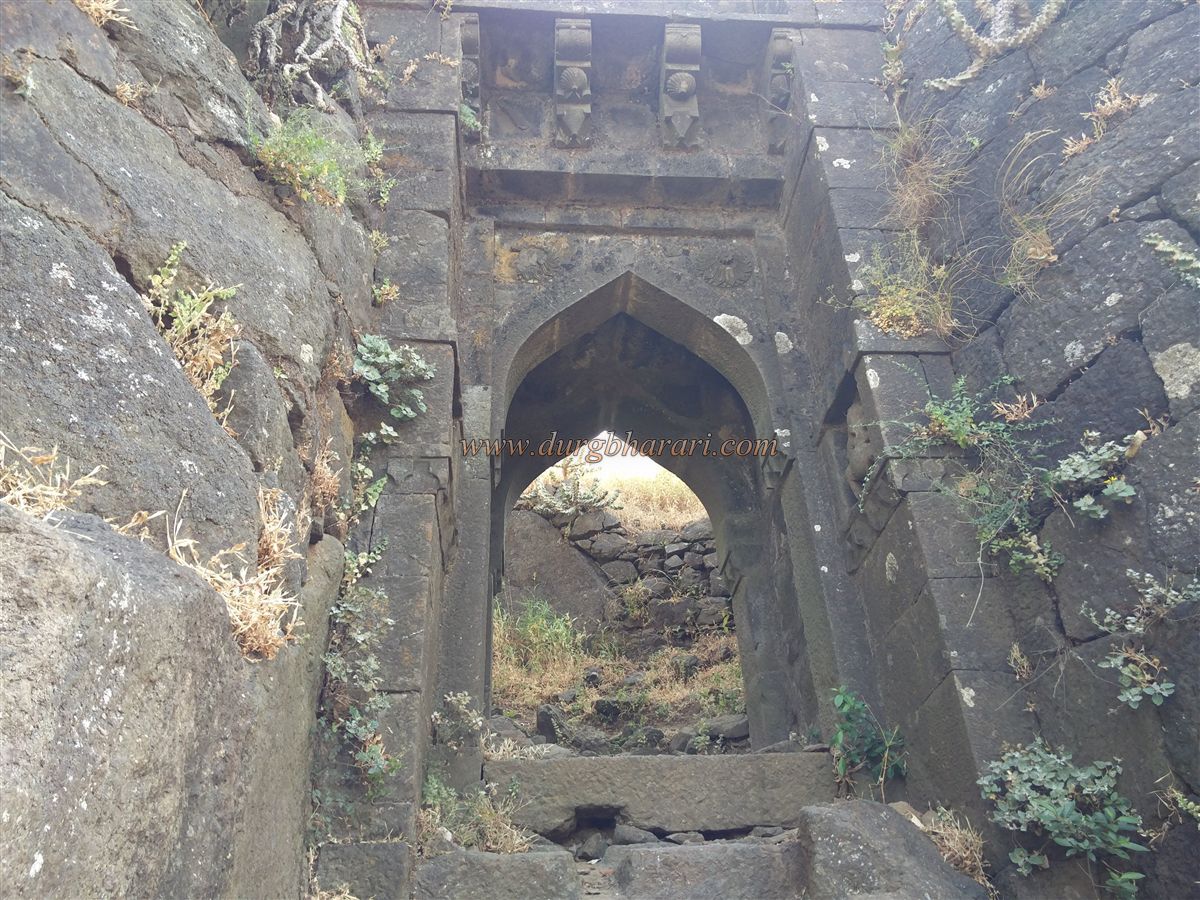
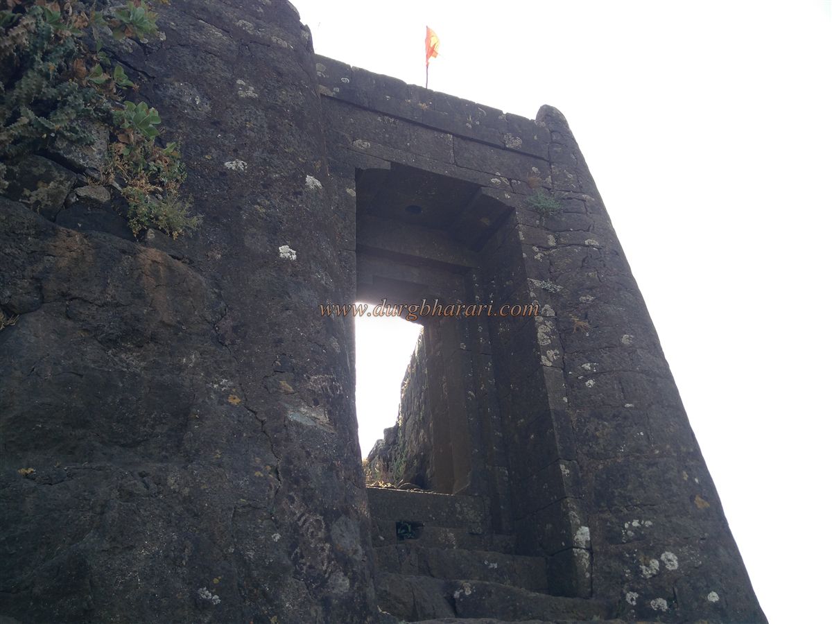
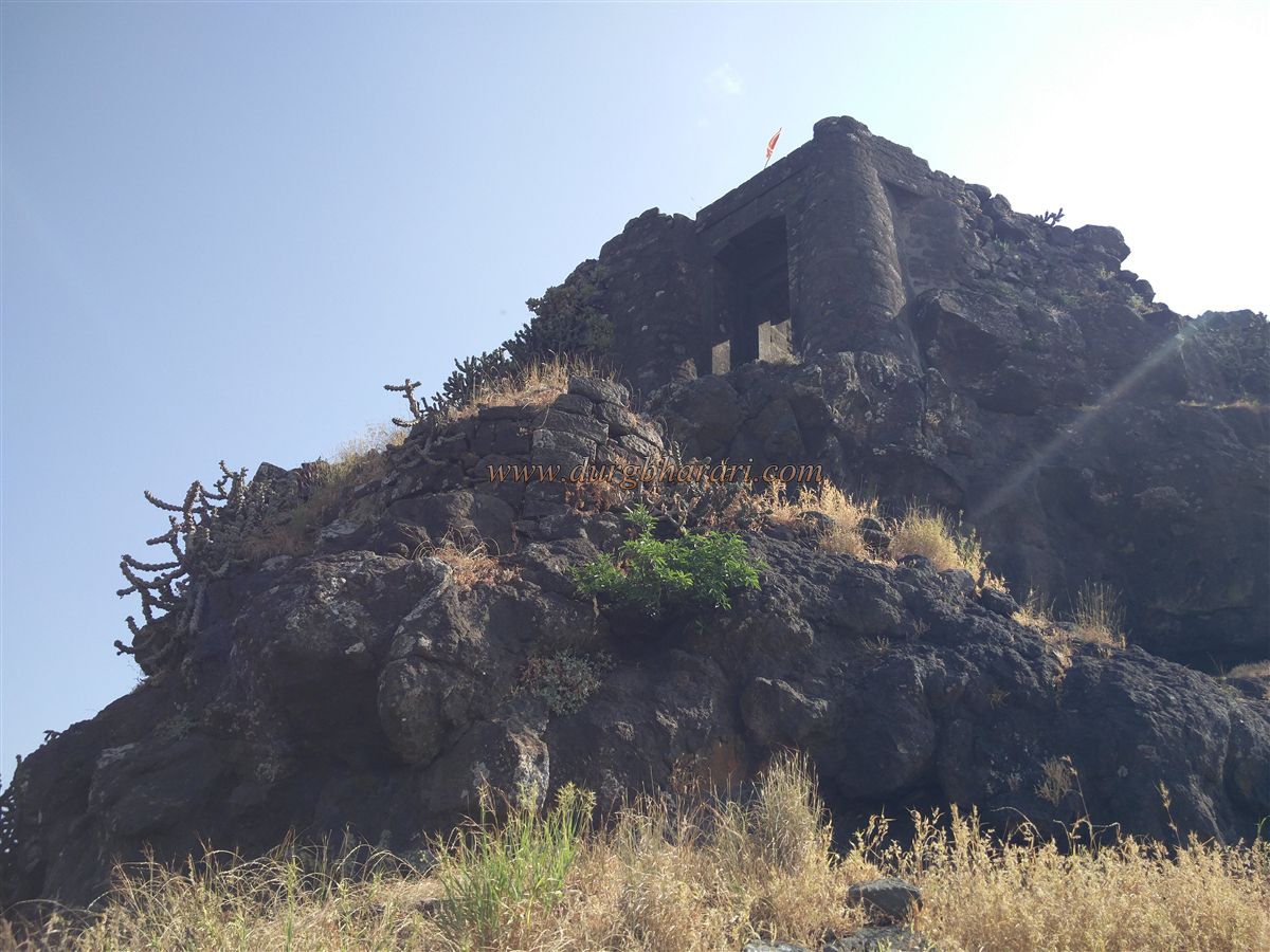
Starting the climb up Mora Fort from the left side of the wall, after carefully ascending two or three crumbling steps, you reach the first east-facing gate of the fort, accessed by broad rock-cut stairs. On the outer side of the gate, idols of Ganapati and a goddess are carved in niches, and lotus flowers are etched into the arch. The ceiling of the gate’s inner section has collapsed. Beyond the gate, a large rock-cut tank appears. Looking up from here, you can see a second east-facing gate built between two bastions on a cliff edge, with steps cut into the rock below.
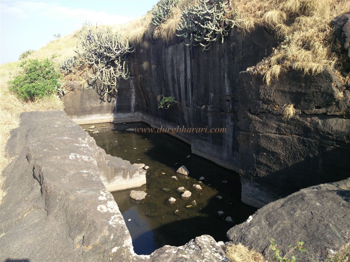
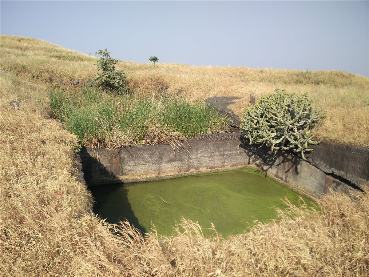
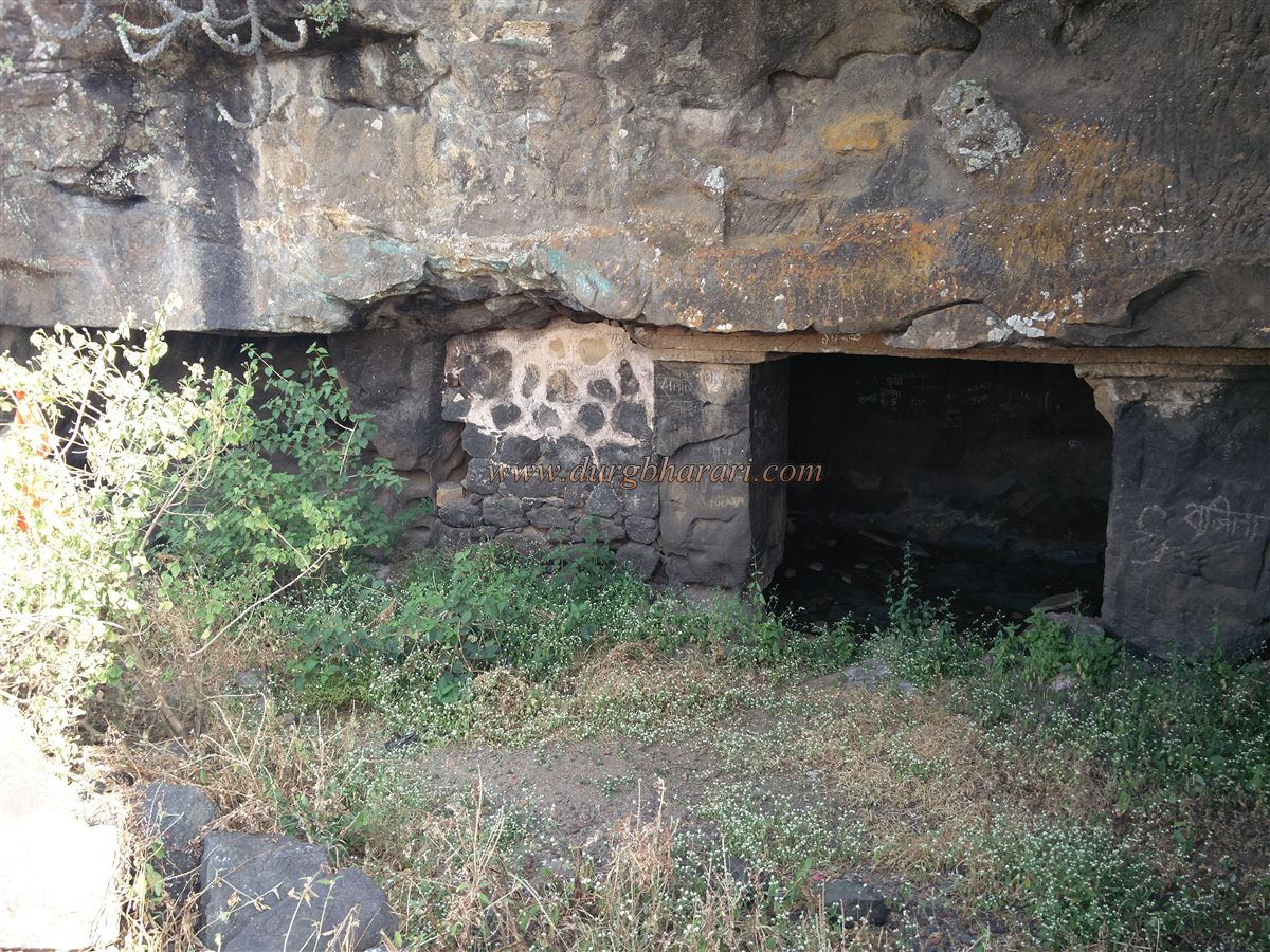
This second gate is visible throughout the climb from the base. To approach it, a path branches off to the right along the cliff. After some distance, you find a cave with three chambers and partial construction at the entrance. Returning the same way, you scale a vertical cliff to reach the fort. The fort stands at an altitude of 4,150 feet and spans about 10 acres in a northeast direction. The summit is a vast plateau. Inside the fort, to the left along the rampart, lie the ruins of a collapsed granary. Proceeding ahead, to the left, is a shallow water tank filled with grass and mud. Further along, two small rock-cut tanks appear on a flat surface—water in one is drinkable.
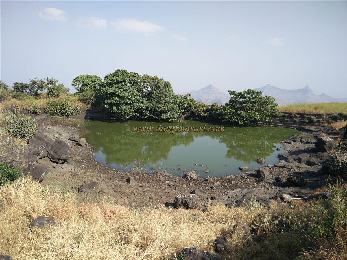
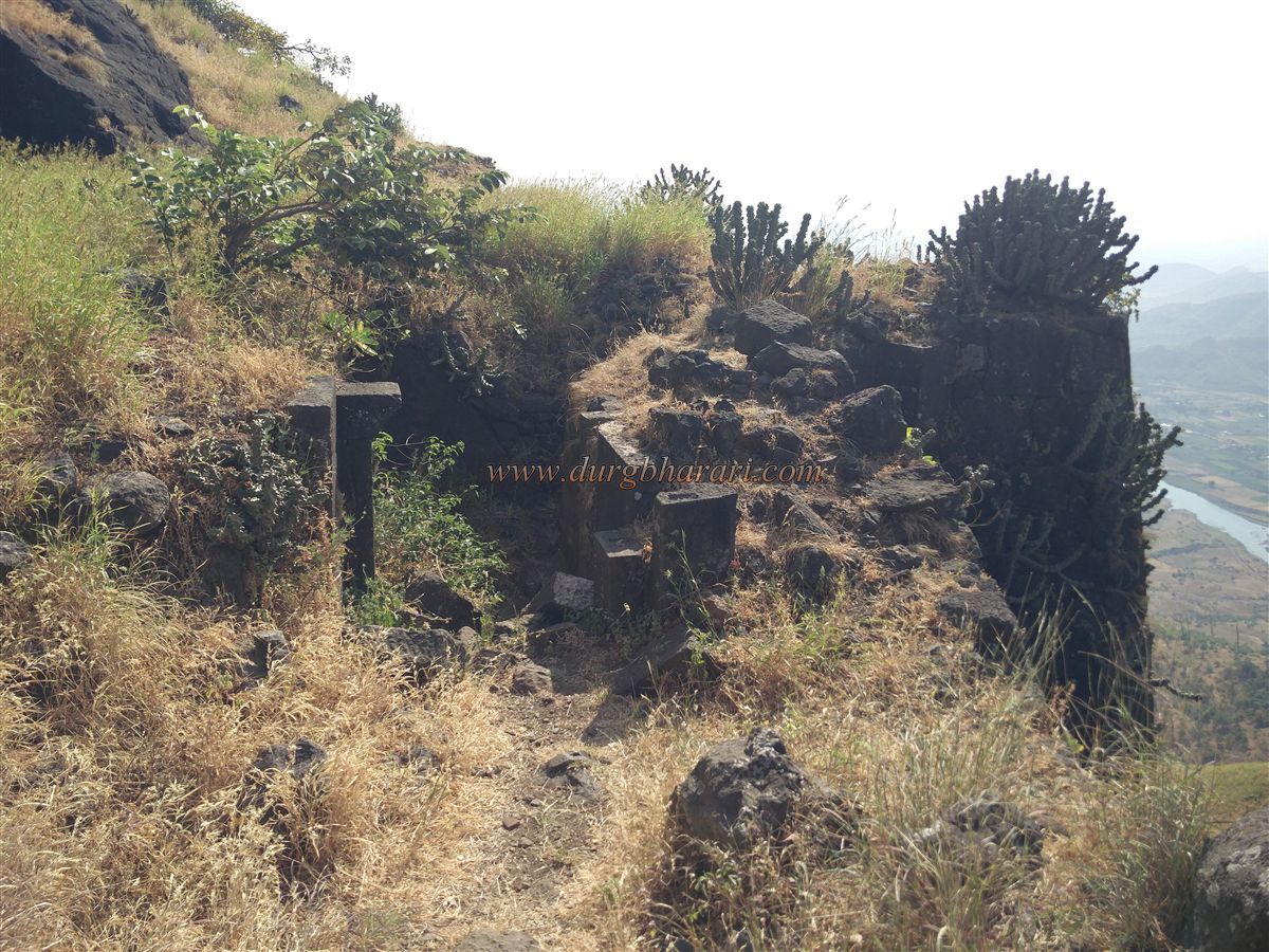
Continuing onward, to the left is another large dry tank. Past this, on a slope, lies a massive reservoir constructed with dressed stone on both sides. The water here is green and not suitable for drinking. A beautifully carved Shivling is situated on a rock inside the reservoir. Around this area, you can see numerous remains of ruined structures. At the northern edge of the fort is a bastion, possibly a sentry post. Nearby are remnants of an old trail descending from the northern ridge, though now completely lost.
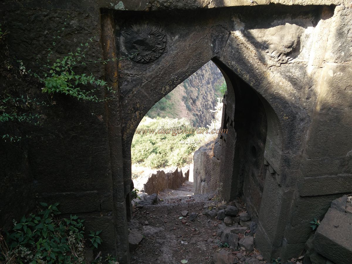
Returning from here, take the path on the other side of the plateau that leads to the second gate. At the beginning of the trail are remnants of house foundations. After passing them, you reach a large twin rock-cut tank, though the water is not potable. Further along, you reach another beautifully carved tank on the slope. This tank has the only clean and tasty water on the entire fort. A little ahead to the right are remains of a spacious mansion, possibly the citadel or commandant’s residence. Past the mansion, you arrive at the fort’s gate, completing your exploration.
From the summit of Mora Fort, one can see the expansive plateau of Mulher in full view. The remains on Mulher Fort are clearly visible from here. You can also see Mulher plateau, Mulher Fort, Hargad, Nhavigad, Mangi-Tungi, and Salher-Salota Forts. One hour is enough to explore the entire summit. From here, you can descend to the saddle and enter Mulher Fort via the small gate in the fortification, or return the way you came. Entering Mulher from this side is easier than going back down to the plateau and circling around. Though large stones have collapsed in this gate, it is still possible to squeeze through.
Since Mora Fort’s history is closely tied to that of Mulher, there is not much distinct historical record of it. In the Mahabharata, Mulher is mentioned under the name Ratnapur. It was said to be ruled by King Mayurdhwaj, and the city was known as Mayurpur, which later became corrupted into Mulher. Mulher was the capital of Baglan, and Mora and Hargad Forts were constructed by the Bagul dynasty. At that time, Mulher was a prosperous market town. A trade route from the south to Surat passed through here. During the rule of the Sultan of Gujarat, coins called Mahmudis were minted in the local mint. Also, Mulher was famous for its sword hilts.
When Mughal commander Muhammad Tahir attacked Baglan, King Bahirji ruled the region. To avoid war, he accepted the Mughal mansabdari, and the wealthy Baglan region fell under Mughal control. Along with Mulher, Mora Fort also came under Mughal rule. In 1672, Moropant Pingle incorporated both forts into Swaraj. In the early 19th century, like other forts, Mora Fort came under British control.
© Suresh Nimbalkar
GALLERY