METGHAR
TYPE : HILL FORT
DISTRICT : NASHIK
HEIGHT : 3084 FEET
GRADE : MEDIUM
Trimbakeshwar in Nashik is one of the twelve Jyotirlinga in India. During the Satavahana period, a trade route from Maharashtra to Gujarat passed through the Trimbak mountain range, and to protect this vital route, the fort of Brahmagiri was constructed on the hill behind the Jyotirlinga shrine. This hill fort is known by several names: Brahmagiri, Shrigaad, and Trimbakgad. Devotees typically refer to it as Brahmagiri, while fort enthusiasts call it Trimbakgad. However, locals residing in the region surrounding the fort refer to it by yet another name—Metghar Fort. The name Metghar is so well entrenched among the local people that one might assume it to be an entirely different fort. But in reality, Metghar is the other side of Trimbakgad. Since our route to the fort is from Metghar and the locals identify the fort by that name, we too will use the name Metghar for the purpose of this description.
...
My earlier treks to Trimbakgad from the Trimbak side had already been documented on this website long ago, so this article does not revisit that route. Instead, it focuses solely on the remains visible along the Metghar route. Between 2000 and 2014, I visited the fort multiple times via the Trimbak side and came to know of an old path from Hathimet that was no longer in use. I had heard that this trail once led to the fort, but I did not know that it contained two partially buried gateways and many remnants, nor that it was once the main royal route to the fort. At that time, I had no reason to explore it, as I had been told it was defunct.
It was not until 2020 that I first came across photographs of this route and realized I had missed a significant part of the fort. Due to the COVID pandemic, the visit had to be delayed until 2023, when I finally had the opportunity to climb the fort via the Metghar route. Up to that point, the Trimbak-side trail was believed to be the main route, but seeing the grandeur of the gateway from the Metghar side made it clear that this was in fact the ancient royal path.
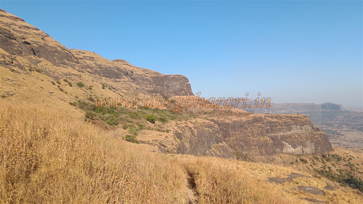
Trimbakeshwar is accessible by many transport options. There are two main paths leading to the fort: one from Hathimet, the ancient royal path that is rarely used today, and the other via Trimbakeshwar town with a stairway that is now the primary route. To take the Hathimet route, one must first reach the village of Kajole, located 32 km from Nashik bus station and 35 km from Ghoti. From Kajole, a rough road leads to Metghar (Hathimet) hamlet at the base of the fort. The road is currently in poor condition and can only be traversed by tractors or bikes. This journey takes about 30 minutes.
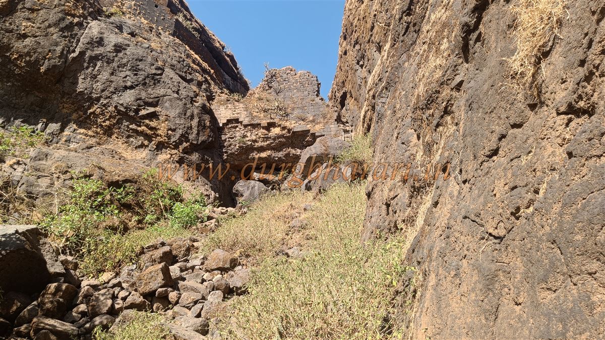
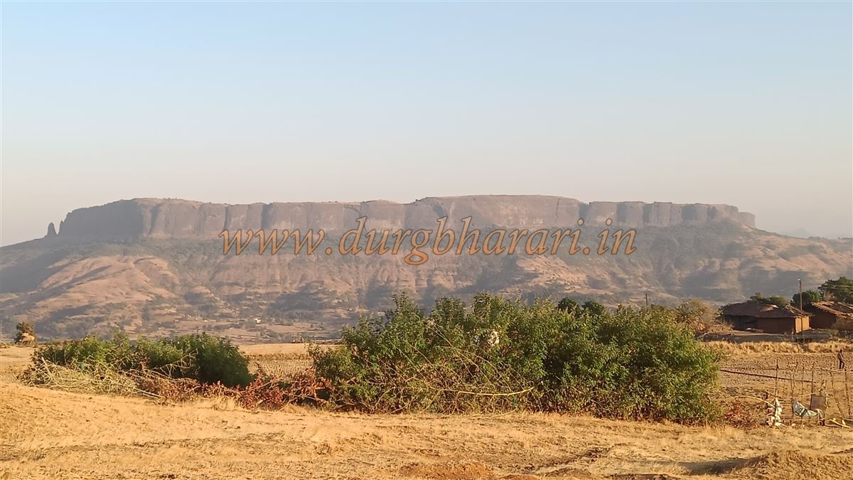
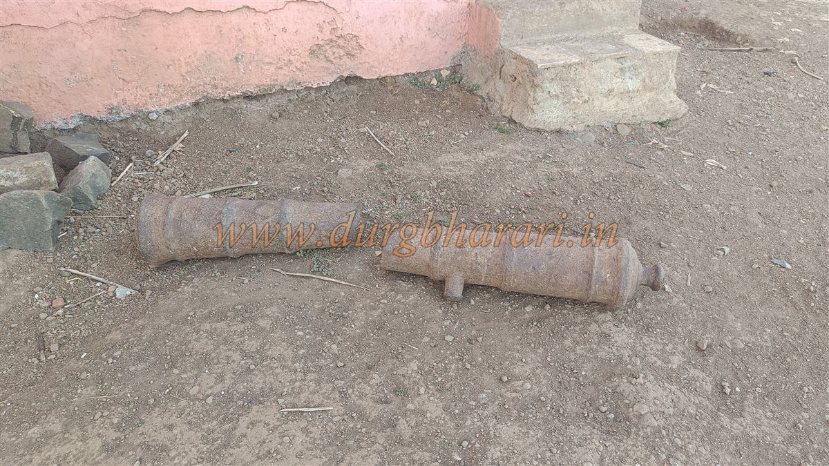
The Metghar hamlet, once a checkpoint for the fort, now consists of 25–30 small houses. Due to the relatively flat terrain at the base, farming is still practiced here, allowing this hamlet to persist. The outline of the fort seen from here resembles an elephant, which is why the place is known as Hathimet. The village has a school up to 7th grade, and within the school compound are two cannons and a stone wheel from an old lime press. A ten-minute walk from here leads to the Renuka temple situated at the base of a gorge below the fort. The temple compound contains five or six hero stones (virgal). The path to the fort begins from here, ascending through a gorge carved by flowing water.
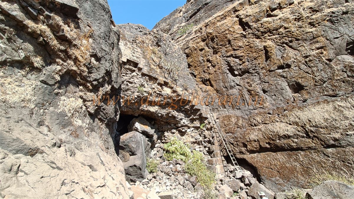
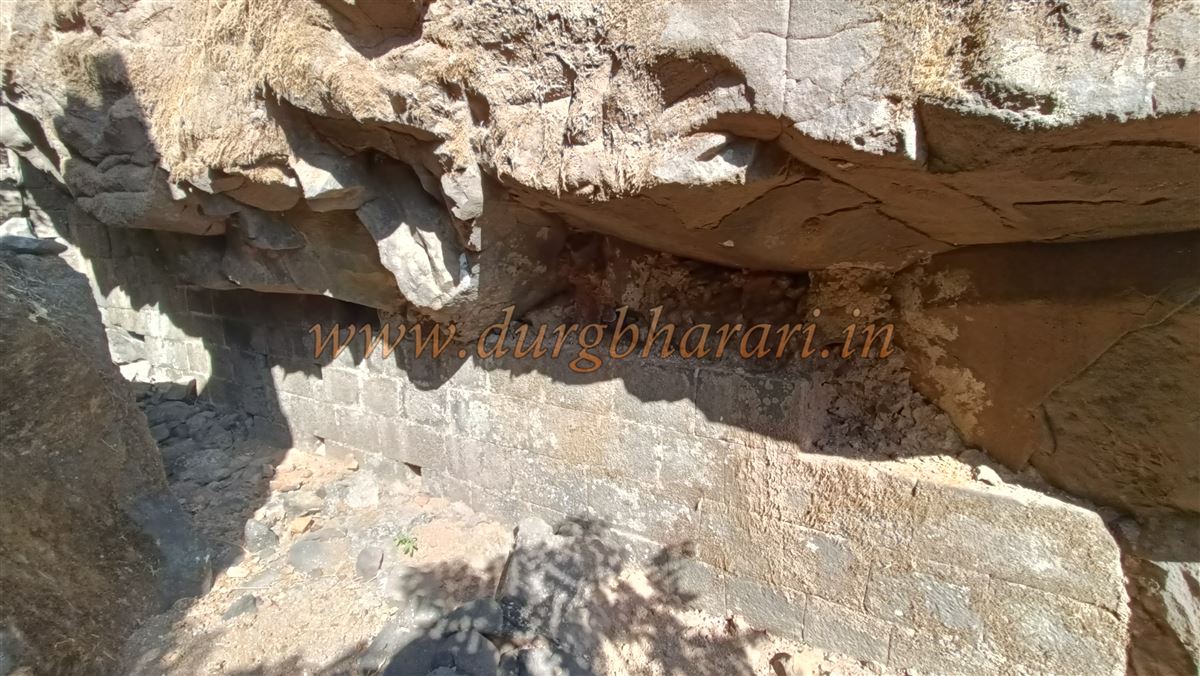
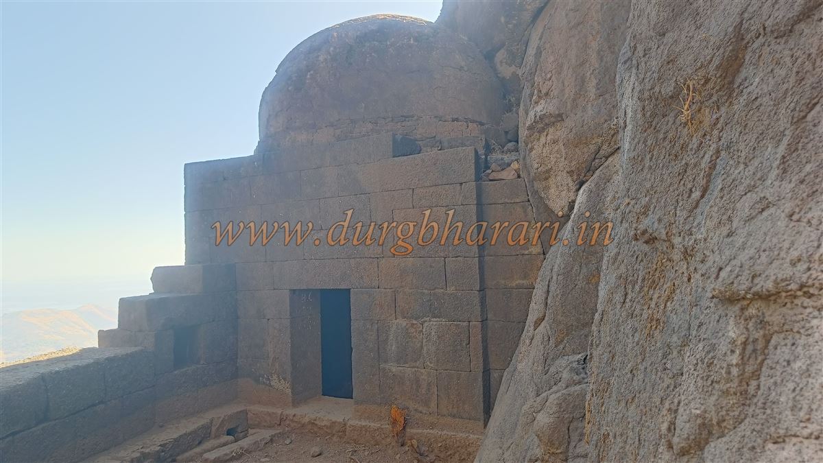
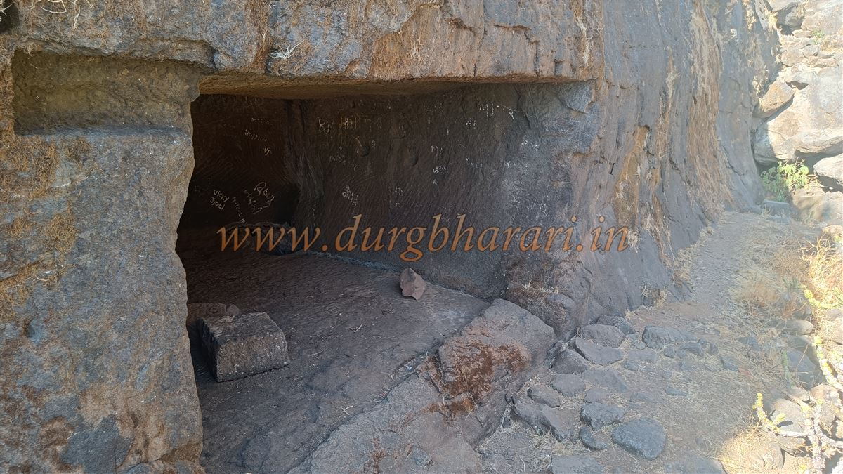
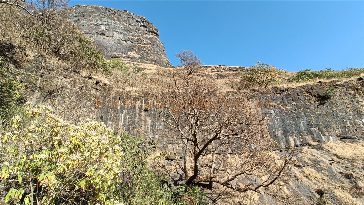
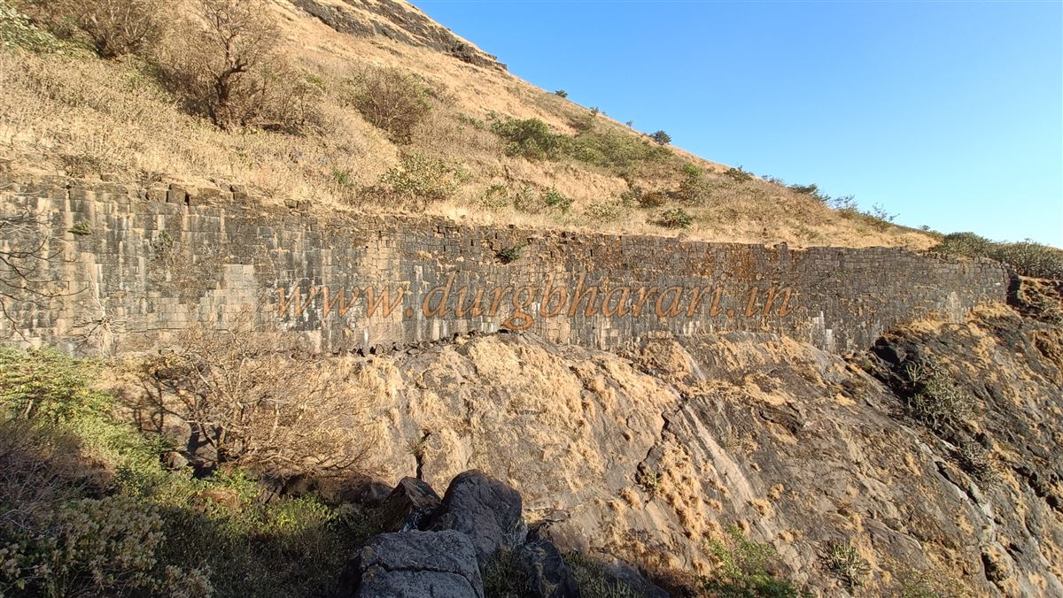
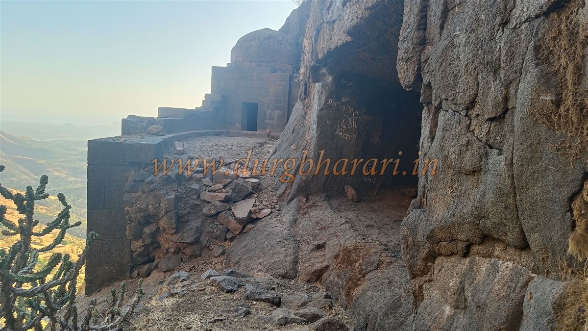
Ten minutes from the temple, one reaches the gorge where four to five rock-cut steps are visible at the entrance, though the remaining steps are buried due to landslides. Five minutes further, one reaches a 40-foot-tall stone wall. This wall was likely constructed by the British to block access to the fort. A modern iron ladder now allows access beyond this barrier. It takes about an hour and a half from the base to reach this point. Inside, the gorge floor has been built up with shaped stones, likely to dam water and make the path more difficult. On the left cliff is a rock-cut cave beside which stands a small Shiva temple enclosed within a stone wall. This appears to be part of the fort’s original construction, strategically placed for surveillance of the path.
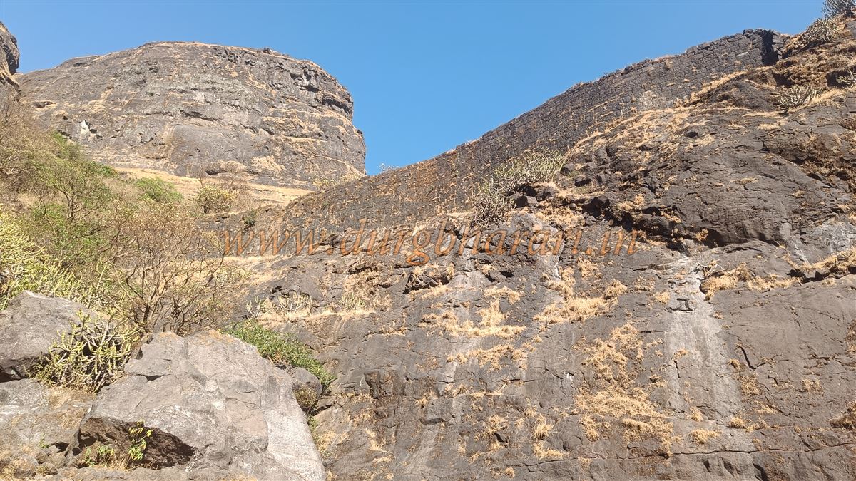
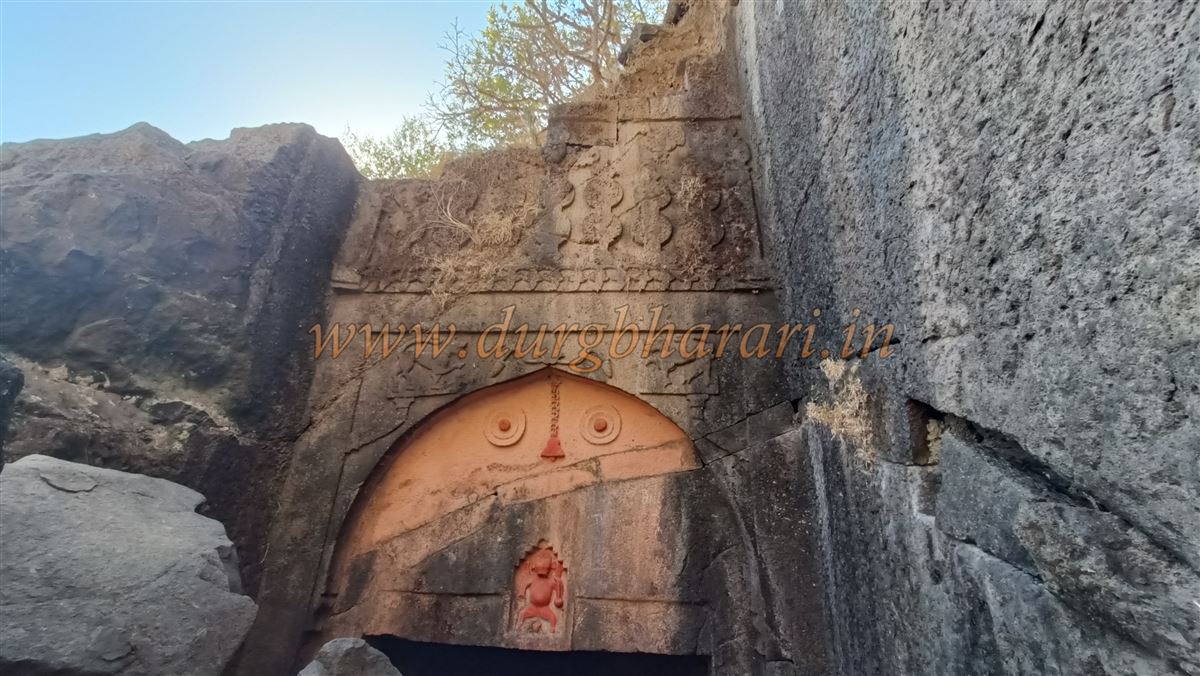
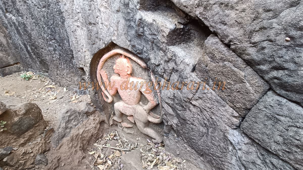
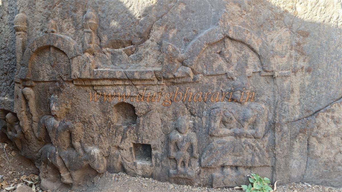
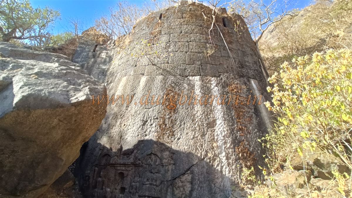
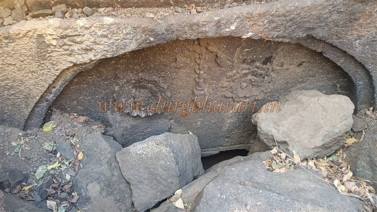
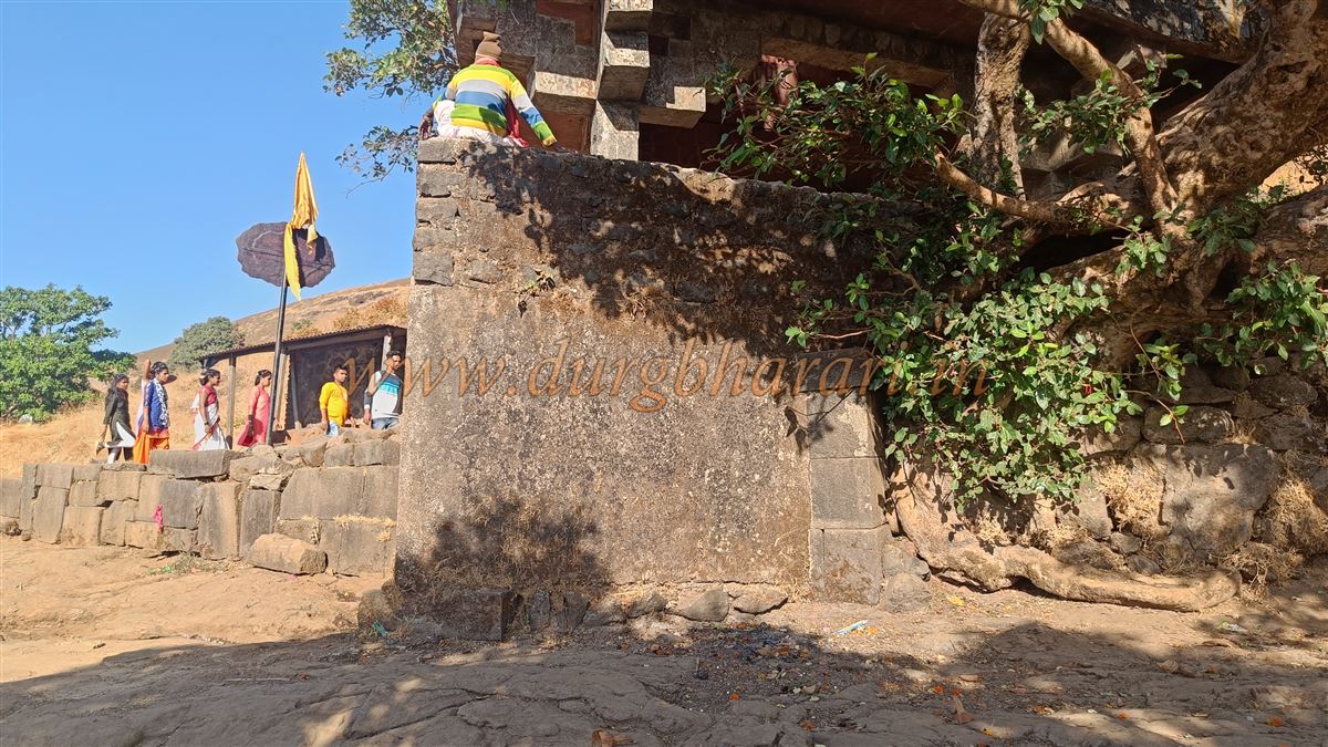
On the right side, a 20-foot-high fortified wall with several bastions extends along the edge. Climbing over the large rocks in the gorge, one eventually arrives at the buried Hathi Darwaja (Elephant Gate). Its construction clearly indicates antiquity. The gateway and its arch are fully carved into the rock, featuring decorative elements like carved demon faces, lions (Sharabh) on both sides of the arch, and lotus motifs. At the centre of the arch is a carved chain with a bell, flanked by lotus flowers and an image of Lord Ganesha. On a nearby bastion to the right is a carved image of Hanuman trampling a demon, along with several more sculptures and arches. The lower section of this bastion is built with dressed stone, while the upper part uses cut masonry.
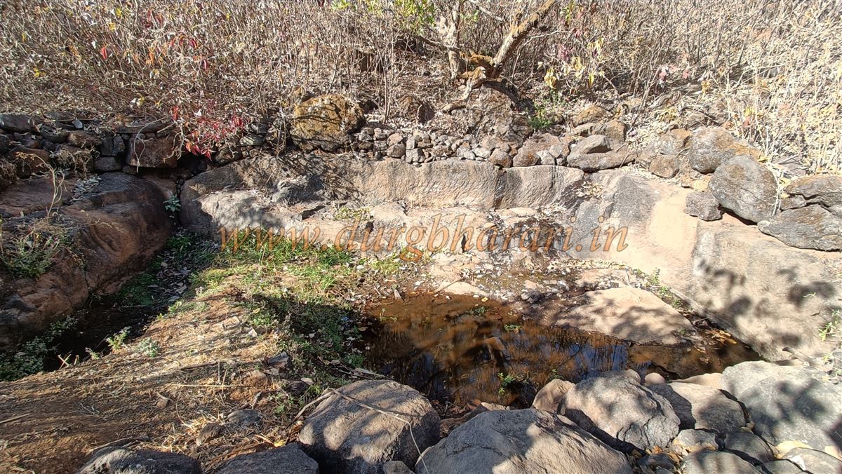
Climbing the stone next to the gate allows one to reach the upper level, where another partially buried gate can be seen. This gate also has carvings of lotus motifs and floral patterns. Both gates face west and were once the main entry points to the fort. Just beyond the second gate are the ruins of a destroyed structure. Skirting around this gate along the edge of the gorge, and walking about ten minutes in the direction of the hill spur, one finds a large rock-cut water tank. The water here is mossy and not fit for drinking. After viewing the tank, one should return to the gate and continue the exploration.
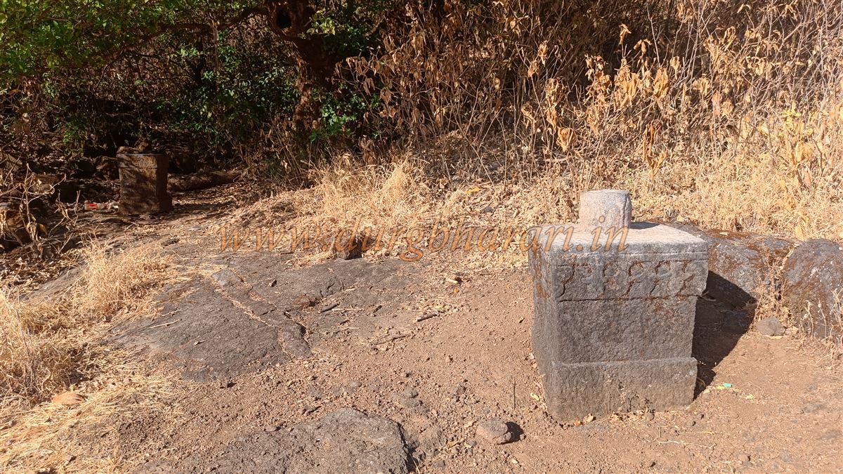
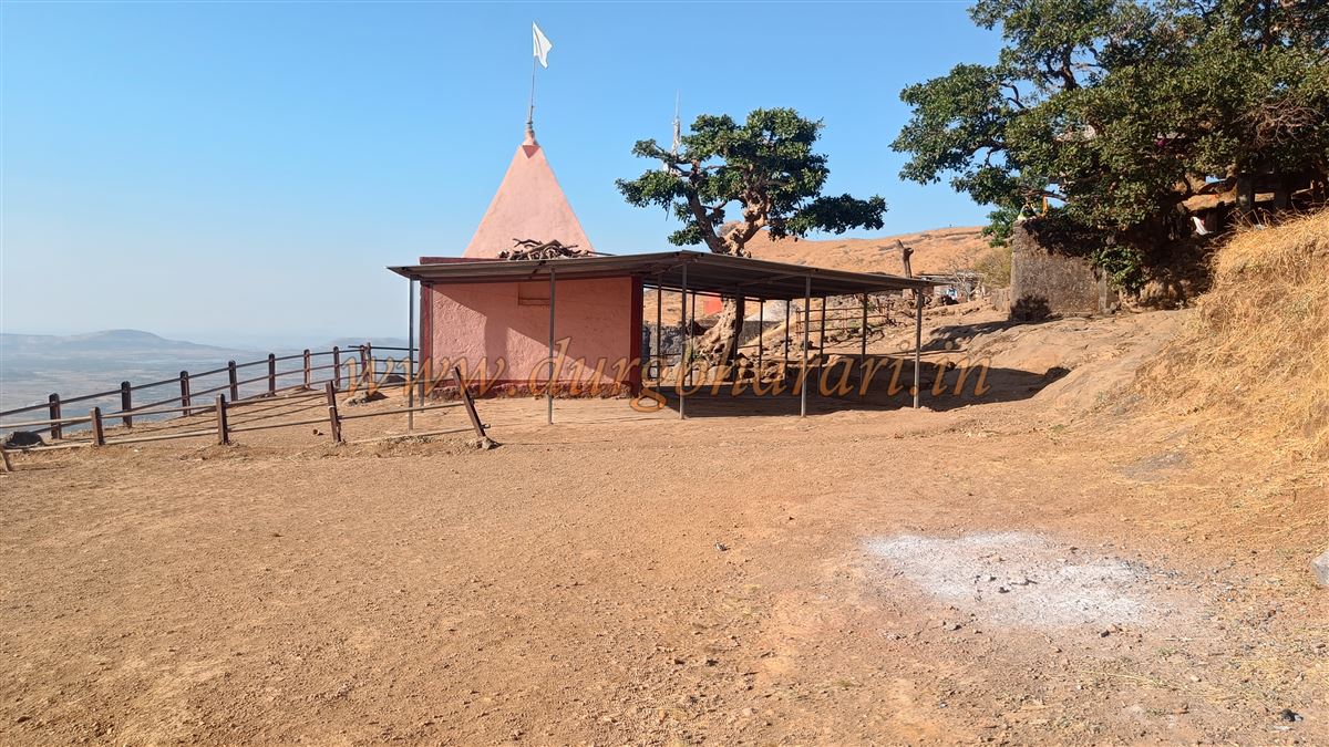
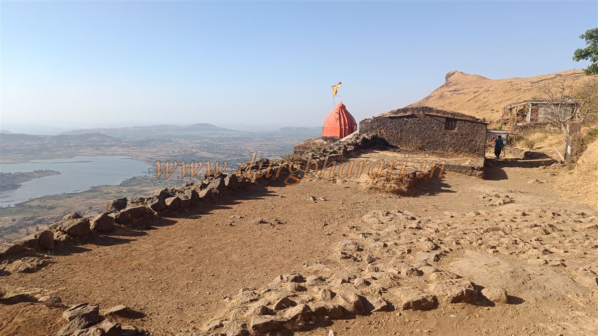
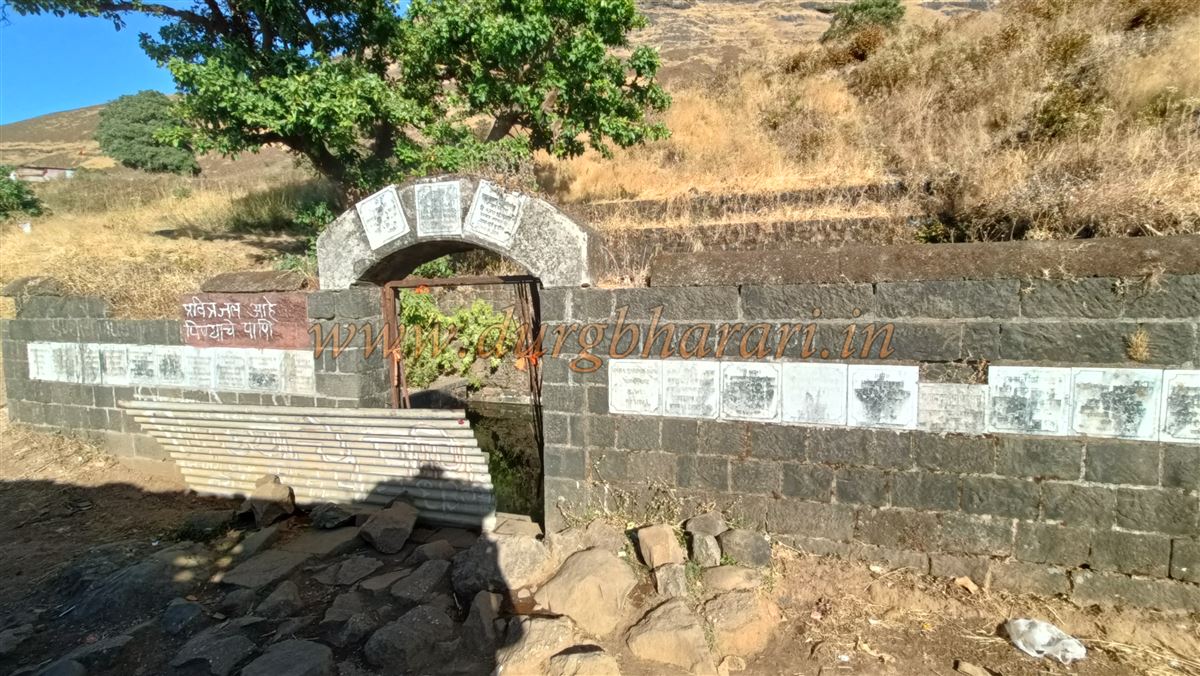
Along the trail, on the left edge of the cliff, remnants of a bastion and an old outpost can be seen. Ahead on the right, there is another rock-cut water tank, which generally holds potable water until March. Further along are two memorial stones, suggesting the presence of a small settlement on the fort. More remnants of outposts and fort walls appear frequently along the edge of the cliff. Within ten minutes, one reaches the Brahmagiri temple at the origin point of the Godavari River.
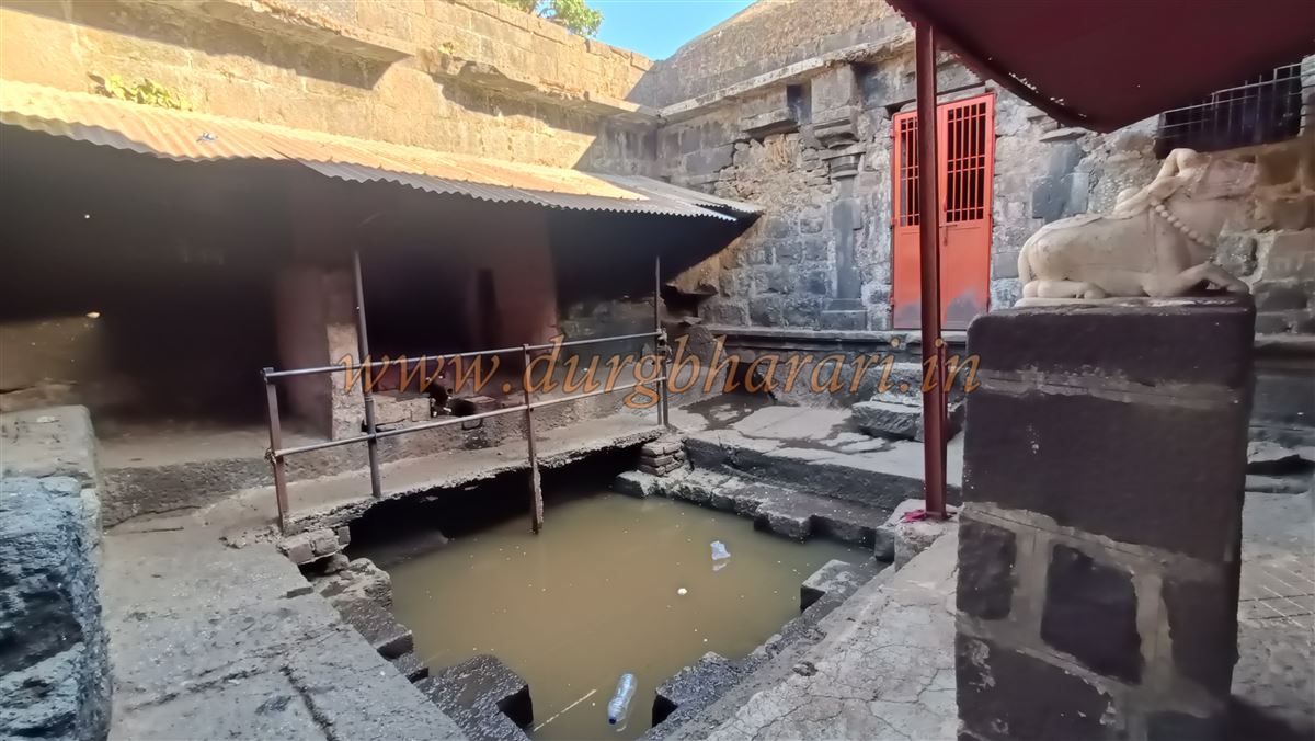
This temple is built right at the cliff's edge, with walls on all sides, a square water tank in the centre, and three shrines established in small porches around it. Above the temple are two water tanks carved into the rock, one of which is enclosed with stones and known as Gangatirth. Just above this tank is a memorial stone. Below are remains of a ruined fort wall and other structures. The route from Kushavarta Talav (pond) joins the Hathimet trail here. It takes about two hours to reach this point from the base. Further descriptions are covered in the article on Trimbakgad and are not repeated here. This concludes the Hathi Darwaja circuit.
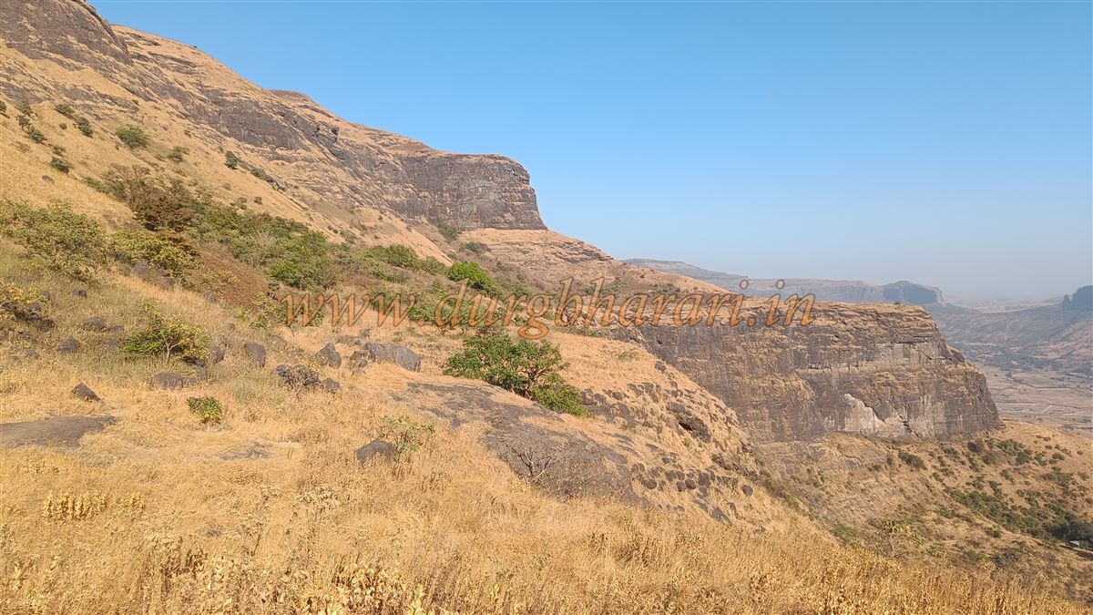
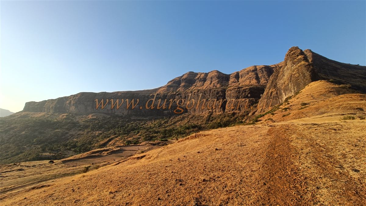
From the summit, one can see far into the distance—Anjaneri, Kavnai, Waghera, Harihar, Basgad, and Tringalwadi. The trek to Brahmagiri offers both spiritual and adventurous experiences and should be undertaken at least once.
The earliest reference to Brahmagiri Fort appears in the Puranas. Sage Gautama, seeking to absolve himself of the sin of cow slaughter, performed penance here to please Lord Shiva and requested that the sacred Ganga be brought to earth from Shiva’s matted locks. Ganga refused, so Shiva struck his locks against Brahmagiri, forcing Ganga to emerge. One legend regarding the name Brahmagiri tells of Brahma and Vishnu attempting to discover Shiva’s beginning and end. Brahma falsely claimed to have found Shiva’s head and presented a cow and ketaki flower as false witnesses. Shiva, enraged by Brahma’s deceit, cursed him so that he would not be worshipped on earth, while Brahma cursed Shiva to remain on earth in the form of a mountain—hence, Brahmagiri.
While the architectural style of Brahmagiri Fort suggests a Satavahana-era origin, recorded history begins with the Yadav period. Between 1271 and 1308 CE, King Ramdevray Yadav ruled this region. A story from the 13th century tells of Dnyaneshwar father, Vitthalpant, visiting Trimbakeshwar with his children when Nivruttinath encountered Gahininath meditating in a cave on Brahmagiri. Later, the fort came under Bahamani rule. A list from 1853 during Burhan I’s reign includes Trimbakgad among 58 forts under his control, though it later came under Mughal rule.
In 1629, Shahaji conquered the fort and surrounding region. After the fall of the Nizamshahi in 1636, Shahaji declared Murtaza, a descendant of the Nizam, as ruler and himself as vizier. But after defeat at Mahuli, the fort was handed over to Mughal general Khanjaman. In 1663, Shivaji Maharaj visited Trimbakeshwar on his return from Surat. In 1672, the fort was captured by Marathas under Moropant Pingle and Keso Trimala. In 1681, Aurangzeb’s son Akbar visited Trimbakeshwar, after which Sambhaji sheltered him in Pali, Konkan.
Around 1682, Mughal forces led by Muzaffar Khan burned three hamlets at the fort’s base. The fort's commander, Keso Trimala, supported Ramshej with a cannon. In 1683, traitor Radho Khopda failed in an attempt to betray the fort to Mughal officer Anamat Khan. In 1684, Akram Khan and Mahabat Khan raided again. Despite these efforts, the Mughals failed to capture the fort between 1682 and 1684.
In August 1688, Mughal commander Matabar Khan laid siege. In a letter to Aurangzeb, he reported blockading the fort for six months, cutting off supplies. Aurangzeb replied with encouragement. On 8 January 1689, fort officers Telangrao and Shyamraj surrendered. Matabar Khan reported that he offered promises of royal favour to get them to capitulate. Rewards and ranks were issued, and Hari Singh, son of Shyam Singh of Aundha, was placed in charge.
By 1691, officer Mukarrab Khan wrote that the new commander, Kadim Kulikhan, had died and his indebted son was unfit to manage the fort. He requested a competent replacement. On 23 September 1694, records indicate the fort was again captured by Mughal commander Ghazi Uddin Bahadur, suggesting the Marathas had briefly regained control.
On 9 December 1704, Commander Mohammad Hussein sent pineapples to Aurangzeb from the fort. In 1716, Shahu Maharaj requested the fort from the Mughals, but the demand was denied. In 1720, the fort passed to the Nizam of Hyderabad. In 1751, Nanasaheb Peshwa brought the fort back into Swaraj with the help of Trimbak Surya Prabhu and Naro Damodar Joglekar. It remained under Peshwa control until 1817.
Between 22 and 24 April, the British heavily bombarded Hathimet Gate, causing extensive damage. At the time, the fort housed 550 soldiers and 25 cannons. In the three-day battle, 13 British and 9 local soldiers were killed, including two officers. The British captured the fort and allowed 528 soldiers to leave. Two months later, Trimbakji Dengle attempted to recapture the fort but failed. During the 1857 rebellion, Bhil and Thakar tribes looted the treasury here. Vasudev Bhagwant Joglekar was executed for allegedly inciting them.
© Suresh Nimbalkar
GALLERY