MARKANDYA
TYPE : HILL FORT
DISTRICT : NASHIK
HEIGHT : 4130 FEET
GRADE : MEDIUM
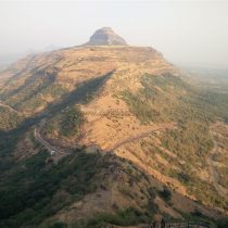
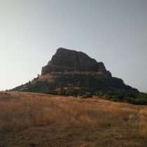
Some of the forts in Maharashtra not only have historical but also spiritual heritage. Markandya fort in Kalvan taluka of Nashik district is surrounded by many forts in the Satmal mountain range. The hill of Markandeya fort is situated in the middle of the forts near Saptashrungi and Ravalya-Javlya. Although Pimpri Markand is a village at the foot of the fort, Babapur is very close to the fort. On the road from Babapur to Kalvan, there is a road leading from Babapur gorge to the fort. Apart from this, one can reach the gorge under the citadel of Markandeya fort by crossing another gorge from the Saptashrungi fort. The distance from Nashik to Babapur gorge via Wani is 53 km and the distance from Wani to the fort is 9 km. If you come to this gorge via Wani from Babapur, the left path leads to Markandeya fort and the right path leads to the lower plateau near Ravalya-Javlya.
...
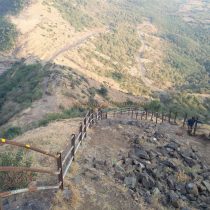
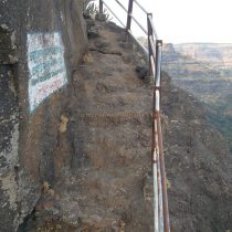
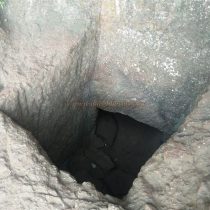
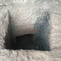
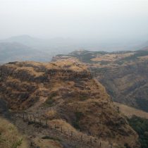
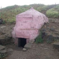
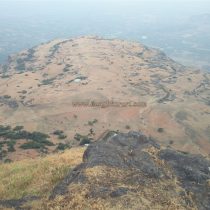
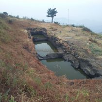
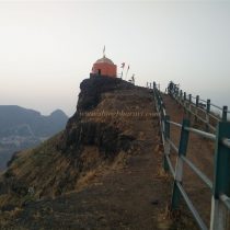
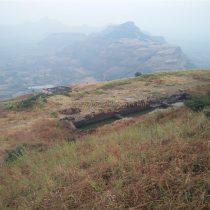
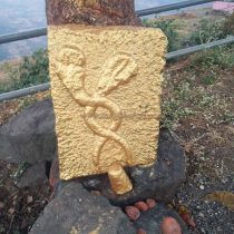
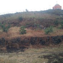
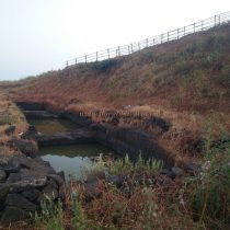
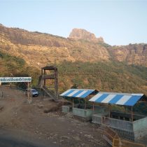
The forest department has set up a tourist shelter in the gorge and provided parking facilities. The Forest Department has declared Markandya Fort as a tourist destination and has done a lot of work for the development of the tourist spot. The path leading to the fort is made entirely of steps and stones, and the path on the ridge is paved with iron bars, and an iron ladder is erected on the difficult stage of the path. So even if it is easy to get to the fort, you have to be prepared to walk and climb. After starting to climb the fort from the gorge, we reach the plateau below the fort, i.e. the fort's machi, by climbing the steep hill and crossing the iron ladder at the end of the road in half an hour. As you climb the stairs, you can see the remaining ramparts of the fort in this area. The fort is spread over an area of 265 acres from north to south. Due to the natural protection from the plateau, the fort is sparsely fortified in some places. At present, some Saints are living on this machi and it is possible to stay in their ashram but we have to arrange the meal ourselves. Drinking water is available all year round at Ramkund on Machi. Apart from these cisterns and sparse ramparts, no other remains can be seen on Machi. When you look at the front from the plateau, you can see a newly built temple under the right side of the fort. The path to the fort goes up from this temple. On the way to the fort from the backside of the ashram on Machi, there are some steps built out of stone. This path takes a ten-minute climb to reach the temple seen from Machi. There is an original path leading to the citadel from the left side of the newly built Mahakali temple, but this path is steep and has collapsed in some places, creating a new path to reach the fort on the right side of the temple. As you approach this path, you will see steps carved into the rock. Further along, this path on the left is two small caves carved at ground level. These caves are not visible until you get very close. Only one person can crawl into this cave at a time. The path inside the cave on the right goes straight and turns to the left, while the cave on the left goes straight and turns to the left as well as to the right. These caves may have been connected on the inside but it is difficult to guess that as there are rocks inside these caves at present. These caves are known as meditation caves. In the next part of the road, the old road coming from the temple meets here. Here you can see the base of the collapsed bastion on the hill on the right side. From here, we climb the steep hill to reach the citadel and the adjoining hill. Saptashringigad is only at a short distance from here. This fortified fort remains today only as a remnant. The path leading to the right from the gorge goes up the hill, the path on the left leads to the citadel and the path descending straight leads to Saptashrungi fort. There are no remnants left on the hill on the right. From here, on the left side, there are three stages to reach the head by the path carved in the rock. At the beginning of the road, near the bastion towards Babapur, one can see a quadrangle structure of a building. From here, you can see the ruined west-facing gate of the fort and the adjoining bastion and ramparts. On the first stage of the fort, there is a carved cistern called Kamandalu Tirtha under a dome. Currently, these cisterns are filled with silt, and drinking water is available only during the rainy season. On the right side of the dome is a water cistern carved in the rock at some distance and on the left side is a carved stone and a newly built ashram. At the second stage of the journey, you can see three cisterns carved in the rock filled with mossy water. Next to them is another dry cistern. In front of this cistern, you can see a cobra sculpture under the tree. In the third phase of the road, which is the highest point of the fort, there is a temple of Markandeshwar. The temple has idols of Markandey sage, Shivling, and Nandi outside the temple. The height of the fort is 4130 feet above sea level and the top of the fort is spread over an area of 5 acres. From the top of the fort, Saptashringigad, Achala, Ahivant forts can be seen to the west and Ravalya-Javlya to the east, and Kanhergad, Mohandar, Dhodap, Kanchana, Koldher, Rajdher, Indrai, and the entire Satmal mountain range can be seen from Markandeya fort. After reaching the plateau from the citadel, your fort round is complete. One hour is enough to walk around the citadel from the plateau. According to the eighth-century copperplate, this fort was in the possession of King Govind III and was known as Mayurkhandi. Then in 1635-36, Shah Jahan sent three chiefs, Khanduran, Khanjaman, and Dilerkhan, to overthrow the Nizamshahi kings. Diller Khan was responsible for taking control of the forts in the Nashik-Trimbak area. In 1636, Alavardikhan, a chief under Dillerkhan, conquered all the forts in the area. You can see the Persian inscription about this on Indrai fort. After the battle of Wani-Dindori, Shivaji Maharaj annexed the forts in this area to the Swarajya which included the Markandeya fort. According to sabhasad Bakhar, the siege of these forts laid by Diller Khan in 1671 was broken by the army sent by Moropant. Mahabatkhan, however, conquered the fort. During the Peshwa period, the fort was re-incorporated into the Swarajya.
© Suresh Nimbalkar

