MANRANJAN
TYPE : HILL FORT
DISTRICT : PUNE
HEIGHT : 2560 FEET
GRADE : MEDIUM
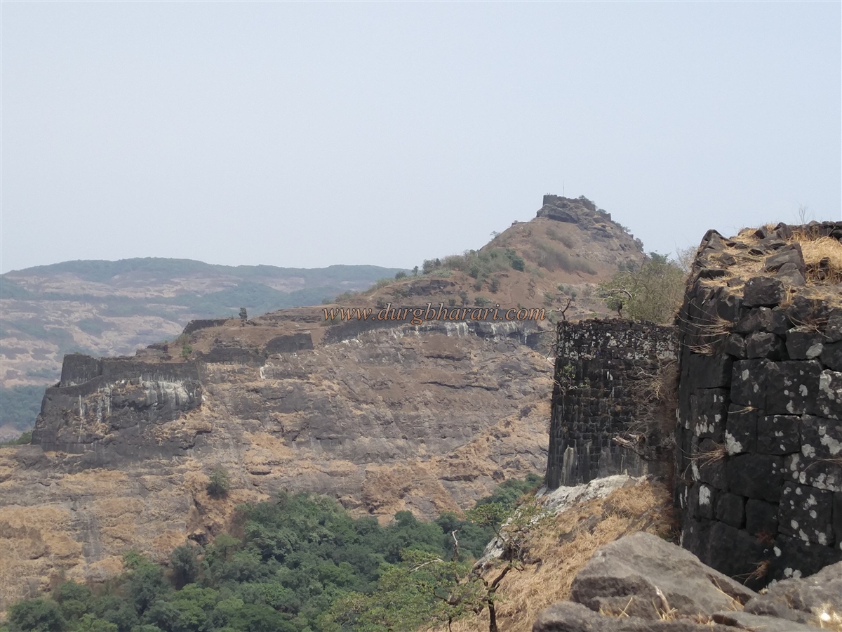
Trekkers must first note that Rajmachi is a single fort whose plateau contains two independent citadels—Manaranjan and Shrivardhan. Rajmachi is the only fort in Maharashtra with two such citadels. The fort complex is vast, and the remains are extensive. To do justice to a visit to this naturally beautiful fort, it is best to divide it into three parts:
1. The plateau area, referred to as Rajmachi.
2. Shrivardhan Citadel.
3. Manaranjan Citadel.
Here, we will explore Manaranjan Citadel. The Ulhas River, along whose banks Ulhasnagar town is situated, originates on Rajmachi Fort, about 15 km northwest of Lonavala. Situated on an ancient trade route, the fort is surrounded by dense forests. Rajmachi stands at an elevation of about 2,700 feet above sea level.
...
There are two routes to Manaranjan Fort. The first is from Karjat to Kondiwade village by bus or rickshaw. From Kondiwade, a footpath via Kharavandi leads to the fort, reaching Udhewadi village in about three hours. The second route is from Lonavala via Tungarli to Udhewadi, about 15 km in total, taking roughly five hours. On the Pune–Mumbai highway, when traveling from Lonavala to Khopoli and entering the Khandala Ghat, there is a Rajmachi Point. From here, one can see the twin peaks of Rajmachi.
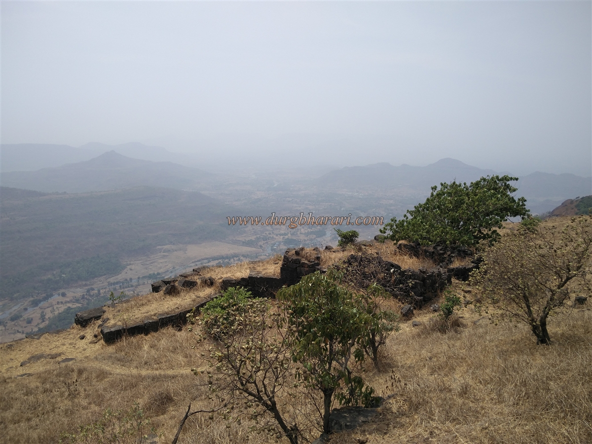
To the east and south of Rajmachi lies a deep valley called “Kataldara.” The hill to the west of this valley is known as Bhairav Hill. From Udhewadi, a path between the Shrivardhan and Manaranjan citadels passes caves carved into rock on the left, and in the valley below lies the Bhairavnath Temple. In front of the temple are three lamp towers and a statue of Goddess Lakshmi. From here, a simple path to the left leads to Manaranjan Fort’s east-facing entrance, reached in about half an hour.
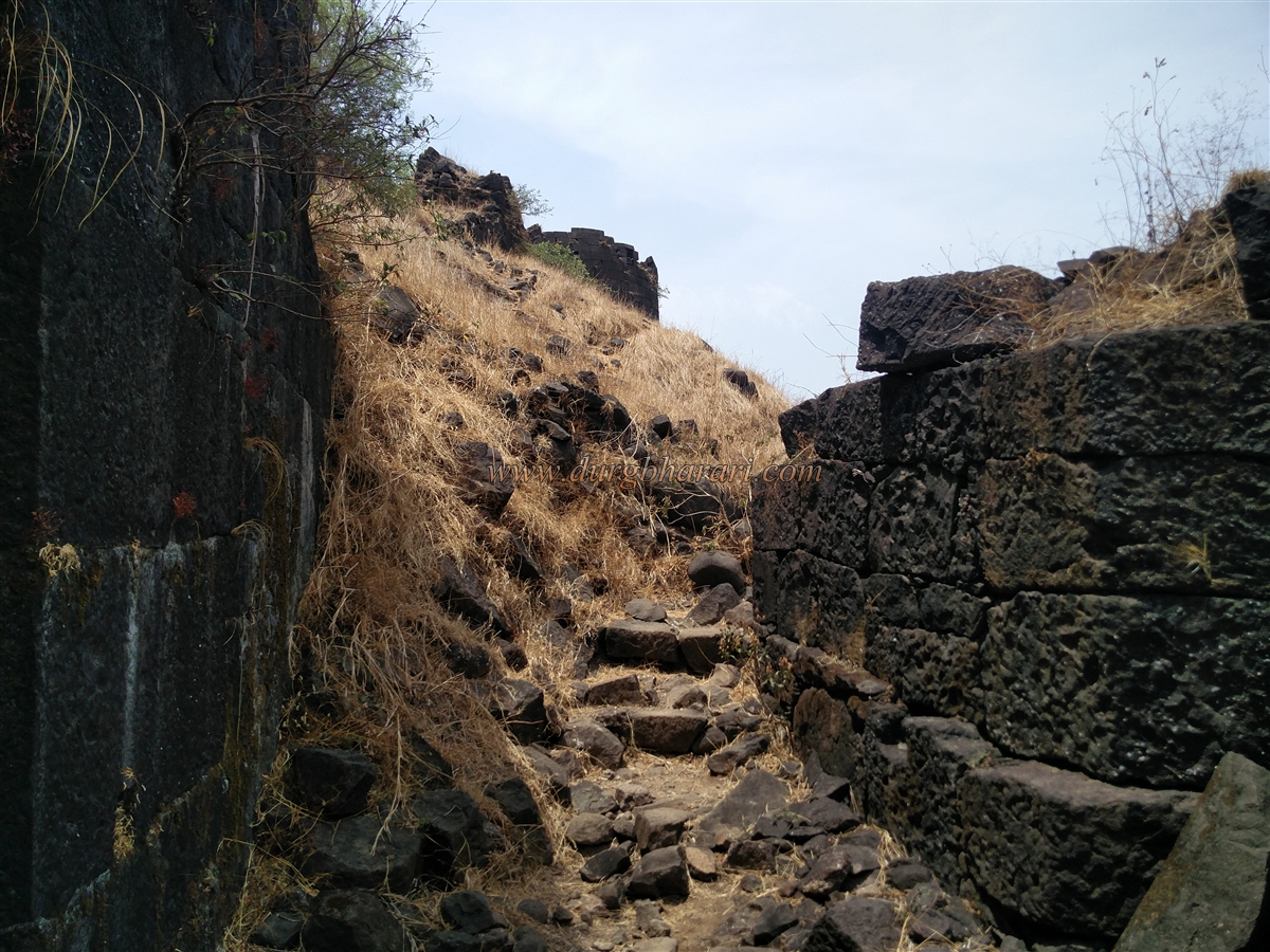
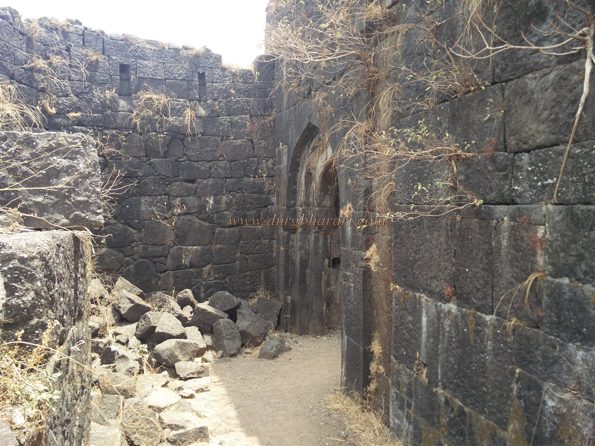
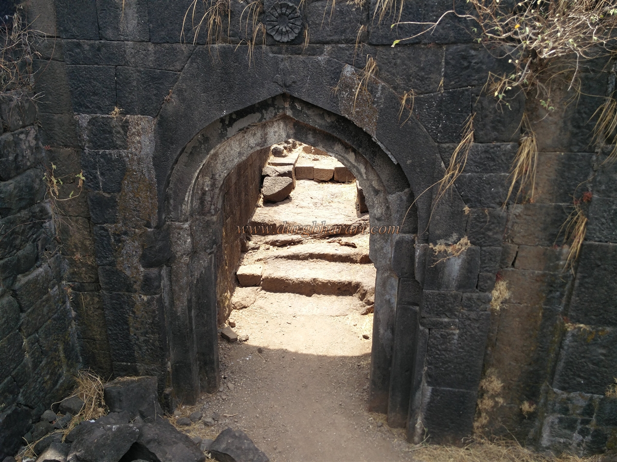
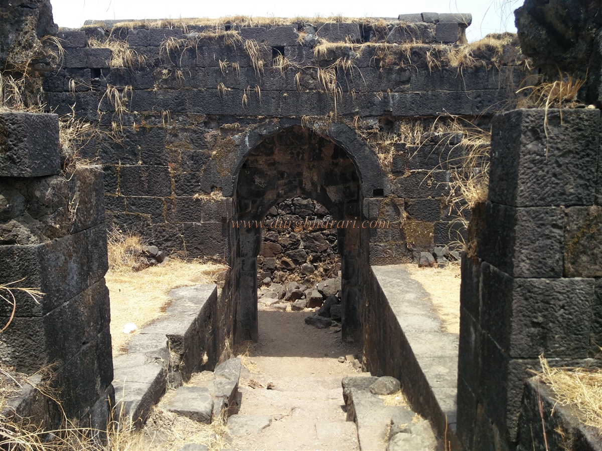
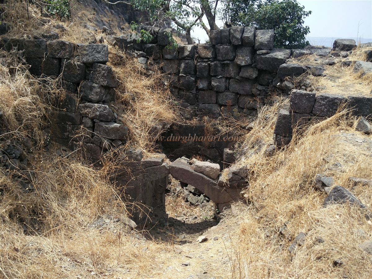
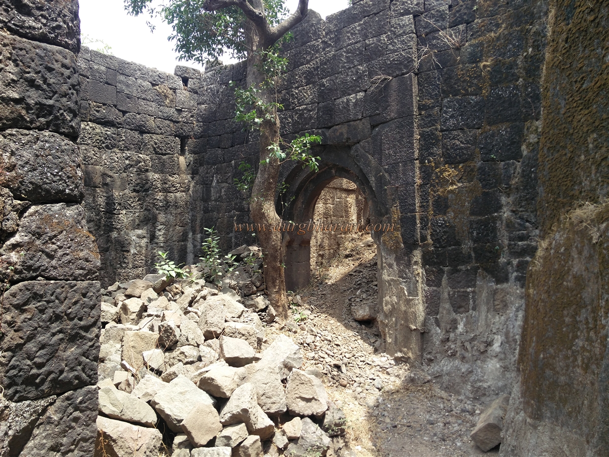
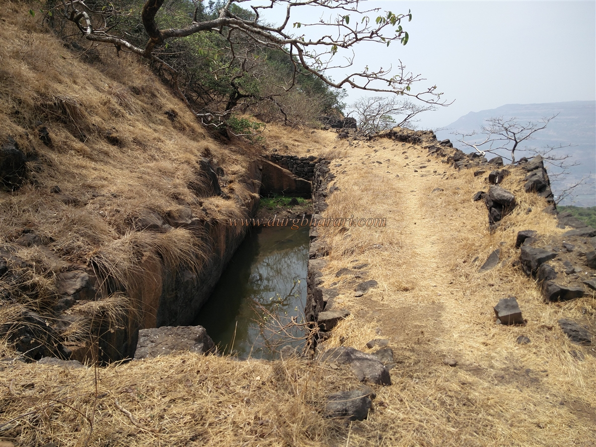
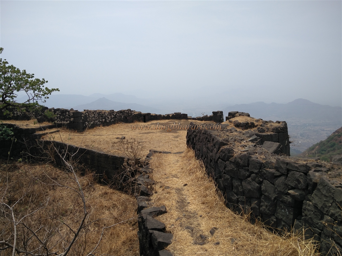
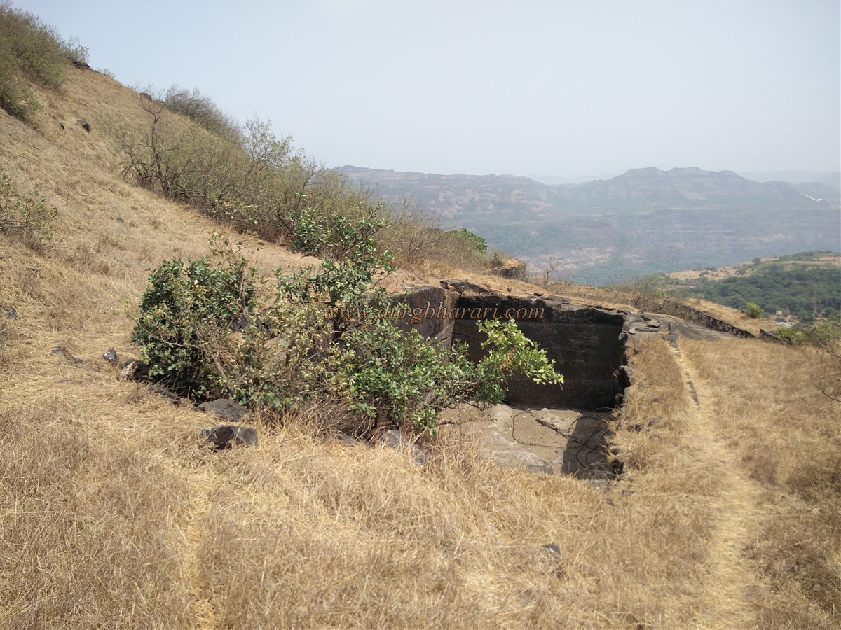
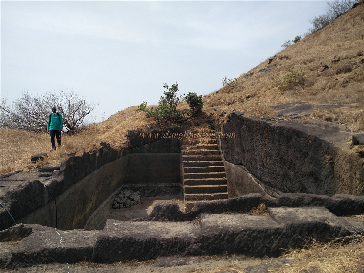
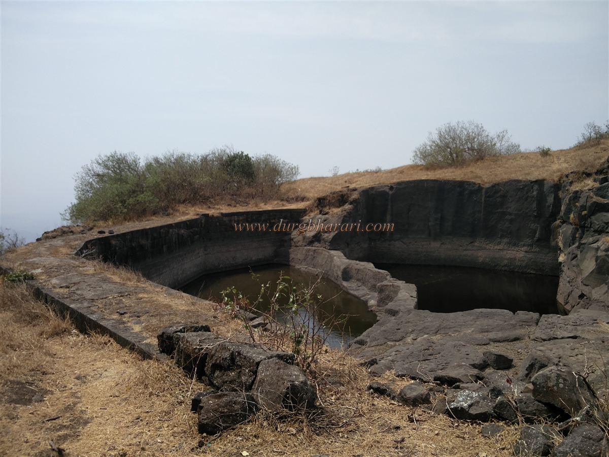
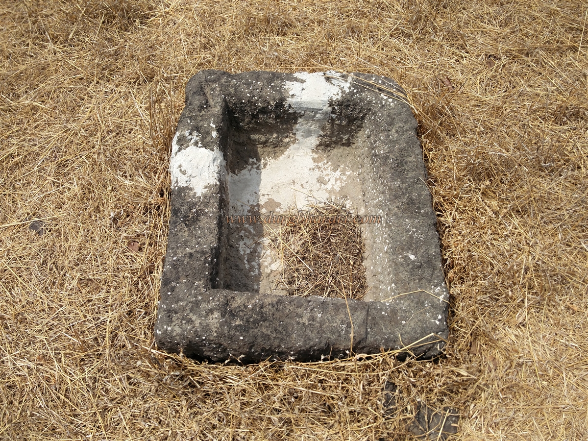
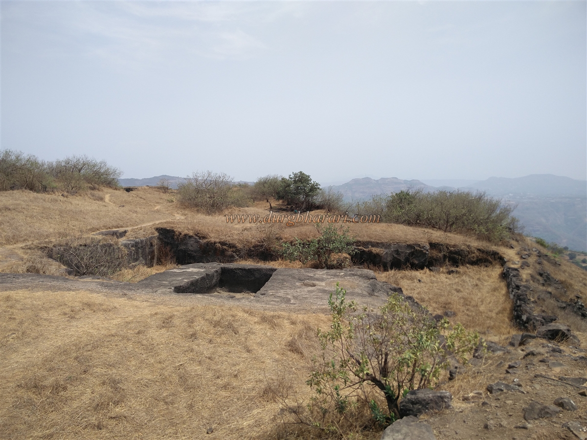
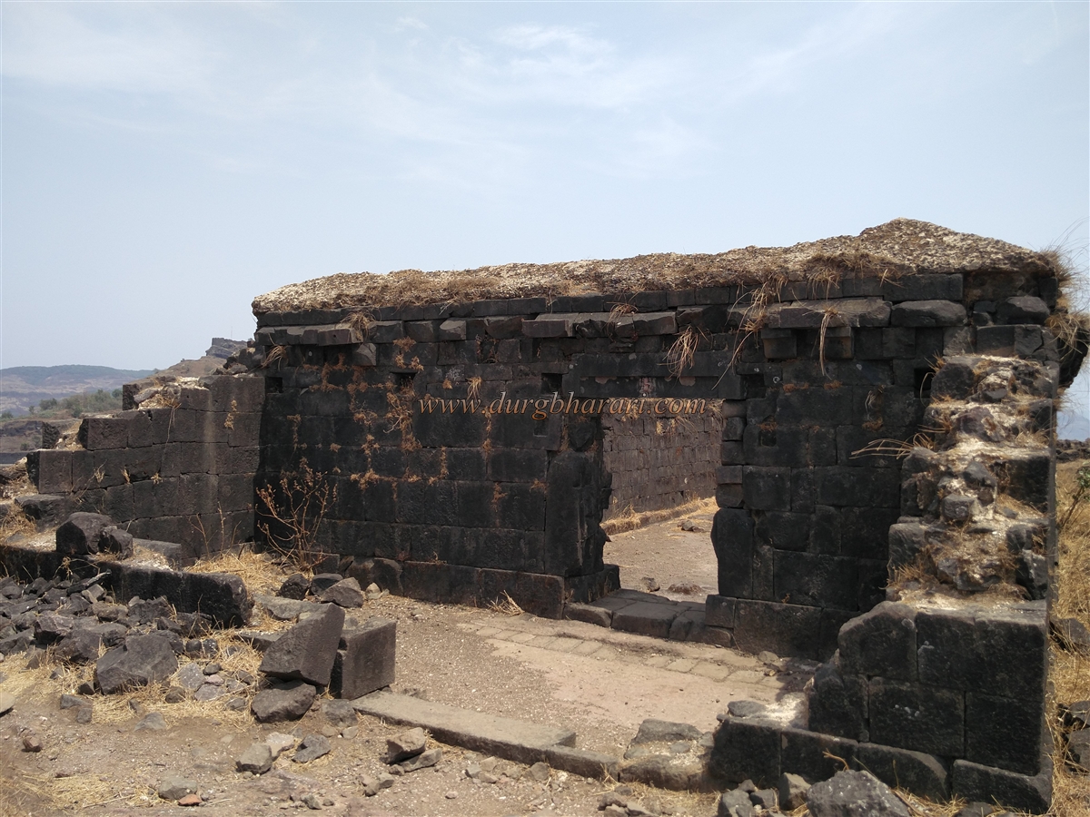
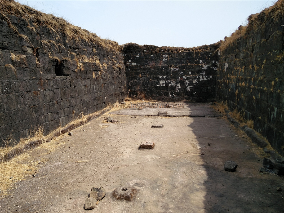
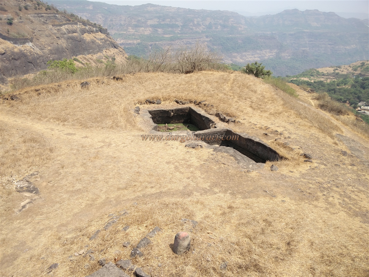
The approach has a defensive layout, with three successive gateways before entry. Additionally, on the northern side of the fort there is another gate with a pair of gateways, one of which is more than half-buried in soil. The defensive architecture of both Manaranjan’s gates is noteworthy. Inside, there is a large plateau with two big reservoirs, 8–10 water cisterns, an ammunition store, the ruins of the fort commander’s mansion, and the main hall (Sadar).
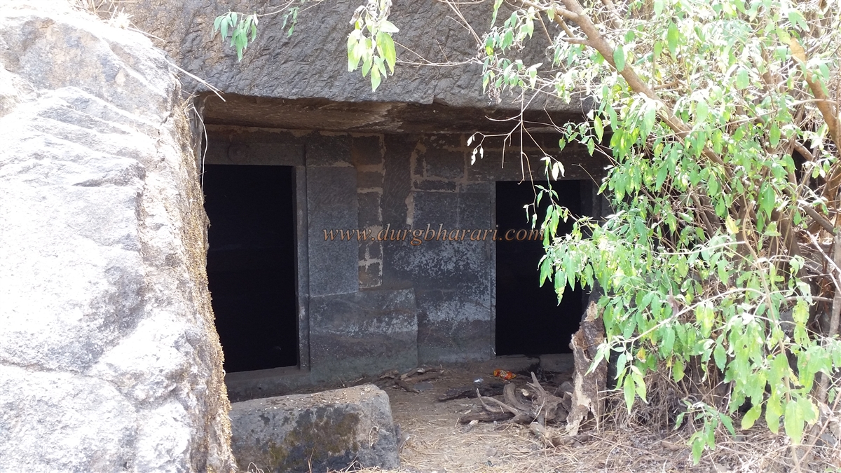
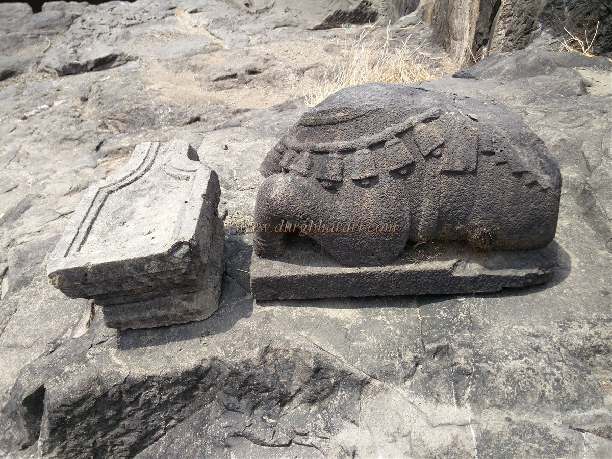
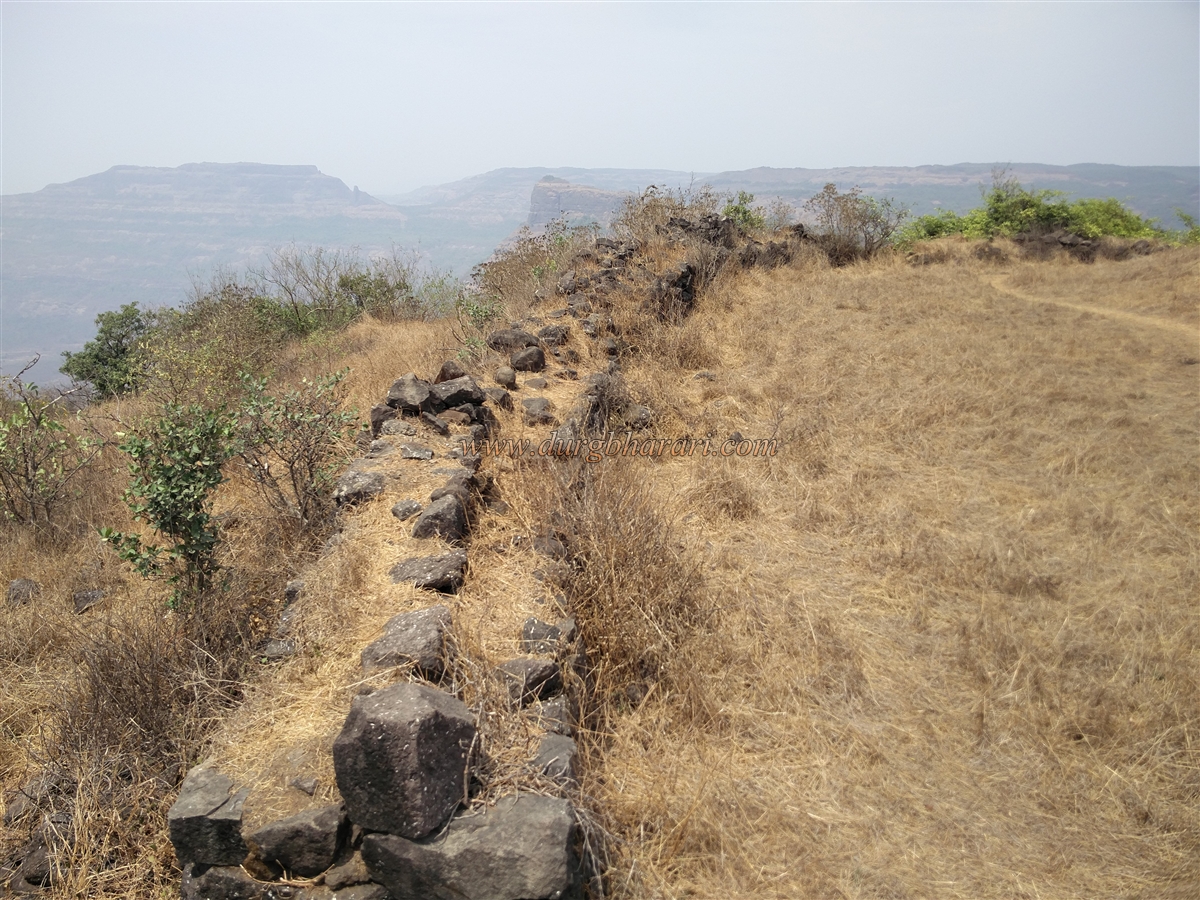
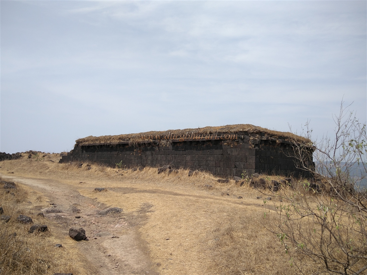
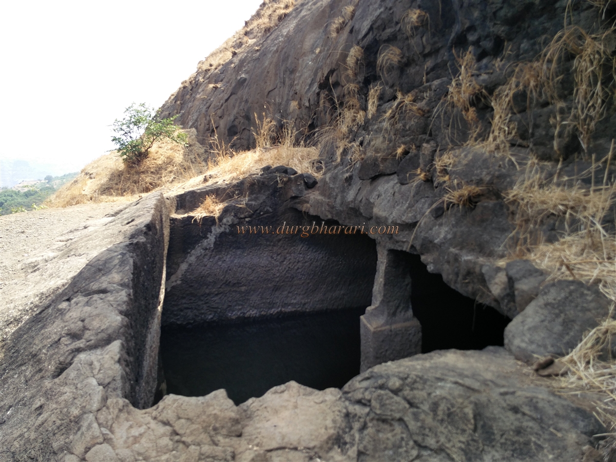
Among these ruins is a roofless but well-preserved building whose entrance features a beautiful carving of Lord Ganesha, flanked by auspicious symbols of the sun and moon, indicating it was once an important structure. Near the eastern gate are two large caves with doorways built of dressed stone; one contains a water source. The construction on Manaranjan appears more extensive and stronger than on Shrivardhan. Being lower in height than Shrivardhan, Manaranjan was fortified with a strong surrounding wall, much of which remains intact. Two cannons can still be seen on the fort walls.
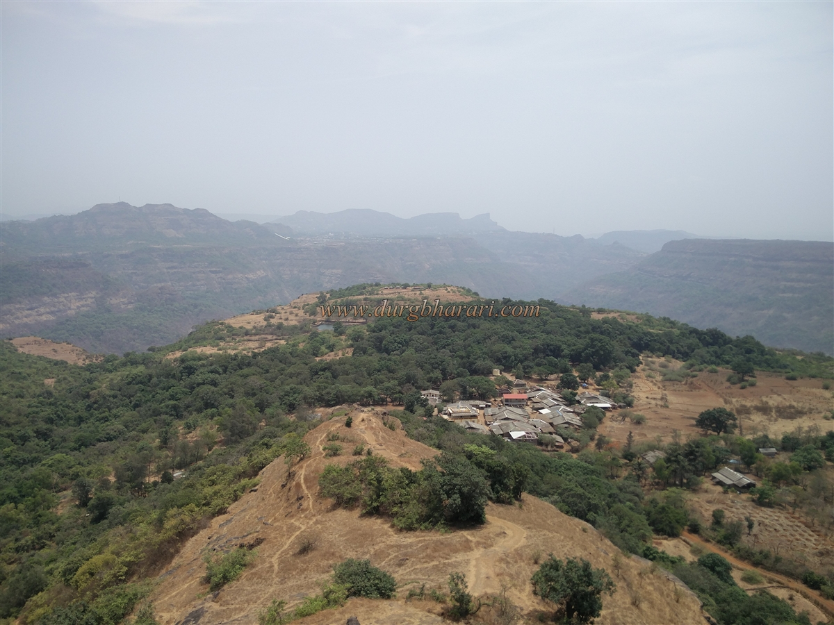
It is said that the fort’s name—Manaranjan, meaning “entertainment”—comes from the beautiful western views it offers. From here one can see the Ulhas River valley, Karnala, Prabalgad, Irshalgad, Dhak Bahiri, Nagphani Point, and Matheran. In front, the Bhore Ghat section of the Pune–Mumbai railway and passing trains are visible.
The fort’s history, though not fiery, is long. In ancient times, Kalyan and Nalasopara were major ports, and like the Naneghat route, the Bor Ghat was also an important trade route to the plateau. Rajmachi was one of the forts controlling this route. On the fort’s western slopes lie the Kondhane Buddhist caves, carved during the Satavahana period, suggesting that the fort was under their rule then. Over time, the fort saw control by the Satavahanas, Chalukyas, Rashtrakutas, Yadavas, Kadambas, Bahmanis, Adilshahis, the Marathas under Shivaji, and the Peshwas, each leaving their mark on its construction. Rajmachi was known as the “Konkan Gate.”
In 1657, during the Kalyan campaign, Rajmachi, along with Lohgad, Tung, Tikona, and Visapur forts, came under Maratha control. By 1689, in the reign of Sambhaji Maharaj, it was still with the Marathas. In 1704, during Aurangzeb’s invasion of Maharashtra, the fort fell to the Mughals, but after his retreat, the Marathas reclaimed it. In 1713, Shahu Maharaj granted it to Kanhoji Angre, and in 1730 it came under Peshwa Bajirao I. In 1776, the impostor Sadashivrao Bhau seized the entire Konkan region up to Bor Ghat, including Rajmachi, but the Peshwas soon recaptured it. In 1818, it fell to the British.
To explore Rajmachi properly, one should allocate at least two days. Excellent lodging and food facilities are available in Udhewadi village at the fort’s base.
© Suresh Nimbalkar
GALLERY