MANGALVEDHA
TYPE : GROUND FORT
DISTRICT : SOLAPUR
HEIGHT : 0
GRADE : EASY
Mangalvedha, nestled on the banks of the Bhima River, is known as a land of saints. The town is sanctified by the presence of Sant Chokhamela, Sant Dnyaneshwar, and Kanho Patra. Located 50 km from Solapur on the Solapur–Sangli road, Mangrul held significant importance during the Adilshahi period due to its proximity to Bijapur. It was frequently ravaged due to the constant warfare between the Adilshahi capital of Bijapur and the Nizamshahi capital of Ahmednagar.
Today, only a few remnants of the fort survive in Mangrul. Sculpted pillars, broken idols, and stone inscriptions are scattered throughout the town. Before entering the present-day entrance of the fort, a white-colour Jumma Masjid can be seen. It is said that during his stay at Machnur from 1695 to 1702, Aurangzeb used to come to this mosque to offer prayers. In the biography of Saint Damaji Maharaj, published in 1960 by R. G. Karandikar, the fort of Mangrul is described in detail.
...
While Aurangzeb was stationed at Machnur, 9 miles from Mangrul, the town was fortified in 1694. The fortified town had a total length of 6,936 feet and a width of 8 feet. There were three gateways—Borale to the east, Sangola to the southwest, and Kasegaon to the north. Fourteen bastions, each 12 feet high and 14 feet in diameter, were part of this wall. In the 15th century, there were several Jain temples in Mangrul which were later destroyed. Using the debris of those temples, the Muslim rulers of Bidar built a ground fort in 1493 consisting of seven bastions.
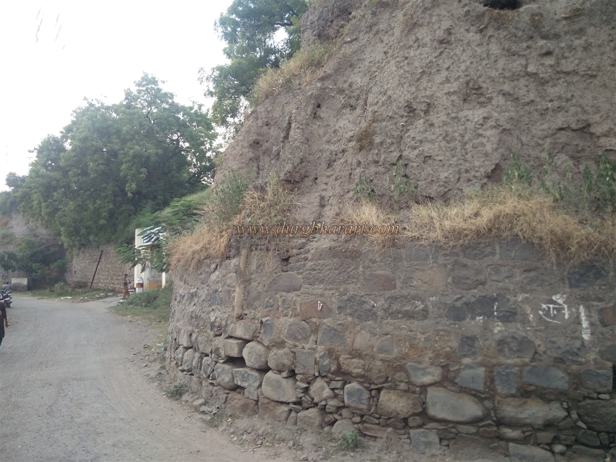
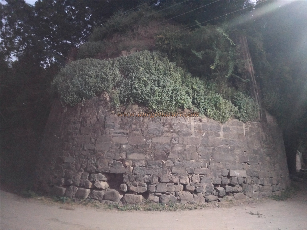
The length of the fort from north to south is 1,245 feet, with the east side measuring 1,200 feet and the west side 920 feet. The fort wall is 13 feet wide and 35 feet high. The names of the seven bastions are Mardan, Karad, Chaufala, Jagbhavi, Gacchi, Kaikad, and Borale. Among these, the Mardan bastion was the largest, measuring 57 feet in height and 50 feet in diameter, located in front of the Lakshmi Narayan temple. A moat 82 feet wide surrounded the fort. The eastern main gate was 14 feet high and 12 feet wide.
After 1700, the Mughal rule ended and the fort came under the control of the Marathas. Chhatrapati Shahu Maharaj appointed Raje Pandhre as the chief. During his rule from 1708 to 1742, he constructed the present-day four-towered inner fort, or "Chauburji," between 1720 and 1730. This square fort had each side measuring 230 feet, with walls 18 feet high and 8 feet wide. It had four bastions named Ran Mandal, Rahat, Bhoot, and Bade khan, each 25 feet high and 30 feet in diameter.
The bastion called Ran Mandal was also known as "Taas Buruj" because a drum used to be played there to signal time. This bastion is located near the house of lawyer Karandikar. Based on the above descriptions, the fort had a triple-layered defence structure. The visible structure today is the inner fortress with four earthen bastions. The fort covers an area of one acre and currently houses the offices of the revenue department, police station, and the sub-divisional magistrate.
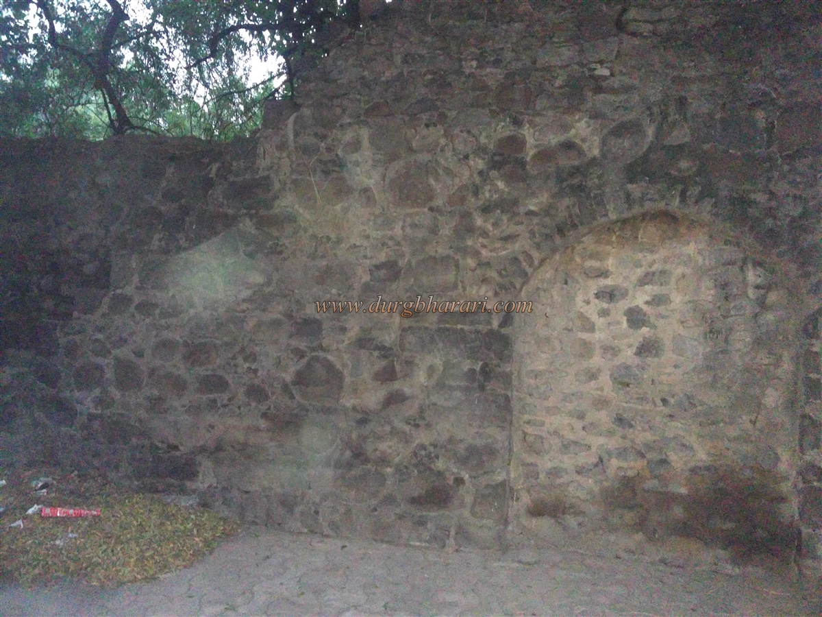
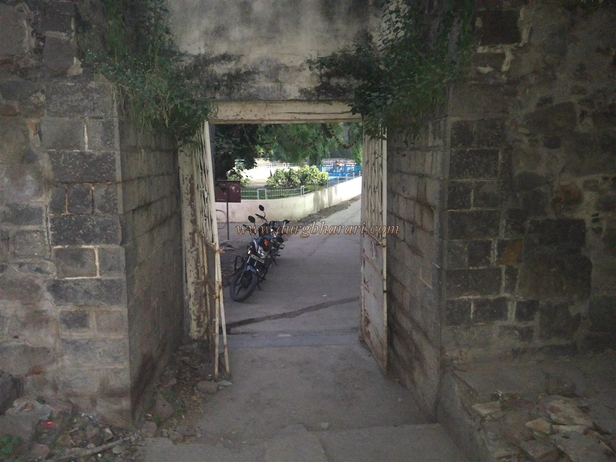
Because of the existing government offices, the fort is divided into two parts, and it must be accessed from two different routes. The entrance currently used was built in recent times, while the original southern entrance is sealed with stones. There are internal staircases leading up to the wall and bastions. The fort's walls are still strong, but the double-storeyed bastions are deteriorating. On closer inspection of the eastern bastion, it appears to have once had a petal-like structure. The moat surrounding the fort has now been completely filled in.
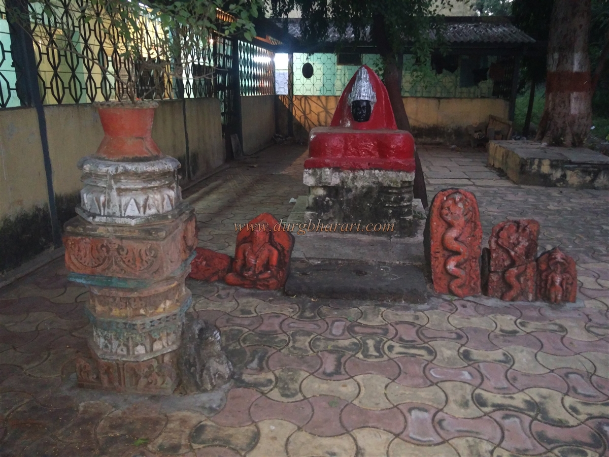
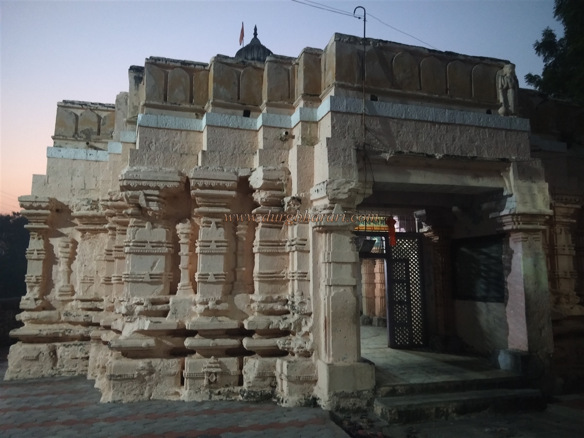
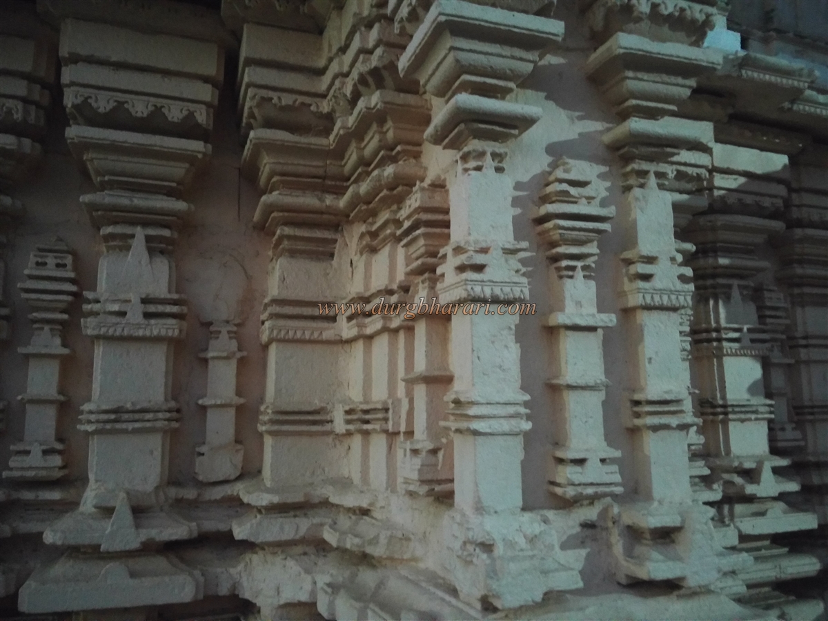
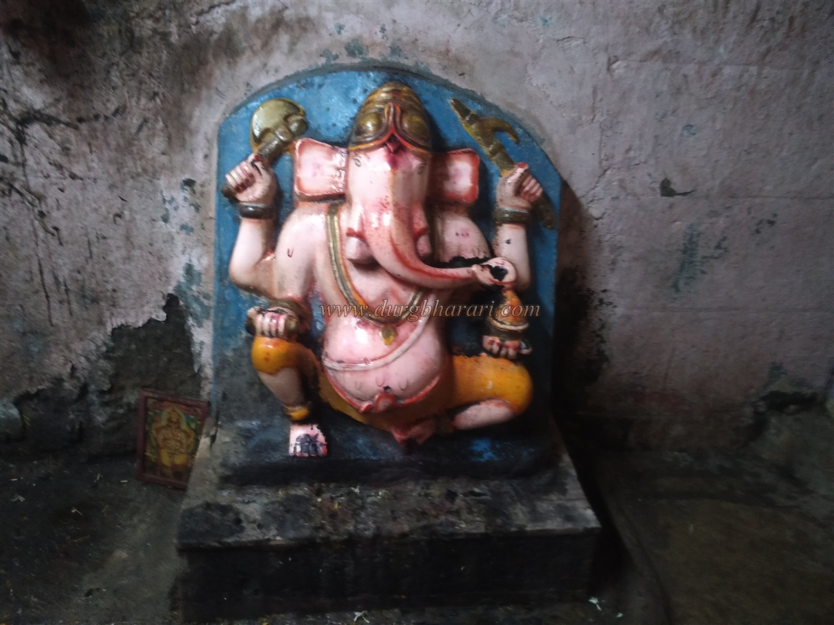
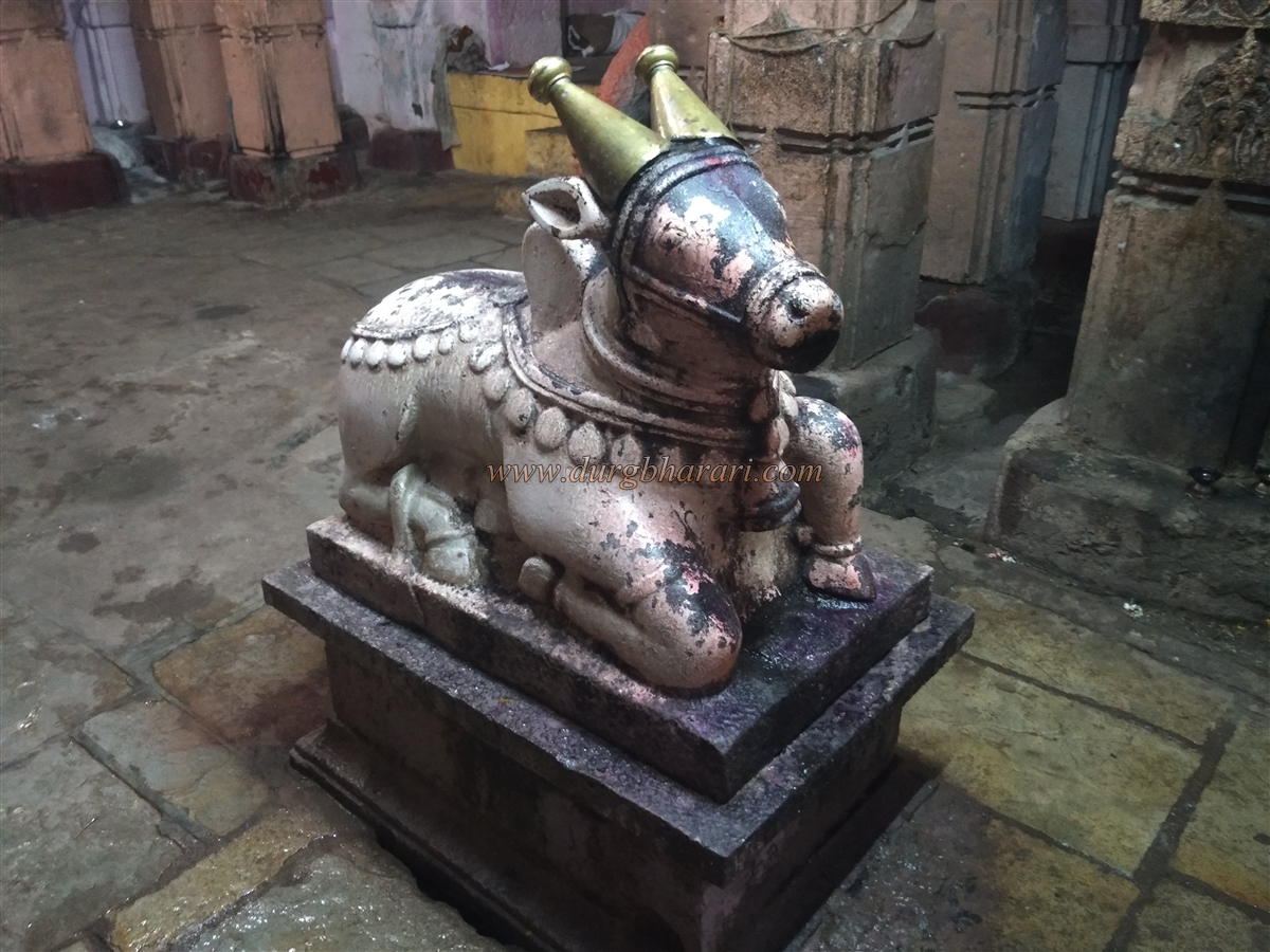
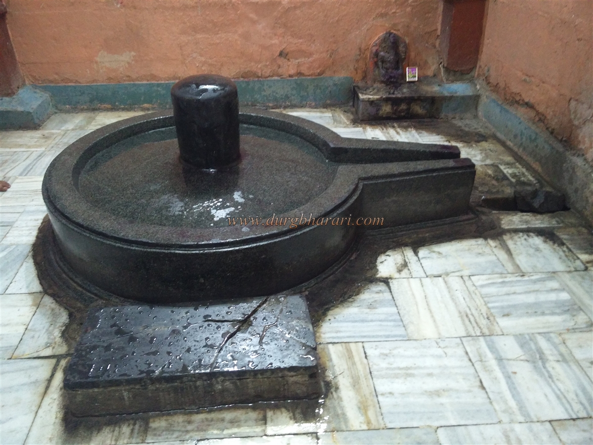
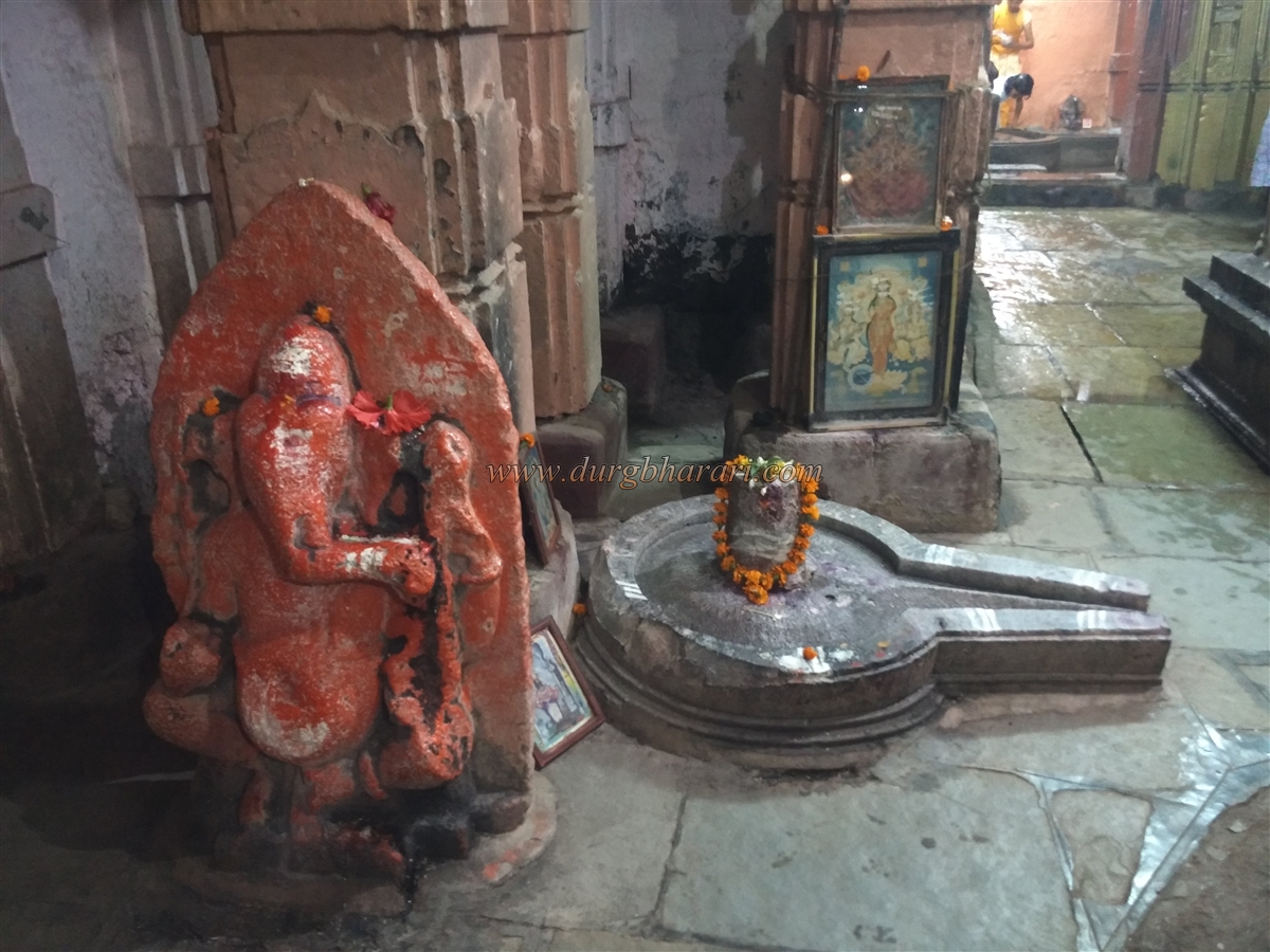
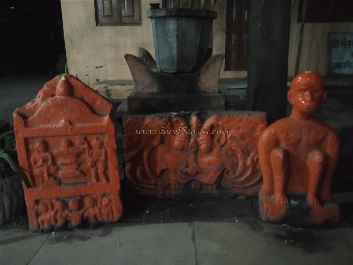
Inside the fort, in an open space, are Jain deity statues, serpent sculptures, carved temple pillars, and a mask of Lord Vishweshwar. In one corner of the wall, sculptures of the Saptamatrikas and Ganesha can also be seen. Because of the government offices, visitors cannot roam freely inside the fort. The oldest structure in Mangrul is the Kashi Vishweshwar temple at the rear of the fort. During the 8th century, when the Kalchuri ruled the region and made Mangrul their capital, they are believed to have built this temple. Believing themselves to be descendants of Brahma, they may have built a temple to Brahma here.
An inscription from 1572 states that the temple was restored in that year. During the decline of the Yadav dynasty, the temple had deteriorated. Later, during the rule of Ali Adil Shah of Bijapur, Dhanaji Kulkarni of Hippargi restored the temple in 1572. This restoration is recorded in five parts on a pillar to the left of the Rangashila. The original inscription, 60 lines long, notes that Dhanaji of the Bhardwaj gotra restored the temple in the 10th century of the Shalivahan era.
The temple is adorned with carvings of various deities. In its courtyard is a broken hero stone. The nearby well is believed to have been constructed at the same time as the temple. Descending a few steps into the well reveals a statue of Brahma, considered the second such idol in India after the one in Pushkar. This statue is six feet tall and three and a half feet wide, carved from black stone. Nearby, broken idols of Tirthankaras and Mahishasurmardini can be seen.
Next to the Brahma idol is a subterranean tunnel, which is said to lead to the Gopal Krishna temple in the middle of Krishna Lake to the west of Mangrul. Near the college in town, carved temple stones, pillars, and hero stones can be seen. It takes about two to two and a half hours to tour the entire town. Mangrul has a rich historical legacy and was known in ancient times as Mangalveshtak and Mahamandaleshwar. Stone inscriptions indicate that Mangalvedha history dates back to the 4th–5th centuries CE.
A thousand years ago, Mangrul served as a capital under the rule of the Kalyani Chalukya. From 1060 to 1121, it was governed by the Kalchuri dynasty, successors to the Rashtrakut. Mangrul was their capital. Basaveshwar, founder of the Veerashaiva sect, was the chief minister of the Kalchuri state. Inscriptions from Mhaswad, Ter, and Akkalkot mention that Mangrul was a capital under the Kalchuri. In 1191, Bhillam, a Yadav ruler from Devgiri, defeated the last Kalchuri king, Bilhan.
After the Yadav as, Mangalvedha came under Bahamani rule. In 1458, during a severe famine, revenue officer Damajipant opened state granaries for the people. When the sultan imprisoned him for this act, Lord Vithoba himself appeared in court and repaid the grain value, leading to Damajipant release. Between 1465 and 1475, Mughal commander Bahadur Jilani conquered the region, bringing Mangalvedha under Mughal control. In 1493, a ground fort was constructed, making it a key military post.
On 5 November 1494, the ruler of Bidar, Mahboob Shah, defeated and killed Bahadur Jilani and took control of Mangalvedha. In 1603, Mughal commander Mir Jayauddin Mustafa Khan was stationed in Mangrul. In 1665, Shivaji Maharaj allied with Mirza Raja Jai Singh to campaign against the Adilshahi. As they marched through Phaltan and Nathwada, they reached Mangrul on 19 December 1665. There, the Adilshahi commander Sarjakhan and Maratha general Netaji Palkar clashed, resulting in Netaji capturing the fort.
On 20 December, Shivaji and Mirza Raja visited and inspected the fort. Mirza Raja appointed Sarfaraz Khan as the Mughal commander of the fort. Because the fort was close to Bijapur, Jai Singh ordered Diler Khan to demolish it. On 24 December, Shivaji’s forces clashed again with the Bijapur army. In this battle, Sarjakhan killed Sarfaraz Khan, his son, and his son-in-law. Before this campaign concluded, Shivaji sought and received permission to return to Panhala on 11 January 1666. Thus, Shivaji remained in the Mangrul area from 19 December 1665 to 11 January 1666.
Later in 1666, the fort returned to Adilshahi control. In 1686, the Mughals defeated the Adilshahi, and Mangrul came under Mughal rule. After Aurangzeb's death in 1707, the Marathas reclaimed the fort. Shahu Maharaj appointed Raje Pandhre, who ruled from 1708 to 1742. As the Maratha Empire expanded, the fort's strategic importance declined. From 1742 to 1750, the Peshwa administered the fort, and Yamaji Shivdev served as commander. In 1751, the fort was granted to Govind Hari Patwardhan estate.
For Patwardhan, Miraj and Mangrul were two vital forts. In 1763, when the Nizam attempted to sack Pandharpur, Patwardhan forces from Mangrul repelled him. Until 1808, Mangrul remained under Patwardhan control. After the estate was divided in 1808, Mangrul was assigned to Chintamanrao Appasaheb of the Sangli Patwardhan family.
In 1818, the final battle between the Marathas and the British occurred at Ashti, 30 miles from Mangrul. In this battle, Maratha general Bapu Gokhale was killed, signalling the fall of the Maratha Empire. After Chintamanrao Appasaheb, Shrimant Dhundiraj Tatyasaheb became the ruler of the Sangli princely state. During his rule, Sangli came under British administration.
Until 1876, the fort of Mangrul remained in good condition. When Sangli came under British oversight, Captain West demolished the gates and Major Waller dismantled the walls. The locals took the stones and earth from the fort, filling the surrounding moat. Some bastions collapsed, while others were deliberately destroyed.
© Suresh Nimbalkar
GALLERY